Explorer 1
Explorer 1
Still winter in Hawaii!!
I needed to make a business trip to Medford, Oregon. Not wanting to waste a business paid trip out of town, I decided my route home (Whittier) would be via an eastern Oregon detour to the OWYHEE region.
For those who don't know it, Owyhee is pronounced just at it is spelled,
O-WY-HEE
Proounced like Hawaii without the H. Turns out that after some question asking and internet searching, that those wonderful Pacific islands we love so much were first spelled Owyhee!
It wasn't until after the missionaries invented a alphabet and written form of the local language that the spelling of the islands came out Hawaii.
So if you look at the South Eastern section of Oregon you see a lot of use of the name Owyhee, there's the Owyhee Desert, Owyhee Mountains, several forks of the Owyhee river to name a few.
During the fur trade some Hawaiians left the islands and joined the Canadian and American Fur Company which operated on the Snake River in Idaho. Three of these Owyheeians left the Snake River area to venture and explore some uncharted areas further west, now Eastern Oregon. They were never seen or heard of again and the area was thereafter called, in their memory, Owyhee.
So there you have it.......
This region, is sparsely populated. I think there are more heads of cattle then people!
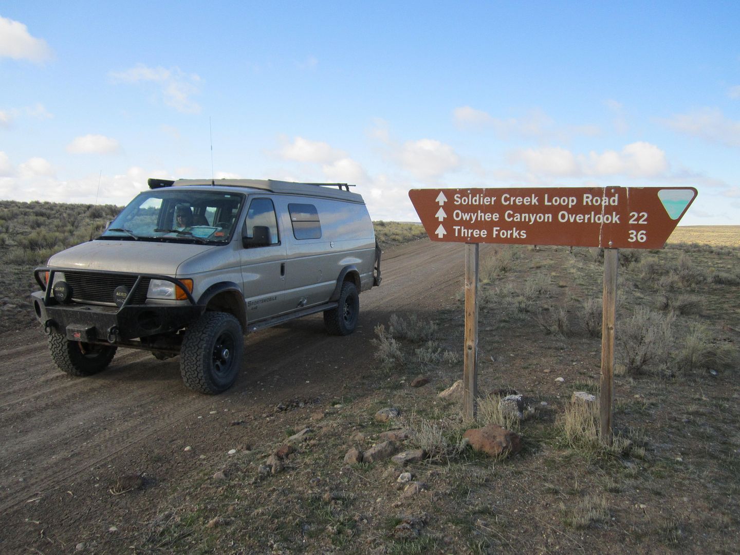
My intent was to check out the main Owyhee River as a possible white water canoe trip in the future. Once we left Interstate 5 it was all small 2 lane country roads passing through very small communities and towns which I think were shown on the map because there was nothing else competing with them for space.
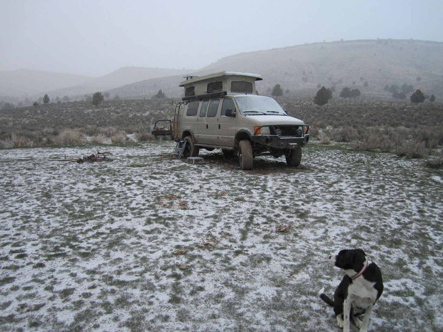
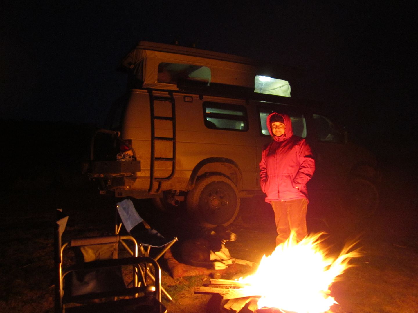
Our first night exploring the Owyhee region was on the east side of the Owyhee river. Winter was still going strong as the thermometer dropped down to about 19 degrees that night. Fortunately, our sleeping bags were rated for such temperatures and we slept as warm as "two bugs in a rug.
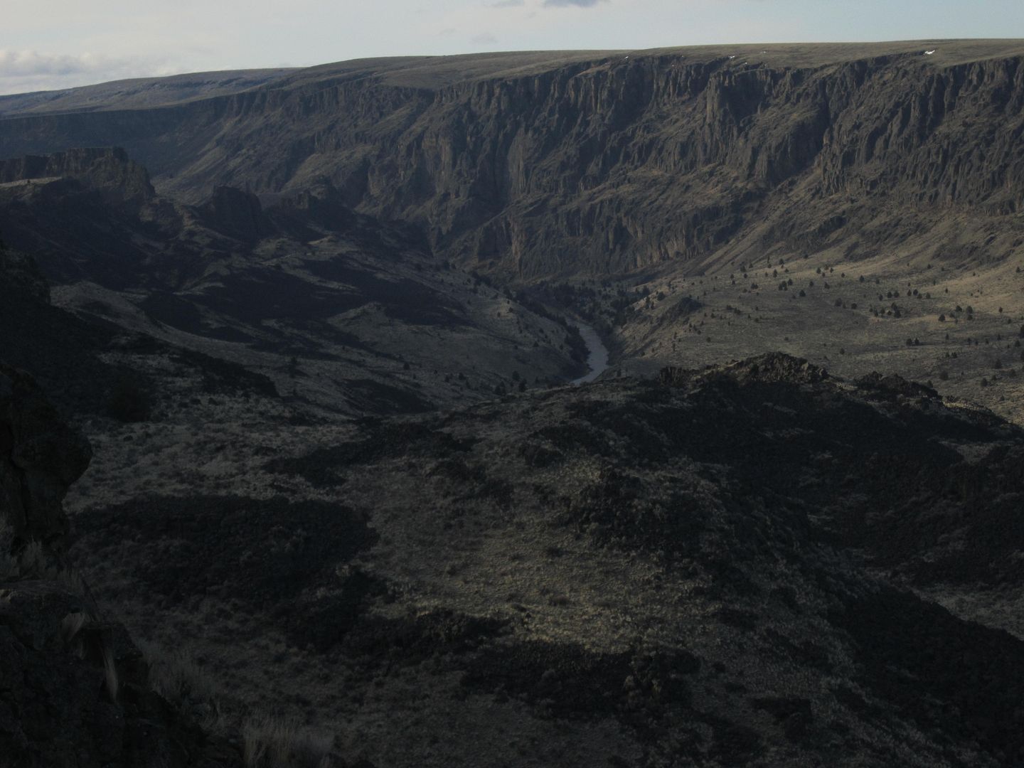
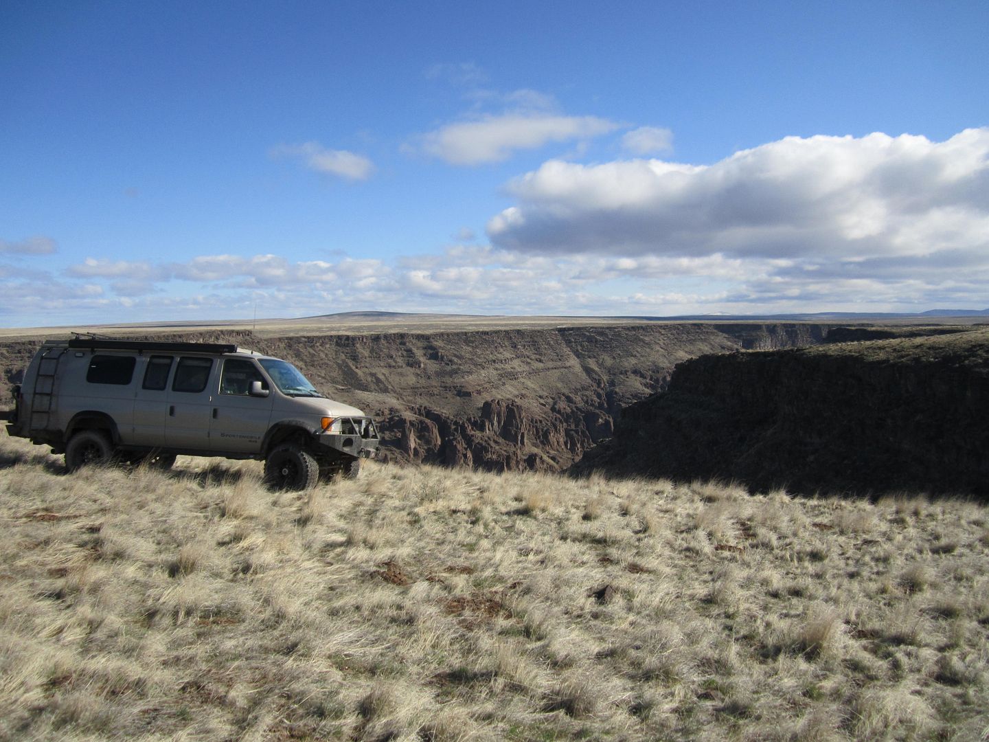
The Owyhee River and canyon has some similarities with the Colorado River and Grand Canyon. However, the Owyhee River isn't dammed before it runs the canyon and is subject to large variations between spring runoff and the end in summer. The canyon is deep but doesn't have the color variations as it is mostly volcanic in origin.
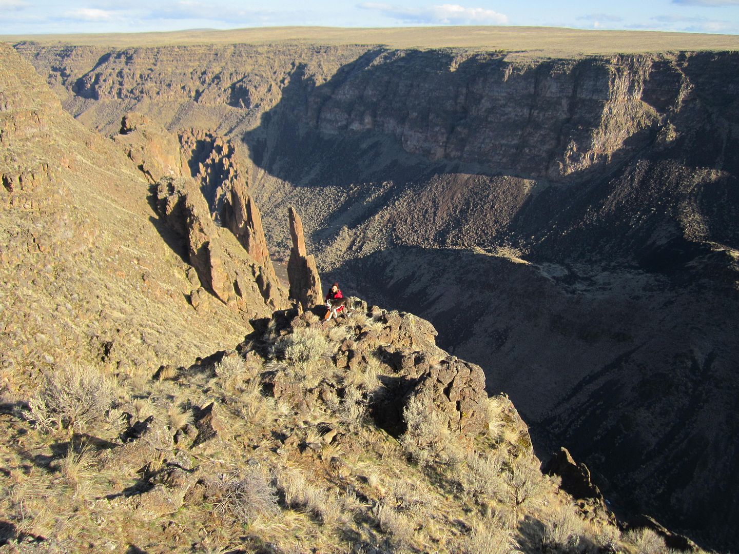
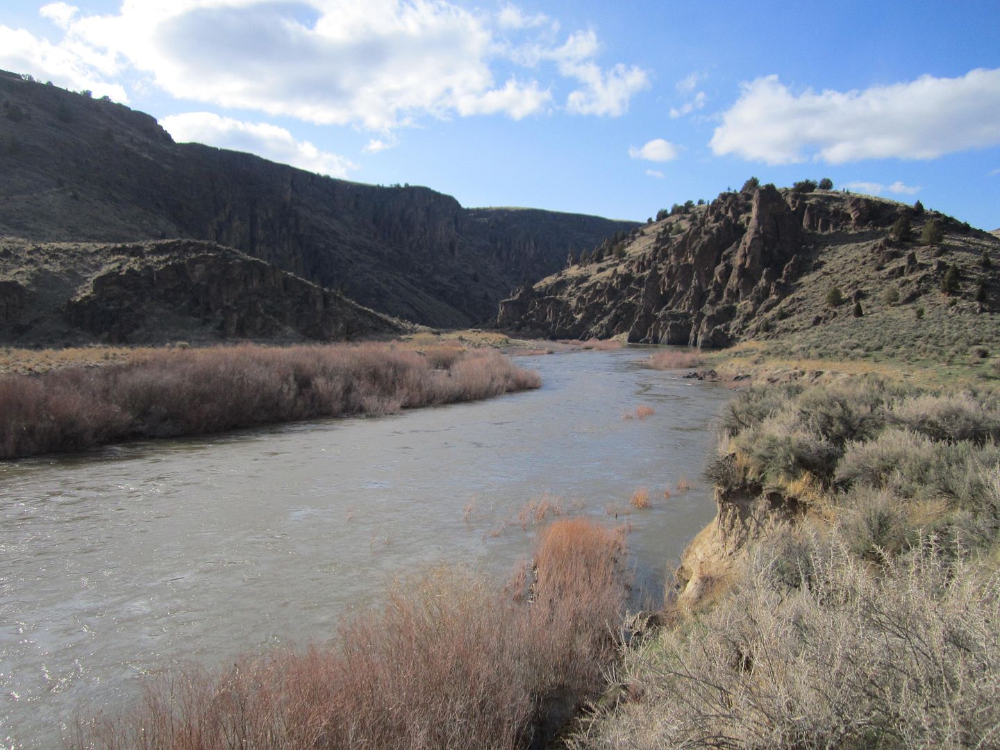
The upper canyon, just below three forks I was told in spring runoff is a class 5 plus river only for the most experienced rafters. The section below the ultra small community of Rome is more manageable and could be run by experienced white water canoe operators.
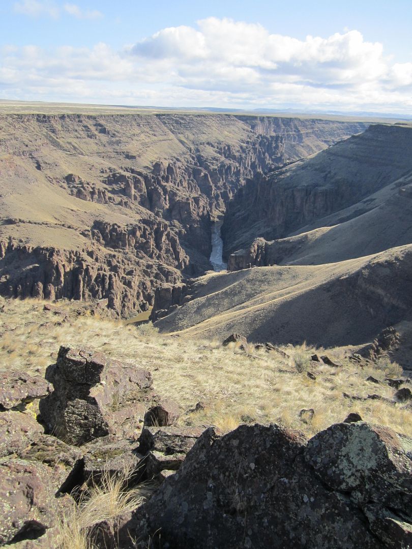
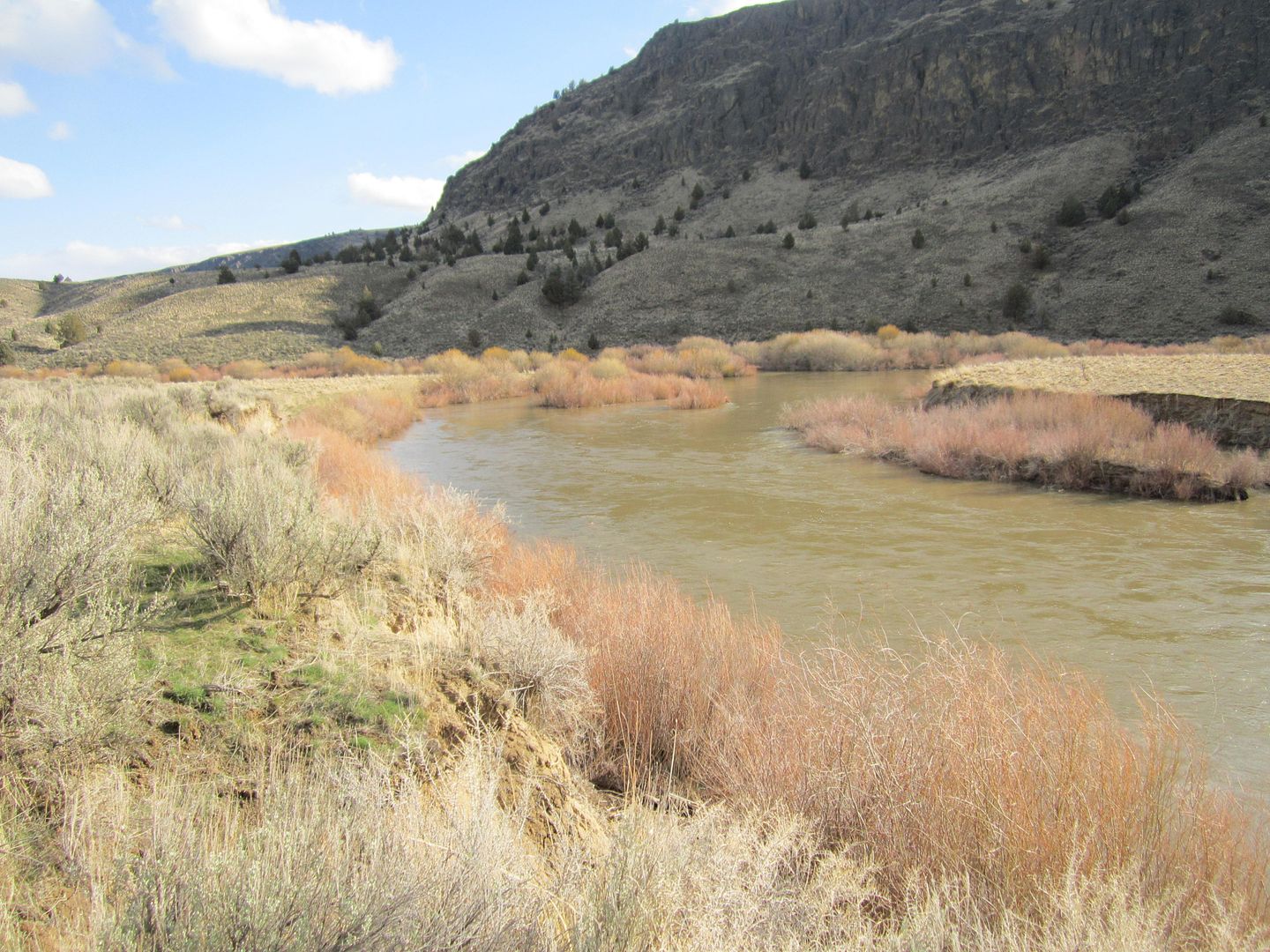
Here is Three Forks at the beginning of the river:
When the wind blows in winter this place can really feel cold.
Thanks,
Fred
Explorer 1
I needed to make a business trip to Medford, Oregon. Not wanting to waste a business paid trip out of town, I decided my route home (Whittier) would be via an eastern Oregon detour to the OWYHEE region.
For those who don't know it, Owyhee is pronounced just at it is spelled,
O-WY-HEE
Proounced like Hawaii without the H. Turns out that after some question asking and internet searching, that those wonderful Pacific islands we love so much were first spelled Owyhee!
It wasn't until after the missionaries invented a alphabet and written form of the local language that the spelling of the islands came out Hawaii.
So if you look at the South Eastern section of Oregon you see a lot of use of the name Owyhee, there's the Owyhee Desert, Owyhee Mountains, several forks of the Owyhee river to name a few.
During the fur trade some Hawaiians left the islands and joined the Canadian and American Fur Company which operated on the Snake River in Idaho. Three of these Owyheeians left the Snake River area to venture and explore some uncharted areas further west, now Eastern Oregon. They were never seen or heard of again and the area was thereafter called, in their memory, Owyhee.
So there you have it.......
This region, is sparsely populated. I think there are more heads of cattle then people!
My intent was to check out the main Owyhee River as a possible white water canoe trip in the future. Once we left Interstate 5 it was all small 2 lane country roads passing through very small communities and towns which I think were shown on the map because there was nothing else competing with them for space.
Our first night exploring the Owyhee region was on the east side of the Owyhee river. Winter was still going strong as the thermometer dropped down to about 19 degrees that night. Fortunately, our sleeping bags were rated for such temperatures and we slept as warm as "two bugs in a rug.
The Owyhee River and canyon has some similarities with the Colorado River and Grand Canyon. However, the Owyhee River isn't dammed before it runs the canyon and is subject to large variations between spring runoff and the end in summer. The canyon is deep but doesn't have the color variations as it is mostly volcanic in origin.
The upper canyon, just below three forks I was told in spring runoff is a class 5 plus river only for the most experienced rafters. The section below the ultra small community of Rome is more manageable and could be run by experienced white water canoe operators.
Here is Three Forks at the beginning of the river:
When the wind blows in winter this place can really feel cold.
Thanks,
Fred
Explorer 1