SPOT Gen3 satellite tracker

haven

Expedition Leader
The third generation of SPOT, the satellite-based GPS tracker and messaging device, has arrived. The new model has better battery life, plus an feature that updates your location only when you're on the move.
http://www.findmespot.com/en/

the SPOT Gen3 device costs $149, and a yearly service contract costs an additional $149. That's a lot of security for less than a dollar a day. The SPOT web site includes stories of people who were rescued by activating their SPOT. Most rescue situations started out as normal outdoor activities, rather than some risky enterprise.

Looking at the SPOT coverage map, there are gaps in southern Argentina and Chile, and in far northern Alaska, Canada and Russia. Otherwise, you're in view of the GlobalStar comm satellites.
 

robgendreau

Explorer
Meh.

I would think those who seek a proprietary rescue service over COSPAS/SARSAT (the Air Force USCG PLB solution that uses 406 beacons) would be better off with the Delorme offering. It does two-way messaging, has a more reliable sat service (Iridium vs Globalstar, who owns SPOT), and less cost per month ($120/yr). But it is more expensive to buy ($330 vs $150).

And not to be overly contrary, but the SPOT system has booted rescues. Maybe not all their fault, in that the system isn't quite suited to all outdoor emergencies, but you have to be careful about what your needs are and how you anticipate you'd need help.

And if you are interested in the non-proprietary rescue beacon solution, ACR is offering a $50 rebate on their PLB beacons till mid August (meaning a unit would be about $250).
 
Last edited:

Christophe Noel

Expedition Leader
Let me preface this by saying, I'm not advocating one system over the next. They all have advantages. I just spent several months compiling a review of the leading devices and they really do all have pros and cons. I think the SPOT's forte is relative to the tracking and web-based interface. It's interesting that they chose to further improve the tracking features on the SPOT G3. For those at home, the SPOT's ability to convey tracks on an easy to use website is a plus. The Delorme site is a little unrefined. There can also be something said for devices like the SPOT G2 with AAA replaceable batteries. That's often an easier solution compared to recharging a device in the field. That's just more pro/con to bounce around. Two-way messaging in an emergency sure is a bonus, though.

Regarding Cospas-Sarsat rescue vs. GEOS (used by both SPOT and Delorme) I think it's a wash for most overlanders, as long as you're within the Globalstar footprint, which is limited. GEOS and Cospas-Sarsat have a pretty equal rescue success rate. Keep in mind GEOS has only been around since 2007 and Cospas-Sarsat since the 1980s. Given their short history, GEOS has done pretty well for themselves. There have been bungled rescues, but few attributed to GEOS dispatch. If you track, or rather backtrack, case studies of the rescue responses, the originating dispatches from GEOS are sometimes a tad faster, but that's highly influenced by the location where the mayday was initiated. In other words, it would be tough to award one service a better score than the other.

GEOS offers pretty cheap rescue insurance. More pro/con to consider.

I was really hoping to get my paws on the Pieps Globalfinder, but that release was pushed back yet again. Maybe by early 2014.
 

chrismc

Adventurer
I'm pretty sure that Delorme uses the Iridium satellite network instead of Globalstar, for better coverage and reliability. GlobalStar is really the Achilles heal of Spot.
 

Cabrito

I come in Peace
Given their short history, GEOS has done pretty well for themselves. There have been bungled rescues, but few attributed to GEOS dispatch. If you track, or rather backtrack, case studies of the rescue responses, the originating dispatches from GEOS are sometimes a tad faster, but that's highly influenced by the location where the mayday was initiated. In other words, it would be tough to award one service a better score than the other.

GEOS offers pretty cheap rescue insurance. More pro/con to consider.

I like what you are saying here.

From some of the reports I've seen where people complain it seems that some have unrealistic expectations, and or use the Spot device improperly.

I've also seen some reporting great success with rescues..

My personal experince with them is fantastic, but I've never had to use it for help. The price point and web tracking are what hooked me.

I'll be watching the 3rd Gen Spot, but as long as my second Gen is working I'm good for now.
 

robgendreau

Explorer
GlobalStar is really the Achilles heal of Spot.

Keeping in mind that GlobalStar owns SPOT.

I am prejudiced, since I do marine stuff, in favor of the cospas/sarsat system; in that environment the rescue protocol is far more critical (if you fall outta your unimog the consequences are usually not as immediate as falling off your boat). And the USAF and USCG have had quite a head start on this rescue business. And I agree SPOT is misused (the fiasco off the coast of Mexico in that race is as much due to the poor choice of SPOT over EPIRB as it was to GEO's failings). But I still don't see that the SPOT system has that much to recommend itself, other than better than nothing. I see GeosAlliance getting better with time, but having my insurer being in charge of rescuing me kinda makes me nervous.

On land I would think a sat phone is a far better investment, even if a rental. The tracking thing might be quite useful for certain applications; I've used APRS for that. And it can be helpful in a rescue if reliable (and unfortunately it may not be). I realize you could call or text with a regular sat phone and say "I'm headed into the abyss; call for help if you don't hear from me in two days"; is that any worse than a tracking system?

Rob
 

Christophe Noel

Expedition Leader
So, here's the process that follows pushing the help button on a Cospas-Sarsat beacon: (assuming it has a GPS receiver)

- The unit first acquires it's location
- It then transmits that location via the Cospas-Sarsat 406MHz frequency to satellites overhead. In North America, those will be NOAA birds most likely. There are two layers of Cospas-Sarsat satellites at 500 and 22,000 feet above.
- The signal is then relayed to LUT receiver/repeater sites on the ground.
- The signal is then directed to the response center closest to the location of the signal.

Now....here's where it gets interesting.

If you haven't registered your PLB, they don't know who the hell you are, or if the signal is legit. That could greatly delay your rescue. If you did register your PLB (required by law) they still won't launch a bunch of helicopters to come get you. They (Coastguard or Airforce) will first try to reach the emergency contacts on register with your device through the International Beacon Registration Database. If your primary contacts confirm you're in the area of the distress, then the rescue is initiated. If they can't contact the emergency contacts, they'll still initiate a rescue, but they're largely assuming you need help.

For overlanders, the Air Force will initiate the response. Once they get a good picture of where the signal is coming from, that will determine which local first responders they will contact. If you're out in the boonies, this could be county SAR, or some smaller agency like that. In other words, don't expect a Blackhawk and an Air Force crew to get you.

As was stated above, mariners like Cospas-Sarsat because the signal goes strait to the people most likely to initiate, and fascilitate the entire rescue - the Coast Guard. On land, Cospas-Sarsat has to go through many of the same local SAR channels as GEOS.
 

Christophe Noel

Expedition Leader
"I'm headed into the abyss; call for help if you don't hear from me in two days"; is that any worse than a tracking system?

Rob
This is just anecdotal, but I'm an avid ultra-endurance mountain bike racer. Some of those events like the Colorado Trail Race can have racers a dozen hours from pavement if things go wrong. The tracking is super slick. My friends at home can watch my progress and know if something is up. Last year I rolled into a gas station having just ridden over two remote mountain passes. I lingered for a long time at that gas station and turned on my phone. The first text said, "Everything okay? You better keep moving..."

Pretty impressive to be in the remote backwoods and know friends at home are not just watching a your dot on a map, but able to read the pace and placement of those dots to predict or identify trouble.
 

Tony LEE

International Grey Nomad
but the SPOT system has booted rescues.
Sorry, but I don't understand "booted" in this context.

I carry Spot just to save letting family know where we are and to provide a trail on Spotwalla (which is better for my purposes than Spot's offerings because the data is there permanently) for my own benefit - needed because of failing memory spans - and as a secondary emergency beacon. It is a Spot 2 so we can easily distinguish between track, normal overnight camp and locations where we will be stationary for a few days. Also it is more useful because it is fully self-contained and doesn't rely on a smart phone for basic operation.

For real emergencies I carry a PLB registered in Australia with the appropriate authorities and my 'profile' contains full details of where we are heading and a rough timetable but at country level only rather than day to day. I figure that way, since it is primarily a marine/aviation emergency system used to dealing with travellers anywhere on the globe, we should have close to as good a response as we would have if we had registered it in each country we visit. A signal originating in Bolivia will flag in the official Australian system and can easily be checked against my profile which shows us in or near Bolivia and that should be good enough.

The changes in Spot 3 don't seem to make it worth getting to replace the Spot 2, especially since I have already cobbled together a power supply from the vehicle battery anyway. When away from the RV I power it with three normal Alkaline cells (100 for $10 Home Depot specials) rather than the expensive ultimates. On tracking mode I still get around three days out of each set of batteries.
 
Last edited:

Christophe Noel

Expedition Leader
By the way, get ready for this market to explode wide open with all sorts of options. Iridium and GEOS are positioning themselves as the go-to for a number of soon to be released devices. Aside from the Pieps Globalfinder, there is the Text Anywhere hotspot and a few other communicators on the very near horizon. More and more devices will include two-way communications and stand alone capabilities with built in displays and I would expect a Qwerty keyboard soon enough.
 

robgendreau

Explorer
Sorry, the booted rescue I was referring to was a boating accident where the vessel was being tracked by spot. When the emergency button or whatever was hit, that signal. Apparently minus GPS data, went to GEOS. They called the guy's wife, who was asleep, so it went to voicemail. No call was made to the Coasties at that point. Not good; people died.

Probably not the best tool for offshore use. Land? Still not convinced better than a sat phone.

But then again no one is so interested in tracking my trips that they'd watch 24/7 unless I paid them :)
 

AndreasN

Observer
Hey Flounder

could you please explain how exactly that tracking with your friend works and what equipment you need?
thx
Andreas
 

Cabrito

I come in Peace
Hey Flounder

could you please explain how exactly that tracking with your friend works and what equipment you need?
thx
Andreas

I think I can help with this a little.

I run a SPOT-2 Second Gen
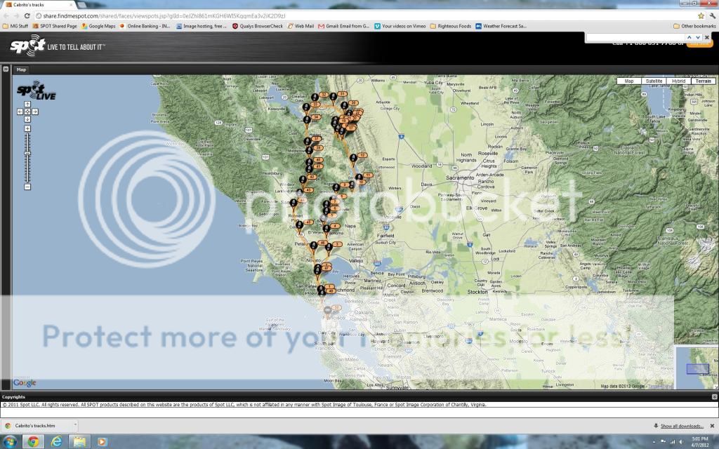
The spot website has a shared page. You can give a website link to whoever you would like to be able to follow your progress on a trip.
My Gal keeps this page bookmarked to follow me on my rides. It's also useful if you are joining a group and as long as they have web access they can track your progress. This has been handy a few times with my friends using their smart phones to see where I'm at when they are waiting for me at a meet up point.
Screen Grab of my SPOT shared page.
spottracksfromaprilride.jpg


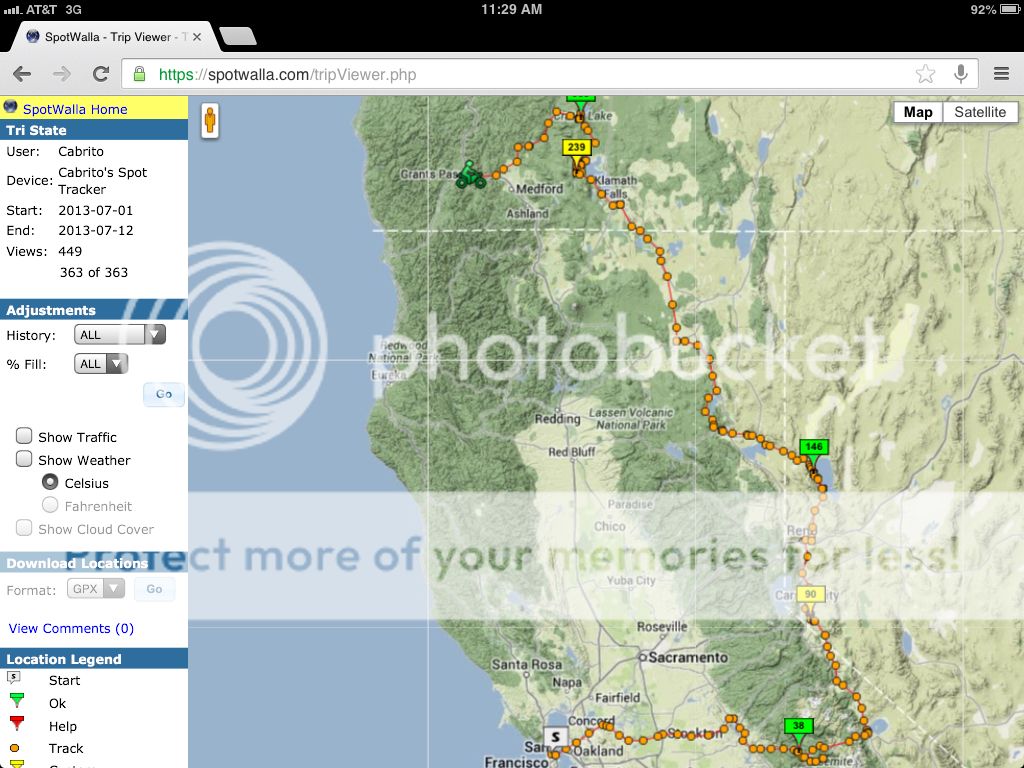
The problem with Spot is that it only saves the tracking info for a few days. This is where a third party website comes in handy. I like Spotwalla - Same as the SPOT page you can give out a public website to others that you want to follow you. You can set up all sorts of security parameters on Spotwalla so only the people you want to see you have access to do so.

With Spotwalla you can set up multiple "Trips" with start and end dates. The tracking info stays forever. That way I can go back and check where I've been on a map later when I get home. I do this for individual trips and I also set up an open-ended trip to track my overall travels. My sig line has my current trip link.

Screen grabs from a few Spotwalla trips.
7b20c482841464c607ca338016a70ffc_zpsedc98eb5.jpg

28de75a6ae6c4f25413a0bf83dd51a20_zps3148e762.jpg


On both SPOT and Spotwalla you can zoom in and out on the maps. You can also grab GPS coordinates by clicking on the bread crumbs left on the map. Nice when you want to find a cool location that you marked during a trip.

--
 

Crom

Expo this, expo that, exp
This Gen 3 SPOT device looks good for a tracking/reporting tool. I like that the device can be feed via +5v line for semi-permanent mounting. I guess with this new device you don't have to reset it every 24 hours like previous versions? If I understand that right, then great! One very recent and harsh review over at REI, reports that a person could not activate the device after purchasing because the back end computers at customer care had not been updated to process activation. Perhaps it was rushed to market?

I like the idea of transmitting my location to the Internet to be tracked by family and friends. That's a nice feature. But I don't like the $149 a year price. I'd maybe do it for $99.00.

For me, SPOT would be a toy and not much more. I've been backpacking and doing backcountry travel with a PLB since 2010.

Sorry, the booted rescue I was referring to was a boating accident where the vessel was being tracked by spot. When the emergency button or whatever was hit, that signal. Apparently minus GPS data, went to GEOS. They called the guy's wife, who was asleep, so it went to voicemail. No call was made to the Coasties at that point. Not good; people died.

Probably not the best tool for offshore use. Land? Still not convinced better than a sat phone.

But then again no one is so interested in tracking my trips that they'd watch 24/7 unless I paid them :)

I've consulted a number of dictionaries and none of them list the word "booted" in the context you do. Perhaps a better word is "botched"? At least people will understand what you are trying to say. :snorkel:

I'd like to read more about the accident you spoke of, do you recall any actual details which are Internet searchable? I found this one but it's somewhat vague.

Thanks.
 
Last edited:

Forum statistics

Threads
185,897
Messages
2,879,321
Members
225,497
Latest member
WonaWarrior
Top