Monsoon Express

pmatusov

AK6PM
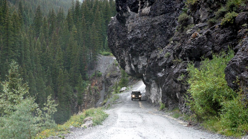
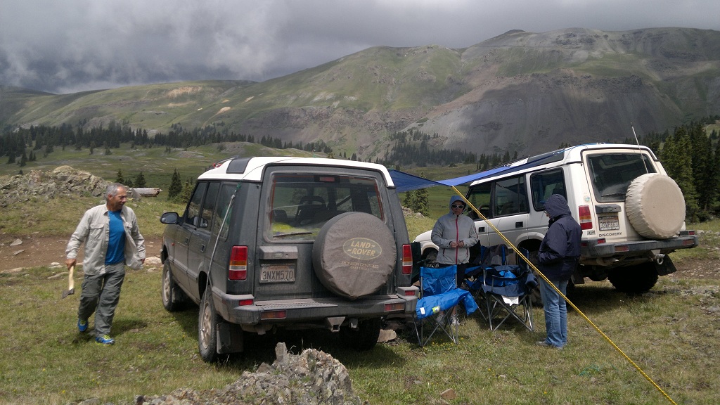
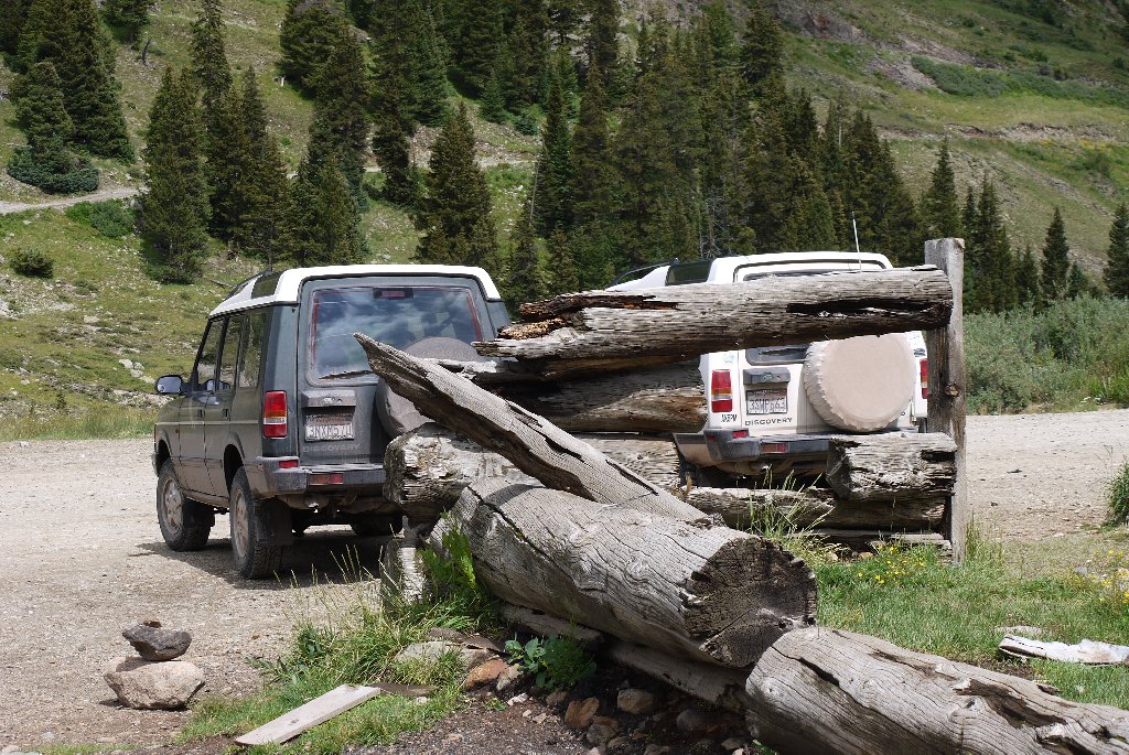
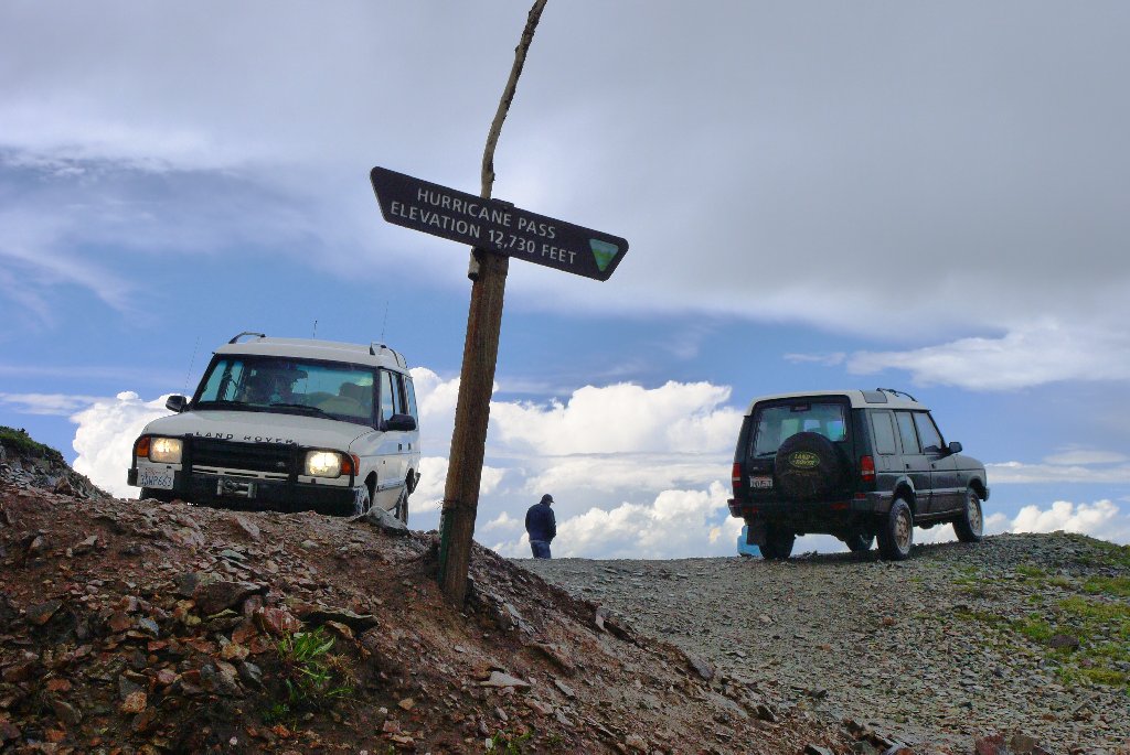
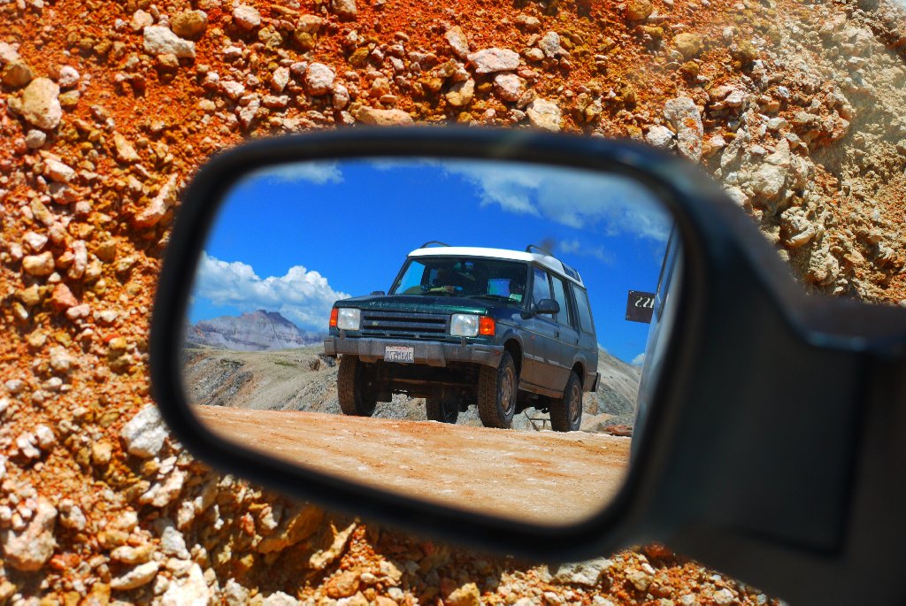
Near the end of July of this year, we - six people evenly split between genders (and just equally - in citizenship, between Russia and the U.S.) – took two 1996 Land Rover Discoveries, one with 247 thousand miles on the clock, another – a youngster with only 155 thousand, on a 10-day, 2600-mile road trip through California, Arizona, Utah, Colorado, and Nevada (with a notional footstep into New Mexico in Four Corners).
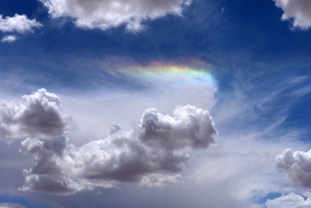
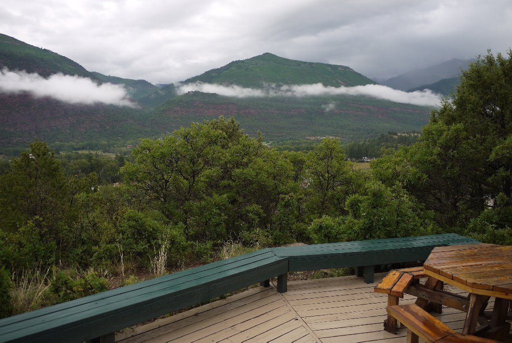
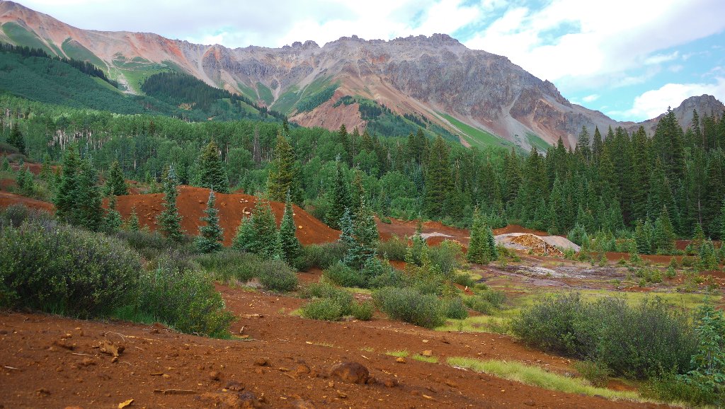
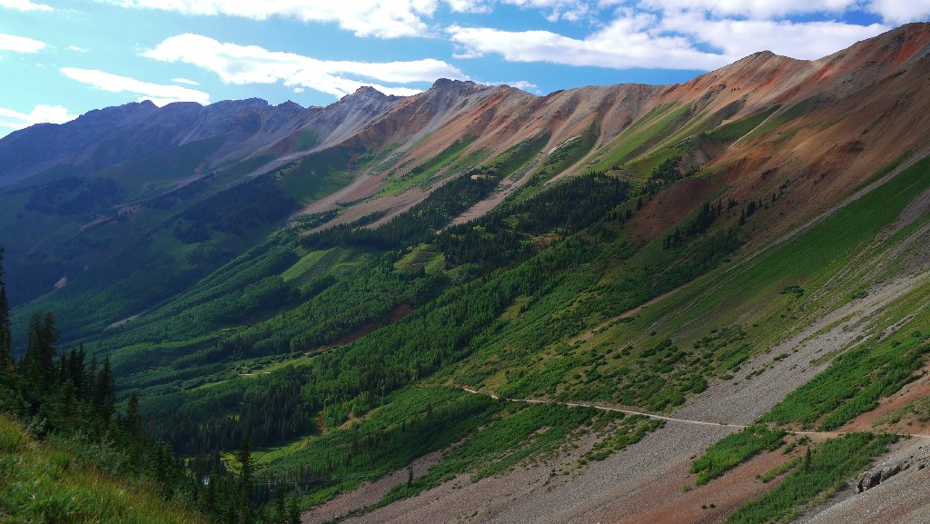
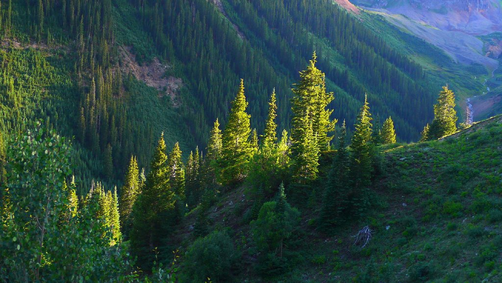
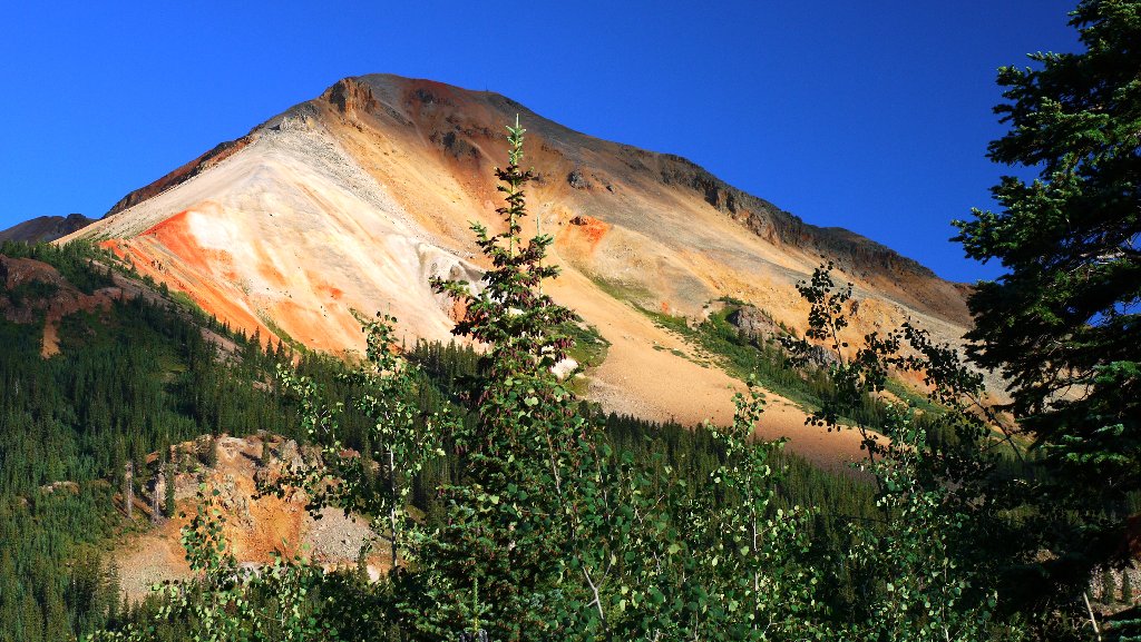
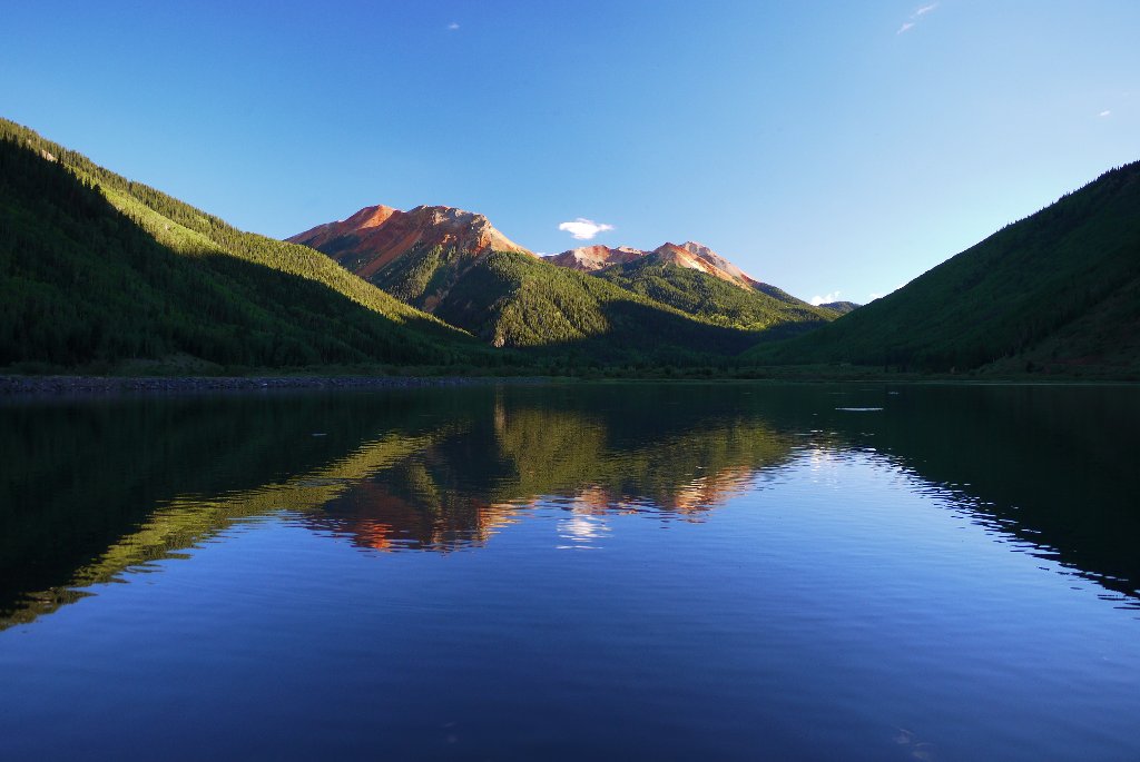
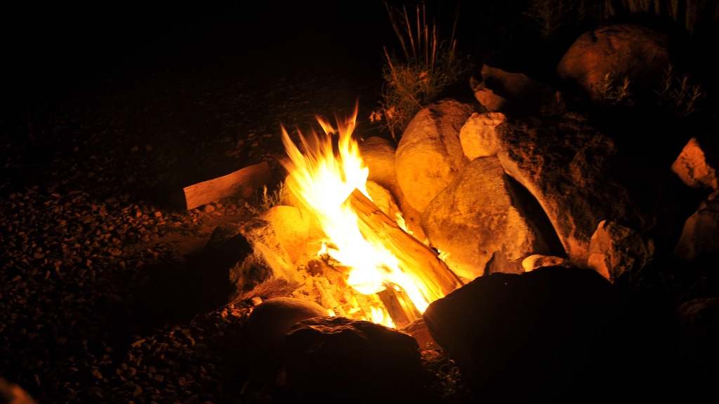
It became somewhat a tradition to set out on a road trip in the late July – early August, when monsoons bring moisture to the Southwest USA. This time the weather went beyond our expectations, with rains pouring for a day at a time. The combination of time span and mileage of the trip, sightseeing ambitions, and weather made it perfectly appropriate to name the trip “Monsoon Express.” Below is a pretty dry trip report, short in text but liberally decorated with the photographs.
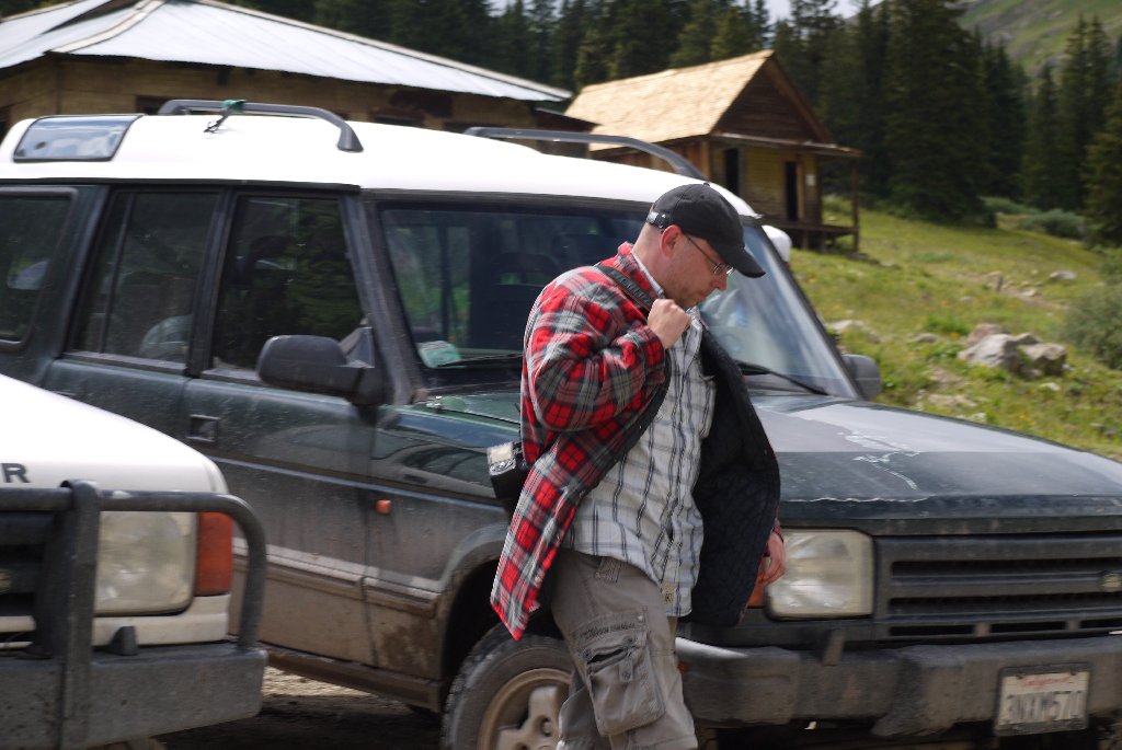
For this report, I pirated some photos of my travel companions.

Vehicle preparations

It’s not like we were about to cross Sakhara or drive from Murmansk to Magadan, but – for people who work for a living, a vehicle breakdown in the middle of vacation is not very popular. Make it two vehicles, make both Land Rovers, and split 400 thousand miles between them. Add a driver who hasn’t been previously known to watch the temperature gauge, and a few people from overseas - and you get the picture.
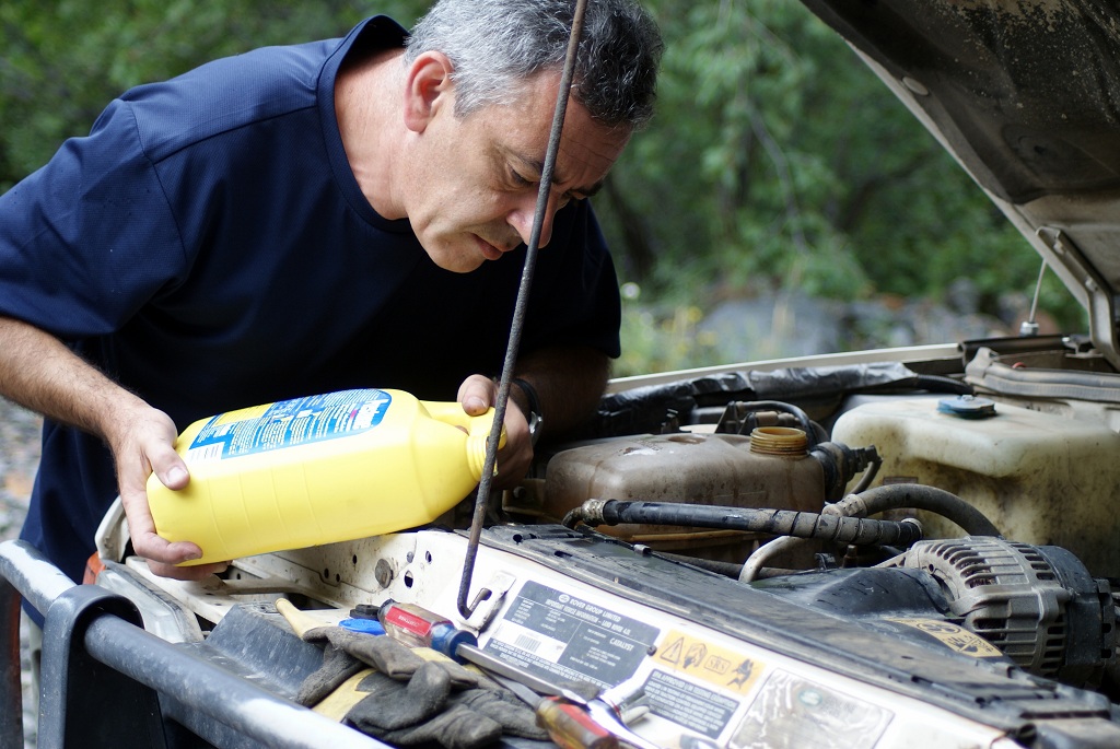
So… The green Disco received a coat of white paint to mask its fading roof, a set of OME HD springs, a set of brand new Chinese-made LT225/75R16 Hercules AT tires (which performed much better than expected, both on and off pavement), an engine oil and filter change, lots of grease in every U-joint (two of which were replaced prior to the trip), gear oil in the diffs and transfer case (including a leak-stopping treatment with Blue Devil snake oil – which also worked well on both trucks). Both transfer case mounts were replaced. This truck accumulated only about 5000 miles since the head gasket job including a rodded radiator and new hoses and fan clutch, so overheating was not expected.
The white Disco, since its 184-mile flatbed ride in Utah earlier in the year, received GM integral-reservoir steering pump and fresh stainless-steel-jacketed hoses. A weep of coolant from under the driver-side head was ignored, much like in May, and a bottle of K-Seal was added to the spares box. The truck has a four-core heavy-duty radiator, a very fresh fan clutch, and a 190F thermostat – all of which kept the engine temperature below 200F during the trip. All fluids were topped off, driveshafts greased, gear oil added to the swivel housings, and one tie-rod end replaced.
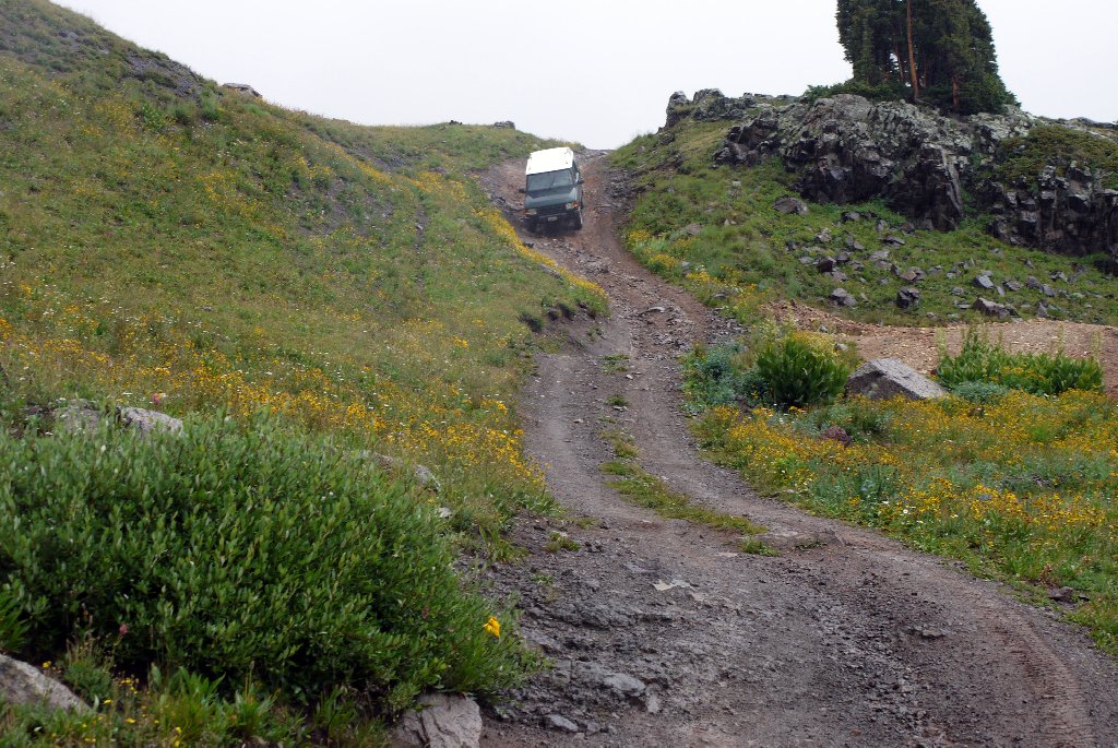
Not that I don’t trust my vehicles, but… a Harbor Freight foldable tow bar, magnet-mount lights, and brackets to attach the tow bar to a Discovery’s framerails, were tossed in the back of a green Disco.

Day One – Sand Dunes and Sedona

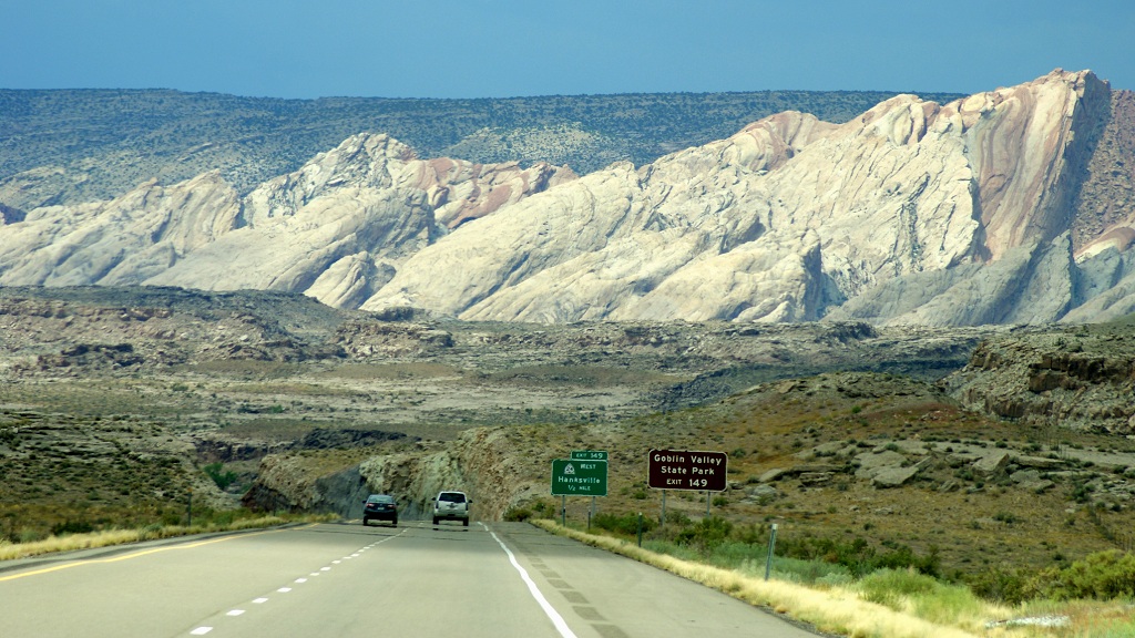
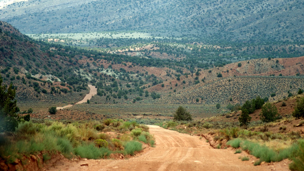
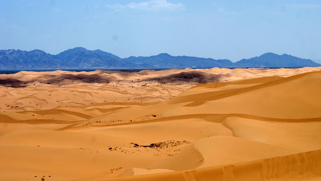
We hit the road in the morning of July 26 from San Diego; the final destination for the day was Flagstaff, and we elected to skip the glory of Yuma and Gila Bend and take a side trip through Imperial Sand Dunes.
In the middle of the week, the dunes were deserted . They didn’t look all that sexy in the broad-daylight photos, so we went on to Quartzsite and Phoenix.

DSC07248.A.JPG


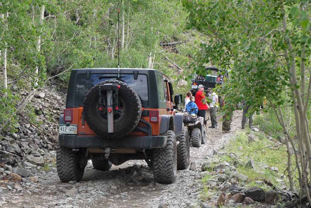
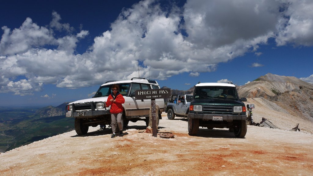
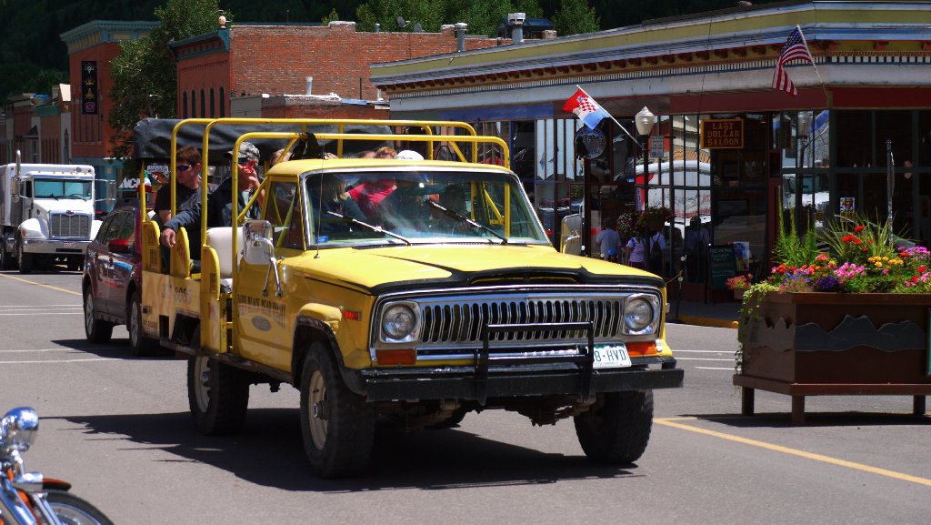
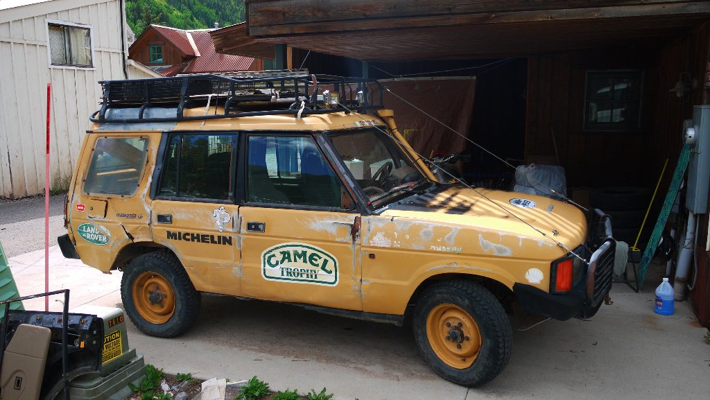
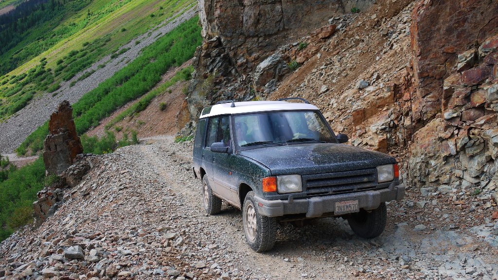
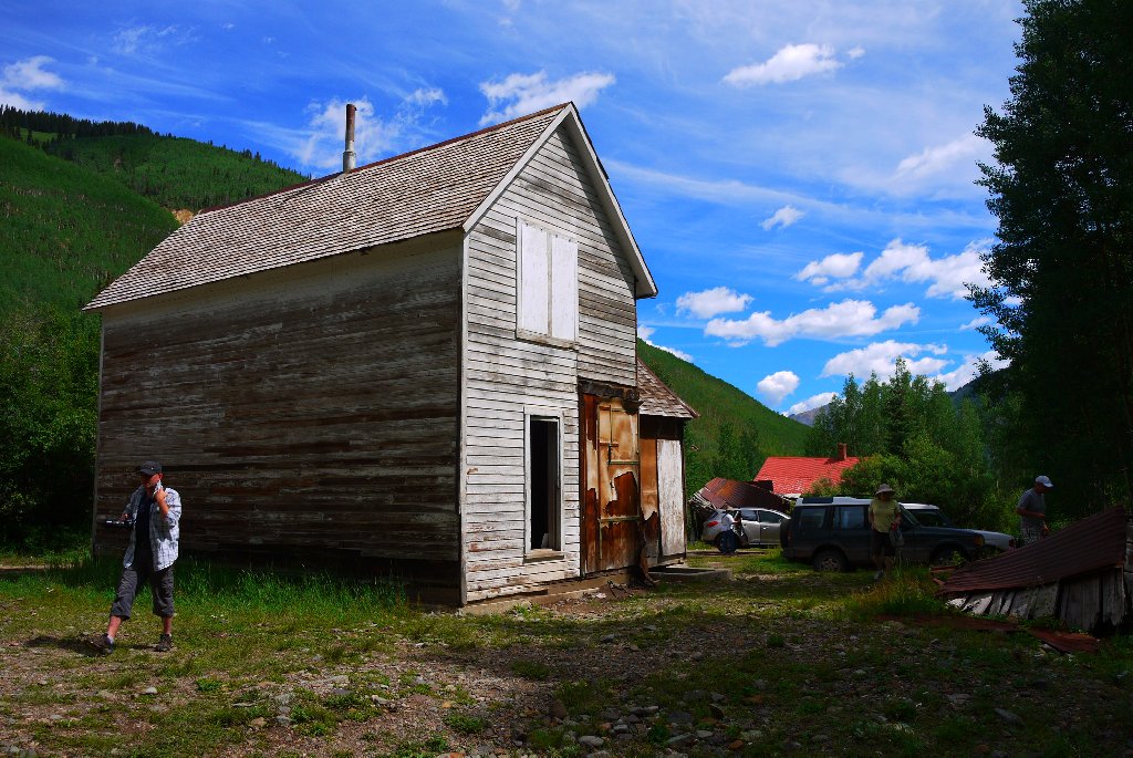
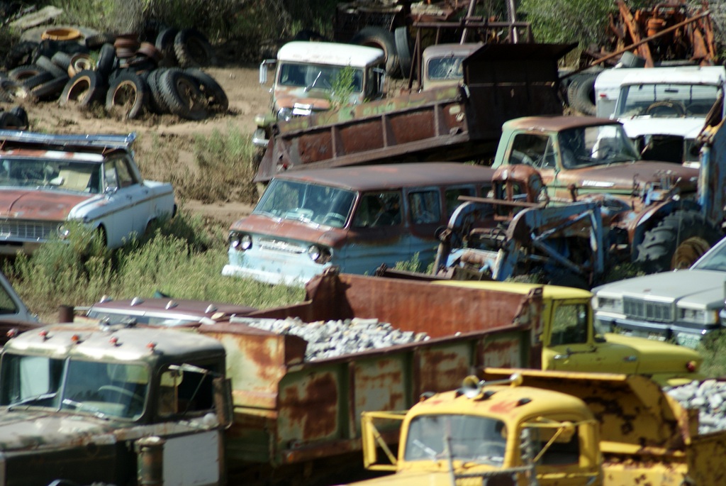
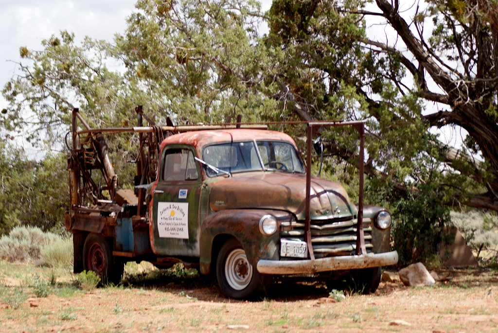
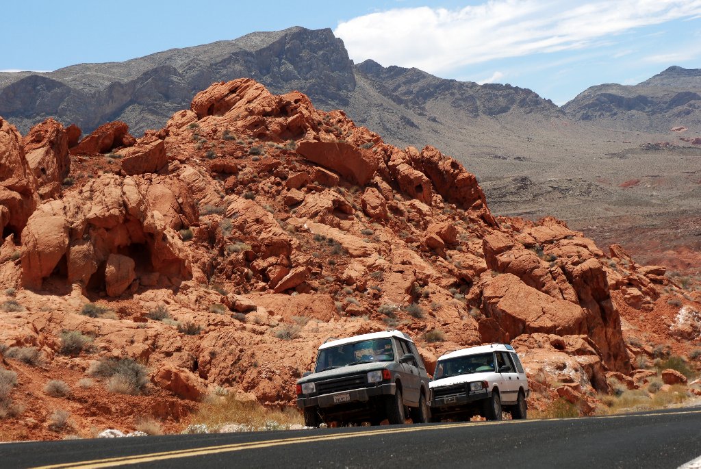
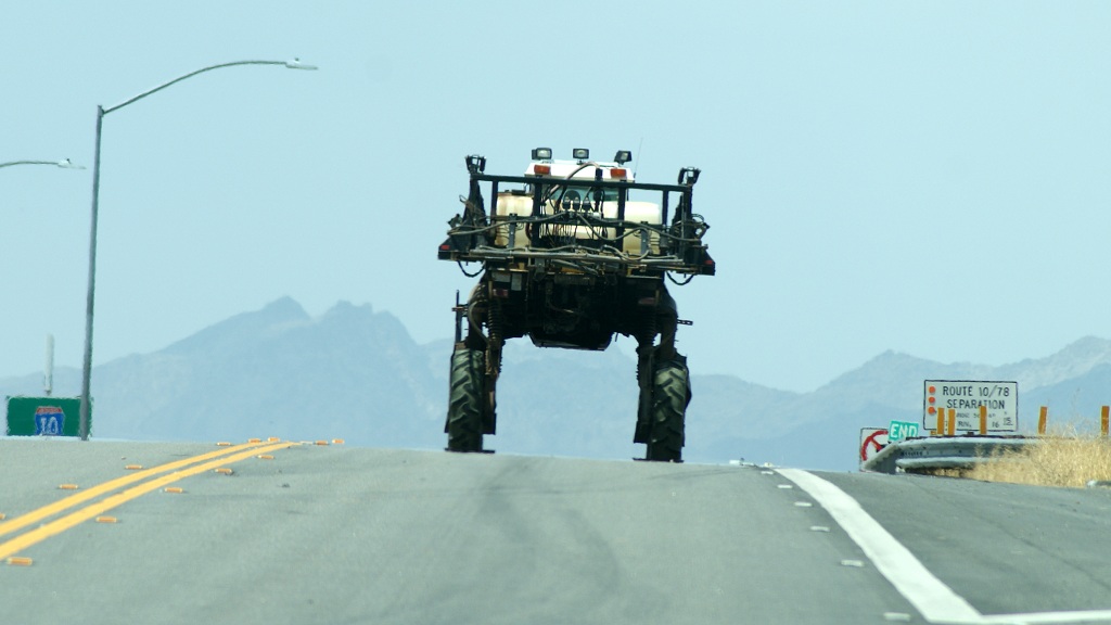
Some cool machinery was observed along the way -
DSC07378.A.JPG


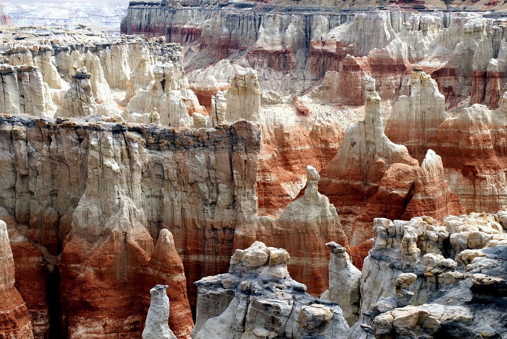
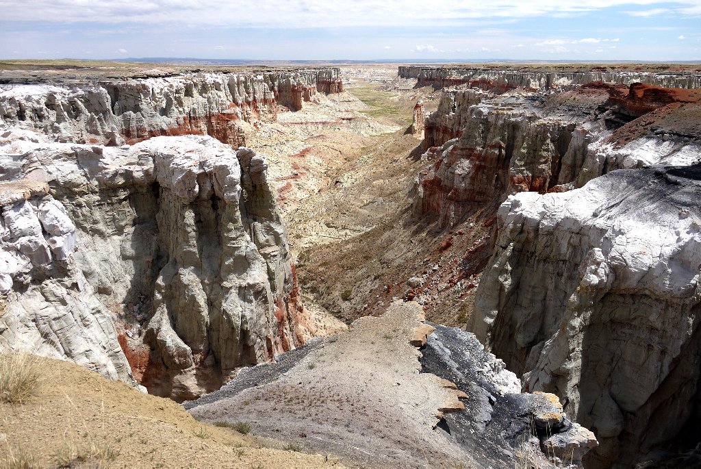
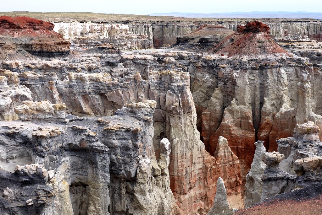
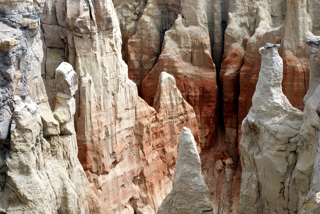
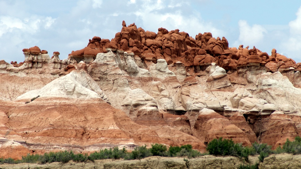
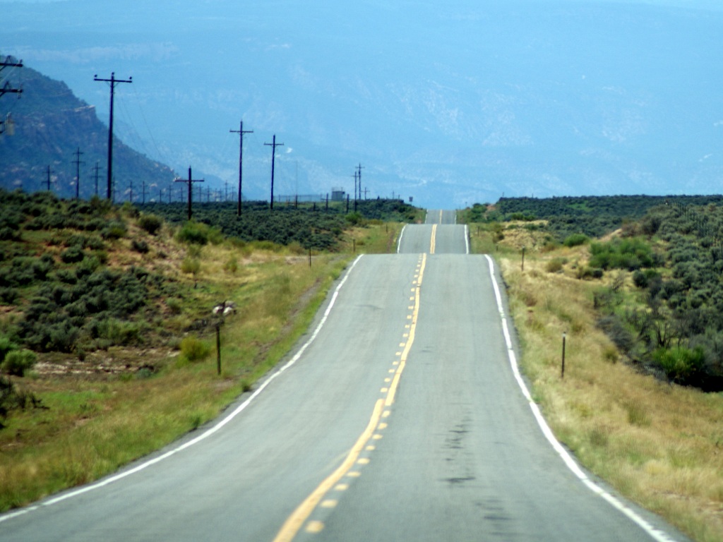
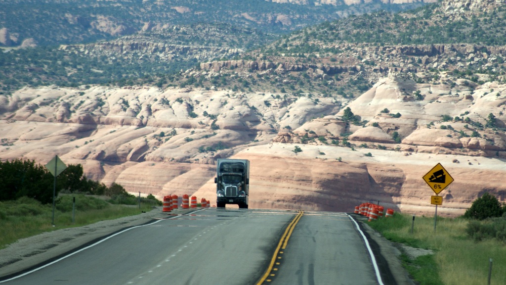
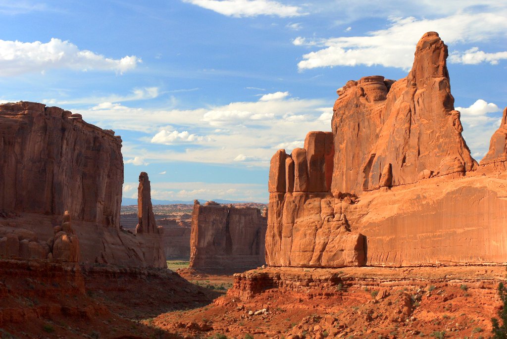
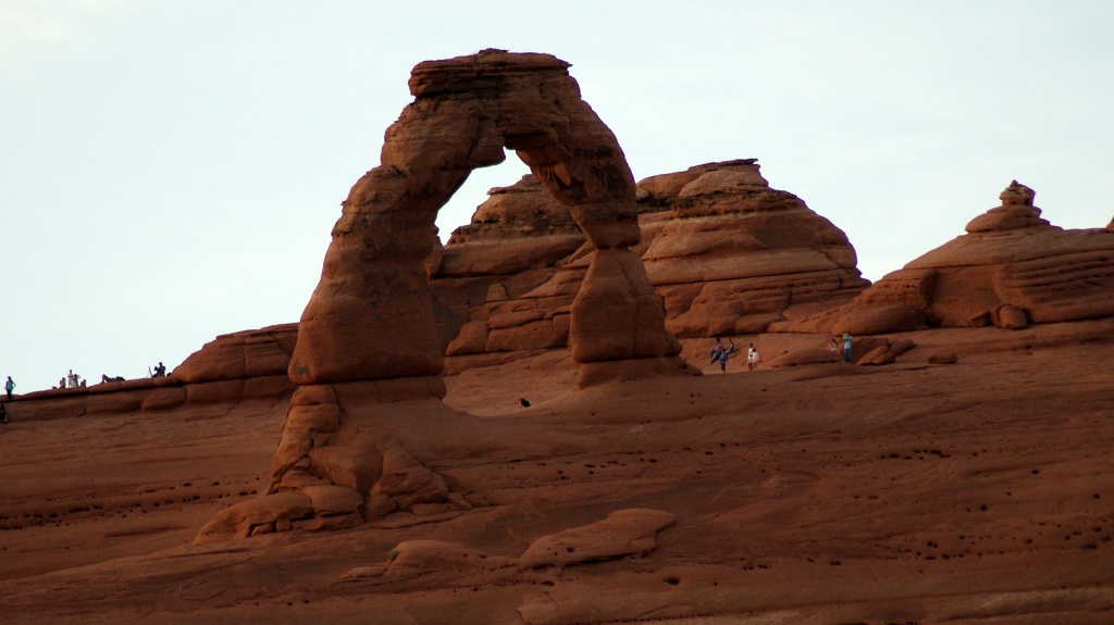
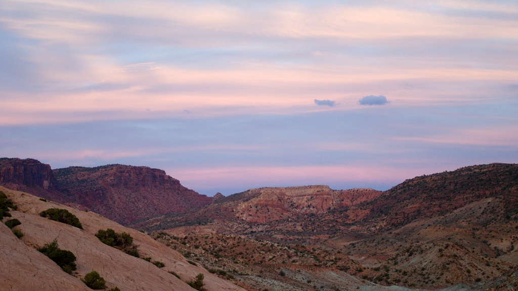
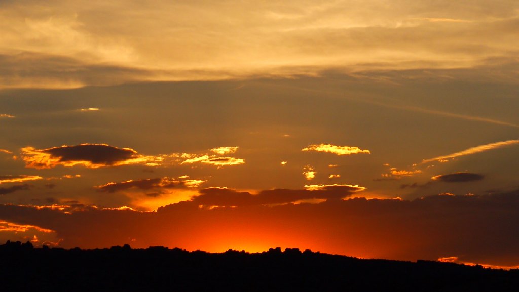
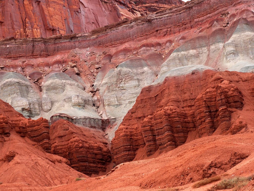
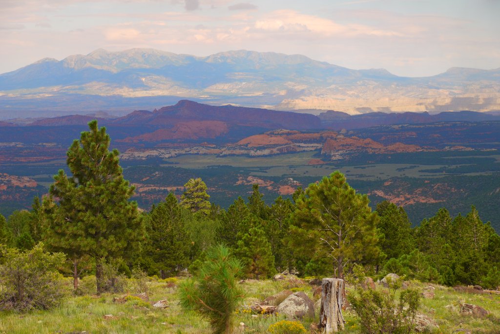
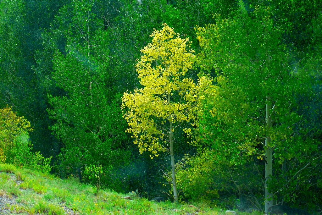
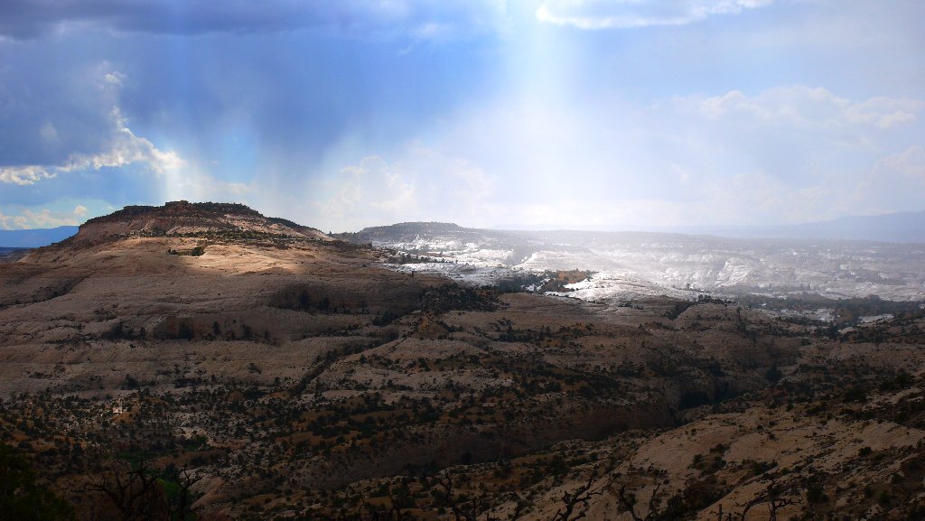
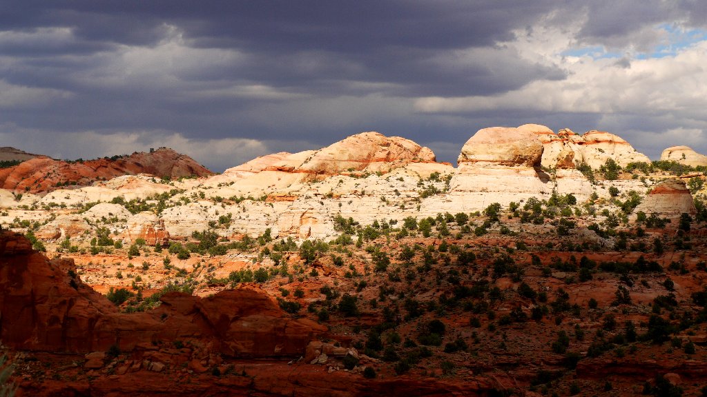
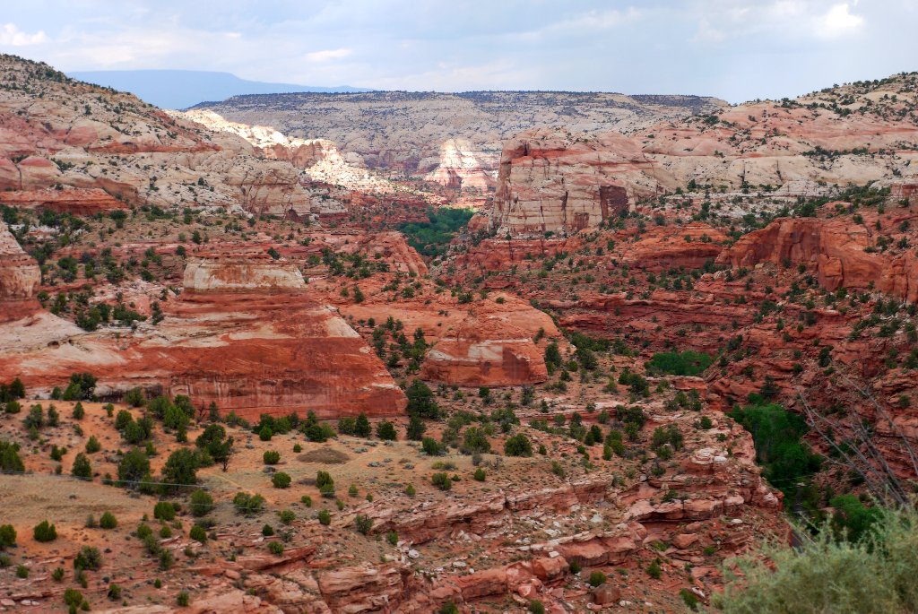
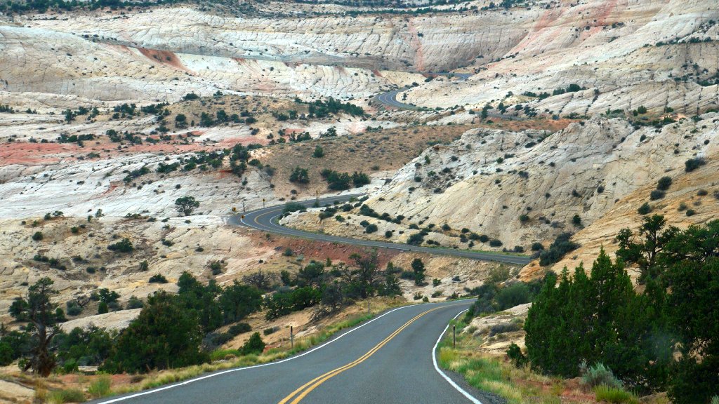
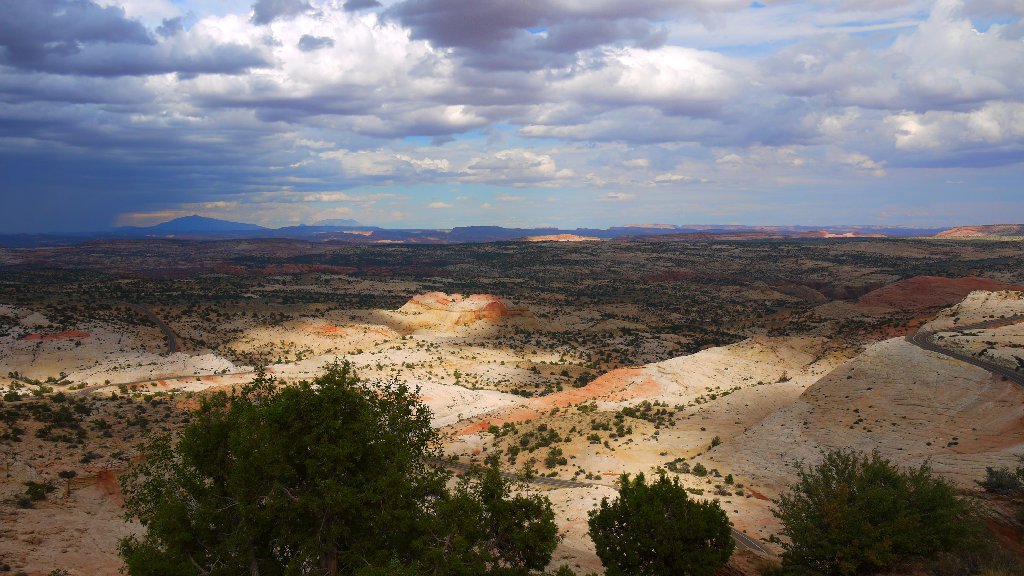
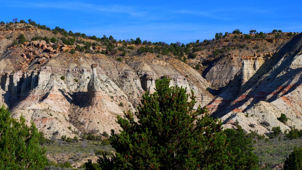
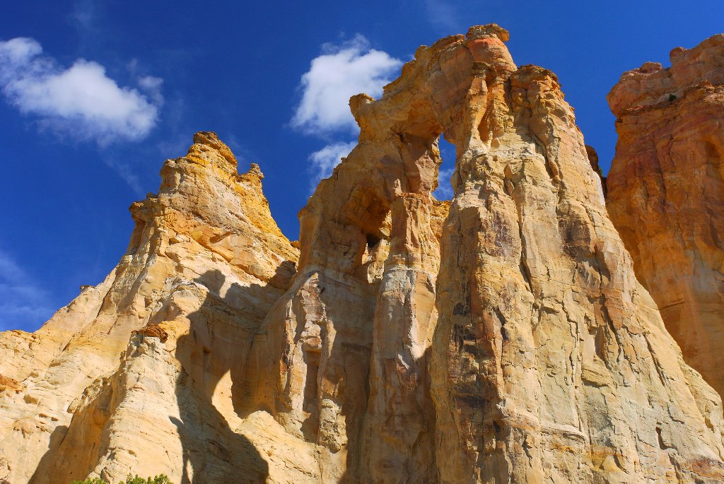
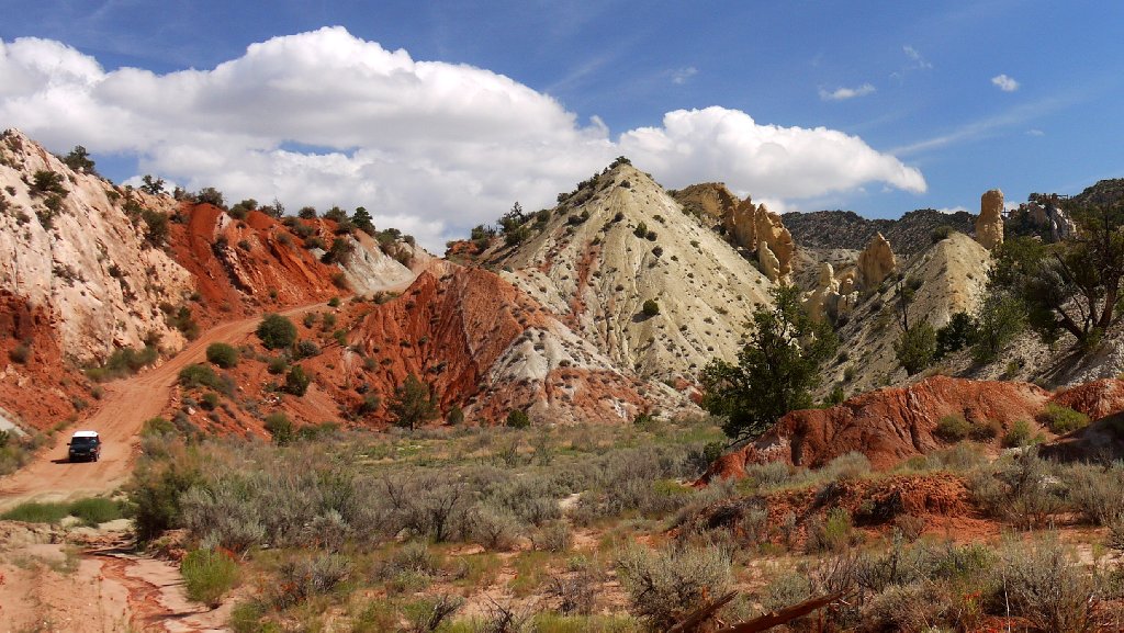
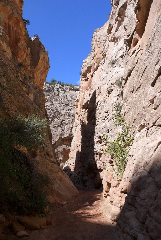
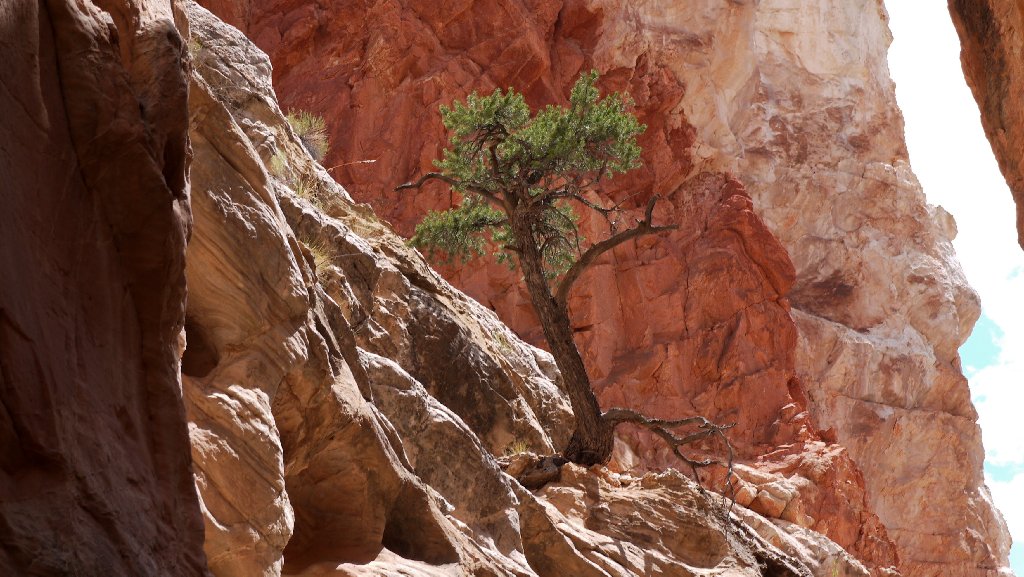
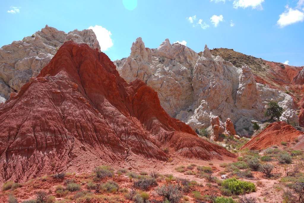
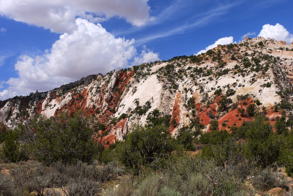
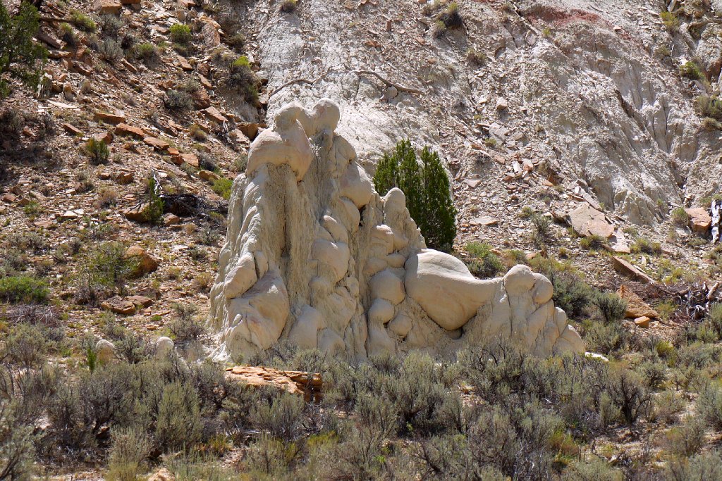
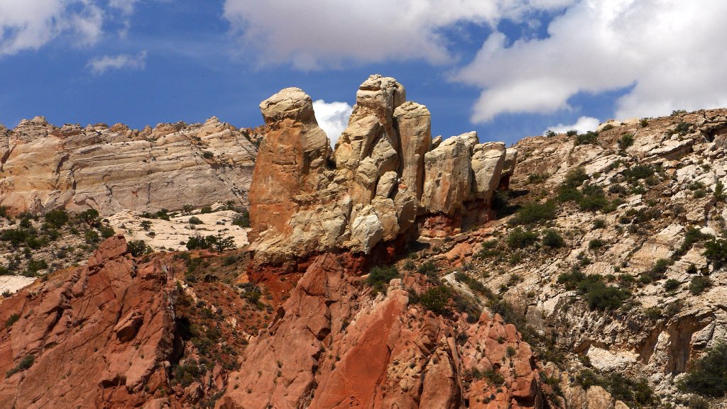
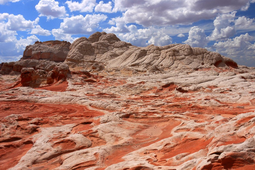
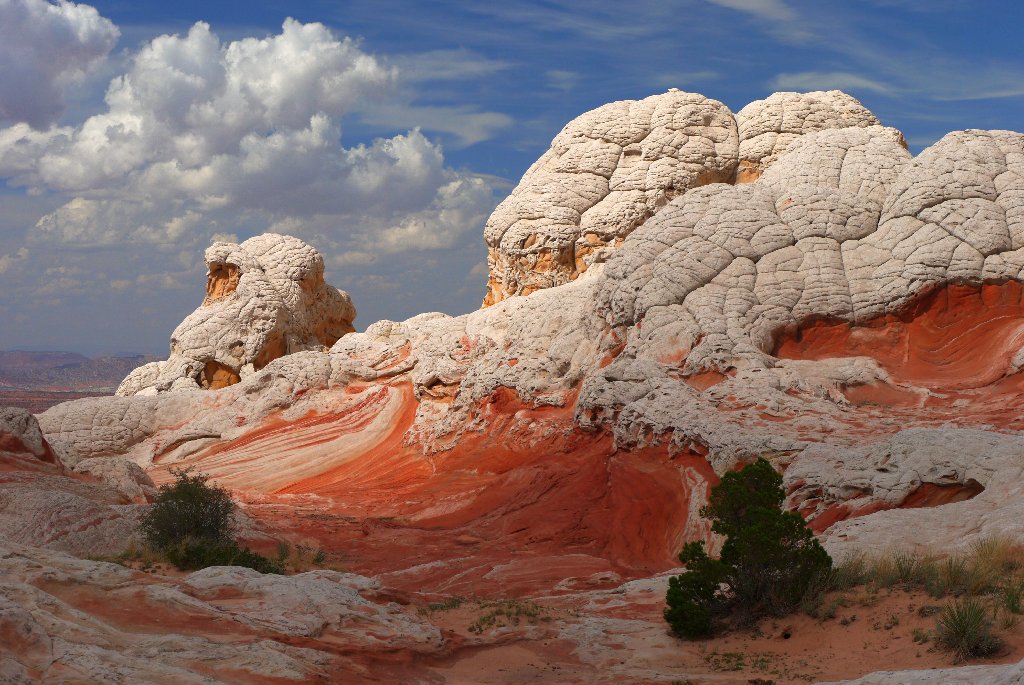
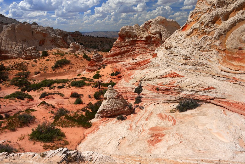
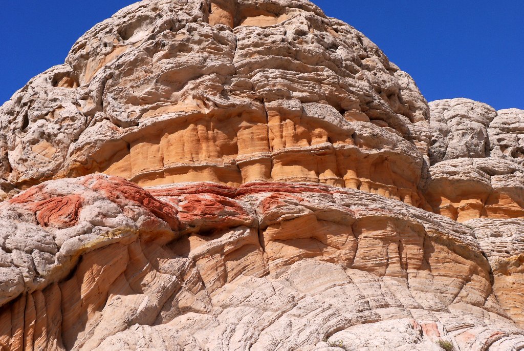
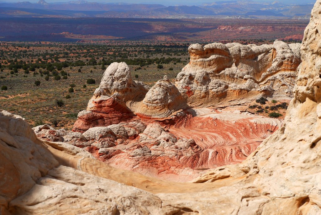
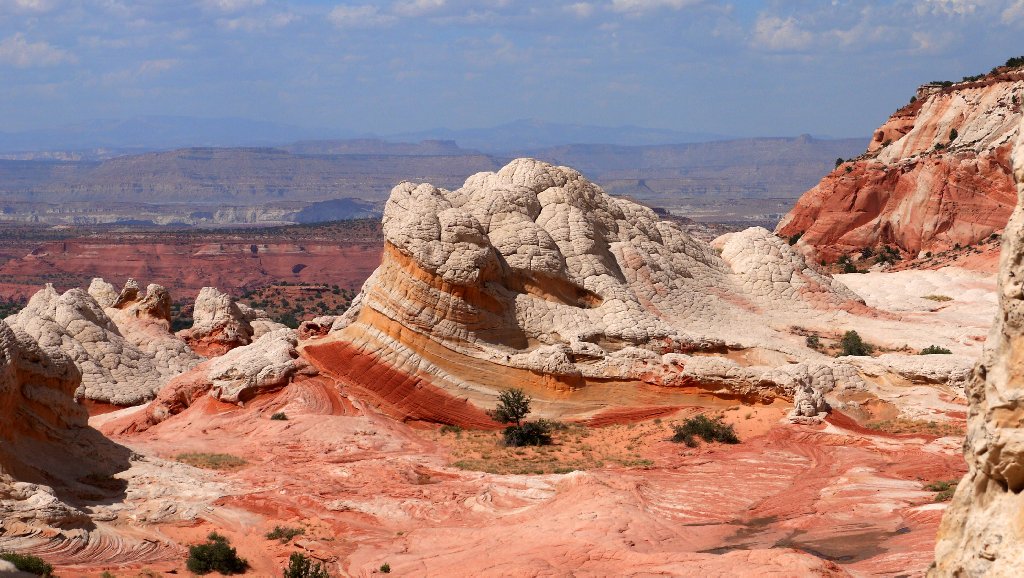
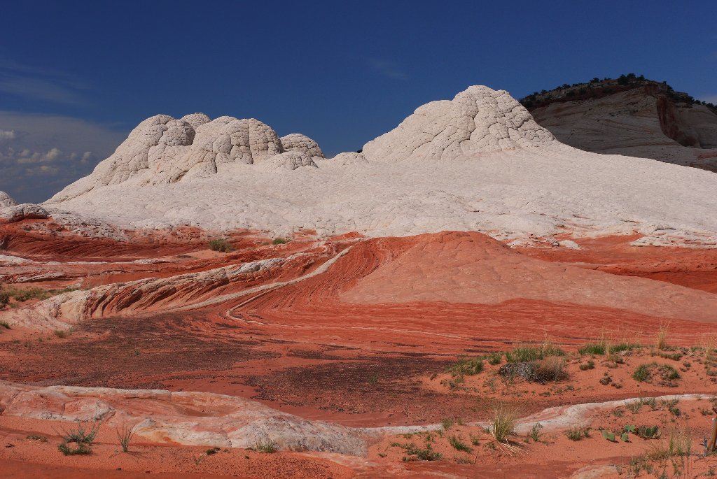
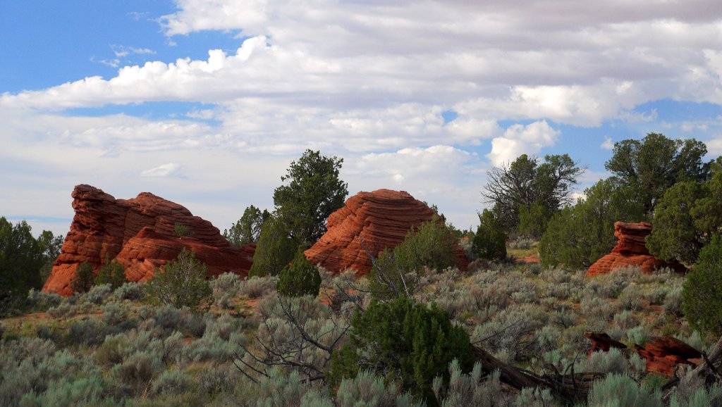
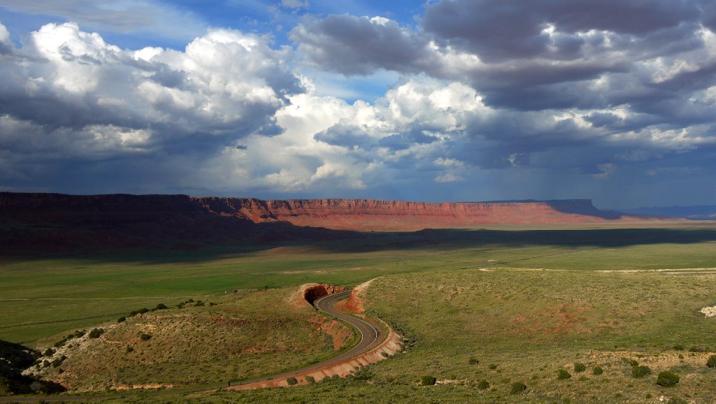
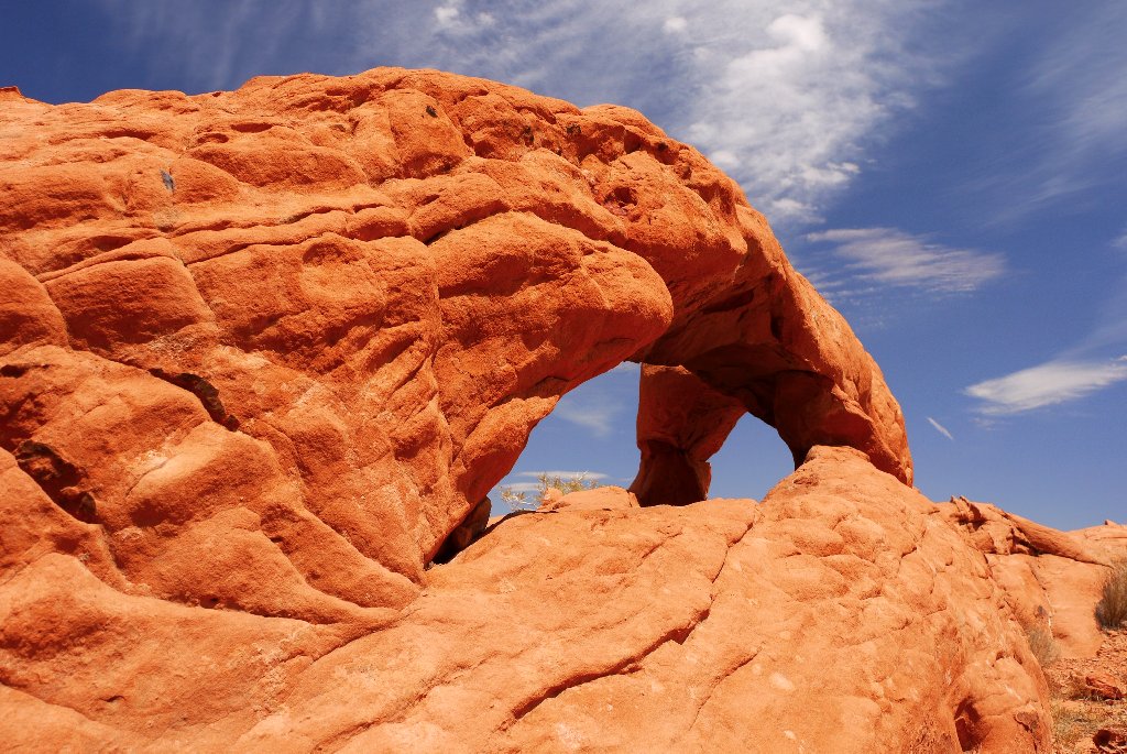
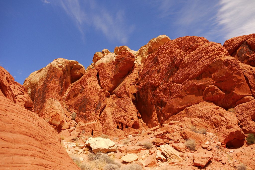
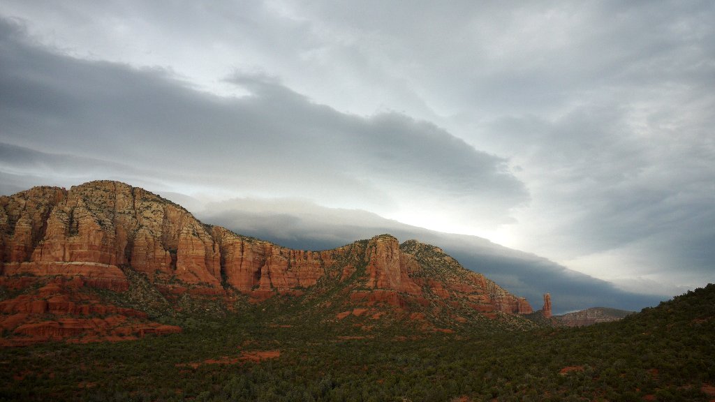
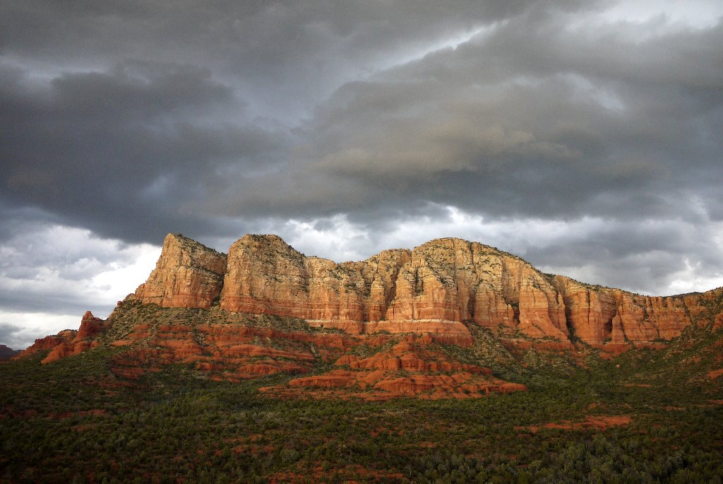
On the way to Flagstaff, we took a sweet detour to Sedona. Evening light and rolling thunderstorms made the skies looking ominous, scenery – entertaining, and sunset - gorgeous.
P1090046.A.JPG


P1090063.A.JPG
 

pmatusov

AK6PM
Day Two - White Canyon, Blue Canyon
After a night in a motel in Flagstaff, we headed out to U.S.89 North towards Cameron and Tuba City. The road onwards included U.S.160 East; however, one intrepid photographer in our group hatched a plan to take a detour to White Canyon (which, not entirely intuitive, is often called "The Coal Mine" by the locals). After a few miles, we broke free from pavement to a faint two-track in the prairie with a few signs of human habitation left behind.
Soon, we were at the edge of the canyon, marveling at the strata of sandstone interspersed with layers of burned coal.

DSC08182.A.JPG


P1090253.A.JPG


P1090192.A.JPG


DSC08344.A.JPG


We met a couple from Strasbourg, France, who also took their time taking the photos, and challenged us to go to Blue Canyon. It took us about half an hour of rather aimless wandering up and down the back roads, until we met a helpful Navajo lady in a pickup truck who gave us the proper directions. The landmarks she mentioned required some good far vision to spot; finally, we were on the right dirt road.
Some fifteen miles into the dirt, we came to a close view of the majestic Blue Canyon:

DSC08541.A.JPG


Unfortunately, that’s where it ended; after heavy monsoon rains every day for the last two weeks, the road was flooded. Out of three vehicles, my Discovery was the only one remotely good for the crossing; however, after a recon on foot, I found that, most likely, I wouldn’t even have made to the water because of quicksand. Funny surface it was – very firm, yet liquefying to a pulp after a few taps with one’s foot.
The creek became a check for level-headedness; crossing it would mean saving about 80 miles of round trip for me, but it served little purpose, since our other Discovery had even smaller tires, no traction aids, and one barely-good recovery point. Our French friends’ front-wheel-drive-only rental Jeep Patriot was only good for its looks.
So, we heeded the signs (“Do not enter when flooded”), and went on a long round-about way back to U.S.160, and towards Four Corners.


P1090284.A.JPG


Four Corners’ site was open, the first time in many years I’ve been driving through, and was a boring point of disappointment. We've used our chance to set a foot in New Mexico, though.

DSC08894.A.JPG


After a few minutes’ watching people attempting to plant various body parts in all four adjacent states, we hit the road yet again and crossed into the Colorful Colorado. Colorado Highway 145 took us towards Telluride, then on to Ridgway and Ouray. GPS was all but useless in finding our rental cabin situated on one of several closely-spaced parallel roads in a deep canyon, but we prevailed.
P1090287.A.JPG
 

pmatusov

AK6PM
Day Three - Yankee Boy Basin and Governor Basin

In the morning, we enjoyed a majestic view of the mountains from the cabin’s living room.

P1090329.A.JPG


The day was gray, gloomy, and wet, and the weather forecast promised rain. We were undeterred, and the plans for the day called for a short trip to two close destinations – Yankee Boy Basin and Governor Basin. We packed the food and drinks for the day, and drove into the town of Ouray.
We crossed town, and turned right on Camp Bird Road. Supposedly passable by any passenger car, this road climbs very steeply up the canyon. I found myself engaging the low range in the transfer case immediately after the creek crossing – more by the seat-of-the-pants feel than out of necessity.
Here, the first-timers were treated with the feel of a shelf road, occasionally blasted out of a vertical rock wall.
P1090466.A.JPG


We passed what’s left of Camp Bird mine, and took the right fork in the road to Yankee Boy Basin. The Sneffels Creek was full of rainwater, and came down in a cascade of waterfalls. The lack of sunlight and relentless rain made for some gloomy and uninviting scenery. Yet, the flowers were more than happy.

P1090344.A.JPG


P1090393.A.JPG


We donned rain gear and took a bunch of gloomy photos.

P1090359.A.JPG


The wildflowers did not disappoint, however -

P1090361.A.JPG


DSC08999.A.JPG


P1090383.A.JPG


There was a large group of jeepers ahead of us; they completely occupied the parking area at the end of vehicular portion of the trail, so we turned around and headed downhill to take another trail to Governor Basin.

P1090439.A.JPG


P1090444.A.JPG


P1090448.A.JPG

The flat spot near the end of Governor Basin trail, at an abandoned mineshaft entrance, was blocked with large rocks – that either rolled downhill or were deliberately winched onto the road. We turned around and headed downhill to Ouray. The evening was spent in cooking and eating lamb, washed down by copious amounts of tequila.


P1090467.A.JPG
 

pmatusov

AK6PM
Day Four - whatever we could make of the Alpine Loop

The vague plan for the day included Alpine Loop; knowing the eagerness of our troop to jump out of the vehicles and take all photos in the world, I doubted we’d ever see Capitol City or Engineer Pass. Sure enough, we did not.
In a remarkable congeniality of timing, we arrived at the Mineral Creek trailhead on the side of U.S.550 right behind the same group of jeepers! It took them forever to get rolling, but then the factory plastic radiator plug blew up in my Discovery. It produced a few chuckles from the jeepers, but only took about five minutes to fit a replacement plug and top off half a gallon of lost coolant. It was the only issue with both vehicles we had to deal with along the entire trip!

DSC09703.A.JPG


We stopped to take a few photos of what was left of San Juan Chief mine, and proceeded to the junction of Mineral Creek and Poughkeepsie Gulch trails.

P1090546.A.JPG


Poughkeepsie was out of question for the green Discovery, so we hiked a hundred feet downhill to see the waterfalls. A curious deer wandered close by, and didn’t care much for us lurking around with the cameras.
P1090565.A.JPG


DSC09808.A.JPG


Farther into the trail, we ran into a traffic jam made of the jeep group. Apparently, one of the jeeps (a rental Wrangler) slid off the trail – in a section with a 40-45-degree downhill slope – yet somehow did not roll over. The Wrangler was about 15 feet down from the edge of the road, and the jeepers set about winching it back – which was not an easy task, with two or three winches working in a team to get the vehicle uphill while keeping it upright. Finally, the commotion ended, and we headed further.

P1090584.A.JPG


The weather improved considerably, with the rain slimming down to a drizzle, then stopping altogether. It had a perfectly-adverse effect on our progress, since we made even more-frequent photo and hiking stops.

P1090607.A.JPG


P1090629.A.JPG


DSC09871.A.JPG


DSC09904.A.JPG


The rain seemed to have stopped, which tricked us into setting up a lunch spot. It started again before we even unpacked the food, so we strung a tarp between two parked trucks - just as we planned.

2013-07-29-3058.A.JPG


At a certain point, it was already too late to press on to Engineer Pass and to Capitol City and Lake City. So instead of turning to Engineer Pass, we kept climbing up the trail, until we reached the ghost town of Animas Forks.

There is an on-going effort to preserve the remaining structures, so several people were working on the town site. The Walsh House with its glorious bay window is now very safe to enter, walk around and go upstairs – which was not the case a few years ago. New timber will take a while to fade and blend with the rest of the buildings, so for now it looks out of place. Nevertheless, I’d love to see it slowly coming back from near ruins – rather than see the buildings go one after another

P1090727.A.JPG


P1090731.A.JPG


P1090765.A.JPG


We continued on to California Pass, which greeted us with ferocious wind, and rain mixed with hail.

P1090800.A.JPG


At the pass, it was so miserable outside that nobody even cared to take a photo near the sign. Later on, I looked down at Lake Como – my favorite lunch spot from the years past – and saw it pelted with hail, and the road downhill (the upper portion of Poughkeepsie Gulch) too muddy for the green truck to proceed.

P1090824.A.JPG


We took the connecting Hurricane Pass trail, and the skies somewhat cleared up just in time for a photo.


P1090828.A.JPG

The weather kept improving; we drove to the junction with the Corkscrew Gulch, which was a destination in itself for us. Shortly after the Corkscrew Gulch parts ways with Hurricane Pass, there is a dead-end spur trail into a valley which we knew for its gorgeous views. It certainly did not disappoint.


P1090864.A.JPG


P1090896.A.JPG


P1090923.A.JPG


P1090998.A.JPG


P1100024.A.JPG


The conditions improved considerably, allowing us to break out our “field kitchen” and have a late lunch al fresco. Once we had our fill of photos and coffee, we returned to Corkscrew Gulch and went steeply downhill towards U.S.550.
Back in Ouray, we were greeted with gorgeous evening skies. We capped the day by dipping in Ouray Hot Springs’ 103-degree water.
 

pmatusov

AK6PM
Day Five - Imogene Pass, Telluride, and Ophir Pass

The plan for the day included traversing Imogene Pass, visiting the town of Telluride, and returning to Ouray via Ophir Pass. So, as soon as we were done with breakfast, we headed back to Camp Bird Road, and split off to Imogene.
The day, the skies, and the flowers were gorgeous – we couldn’t have picked a better day for this trip. Remarkably, the timing worked out yet again – despite how different must our morning routine have been from the group of jeepers, we found ourselves at the tail end of their convoy. To keep our heads out of noxious fumes from a couple of carburetted CJ7s and YJs, we stopped by the great waterfall just off the trail.

DSC00010.A.JPG


The flowers felt the sun and went crazy.

P1100122.A.JPG


P1100123.A.JPG


DSC00034.A.JPG


DSC00041.A.JPG


DSC00116.A.JPG


Fortunately, the oncoming traffic wasn’t too heavy, and we soon reached Imogene Pass.
A mandatory photo near the sign, and that of the mailbox, was taken.


P1100147.A.JPG


P1100151.A.JPG


P1100154.A.JPG


Now, we could get on with the descent into the remains of the ghost town of Tomboy. We walked around Tomboy town and mill sites, wondering about the purpose of steel parts strewn around, and taking what we fancied to be artsy photos.

P1100182.A.JPG


P1100185.A.JPG


After a while, we felt hungry, and headed downhill to Telluride. The view of Black Bear Pass and the Bridalveil waterfall appeared at our left.

P1100217.A.JPG


Telluride appeared in our view soon, although there we still had a couple of miles of switchbacks to cover.
DSC00852.A.JPG


The town of Telluride, after its bouts with mining decline, influx of hippies and conservationists, and dope smuggling, firmly established itself as a fancy mountain resort. The streets and glass storefronts are clean, brand-names and fancy cars present, and flower pots situated in the median of the main drag.
Still, there’s hope for Telluride – here’s some off-road luxury squeezed in by off-road beaters.

P1100248.A.JPG


It was also nice to see one of the last true Jeep rides – a late-70s J-truck carrying happy passengers.

P1100250.A.JPG


While walking around town, we spotted what seemed to be a real Camel Trophy Discovery – complete with dents, rips, tears, broken windows, and badly worn skinny Michelins on badly bent steel rims!

P1100278.A.JPG


Ogling that Camel Trophy truck wrapped up our visit to Telluride, and we drove South on Colorado 145 towards the turn-off to the town of Ophir. The little town doesn’t seem to care much for tourists, and rerouted the road away from the main street with mean speed bumps and speed limit signs. We were barely making the legal 15mph when a local cop in a squad SUV waved us to slow down even more.
Around town, there were telltale signs of its mining past.

P1100291.A.JPG


Soon, we were fully into a large aspen grove – which looked like perfect grounds for wild mushrooms.
Not even a minute into the aspens, I spotted a large mushroom of Leccinum aurantiacum variety. These mushrooms are perfectly edible and are members of Boletes family, and relatives to Porcini mushrooms.
DSC00988.A.JPG


It took us less than half an hour to collect enough mushrooms for a hearty dinner! After this success with wild mushrooms hunting, we took to the road and uphill towards Ophir Pass.

P1100303.A.JPG


P1100312.A.JPG


P1100327.A.JPG


Once we descended to U.S.550, we headed North towards Ouray. Still, there was a couple of photographic “checkpoints” for us – the remnants of old silver mine, Red Mountains # 2 and 3, and a man-made lake making gorgeous mirror-like images of the mountains.

P1100350.A.JPG


P1100366.A.JPG


The evening was busy with cleaning, pan-frying, and eating the mushrooms.
 

pmatusov

AK6PM
Day Six - between Ironton and Arches
This was supposed to be our last day in San Juan Mountains of Colorado; we planned to take the pavement route to Moab, Utah, some three hours away. However, somebody checked the weather forecast, and noticed the 25-degree difference in temperature between Moab and Ouray, and not in Moab’s favor. After some hesitation and soul-searching, we put off the departure to Utah, and went to hike around the ghost town of Ironton (somewhat halfway between Ouray and Silverton).
P1100380.A.JPG


P1100383.A.JPG


P1100384.A.JPG


P1100388.A.JPG


P1100398.A.JPG


P1100407.A.JPG


P1100422.A.JPG


It didn’t take us long to come across our first mushroom score. By the time we completed our stroll, we had another pile of mushrooms, and decided to dry them out in the back of the green Discovery. About one-third of these made it back to San Diego!

P1100409.A.JPG


P1100425.A.JPG

We took one last look at the town of Ouray from the U.S.550. The drive from Ouray to Moab went uneventful, interrupted mostly by our attempts to identify pieces of automotive machinery deposited in the backyards of the local population. Quite a few rarities were found.

DSC01216.A.JPG


I don't remember passing or being passed by a single vehicle almost all the way from turn-off to Telluride and U.S.191. Wait, I don't remember ever passing anyone or being passed by anyone on this road in all trips we've made along this stretch of CO 145/CO 141/CO 90/UT 46. It makes this road even with California highways 168 and 190 near Death Valley.

DSC01233.A.JPG


DSC01301.A.JPG

Later in the day, we rolled to a stop at Moab KOA campground, and were hit with a heat wave once the doors flew open. Dropped our stuff in the cabins (kabins in KOA speak), and headed out to Arches National Park.

The skies opened up with fantastic clouds, making late afternoon and evening views of the Arches’ features even more scenic.

P1100428.A.JPG


DSC01579.A.JPG


DSC01646.A.JPG


DSC01805.A.JPG


P1100503.A.JPG


P1100516.A.JPG


The evening came as we arrived to the viewpoints of the Delicate Arch; we regretted not being able to reach the arch from the Wolfe Ranch site – until we saw the crowd of photographers rimming the arch.
So we simply enjoyed another fiery monsoon-sponsored sunset.

DSC01870.A.JPG


DSC01909.A.JPG


P1100537.A.JPG


The night in the KOA cabin left quite a bit to be desired – hot and stuffy.
 

pmatusov

AK6PM
Day Seven - Capitol Reef and Grand Staircase – Escalante

We woke up somewhat heavy-headed, and decided to pack up our stuff and head into town of Moab for breakfast. Our lucky streak with clear skies seemed to be ending – a large front approached Moab from the West.
We left the campground amidst flying tents and camping equipment, and a few drops of rain. Our way continued North on U.S.191 to Interstate 70, then South on Utah highway 24 through Capitol Reef National Park and Grand Staircase – Escalante National Monument.
On the Interstate 70, a view opens up of the San Rafael Swell - I wish we had time and weather to explore it.

DSC02015.A.JPG


The grayish hills on the 24 gradually yielded to the ochre, and then red, of towering walls of the canyon in Capitol Reef’s Northern expanses.

P1100598.A.JPG


DSC02271.A.JPG


DSC02196.A.JPG


We managed to dodge the rain squalls pretty well, although we could see the localized storms all around us. Soon, we stopped at the pull-over area where a couple of locals told us of an imminent flash flood. We trusted them an hour-long wait of the floodwaters, which eventually came – if not quite as spectacular as we anticipated. A few weeks after the trip, we learned of the epic-proportions flash flood not too far away - in Page; in the retrospect, we shouldn't have been all that eager to wait for the flash flood in a narrow canyon.
P1100611.A.JPG


P1100618.A.JPG


While we waited, the storm kept going – and getting closer to us. We made a short stop at Fruita’s orchard – to pick up some peaches and apples. A little sunflower looked like a sad prisoner of the orchard.

P1100624.A.JPG


P1100628.A.JPG


P1100629.A.JPG


P1100635.A.JPG


The time has come for Capitol Reef to show its full glory. We stopped at the Goosenecks’ overlook for more sight-seeing and photo session.

P1100640.A.JPG


P1100641.A.JPG


P1100646.A.JPG


P1100648.A.JPG


P1100650.A.JPG


In the little town of Torrey, we left Highway 24 and entered the “Dixieland of Photographers” – Utah Highway 12.
The highway skirted the edge of Aquarius Plateau – and climbed to about 400 ft short of the Plateau’s 10 thousand foot elevation. We crossed all vegetation zones from a typical Utah redstone through mixed and conifer forests to alpine tundra and back, all within an hour and a half. As we slowed down going uphill, the storms caught up with us, and doused us with rains. Between the towns of Boulder and Escalante, Highway 12 winds along the top of one giant fin separating two deep gorges, and the views are really breathtaking. Come to think of it, I may not have known about it without Chris Snell's planning of the spring trip to Utah.
P1100696.A.JPG


P1100698.A.JPG


P1100717.A.JPG


P1100735.A.JPG


P1100741.A.JPG


P1100750.A.JPG


P1100762.A.JPG

We ended up our day at the Bryce Valley KOA campground in Cannonville, Utah - with a great beef kabob with the friends from Nevada.

P1100778.A.JPG


_DSC3906.A.JPG
 

pmatusov

AK6PM
Day Eight - Cottonwood Canyon and White Pocket

We didn’t plan on covering too much ground on this day, but some of the going was to be interesting. Cannonville KOA campground is right on the Kodachrome Way, which turns into a Cottonwood Canyon Road. The road goes mostly along the bottom of a canyon following a great old fault, which is nearly straight for 40 miles or so. All sorts of landscapes and colors can be found along the way, starting with pale-ochre Grosvenor Arch.

P1100793.A.JPG


Near Cottonwood Narrows, the landscape turns into a mix of bright red and white sandstone.

P1100843.A.JPG


We took our time to hike Cottonwood Narrows – a nearly-slot canyon in places, and incredibly scenic.
P1100854.A.JPG


Our resident geologist-photographer explained how things came to be here.
P1100863.A.JPG


P1100886.A.JPG


P1100888.A.JPG


P1100904.A.JPG


P1100927.A.JPG


Further South, the views along Cottonwood Canyon Road became no less spectacular.

P1100932.A.JPG


P1100946.A.JPG


P1100973.A.JPG


P1100996.A.JPG


P1110002.A.JPG


The road veers to the East of the fault line near its South end; we hit the pavement on U.S.89 for a few miles to the West, and turned left on House Rock Road – which continues its way South along the same fault line.
Our next destination was the famous White Pocket . We heard about the place, but until this day never cared to take the drive. The road surface became so badly washboarded that we had to stop and air down – something we didn’t care to do even while four-wheeling in Colorado. It had a side benefit, too – after about 20 miles, we turned East on the road that had many spots with deep and soft sand. Having some extra tire footprint was very beneficial – we wouldn’t get stuck, but we could maintain a fairly fast pace.

DSC03482.A.JPG


DSC03535.A.JPG


We weren’t quite ready for what we saw in White Pocket. We grew used to bizarre geological features in the America’s Southwest, but White Pocket was simply insane.

P1110049.A.JPG


P1110053.A.JPG


P1110058.A.JPG


P1110085.A.JPG


P1110127.A.JPG


P1110131.A.JPG


P1110132.A.JPG


P1110142.A.JPG


Between House Rock Road and White Pocket, on the County Road 1086, bizarre red stone outcroppings rise between low cypress trees.

P1110150.A.JPG


By the late afternoon, we were back to House Rock Road.

P1110161.A.JPG


We left the valley at the intersection with U.S.89A, and drove West towards our motel in St.George, UT. By the time, we were too tired to take a “quick” 80-mile side trip to the North Rim of Grand Canyon, and our planned trip to Coral Pink Sand Dunes was also scuttled. The skies treated us with a gorgeous sunset, and a 270-degree view from an observation point not far from Grand Canyon.
The night saw us eating not-very-hot pizza with not-very-cold beer in a not-too-clean Econolodge room in St. George. We must have been pretty worn out already.
 

gunnermoose

Adventurer
Those pictures are amazing. My son and I are planning a trip to do those passes this October. I am hoping the major snow will hold off until we complete. Your picture make me want to load the truck and go today.

Nicely done!
 

pmatusov

AK6PM
Day Nine - Valley of Fire, Lake Mead, and Hoover Dam

In the plans for the day we had a nearly-shortest highway ride – from St. George to Valley of Fire in Nevada. The drive was entirely unremarkable; when we turned our engines in St. George, we could already feel the heat coming in. What was in store for us in the Valley of Fire?
Heat.
Opening the door of the Land Rover felt like peeking into the baking oven – 104F was in sharp contrast with balmy air-conditioned environment inside the trucks. That meant, among other things, that any long hiking trips were out of question – at least because it could be dangerous to some from the crew. The engine of my Discovery, which has never reached temperatures in excess of 195F during the entire trip, reached 210F within several minutes of idling at the parking lot with A/C on – still perfectly safe, but telling. So we decided to limit ourselves to attractions within five minutes’ trips from the road. It turned out there were many.
Fortunately, the famous “Elephant Rock” could be reached in a lot less than half a mile.

P1110225.A.JPG


P1110248.A.JPG


P1110271.A.JPG


P1110282.A.JPG


P1110290.A.JPG


P1110296.A.JPG


P1110301.A.JPG


P1110304.A.JPG


P1110313.A.JPG


P1110318.A.JPG


We decided not to return to Interstate 15 from the Valley of Fire, but drive along the shores of Lake Mead instead.
We stopped at the Echo Bay Marina for a fantastic refreshing dip into the lake, and a watermelon lunch.

P1110342.A.JPG


P1110350.A.JPG


It was so hard to leave the beach that we only arrived to Hoover Dam around 5 pm.

P1110382.A.JPG


After taking in any views that could be taken without the assistance of already-closed park office, we took U.S.93 back to Sin City.
The Hard Rock Hotel and Casino in Las Vegas proved itself to be the Hard Rock Bottom of our trip. Upon our arrival, we tried to call the hotel staff’s attention to the broken door lock, clogged sink and bathtub, and beer caps on the floor – but the telephone was broken as well. All in a $254 hotel room, no less. So we were just happy to leave it behind, and reach San Diego in a good 5 hours and 14 minutes, beating the GPS estimate by 2 minutes despite 50 miles of traffic jams and a fuel stop.
Now the trip is over, we are home happily poring over photographs and videos from the trip. In the morning after the trip, the white Disco refused to fire on all 8 cylinders - and a compression check confirmed the impending head gasket job... Thanks for keeping it together for 2500 miles!

Finally, some statistics
Total mileage - 2473 miles
Out of these, off pavement - 149 miles (about half of those - in low range)

The lowest point of the trip - sea level
The highest point of the trip - 13,220 ft above sea level
The largest elevation change in a day - 5500 ft

Gas mileage (in a truck with 249.7 kmi on the clock, running on 265/75R16 tires, with 1.4:1 high range ratio):
Average - 13.5 mpg
Worst - 10.8 mpg (bombing up Interstates 40 and 17)
Best - 19.1 mpg (in San Juan Mountains)
Motor oil used - one and a half quarts
Fuel costs per mile - 30 cents
Mechanical breakdowns - 1
Time to fix them - 5 minutes.
 

roverrocks

Expedition Leader
WOW!! Absolutely marvelous pictures and adventure. Great and stunning photography. As I am also a Disco owner in the Four Corners area I enjoyed them even more!! Thanks for posting!!
 

Forum statistics

Threads
185,914
Messages
2,879,565
Members
225,497
Latest member
WonaWarrior
Top