Death Valley Weekend - Nov 8-10 - 2013

Captm

Adventurer
Thanks for a great day 2 report, I've been looking forward to seeing the reflection shot you took :Wow1:
Cheers
 

nckwltn

Explorer
Thanks for a great day 2 report, I've been looking forward to seeing the reflection shot you took :Wow1:
Cheers

I was a little sad that it didn't come out as awesome as I remembered that reflection being.... Probably better that the photo is never as good as the real thing.
 

nckwltn

Explorer
Day 3 - Part 1 of 3

-- Start of Day 3 --

I popped my head out of the tent to see if anyone was up and moving around yet. Seeing no one, I let the dogs out and pointed left so they would do their business away from camp. I had slept much better this night. Thanks in part to the over-night low temperatures of only 47, and a more inflated air mattress that kept me from bottoming out.

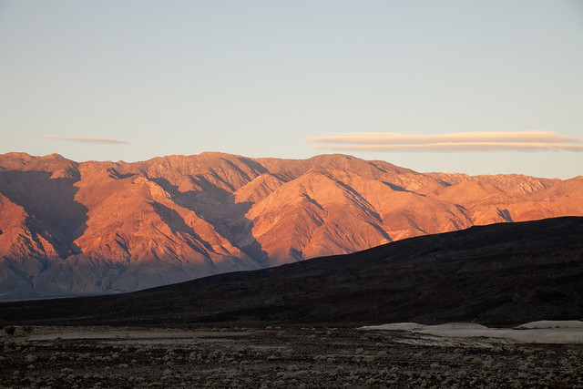
I don’t often get up before the sun rises. I guess it was technically pre-sunrise, because the sun hadn’t yet broken the peaks to our east, leaving the camp in the shade. However, the sun was hitting the Inyo mountain range to our west, and lighting it up with a nice warm orange hue.

Being the first (or one of the first) up for the day, I decided to walk over to the bathrooms. Thinking there might be some running water, I brought my toothbrush along. As they were heading back to camp, I met up with Guri, his wife, and son. They held onto the dog’s leashes while I used the facilities. Unfortunately the restrooms were nothing more than a hole in the ground with a seat perched up off the floor. It was interesting to see how well-stocked the shelf was. There was more TP than my wife and I use in about a year! Along with the wipes were a few cleaning products, and note requesting that the door be kept closed at night and that everyone clean up after themselves.

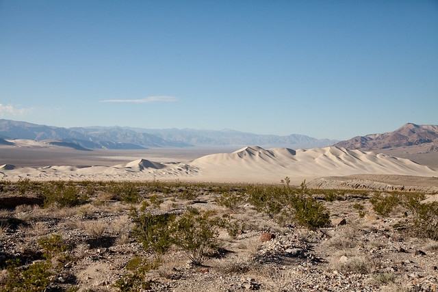
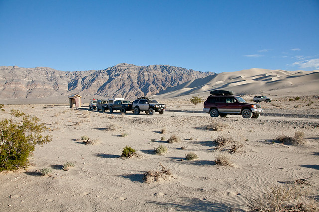
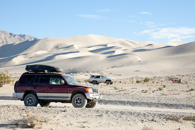
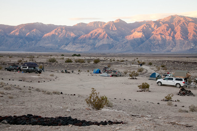
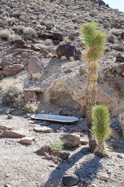
On the way back to camp, I took a little detour from the main trail and snapped a few photos of camp with the Inyo range to our west, and a photo looking east. As you can guess, the bunches of palm trees mark the natural springs. The Last Chance Range beyond the springs to our east.


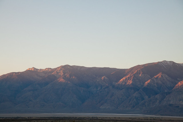
(Notice the snow covered north faces of the peaks)


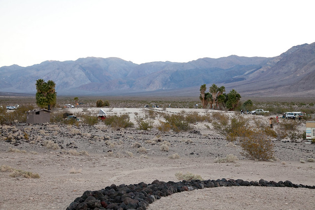
(looking east toward the Last Chance Range)

Back at camp, I didn’t get too creative and had the same breakfast as I did the previous day. This time though, my skills had improved, and with nothing burnt, the dogs didn’t get any extra.

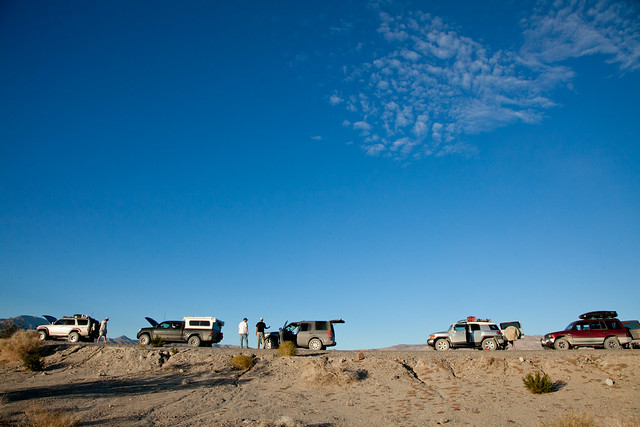
By now, I think most everyone was looking forward to getting home. Matt, having a longer drive than most of us; he was up early and had everything packed up pretty quickly. He had decided to head out taking a quicker route up to Big Pine by going back to Saline Valley Road. The remainder of the trip, we would be a 5 vehicle convoy.

Not knowing what time we would be heading out, I pretty quickly tried to get camp broken down and packed up. Guri’s son and Matt’s son both came over and played with Gus and Waldo while I took the tent down. The previous morning, I had some challenges getting everything to fit back in its place. So I took a extra care rolling up the tent and folding the tarp to make the most of the space I had. One of the last things I thought about was where to put the trash. I had brought a few trash bags, but you don’t want that riding up in the cab. I noticed that a few guys had these things called [ur=http://www.trasharoo.com/TRASHAROO%20/About.html]Trasharoo[/url]s which were mounted on their spare tire. It was the first time I had ever seen one, but it is one of the best pieces of kit you could bring on a trip. It’s one of those items that is so much “duh, why didn’t I think of that”, and a really catchy name. I’ll be scrounging Craigslist and the classifieds for something similar before the next trip I take. I ended up stuffing my trash bag up in my Thule, but while I had more room in my cooler, things were a much tighter fit in the Thule.

So far my dogs and Tim’s dogs had done a good job of giving each other distance. As I was packing up, I looked away for just a few seconds and my Dane and one of Tim’s dogs were rolling around on the ground. With vicious snarling and barking filling the camp; Tim was the first one on the scene and broke things up quickly. After a quick inspection of each of our animals, it was thankfully a no-harm no-foul situation; but my dogs (especially Waldo) had lost off-leash privileges around camp. During the remainder of the trip, Tim and I took turns letting our dogs out to roam around.

A few of the guys had gone up to the springs to take advantage of the hot showers. Not having brought any soap, or towel I opted to just wait until I got home later that night. While standing around, Phil mentioned that he had gone up to the soaking tubs the night before. It was a great soak under the star-filled sky. Not realizing what he was in for, and not planning on soaking facilities, Phil hadn’t brought a towel either. Making matters worse, as the evening progressed, a soft but steady breeze was blowing in from our east. Phil said he had never gone from the two extremes before. One moment he was enjoying the hot water, and as he stood up, the breeze put him in an extreme shiver almost instantly. Without a towel, he had to put dry clothes on, while shivering, and soaking wet!

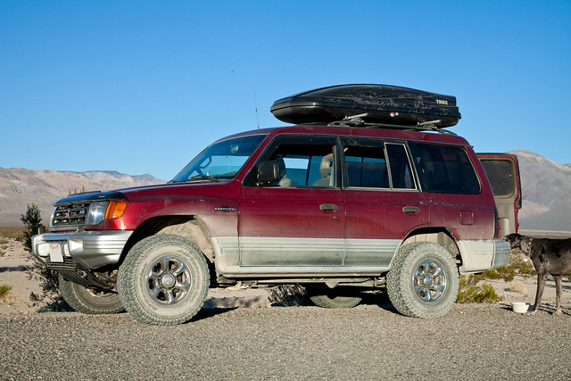
I went to the Montero to see if I could make any contact with my radio. Before leaving I looked up a few repeaters that I would likely be able to hit while on the trip. The primary purpose was just to have some kind of contact in the case of an emergency. After dialing in the frequency, I was able to listen in on a conversation between a few hams. Waiting for an opening in the conversation, I called out my sign, but no response. I tried a few more times, checked my radio settings, but my little 5w Baofeng uv5r with a mag mount antenna just wasn’t able to break into the repeater. While the radio had worked like a charm for rig to rig coms, I had found the limit.

The springs are certainly an area I want to come back to. With the shower and toilet facilities, stopping here for a night would certainly help extend a trip into the wilderness by a few days. Especially with a significant other and children along for the ride.

As we pulled out of camp, I again put myself in the sweeper position. Someone else was likely better qualified for this position, but I figured that having one of the more powerful radios in the bunch, if we did have a problem, I would be more likely to be able to reach Josh in the lead vehicle more easily.

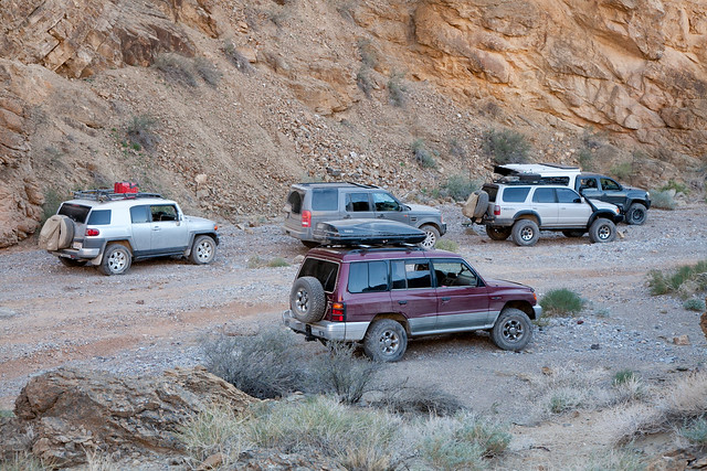
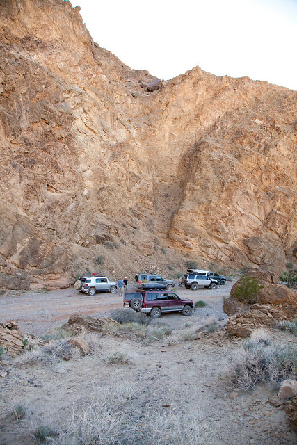
Over the years, the trail heading up to Steel Pass from the springs had been washed out quite heavily. Fortunately, someone has hand-marked a path through a wash that would lead us up. The trail was well-traveled, and even without the orange and green plastic ribbons tied to various vegetation, it would be difficult to get lost. Just a few miles up the road we reached Upper Warm Springs. The upper springs were almost entirely undeveloped. The only thing that had been done was a chain link fence that surrounded the springs enclosing a 50x50 foot area. I think this was done to keep the wild burros from trampling all of the lush vegetation. We made a quick stop at the upper springs, and admired a really nice (nearly mint) red FJ40 that you can see in the photo of the middle springs looking east from earlier that morning.


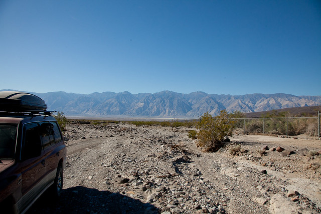
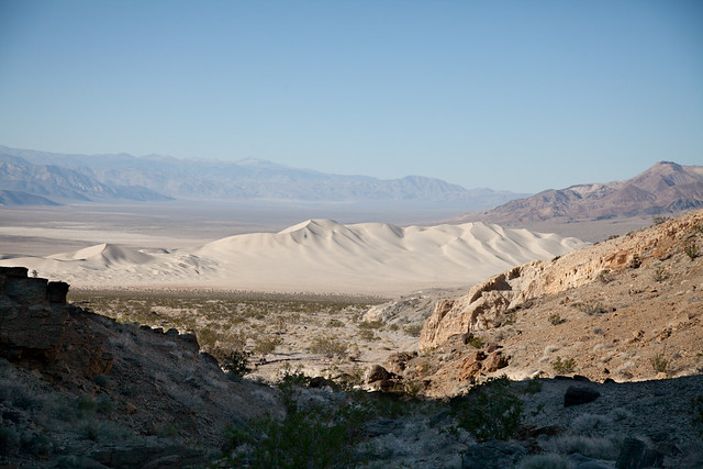
(Saline Valley to our west)


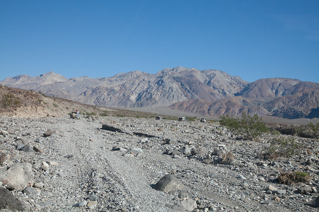
(Looking easterly at where we would be going)

For the next 15 or so miles, we wound our way up this wash. Most of the topsoil had been carried down into the valley over time, leaving only stones behind. A couple of times I misjudged just how far a large rock was jutting out from the ground and pinged something under the Montero.

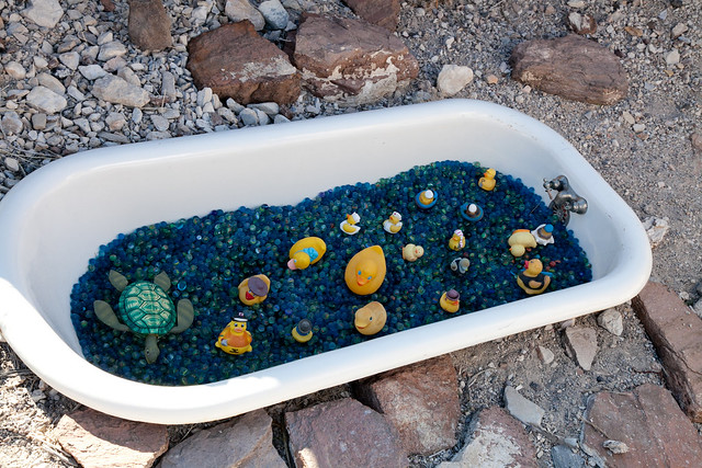
Just before Steel Pass we arrived at the famed Marble Bath. Someone has dragged out a cast-iron bathtub into what is quite literally the middle of nowhere, and filled it with blue marbles. While this faux attraction is just a few hundred feet hike off the road, the real marble bath is a depression in the rocks in the same area. Rumor is that an early cartographer found the depression and seeing it full of water jokingly labeled it “Marble Bath”. Worth stopping at, and taking the 5 minute walk. Bring a rubber duck* to add to the collection!

*Probably not officially sanctioned by the NPS though.


Just past the Marble Bath trail, up a short steep climb and we have gone through Steel Pass. We had climbed up from around 1,300 feet to around 5,100. We were finally out of the canyon wash, and were onto smooth and fast (and dusty) roads. Pretty quickly, Josh and Tim shot out ahead of the group leaving Phil, Ken and myself in their dust. We were topping out around 20-25 mph, and with our stock vehicles, that was about all the speed we wanted. Although smooth and not too heavily washboarded, we would hit several whoopty-do sections. The spacing would be just enough to quickly build up an undulating up-down motion and throw everything that wasn’t strapped down up to the ceiling inside the rig. On one of them Ken, in the FJ, hit a section with too much speed, and by the time he hit the 4th whoopty, he was nearly airborne!

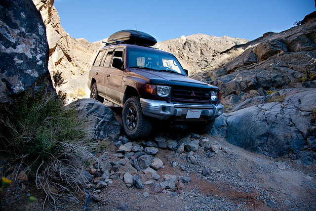
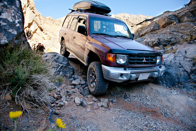
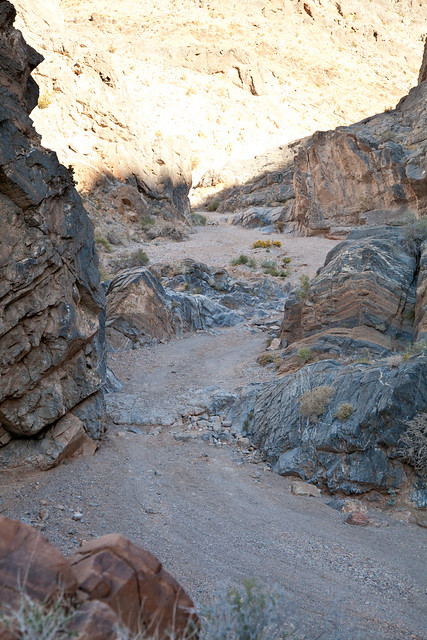
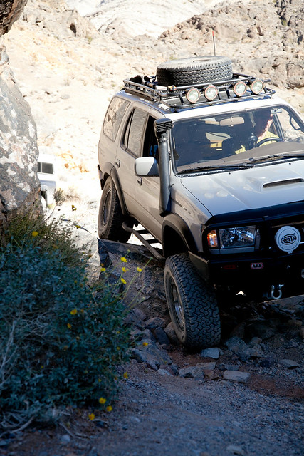
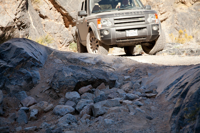
When we had caught up to Josh and Tim, they had already reached the opening of Dedeckera Canyon. This would be the final challenge of the trip. To get through the canyon you need to traverse 4 or 5 “waterfalls” or “stair-steps”. Google on Youtube “Dedeckera Canyon” to see some video. While the steps do look daunting, they are pretty well-traveled. One of the more difficult sections even has a little concrete poured on it to help ease the lower clearance vehicles through. The first two were the most challenging with a drop of at least 2 feet each. The canyon walls in this area are nearly sheer; as such, there wasn’t much sunlight, and the air temperature was easily 10-15 degrees cooler.


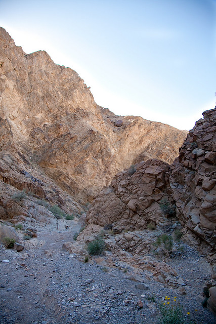
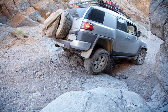
(Looking down the canyon after the first step, notice the boulder perched high up on his slope.)

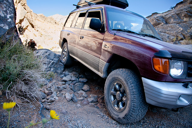
Both Josh and Tim were able to make the first step without any assistance. Their tactic was to drive up onto the rock wall on their drivers side, this would get them out far enough that they could then allow gravity to slide them down the rock wall and keep their vehicle from high-centering. The steps are a good place to put your rig’s articulation on display.


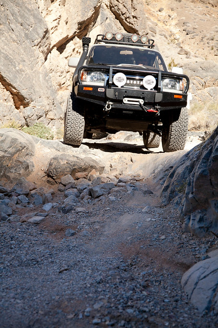
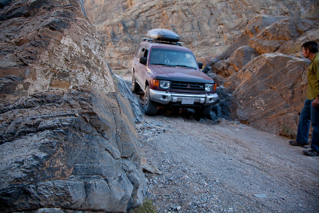
With Josh through, Tim took a shot down the same line.


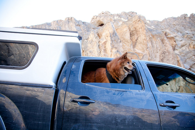
(Koa enjoying the slow cruise down the steps)

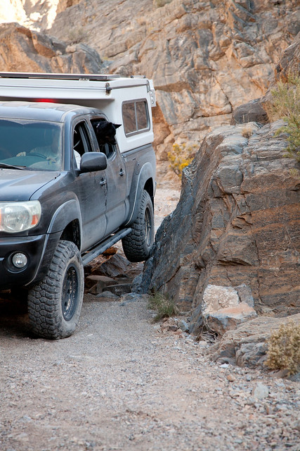
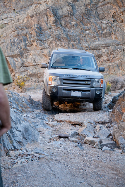
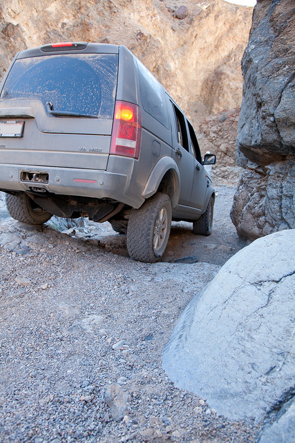
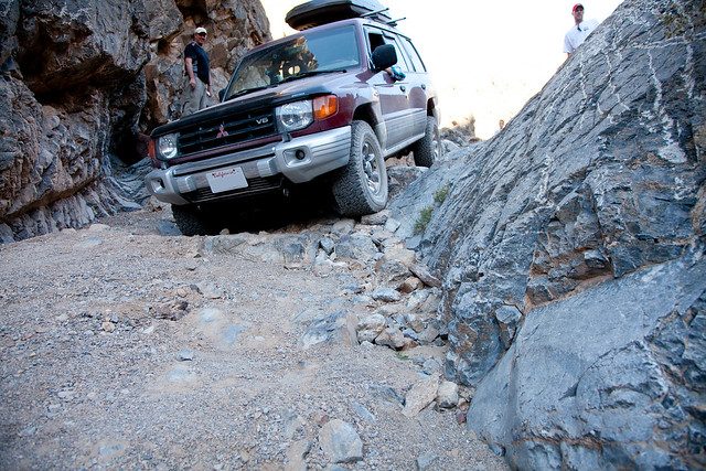
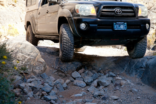
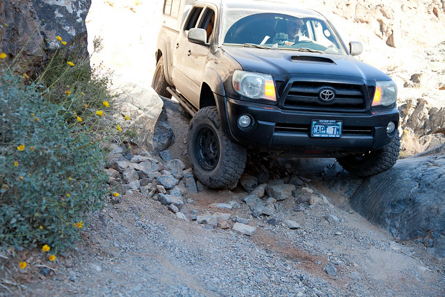
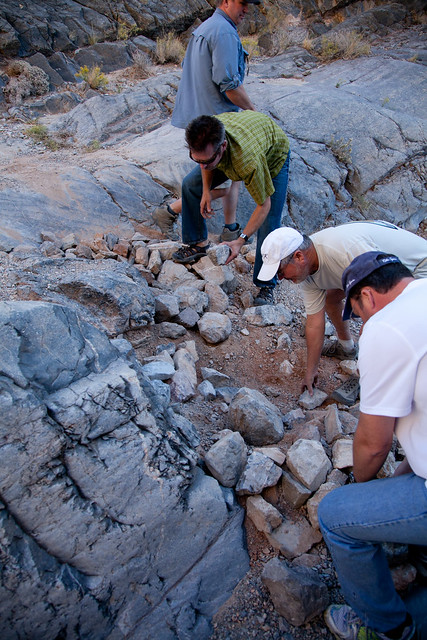
It was now time for the stock vehicles to try their hand. Phil was the first to go, he brought his LR3 up to the edge while the rest of us piled up some near by rocks to soften the severity of the drop.


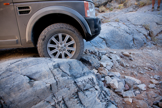
(not much clearance left, but it was enough.)


(Phil, just about to clear the first step)

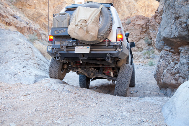
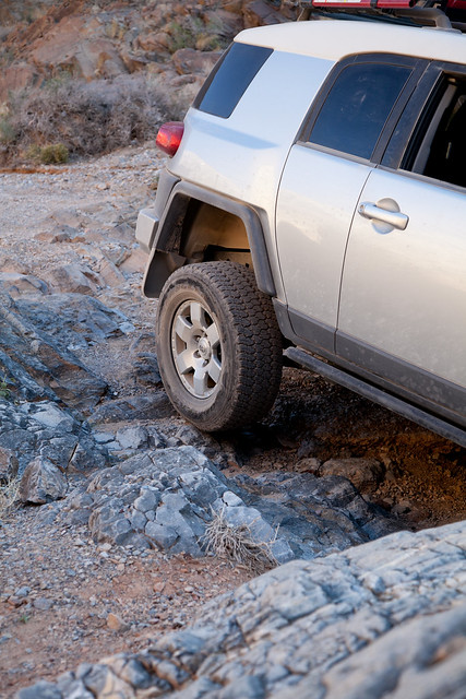
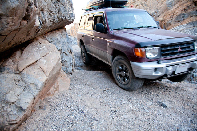
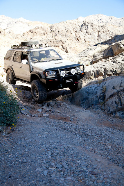
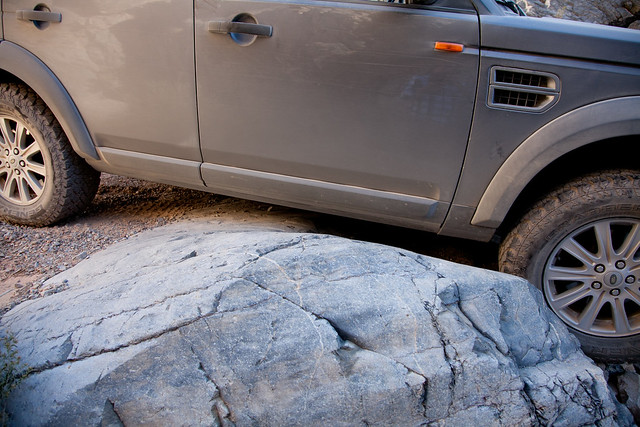
Next up was Ken in the FJ

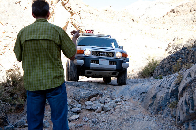
(Josh guiding Ken into the step)


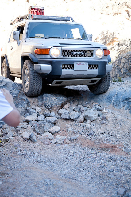
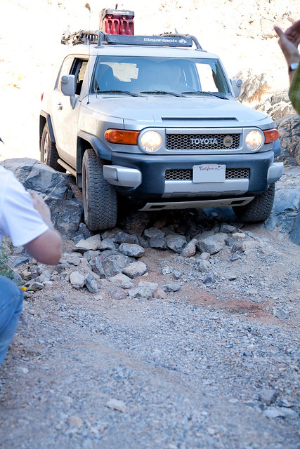
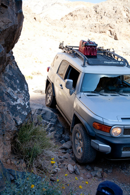
(with this wheel stuffed up so high in the wheelwell, I wish I had a photo of what the other wheel was doing!)
 

nckwltn

Explorer
Day 3 - Part 2 of 3

With Ken through, it was finally my turn. I handed my camera (Canon 5DM2) to Doug who did a really great job capturing me in each of the steps. I wish I had done such a good job for the other rigs. Doug planted himself in a single spot, and took several photos showing the progression nicely. I’m only showing a few of the series that Doug took.


The next several steps were much less eventful. No rock piling was necessary. The only thing we needed was some solid guiding, and Josh continued his tradition of doing a great job.


This section was especially narrow. None of us had full-sized trucks, and even then there were only a few inches on each side to get through without any scrapes. Too much on one side, and you were going to crawl up the face of the rock a little.


(Phil making his way through the narrow section)


The Montero is pretty narrow, at just under 70 inches, so I didn’t have much difficulty getting through the narrow section.


On the final step I think my lack of articulation hurt a little. I noticed in one of the pictures that, my drivers wheel isn’t in contact with the ground. I think this is what caused me to slide down the step and bang something on the underside behind my wheels. I couldn’t find any damage though.


(notice my wheel off the ground)

We had all made it with little to no issues at all. As we were going through, another group stacked up behind us and had to get a Chevy Avalanche through. As we were stopped for lunch, I remember hearing a couple of bumps echo through the canyon, but this group had also made it without any major problems.

Just after passing the steps there is a wide opening where several vehicles can park off the trail. On one side of the canyon, about 20 feet up, is a flat area that has excellent views of the last sight on our trip, Eureka Dunes.


(looking back up the canyon)


(Remember that boulder? We parked right under it!)


It was now just around 2:30pm, we had been trail since about 10:30am and had gone probably 22 miles. I was pretty hungry and didn’t take any pictures of lunch, other than the view of the dunes from where we were eating. With all of the major challenges behind us, my only concern now was making it back to civilization where I could refuel. I had a brief panic attack when I thought I overheard someone say that we had another 200 miles. At this point, I was just above ½ tank on the gauge, which gave me another 125-150 miles range under normal conditions. After clarifying the distance, we were much MUCH closer to the end of the trip, and I would have more than enough gas to get out.

As we proceeded out of Dedeckera Canyon toward the dunes Tim got on the radio, “I’ve got a flat”. He had gotten a little too much sidewall on a jagged rock and popped his tire. Thankfully, this was the only breakdown of the entire trip. With Doug riding along, there wasn’t much for anyone else to do to help out with the tire change. So Ken, Josh, Phil and myself all watched, checked out our tires, and found a slice in the sidewall of Phil’s rear passenger tire. The slice was so clean it clearly didn’t come from the trail, but likely the factory. Phil made it home on the tire without any problems though.


After having difficulty getting the spare tire free on a previous trip, Phil, riding solo, decided to just pack his spare behind the passenger seat.


nckwltn

Explorer
Day 3 - Part 3 of 3

Back on the road, we made good time down to the valley floor. For just a short section, we were again driving through sand which I really enjoyed. We stopped for a few minutes on the north side of the dunes. We were now on roads that are maintained, and traversable by any modern automobile. For most people, the dunes is a turn-around point. For us, it was a through stop.

The Eureka Dunes are about 1x3 miles, and rise up about 700 feet from the valley floor and are the tallest dunes in all of California. Although we didn’t climb to the top, it is allowed. We saw what appeared to be several trails where snowboarders or sledders had climbed up and gone down the fun way.


I snapped this photo just before 4:30. The sun was low in the sky, making for very long shadows.


The next 12 miles the convoy bombed across the valley at 50-55mph away from the dunes and to paved road. Although the dirt road was heavily washboarded in places, the high speed kept the wheels from dropping down too far into the washboards and smoothed things out. The speed felt even more intense due to the snail’s pace we had been maintaining for the last 2 days. Just as we hit Big Pine Road, the surface became paved and we all stopped to air up.


(the Montero had made it through the weekend!)

Everyone was quick to breakout their portable air compressors and begin the slow process of airing up. Having not brought a compressor, and not having aired down quite as far as some of the other guys, I planned on shooting into Big Pine and airing up.

As we circled up between the LR3 and the FJ, the feeling was kind of surreal. Two days ago, none of us knew each other; as we were circled around, with the sun setting over the mountain range behind us, it felt like an old western movie. The group had joined for a common goal; each riding in on a different horse, and each coming from a different background and stage in life. An insurance adjuster, a Navy Man, a facilities director, a lawyer, a customer service manager, and a ship’s Captain. We weren’t fighting for land, or cattle. Yet, we had stood toe-to-toe with our foes and reaped the rewards after a victory. Each went by a different name, and each had their own challenges, rewards, and history: Swansea, Cerro Gordo, Salt Tram, Panamint Springs, Saline Valley, Hunter Mountain, Teakettle, Racetrack, Lippincott, Palm Springs, Marble Bath, Steel Pass, Dedeckera Canyon, Eureka Dunes. We had traversed some of the most harsh roads and trails that exist in Death Valley. We had accomplished our goal and slayed our foes. Two days earlier, I had trouble remembering the names, and which name went with which face. Now we were all joined together; bonded by the obstacles, the vistas, the campfire stories, and the days spent away from the “real world”. None of us had checked email, received phone calls, or sent a text message. We had been disconnected from everything that would have normally mattered and devoted ourselves to the journey.

We all thanked Josh for organizing and leading the weekend. Save for one flat tire on the last day, everything had gone about as perfectly as it could have. Keeping tradition, Josh led the way and was the first to hit the road, but one-by-one we all climbed back into our rigs and drove into the sunset.

The journey for which we had each traveled all this way was now complete.

I still had a 5-hour drive before I would be home. I hadn’t really needed my map the entire weekend. In fact, I’ve used the map 10x more on this write-up than I did during that weekend. Had I looked at the map, I probably would have realized that I still had an hour-drive up and over the Inyo mountain range before I would be back in civilization. Josh had mentioned an indian casino between Big Pine and Lone Pine where gas would be cheaper, but I couldn’t wait that long to air back up. Stopping at the first gas station in Big Pine, I promptly went inside and washed my hands, rinsed my face, and purchased chapstick.

I guess I didn’t really notice during the first two days, but I hadn’t been drinking enough water. It wasn’t particularly hot on our trip, but that didn’t matter. The overall dryness of the area, and my lack of water consumption had lead to some seriously uncomfortable chapped lips. I had brought 8 gallons of water with me, the dogs had gone through 5 of those. On the last day, I drank a gallon myself.

I also turned my phone back on and did a cursory check of email, it exploded with a cacophony of dings and beeps from emails and text messages. It was a sharp reminder that tomorrow I would be back in the office. It was somewhat comforting to know that I was reconnected. I let my wife know I was safe, and that the weekend was great. For now though, I was still on vacation and just made sure I still had a job to go back to the next day.

Tim wasn’t able to make it down to the casino gas, so he filled up in Big Pine. We both pulled out of the filling station at the same time, and I followed him for a few miles before picking up speed to about 5 over the limit leaving Tim and Doug behind me. I found the casino without any problems and filled up. As I was just about to pull back on the road, a car came over flashing their lights. It took me a moment to realize it was Ken. He was now just stopping for gas. Turns out Phil’s air compressor had broken, Phil had to wait for Ken to finish and then borrow his compressor. At 15-20 minutes per tire, they were around for another 30-40 minutes before they were able to head out. I bid Ken a good trip home and pulled onto 395 South toward Los Angeles.

After making a quick stop at McDonalds in Lone Pine, I set the cruise and didn’t stop until I got back to LA. Pulling into the same Shell station that I had topped off at on Friday morning, I topped off again. In total I had gone 673 miles. For some reference, this 673 miles represented 15.52% of the total miles I had driven on the Montero since I had purchased it on New Year’s Day 2013. This was by far the longest trip I had ever gone in this vehicle. To get there and back, I had used 41.17 gallons of fuel at a total cost of $187.53; with an average economy of 16.35 miles per gallon. Having read several forums over the last year, I had read that the Montero had some substantial off-roading capabilities. Thanks to this trip, I was able to experience the capabilities first hand.

I pulled into my driveway at half past 9:30pm. I unloaded the the perishable supplies, and promptly took a long, hot shower. Although it had been a long day, and I was tired, I was drawn to the internet to read the history of the places I had just visited. I was up researching well past midnight. I also decided to do a pretty significant write-up of the weekend. If nothing more than to preserve the memory, but also as a way to share with family and friends.

-- End of Day 3 --

My wife can attest; over the next few weeks I gushed to just about everyone I talked to about the experience and how great it was. For me the the weekend was more than a road trip on some desolate roads. It was truly an escape; a time to reflect on life, and experience adventure. A chance to become part of the photos and not just look at them on my computer, and an opportunity to get out into nature as I had done on many camping vacations my family took as a kid.

John Muir:
Wilderness is not only a haven for native plants and animals but it is also a refuge from society. Its a place to go to hear the wind and little else, see the stars and the galaxies, smell the pine trees, feel the cold water, touch the sky and the ground at the same time, listen to coyotes, eat the fresh snow, walk across the desert sands, and realize why its good to go outside of the city and the suburbs. Fortunately, there is wilderness just outside the limits of the cities and the suburbs in most of the United States, especially in the West.


One of the last things I say to people after telling them about the trip: The desert really is a magical place.
 

bikerjosh

Explorer
.....insert slow clapping becoming louder and faster.
Well done Nick, and well said. This was a great trip and as Nick mentioned we really did bond over the course of a few days on the trail. Over the weekend I got out my big map, trail books (have 4 that cover DV) and started drawing potential routes for my next trip (after the snow melts that is):smiley_drive: We only scratched the surface of what is out there to see.
thanks again for taking the time to do a write up.-josh
 

k9lestat

Expedition Leader
You know there is trasharoo group buy thread here on the portal. I'm on phone so I don't know how link it for you.
Good job again

Sent from my SCH-I605 using Tapatalk
 

EMrider

Explorer
That was a fantastic trip report. Thanks for taking the time to share your trip details.

I have done that route 3 times and you have captured the experience very well.

R
 

Crom

Expo this, expo that, exp
Great narrative. I very much enjoyed reading. Death Valley is a unique place, there is no doubt about that.
 

peneumbra

Explorer
You, know, if you'd just move to Bishop or Lone Pine, you'd cut out the worst part of this trip, which is getting to the Owens Valley from L.A. Think of the time you'd be saving!
 

Forum statistics

Threads
185,916
Messages
2,879,606
Members
225,497
Latest member
WonaWarrior
Top