Death Valley Weekend - Nov 8-10 - 2013

nckwltn

Explorer
**Edit - Here is the planning thread for this trip. There might be a spoiler or two: http://www.expeditionportal.com/forum/threads/116959-November-trip-to-DV

Index:
--Day 1--
--Day 2--
--Day 3--

-- Start of Day 1 --

The day started early, 4:15am early. I knew that to arrive at the rally point of McDonalds in Lone Pine by 8:30am I had to be on the road no later than a little after 5:00am. I was worried that the night before would be like Christmas Eve when I was 9. So excited about what is going to happen the next day, that I just couldn't sleep. I still experience the same kind of excitement 25 years later. Thankfully that wasn't the case, and shortly after crawling under the covers I was fast asleep. After a jolting alarm on my iPhone, I pulled myself out of bed, showered and finished loading the final supplies into the back of my nearly stock ‘99 Montero.

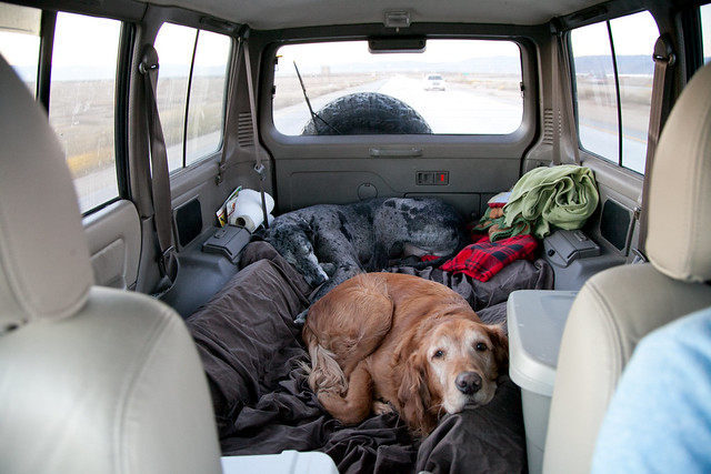
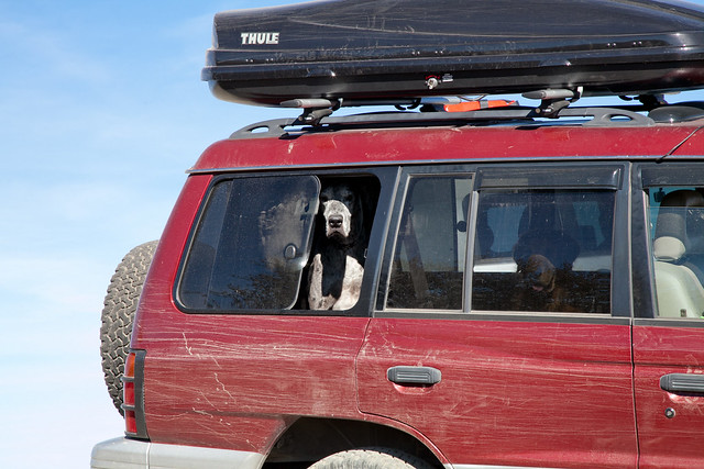
My travel companions for the trip would be a 7 year old Golden Retriever, Gus, and a 5 year old Great Dane, Waldo. Although they are bigger dogs, they travel well, and after the first few uneventful miles lay down and sleep.


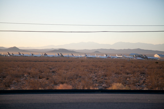
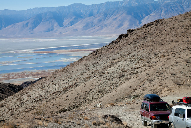
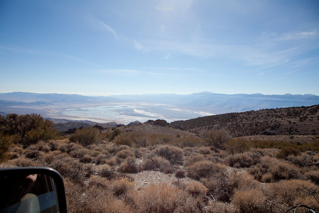
The road out of Los Angeles takes me out of the San Fernando Valley on the I-5. As I pass through the Santa Clarita area I listen to a couple of hams on a local repeater shoot the breeze as they head the opposite direction. I skirt the northern edge of Palmdale, pass over the Los Angeles Aqueduct, and past the Mojave Airplane Graveyard along California 14. At the southwest edge of the China Lake Naval Air Weapons Station I pick up US 395 and continue north. The next few hours went by quickly as the mountain peaks around me shot up.


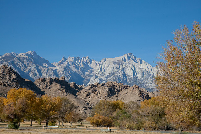
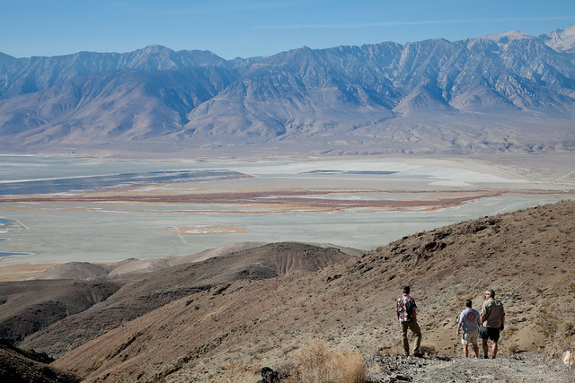
As I roll into Lone Pine, the views of the Sierra mountains were excellent. I thought the rendezvous point was the local McDonalds, which was a great spot to walk the dogs around and let them take care of their business. At 8:25, and no other rigs in sight, I knew something wasn't right. I made a quick visit to expedition portal and realized that I was in the wrong spot. I quickly hurried down the road to the Eastern Sierra Interagency Visitor Center just south of Lone Pine where I met up with the rest of the group.


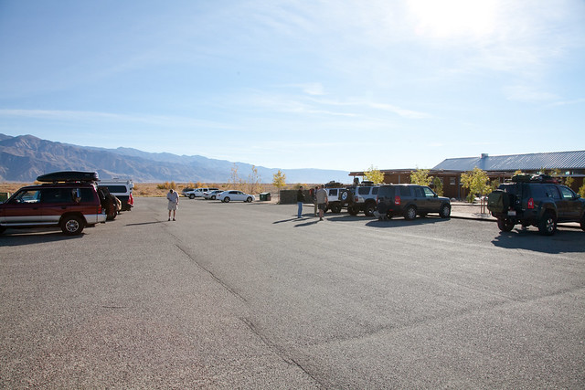
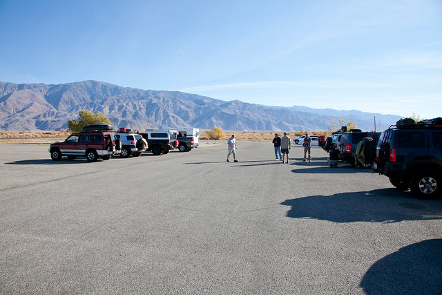
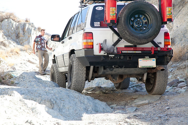
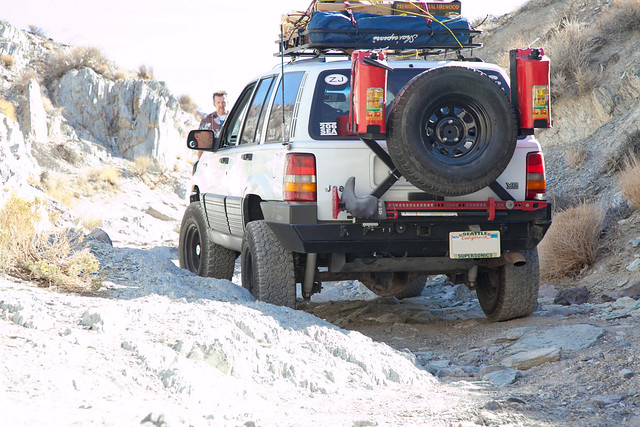
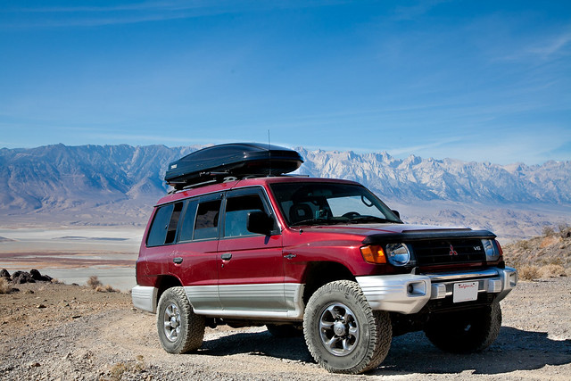
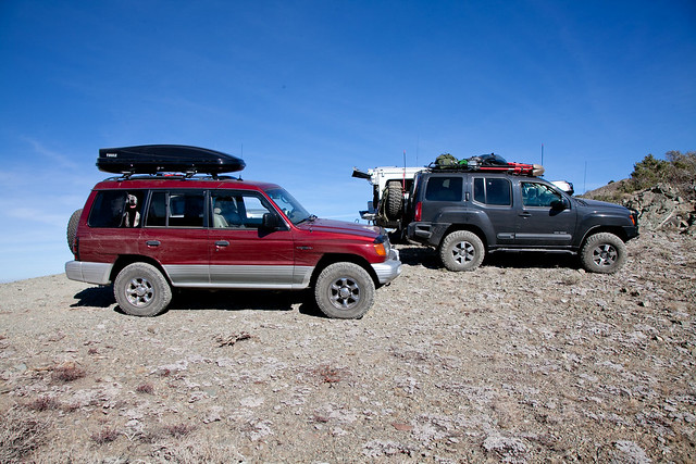
As I pulled in and scouted a few of the other rigs, I was feeling a little inadequate with my setup. The only modification I made was to remove the running boards, something I would be quite happy about later. The previous owner was responsible for the 31” tires. As we all exchanged pleasantries and introduced ourselves, we discussed the basic plan for the day, settled in on a radio frequency and hit the road.

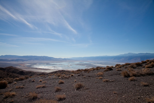
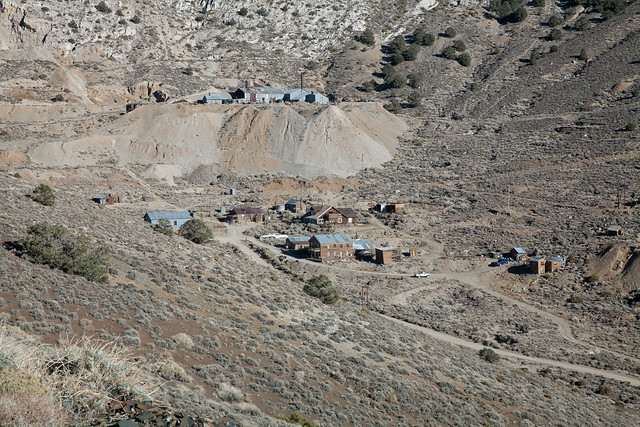
Our first taste of dirt road would start a few miles south of the visitors center, just off of CA 136 at the former town of Swansea. The town, now completely abandoned, was once a boomtown smelting ore into ingots to be shipped to Los Angeles throughout the 1860s. The Lone Pine earthquake in 1872 caused significant damage to the smelters while also upheaving the shoreline and making the pier inaccessible for the steamships on Owens Lake. The smelters would be moved further south to Keeler.

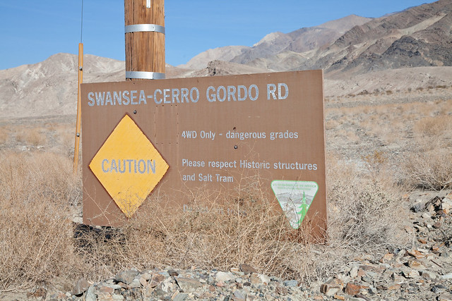
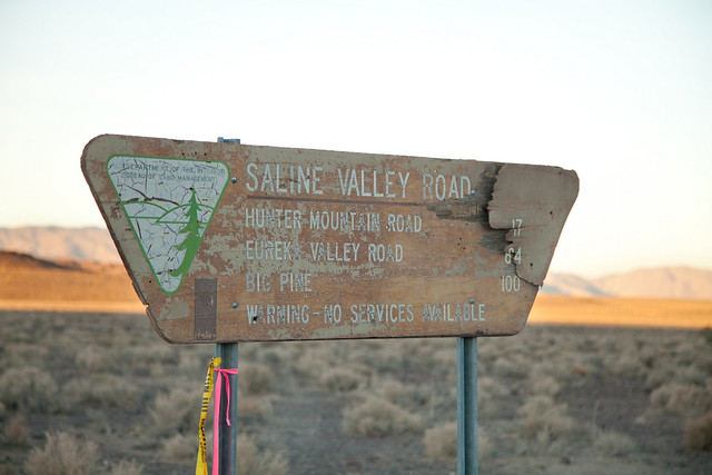
The entrance to the road was marked with a sign that promised our trip would not disappoint.


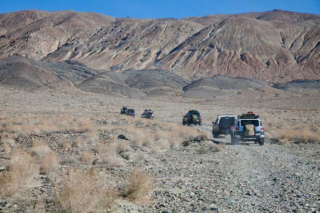
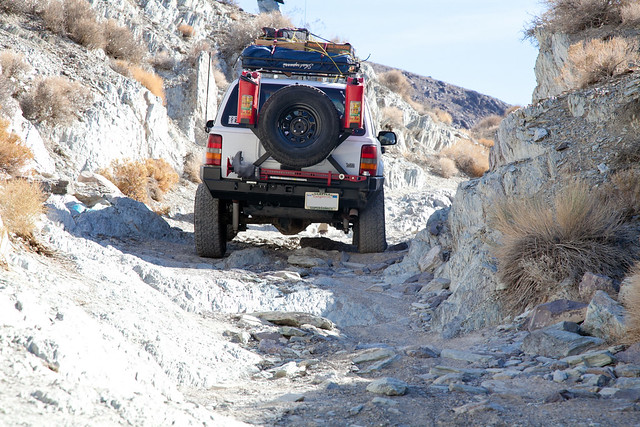
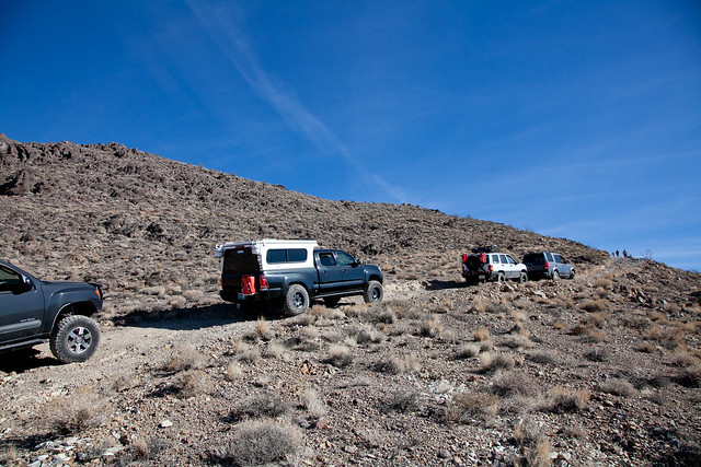
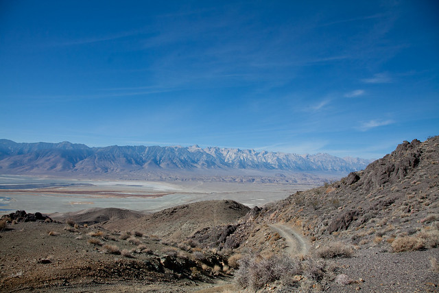
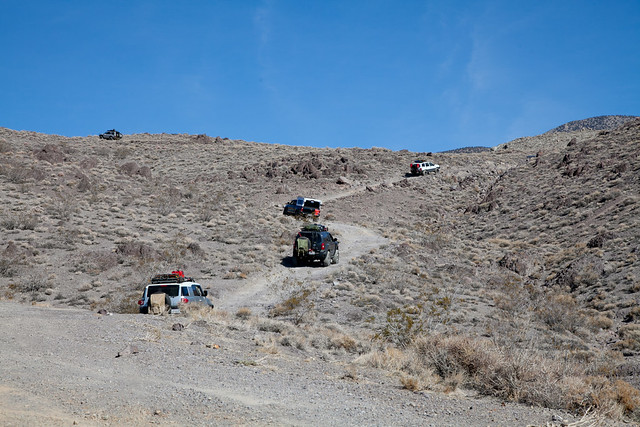
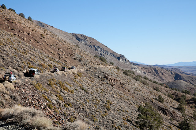
The first few miles of the road were uneventful. We were climbing quickly from Swansea at 3600 feet in elevation. After 10 minutes on the trail, we had cleared a few small ridgelines and could no longer see CA 136. We then all stopped to air down. Not having an air compressor with me, and tires that had spent a few years baking in the Arizona sun, I only took my tires down to 23 PSI. A couple of the guys took their wheels down to mid-teens.


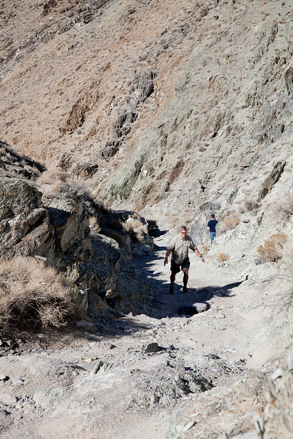
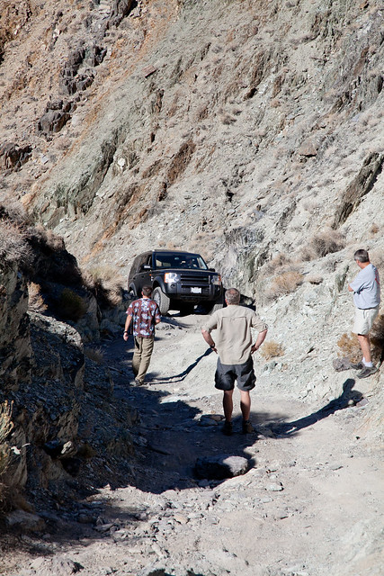
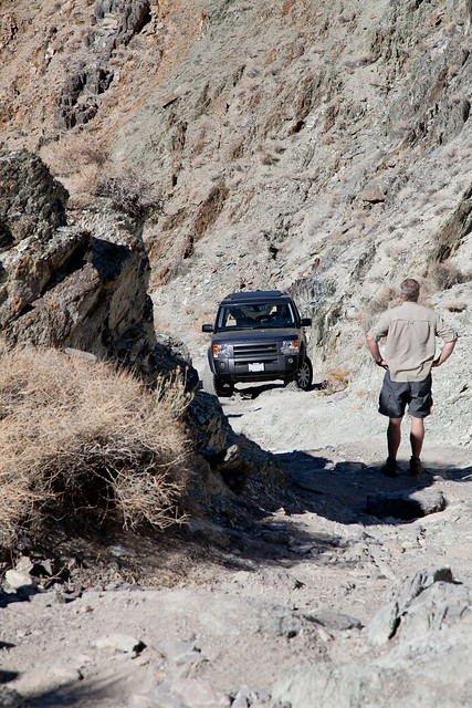
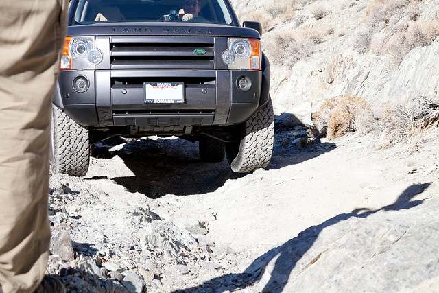
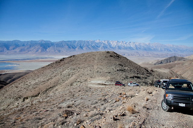
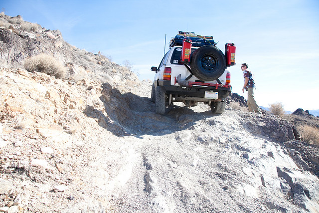
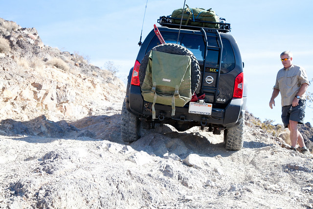
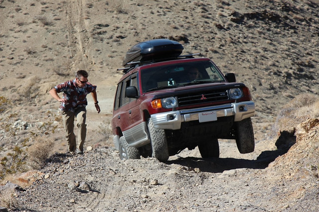
The first real challenge for the group was a set of steps through a semi narrow canyon. As with all of the challenging sections throughout the weekend, Josh took the lead both in scouting a passable line and in driving his rig up first. We each took our turns making our way up steep inclines, Josh guiding each of us onto the best line.


(Ken planning his lines)

(Looking on as Phil gives it a try)


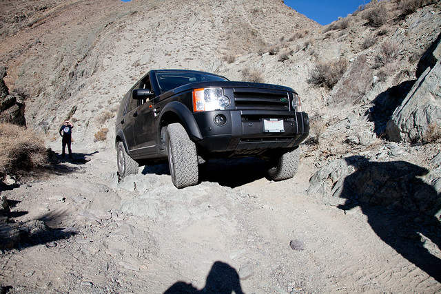
(Patrick keeping his rear diff from getting knocked about)


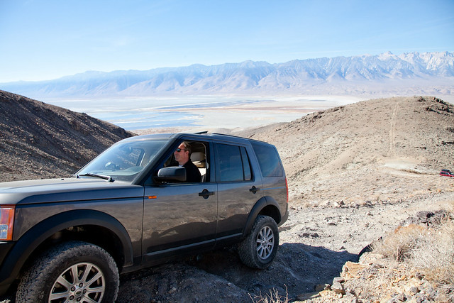
This was the first time I was really able to put some of the more robust stock features of the Montero to use. For good measure, I slipped the transfer case down into 4Low, which also locked the center differential, then I reached for the switch to activate the rear air locker. The Montero was ready to give me the best it had to offer in terms of climbing capability.

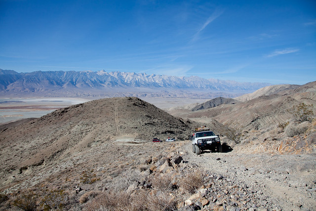
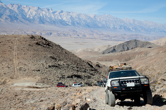
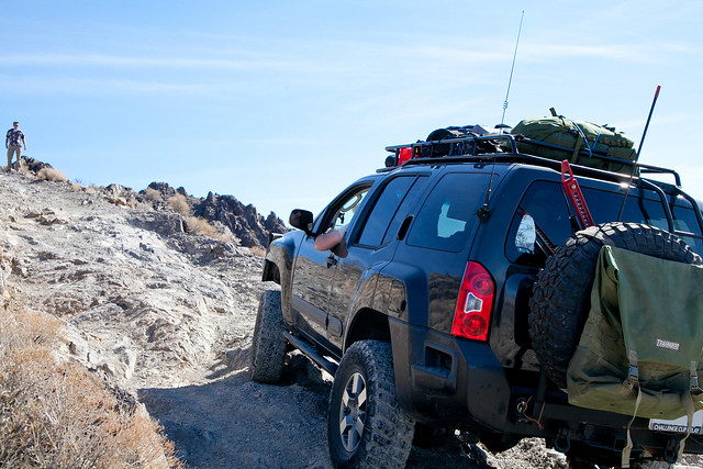
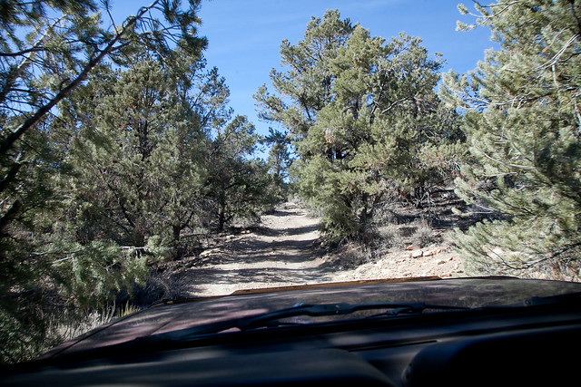
The Montero did its duty and pulled me right on up and out of the challenging section. With that, the group was clear of the first significant obstacle. We regrouped at the top of a hill and proceeded to move on. I had shifted back into 2wd, and drove along the road, eating the dust trail of the vehicle in front of me.

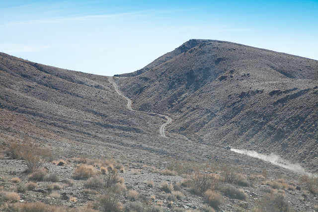
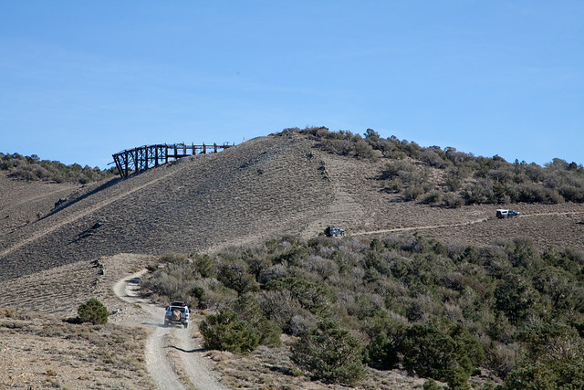
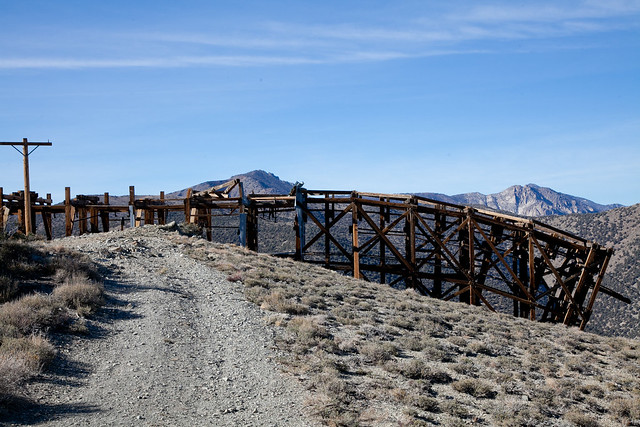
I had specifically rolled out of the parking lot as the last one in the group. This allowed me to stop and take pictures without having to hold up anyone else in the convoy. The downside to this was that everyone else didn't stop when I did. So each time I would stop for a few photos, I would fall just a little further and further behind.
 
Last edited:

nckwltn

Explorer


I could see off in the distance, a small dust cloud being kicked up by Josh’s 4Runner as he motored up an incline about ½ a mile long, until he reached the ridge line and disappeared. Moments later I hear his voice on the radio mentioning that we should stop, and check out this next section of trail. Unbeknownst to us, Josh had gone on up the trail, but thought it a good idea to have someone spotting and planned lines.


By the time I made it to the group, everyone was ½ way up the steep trail trying to determine if this was something we even could accomplish. As I walked up the steep hill, the decision was to push on. After all, Josh had powered up without any spotting. Being the last rig in the convoy, I had to wait my turn, so I stayed up on the trail and spotted while snapping some photos. It is really difficult to convey the steepness of terrain through a camera. I can assure you, this was quite steep.


(Phil’s LR3 made the climb look easy)


(Matt pushing along the right edge of the trail)


(on my way back down, the dogs are wondering what is going on)

Finally I was on deck, I watch Ken (FJ Cruiser) making his way up. All of a sudden, I see the FJ’s reverse lights kick on, I let out an “oh boy!” as he had to move back down the trail a few feet and get himself into another line.

Low range, engaged. Center diff lock, locked. Rear air locker, engaged. Ready! Thankfully Josh had come down the hill a little to spot me. I inch my way up the hill, trying to pick a line that will keep me on from grinding a rear differential into the ground. At one point, my front passenger wheel needs to get up over a rock. I get on the gas, a little more, a little more, but I’m not moving, the wheels aren’t even spinning. Josh says “Back up a little, and see if you can hit it with some speed”. I move back a few inches and try, and still the same. I just can’t make it up over this rock. Josh now suggests “Back up a few feet and see if you can get on this other line”. I mentally do a double take on what he just said. Moments earlier, I’m about to wet myself as I see another guy back down the trail, and now I have to do the same. I slip the transmission into neutral and just let gravity do the work. At this point, I don’t think I could be gripping the steering wheel any tighter. I finally get back to a point where I can get into a new line. Shift into “L”, and proceed up the new line. As I’m sweating bullets trying to make my way up the hill, Matt was up snapping some photos and captured this one. You can see where my front tire was stuck, my rear passenger is in the same rut. Looking at that rear passenger wheel, it is nearly 50% below the top of the rock. Great shot, thanks Matt!!


The next several miles of the trip were a lot less eventful. We all continued to motor up the mountain, climbing to I think 11k feet at the peak. I did get an auto transmission heat light come on once or twice, but shifting back into “L” from “D” seemed to help keep things running cooler. At some point the small brush turned to larger trees giving everyone an opportunity to receive some desert pinstriping. From here on out, everything was really just a 2wd challenge. As we climbed higher and higher, Owens Valley below us, and the Sierra Nevada mountains to the west were quite spectacular to look at.


(Pausing for a moment to enjoy the views)

(Eastern slopes of Seirras)

(MONTERO!)

(What remains of Owens Lake)


Owens Lake, at the heart of the Owens Valley was once so full of water that steam ships were used to haul the ore from the smelters in Swansea and Keeler to the opposite side for transport to Los Angeles. However, in the early 1900s, LA’s thirst for water was difficult to quench. Finally in 1913 the Owens River was diverted into the , ultimately leading to Owens Lake becoming a “dry lake”. Things got so serious that the [url=http://en.wikipedia.org/wiki/California_Water_Wars]residents of the Owens Valley began to dynamite the pumping stations that fed the aqueduct in a last ditch effort to keep farming a viable option in the valley. Ultimately their efforts failed. On November 5th, 1913 water from the Owens River reached Los Angeles. Almost 100 years to the date we were now looking onto the effects of that water diversion from a 10,000 foot view.
 
Last edited:

nckwltn

Explorer


As we rounded a bend, perched up in the saddle between a couple of peaks, sat the remains of a gigantic tram that once carried salt 14 miles down into Keeler. The tram carried the salt from 1100 feet in the Saline Valley, up and over 8500 feet, and then back down to 3600 feet at Keeler, making it the steepest tram ever built. It was ultimately too costly to operate, and only ran for a few years. The tram location was also our lunch stop. I had been up since 4am, and although I made a McDonalds stop, I was ready for some lunch. The dogs were also ready to get out of the car and do some business.


(Salt Tram Ruins from the other side)

It was around this point that I also started to worry a little. The dogs were drinking much more water to this point than I thought they would. Although it was dry out, it wasn’t terribly warm. The air temperature had been in the low 70s at lower elevation and the high 50s at these higher elevations. I had brought along 8 gallons of water (Crystal Geyser, which is bottled from the Olancha Peak runoff down in in the Owens Valley), and a dozen or so 12 oz bottles which I kept in the cooler. We were only 7 hours into the three day trip, and the dogs had gone through ½ of a gallon by themselves! At this rate, I was concerned that I would run out of water. My plan was simple, give the dogs plenty of water, let them drink as much as was reasonable. Encourage them to drink everything in the water bowl, but after that I would pour lapped from water back into the gallon jugs. This proved to be a great solution, and I finished the weekend with 2 gallons of fresh water and 4, 12 oz bottles untouched.


The views from the Salt Tram area were fantastic. From here you could see both Owens and Saline Valleys. Although I can’t find it in the full resolution images, I’m pretty sure that we were able to look down into the Saline Valley and see the hot/warm springs area we would be camping in between day 2 and 3. Only 14 miles as the crow fly’s. Kind of difficult to imagine that it was going to take nearly two days of travel to get somewhere that we could see from where we currently were.

As lunch wrapped up, we all gathered around Josh to listen to a report of the upcoming trail. We would expect a section of pretty serious downward grade, and it was suggested to use low range to keep from burning through brake pads. Josh also mentioned that we were going in the normal direction on this trail because it can be quite difficult to make it up the section we were about to go down.


At this point, after the two obstacles we had faced earlier that morning, I was beginning to seriously wonder if my Montero would be up for whatever the weekend would have. I had already gone up a seemingly impossible trail, had my automatic transmission heat warning light kick on a few times, and we were only ½ way through day 1. Plus the dogs had been bounced around in the back more than they ever had before. They spent most of the day acting like two buoys on the ocean. Bobbing around as everything below them was steadily swaying back and forth. I was nervous to ask what the next 2 days would hold. I planned on assessing things at the end of the day and figured that if I needed to take an early bow and head back to Los Angeles, the next morning would be my opportunity.

As we pushed on, the noted section of downward terrain was no joke. It was steep, 4Low was the gear to be in, and many times, the passenger side of the Montero was up a foot and a half from the drivers side. All of this made for some nervous dogs, as they spent most of the first day panting heavily. Luckily for me, Waldo had a small breakfast--he has been known to develop some serious gas when he gets nervous.

As I finally made it to the bottom, I made a call on the radio that everyone was down the steep section. A few turns later this shelf road lead us down into the ghost town of Cerro Gordo. The Cerro Gordo Mines were a collection of mines in operation from 1866 until 1957, producing high grade silver, lead, and zinc ore. Although most of the buildings from a distance look abandoned, there does appear to be a resident or two living on site, or at least making regular trips to keep things tidy. The area is privately owned, and tours can be arranged.


After a 5-minute, get-out-and-stretch-your-legs stop in the town, we proceeded down the Yellow Grade Road (aka Cerro Gordo Road) into Keeler. Outside of some sandy sections of Saline Valley, this was the dustiest road of the trip. Pretty quickly I brought my rig to a full stop to get some distance between me and Matt, who was now in front of me. One of the things I didn’t really anticipate was how steep of a downward grade we were traveling on. I started feeling my braking power begin to fade away, and at one point, just to be safe, I used the main brakes and the emergency brake to bring myself to a near stop while I shifted into “L”, to let the engine help out with the steep grade. While only 7.5 miles from Cerro Gordo to Keeler and California 136, the drop is around around 5,000 feet. Thankfully, two weekends prior I put new front brake pads on, as well as greasing a stuck caliper!

Once at the bottom, we were back in the Owens Valley and on pavement. We turned onto California 136 heading south east toward Death Valley National Park. We had left the paved road 6 hours earlier and had traveled 30 miles.

After a 30 min cruise, our convoy reached the entrance to the Saline Valley Road. As we pulled off, I remembered hearing Josh mention at lunch something about making a run into a town for fuel. The trip planning on expedition portal suggested bring along some fuel, but I didn’t have any suitable cans, nor a great place to store them. I knew that even at 14-15 mpg (my regular in-town consumption) I would be able to push 280 miles on a tank. What I hadn’t anticipated was these extreme uphill climbs like we had done today, or having to drive long periods of time in “L”, both of which used fuel at an unknown rate. I made a call on the radio, mentioned the fuel stop, we made a brief stop at the turn out, and all made the decision to head into Panamint Springs for a fuel stop. I made a quick stop at the marker for the entrance to Death Valley to capture a photo. This was the only sign of the entire trip welcoming visitors to Death Valley National Park.


Until 1994, this area may not have even been inside the park. It was only known as Death Valley National Monument. On October 31, 1994 congress passed the Desert Protection Act, expanding the borders of the monument by 1.3 million acres and redesignating it a national park, thus making it the largest National Park in the lower 48.

The winding road into Panamint Springs revealed fantastic vistas of the . You get the feeling that Pixar spent some time here gaining inspiration for Cars and their Radiator Springs town. If you do much with photography, you’ve probably heard of “golden hour”. With the sun low in the sky, stark contrasts between high and low areas on the surrounding hillsides jumped out.

Panamint Springs is one of only a few privately owned and operated areas within Death Valley National Park. At just under 2000 feet above sea level, Panamint Springs sits on the western side of the Panamint Valley. Within the unincorporated community sits a motel, RV park, campgrounds (with restrooms), a gas station/convenience store, and a full service restaurant and bar. One of the claims of fame to the restaurant is the wide selection of beer, numbering over 100.

[url=http://www.flickr.com/photos/philipjcaputo/10938344076/]


When operating a filling station at such a remote location, you can charge just about anything you want for fuel. This was the most I have ever paid for a fill up. Thankfully I only needed 6.4 gallons. From the time I had last filled up 8 hours ago in Lone Pine, my odometer had increased by only 77 miles. This gave me a 12 mpg average, wIth 36 of those miles being done on pavement at 55 mph, where I was likely pulling 16-17mpg. Without this fuel stop, I would have been worried about running short later in the trip; but even at 12 mpg, I could make it 200+ miles.

As we pulled out of Panamint Springs our convoy decreased by 1. Patrick didn’t want to subject his lady friend to another hour or two of unpaved roads and decided to stay put for the night and would be joining us tomorrow at the next campsite.

As the 6 vehicles headed west on CA 136 the sun had begun to set on the valley floor. Before making the run into Panamint Springs, we knew that we wouldn’t be getting to camp with the sun still up. I was glad I had done a practice setup of my borrowed tent the week before!


Our spot for the night was a public-use cabin area on Hunter Mountain. Over the next 20-30 miles, we would cross through a forest of Joshua Trees. It was this same area where the famous U2 Joshua Tree once stood. Although it has since died and fallen over, there is still a plaque marking its location. You will need accurate GPS coordinates to find it now. As the sun set, the trees made a great silhouette against the sky.


I was surprised to see so much traffic that evening. We encountered two motorcyclists who weren’t quite sure where they were. Josh, having been in the area before, and having GPS onboard his rig set them straight. We also encountered a man in his 50s in one of those 4 door Jeep Wranglers. I’m not sure where he was headed, but he didn’t roll into our camp that night. The campsite wasn’t on the main road, and we had to take a little spur. The only problem was that we weren’t 100% sure of where the spur was, and the GPS that had the exact coordinates was out of battery power. We ended up finding the road, and in .7 miles we were at the campsite.

It was now completely dark, and the temperature had begun to steadily fall. From the time we turned from Saline Valley Road onto Hunter Mountain Road, the air temp had gone from the low 60s to the high 40s. I had anticipated being able to park right next to my tent area, but this camp wasn’t going to allow for that. Only Tim and Doug with a rooftop tent were going to be afforded that luxury.

We all made quick work of getting camp setup. I quickly got my kitchen area setup and pulled out a steak. After the day of amazing roads and views, I figured it was only fitting to eat it that night. A few minutes in my frying pan, some basic seasoning with salt & pepper, I was ready to go. I borrowed a plastic fork, and promptly snapped it in half while stabilizing the steak while cutting. Two things about camping can really rejuvenate spirits. First is warm food (especially on a cool night, the other is a campfire. Thankfully, Tim brought his Campfire in a Can, as the area we were in didn’t allow open pit fires. We all talked about the day, the obstacles encountered, what tomorrow would hold, and various other manly things. One by one folks peeled off to turn in for the night.

When planning for the weekend, I tried to borrow an inflatable sleeping mat from someone. Unfortunately I wasn’t able to find one to borrow. I also tried to find an inexpensive camping-cot on craigslist, but had no luck there either. My last resort was to use our AeroBed inflatable mattress. While inflating it is easy, when doing it at home; Up on Hunter Mountain, 60 miles drive to the nearest 110 volt AC outlet, inflating would be a bit more of a challenge. I planned on camping right next to the Montero, and I assumed I would be able to inflate the bed using an inverter plugged into one of the Montero’s 12 volt outlets. With the rig now 40 feet away, this wasn’t going to work (the extension cord I bought was only 15 feet long). So I inflated the bed in the back of the Montero. The catch was I couldn’t fully inflate, because I still needed to be able to fold it in half to slide it into the tent. The other thing I hadn’t anticipated was how much tent space the queen sized mattress was going to occupy. Needless to say, the dogs and I got very cozy.

One thing I had anticipated was the slow leak in the air mattress. At some point over the night, enough air had escaped the mattress to allow my lower back to be resting on the ground. The dogs had also begun to encroach on my side, likely due to the cold temps. Even during the winter months in Los Angeles, Waldo (Great Dane) sleeps under a blanket in our master bedroom. That night, even Gus (Golden Retriever) was under the blanket I had brought for him. At 120 lbs and 65 lbs respectively, it isn’t too easy to just push them away. None of this mattered; after being awake, on the road, and traversing some of the most treacherous and amazing trails I had ever been on, I quickly fell asleep. Even the deflating air mattress didn’t keep me from sleeping.

Distance traveled: ~100 miles
Time on Trail: ~9 hours
High Elevation: 9300
Low Elevation: 1900
High Temp: 80
Low Temp: 28

--- End of Day 1 ---
 
Last edited:

bikerjosh

Explorer
Nick, way to step up with the trip thread. Great write/history. Awesome job can't wait to read the next installment.
I like the fact you left out my first missed turn on Swansea and tried briefly to lead us up a steeper canyon.:Wow1:
Slight chance I may make it back to DV right after Christmas for a couple days.
BTW-thanks for the radio help, and I have to say I was in awe of your skill in driving the Montero over some of that terrain.
Josh
 

Guri

Explorer
It was a pleasure meeting you.
I just snap a photo of you get to camp and the other photo is of your travel companions with magnificent scenery.
Hope to see you.

IMG_7442_2.JPG IMG_0264.JPG
 

Captm

Adventurer
Nick, thanks for the 1st day report, looking forward to more! I knew you took a lot of photos and been have eagerly waiting to see them. Josh-thanks for putting this trip together, it was a great group to travel with.
Cheers
 

Werrea

Observer
Great trip report for day 1. I have a Dane too. Duke. Planning for a Mojave trip end of March. Your pictures look much better than the soggy outside here in the Northwest.

Thanks again.

Anthony


Sent from my iPad using Tapatalk
 

steve c

Adventurer
Great trip report so far. Looking forward to the rest.

Side note, I love seeing Xterra's out on expeditions. Looks like the X that joined your group is on SCCX. (socalclubxterra) Who is this? Would love to find a build thread of his truck.
 

Byways

Adventurer
So ... I've not been to Lone Pine in a while, and I'm shocked -- shocked! -- to read right at the top of this report that there's a McDonald's there. Is no place sacred ...

Ah, but the rest of this adventure picked my spirits right quick. Thanks for the time and effort you put into it, NCKWLTN. Glad you made it up from the valley safely.
 

stioc

Expedition Leader
^x5 - a great fun-to-read report and nice pics.

You'll be amazed at what you can do with that Montero with just a simple 33" (or 255/85/16) AT/MT tire upgrade. Unlike many trucks no additional mods needed to make 33s work.
 

Crom

Expo this, expo that, exp
Loved the opening post. Living vicariously through your writing... Keep it coming! :)
 

Forum statistics

Threads
185,883
Messages
2,879,162
Members
225,450
Latest member
Rinzlerz
Top