You are using an out of date browser. It may not display this or other websites correctly.
You should upgrade or use an alternative browser.
You should upgrade or use an alternative browser.
Eastern Sierra Nevada
- Thread starter pmatusov
- Start date
pmatusov
AK6PM
Cool, I am envious!Looks like you guys had a great trip, great writeup and fun to read thru. Happens to be one of my favorite places ever, I Live and Play in the E. Sierras daily. Mammoth specifically :sombrero:
pmatusov
AK6PM
We've just came back from another short stint in the same area; I thought it would be more appropriate to continue the old topic, rather than create a new one.
The original plan was similar to the "Three-Day Escape" trip; but just as we started to shake down plans for another insane dash to Arizona and Utah, things fell apart and we were left with a prospect of spending a four-day weekend by working on a 47-year-old Jeep at best, or doing nothing at more-realistic worst. So we fell back on the best stand-by for a short road trip we've ever known - that to the Eastern Sierra Nevada. Besides, a recent snowstorm in the mountains promised us relief from a completely snow-less Winter; having no specific destination in mind was awesome for exploring places we've overlooked in the past. Here's a quick recap - with few words and lots of photos - of what we've come across this time, in no particular order. It is more of a short guide to the places we've visited than a trip report, but has elements of both.
We took off from San Diego on a Friday afternoon; got mired in horrendous traffic at the merge of I-15 and I-215 near San Bernardino; ate something questionnable in otherwise excellent Bravo Burgers in Adelanto; and finally hit the rack in Vagabond Inn in Bishop (which is not likely to happen again). One of these times you wish for a designated driver so you could just sleep through a day.
pmatusov
AK6PM
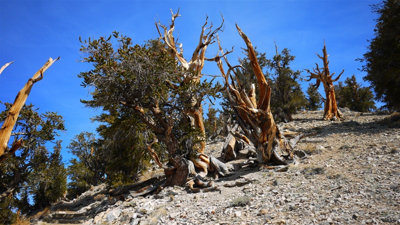
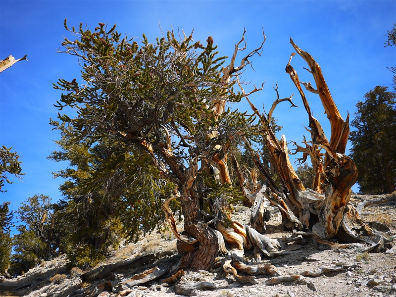
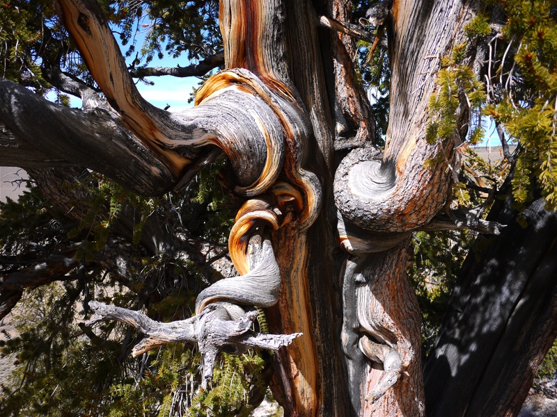
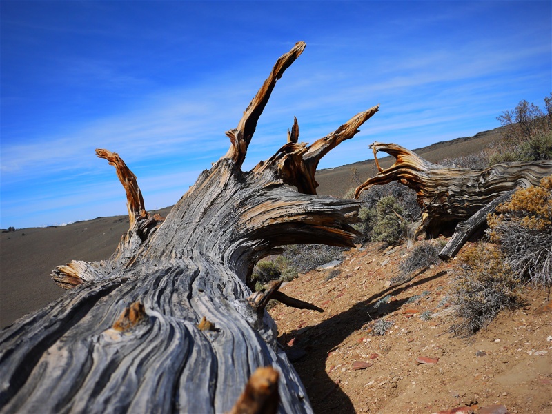
Ancient Bristlecone Pine Forest
As you are slowly rolling South on U.S.395 at 26.5mph through downtown Bishop, watching the CHP cruiser in your rearview mirror, you are oblivious to the mountain chain to your left (East of Bishop). You may know that Mount Whitney is the highest point in the continental U.S., towering at ... however many feet it has, but if you are as ignorant as I was, you may not know that the mountain East and slightly North of Bishop, with a prosaic name of "White Mountain," is only about 200 feet lower - yet has a whole research station on its top. The whole range East of Owens River valley near Bishop is called the same unassuming name - White Mountains.
Most of the Pacific moisture is sucked out of the westerly winds by the High Sierras, leaving next to none to the White Mountains.
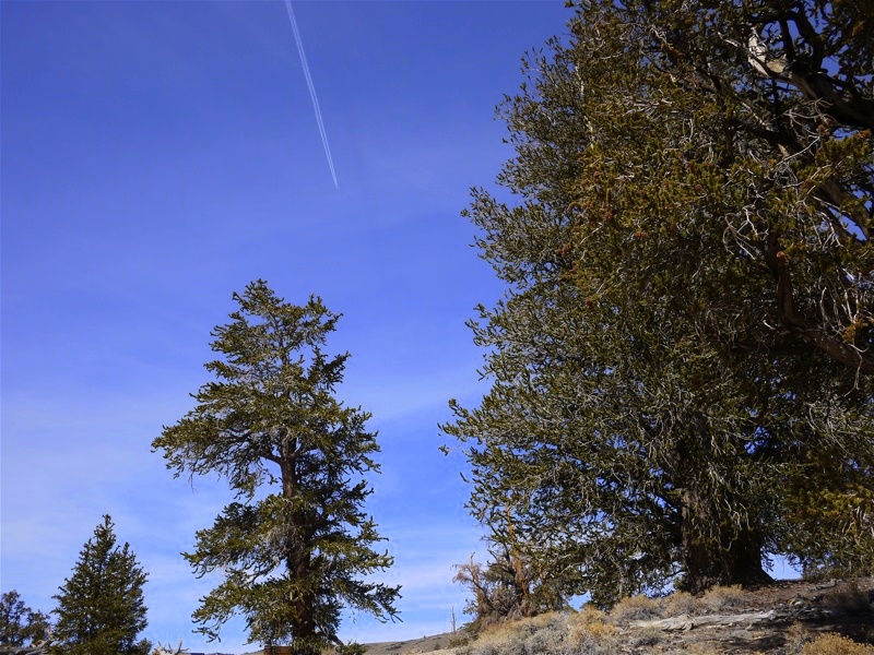
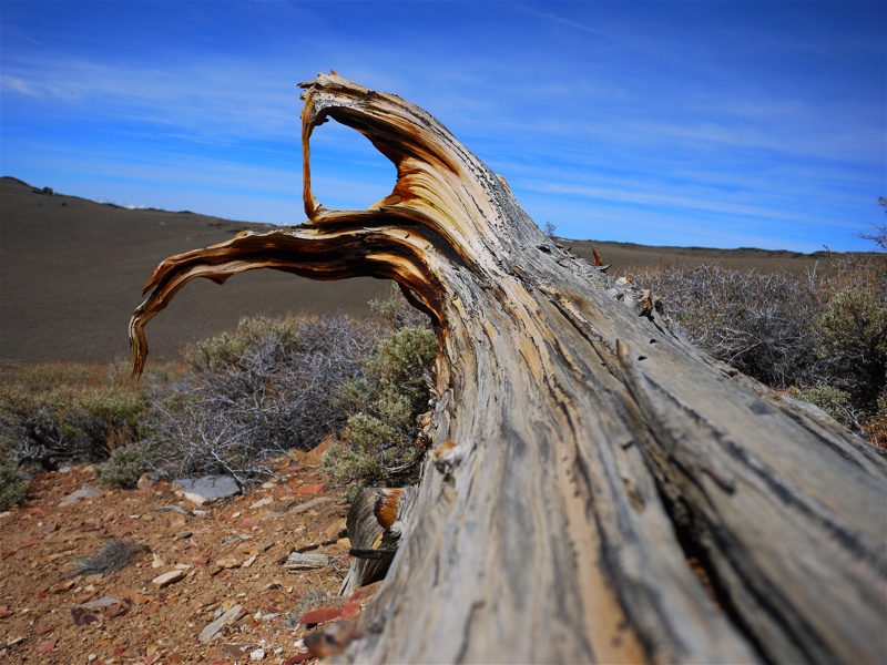
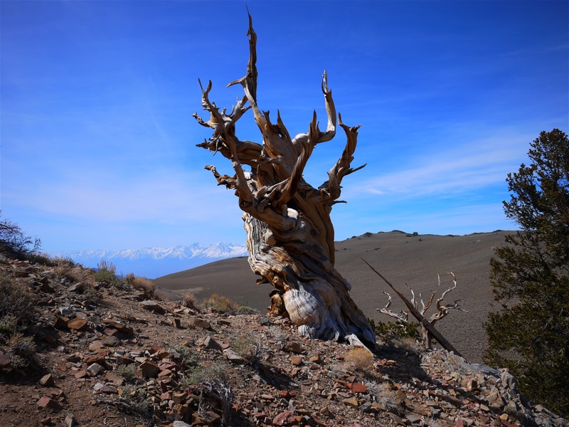
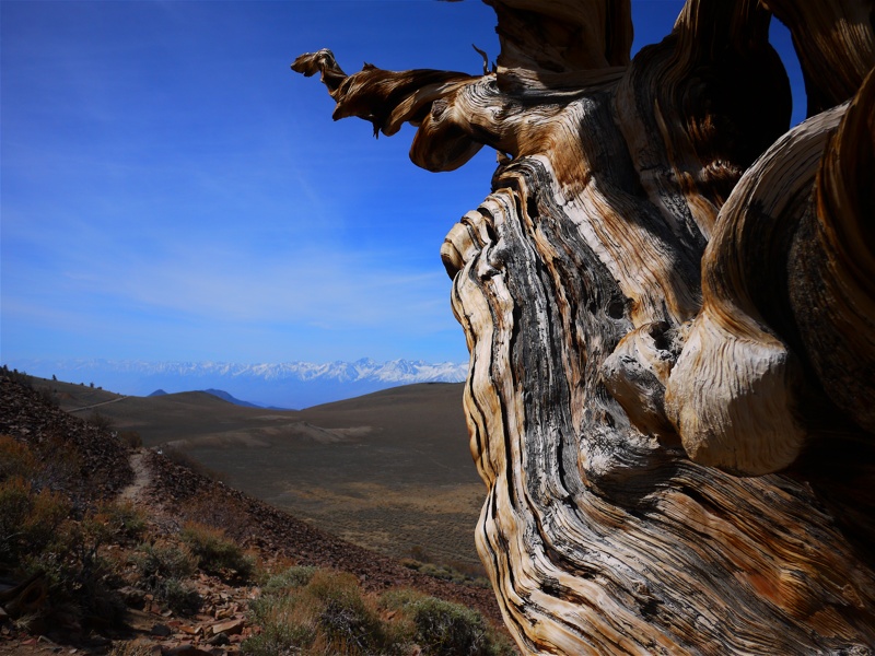
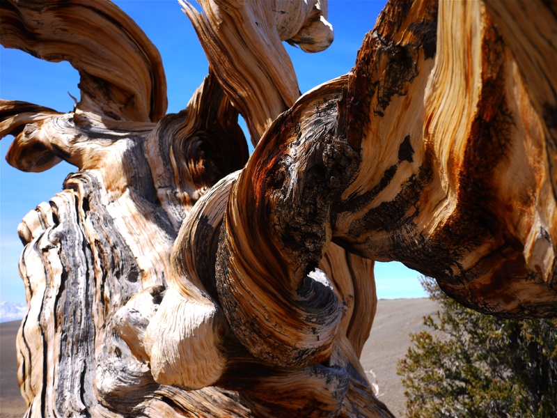
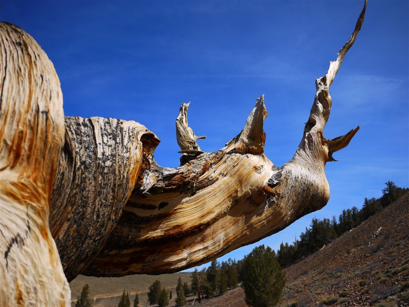
Late in Winter, when Sierras still sport a good white crown, White Mountains are already dry and dull gray. Yet... they have something that no other mountain range in the world has: Ancient Bristlecone Pine Forest.
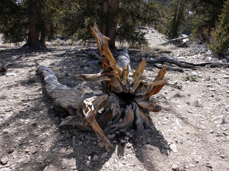
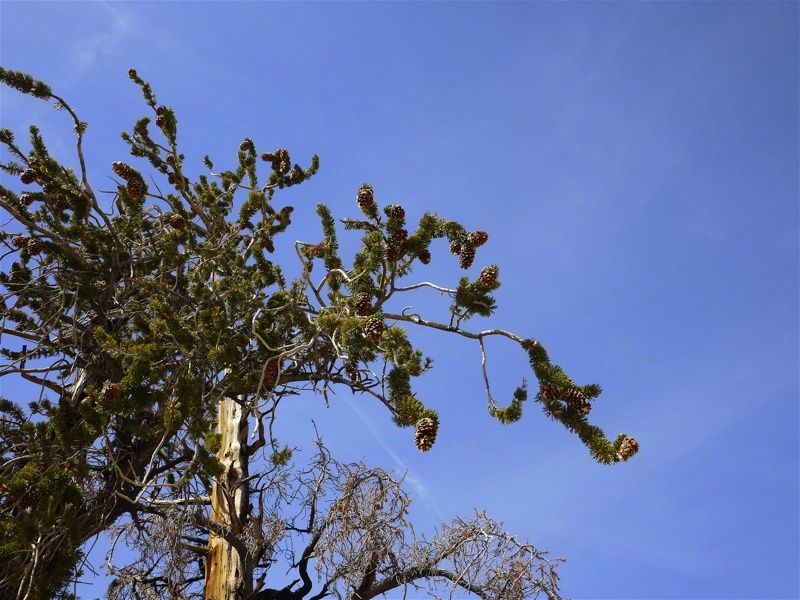
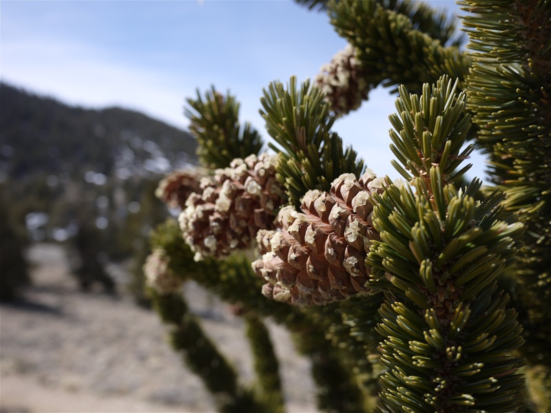
It is nowhere as glamorous as groves of Giant Sequoias or Redwoods, and at the first glance reminds of Southern California forest that just survived a brush fire. But many of these scrappy, curvy, craggy, twisted trees were born before the Last Supper. Some of them were born before Egyptians came up with an idea for pyramids! These trees are the oldest living things on Earth. Makes you dizzy, doesn't it?
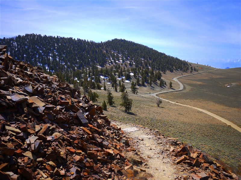
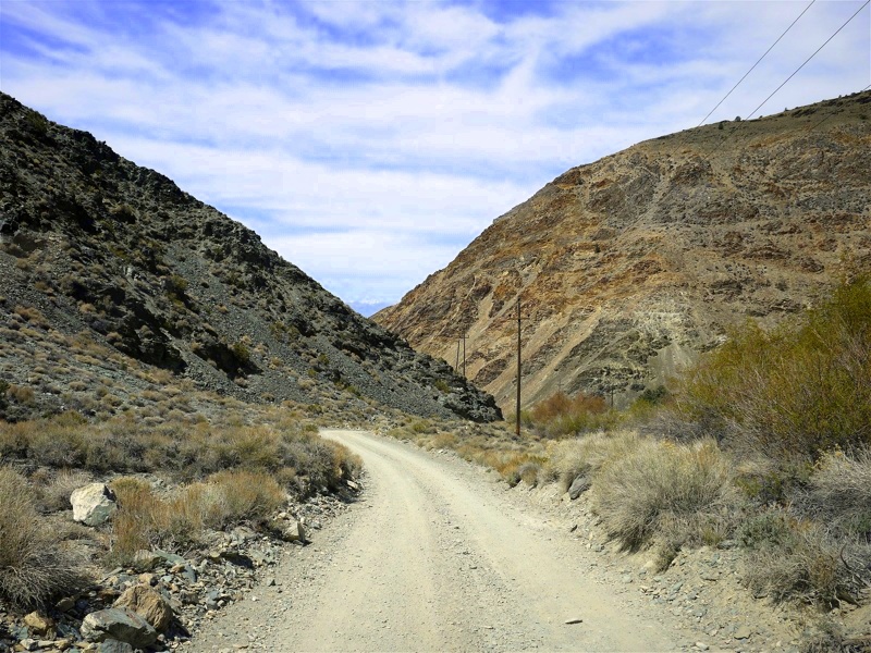
... Especially when you are there, at about 10 thousand feet. If you are driving a proper 4x4 with low range and a good cooling system, you'll be thrilled to drive up Silver Canyon Rd. It's a prominent side road East from the U.S. 6 heading North from Bishop; soon, it loses its pavement, and you are enjoying dust on the washboard dirt road. Not for long, though, since you'll be facing a few creek crossings - seven at my last count. The lowest is the deepest - it may be ankle-deep or hub-deep or a little deeper, depending on how wet the season was. The road seems moderately steep ... until you reach the end of the canyon. The road will then turn into a series of switchbacks so tight and frequent that on all maps the road looks straight. You'll be gaining close to 5 thousand feet in about 5 miles - a good 20% grade that never lets go. If you do it in Winter, however, check with the Ranger Station in Ancient Bristlecone Pine Forest - they can tell you if the road is at all passable.
Alternatively, you can mash the thin pedal on 395 South of Bishop, and hang a left to CA 168 just before Big Pine. Some fun can be had there as well - especially when it narrows down to a single lane (for both directions!) in the narrow canyon, and you have to back out for a quarter-mile or so. Soon after the "gorge," there's a left turn to White Mountain Road, which will take you all the way to the forest (and a little farther, if you're willing). Note that park Rangers don't allow vehicles without low range gears (which means real 4x4) descend into Silver Canyon as means to get to Bishop quickly. And, by the way, it is not a minute quicker than blacktop, despite what it looks on the map.
The change in scenery and vegetation is rather unusual on any of these climbs. You start off at the dry valley floor, then pass some leafy trees wherever there's a little moisture, replaced by junipers and the like. Then, around 7-8 thousand feet, they disappear - and you drive through what people in other places call Alpine tundra - it would be appropriate here if it weren't so dry. After a while, you are almost down to bare rock... and then the Old Trees appear all around you. I can't remember any other place with conifer trees above the level of Alpine tundra!
It has a status of a National Park, so the Ranger Station at Shulman Grove is a good place to buy your annual pass. You know you'll need it, right?
Take your time to walk at least a mile-long trail between the trees - it is worth it. Or be more adventurous, and take on a 4.5-mile trail and try to find the Methuselah Tree - more than five thousand years old!
As you are slowly rolling South on U.S.395 at 26.5mph through downtown Bishop, watching the CHP cruiser in your rearview mirror, you are oblivious to the mountain chain to your left (East of Bishop). You may know that Mount Whitney is the highest point in the continental U.S., towering at ... however many feet it has, but if you are as ignorant as I was, you may not know that the mountain East and slightly North of Bishop, with a prosaic name of "White Mountain," is only about 200 feet lower - yet has a whole research station on its top. The whole range East of Owens River valley near Bishop is called the same unassuming name - White Mountains.
Most of the Pacific moisture is sucked out of the westerly winds by the High Sierras, leaving next to none to the White Mountains.
Late in Winter, when Sierras still sport a good white crown, White Mountains are already dry and dull gray. Yet... they have something that no other mountain range in the world has: Ancient Bristlecone Pine Forest.
It is nowhere as glamorous as groves of Giant Sequoias or Redwoods, and at the first glance reminds of Southern California forest that just survived a brush fire. But many of these scrappy, curvy, craggy, twisted trees were born before the Last Supper. Some of them were born before Egyptians came up with an idea for pyramids! These trees are the oldest living things on Earth. Makes you dizzy, doesn't it?
... Especially when you are there, at about 10 thousand feet. If you are driving a proper 4x4 with low range and a good cooling system, you'll be thrilled to drive up Silver Canyon Rd. It's a prominent side road East from the U.S. 6 heading North from Bishop; soon, it loses its pavement, and you are enjoying dust on the washboard dirt road. Not for long, though, since you'll be facing a few creek crossings - seven at my last count. The lowest is the deepest - it may be ankle-deep or hub-deep or a little deeper, depending on how wet the season was. The road seems moderately steep ... until you reach the end of the canyon. The road will then turn into a series of switchbacks so tight and frequent that on all maps the road looks straight. You'll be gaining close to 5 thousand feet in about 5 miles - a good 20% grade that never lets go. If you do it in Winter, however, check with the Ranger Station in Ancient Bristlecone Pine Forest - they can tell you if the road is at all passable.
Alternatively, you can mash the thin pedal on 395 South of Bishop, and hang a left to CA 168 just before Big Pine. Some fun can be had there as well - especially when it narrows down to a single lane (for both directions!) in the narrow canyon, and you have to back out for a quarter-mile or so. Soon after the "gorge," there's a left turn to White Mountain Road, which will take you all the way to the forest (and a little farther, if you're willing). Note that park Rangers don't allow vehicles without low range gears (which means real 4x4) descend into Silver Canyon as means to get to Bishop quickly. And, by the way, it is not a minute quicker than blacktop, despite what it looks on the map.
The change in scenery and vegetation is rather unusual on any of these climbs. You start off at the dry valley floor, then pass some leafy trees wherever there's a little moisture, replaced by junipers and the like. Then, around 7-8 thousand feet, they disappear - and you drive through what people in other places call Alpine tundra - it would be appropriate here if it weren't so dry. After a while, you are almost down to bare rock... and then the Old Trees appear all around you. I can't remember any other place with conifer trees above the level of Alpine tundra!
It has a status of a National Park, so the Ranger Station at Shulman Grove is a good place to buy your annual pass. You know you'll need it, right?
Take your time to walk at least a mile-long trail between the trees - it is worth it. Or be more adventurous, and take on a 4.5-mile trail and try to find the Methuselah Tree - more than five thousand years old!
Last edited:
pmatusov
AK6PM
Lake Mary Road
If you follow CA 203 into Mammoth Lakes to the intersection with Minaret Rd., keep going straight - the road becomes Lake Mary Rd. About 2.5 miles later you'll cross Mammoth Creek and arrive to Tamarack Lodge near Twin Lakes; in Summer, you can keep driving all the way up to Lake Mary. In Winter, your only realistic option is to don cross-country skis (which can be rented at Tamarack Ski Center); Spring and the fall are murkier. This year, mid-April, Lake Mary Road was still closed but good for a perfect two-hour walk. Keep in mind that between Twin Lakes and Lake Mary, you'll climb from about 8600 to close to 9000 ft. This little hike, with occasional wading in to the lake and eating snow, wore out our 3-months old Airedale.
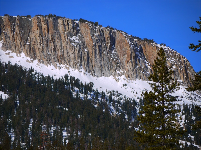
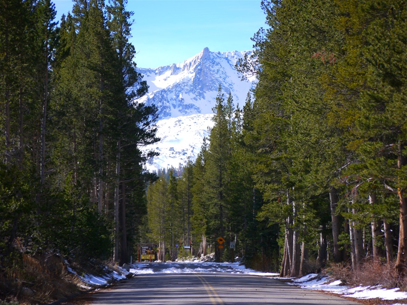
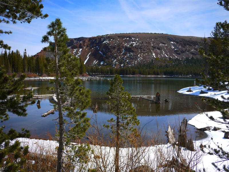
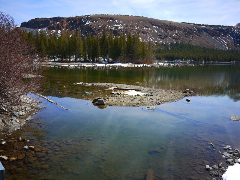
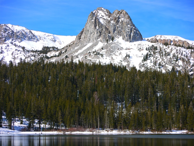
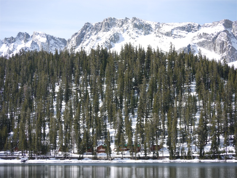
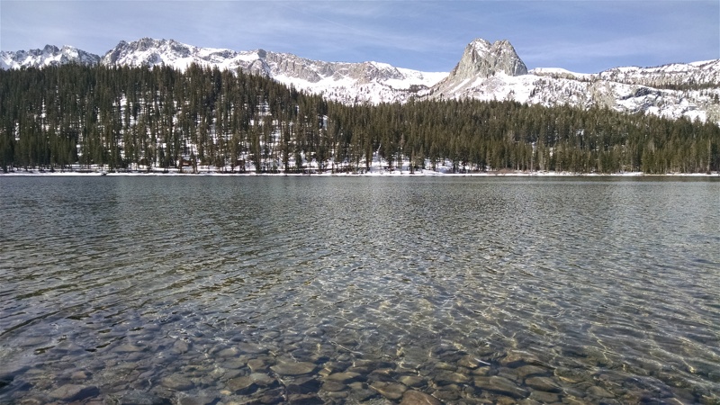
If you follow CA 203 into Mammoth Lakes to the intersection with Minaret Rd., keep going straight - the road becomes Lake Mary Rd. About 2.5 miles later you'll cross Mammoth Creek and arrive to Tamarack Lodge near Twin Lakes; in Summer, you can keep driving all the way up to Lake Mary. In Winter, your only realistic option is to don cross-country skis (which can be rented at Tamarack Ski Center); Spring and the fall are murkier. This year, mid-April, Lake Mary Road was still closed but good for a perfect two-hour walk. Keep in mind that between Twin Lakes and Lake Mary, you'll climb from about 8600 to close to 9000 ft. This little hike, with occasional wading in to the lake and eating snow, wore out our 3-months old Airedale.
Last edited:
pmatusov
AK6PM
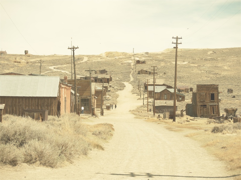
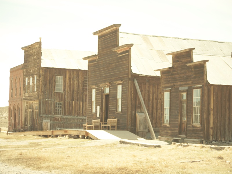
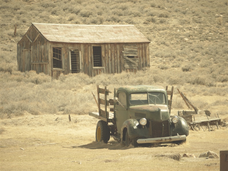
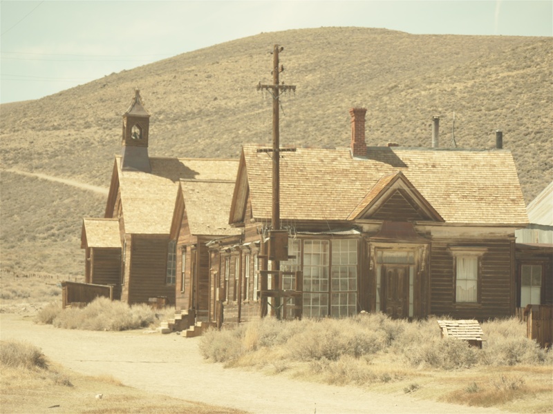
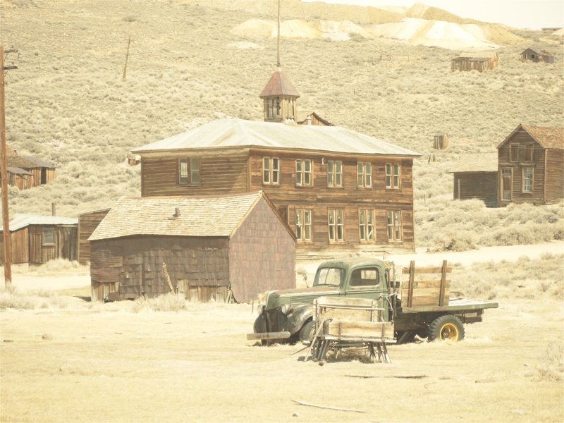
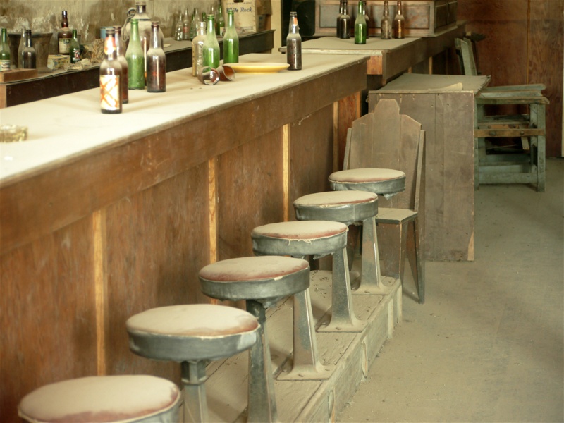
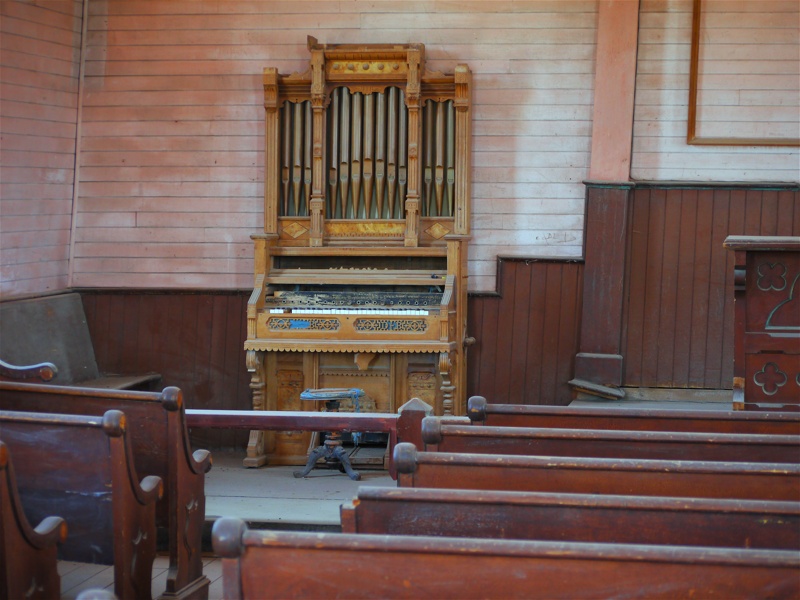
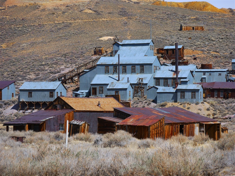
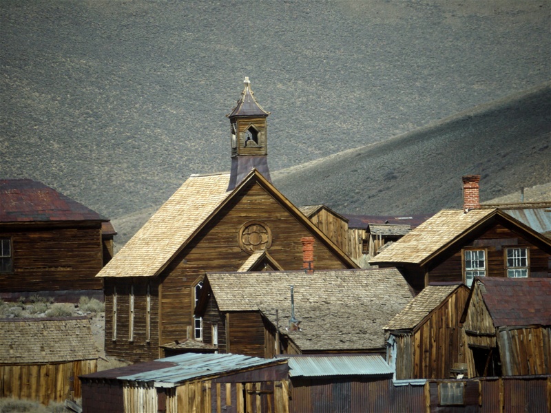
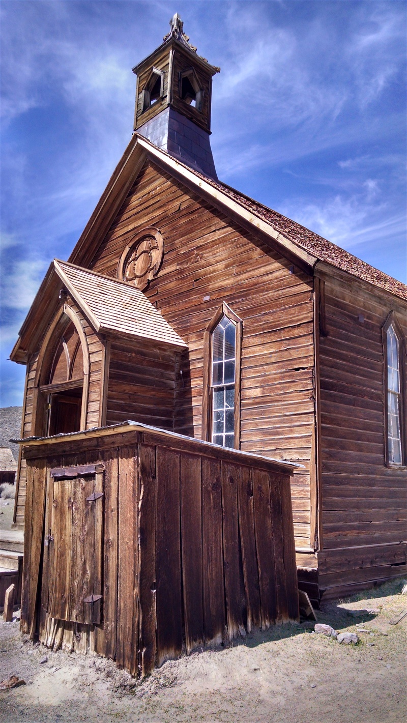
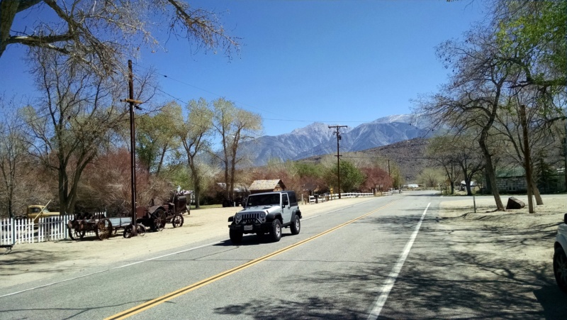
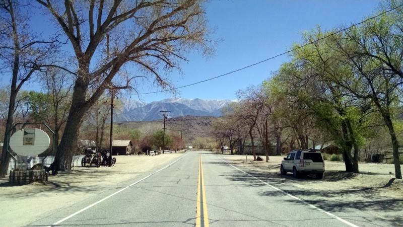
Ghost town of Bodie
"Good bye God, I'm going to Bodie,” wrote a little girl, departing with her family from San Francisco to the booming mining town of Bodie at some time in the third quarter of the 19th century. That must have been a fun place to go!
Google will dig you pretty much all the facts there are to know about this place - which is as much fun to visit now as Tombstone, Arizona, however different. It is neither a completely abandoned ghost town (it is a California State Park), nor neatly restored like Tombstone or lived-in like Jerome or many others. I think it would be very neat to spend a night there - someplace - but I don't know of a park ranger-approved way to do so (rangers have a residence in town, and likely won't be impressed finding you stoking a campfire on the town street). It is a popular tourist attraction, despite being 13 miles off U.S.395, last three - a rough and very dusty graded dirt road. You may get a break, however, and enjoy the near-solitude and quietness in town.
If you are adventurous, once you had your fill of ghost town, you can take a dirt road towards Mono Lake instead of returning to 395. It has little traffic, and a lot of fun trying to get your car's tail around the corners. By the way, Bodie State Historic Park gets my thumbs up by being dog-friendly - as long as you keep your furry friend on the leash.
pmatusov
AK6PM
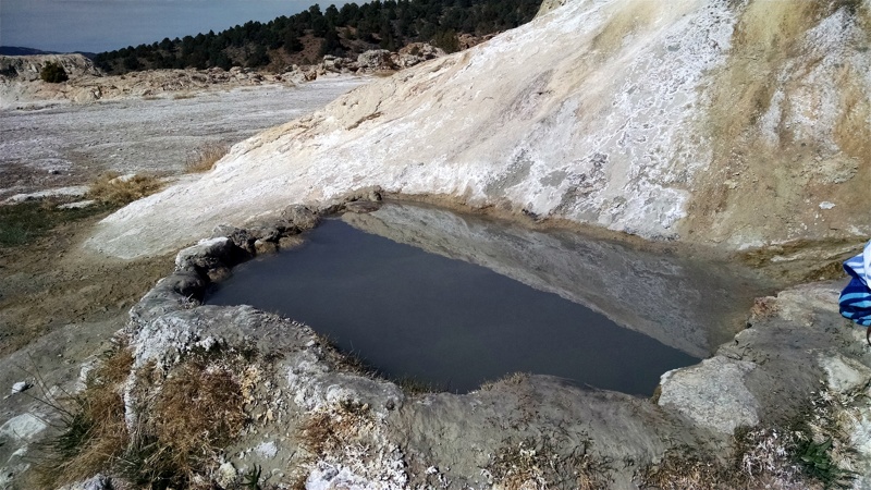
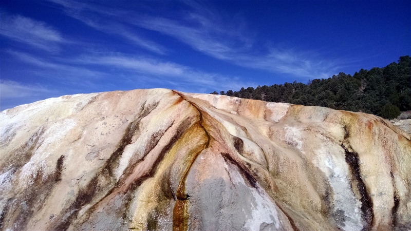
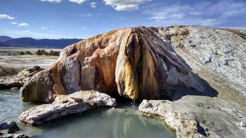
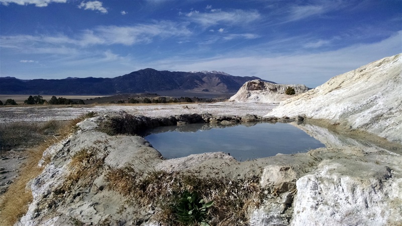
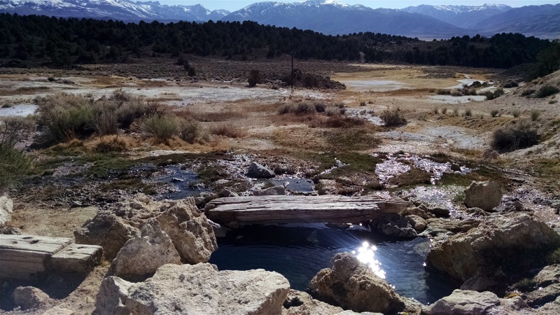
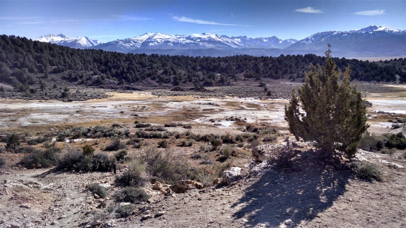
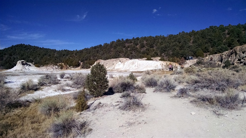
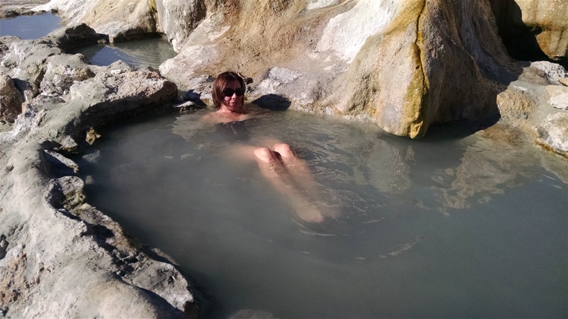
Travertine Hot Springs
Imagine spending years watching evening news on CNN or Fox, and turning off your TV after getting bored in twenty minutes; and, all of a sudden, discover that there's a fresh episode of Top Gear right after the news - that you've been missing all these years?
Maybe with not as much drama as I described, but Travertine Hot Springs had a similar effect on us. After all, we must have driven by 20 times in the past without lifting a foot off the gas pedal.
Just like most other wild hot springs along U.S.395, these are not announced on the road in any way. I am sure the locals prefer to keep them relatively low-key, and if CalTrans installed a prominent sign luring people to hot waters, the sign wouldn't last very long. So, I also won't tell where they are, leaving it to Internet to break all secrets.
These are very close to the highway, and heavily visited. Fortunately, there is enough room for 20 people easily in a variety of tubs - from right near the road to somewhat remote, and from cool to scalding hot. There is a proper restroom maintained by the Forest Service near the dirt parking lot - convenient at least if you aren't a surfer type used to changing wet clothes at any place short of Times Square.
pmatusov
AK6PM
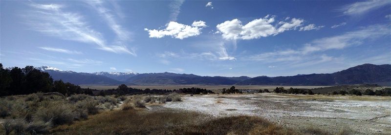
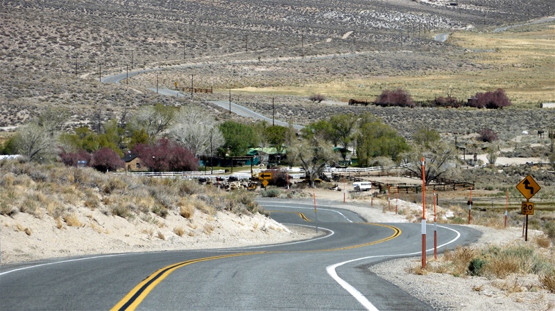
Benton Hot Springs
This was another first for us. After years of driving past the sign "Benton Crossing Road" near Mammoth Lakes or U.S.6 in Bishop, and thinking "there's got to be something interesting there," we took the first on our way home (to San Diego) from Mammoth Lakes. Of course, we had to swing by our favorite hot tub off Whitmore Tubs Rd., enjoying the solitude on a Monday morning; but when we hit the blacktop, we turned East towards Benton Crossing. Benton Crossing Road runs away from 395, and then veers South, hugging Crowley lake, before turning East again, then North, until it empties into CA 120.
Some parts of it are as "generic high desert" as parts of CA 168; then it crests a small ridge, and descends into a valley where Benton Hot Springs are.
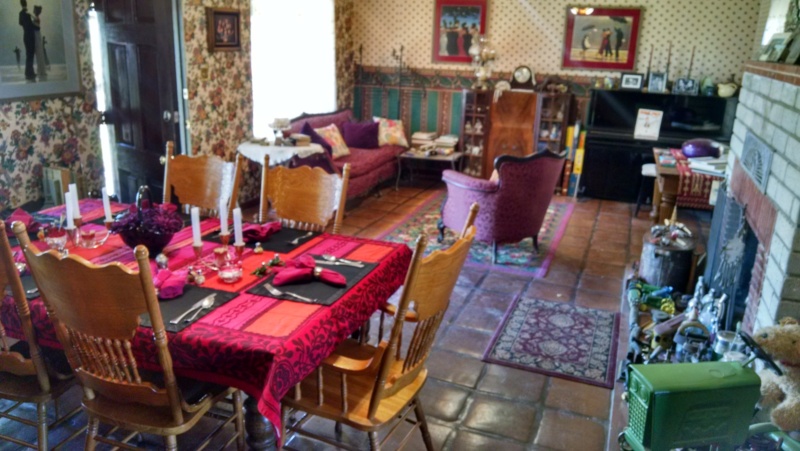
Rolling into the tiny town, you are treated to the sights so common to this desert - collections of rusting farm equipment of hundred years ago, defunct gas pumps, wooden wagons and parts of them, an occasional old truck or a few. It takes slowing down not to miss the Inn at Benton Hot Springs - which is ran and maintained by Bill and Diane Bramlette. We asked the owners' permission to take a few photos inside and on the front yard; it looks like it is a beautiful weekend destination by itself. We are looking forward to staying in one of the three historic houses that are part of the Inn.
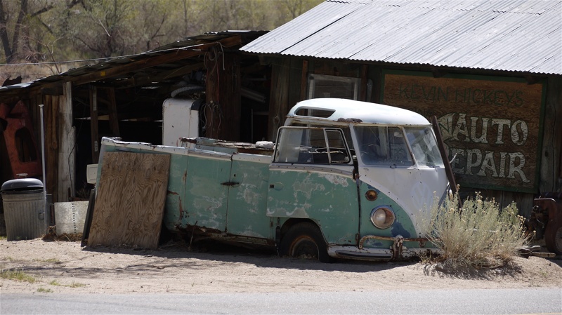
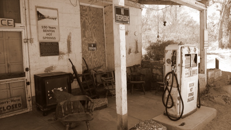
We continued along highway 120 until its intersection with the U.S.6 in Benton. It was time for lunch, so we checked out a cafe at the gas station in Benton. The two people in it - the waitress and the only customer - looked at us without a hint of approval, so we elected to suck it up and head to Bishop. Along the road, desert people dwellings abounded; Tarantino's "Kill Bill 2" certainly spaked our interest to this lifestyle, and we certainly are looking forward to more knowledge. For now, a 300-mm lens will do.
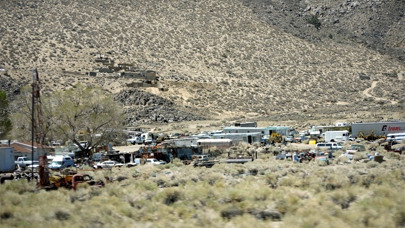
This was another first for us. After years of driving past the sign "Benton Crossing Road" near Mammoth Lakes or U.S.6 in Bishop, and thinking "there's got to be something interesting there," we took the first on our way home (to San Diego) from Mammoth Lakes. Of course, we had to swing by our favorite hot tub off Whitmore Tubs Rd., enjoying the solitude on a Monday morning; but when we hit the blacktop, we turned East towards Benton Crossing. Benton Crossing Road runs away from 395, and then veers South, hugging Crowley lake, before turning East again, then North, until it empties into CA 120.
Some parts of it are as "generic high desert" as parts of CA 168; then it crests a small ridge, and descends into a valley where Benton Hot Springs are.
Rolling into the tiny town, you are treated to the sights so common to this desert - collections of rusting farm equipment of hundred years ago, defunct gas pumps, wooden wagons and parts of them, an occasional old truck or a few. It takes slowing down not to miss the Inn at Benton Hot Springs - which is ran and maintained by Bill and Diane Bramlette. We asked the owners' permission to take a few photos inside and on the front yard; it looks like it is a beautiful weekend destination by itself. We are looking forward to staying in one of the three historic houses that are part of the Inn.
We continued along highway 120 until its intersection with the U.S.6 in Benton. It was time for lunch, so we checked out a cafe at the gas station in Benton. The two people in it - the waitress and the only customer - looked at us without a hint of approval, so we elected to suck it up and head to Bishop. Along the road, desert people dwellings abounded; Tarantino's "Kill Bill 2" certainly spaked our interest to this lifestyle, and we certainly are looking forward to more knowledge. For now, a 300-mm lens will do.
pmatusov
AK6PM
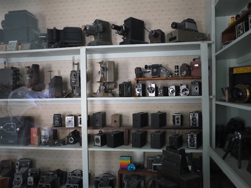
Laws Railroad Museum

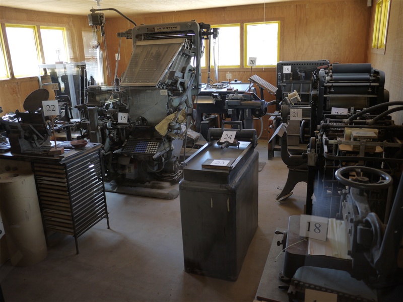
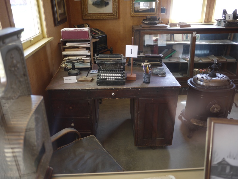
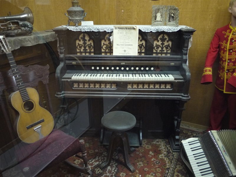
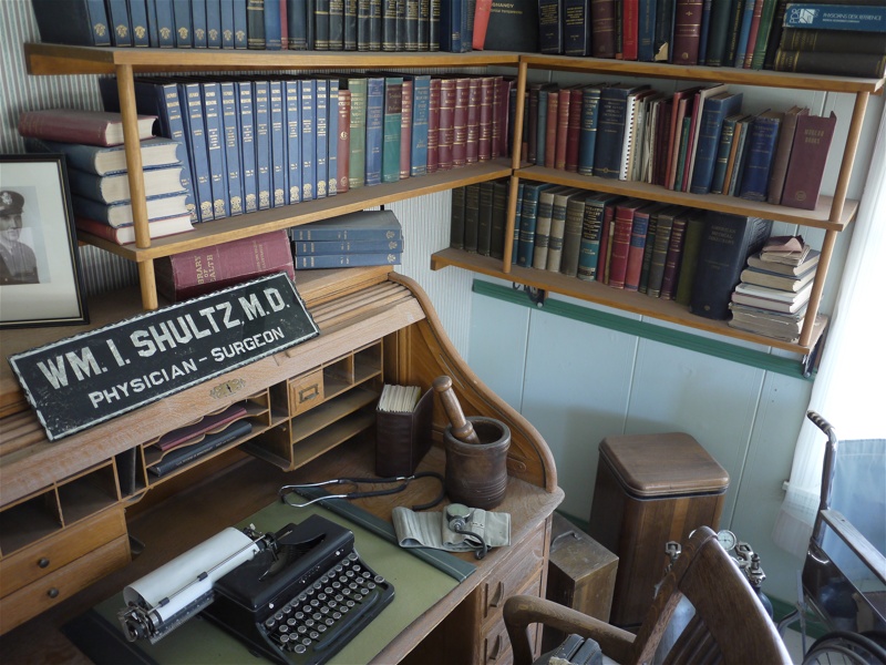
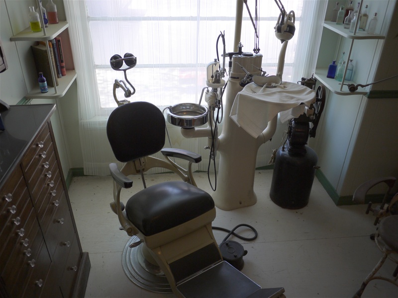
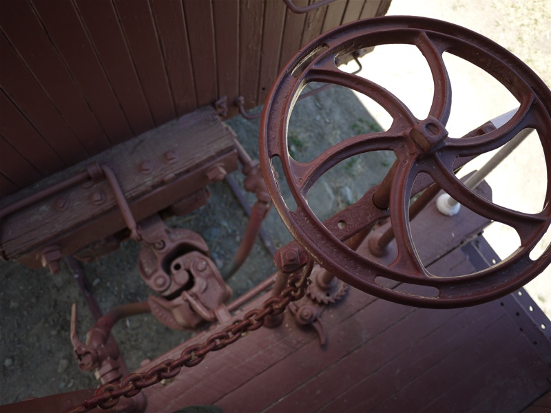
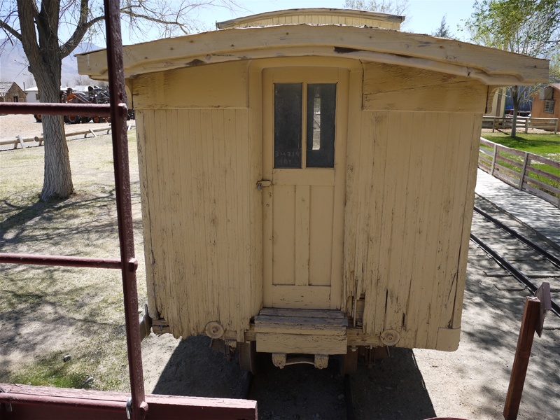
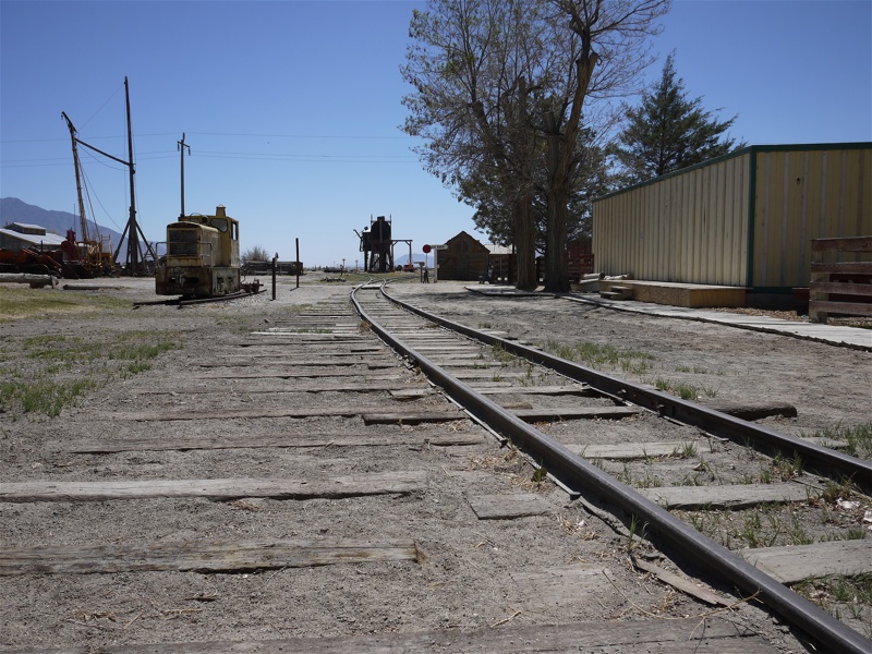
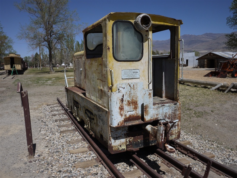
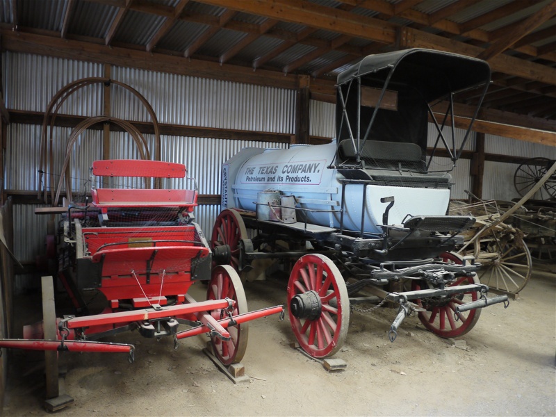
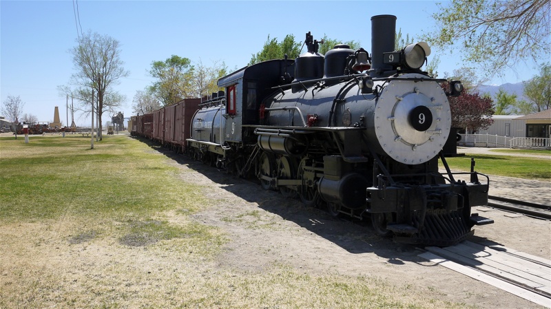
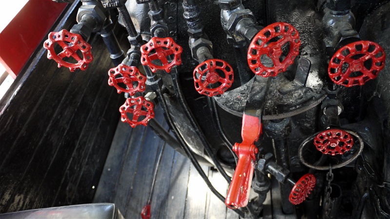
On the U.S.6, roughly halfway between Silver Canyon Rd. and Bishop, you can - and should - stop and visit another gem of Owens River Valley - Laws Railroad Museum. Our use of deontic modality in the previous sentence is not random - how often can one visit Henry Ford Museum and Greenfield Village in the desert? Okay, that may be somewhat of an overstatement, but in reality this Museum, besides documenting the Laws Railroad, offers a collection of life artifacts of late 19th and most of the 20th centuries, often in the most-appropriate setting. Where else have you seen a couple of hundreds of old film cameras? (It also makes me wonder - how or why they ended up here?). You'll see pretty much the entire life of a railroad town in mid-20 century (the railroad ceased operations in 1960) - a store, a post office, a doctor's and dentist's offices, a carpenter shop, a forge, engine repair shop, a miner's cabin, a bathhouse, and so on and on. Try to guess the use of any of a hundred or so valves in the steam engine cabin.
All of this - for a nominal $5 donation per adult.
Stop by, you and your kids will love it. Your dog, sadly, will not - pets are not allowed behind the gate.
In case you guys think this is crazy - this is how dental offices looked and worked in Russia when I was a kid (and that wasn't all that long ago):
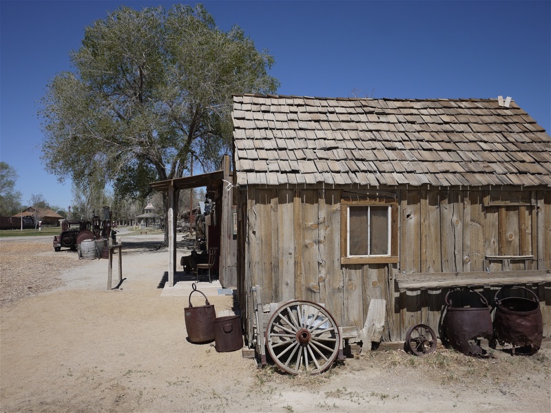
A miner's cabin:
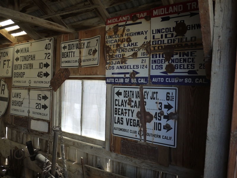
Road signs - courtesy of Automobile Club of California:
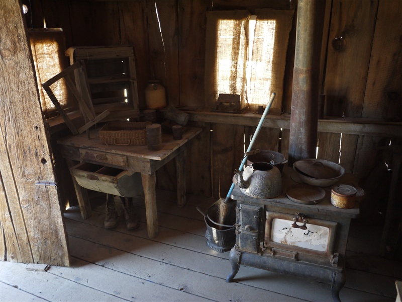
Travel kitchen worth of ExPo:
Mr.Engineer, could you please go over these valves one more time?
Nice lilac -
We had an outstanding lunch at Aaron Schat's Roadhouse in Bishop, enjoying beer and burgers outside, watching the lazy Monday traffic.
The rest of the trip home was uneventful - with the exception of us deciding to try new things, and the new thing of the day being taking Highway 14 to I-5 instead of U.S.395 to I-15. Trading Victorville/San Bernardino/Corona traffic for Los Angeles traffic is a questionnable choice - that of choosing beat-up German cars with pitch-black-tinted windows of East San Fernando Valley as your traffic neighbors instead of lifted pickups of Inland Empire that haven't seen a minute on a wheel alignment rack. Hey, this is all fun.
On the U.S.6, roughly halfway between Silver Canyon Rd. and Bishop, you can - and should - stop and visit another gem of Owens River Valley - Laws Railroad Museum. Our use of deontic modality in the previous sentence is not random - how often can one visit Henry Ford Museum and Greenfield Village in the desert? Okay, that may be somewhat of an overstatement, but in reality this Museum, besides documenting the Laws Railroad, offers a collection of life artifacts of late 19th and most of the 20th centuries, often in the most-appropriate setting. Where else have you seen a couple of hundreds of old film cameras? (It also makes me wonder - how or why they ended up here?). You'll see pretty much the entire life of a railroad town in mid-20 century (the railroad ceased operations in 1960) - a store, a post office, a doctor's and dentist's offices, a carpenter shop, a forge, engine repair shop, a miner's cabin, a bathhouse, and so on and on. Try to guess the use of any of a hundred or so valves in the steam engine cabin.
All of this - for a nominal $5 donation per adult.
Stop by, you and your kids will love it. Your dog, sadly, will not - pets are not allowed behind the gate.
In case you guys think this is crazy - this is how dental offices looked and worked in Russia when I was a kid (and that wasn't all that long ago):
A miner's cabin:
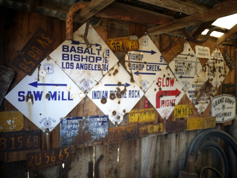
Road signs - courtesy of Automobile Club of California:
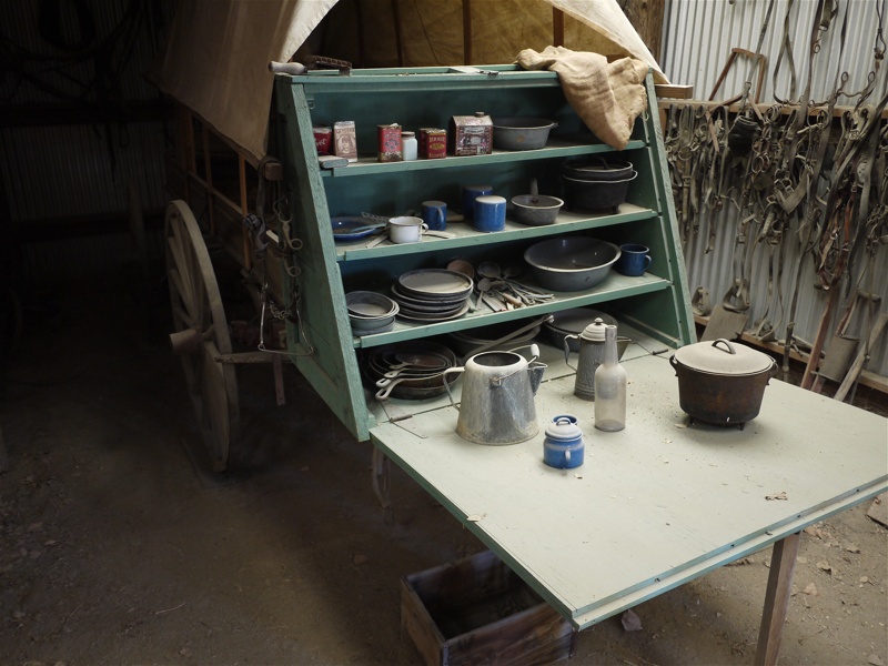
Travel kitchen worth of ExPo:
Mr.Engineer, could you please go over these valves one more time?
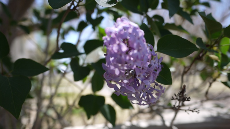
Nice lilac -
We had an outstanding lunch at Aaron Schat's Roadhouse in Bishop, enjoying beer and burgers outside, watching the lazy Monday traffic.
The rest of the trip home was uneventful - with the exception of us deciding to try new things, and the new thing of the day being taking Highway 14 to I-5 instead of U.S.395 to I-15. Trading Victorville/San Bernardino/Corona traffic for Los Angeles traffic is a questionnable choice - that of choosing beat-up German cars with pitch-black-tinted windows of East San Fernando Valley as your traffic neighbors instead of lifted pickups of Inland Empire that haven't seen a minute on a wheel alignment rack. Hey, this is all fun.
mountainsports2002
Observer
Great report,thanks for sharing.