Maze Memorial Weekend

IntrepidXJ

Explorer
Memorial Day Weekend | Friday - Monday, May 23-26, 2014

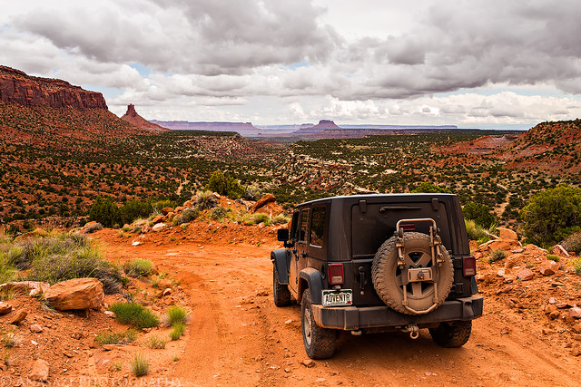
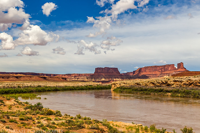
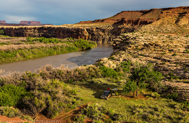
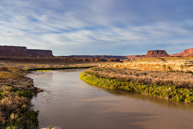
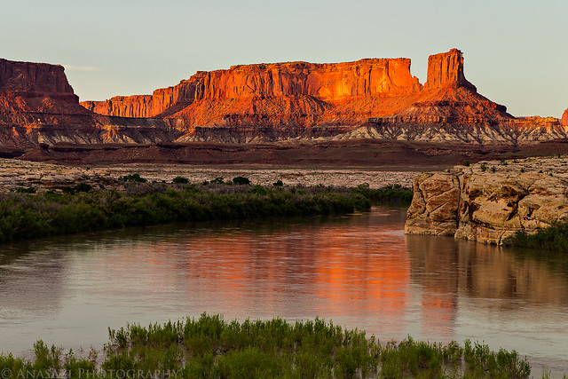
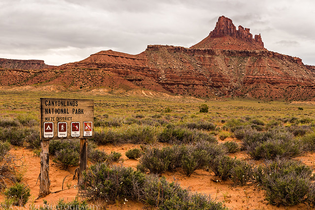
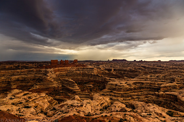
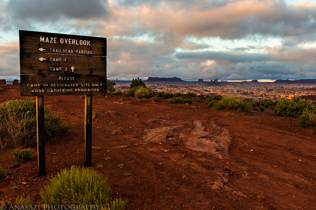
It's been over three years since I have been to the Maze District of Canyonlands National Park and I have been wanting to get back. Earlier this year I decided to try out Canyonlands' new online permit system and got a permit for a few campsites in The Maze over Memorial Day weekend. The last time I was in The Maze we camped in the Land of Standing Rocks, but this time I wanted to make sure we spent a night at the Maze Overlook. I also wanted to check out the Millard Campsite along the Green River since it seems like a pretty remote area of the park and I haven't heard about too many people driving out to it.

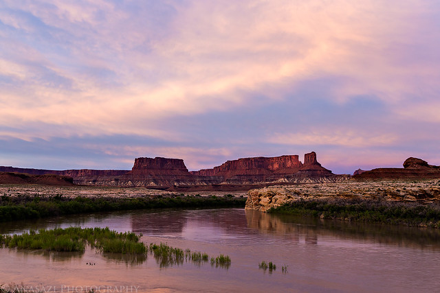
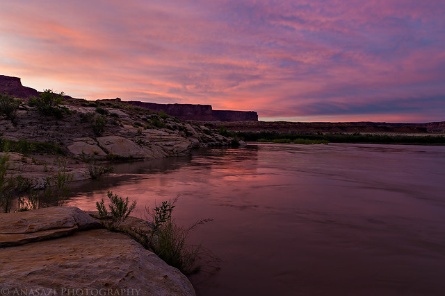
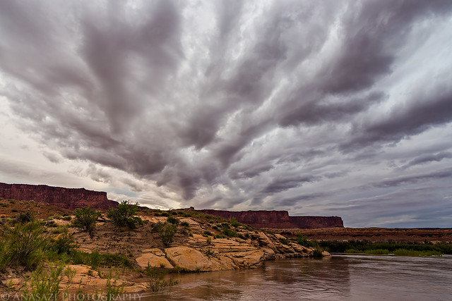
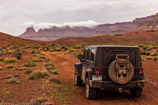
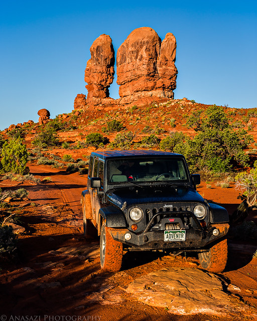
After work on Friday, I picked up Diane and we headed west into Utah. I topped off my fuel tank in Green River and we grabbed a bite to eat for dinner before heading south on Highway 24 through a very heavy storm that dumped a lot of rain in the area and caused some flash flooding. It left wet road conditions behind and even some deep water holes in the roads. These conditions slowed us down a little, but didn't stop us. We would find minor washed out sections of the roads and trails we drove for the rest of the weekend, but luckily none were completely washed out. We made the long, wet and bumpy ride out to the High Spur campsite atop the Orange Cliffs overlooking Millard Canyon and setup camp in the twilight. It had stopped raining by the time we were setting up camp, so at least we didn't have to deal with getting wet. We wanted to try and watch the Camelopardalids meteor shower this evening, but the clouds that still filled the sky prevented that. As we went to sleep we could see flashes of lightning off in the distance, but they were far enough away that we didn't even hear any thunder. I had a hard time falling asleep this evening and ended up not getting much sleep at all.

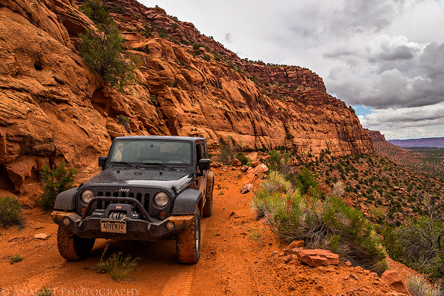
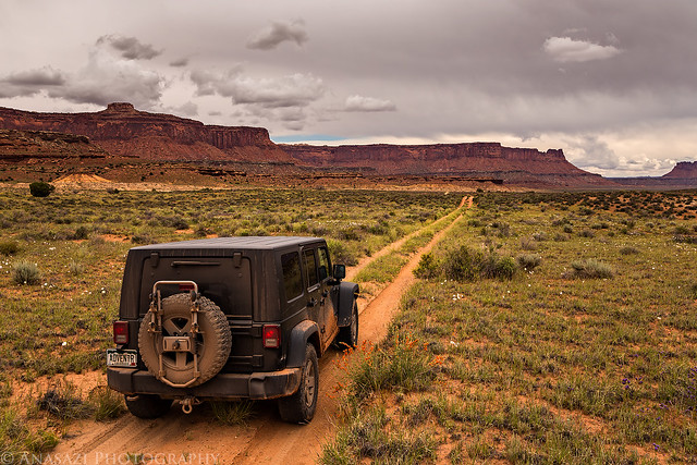
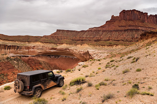
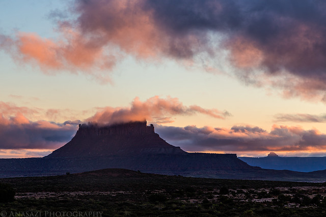
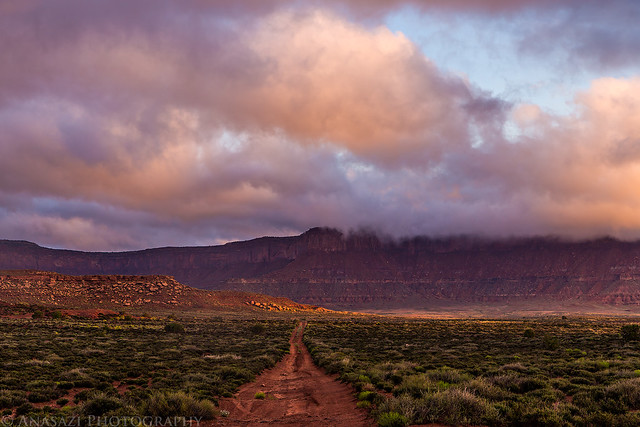
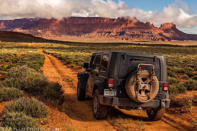
Ready to start our adventure on this stormy evening as we turn off Highway 24 onto the Hans Flat Road.

The Beginning by IntrepidXJ, on Flickr

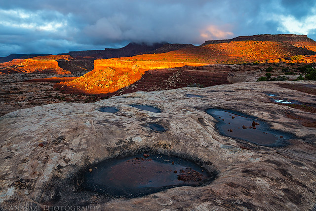
I don't recall it raining overnight, but the tent was soaked in the morning, so maybe I slept through it? Even without much sleep I woke up before sunrise and hiked over to the rim of Millard Canyon to shoot a few sunrise photos. The clouds had cleared out and the sky was mostly clear by now.

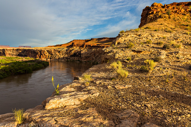
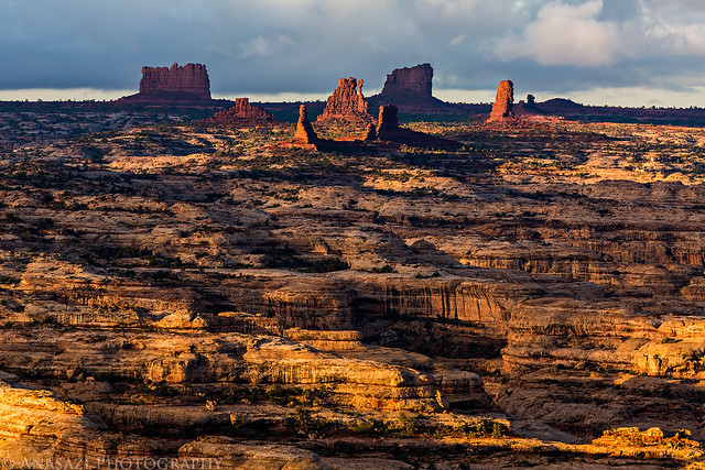
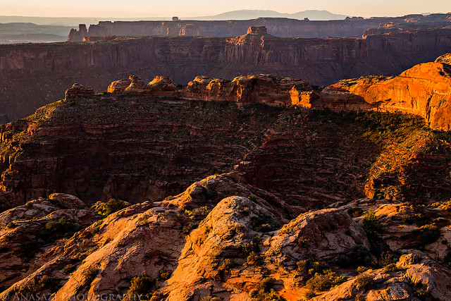
Looking down from the rim as the sunlight strikes the edge of the sandstone below.


Millard Below by IntrepidXJ, on Flickr

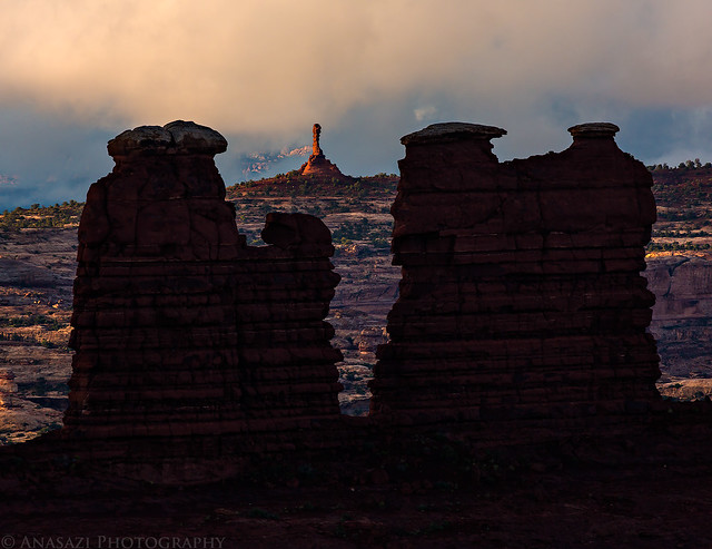
Cool rock formations near the High Spur campsite.


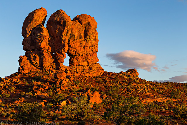
Morning Rocks by IntrepidXJ, on Flickr


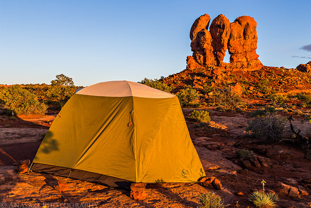
High Spur Camp by IntrepidXJ, on Flickr


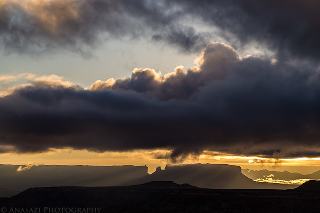
High Spur Sunrise by IntrepidXJ, on Flickr

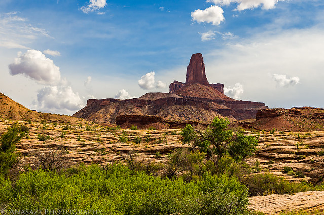
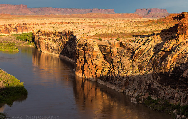
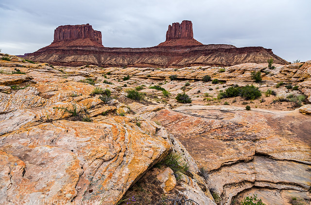
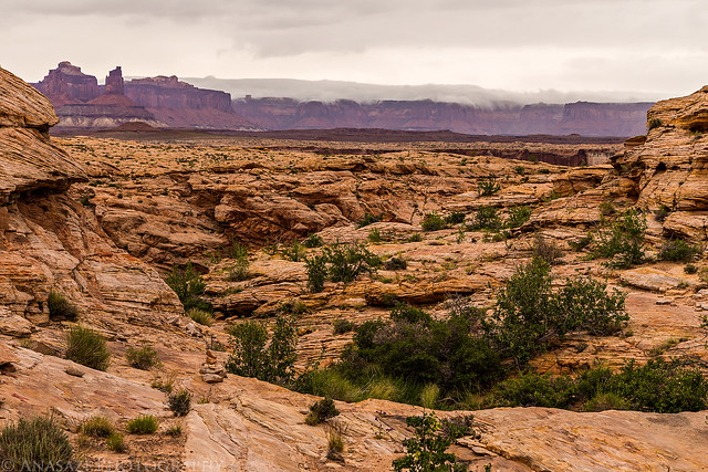
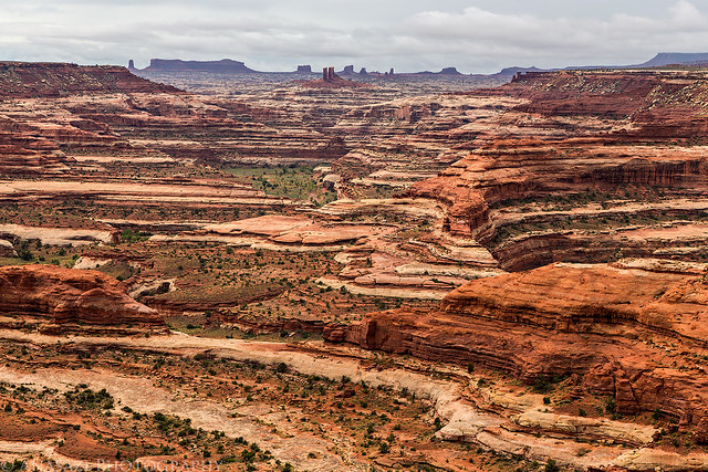
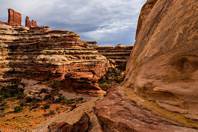
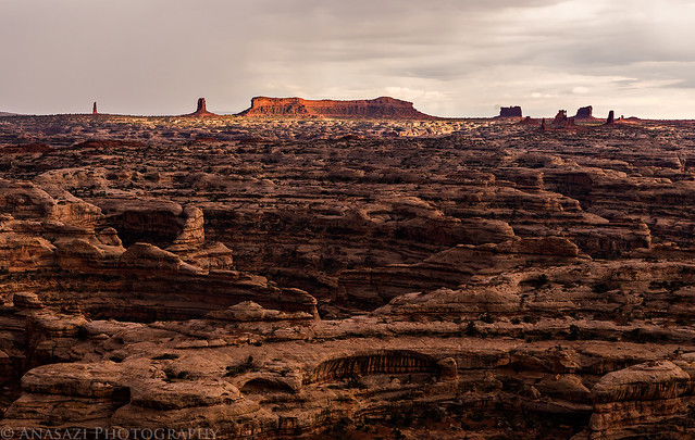
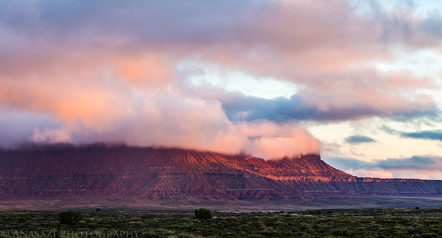
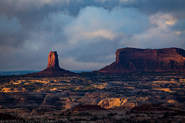
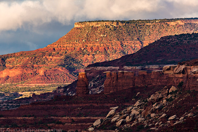
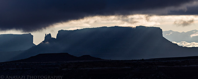
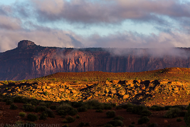
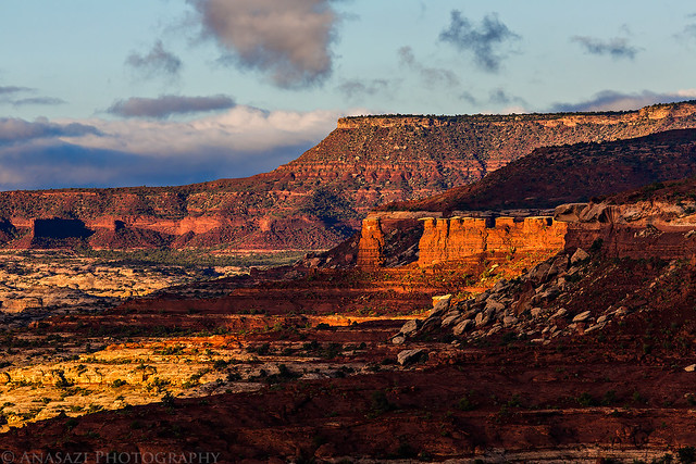
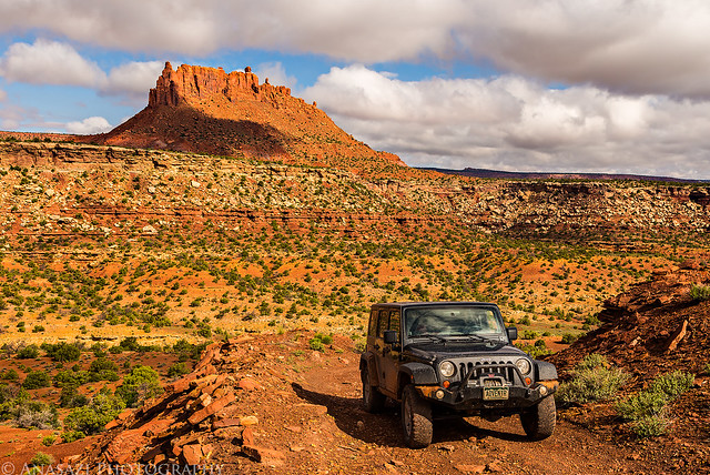
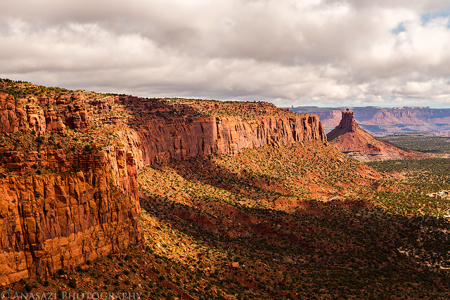
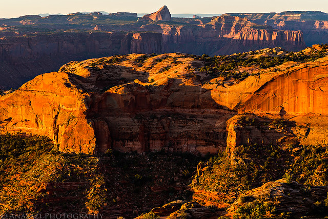
The Buttes of the Cross are on the other side of Millard Canyon. We will be getting a better view of those later in the day.


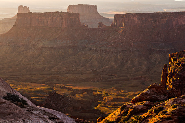
Over Millard Canyon by IntrepidXJ, on Flickr

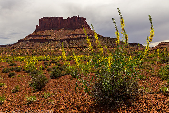
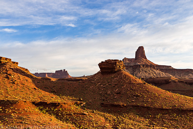
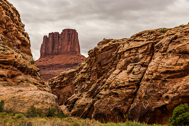
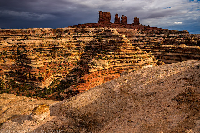
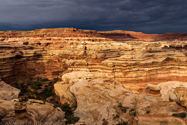
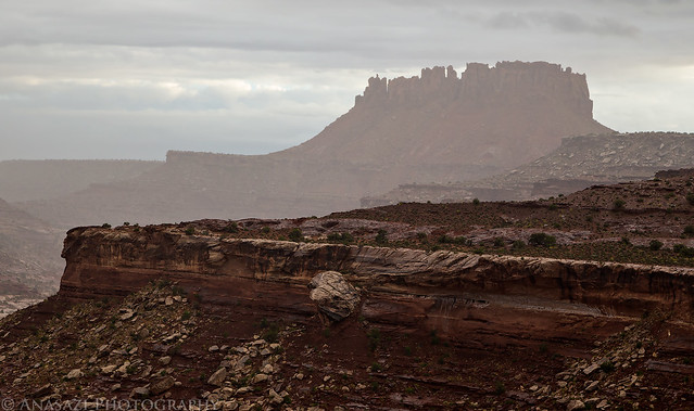
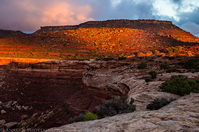
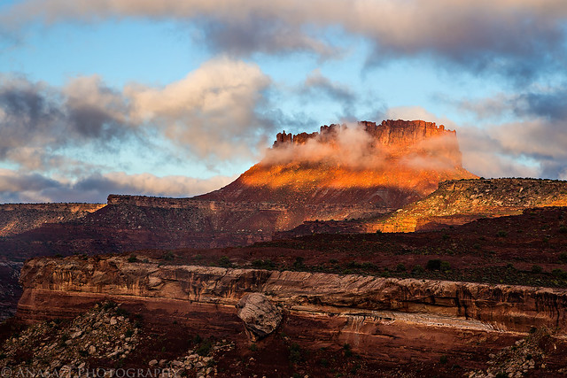
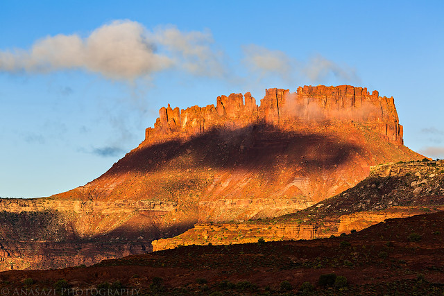
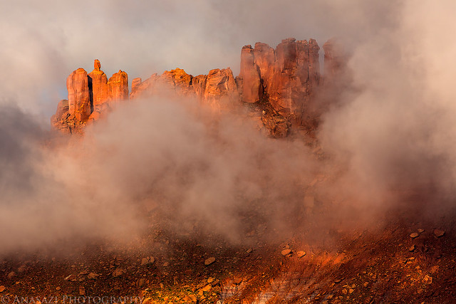
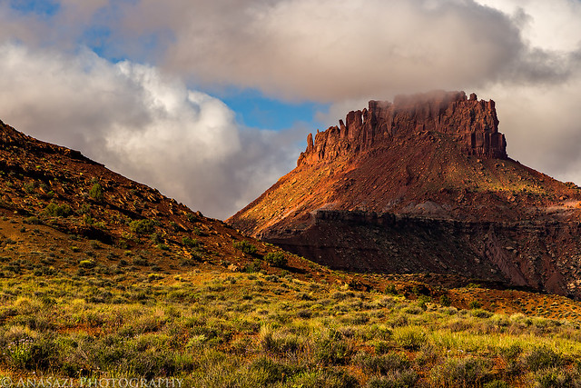
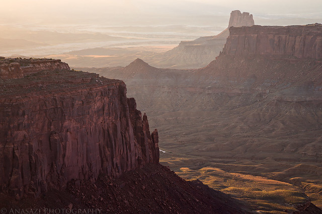
Cleopatra's Chair is the prominent sandstone formation in the middle at the top of this photo.


Cleopatra's Chair by IntrepidXJ, on Flickr


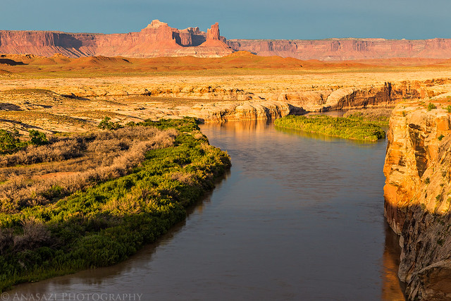
Millard Canyon Sunrise by IntrepidXJ, on Flickr

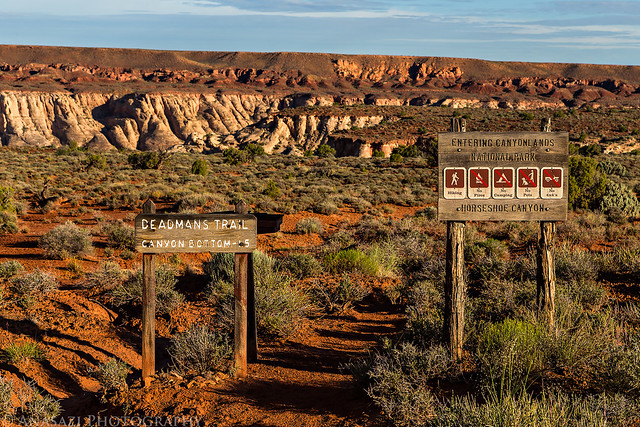
After we broke down camp and loaded it into the Jeep, we drove a little further on The Spur to the beginnign of the Deadmans Trail. The road appeared recently washed out in a few places, but it wasn't anything my Jeep couldn't handle. I've hiked to the Great Gallery in Horseshoe Canyon from the typical trailhead a few times before but have always wanted to hike down to it from the Deadmans Trail. When I first planned this trip I was hoping to hike down in the dark and photograph the Great Gallery while it was still in the shade, but thanks to a lack of sleep and catching the sunrise at camp I will have to try that another time in the future. Some of the pictographs were still in the shade when we arrived, but not all of them. We were the first and only people at the panel this morning which was nice and relaxing. After sitting and studying the panel for a while we started the climb back out of the canyon to the Jeep so we could continue on our journey.

Leaving High Spur camp.


Leaving High Spur by IntrepidXJ, on Flickr

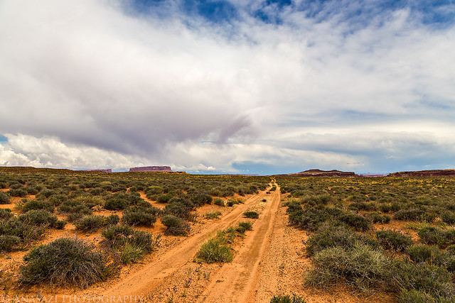
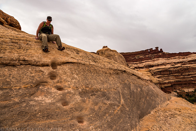
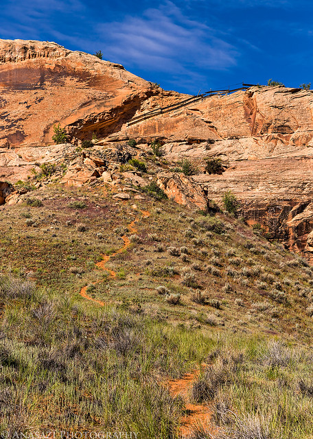
Ready to start our hike down the Deadmans Trail.


Deadmans Trail by IntrepidXJ, on Flickr

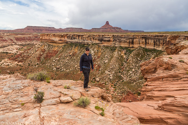
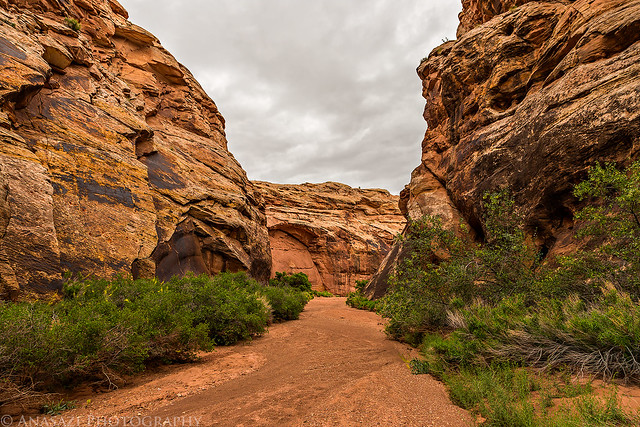
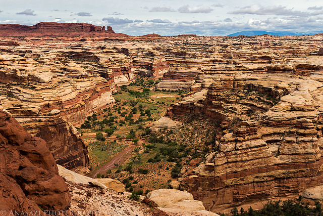
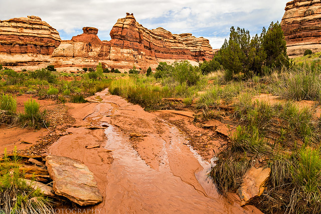
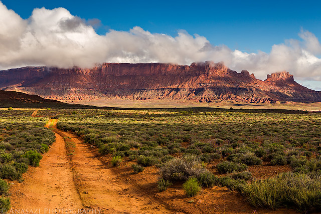
A nice view down into Horseshoe Canyon.


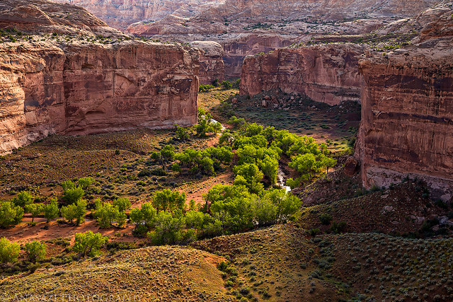
Horseshoe Canyon by IntrepidXJ, on Flickr


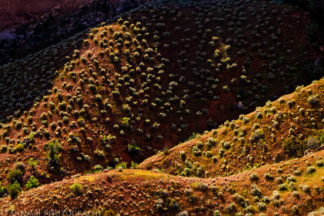
Hills & Light by IntrepidXJ, on Flickr

Ghosts of the Great Gallery.


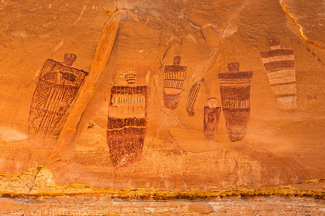
Great Gallery Ghosts by IntrepidXJ, on Flickr

Amazing detailed pictographs.


Details by IntrepidXJ, on Flickr

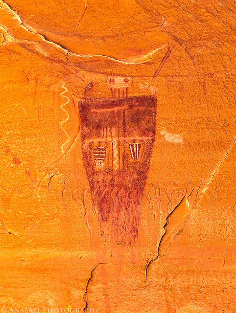
The Holy Ghost Panel.


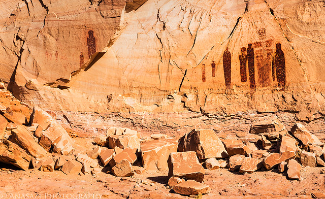
Holy Ghost by IntrepidXJ, on Flickr

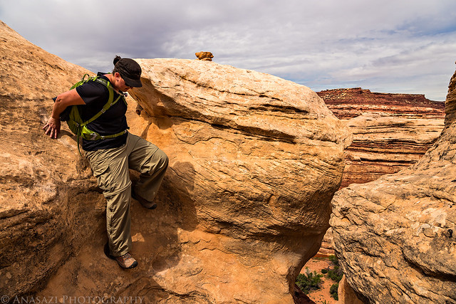
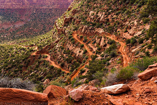
A steep climb back up the Deadmans Trail.


Steep by IntrepidXJ, on Flickr

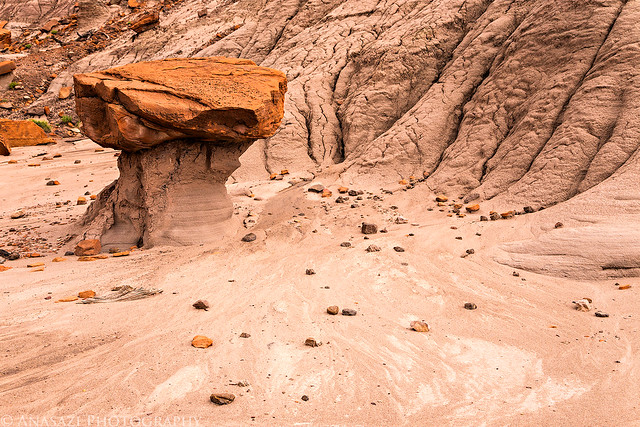
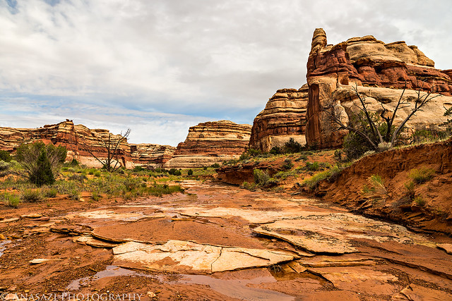
Sandstone formations inside a shallow alcove along the trail.


Alcove Design by IntrepidXJ, on Flickr
 

IntrepidXJ

Explorer
After our morning hike we drove back to the Hans Flat Ranger station so we could get updated weather conditions before heading down into The Maze. As we drove towards the ranger station, we noticed the clouds were starting to build and it looked like more rain might be in store for the afternoon. It seemed like a monsoon pattern which is quite a bit early in the year to be happening. The park ranger confirmed our suspicions with a 40 percent chance or rain forecasted for the rest of the day. He also told us that not many people drive out to the Millard Campsite and that we would be the first ones out that way in a while, so he had no idea the conditions of the road and we would have to find out for ourselves how it was. We left the ranger station and made our way to the Flint Trail switchbacks so that we could get down them before any more rain moved into the area. They were in good shape on our drive down and had not beef affected by the previous night's storm. We stopped for lunch at the Golden Stairs and then continued past the Maze Overlook turnoff on our way to the mouth of Millard Canyon.

Driving down the Flint Trail.


Down the Flint by IntrepidXJ, on Flickr


Switchback View by IntrepidXJ, on Flickr

Main intersection near the bottom.


Intersection by IntrepidXJ, on Flickr

A small hoodoo near the intersection.


Junction Hoodoo by IntrepidXJ, on Flickr

Two-track driving along the base of the Orange Cliffs on this overcast afternoon.


Two-Track by IntrepidXJ, on Flickr


On the Edge by IntrepidXJ, on Flickr


Rim by IntrepidXJ, on Flickr

Following the road across the Millard Benches.


Millard Road by IntrepidXJ, on Flickr

We passed Horse Canyon, Ekker Butte, Deadhorse Canyon and the Buttes of the Cross on our way to the Millard Camp. The road was a little bumpy but it wasn't difficult. It was a little too bumpy to drive as fast as I would have liked, though. This section of the road kind of reminded me of The White Rim trail on the other side of the river, except less traveled. We had a little on and off rain during the drive, but there wasn't enough precipitation to even get the ground wet. There was just enough to keep the dust down, which is always nice. When we reached the campsite along the Green River, we setup our tent under a large cottonwood tree. It was a very nice site that offered great views and plenty of solitude. I would happily camp here again. While we were setting up camp, the clouds finally started to clear and the sun broke free of the overcast sky we had been driving under all day. We spent the evening exploring the area and taking photos until the sun set. Unfortunately, by the time it started to get dark out there were too many clouds to watch the meteor shower again.

There was a lot of Prince's Plume around and plenty of other desert wildflowers.


Prince's Plume by IntrepidXJ, on Flickr

A bend in the Green River near the mouth of Millard Canyon as the sky finally starts to clear a little.


River Bend by IntrepidXJ, on Flickr

A view of the Buttes of the Cross from near our campsite. This is the only area where these buttes look like a fallen cross.


Buttes of the Cross by IntrepidXJ, on Flickr

<blockquote>Off to the south we see a butte in the form of a fallen cross. It is several miles away, but it presents no inconspicuous figure on the landscape and must be many hundreds of feet high, probably more than 2,000. We note its position on our map and name it &#8220;The Butte of the Cross.&#8221; - John Wesley Powell, July 17, 1869</blockquote>

Looking down on our camp along the Green River. You can see Junction Butte in the background.


Millard Camp by IntrepidXJ, on Flickr


Queen Anne Bottom by IntrepidXJ, on Flickr

Following the bench behind camp above the river.


Climbing the Ridge by IntrepidXJ, on Flickr

A nice reflection of the cliffs on the river at the beginning of Stillwater Canyon.


Cliff Reflection by IntrepidXJ, on Flickr

Looking across the Green River towards Candlestick Tower.


Green River by IntrepidXJ, on Flickr


Millard Benches by IntrepidXJ, on Flickr

Steer Mesa is reflected on the river shortly before sunset.


Steer Mesa Reflection by IntrepidXJ, on Flickr

There was nice color in the sky after the sun went down.


Green River Clouds by IntrepidXJ, on Flickr


Green River Sunset by IntrepidXJ, on Flickr
 

IntrepidXJ

Explorer
The sky was pretty overcast when we woke up on Sunday morning so there wasn't a good sunrise to photograph. We packed up camp and started our drive back out, but first we stopped near the Anderson slot canyon below the Buttes of the Cross and hiked down into Anderson Bottom on an old stock trail to search for some petroglyphs and a granary. We managed to find the small granary on The Frog in the middle of the rincon but it wasn't very impressive. There was no opening and it just looked like a stack of rocks. We had a tougher time finding the petroglyph panel and were just about ready to give up and start our hike back to the Jeep when I managed to spot it. On our way back, we hiked past the stock trail and went further up the canyon to check out the slot. I'm glad we didn't try to come down through the slot since it was full of water from the recent rain and we would not have been prepared for it. We hiked back up to the Jeep and then drove to the Maze Overlook. We stopped for lunch along the rim of Horse Canyon with a nice view of the Land of Standing Rocks in the distance. When we reached Camp 2 at the Maze Overlook we setup our tent at a nice site near the edge with a great view of the Chocolate Drops. Diane had some schoolwork to get done, so she spent some time working on that while I hiked along the edge towards Elaterite Butte.

Though the sky was overcast this morning, there was an interesting shape to the clouds above.


Morning Clouds by IntrepidXJ, on Flickr

Side view of the Buttes of the Cross from where we started hiking to Anderson Bottom.


Buttes by IntrepidXJ, on Flickr

The nice petroglyph panel we found.


Anderson Bottom Petroglyphs by IntrepidXJ, on Flickr

There were plenty of wildflowers down in this old meander of the river.


Anderson Flowers by IntrepidXJ, on Flickr


Purple by IntrepidXJ, on Flickr

Hiking up Anderson Canyon to reach the slot.


Butte Over Canyon by IntrepidXJ, on Flickr

A pool of water at the end of the slot canyon.


Anderson Slot by IntrepidXJ, on Flickr

Hiking back to the stock trail.


Anderson Canyon by IntrepidXJ, on Flickr

When we reached the rim of the canyon, we looked across to the Island in the Sky and noticed these low clouds that seemed to be pouring over the edge. I have not seen anything like it before.


Cloud Waterfall by IntrepidXJ, on Flickr

There were other low clouds hanging onto the buttes and cliffs as we drove back towards the Maze Overlook.


Low Clouds by IntrepidXJ, on Flickr


Around the Rim by IntrepidXJ, on Flickr

A view of the Land of Standing Rocks and the Maze Overlook from our lunch stop.


Standing Rocks View by IntrepidXJ, on Flickr

Entering The Maze again.


Maze District by IntrepidXJ, on Flickr

Diane gets some homework done from our campsite. Can you think of a better place to get schoolwork done?


Homework on the Edge by IntrepidXJ, on Flickr
 

IntrepidXJ

Explorer
We were originally planning on hiking down the Maze Overlook trail to the Harvest Scene in the morning before leaving, but when I told Diane that the panel would be in direct sunlight and hard to see if it wasn't cloudy, she suggested we hike down and see it that evening. We had enough time before sunset, so we grabbed our packs and left for the nearby trail. Most of the trail down was pretty easy, except for the one large ledge we had to descend. I was worried about being back to get back up it, but it turned out that going back up was much easier than down. It was nothing to worry about. The moki steps were easy, too. While we were hiking in the canyon the overcast skies finally started to break up and we got some spotlighting in the canyons. On the way to the Harvest Scene we stopped at another panel I had searched for a few years ago and not found. I have no idea how I missed it back then? It was so easy to spot on this time! We visited the Harvest Scene and took some photos while it was in the shade and then we started our hike back up to camp. We made good time on the hike and still had plenty of time to eat dinner before sunset. While we were cooking dinner it started to rain and we ended up eating in the tent. It would rain on and off the rest of the night, but our tent kept us nice and dry and still allowed us a beautiful view towards the Chocolate Drops. At sunset, there was a small enough hole in the clouds to the west which created a rainbow behind the Chocolate Drops and added a little color to the sky. What a way to end the day!

View from the trail as we descend into The Maze.


Trail View by IntrepidXJ, on Flickr


Descending by IntrepidXJ, on Flickr

Coming down the moki steps.


Moki Steps by IntrepidXJ, on Flickr

Faint Barrier Canyon Style pictographs and petroglyphs that I was unable to find the last time I was here. I have no clue how I missed them, they were fairly obvious this time! Maybe I've got better at locating them over the past few years?


Mixed Panel by IntrepidXJ, on Flickr

Hiking through the beautiful canyon on our way to the Harvest Scene.


Down in the Maze by IntrepidXJ, on Flickr


Water by IntrepidXJ, on Flickr

The Harvest Scene pictographs are so much easier to see when they are not in direct light.


Harvest Scene Alcove by IntrepidXJ, on Flickr


Harvest Scene by IntrepidXJ, on Flickr

This was Diane's favorite pictograph in the area. It's small, but very detailed.


Intricate by IntrepidXJ, on Flickr


Snake Panel by IntrepidXJ, on Flickr


Maze Overlook Trail View by IntrepidXJ, on Flickr


Chocolate Drops on Top by IntrepidXJ, on Flickr

Spotlight on the Chocolate Drops.


Chocolate Drops Spotlight by IntrepidXJ, on Flickr

Dark clouds over The Maze.


Clouds Over Petes Mesa by IntrepidXJ, on Flickr

Waiting out the rain in our tent with an amazing view.


Waiting out the Rain by IntrepidXJ, on Flickr

Light on Lizard Rock after the rain.


Lizard Light by IntrepidXJ, on Flickr

Storm clouds over The Maze.


Storm Over The Maze by IntrepidXJ, on Flickr

Elaterite Butte through the rain.


Through the Rain by IntrepidXJ, on Flickr

The beginning of a beautiful sunset.


Elaterite Sunset by IntrepidXJ, on Flickr

I was hoping to catch a rainbow near the Chocolate Drops, and it actually happened!


Chocolate Drops Rainbow by IntrepidXJ, on Flickr

Beautiful color in the sky over the orange Cliffs after the sun dropped below the horizon. A great way to end the day!


Color Over the Orange Cliffs by IntrepidXJ, on Flickr
 

IntrepidXJ

Explorer
It rained for most of the night and when I looked out of the tent shortly before sunrise I was disappointed to see a lot of clouds still in the sky. However, looking towards the east it looked like there might be a small hole to let some sunlight through. I got up, grabbed my camera, and took my chances. I'm glad that I did, because it turned out to be the best sunrise of the trip. It was an amazing morning! I'll let the photos do the talking...


Ekker Butte Sunrise by IntrepidXJ, on Flickr


Panorama Point Sunrise by IntrepidXJ, on Flickr


Camp Sunrise by IntrepidXJ, on Flickr


After the Storm by IntrepidXJ, on Flickr


Morning Road by IntrepidXJ, on Flickr


Distant View by IntrepidXJ, on Flickr


Out of the Clouds by IntrepidXJ, on Flickr


The Plug by IntrepidXJ, on Flickr


Layers by IntrepidXJ, on Flickr


Under Clouds by IntrepidXJ, on Flickr


Chimney Rock Light by IntrepidXJ, on Flickr


Maze Overlook Sign by IntrepidXJ, on Flickr


Layers of Light by IntrepidXJ, on Flickr


Cloud Shadow by IntrepidXJ, on Flickr


Canyonlands Blues by IntrepidXJ, on Flickr


Land of Standing Rocks by IntrepidXJ, on Flickr


Maze Layers by IntrepidXJ, on Flickr


Elaterite Clouds by IntrepidXJ, on Flickr


Morning Maze by IntrepidXJ, on Flickr
 

IntrepidXJ

Explorer
Since we had hiked down into The Maze the evening before we took things slow this morning as we packed up camp and got ready for the drive back home. The sky and light was still pretty nice as we drove back to Hans Flat. The roads had quickly dried out from the rain and the Flint Trail was still in good shape. I had been a little worried about not having enough gas to get back to Green River, even with an extra 5 gallons I brought with, but once we got past the Ranger Station my Jeep's MPG vastly improved and I had nothing to worry about. I probably could have got away without the extra gas, but it really would have been cutting things too close for me. We fueled back up in Green River and grabbed some burgers from Ray's Tavern to end the trip. It was a great long weekend in the Maze District of Canyonlands!


Maze Overlook Road by IntrepidXJ, on Flickr


Leaving The Maze by IntrepidXJ, on Flickr


Elaterite by IntrepidXJ, on Flickr


Under Bagpipe Butte by IntrepidXJ, on Flickr

A view of the Flint Trail switchbacks below.


Flint Trail by IntrepidXJ, on Flickr


Orange Cliffs by IntrepidXJ, on Flickr

One of my favorite signs!


High Clearance 4WD by IntrepidXJ, on Flickr

>> Maze Memorial Weekend Photo Gallery
>> The Original Trip Report on ADVENTR.CO
 

roverrocks

Expedition Leader
WOW!! Simply WOW!! Stunningly beautiful pictures!! Another of your superb adventures brought to life by your amazing photography.
 

shawnr

New member
Thanks for all the adventures you've been posting. Definitely giving me inspiration for some trips.
 

meatblanket

Adventurer
Those clouds made for some really nice photos at Maze Overlook. We were up top of the Orange Cliffs at the same time, and entirely shrouded in fog. Amazing what a difference a few hundred feet of elevation makes.
Very nice, thanks for posting!
 

IntrepidXJ

Explorer
Those clouds made for some really nice photos at Maze Overlook. We were up top of the Orange Cliffs at the same time, and entirely shrouded in fog. Amazing what a difference a few hundred feet of elevation makes.
Very nice, thanks for posting!

Funny you should mention that...while I was taking photos of the clouds around the Orange Cliffs, Diane mentioned to me that it would be cool to be on top in the clouds. I disagreed and told her we wouldn't be able to see anything if we were!
 

TerryG

New member
marvelous photography!!

I am drawn to this area by its remoteness and beauty. As a fine art photographer, I am inspired by your work!! Well done! I plan to spend about 4 days in April 2015 wandering about the area and your narrative and photography reinforces this as a place to visit. Thank you immensely for your time to document and narrate your experience!!
Terry
 

Forum statistics

Threads
185,814
Messages
2,878,489
Members
225,372
Latest member
camshaft700
Top