They Went Without Me so I'll Go Without Them

4x4x4doors

Explorer
Cache Creek to Hope to Vancouver
sDSCF8396.jpg
Two of the seven railroad tunnels in a stretch they had to dig to put the tracks next to the Fraser River
sDSCF8402.jpg
Fraser River canyon. If you look, you can see two sets of train tracks. The US built the tracks on one side, the Canadians built the set on the other side due to territorial disputes. For years, each was run totally independent of the other. In the last 15 years, they have agreed to run one set for northbound traffic and one for southbound traffic. sDSCF8408.jpg
Front end of a very long southbound Canadian train
sDSCF8420.jpg
Highway tunnel. Not a great picture but its one of the longest in North America. This picture shows the curve to follow the canyon
sDSCF8445.jpg
One of many pretty chain saw carvings we saw in Hope
sDSCF8457.jpg
Riverfront view in Hope
sDSCF8464.jpg
Another chainsaw carving in Hope. Note the blow up of the guy's beard
sDSCF8479.jpg
Part of the Vancouver skyline taken from the vicinity of the Olympic Athlete's village
sDSCF8492.jpg
Stadium from the 2010 Winter Olympics in use as a sports and concert venue these days
 

4x4x4doors

Explorer
Vancouver BC 8/6. Walked a bit over 10 miles to try to see everything we could. It was worth it!
DSCF8506.jpg
Vancouver Rowing Club at Stanley Park
DSCF8514.jpg
3 of 4 Sea otters we saw playing
DSCF8528.jpg
Part of the Totem pole display at Stanley Park
DSCF8530.jpg
Part of the Totem pole display at Stanley Park
DSCF8557.jpg
Brighton Light at Stanley Park
DSCF8563.jpg
We think this is a commorant? He posed for us
DSCF8568.jpg
The Olympic Cauldron from 2010 Winter Games
DSCF8596.jpg
View of the harbor towards Stanley Park
DSCF8610.jpg
Steam operated clock in Gas Town section, the originally settled part of Vancouver
 

4x4x4doors

Explorer
Vancouver BC to East Wenatchee WA on 8/7 via Blaine Border Crossing and Stevens Pass in the Cascade Mountains
sDSCF8614.jpg
Stone Inukshuk on the beach — in Vancouver, British Columbia.
sDSCF8618.jpg
Seems like EVERYONE was coming into the US.. Wait was about 50 minutes which wasn't bad considering the numbers of people. — in Blaine, Washington.
sDSCF8623.jpg
Winter ski slopes turned summer hiking trails — at Stevens Pass Mountain Resort.
sDSCF8629.jpg
Alpine village theme again — in Leavenworth, Washington.
sDSCF8633.jpg
Cascades Mountains from the eastern side between Leavenworth and Wenatchee
 

4x4x4doors

Explorer
Wenatchee WA through the narrow northern part of Idaho to Missoula MT
sDSCF8638.jpg
People warned us about stone chips driving the mostly graveled roads in AK. We thought we had escaped but as we were driving on smooth asphalt in WA, a truck kicked up one just for us.
sDSCF8641.jpg
Backstreet in the downtown section — in Wallace, Idaho.
sDSCF8647.jpg
Main St. Note the curved elevated roadway in the lower left corner. The canyon is so narrow that they had to raise I90 to bring it past town. It is an old silver mining town whose economy today seems linked to tourism. They were welcoming visitors to the accordion festival as we drove through but we didn't have time to hang around for it. — in Wallace, Idaho.
sDSCF8653.jpg
Somewhere in eastern ID or western MT. Note how arid the east side of the mountains are. West side tends to be lush and green as you can see in picture
sDSCF8662.jpg
Restored SGT's family quarters — at Ft. Missoula MT.
 

4x4x4doors

Explorer
Missoula to Butte MT via National Bison Range
sDSCF8675.jpg
Animal Bridge over the Highway — in Dixon, Montana
sDSCF8686.jpg
Mule deer — at National Bison Range.
sDSCF8692.jpg
Chipmunk — at National Bison Range
sDSCF8700.jpg
Bison and the winding road through the range — at National Bison Range
mDSCF8699.jpg
sDSCF8709.jpg
Bison (up close and personal) — at National Bison Range
sDSCF8710.jpg
Bison on rock — at National Bison Range.
sDSCF8723.jpg
Pronghorn antelope — at National Bison Range
sDSCF8728.jpg
Pronghorn antelope — at National Bison Range
sDSCF8738.jpg
Our Lady of the Rockies statue on the Continental Divide — in Butte, Montana
 

4x4x4doors

Explorer
Some morning sightseeing in Butte MT at the World Museum of Mining and a tour of the Copper King Mansion before driving to Hardin MT for the night.
sDSCF8754.jpg
Preserved/reconstructed mining town — at World Museum of Mining
sDSCF8800.jpg
Carpenter's shop — at World Museum of Mining
sDSCF8807.jpg
Milliner's shop — at World Museum of Mining
sDSCF8812.jpg
Traveling dentist — at World Museum of Mining
sDSCF8867.jpg
Head frame — at World Museum of Mining
sDSCF8907.jpg
Head frames behind the older part of town — in Butte, Montana. Apparently, as the mines expand, the town moves out of the way willingly or via mysterious fires.
sDSCF8910.jpg
Bedroom, partially restored (no fresco on ceiling) — at Copper King Mansion
sDSCF8913.jpg
Very advanced shower system from 1890s that squirted from multiple shower heads as well as the 4 horizontal rings — at Copper King Mansion.
sDSCF8920.jpg
Ballroom showing the organ pipes which were played once for 4 minutes. The reverberations shook the plaster off the walls and ceiling — at Copper King Mansion.
sDSCF8959.jpg
Formal parlor — at Copper King Mansion
 

4x4x4doors

Explorer
A little more from Butte. Be aware that rooms at the Copper King Mansion are available for overnight stays.
sDSCF8967.jpg
Carved wooden staircase showing a bird and plant from each country known at the time. — at Copper King Mansion
DSCF8979.jpg
Dumas Brothel Museum had to close early today and we didn't get to take the tour. Mrs. Doors was sooo disappointed!
 

4x4x4doors

Explorer
Hardin to Glendive MT via Little Big Horn
sDSCF8992.jpg
Interesting piece of machinery we passed on the railroad. 1 of about 6 total just tooling on by
sDSCF8998.jpg
Just a sample of the terrain and the info signs at Little Big Horn
sDSCF9001.jpg
Just a sample of the terrain and the info signs at Little Big Horn
sDSCF9008.jpg
Memorial to the soldiers on top of Last Stand Hill (bodies buried beneath it)
sDSCF9009.jpg
Memorial to the Indians next to top of Last Stand Hill. Generally the Indians took their dead elsewhere. (Note the term Indian. Its used a lot out here rather than the terms we are being told are more sensitive - no offense intended)
sDSCF9012.jpg
Ranger Interpreter Adelson gave quite an animated presentation of the battle. His presentation was interesting in part because of the attitude towards Custer. It spoke of Custer's past successes in the Civil War against tall odds and perhaps that Custer's luck had run out rather than being the arrogant so and so we so often hear about. Just a different perspective.
sDSCF9016.jpg
Veterans Cemetery on the National Monument grounds. These veterans are from later wars. They stopped accepting new internees in 1978 due to space constraints.
sDSCF9020.jpg
Some of the changing scenery between Little Big Horn and Glendive
sDSCF9021.jpg
Some of the changing scenery between Little Big Horn and Glendive
 

4x4x4doors

Explorer
Glendive MT to Ft. Yates ND via Teddy Roosevelt NP (the ND Badlands)
sDSCF9035.jpg
sDSCF9052.jpg
sDSCF9081.jpg
sDSCF9083.jpg
sDSCF9096.jpg
sDSCF9102.jpg
sDSCF9110.jpg
sDSCF9115.jpg
More bison. See how close they were? That's the truck window frame in the lower right corner and this is not the shot where they were closest, just the best shot.
sDSCF9124.jpg
TR's cabin. He had it remodeled to suit him and was probably the original "glamper"
sDSCF9145.jpg
 

4x4x4doors

Explorer
Ft. Yates to West Fargo ND via Ft. Abraham Lincoln State Park in Mandan ND
sDSCF9155.jpg
On-A-Slant Mandan Indian village huts
sDSCF9160.jpg
Infantry fort watch towers
sDSCF9164.jpg
Missouri River adjacent
sDSCF9165.jpg
On-A-Slant Mandan Indian village huts
sDSCF9173.jpg
Kitchen in reconstructed Custer's quarters
sDSCF9182.jpg
Gaming room and de facto Officers club in Custer's quarters
sDSCF9184.jpg
Outside of reconstructed Custer's quarters
 

4x4x4doors

Explorer
Many more miles today. West Fargo ND to Loves Park IL.
DSCF9192.jpg
Grain elevators — in Minnesota.
DSCF9194.jpg
Bayport, Minnesota.
DSCF9195.jpg
DSCF9197.jpg
DSCF9198.jpg
In Wisconsin.
 

4x4x4doors

Explorer
11,704 driven miles later, we are home. Looking forward to sleeping in our own bed. We appreciate how truly blessed we are to live in such a beautiful place and to have the time, money and health to make this trip together. We did make one more stop on our way here which I will share. It's the Flight 93 Memorial, one of those places that's not too far away but easy to slide on to the "later" list. Its still under construction and is a fitting tribute to those 40 heroes. Although its been almost 13 years, it still touched at a spot in my heart that is a bit more tender than I realized. Take the time to visit it.
DSCF9213.jpg
DSCF9215.jpg
Visitors center (under construction) will give an overview. — at United Flight 93 Memorial.
DSCF9217.jpg
Final path. The white stones to the right of the people contain the names. — at United Flight 93 Memorial.
DSCF9218.jpg
Nearest house that shows in several of the pictures from that day — at United Flight 93 Memorial.
DSCF9221.jpg
Final path stopped near that boulder — at United Flight 93 Memorial.

Thanks for following along and thanks again for the tips and suggestions in planning this one. We've pretty much just shared pictures here but there are some stories that require telling rather than just showing. We'll be adding those to the blog (linked in my signature) soon.

Now, back to unpacking and sorting....
 

4x4x4doors

Explorer
Backtracking a bit to add some context for the pictures.


Summer 2014: Alaska via the AlCan Begins

In the early 50s, Mom and Dad went up and down the AlCan twice with my sisters (before I was born). In those days, mobile homes were still pretty mobile. On the second trip, they pulled their Spartan mobile home behind the Packard on the way up and behind a Chevy pickup on the way down.
Scan0067
Traveling along with them on the way to Alaska were 4 other families, also pulling their own mobile homes. The adults in those five families were lifelong friends, in part due to their shared adventures. To the best of my knowledge, two of the wives are still alive. I know my Mom stayed in touch with those folks until her death in 2007.
On that second trip, Mom had an Argus C3 that she bought with money earned from baking pies which Dad sold at work. I heard about their trip my entire life and saw the pictures and had this trip on my “bucket list” before I knew what a bucket list was. You can find quite a few of Mom’s pictures here.
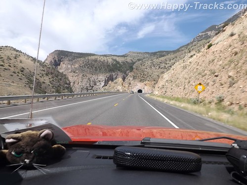
On Sunday, July 6, 2014, Betty, my wife and I loaded up our Chevy Colorado and left Maryland with plans to reach Alaska and to retrace some of their route.
Much of the 1950s AlCan highway no longer exists. The AlCan was hastily constructed in 1942 as a means to reach from the contiguous United States to the Alaska territory as part of the effort to defend the territory against the Japanese in World War II and also to enable the transport of US warplanes to Russia, our allies in WWII.
Our 2014 trip included trying to re-trace part of their route and also to visit some places we’d not seen before. Our trip included time in National and state parks as well as kitschy tourist destinations along the way.
Continues here along with a link to pictures

******
Summer 2014: Alaska via the AlCan, Maryland to South Dakota

Sunday, July 6th had finally arrived. It was time to begin the big adventure. As it was the third day of the 4th of July holiday weekend, we had thoughts of getting an early start to avoid the leaving Washington traffic. It was probably a good idea but…we pulled out of the driveway at 11:15. It was still morning but hardly qualified as an early start. Thankfully, traffic was not particularly heavy as we headed west on I70 out of Frederick but by the time we reached Breezewood, PA (our usual entry point to the PA Turnpike), the usual weekend stop and go stretched for a couple of miles. It was a good time for lunch. When we came back out, it was apparent that the route onto the turnpike would be a grind but that traffic going west on Hwy 30 was very light. In our first “let’s see where this goes” move, we headed west on 30 and joined up with the turnpike in Bedford.
Continues here along with a link to pictures

*******

Summer 2014: Alaska via the AlCan, Mt. Rushmore and Crazy Horse Memorial in SD

On Wednesday morning, we left Wall and made our way through the edges of the South Dakota Badlands toward Mt. Rushmore. We stayed on the interstate although the scenic loop through the Badlands was only 43 miles. We hadn’t yet fully acclimated to the amount of freedom our schedule provided. We were still able to see the Badlands though.
The giant granite carving of Mt. Rushmore is truly an American icon as a monument to freedom and greatness that are close to our hearts. Informally, the sculpture there has become an icon of the Great American Roadtrip Vacation which is somewhat fitting. It turns out that Mt. Rushmore shares more than geography with Wall Drug and the Corn Palace. Mt. Rushmore’s sculpture was intended to encourage tourism and get more people to visit that part of our great country. (By the way, 70 years later its still working as evidenced by our stop and the crowds that accompanied us that day. Annually, nearly 2 million people visit the monument.)

Continues here along with a link to pictures

*******

Summer 2014: Alaska via the AlCan, Custer SD to Cody WY via the Devils Tower

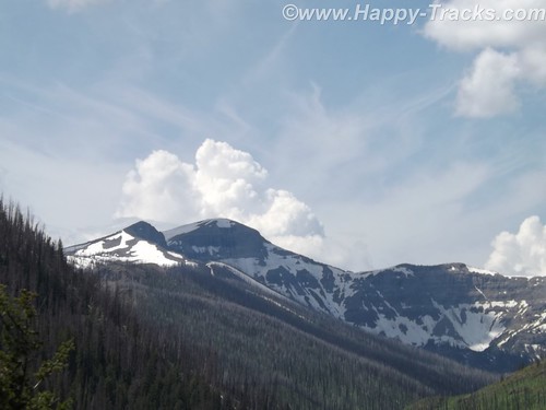
This day’s travel plans included trekking from Custer SD to Cody WY, our gateway to Yellowstone National Park. We were taking a non-direct route that would allow us to visit Devils Tower, America’s first national monument, created by President Theodore Roosevelt under the Antiquities Act in 1906. Devils Tower is also a sacred area for several of the Plains Tribes.

After breakfast and fuel, we hit the road. Route 16 took us through the Black Hills National Forest where the road quickly switched from pavement to dirt and gravel. Very shortly we encountered a stop for construction. Several times we stopped as there was only enough room for one lane of traffic. The pace allowed us to view the scenery and we weren’t in any particular hurry.

Continues here along with a link to pictures
 

4x4x4doors

Explorer
Summer 2014: Alaska via the AlCan, Yellowstone National Park


Yellowstone National Park was established in 1872 by Act of Congress and signed by President Grant. It is widely thought to be the first national park in the world. The area was bypassed by the Lewis and Clark Expedition and exploration really started in the late 1860s. Initially, it was overseen by the US Army at Fort Yellowstone in the northern section of the park. Administration passed to the National Park Service following its establishment in 1917.
DSCF6456 by RKHolman, on Flickr

We left our cabin in Cody after breakfast and entered the park though the east entrance with plans to make a backward S and leave through the north entrance by day’s end.
DSCF6468 by RKHolman, on Flickr
On entering the park, we received our separate handout sheet advising against feeding the animals and telling us that wild animals were dangerous. It also cautioned us to stay in the car when animals were nearby. The road in took us around the shoreline of Yellowstone Lake and into Lake Village.

Story continues including a link to all the pictures.
 

Forum statistics

Threads
185,827
Messages
2,878,614
Members
225,393
Latest member
jgrillz94
Top