You are using an out of date browser. It may not display this or other websites correctly.
You should upgrade or use an alternative browser.
You should upgrade or use an alternative browser.
They Went Without Me so I'll Go Without Them
- Thread starter 4x4x4doors
- Start date
4x4x4doors
Explorer
Alberta
We crossed the border at Carway and proceeded to Lethbridge for the night. We still needed to convert US or obtain Canadian cash. That turned out to be relatively painless as we just used our own bank’s ATM card at the TD Bank ABM. We knew we would incur a service charge from one or both banks and that the conversion would be factored into what was removed from the account. Sounds complicated but it really was as simple as the ATM withdrawal at home. For those of us used to US currency, Canadian currency looks strange. It has a window of transparent film where you can see through it. Canadians have also abandoned the use of the penny. All our cash purchases were rounded to the nearest 5 cents. One dollar (loonie) and two dollars (toonie) are coins rather than bills.
If one were to map out a route from Lethbridge to the start of the AlCan Highway, your route would most likely take you to Calgary, then to Edmonton and then northwest along Route 43, a modern highway, to Grand Prairie and then to Dawson Creek and the beginning of the AlCan (generally now called the Alaska Highway). We chose instead to continue north from Edmonton to Athabasca, then west-ish to Grand Prairie because this would more closely follow the 1950s routing of the highway and its approach, as Route 43 didn’t exist.
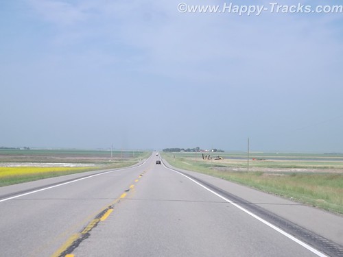
From Lethbridge north past Edmonton, the highway itself was fairly modern divided 4 lane affair. It was of modern state highway standards generally. The route took us through farmland and around the perimeter of most towns.
 DSCF6806 by RKHolman, on Flickr
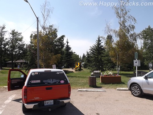
We did take the opportunity to try out a Tim Horton’s for our morning break. We’d heard a lot about Tim Horton’s and wanted to try for ourselves.
More text and pictures here
 DSCF6813 by RKHolman, on Flickr
We crossed the border at Carway and proceeded to Lethbridge for the night. We still needed to convert US or obtain Canadian cash. That turned out to be relatively painless as we just used our own bank’s ATM card at the TD Bank ABM. We knew we would incur a service charge from one or both banks and that the conversion would be factored into what was removed from the account. Sounds complicated but it really was as simple as the ATM withdrawal at home. For those of us used to US currency, Canadian currency looks strange. It has a window of transparent film where you can see through it. Canadians have also abandoned the use of the penny. All our cash purchases were rounded to the nearest 5 cents. One dollar (loonie) and two dollars (toonie) are coins rather than bills.
If one were to map out a route from Lethbridge to the start of the AlCan Highway, your route would most likely take you to Calgary, then to Edmonton and then northwest along Route 43, a modern highway, to Grand Prairie and then to Dawson Creek and the beginning of the AlCan (generally now called the Alaska Highway). We chose instead to continue north from Edmonton to Athabasca, then west-ish to Grand Prairie because this would more closely follow the 1950s routing of the highway and its approach, as Route 43 didn’t exist.
From Lethbridge north past Edmonton, the highway itself was fairly modern divided 4 lane affair. It was of modern state highway standards generally. The route took us through farmland and around the perimeter of most towns.
DSCF6806 by RKHolman, on FlickrWe did take the opportunity to try out a Tim Horton’s for our morning break. We’d heard a lot about Tim Horton’s and wanted to try for ourselves.
More text and pictures here
DSCF6813 by RKHolman, on Flickr4x4x4doors
Explorer
The AlCan Highway (The Alaska Highway)
After breakfast, we visited the tourist center in Dawson Creek in the Northern Alberta Railway museum which is part of the old train station. In addition to the usual fare of souvenirs, brochures and information, of particular value was a listing of the various facilities along the Alaska Highway showing lodging, restaurants and fuel locations all on one sheet of paper.
We used an annual publication called the Milepost. This guide has been published annually since 1949 and is considered the definitive guide to the AlCan. The guide, in addition to advertising content, contains a milepost by milepost guide book for the major highways throughout this part of Canada and for Alaska. Its layout is logical but is sometimes difficult to follow along as you are sometimes required to read from bottom to top to match your travels. The single page sheet from the visitor center at Dawson Creek allowed a quick glance to determine the information that the Milepost would provide over several pages, once you found them.
We had noticed signs outside this and other buildings that indicated “Muster Area” and asked what that meant. Unlike most places in the States, its fairly common in Canada to identify a spot for building occupants to muster (meet) in the event they have been evacuated from the building. I remember our work offices had designated places for the workers to meet in case of evacuation but it was a place you were supposed to know rather than being marked. The designated area seems like it could be useful in quickly determining whether everyone had made it safely out.
We were finally on our way on the Alaska Highway.
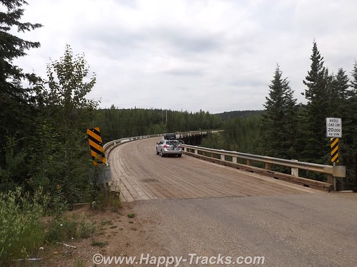
About 20 miles on, we found a marked section of the old highway. We turned to go that way and it was a bit more rustic.
 DSCF6894 by RKHolman, on Flickr
 DSCF6956 by RKHolman, on Flickr
From Dawson Creek to Delta Junction, more pics and text here
After breakfast, we visited the tourist center in Dawson Creek in the Northern Alberta Railway museum which is part of the old train station. In addition to the usual fare of souvenirs, brochures and information, of particular value was a listing of the various facilities along the Alaska Highway showing lodging, restaurants and fuel locations all on one sheet of paper.
We used an annual publication called the Milepost. This guide has been published annually since 1949 and is considered the definitive guide to the AlCan. The guide, in addition to advertising content, contains a milepost by milepost guide book for the major highways throughout this part of Canada and for Alaska. Its layout is logical but is sometimes difficult to follow along as you are sometimes required to read from bottom to top to match your travels. The single page sheet from the visitor center at Dawson Creek allowed a quick glance to determine the information that the Milepost would provide over several pages, once you found them.
We had noticed signs outside this and other buildings that indicated “Muster Area” and asked what that meant. Unlike most places in the States, its fairly common in Canada to identify a spot for building occupants to muster (meet) in the event they have been evacuated from the building. I remember our work offices had designated places for the workers to meet in case of evacuation but it was a place you were supposed to know rather than being marked. The designated area seems like it could be useful in quickly determining whether everyone had made it safely out.
We were finally on our way on the Alaska Highway.
About 20 miles on, we found a marked section of the old highway. We turned to go that way and it was a bit more rustic.
DSCF6894 by RKHolman, on Flickr
DSCF6956 by RKHolman, on FlickrFrom Dawson Creek to Delta Junction, more pics and text here
4x4x4doors
Explorer
Fairbanks
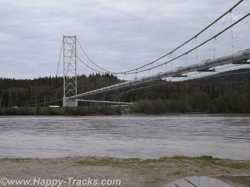
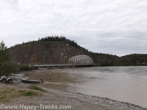
Continuing north from Delta Junction toward Fairbanks, we crossed the Tanana River and got our first glimpse of the Alaskan Oil Pipeline where it crossed the river near the road.
 DSCF7289 by RKHolman, on Flickr
The pipeline is 48 inches in diameter, 800 miles long and crosses three mountain ranges and over 500 rivers and streams.
Most of the major river crossings for the pipeline have the pipeline buried under the river bottom but the power of the current and the silt here create major scouring of the river bottom. The scouring could eventually expose the buried pipeline and lead to damage. The pipeline is built to withstand an earthquake up to 7.5 and cold down to 60 below. The pipeline includes zigzags in its course to allow for some shock absorption as well as thermal expansion. The supports are built to transfer heat away and thus prevent melting of the frozen ground beneath the towers.
 DSCF7290 by RKHolman, on Flickr
The bridge over the Tanana is the second longest along the pipeline at 1200 feet. This crossing over the Tanana River is the first place you see the pipeline in the ride up the AlCan towards Fairbanks.
Special consideration was given to the wildlife along the pipeline's course to minimize the impact of the pipeline. Those considerations include the tower designs as well as lengths where the pipeline remains below ground to allow for uninterrupted crossings by the wildlife.
More text and pictures here
Continuing north from Delta Junction toward Fairbanks, we crossed the Tanana River and got our first glimpse of the Alaskan Oil Pipeline where it crossed the river near the road.
DSCF7289 by RKHolman, on FlickrThe pipeline is 48 inches in diameter, 800 miles long and crosses three mountain ranges and over 500 rivers and streams.
Most of the major river crossings for the pipeline have the pipeline buried under the river bottom but the power of the current and the silt here create major scouring of the river bottom. The scouring could eventually expose the buried pipeline and lead to damage. The pipeline is built to withstand an earthquake up to 7.5 and cold down to 60 below. The pipeline includes zigzags in its course to allow for some shock absorption as well as thermal expansion. The supports are built to transfer heat away and thus prevent melting of the frozen ground beneath the towers.
DSCF7290 by RKHolman, on FlickrThe bridge over the Tanana is the second longest along the pipeline at 1200 feet. This crossing over the Tanana River is the first place you see the pipeline in the ride up the AlCan towards Fairbanks.
Special consideration was given to the wildlife along the pipeline's course to minimize the impact of the pipeline. Those considerations include the tower designs as well as lengths where the pipeline remains below ground to allow for uninterrupted crossings by the wildlife.
More text and pictures here
Last edited:
4x4x4doors
Explorer
Denali
On leaving Fairbanks, we gave some consideration to traveling north up the Dalton Highway towards the Arctic Circle or even as far as the Arctic Ocean but it came down to making a choice between either of those and having to cut out a day or even two to somewhere else as we had reservations on the weekly ferry ride from Haines in about a week. The side trip just wasn't worth it so we headed to our next planned destination, Denali National Park.
Denali National Park and Preserve dates back to 1917 when Congress approved the creation of McKinley National Park. While its most famous feature is the tallest mountain in the US, the park and preserve includes 6 million acres of wild country with a single ribbon of road through it. But first we have to get there!
 DSCF7436 by RKHolman, on Flickr
More here
On leaving Fairbanks, we gave some consideration to traveling north up the Dalton Highway towards the Arctic Circle or even as far as the Arctic Ocean but it came down to making a choice between either of those and having to cut out a day or even two to somewhere else as we had reservations on the weekly ferry ride from Haines in about a week. The side trip just wasn't worth it so we headed to our next planned destination, Denali National Park.
Denali National Park and Preserve dates back to 1917 when Congress approved the creation of McKinley National Park. While its most famous feature is the tallest mountain in the US, the park and preserve includes 6 million acres of wild country with a single ribbon of road through it. But first we have to get there!
DSCF7436 by RKHolman, on FlickrMore here
4x4x4doors
Explorer
Hatcher Pass, Independence Mine and Anchorage
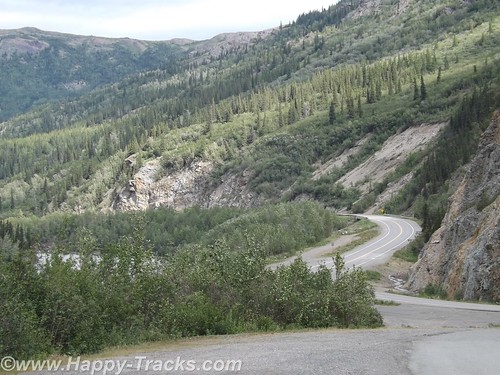
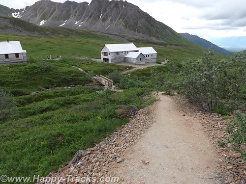
We left Grizzly Bear Lodge heading south towards Anchorage. Our plan included stopping at Independence Gold Mine State Historical Park and then go on to Anchorage for the night.
About 80 miles out of Anchorage, Betty noticed that there was a road that went directly to Independence Mine that looked to shave 30 miles or more off our route. So we made the turn onto Hatcher Pass Road at Willow to take the direct shorter route. It was a narrower paved two lane road. We were hoping to make the morning tour which began in 30 minutes and it looked to be about 20 miles.
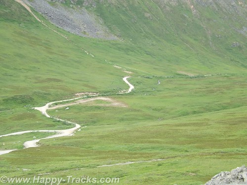
The road got narrower. There was no longer a painted line down the center as there just wasn’t enough room to give both sides a full lane and a stripe. The turns got a little sharper and more frequent and the pavement got a little rougher. And then about 10 miles in, the pavement stopped, the road crossed over to the other side of Willow Creek and the scenery got a little more rustic.
 DSCF7534 by RKHolman, on Flickr
 DSCF7562 by RKHolman, on Flickr
 DSCF7576 by RKHolman, on Flickr
More here.
We left Grizzly Bear Lodge heading south towards Anchorage. Our plan included stopping at Independence Gold Mine State Historical Park and then go on to Anchorage for the night.
About 80 miles out of Anchorage, Betty noticed that there was a road that went directly to Independence Mine that looked to shave 30 miles or more off our route. So we made the turn onto Hatcher Pass Road at Willow to take the direct shorter route. It was a narrower paved two lane road. We were hoping to make the morning tour which began in 30 minutes and it looked to be about 20 miles.
The road got narrower. There was no longer a painted line down the center as there just wasn’t enough room to give both sides a full lane and a stripe. The turns got a little sharper and more frequent and the pavement got a little rougher. And then about 10 miles in, the pavement stopped, the road crossed over to the other side of Willow Creek and the scenery got a little more rustic.
DSCF7534 by RKHolman, on Flickr
DSCF7562 by RKHolman, on Flickr
DSCF7576 by RKHolman, on FlickrMore here.
4x4x4doors
Explorer
Anchorage to Seward
We started our morning in Anchorage with breakfast and then off to the Hood Canal adjacent to Ted Stevens International Airport to view the seaplanes.
 DSCF7594 by RKHolman, on Flickr
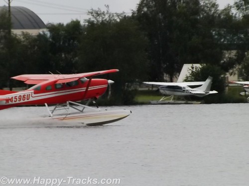
Alaska is a vast state but not dense in roadways. This is a combination of the great distances involved, the harsh environment and the mountainous (in many places) geography. Given the abundance of lakes and rivers, seaplanes are a natural choice for transportation throughout the state.
Scattered around the lake end of the canal are floating docks and numerous seaplanes tied alongside. There were multiple signs advertising tours. After waiting just a little while, we saw a seaplane landing and another taking off. The morning traffic was getting started. Many of the planes are also used for freight and passenger service. According to our reading, over 500 flights per day use the Hood Canal.
 DSCF7611 by RKHolman, on Flickr
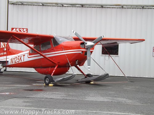
We were also able to travel around the hangars area where the planes were stored and we saw that many of the seaplanes can switch out their floats for skis or for wheels and tires. Our driving about even took us to a couple of places where auto traffic was required to yield the right of way to airplane traffic. The area also allowed us to see some of the Alaska Airlines planes taxiing to and from the terminal.
We were a bit surprised that we were able to travel about as freely as we were with no checkpoints.
More here
We started our morning in Anchorage with breakfast and then off to the Hood Canal adjacent to Ted Stevens International Airport to view the seaplanes.
DSCF7594 by RKHolman, on FlickrAlaska is a vast state but not dense in roadways. This is a combination of the great distances involved, the harsh environment and the mountainous (in many places) geography. Given the abundance of lakes and rivers, seaplanes are a natural choice for transportation throughout the state.
Scattered around the lake end of the canal are floating docks and numerous seaplanes tied alongside. There were multiple signs advertising tours. After waiting just a little while, we saw a seaplane landing and another taking off. The morning traffic was getting started. Many of the planes are also used for freight and passenger service. According to our reading, over 500 flights per day use the Hood Canal.
DSCF7611 by RKHolman, on FlickrWe were also able to travel around the hangars area where the planes were stored and we saw that many of the seaplanes can switch out their floats for skis or for wheels and tires. Our driving about even took us to a couple of places where auto traffic was required to yield the right of way to airplane traffic. The area also allowed us to see some of the Alaska Airlines planes taxiing to and from the terminal.
We were a bit surprised that we were able to travel about as freely as we were with no checkpoints.
More here
4x4x4doors
Explorer
Exit Glacier to Homer
 DSCF7713 by RKHolman, on Flickr
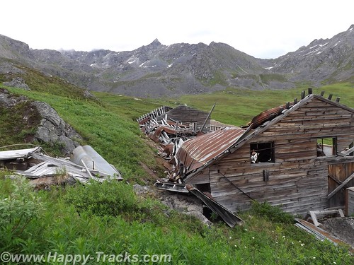
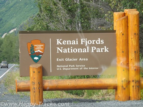
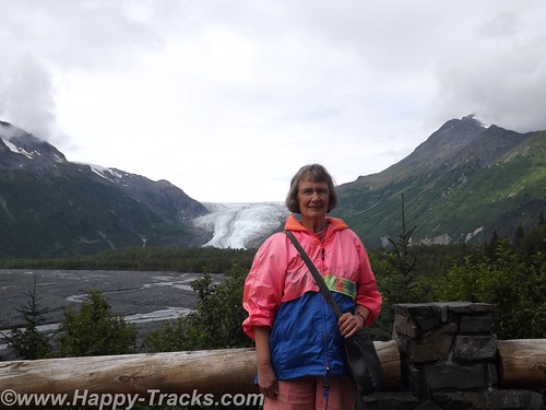
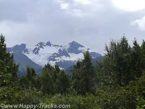
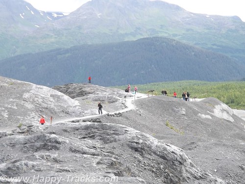
Our National Park system was established near the turn of the 20th century. We've come to learn that many of our country's national parks are considerably newer than that. For example, the Kenai Fjords National Monument was established in 1978 by Executive Order of President Jimmy Carter. The Kenai Fjords National Park was established in 1980 with the Alaska National Interest Lands Conservation Act. Within the Kenai Fjords National Park is Exit Glacier. The name came from a newspaper story describing the first recorded passage across the Harding Icefield saying those crossing the icefield would soon be leaving via the "exit glacier".
 DSCF7711 by RKHolman, on Flickr
To access the Exit Glacier, we drove along a spur road off the Seward Highway for about 2 miles to the visitor center and a parking lot. There was a pulloff along the way which offered a view of the foot of the glacier and the stream flowing from there towards Resurrection Bay. Along this road were several tour guides both for the glacier and for kayak and other nature tours.
In the pulloff (posted with no camping signs), one visitor had a popup tent camper setup and appeared to be taking pictures perhaps for an advertisement or story layout of some sort.
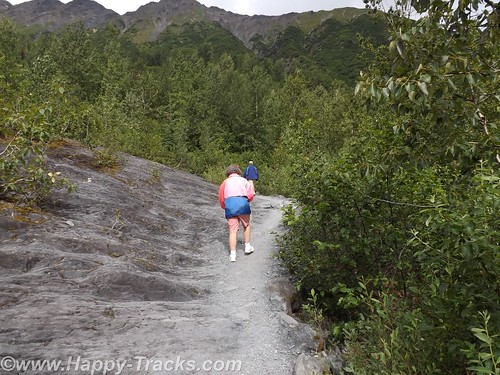
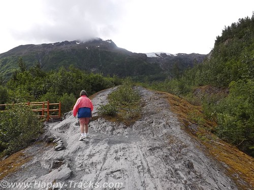
On the drive in, we passed signs marking the recession of the glacier as this current ice age plays out. The Ranger Station area includes a parking area including space for RV and bus parking which also took the overflow from the car parking area. It was a sunny and warm Saturday so there were many cars in the lot. The building includes some interpretive displays as well as a small shopping area along with the ever-present warning to beware of the bears and not to feed the wildlife. Ranger tours are available every couple of hours as well as a mid-day presentation at the visitor center.
We opted to walk on our own. Parts of the trail are ADA accessible. The accessible parts are relatively flat (and paved with asphalt or crushed gravel). That part of the trail goes to the rocky streambed at the foot of the glacier.
 DSCF7721 by RKHolman, on Flickr
 DSCF7722 by RKHolman, on Flickr
 DSCF7724 by RKHolman, on Flickr
 DSCF7748 by RKHolman, on Flickr
The trail also proceeds upward toward the glacier itself. Fairly easy walk if you're in good health and there are places to step off and rest if that suits you. In several places the trail narrows so that you have to alternate for folks going up and down. There were a number of families on the trail from kid strollers to folks older than us. A bit more than halfway up the hill is a marker for where the edge of the glacier was in 1998. A half mile or more behind us was the marker for the 1980 edge.
More here
DSCF7713 by RKHolman, on FlickrOur National Park system was established near the turn of the 20th century. We've come to learn that many of our country's national parks are considerably newer than that. For example, the Kenai Fjords National Monument was established in 1978 by Executive Order of President Jimmy Carter. The Kenai Fjords National Park was established in 1980 with the Alaska National Interest Lands Conservation Act. Within the Kenai Fjords National Park is Exit Glacier. The name came from a newspaper story describing the first recorded passage across the Harding Icefield saying those crossing the icefield would soon be leaving via the "exit glacier".
DSCF7711 by RKHolman, on FlickrTo access the Exit Glacier, we drove along a spur road off the Seward Highway for about 2 miles to the visitor center and a parking lot. There was a pulloff along the way which offered a view of the foot of the glacier and the stream flowing from there towards Resurrection Bay. Along this road were several tour guides both for the glacier and for kayak and other nature tours.
In the pulloff (posted with no camping signs), one visitor had a popup tent camper setup and appeared to be taking pictures perhaps for an advertisement or story layout of some sort.
On the drive in, we passed signs marking the recession of the glacier as this current ice age plays out. The Ranger Station area includes a parking area including space for RV and bus parking which also took the overflow from the car parking area. It was a sunny and warm Saturday so there were many cars in the lot. The building includes some interpretive displays as well as a small shopping area along with the ever-present warning to beware of the bears and not to feed the wildlife. Ranger tours are available every couple of hours as well as a mid-day presentation at the visitor center.
We opted to walk on our own. Parts of the trail are ADA accessible. The accessible parts are relatively flat (and paved with asphalt or crushed gravel). That part of the trail goes to the rocky streambed at the foot of the glacier.
DSCF7721 by RKHolman, on Flickr
DSCF7722 by RKHolman, on Flickr
DSCF7724 by RKHolman, on Flickr
DSCF7748 by RKHolman, on FlickrThe trail also proceeds upward toward the glacier itself. Fairly easy walk if you're in good health and there are places to step off and rest if that suits you. In several places the trail narrows so that you have to alternate for folks going up and down. There were a number of families on the trail from kid strollers to folks older than us. A bit more than halfway up the hill is a marker for where the edge of the glacier was in 1998. A half mile or more behind us was the marker for the 1980 edge.
More here
4x4x4doors
Explorer
Homer to Haines, the long way
After a good night's rest in Anchor Point, we loaded up and headed back into Homer.
 DSCF7861 by RKHolman, on Flickr
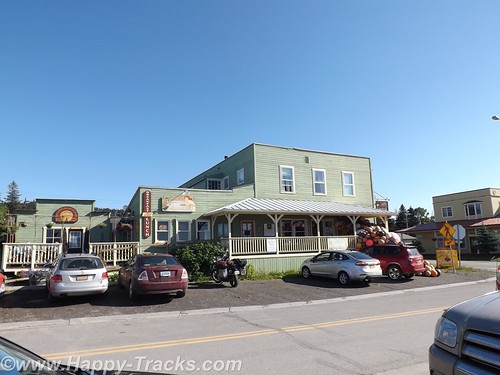
We had one recommendation but went instead to Maura's Cafe and Deli in the old part of Homer. They looked to be doing a great business and we believe in the old adage to eat where the locals eat.
 DSCF7868 by RKHolman, on Flickr
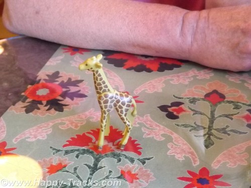
When we went inside, there was a line to order and no seats to be had. By the time we got to place our order a couple of tables had emptied out. We both ordered the quiche and were given a plastic giraffe to take to the table with us instead of a number.
 DSCF7862 by RKHolman, on Flickr
As we waited, it became clear the morning rush had been a good one and they were running out of things. We enjoyed our meal and went out to explore.
 DSCF7870 by RKHolman, on Flickr
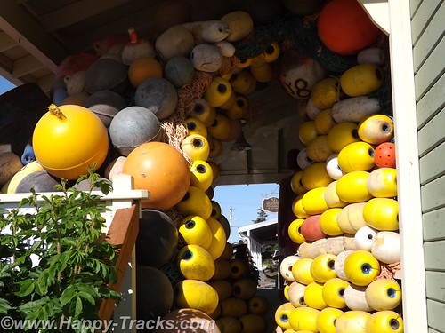
There was an interesting tableau of buoys on the porch of the store next door.
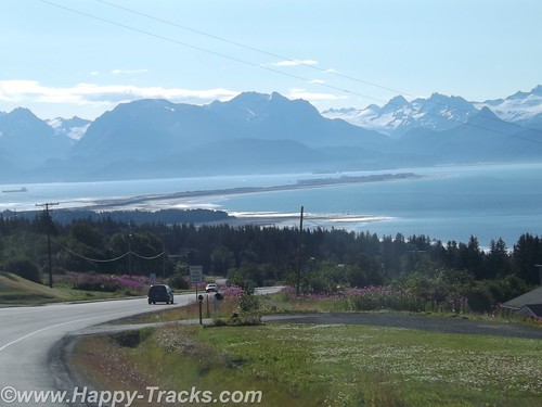
Then we followed the road down to the beach and on out to the Homer Spit. The Homer Spit is 4.5 miles of land sticking out into Cook Inlet and home to both deep water on one side and shallow water on the other. The theories to its origins differ with one suggesting that the Spit is the result of glacial movement and one suggesting that it's the buildup of sand deposited by the comings and goings of tide and wave action over millennia.
The spit includes a fishing lagoon which is stocked each spring from the nearby salmon hatchery.
More at this link
After a good night's rest in Anchor Point, we loaded up and headed back into Homer.
DSCF7861 by RKHolman, on FlickrWe had one recommendation but went instead to Maura's Cafe and Deli in the old part of Homer. They looked to be doing a great business and we believe in the old adage to eat where the locals eat.
DSCF7868 by RKHolman, on FlickrWhen we went inside, there was a line to order and no seats to be had. By the time we got to place our order a couple of tables had emptied out. We both ordered the quiche and were given a plastic giraffe to take to the table with us instead of a number.
DSCF7862 by RKHolman, on FlickrAs we waited, it became clear the morning rush had been a good one and they were running out of things. We enjoyed our meal and went out to explore.
DSCF7870 by RKHolman, on FlickrThere was an interesting tableau of buoys on the porch of the store next door.
Then we followed the road down to the beach and on out to the Homer Spit. The Homer Spit is 4.5 miles of land sticking out into Cook Inlet and home to both deep water on one side and shallow water on the other. The theories to its origins differ with one suggesting that the Spit is the result of glacial movement and one suggesting that it's the buildup of sand deposited by the comings and goings of tide and wave action over millennia.
The spit includes a fishing lagoon which is stocked each spring from the nearby salmon hatchery.
More at this link
4x4x4doors
Explorer
Haines, Ft. Seward
Leaving the Customs station (Pleasant Camp Border Crossing) with a brochure from the Hawaiian Customs Agent, we continued alongside the Chilkat Inlet towards Haines. Primary task for us at the moment is finding lodging for the next two nights and its about 7:30 pm. Waiting until this late to start finding lodging hasn’t worked out well for us in the past.
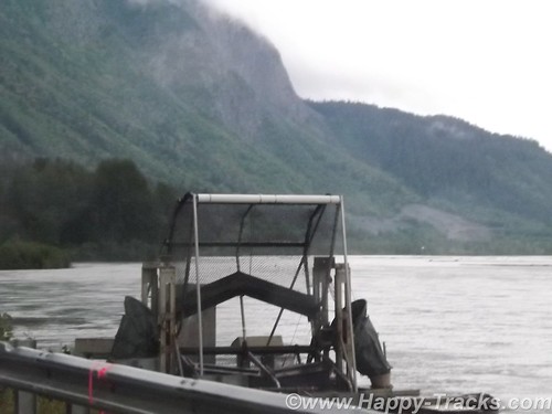
We find a place to pull over and make some calls and see this contraption. It looks sort of like a paddle wheel or even an automated fish catching device. We later find that its a device mounted by the state to help count the salmon population.
 DSCF7982 by RKHolman, on Flickr
The first place (a BNB) we called had nothing available for the two nights we needed. We tried a second call and connected with a woman who said she could accommodate us at the Ft. Seward Lodge although she wasn’t at the lodge but could meet us there in the half hour we needed to get there. She said she had to put her child down to sleep for the night and would meet us there.
 DSCF7997 by RKHolman, on Flickr
Haines, Ft. Seward, and Port Chilkoot history is like many of the towns in Alaska ranging over the Native population, the US acquisition, the gold rushes, fishing and the tourism industry.
The Tlingit Indians established the first permanent settlements around 8,000 years ago. The area is relatively temperate, has abundant food resources and geographically provides a portage opportunity to connect the Chilkoot and Chilkat Inlets. The Tlingits established trade with other groups and became wealthy. They also are recognized as the artists of some of the finest indigenous creations.
More here
Leaving the Customs station (Pleasant Camp Border Crossing) with a brochure from the Hawaiian Customs Agent, we continued alongside the Chilkat Inlet towards Haines. Primary task for us at the moment is finding lodging for the next two nights and its about 7:30 pm. Waiting until this late to start finding lodging hasn’t worked out well for us in the past.
We find a place to pull over and make some calls and see this contraption. It looks sort of like a paddle wheel or even an automated fish catching device. We later find that its a device mounted by the state to help count the salmon population.
DSCF7982 by RKHolman, on FlickrThe first place (a BNB) we called had nothing available for the two nights we needed. We tried a second call and connected with a woman who said she could accommodate us at the Ft. Seward Lodge although she wasn’t at the lodge but could meet us there in the half hour we needed to get there. She said she had to put her child down to sleep for the night and would meet us there.
DSCF7997 by RKHolman, on FlickrHaines, Ft. Seward, and Port Chilkoot history is like many of the towns in Alaska ranging over the Native population, the US acquisition, the gold rushes, fishing and the tourism industry.
The Tlingit Indians established the first permanent settlements around 8,000 years ago. The area is relatively temperate, has abundant food resources and geographically provides a portage opportunity to connect the Chilkoot and Chilkat Inlets. The Tlingits established trade with other groups and became wealthy. They also are recognized as the artists of some of the finest indigenous creations.
Haines, Ft. Seward, and Port Chilkoot history is like many of the towns in Alaska ranging over the Native population, the US acquisition, the gold rushes, fishing and the tourism industry.
The Tlingit Indians established the first permanent settlements around 8,000 years ago. The area is relatively temperate, has abundant food resources and geographically provides a portage opportunity to connect the Chilkoot and Chilkat Inlets. The Tlingits established trade with other groups and became wealthy. They also are recognized as the artists of some of the finest indigenous creations.
More here
4x4x4doors
Explorer
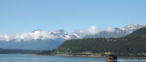
Inland Passage via Ferry
Posted on November 13, 2014
In looking carefully at a map of Alaska, one first notices the size of the state and its coastline and how much vast space with no roads. In the interior, the distances are covered by bush and float planes like we saw in Anchorage. This works on the rugged coast between the islands but is remarkably inefficient in moving freight or if you want to use a vehicle to proceed beyond the landing spot.
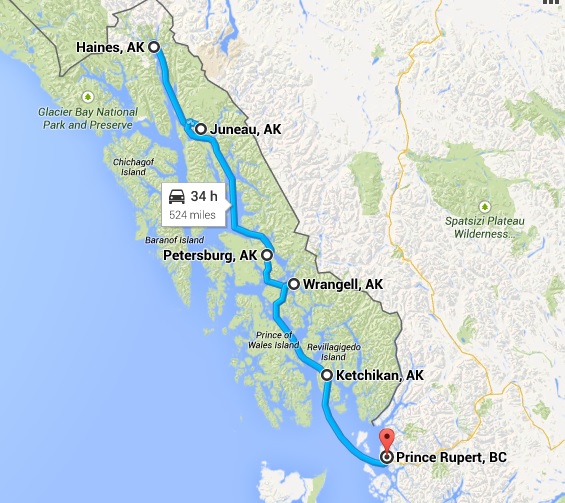
In 1948, three Haines residents Steve Homer, Ray and Gustav Gelotte, purchased a surplus US Navy landing craft and began providing ferry service for up to 14 cars with very crude provisions for passengers. After a couple of years, it proved to be economically unsuccessful and was subsequently purchased by the Alaska territorial government. The service proved useful and was expanded with bigger and better vessels and more towns served. As we mentioned in the Haines posting, the distance by water between Haines and Skagway are only 20 miles apart by water but hundreds of miles distant by car. Other cities in Alaska, including Juneau, the capital, are totally unreachable except by boat or plane.
The Alaska Marine Highway System over the ensuing decades now transports folks, vehicles and freight over the broad range from Bellingham, Washington over 3500 miles to Dutch Harbor, Alaska in the Aleutian Islands.
As I was working on our itinerary, I had us in the Wrangell-St. Elias area with plans to go down towards Washington and the ferry seemed to be a perfect way to give us a break from the drive, fuel and hotel costs and let us see the Inland Passage. My haste didn’t allow me to see that there was no direct road route to Haines for our trip, another case of serendipitous planning taking us to a particularly enjoyable part of our journey.
 DSCF8087 by RKHolman, on Flickr
Our ferry ride took us about 475 miles by water in 39 hours to cover what would have been 915 miles by highway over perhaps 3 days. Had we driven to Prince Rupert, we would have seen some parts of British Columbia that we didn’t but we would have missed the Inland Passage and all its beautiful sights. You do miss things in the truck as you’re making miles and watching for signposts and directions. You also miss some of the conversations and people watching opportunities.
 DSCF8263 by RKHolman, on Flickr
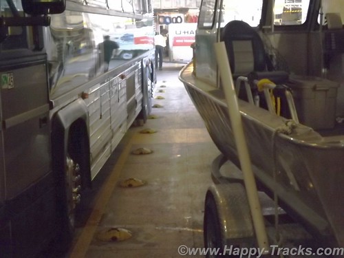
We drove onboard on a ramp which took us down to a lower level of the ship or the car deck. The car deck held all manner of vehicles. There were passenger cars and pickups like ours. There were tour buses and motorcycles. There were huge RVs, both motorhomes and fifth wheel campers. There was a truck pulling a boat on a trailer and there were the trailer halves of tractor trailers that were traveling unaccompanied and maneuvered about by tractors at their embarking and disembarking ports.
While at Homer, we had seen the MV Kennicott loading but it had a vehicle elevator and turntable for ports that don’t have facilities for the ramps. The car decks are secured and not accessible to passengers while underway. Folks traveling with pets bedded them down in the vehicle and went down to check when we pulled into port.
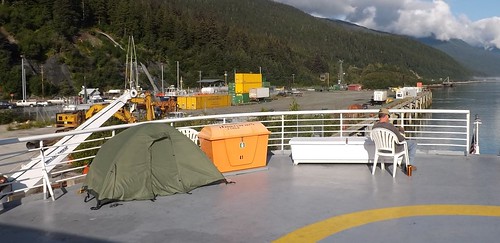
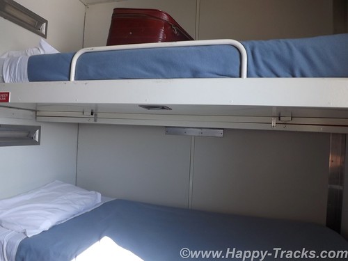
After securing the truck, we went upstairs to the purser’s desk for our cabin assignment and keys. We had reserved an outside cabin but some folks had plans to stay in the common areas or even to pitch a tent on the upper level sundeck (which has heat lamps under the roof).
 DSCF8074 by RKHolman, on Flickr
 DSCF8135 by RKHolman, on Flickr
Continues at the link
Posted on November 13, 2014
In looking carefully at a map of Alaska, one first notices the size of the state and its coastline and how much vast space with no roads. In the interior, the distances are covered by bush and float planes like we saw in Anchorage. This works on the rugged coast between the islands but is remarkably inefficient in moving freight or if you want to use a vehicle to proceed beyond the landing spot.
In 1948, three Haines residents Steve Homer, Ray and Gustav Gelotte, purchased a surplus US Navy landing craft and began providing ferry service for up to 14 cars with very crude provisions for passengers. After a couple of years, it proved to be economically unsuccessful and was subsequently purchased by the Alaska territorial government. The service proved useful and was expanded with bigger and better vessels and more towns served. As we mentioned in the Haines posting, the distance by water between Haines and Skagway are only 20 miles apart by water but hundreds of miles distant by car. Other cities in Alaska, including Juneau, the capital, are totally unreachable except by boat or plane.
The Alaska Marine Highway System over the ensuing decades now transports folks, vehicles and freight over the broad range from Bellingham, Washington over 3500 miles to Dutch Harbor, Alaska in the Aleutian Islands.
As I was working on our itinerary, I had us in the Wrangell-St. Elias area with plans to go down towards Washington and the ferry seemed to be a perfect way to give us a break from the drive, fuel and hotel costs and let us see the Inland Passage. My haste didn’t allow me to see that there was no direct road route to Haines for our trip, another case of serendipitous planning taking us to a particularly enjoyable part of our journey.
DSCF8087 by RKHolman, on FlickrOur ferry ride took us about 475 miles by water in 39 hours to cover what would have been 915 miles by highway over perhaps 3 days. Had we driven to Prince Rupert, we would have seen some parts of British Columbia that we didn’t but we would have missed the Inland Passage and all its beautiful sights. You do miss things in the truck as you’re making miles and watching for signposts and directions. You also miss some of the conversations and people watching opportunities.
DSCF8263 by RKHolman, on FlickrWe drove onboard on a ramp which took us down to a lower level of the ship or the car deck. The car deck held all manner of vehicles. There were passenger cars and pickups like ours. There were tour buses and motorcycles. There were huge RVs, both motorhomes and fifth wheel campers. There was a truck pulling a boat on a trailer and there were the trailer halves of tractor trailers that were traveling unaccompanied and maneuvered about by tractors at their embarking and disembarking ports.
While at Homer, we had seen the MV Kennicott loading but it had a vehicle elevator and turntable for ports that don’t have facilities for the ramps. The car decks are secured and not accessible to passengers while underway. Folks traveling with pets bedded them down in the vehicle and went down to check when we pulled into port.
After securing the truck, we went upstairs to the purser’s desk for our cabin assignment and keys. We had reserved an outside cabin but some folks had plans to stay in the common areas or even to pitch a tent on the upper level sundeck (which has heat lamps under the roof).
DSCF8074 by RKHolman, on Flickr
DSCF8135 by RKHolman, on FlickrContinues at the link
4x4x4doors
Explorer
Prince Rupert to Vancouver
We pulled into Prince Rupert from the ferry and waited in line for Customs. Since this was the end of the line for the ferry, the Customs station was busy with the whole ship trying to get through Customs at the same time. As we left the ship in 6 lines, we merged into 3 to pass. All told, it really moved along rather quickly. We drove out of the Customs gate and up into the fog to make the drive into Prince Rupert. We had called ahead to the Prince Rupert Hotel and made arrangements for two nights stay.
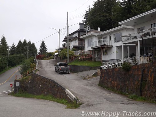
The next morning we set out to find Totem Park. Our map showed it to be a short walk away. Our map didn’t show the change in elevation though. Totem Park could be reached following a trail which looked to be little used and a bit overgrown. Luckily, a lady passed by walking her dogs and told us we could also take the public path between these houses to get there.
 DSCF8296 by RKHolman, on Flickr
 DSCF8300 by RKHolman, on Flickr
The public path was stairs. The stairs climbed up the 10 feet or so to reach the houses’ front yards and then continued up above their second stories and then still continued higher. I would estimate the climb was near 45 degrees and rose 100 feet in about 200. Then the stairs ended and the path climbed just a bit further. We finally reached the top after availing ourselves of several opportunities to stop and admire the view off the bluff and out to the harbor.
 DSCF8304 by RKHolman, on Flickr
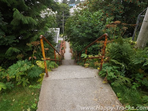
There are only three totems in Totem Park. You can see where there were two more that are no longer there. These totems are reproductions of authentic ones created by First Nations people.
We had thought there must be some universal code in totems and had tried to decipher but it just wasn’t to be. It starts with the totems having different purposes. Some are to celebrate a life, some are to commemorate an event, some are to give praise and some are to condemn or shame such as the one in Valdez meant to shame Exxon for wrongs no made right. Individual figures on the totem can also have meanings such as the frog meaning prosperity. As in other art, there is no universal key of this always means that.
We walked down a different way than we had come up to see more of town. There were a couple of other totems standing by themselves and we also found two by city hall.
After setting on the ferry for 40 hours and the short drive to the hotel while powering our DC refrigerator, we had to jump start the truck this morning. We had been running the refrigerator off the truck battery rather than the spare battery we brought along and had used in Anchorage to jumpstart the stranded motorists. The spare battery started the truck instantly and we recharged the battery as we made our way to our next attraction.
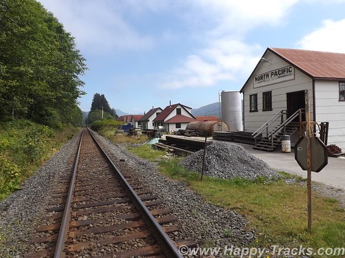
The maps and list of attractions listed the North Pacific Cannery and North Pacific Historic Fishing Village out past Port Edward. Since we had seen the cannery at Haines, we opted to go to the fishing village instead. The paved road led us toward the mouth of the Skeena River and we passed the cannery museum but then found only what looked to be private property as the road became a driveway. We carefully retraced our path but still found nothing other than the cannery museum so we went there instead.
 DSCF8311 by RKHolman, on Flickr
More at this link
We pulled into Prince Rupert from the ferry and waited in line for Customs. Since this was the end of the line for the ferry, the Customs station was busy with the whole ship trying to get through Customs at the same time. As we left the ship in 6 lines, we merged into 3 to pass. All told, it really moved along rather quickly. We drove out of the Customs gate and up into the fog to make the drive into Prince Rupert. We had called ahead to the Prince Rupert Hotel and made arrangements for two nights stay.
The next morning we set out to find Totem Park. Our map showed it to be a short walk away. Our map didn’t show the change in elevation though. Totem Park could be reached following a trail which looked to be little used and a bit overgrown. Luckily, a lady passed by walking her dogs and told us we could also take the public path between these houses to get there.
DSCF8296 by RKHolman, on Flickr
DSCF8300 by RKHolman, on FlickrThe public path was stairs. The stairs climbed up the 10 feet or so to reach the houses’ front yards and then continued up above their second stories and then still continued higher. I would estimate the climb was near 45 degrees and rose 100 feet in about 200. Then the stairs ended and the path climbed just a bit further. We finally reached the top after availing ourselves of several opportunities to stop and admire the view off the bluff and out to the harbor.
DSCF8304 by RKHolman, on FlickrThere are only three totems in Totem Park. You can see where there were two more that are no longer there. These totems are reproductions of authentic ones created by First Nations people.
We had thought there must be some universal code in totems and had tried to decipher but it just wasn’t to be. It starts with the totems having different purposes. Some are to celebrate a life, some are to commemorate an event, some are to give praise and some are to condemn or shame such as the one in Valdez meant to shame Exxon for wrongs no made right. Individual figures on the totem can also have meanings such as the frog meaning prosperity. As in other art, there is no universal key of this always means that.
We walked down a different way than we had come up to see more of town. There were a couple of other totems standing by themselves and we also found two by city hall.
After setting on the ferry for 40 hours and the short drive to the hotel while powering our DC refrigerator, we had to jump start the truck this morning. We had been running the refrigerator off the truck battery rather than the spare battery we brought along and had used in Anchorage to jumpstart the stranded motorists. The spare battery started the truck instantly and we recharged the battery as we made our way to our next attraction.
The maps and list of attractions listed the North Pacific Cannery and North Pacific Historic Fishing Village out past Port Edward. Since we had seen the cannery at Haines, we opted to go to the fishing village instead. The paved road led us toward the mouth of the Skeena River and we passed the cannery museum but then found only what looked to be private property as the road became a driveway. We carefully retraced our path but still found nothing other than the cannery museum so we went there instead.
DSCF8311 by RKHolman, on FlickrMore at this link
4x4x4doors
Explorer
Vancouver BC
 DSCF8492 by RKHolman, on Flickr
Our destination for the next couple of days is Vancouver, the city, not the island. The city has a population of over 600,000 with the greater Vancouver area topping out at over 2.4 million people. That makes it third most populous in Canada and most populous in western Canada. It's also one of the most ethnically and linguistically diverse with over 52% of its population having a language other than English as their primary language. Vancouver was also the site of the 2010 Winter Olympics and 2010 Winter Paralympics and many structures from those events remain today.
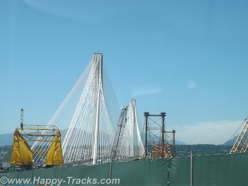
The journey west took us through farmland and the increasing signs of suburbia with housing developments and shopping centers until we were obviously into the edges of Vancouver, complete with summer road construction. The freeway added and subtracted lanes while increasing the density of orange construction barriers until we were funneled onto the Port Mann bridge and into town.
 DSCF8466 by RKHolman, on Flickr
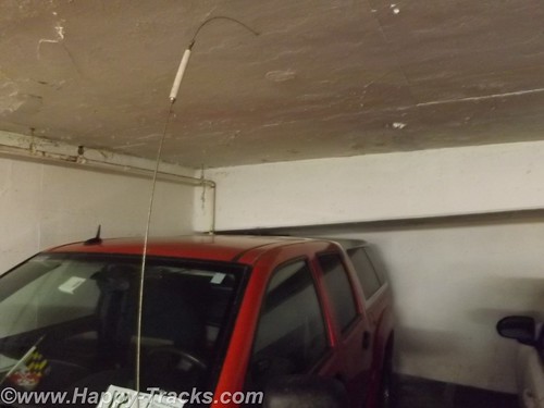
Armed with our research and the recommendations from the desk clerk in Prince George, we made our way into town and secured lodging at the Sandman Hotel. The Sandman is next to the former Olympic stadium near the harbor. Underground parking is available but it was a tight fit for the truck. Luckily we didn't plan for much in and out so got parked in a space that just barely had enough vertical room for us.
 DSCF8498 by RKHolman, on Flickr
As the picture shows, it was only inches. Our room was cozy but nicely furnished and with something of a view.
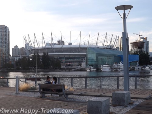
On the harbor side of our hotel, you could see the BC Arena, formerly used in the 2010 Winter Olympics. The athletes' village was primarily located across the Cambie Street Bridge over False Creek.
 DSCF8478 by RKHolman, on Flickr
There were sidewalks and stairways to facilitate getting down to the water's edge. As we crossed over late on this sunny afternoon, there were rowers, skaters, runners and bikers as well as dog walkers and families shuffling along. As we descended and ascended the long stairways from the bridges to the water, we were passed (and re-passed) by the same runners heading up and down. There are a couple of parks right along the water's edge and the athlete's village is primarily apartments and condos now with terrific views in an urban landscape.
More at the link
DSCF8492 by RKHolman, on FlickrOur destination for the next couple of days is Vancouver, the city, not the island. The city has a population of over 600,000 with the greater Vancouver area topping out at over 2.4 million people. That makes it third most populous in Canada and most populous in western Canada. It's also one of the most ethnically and linguistically diverse with over 52% of its population having a language other than English as their primary language. Vancouver was also the site of the 2010 Winter Olympics and 2010 Winter Paralympics and many structures from those events remain today.
The journey west took us through farmland and the increasing signs of suburbia with housing developments and shopping centers until we were obviously into the edges of Vancouver, complete with summer road construction. The freeway added and subtracted lanes while increasing the density of orange construction barriers until we were funneled onto the Port Mann bridge and into town.
DSCF8466 by RKHolman, on FlickrArmed with our research and the recommendations from the desk clerk in Prince George, we made our way into town and secured lodging at the Sandman Hotel. The Sandman is next to the former Olympic stadium near the harbor. Underground parking is available but it was a tight fit for the truck. Luckily we didn't plan for much in and out so got parked in a space that just barely had enough vertical room for us.
DSCF8498 by RKHolman, on FlickrAs the picture shows, it was only inches. Our room was cozy but nicely furnished and with something of a view.
On the harbor side of our hotel, you could see the BC Arena, formerly used in the 2010 Winter Olympics. The athletes' village was primarily located across the Cambie Street Bridge over False Creek.
DSCF8478 by RKHolman, on FlickrThere were sidewalks and stairways to facilitate getting down to the water's edge. As we crossed over late on this sunny afternoon, there were rowers, skaters, runners and bikers as well as dog walkers and families shuffling along. As we descended and ascended the long stairways from the bridges to the water, we were passed (and re-passed) by the same runners heading up and down. There are a couple of parks right along the water's edge and the athlete's village is primarily apartments and condos now with terrific views in an urban landscape.
More at the link
mjmcdowell
Explorer
Your trip to Alaska 2014
Keith, just got thru checking out you and your wifes trip this past summer to Alaska........ Awesome account!!! I hope we meet again on a future DE. ( I have better tires on the truck now and 2 spares..... mjmcdowell
Keith, just got thru checking out you and your wifes trip this past summer to Alaska........ Awesome account!!! I hope we meet again on a future DE. ( I have better tires on the truck now and 2 spares.....
mjmcdowellForum statistics
Members online
- wanderon
- Bobmog
- llamalander
- ljzxup4
- jerry.jones.7330
- RollingTaco
- JCDriller
- andy_d
- 4runnerteq
- Atl-atl
- fastevo
- PiggyBoys3
- jgrillz94
- MirnesB
- Photomike
- Fadeagray
- zidaro
- kfricke87
- mark5280
- WillySwan
- SkiFreak
- nicholsmf
- Rdy2offrd88
- fattycharged
- Spatch
- HokeyRover
- austastar
- smokeysevin
- Geared4adventure
- smb
- Lee
- Mfitz
- gabrielef
- Toyaddict
- Antuan250
- IdaSHO
- Gsheller
- Deleted Member 183
- cobb ridge
- dnovotny
- Delsh
- Windaroo
- aknightinak
- Wakeup2river
- pat11784
- adamalli
- Rakkasan3187
- kickitup04
Total: 1,005 (members: 54, guests: 951)