The EJ1096 Family Michigan Trip

ej1096

New member
Hey all. I've been lurking here for a while and love the trip reports and stories. This passed June we took a trip to the Upper Peninsula in Mi. I want to try my hand at writing up a trip report. I have not done this before and kinda wish I would have with the various trips we've done already. I think its a good way for people to see whats out there as well as document the experience for myself. I'm also posting this report on UPOverland.Org. The people there were such a help when planning our route. Now I know this trip is not a huge around the world adventure like so many on here do (We soo want to). But it's a start for us. So, on to the report.

A while ago we were watching the Travel Channel. We talked about our travels and how we both felt we needed to get away from the world again. The last real trip we went on was a few years ago. We kinda stopped after our daughter was born. We felt it was time to start again. Our original plan was to drive around Lake superior from Duluth and back to Duluth. After spending some time here we decided to skip Canada and focus on Michigan.

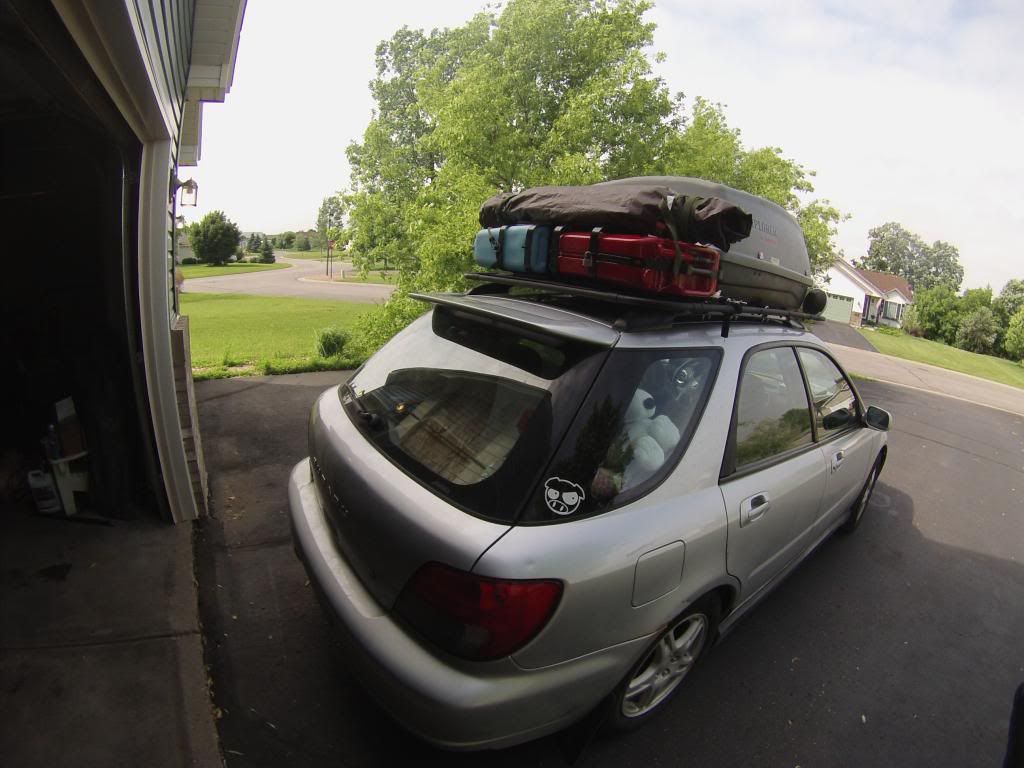
Day 1-On June 18th at around 9am (after I worked from 5pm on the 17th to 3am that morning) we loaded up the Subie and headed to Duluth from Big Lake.


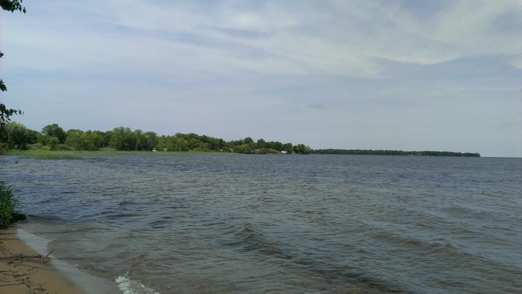
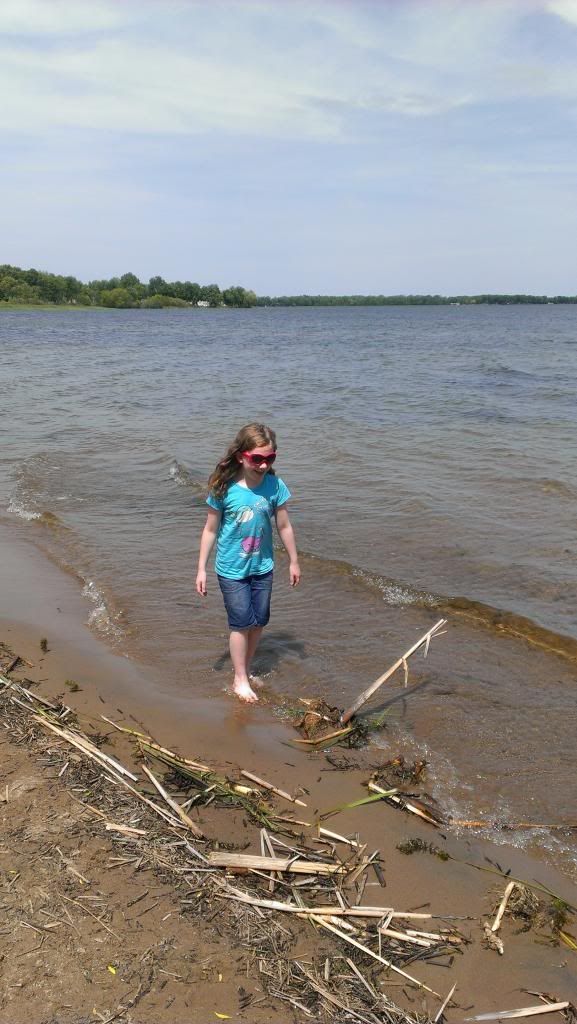
Our plan was to take as many back roads as possible and stay off major highways. We went from Big Lake up to Lake Milacs. We got lucky, the weather was great after having rained so much here. We stopped at a little side road by the lake so we could stretch and the Lil' Roamer could play for abit.


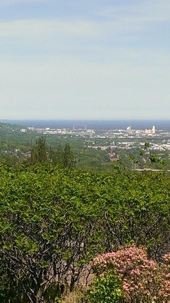
We then continued on more back roads to Duluth. We are somewhat familiar with Duluth as my wife has family there. Back in the day we would go there at least once a year but have not been there for a while and the Lil' Roamer has never been there. We drove up to the Rest stop/ Look out area just to the south of the city. Then drove Skyline Dr. into town. If you ever get to Duluth it's a good way to get views of the city, lake and river.

The lookout/rest stop just south of town. That road in the lower part of the photo is Skyline Dr.

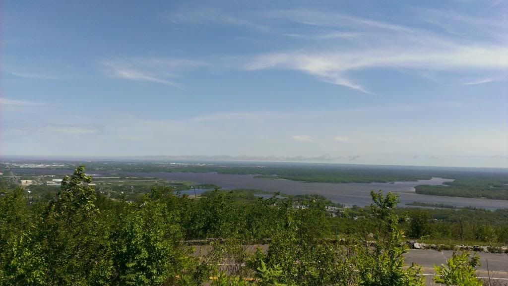
This is a pic driving along skyline Dr. If your into twistie roads this is a fun one with several areas along it to pull over and get a good view.


After cruising Skyline Dr. into town, we went to the hotel to check in for the night. We used to start our endevors with the first night at a nice hotel before we rough it for several days.

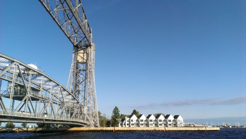
We stayed at the South Pier Inn on the island side of the lift bridge. You can't get any closer than this. All the years we went to Duluth we talked about getting a room there so...We didn't get a water side room cause that was around $200 something. We got a parking lot side room on the second floor for $120. Even the parking lot side was cool.

The white building by the bridge was our hotel
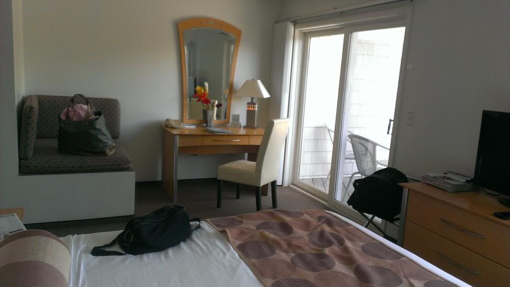

Our room.


After checking in we were hungry so it was time for food. The hotel being where it is, all we needed to do was walk across the bridge and we were at the heart of the harbor area called Canal Park. There's Food, bars and stuff to check out. All with in walking distance. We left the hotel and realized the shorts and t-shirts we were wearing from Big Lake was bit "under dressed" for the weather. In Duluth, the sky was sunny and it looked warm. It would have been warm without the 1,000 MPH wind coming off the lake :lol: . It was pretty windy. The Lil'Roamer was laughing that she was going to blow away.

We trekked across the lift bridge and went to a place called Grandma's. The food was good and because it was a Wednesday it was rather quiet. The city was getting ready for the Grandmas Marathon so there was lots of "setting stuff up" activity.

You can walk across the bridge and get a neat view of the inlet. This was about 1/2 way across the bridge looking out to Superior.

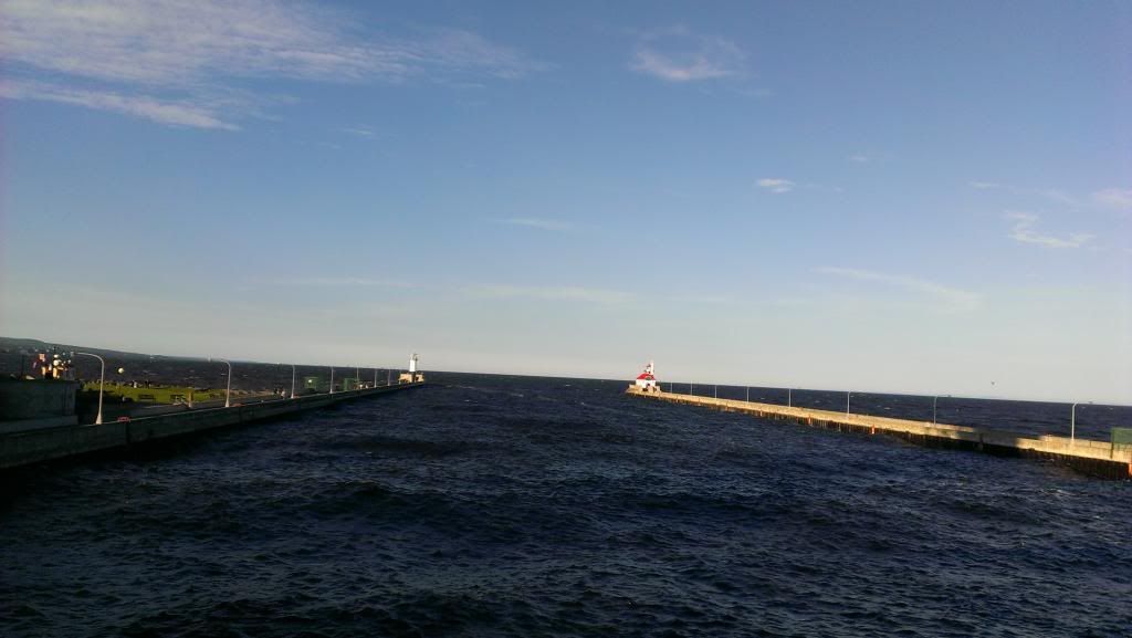
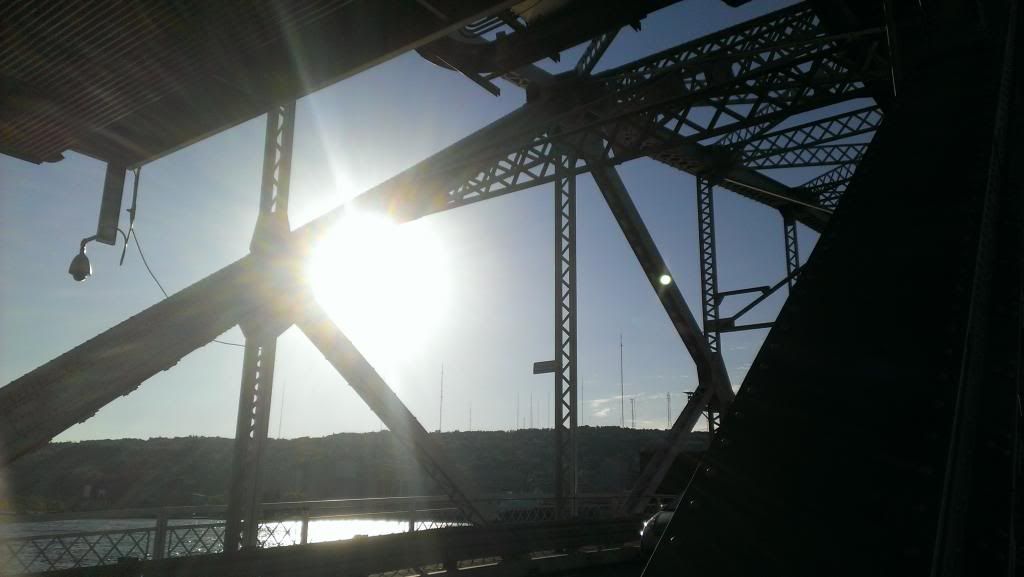
An artsy shot of the bridge structure.


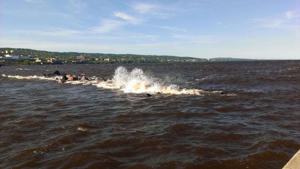
After lunch we walked around Canal Park down by the lake. As always it was fun to watch the waves crash up on rocks and the shore line. We walked along the north side "jetty" or pier thing out to the light house.


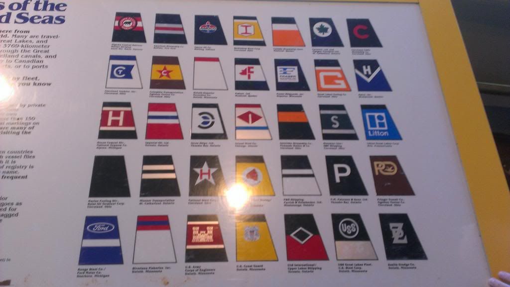
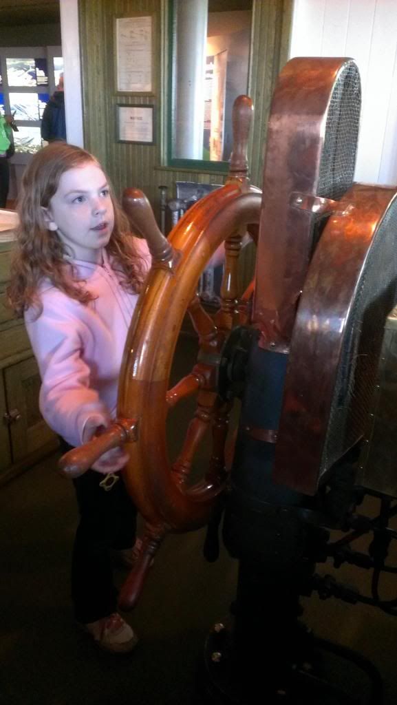
We then checked out a museum run by the Army Corps of Engineers. It's a cool place. They have some stuff on the ships that sail the great lakes and some historical stuff on the lift bridge and the Duluth/Superior area. They also have a mock freighter bridge set up.

Smoke stack insignias of the ships that sail the lakes.


The Capt. getting her cargo of taconite across the rough waters.


After the long day of driving and exploring, we headed back to our room to relax and enjoy a soft bed one more time. When we got back to our room we were hungry for dinner. Not wanting to go out again we decided we were going to order a pizza. We called up Dominos to get some grub. Well, it turned out Dominos doesn't deliver across the bridge. Bummer. So, we had a hotel vending machine dinner. :clap: T.V. on, Lights out. off to bed.
 

ej1096

New member
Day 2

Day 2- We woke up, opened the window and saw that it was going to be a cold wet day. Meh, whatever... We're gonna have fun anyway! We went down to the hotel lobby for a decent continental breakfast. The lobby overlooks the bridge and canal area. Seriously, you can't get any closer. While we were eating, the bridge started to lift. Lil'Roamer and I were excited, we were going to see a ship! Wife decided the view in the warm dry hotel lobby was just fine. Me, not so much. Lil' Roamer and I walked the 20 feet down to the canal to watch the ship pass by. I'm always amazed no matter how many times I've seen it. Standing 10 feet away from a 1,000 ft. freighter is never old.


After the ship passed and we ate our breakfast, it was time to head out. Before leaving Duluth, we drove down Minnesota Ave. Theres a park at the end of the road near the southern "tip" of the island. It's a pretty standard park with some walking paths, a play ground and ball fields and access to the beach of Superior. They did build a cool wooden replica of a lakes freighter and the canal. It's by the playground and made for kids to play on.


After that it was time to leave Mn. and head east. We jumped on 535 and crossed over the Blatnik bridge into Superior Wi. Theres a "whale back" lake freighter you can tour there. It's at place called Barker's Island. We were not able to make the tour due to some group having that time booked. We didn't feel like waiting around till 11 so we took off. We figured there'd be more ships to see. We went east on 53 / 2 and took a side trip down Moccasin Mike Road to Wisconsin Point Road. The road drives north along a peninsula with Superior on one side and Allouez bay on the other. You can see where some the freighters dock in Superior Wi. in the bay. On the Superior side of the road there's lots of areas to access the beach.

Wisconsin Point Road


When we got to the end of the road it looked out across the inlet I thought it was cool even if it was raining, cold and windy. The lake was churning up lots of silt so the waves cashing on shore looked like chocolate milk.


After that little side trip, we jumped back on 2 and headed east to 13. Our next destination for the day was Bayfield. Along the way we came across another side road to explore. We found Brule River Rd. it was a gravel road that brought along the Brule River and takes you out to the mouth at Lake Superior.

The mouth of Burle River. Sorry this was the only pic I could find. I'm still trying to find a memory card that had a few pics on it.

The road was gravel and had cabins and houses dispersed along it. Some were small but hey, what do ya really need out here.


Continuing on to Bayfield, the plan was to truck up along 13 and follow it up around the peninsula to Bayfield. When we got to Cornucopia the plan had to change. 13 was closed north of Cornucopia. We were forced to take a detour to get to Bayfield. Now, Normaly I'm not opposed to detours but this one was like 20 miles. and we missed a bunch of stuff we wanted to see. Oh well. gives us a reason to go back. We took the detour into Washburn then turned north to Bayfield.

Driving 13 near Cornucopia Wi. We loved the purple wild flowers all over


We got into Bayfield and had a late lunch. Bayfield is a neat shoreline town. Its got that New England feel to it. Because we didnt want to set up camp in the dark we didn't stay long in Bayfield. We pretty much ate lunch and took off. Because of that we did not think of getting any pics. Kinda bummed about that. Our ultimate goal for the day was Ashland Wi. We took off out of Bayfield and headed down 13.

We followed that down into Ashland where we were going to stay the night. We found a city park with camp sites called Prentice Park. They have a few tent sites and a few R.V. sites. It's first come first served and was $13 for a tent site. The tent sites were grouped together and there was about 3 spots left. We really did not feel like camping 8 feet away from the college party that seemed to be going when we pulled in. We drove over to check out the R.V. spots. There was only one person in the R.V. area and like 10 or more spots open. We figured last resort, we would grab an R.V. spot away from everybody. We found a little side road that lead away from the R.V. spots and decided to explore it before setting up camp.. Glad we did! Down that road was a secluded 2 tent site area. Sites 17 and 18. There was nobody there. We hung out for a few minuets talking and waiting to see how many people came down this way. The answer was 0. None of the other tenters ventured down there and we were far enough away we didn't hear the collage party campers. Perfect! we claimed site 18T and set up camp for the night. We suited up in long sleeve shirts, pants, bug spray and life saving mosquito head nets. You may look silly but MAN I love mine! We ate some dinner and tried to have a fire but the wood was too wet. So off to bed to get an early start Michigan was ahead.

our site first night camping. Prentice Park Ashland, Wi. Site 18T


We had the whole area to ourselves
 

ej1096

New member
Hello fellow UPO member! Great trip report.

Looking forward to seeing the rest. Great choice in vehicle too. I am a Subie nut.

Looks like a great trip...made me miss a little bit of Wisconsin...thx

Hey Jack Thanks, Its my first attempt at one. I'm hoping its interesting and informative. I wish we woulda got some better pics but most of the time we were using our cell phones. We have a Nikon D80 and love it but its just so bulky to pull out, get all the settings right and so on for some quick travel pics.

Upcruiser. Thanks, I love my WRX, that thing is so fun to drive and can handle just about anything.

MPH, Northern Wisconsin is a beautiful place. I liked going up by Bayfield. For sure going to have to go back.
 

ej1096

New member
Day 3

Day 3

We woke up after a night of weathering some pretty good rain and were in for another cloudy wet day. I'm glad I sprayed on 3 layers of camp dry stuff on the tent and rain fly. Although I'm thinking I need to add more on the walls... They were a bit damp on the inside. But otherwise everything was dry. As I'm laying there thinking about the damp walls, The Mrs. wakes up and all I hear is "GAHHHAAA!" after I took a moment to restart my heart and regain my hearing I look up and saw this.


Now I've spent time in texas, I've seen tarantulas and other big spiders. But when your in that just waking up haze and this thing is right above your head, it takes a second for common sense to kick in. For a brief moment that spider was the size of a volkswagon. Not to mention my wife and anything NOT cute and fuzzy don't get along. So as the guy in the relationship I did my manly duty (after watching it for a bit and tormenting the Wife) and flicked it off the tent. In all fairness to her, it was kind of a big spider. After I assured The Mrs. that it was ok to leave the tent, we broke down camp and packed up the subie. Today was exciting we were going to be in Michigan! After some egg Mcmuffins and coffee at the Mac Donalds in town, we jumped on Highway 2 and headed east.

When we got to the Michigan boarder we turned North off 2 and on to 122 which turns into Mi 505. We followed 505 (Lake rd.) to 204 (Airport Rd) then went north on Black River Road. We followed Black River Road up to Black River NFCG. The plan was to drive to the end of the road, hike around a bit, Check out Rainbow falls first and then hit some of the other falls on the way back south.

Meandering along Black River Road


The sign at the parking lot to the harbor area.


The gate way to the hiking paths on the east side of the river. This is a cool foot bridge.

When you get on the bridge you can get a good view of the mouth of everything. The misty fog made everything feel so mystical. The temp was warm so the mosquitos were just obnoxious. We broke out our anti-mosquito gear for walking through the woods.

Looking North out to Superior.


Looking south down the river


When you get across the bridge there's a grassy area along the river and shoreline with some benches you sit and watch the world go by. Today however, standing still for longer than 10 seconds ment you were lunch for the mosquitos. I was amazed that even though it was misty, fogy and cloudy it was still awesome to see. The weather did not put a damper on the views. in fact in some cases it made it better.

We then started our hike up to Rainbow Falls. It's about 3/4 of a mile and takes you up into the woods along a ridge. I don't have many pictures from the actual hike. I was using our GoPro to shoot some video and Mrs. EJ1096 was to busy taking in the surroundings, swatting mosquitos and getting schooled in all things nature fairy by the Lil' Roamer...Apparently fairy's have movie theaters in old logs.

When we got to Rainbow falls, the battery in the GoPro died. Bummer. So the Mrs. started taking a few cell phone pics.

After the mandatory family selfie, we headed back to the car. As we headed back down Black River Road the Ladies expressed their desire to NOT hike in more mosquitos. Because I know whats in by best interest ( and I kinda didn't want to either), we continued on down the road back to 2 and over to Wakefield. From Wakefield, we wanted to head up the to the Porcupine Mts. area check it out and cruze along South Boundary Rd.


When we got there we found a DNR camp station and got out Michigan DNR permit. We decided that since we were going to be in alot of the parks and camping for several nights it was best to just get the year pass and not worry about it. We also bought 2 bundles of dry wood just in case. We then hit South Boundary rd. That was another fun road to drive. I can see that that place is awesome in the fall. The way the trees line the road and the twisties... Love the twisties.

Some random stretch of South Boundary Rd.


My favoritist sign in the whole world.


We took South Boundary Rd. up to 64 and over to Ontonagon. From Ontonagon we took 38 to 26 and jumped on the Bill Nichols Trail for a little bit. I can't pass up an opportunity to get off pavement. As they say dirt if for fun, pavement is for getting there.


Ok, so maybe we went a bit overboard with the fire steel bridge pic's.. Cause theres a bunch more. But hey, what ya gonna do. I cant think of anyplace I'm from that you can drive on roads like this. We followed the trail and joined back up with 26 somewhere west around Twin Lakes State Park. We didn't feel the need to drive the trail in a car when its like 20 feet away from the main road.

This was our view of 26 up to Hughton


We boogied up 26 to Hughton and crossed into Hankock. What a beautiful area. Even in the mist and fog it was neat. That seemed to be the running theme so far. Fog, mist, rain but everything we saw still made us go WOW or look at that view!

Headed to the bridge to from Hughton. Pics never do any justice.


This is kinda cool. I've not seen a double decker lift bridge before.


We followed 503 up to McLain State Park, that was our home for the night. McLain was a nice place and I would for sure stay there again. The grounds were clean and the sites along the lake were cool. You don't get a secluded site but if your crashing for a night it's a nice place.

We grabbed site 85 overlooking the lake.


The view looking north from our site. The chairs were nice to sit on and relax.


The beach is just on the other side of the chairs in the last pic so we headed down there before it got to dark and meandered for a bit.

OMG, OMG, OMG!!!!! Dry wood and a camp fire! HA!


After hanging out by the fire we headed off to bed. More to come.

Sorry for the delays in the postings. Being back at work means not much time. But I will keep going until I'm all done.
 

ej1096

New member
Day 4-

Something felt different as I was laying there in the tent starting to wake up. The red and gray world in the tent felt.. brighter, As the fog of sleep wore off I could make out shadows on the top of the tent. The shadows were tree branches dancing in a light breeze. "Shadows?" I thought. "How weird that there would be shadows on the tent". And then it hit me .. "wait! if theres shadows, from the trees...That means!...." I opened up the tent door threw on some shoes and headed out to the chairs and down to the beach. No telling how long this was gonna last. A few hours or a few days, it didn't matter I was gonna take it in while I could. Even if it was Too Early:30 A.M.


Mrs. joined me a short time later and we just sat and looked over the lake. It was very peaceful. Eventually the Lil' Roamer awakened. That was our cue to start the day. After a doughnut and apple juice breakfast, we broke down camp and headed out. We took 203 into Calumet then up 23 to 5 Mile Point Rd. 5 Mile Point road was a blast to drive. Some of the views were awesome too.

A rest stop along 5 Mile Point Rd. has cool stone steps you can climb and get a good view of Superior.


The view from the top of the steps.


We drove 5 Mile Point Rd to Eagle River where we met up with 26 or Sand Dunes Dr. We followed that all the way to Eagle Harbor. Along the way we found some water falls and a really cool military monument of a ship made out of stone and old pipe. As you can see in the pictures, the sun did not last very long. Bummer.


From Eagle Harbor, we continued on 26 to Copper Harbor. We did find Brockway Mt. Drive. We even drove on it for a bit to explore it. But due to us not realizing where we actually were, we ended up thinking we were on some road that was just going to take us away from where we wanted to go. So, we turned around...Stupid! I know, we found out later what we missed. Anyway, We got to Copper Harbor and checked out the area. We went to the State Harbor to see about getting a boat ride out to Copper Harbor Light House. After milling around the gift shop and contributing to the local economy, we decided it was time to continue on. The Mrs. heard about a forest not to far away that had really really tall old trees. As we were leaving the parking lot we saw a DNR Officer. Neither of us really knew where the place was so the conversation in the car went something like this:
Mrs.: "Oh hey, theres a DNR guy stop and ask him".
Me : "Naw, just look at the map"
Mrs.: "It's not on the map... just ask"
Me: "If its not on the map where did you hear about it?"
Mrs. " From the book I have about the area, now stop and ask"
Me: " Well how did the book say to get there?"
Mrs. "It didn't, just ask...He's right there, Why wont you ask?"
Me: "I can't, they'll revoke my man card"

.....The DNR Officer was nice and really helpful. He told us all about the hiking trail around the trees and why it was a place to see in the area. Apparently for whatever reason that area was never logged, so all the trees there have been around since before people. Once we got directions we were off.
Righty O' .."Left from the parking lot, Check". " Drive down to the next stop light and.... "Wa wawawa, Wa waaw something, something right something something". Guys, when you stop and ask for directions the world punishes you by not allowing you to remember anything after.. "Ok, so you take.."
We got to a stoplight and turned the wrong way. Now how did I know we turned the wrong way? Well, about 1/4 mile up the road from the intersection we turned at, I see the head lights of a Chevy truck in the rear view. My first thought was "thats a nice bumper", then it was "that driver looks familiar" and finally "Hey! look at all the flashing lights on it....Ohhhh...this cant be good".

The DNR Officer laughed at us poor travelers and explained he was going to that area anyway and to follow him. He said he was going in a back way and was not entirely sure how passable the trail was, as it had been a while since he drove it. He was happy to hear I had my own recovery equipment, hand saw and axe. We got our own DNR Officer escort on some fun low maintenance dirt road all the way to the trail head.

I thanked the DNR Officer and asked him about getting to High Rock Bay. I showed him our planned route. He said its totally worth the drive and we should check it out if we can make it out that way. We thanked him for the escort, advice and knowledge. The plan from here was to take Mandan Rd. and check out High Rock Bay then go back to Mandan Rd and stick along the shore as much as possible. I was supper excited for this part of the trip. Dirt roads, forest, killer lake views. YES!

Then there we were, Mandan Rd.


Cruising along Mandan Rd. That was the only picture we have. Through my travels and life in general I have picked up a philosophy. In simple terms its this: If a plan works you'll have a story to tell. If a plan doesn't work, you'll have a GREAT story to tell.

"Look out for that rock!".... Yup I see it.... "Woah are we gonna make it over that washout?" .. Of course we will, one wheel at a time nice and slow. "How are we gonna get a round that big hole?" very carefully with the right line. "Look out!" ..Yup I got it. "That did not sound good, I think a big rock just scrapped under the car. " Yup it did. "is it gonna be ok" .. Ya it'll be fine, oil, coolant and steering are all good.

Mandan Rd., The words of The DNR Officer bounced around in my head with every rock, pothole and washout we crossed. "If you can make it". He was so cheerful and up beat about it. Like... "if you have time", "if your in the area", "if its along your route". Not, "if your driving Bigfoot" or "if your in the area with your M1 Abrams Tank". It seemed Mandan Rd and Highrock Bay Road was mostly washed out with sections of very large and very sharp chunk gravel. After an hour in first gear I was getting tired. Normally I love this kinda stuff. Tricky trail, technical driving techniques, pushing the limits. LOVE IT! Had I still had my Jeep this would have been no problem and not much of a story. Now I'll set the stage for ya. After an hour on the trail the only other vehicles we saw were ATV's. Who, by the way were giving some looks of amazement that we were even attempting it. We were traversing large chunk gravel on all season Parelli's with 1 spare doughnut tire, AWD and mismatched tires don't get along. The skid plates are still sitting at the store I have not bought them from yet. We crossed deep washout crevasses in a car, that when loaded down sits about as tall as a 12oz. can of beer. I'm no where near home, my family is with me and we are alone. I've always taken issues with wheeling alone when you know your pushing the limit either of the driver or vehicle. If we were in my Jeep I would not have been as worried capable vehicle, decent driver. In a loaded WRX with sounds of rocks against unprotected undercarriage , yup.. I'm worried. We got to the intersection of Mandan Rd and Highrock Bay Rd. My gut is telling me nothing good is going to come from this. I'm crazy but not stupid. I told the Mrs. my concerns. We consulted the map and decided to head back the way we came knowing we would find better road.

We made it back to pavement. I got out did a once around the Subie. Nothing leaking, nothing major bent or broken. I felt relieved and a bit defeated. I was bummed we were going to miss so much. I was mad at myself for what felt like a waste of about 2 or so hours. Mrs. reminded me of my philosophy and we had a good laugh as I cornered through the twisties heading south. And to Mandan Rd... We will be back. Maybe in a Subaru, maybe not but we WILL be back. You have my mudflap!

Next stop was Gay Beach.
 

ej1096

New member
Day 4.5

Day 4.5

After Mandan Road we wanted to go to Gay Beach. After I pouted for a bit about being back on tarmac, we headed down 41 to Lac La Belle Rd. We followed that to the Town of Gay. The drive was still a good drive (for tarmac ;) )

We came across this ski place, I thought it was cool that the building s were Yurts. This looks like a fun place to ski.


Lac La Belle Rd... Somewhere.


We got into The town of Gay, The Mrs. had a moment of being back in Jr. High and had to get a picture of the town bar. We then headed to the beach. I'm not really sure what I was expecting, I've seen pictures of it and even video. But it was not what I was expecting. We got there and all I thought was WOW. It seemed to go on forever. The black sand was way cool to. We hung around for a bit, grabbed some photos and checked out the area.


After Gay Beach, the next stop was L' Anse. We took Lake Linden to Rice Lake Rd. We followed that to Lake Linden We then took 26 back to Hancock.

The Keweenaw area was awesome. The roads, views, nature, just awesome! Its amazing all the stuff to explore there. We will be back and maybe be able to spend more time in the area. I loved the Copper Harbor area and even Mandan Rd. I really want to go back and be able to camp at High Rock.

Back over the bridge.


41 Somewhere


We got to Baraga and stopped for a break. We found a little marina on a peninsula with a park. We walked around for a bit just to get out of the car. some pics of the park area around the marina.


We continued on 41 to L'Anse


The destination for tonight was Marquette. We had a time schedule we needed to keep. I wanted to see the shore line from L'Anse to Marquette. That was our original plan but shortly before we left, plans had changed and we had a date... with my parents.... in Ludington.

We followed the highways from L'Anse to Marquette. We pulled into Marquette and found a Walmart to grab a few little campfire things (smore's) and some other stuff.

Efficient packing is the key. We used some Rubber Maid storage boxes for small stuff like toiletries, fire starting stuff, bug sprays/sun lotion and what not. a fold up stool to reach the back of the topper storage, blankets, lantern, some fake wood so we know in an emergency we will be able to get a fire or if we cant find any dry wood. We also have a full medical bag stashed in there. We also had a cooler, and small travel fridge along with the camera stuff, all that went in the back seat behind the driver. The wooden box was our kitchen. You'll see that in a later pic.

While in Marquette we finally had a strong cell signal but our phones were on roaming and we were not going to pay any data roam fees so we rolled over to a coffee shop, ordered some coffee and spent a stupid amount of time on the free WiFi. After all, ya gotta update Face Book and let people know your having a better time than they are. We also needed to check out places to sleep. The Mrs. found Tourist Park so, off we went.

It was getting dark when we pulled in. We found a spot and set up camp. Tourist Park seemed like a nice campground. It was clean and looked well taken care of. Would I camp there again if I had the chance? Well, it depends. If It's late, I'm tired and just looking for a place to crash... Sure! if I still have other options and time.. Probably not. When we camp, we look for the out of the way areas. We don't want to see our neighbors. In fact if I can help it, we don't want to be able to hear them either. We like that alone feeling. Tourist Park is kinda the opposite. The sites are packed in and theres no privacy. Some people really enjoy that R.V. campground, socializing feel. Us... Not so much. We camp to get AWAY from everybody. LOL.

Anyway, here are some pics of Tourist Park. We took them the next day in the light. Again, nothing wrong with the park. It was clean, well maintained and not a bad setting. But for us, it was just a place to crash for the night.


*YAWN* "Good Morning Sunshi... oh, Meh, Whatever."


Our camp site over looked a small lake.


On my way to the bathroom in the morning there were some kids making a big deal about something by the side walk. I went over to check it out and found it was a snapping turtle and it had dug a hole to lay eggs. Mom soon came over and chased all the kids away.

We did the morning ritual of packing up the gear and getting ready to head out. Thus begins day 5 and another adventure.
 

1stDeuce

Explorer
Thanks for sharing! I went to Michigan Tech, and consider my time in the Keweenaw one of the best times of my life!! Fiancee and I were there last summer, and we camped out at HighRock. Mandan didn't used to be so rough when the rally used it every year. (They graded it.) Now it's a total mess, and there's a LOT of private land blocking access to the beach along it's length. I'd rate the road from Mandan out to HighRock a little tougher, so you probably made the right call. You're going to have to lift the Suby so you don't get turned around next time!! :)

And BTW, it's Houghton, not Hughton. :)
 

ej1096

New member
Thanks for sharing! I went to Michigan Tech, and consider my time in the Keweenaw one of the best times of my life!! Fiancee and I were there last summer, and we camped out at HighRock. Mandan didn't used to be so rough when the rally used it every year. (They graded it.) Now it's a total mess, and there's a LOT of private land blocking access to the beach along it's length. I'd rate the road from Mandan out to HighRock a little tougher, so you probably made the right call. You're going to have to lift the Suby so you don't get turned around next time!! :)

And BTW, it's Houghton, not Hughton. :)

We loved that area a lot. Its a bummer to hear that Mandan Rd has become what it is. But on the flip side.. I can see it being a blast with the right equipment. I think I may have pressed on if I had different tires. The washouts I was fine with. if you pick the right line or stack logs you can make up for ground clearance. I didn't trust Pirelli all seasons to be able to handle the sharp rocks.

And thanks for the correction on Houghton LOL. When I get typing and spell a name wrong once... it's forever wrong. I got more to come.
 

ej1096

New member
Day 5

Day 5


We woke up and checked out of our camp site. The temp was warming up already by the time we got all packed up. We wanted to check out the city of Marquette and some of the sites along the lake. The day turned out to be awesome.The clouds broke, the sun came out and it was going to be a good day. The first thing we did was head over to the ore dock. It was impressive to see one up close. It was neat and kinda creepy at the same time. I bet you could get some really neat "mood" pictures there when its foggy, or at night. I also liked the little island off to the side of the dock. Its too bad that bridge looked broken or we would have gone out there. Here's some pics we took.


After hanging out by the ore dock, we went to the Maritime Museum. They do some treasure hunt things for the kids with hidden pirates and treasure chests. Its a good way to get the little ones to actually look at and pay attention to the exhibits. They also have a dress up box for kids. I thought it was awesome that they thought of ways to keep the kids engaged. Its a good family stop. We didn't do the walk out to the light house but you can see it and get a decent pic or 2 from the museums main building.

Stormy seas ahead!


FIRE 1!


ArrR


The light house.


When we got done geeking out at the museum we headed on down the trail. We left Marquette and took 28 to Munising. What a great drive! We found this Place called Lakenenland, basically this guy has some property and has made artwork out of metal. He has 80 some pieces that you can check out. It's free but he takes donations for supplies and materials. We left a donation because you can't leave there without giving the guy props for all he's done. Theres even a place you can watch him work if he's out there. You can drive or walk the route and there is tons to see. Here are just a few pics of what it's like. I recommend it.


Lil' Roamer calls this the deermonkey


And a tribute to the U.P. (and MN) winter pass time.


After experiencing what felt like a 70's music video, we pressed on. We drove 28 along the lake shore and found lots of places to stop and just take it all in. The weather stayed sunny and warm, we were in good spirits and a bit ahead of schedule.

We found some road side area to get out, walk for a bit and take some pics.

Shameless car pics.


Shameless scenery pics.


We continued on 28


Until we came here.. I mean, come on..ya gotta stop here and get some pics of this town.


The people that set this town up are awesome. Every town has a Main st. and 1st Ave. But this... This is great.


I would love to live next door to this. just so I could give directions to my house. "Turn right when you get to Santa Clause at the north pole. l'm in the blue house next to the old lady who lives in a shoe".


Forum statistics

Threads
185,914
Messages
2,879,565
Members
225,497
Latest member
WonaWarrior
Top