Lumpskie's 1989 Grand Wagoneer Build

shortbus4x4

Expedition Leader
You will be drilling through the frame rails to install this hitch. Just primer and paint the holes and it will be good. I wouldn't worry about rust if you do this. I would get this hitch instead of the 3500 lb one, no questions. Hope to make it out to the Fullsize invasion next year.
 

unkamonkey

Explorer
OK, go for the most heavy duty hitch you can find. Dynamic weight versus static weights can be a big change but it should have been figured into the rating if they did it right. I almost pulled the rear of my Jeep off with an 8,000 lb winch, and my Mitsu Fuso 4X4 motor home is rated at 11,000 lb of pull in low range. I sort of bent the hitch on it. Sitting on pavement and was spinning tires trying to get a little bush out. Fixed it. Fixed the Jeep too. Plan ahead, if you do something thing like add a motorcycle on the front of the trailer, it will probably help with how the trailer tows but is an increased load on your hitch.
Have fun and put an eyeball on things while you are towing.
I've got more things to say but I've rambled on long enough already.
 

lumpskie

Independent Thinker
Thanks for the input, you guys. That's the info I needed. I'm going to pass on the 3,500 lb hitch and get a 5,000 lb setup later on.

Also, Happy Independence Day! More adventure posts coming up...


shimniok

New member
Hey, great pic, and happy 4th! I forgot I even had an account here, but found it again while looking for GPS mapping software for the upcoming Ouray trip.
 

lumpskie

Independent Thinker
Short Overland Adventure - Part 1

This past weekend, I took the Waggy out on another little adventure with a few friends. We started in Frisco and headed up Shrine Pass. The trail is pretty easy but the scenery was beautiful.


After a half hour or so, we stopped for lunch here:


You couldn't beat the view!


After lunch we continued down the trail. Soon we reached the peak of just over 11,000 ft and began to drop into a lush valley. The view straight ahead was of Mt. Holy Cross most of the way. It was amazing.


As we lost more elevation, the scenery was a mix of Aspen trees, pine and wild flowers. Most of the route ran next to Turkey Creek.


Jeep hood ornament looking cool through the windshield:


After travelling for a number of miles, I spotted an old structure off to the left:


So, we all hopped out to investigate.


It looked like there were a couple old cabin ruins with a two track road leading to them. So, we drove up and took a few pictures.


After spending a little time there, we were back on the road. After a few minutes, my buddy Josh called out over the CB asking, "what do you think that stone structure is off to the right?" At first, it didn't look like much.


But when I really looked, it appeared to be man made. We have no idea what it was:


We continued to the trail to McAllister Gulch which, I believe, is part of the old Camp Hale. Camp Hale was the original permanent military base for the 10th Mtn. Division. They used this area for mountain acclimation and training for World War 2. Wikipedia says that after that, in the 1960's the area was used by the CIA to train Tibetan guerilla fighters. The site was chosen because of the similarities of the terrain with the Himalayan Plateau. The Tibetans nicknamed the camp "Dhumra", meaning "The Garden".


The area is so beautiful, you can't tell that it was part of an artillery range.


Soon, we rounded a corner and some buildings came into view. We had made it to Red Cliff, Colorado.


That's it for Part 1. More to come tomorrow!
 

lumpskie

Independent Thinker
Part 2

As we hit the pavement of Red Cliff, I can see that it's a cool little town! It's small but filled with historic buildings all of which are in good shape. Sorry for the pictures... I took them on the fly.


This was a neat "Old World" style house on a hill.


And I don't know what this machine was, but it was really neat to see. It looks like the owner runs these rubber tracks in summer and I suspect he swaps for standard metal tracks in winter.


After we drove through Red Cliff, we got on Hwy 24, going south. I tried to get some pictures here, but the Waggy was COVERED in bugs at this point. For example, here's a picture of a really cool set of bridges. The road I'm on is a bridge that's probably 100 feet in the air and you can see the old steel bridge towers above my road. But I couldn't get my camera to focus through the windshield.


Here's why:


At any rate, we traveled down Hwy 24 for about 10 miles and pulled off at No Name Gulch. We aired down and decided to try to make it to Slide Lake. The trail started off pretty smooth but got rocky pretty quickly.


As we continued, the trail just kept getting rockier. Not the fun, obstacle style of rocky either. Just the never ending bumpy kind of rocky.


Man pictures don't do it justice! I had my 7 month old in the car and Shortround had his pregnant wife in his truck... I can't believe how well each of them held up. It was ROCKY.


We were travelling at less than a mile an hour at this point, the sun was getting low in the sky and Wifey and I agreed that we'd gone far enough. When we called the other guys over the CB, saying that we wanted to turn around, everyone agreed. So we headed back. Man, that trail was rocky...


Finally, we made it back to the forest, and back onto smoother trail.


And then, back to the trailhead to air back up. It was a beautiful evening.


So, the plan was to head north on Hwy 24 and stay at Copper Mountain for the night. But, as we headed up 24, I spotted a place I've wanted to explore for a long time!


It's the ghost town of Gilman, abandoned in 1984. It was a mining town that mined almost everything over the years. It started in precious metals like silver and gold and ended up mining a number of metals... like zinc.


In the end, the EPA forced new regulations and the mine was closed. I believe it ran from 1886 to 1984.


We'll definitely be coming back to explore this place again.


And that was it. After that, we headed into Vail to grab some groceries. Then we stayed the night at Copper and headed home. It was a really great trip, exploring a part of the state I hadn't really seen before. I can't wait to go back in explore some more.
 

onemanarmy

Explorer
Thanks for sharing, been following along, due to the fact that the Wagoneer is one of my favorites, especially with some lift.

Hope it's treating you well.
 

lumpskie

Independent Thinker
^Thanks! So far, it's been treating me really well and I don't have any complaints.

Unfortunately, that last trail didn't treat it too well, though. I didn't pay close enough attention and ended up hitting a rock with the end of one of my u-bolts. (I knew I should have cut back the ends!)


Now, I'll have to cut it off and replace it with a spare. I'm not motivated to do it right now... maybe I can figure out a u-bolt flip while I'm at it.
 

lumpskie

Independent Thinker
I got together with some local Full Size Jeep (FSJ) guys yesterday. 10 jeeps ended up showing up to the meet and it was really good to meet the owners!


lumpskie

Independent Thinker
Here are a few more pics of the meet.


With only 2" of lift, my jeep looked like the smallest one there!


Speaking of big Jeeps...


lumpskie

Independent Thinker
I think I'm going to try to get up to the Santiago Mine, off of Argentine pass this coming weekend. This will be a good test for the Waggy... especially running my carb above 13,000 feet! I'll try to take some pictures and post them up on here. (Also, if there are any local guys that want to come along, post up and I can send you meet up info)
 

lumpskie

Independent Thinker
As most of you know, I headed up Argentine Pass this weekend. It turned out to be much more of an adventure than I expected. Here's the trip report.

My buddy Glen was the only other person who decided to head up the pass with me. He brought his 4 Runner and we headed up I-70 around 9:30 am. While filling up in Georgetown, we ran into another guy in a 4 Runner who decided to run the trail with us. I'd like to point out here that both 4Runners were lifted 4 or 5 inches and had 33" and 35" tires, respectively. At any rate, we made it to the trail head and hit the trail without issue.

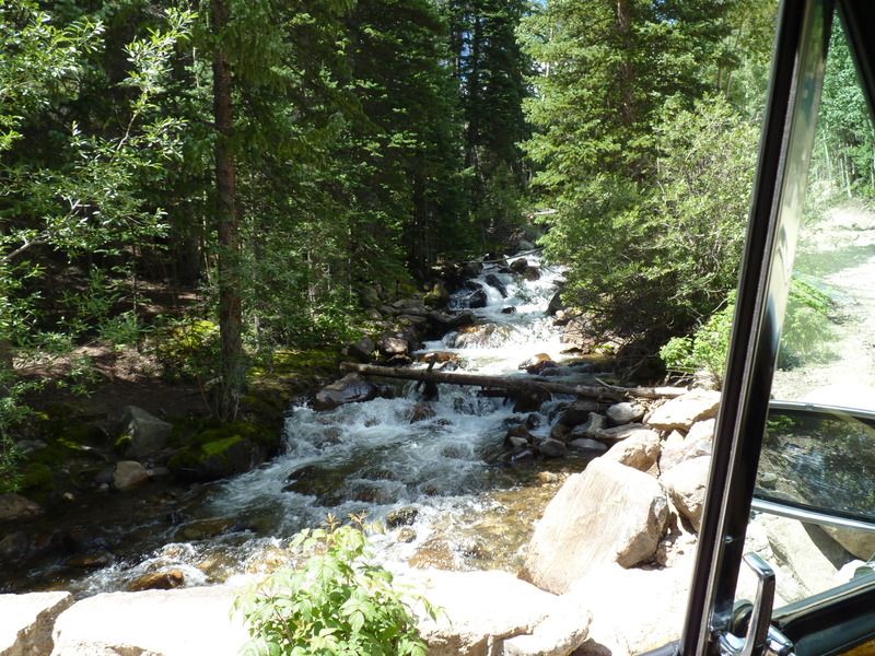
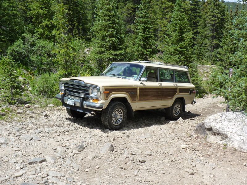
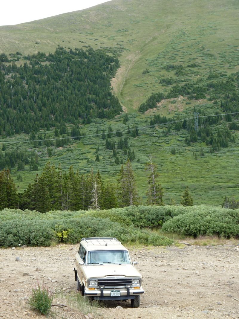
We drove through the initial switchbacks and the Waggy did great. The extra clearance came in handy and, according to my planned route, this was to be the hardest part of the trail. With the run off being high, there were some great creek views.


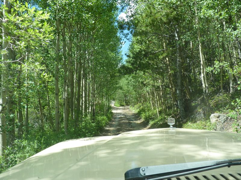
At some point, we headed off the trail to the left. I didn't recognize the turn off but Glen had run this trail so many times I didn't think anything of it. I remember thinking "Boy the trees have sure grown closer to the trail than I remember".


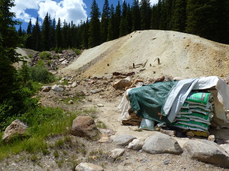
As we were driving up, we ended up having to make two deep water crossings. Again, I never remember that as being part of Argentine Pass. After the water crossings, we spied this stack of fertilizer on the side of the trail. We couldn't figure out what someone would be doing with it all the way up there.


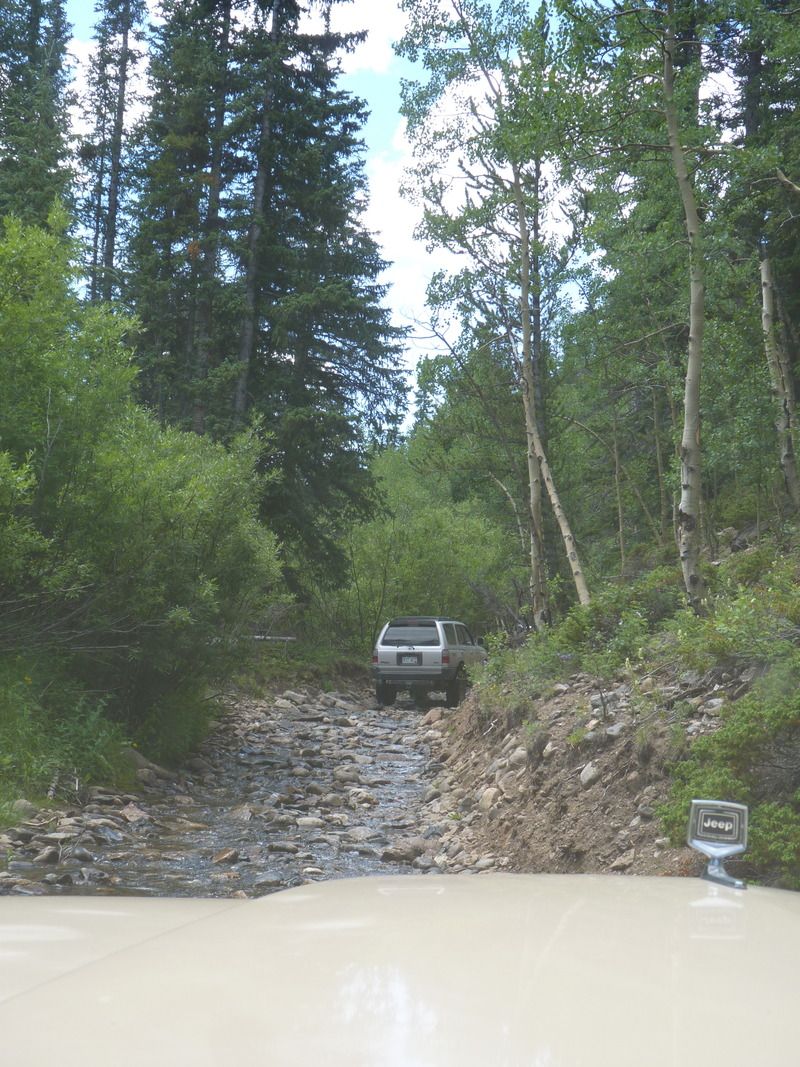
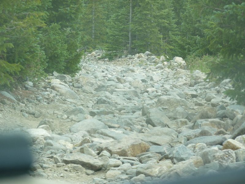
This is where the trail really started getting rockier. The 4 Runner guys didn't notice it at all but I, on 30" tires was starting to get a little concerned. (pictures never do a trail justice... keep that in mind)


Then it started to get REALLY rocky. The poor waggy started dragging it's under carriage on rocks and I had to be really careful where I put my tires. The road consisted of bowling ball sized rocks and there were larger rocks in the trail that were easily 40" even bigger. (Again, pictures never do a trail justice)

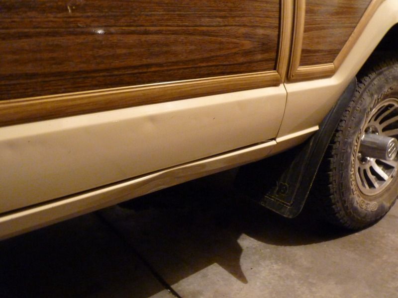
At one point, my wife told me "You're not going to clear that rock. You'd better back down." I thought, she's over reacting... I was wrong. It turned out that I was on a rock similar to this:


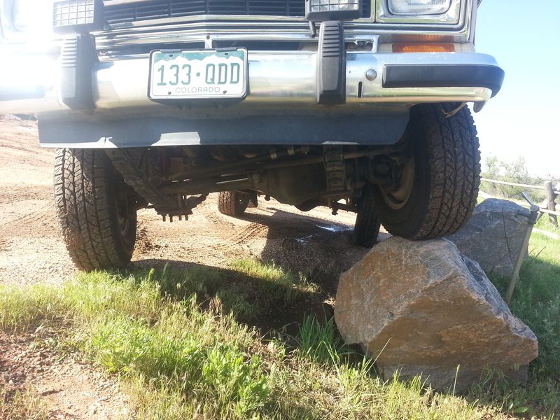
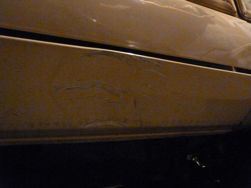
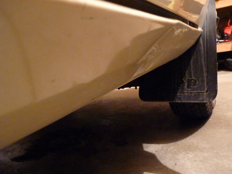
The waggy came down with a huge crunch... Here are some pics of the damage I took after we got back:


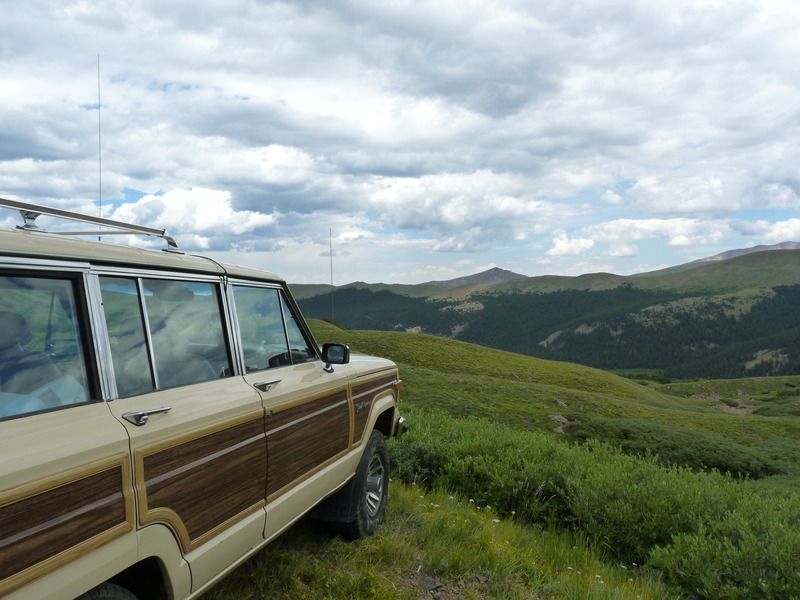
It was then that I realized Glen had taken us up McClellan Mountain Trail... not Argentine Pass. Both trails parallel each other but McClellan is a much rockier trail. From that point, Glen, John (who we met earlier that day) and Paula (my wife) all had to spot me to get the poor waggy up the trail. But, it worked and when we intersected with Argentine Pass, we took that trail for the rest of the trip. The Waggy was back in its element.


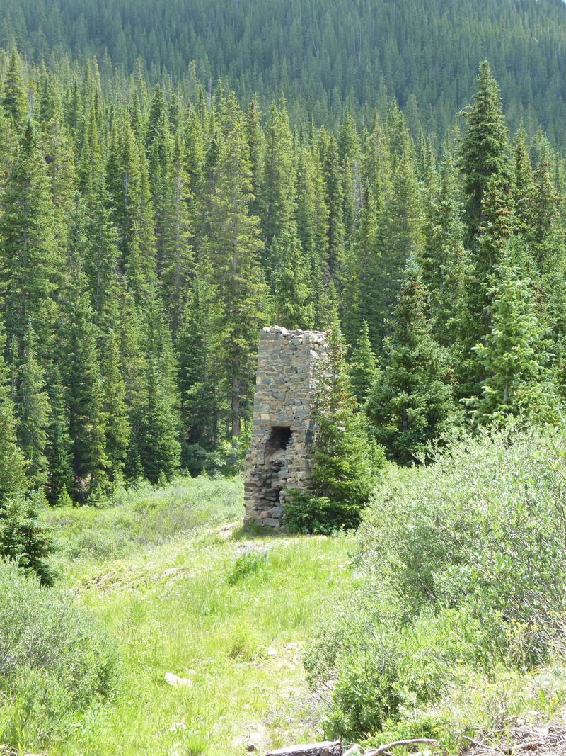
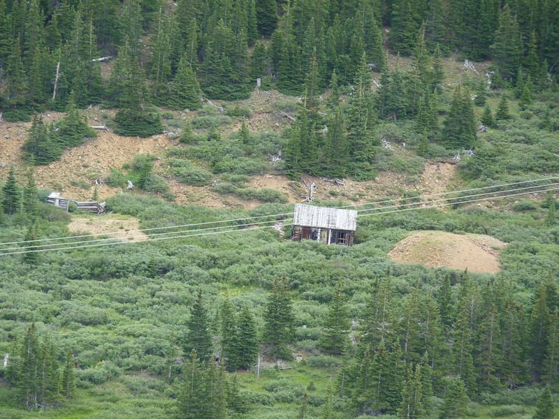
We saw what was an old cabin out in the woods. Only the chimney was left:


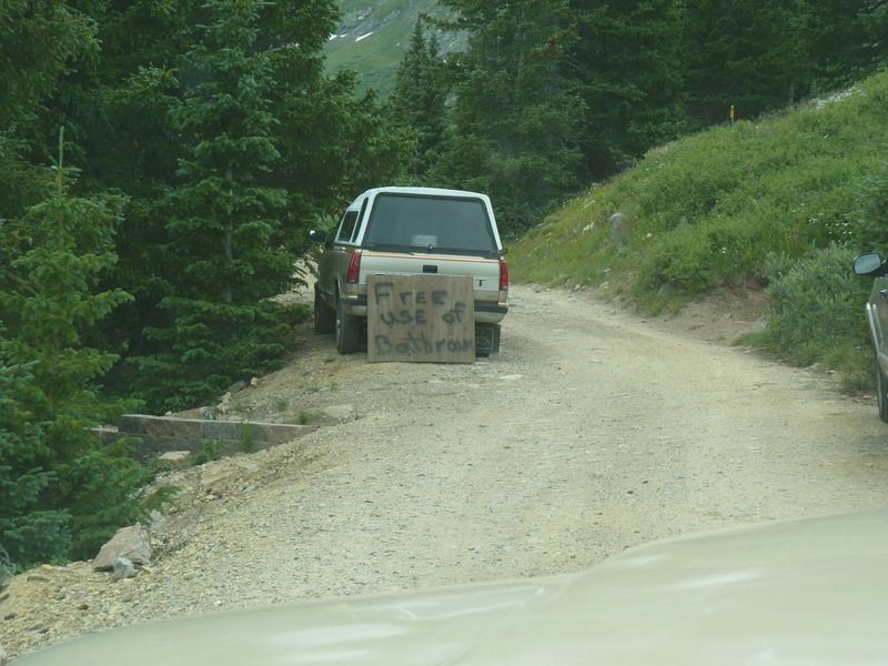
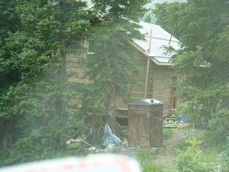
Then we saw some people building a new cabin. They seemed like interesting kind of folks...


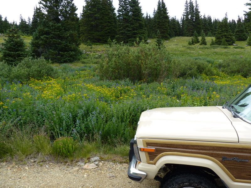
And the wild flowers were still in bloom.


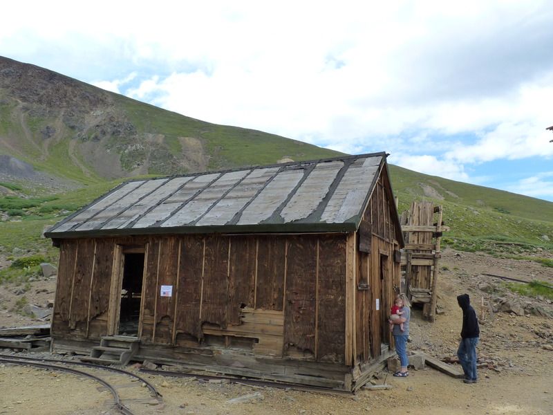
Soon after that, we reached the old mine and ghost town area of Waldorf. There's not too much left of the town.


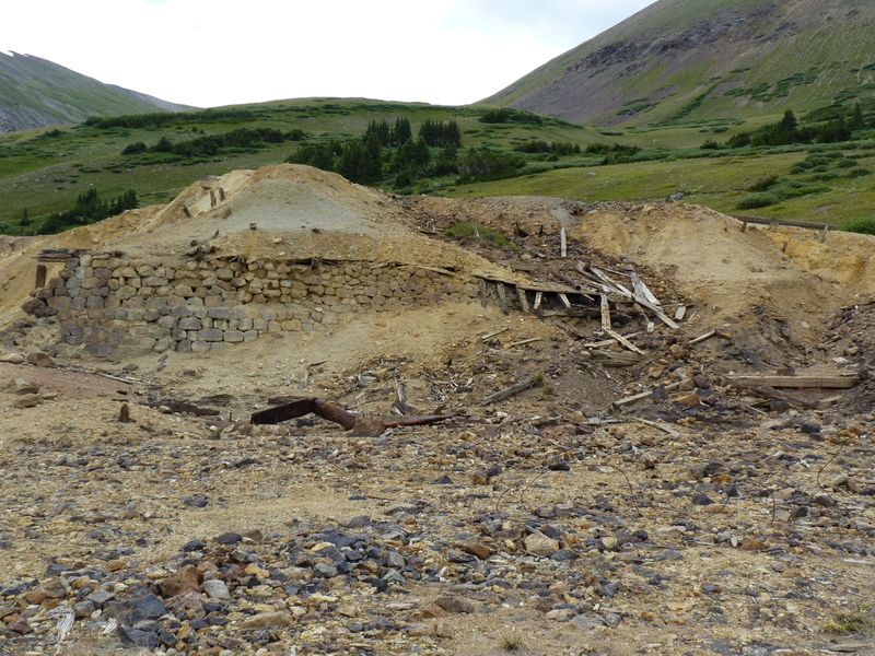
After that, we continued up toward the Santiago Mine. This would prove to be much more fun to see! As we climbed, there were some old mining relics along the trail.


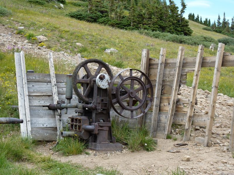
Then we reached our destination at over 12,000 ft.


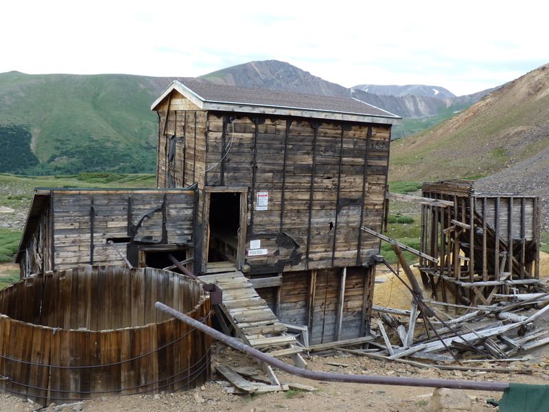
We parked and could see the mine shaft, the mill, and some other buildings.


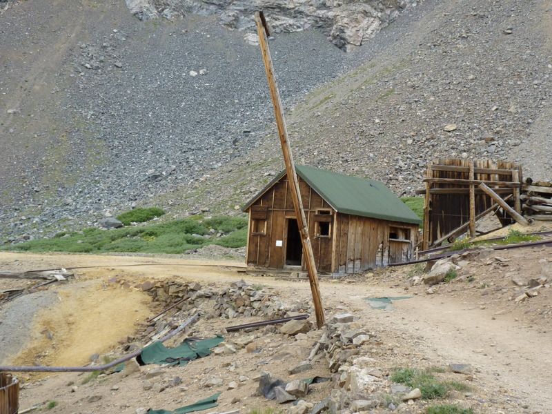
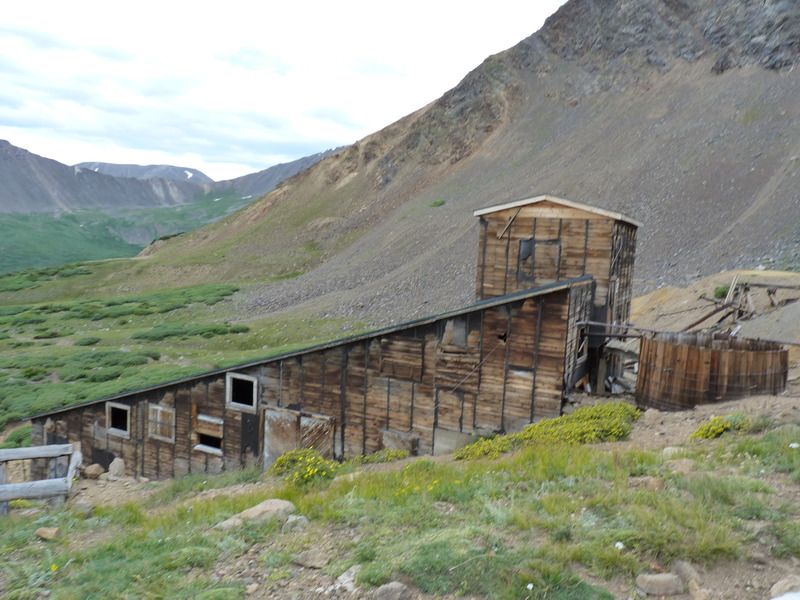
As we approached, we could tell this was going to be a fun area to explore!


That's all for Part 1... stay tuned for part 2, where the adventure really begins!
 
Last edited:

lumpskie

Independent Thinker
Here's Part 2! (of 3)
So, after we reached the Santiago Mine, we hopped out of our rigs and began exploring. This site is located at over 12,000 feet elevation and sees a lot of snow and weather each year. Given that, I was very surprised to see that the buildings remained in a well preserved condition. First, we took a look at what appeared to be personnel quarters or a supply shack. It was a small building with some shelving and left over supplied inside. I don't know what they were storing in the 55 gallon drum.


Here's the view out the front door. It looks directly toward the mill.


Here's a neat little window out back, looking at the mountain peaks behind.


If you walk out the side door, you'll stumble upon the tracks going from the mine out to the mill. The used to connect to the door you can see here but, fairly recently, that section of track collapsed.


Looking the other way, you can see the entrance to the mine.


Peeking behind the tarp, you can see that the entrance is still filled with snow in August! It looks like at least 30" of snow is still in there... I doubt it will melt before fall.


Turning around, we followed the tracks to the hill and took a look at the mill system. It looked like the structure on the right consisted of ore chutes and may have had some stamp mill functionality in it... I'm not knowledgeable enough on the process to tell.


The structure to the left was the real gem. It was the main mill that processed the ore. A little make shift bridge was set up to explore this building. It also had a water collection barrel out front. (more on that later)


Looking back at the stamp mill/chute system from the front of the main mill.


Just before walking into the main mill, I took a shot of the empty room just to the left of the entrance. (through a hole in the wall) There was an old bed frame, some old soup cans and miscellaneous construction material in there.


After that, I walked into the main mill. (As you can see, Glen beat me in there)


The ore would come in from the top, and would have a very rough screen before entering the building.


Then, the larger chunks would enter this belt driven stamp. (I think that's what this is)


From here, the ore would go down a chute. So, I had go downstairs to see what happened next.


Looking to the right, on the stairs, you can see that the ore lands in this collection room. I had to continue down the stairs to see what this room connected to.


When I got to the bottom of the stairs, I entered a huge room, where the majority of the processing was completed. Honestly, I was awe struck when this room came into view.
 

lumpskie

Independent Thinker
So, here's where I left off... Once I reached the bottom of the stairs, I went through the door.


It opened up to a HUGE room, with all the equipment you'd expect to see in a large scale mining operation. It was very impressive and I was stunned that everything, for the most part, was still intact. (In fact, I just found out that the owner is looking to restart operations of the mine)


The crushed ore came to this drum media separator first. You can see that it has at least 3 stages for separation.


Drum Opening:


From the drum separator, the ore was sent to the shaking table. This is where the water from the holding barrel/tank went.


From here, the ore was sent to a number of smaller processing stations located all over the lower levels of the mill. I don't know what everything is, but here are some general pictures.


Froth Floatation cells?


Conveyor from ore dump to drum separator.


Pictures really don't do this place justice. It was amazing to see. After looking around for at least 30 minutes, we decided to head back upstairs. It felt like travelling through time back into modern life.


From here, we headed back down the (correct) trail. Things went nice and smooth.


Once we aired back up and I reinstalled my front sway bar, we headed down to Georgetown.


Heading down Guanella Pass, we could see that I-70 traffic was stopped. Glen's navigation app said that there was a traffic jam all the way from Idaho Springs. As we were talking about the situation over the CB, a trucker responded and said that a biker (likely travelling to Sturgis) had been in a traffic accident. Colorado State Patrol had closed the freeway and Life Flight had just landed at the scene. Hearing this, we decided to have some early dinner in Georgetown. We thanked the trucker and headed to the Whistle Stop Café.

http://www.tripadvisor.com/Restaura...-A_Whistle_Stop_Cafe-Georgetown_Colorado.html

I had an amazing Spicey Burger, with Ghost Pepper cheese. After eating the freeway situation had actually gotten worse. We talked about our options and decided to commit our future to Waze and see where it routed us. This is where the Overland portion of our trip began. We followed frontage roads along the freeway until we hit Idaho Springs. Once in Idaho Springs, we took a right up Soda Creek road, where the surface turned to dirt.


As the road got steeper, a lot of folks in cars started to turn around and the steady stream of traffic thinned out to the occasional clump of cars. At this point, we were climbing back up into the mountains and could no longer see the freeway!


After a couple of corners, we saw an old BMW motorcycle that seemed to be broken down on the side of the road. The owner was taking out a tow strap.


We stopped and talked with the owner (I believe his name was John). His navigator was a Pitbull named, Rosie. (I think)


He was a really cool guy and his dog was very sweet. So, we decided that Glen would tow him back to his house, which was near the top of the mountain. Paula offered to have his dog ride with us, but he said she'd prefer to just stay with him. After hooking up, we hit the road.


The road was a series of twisty switchback but John didn't seem to have any trouble keeping things nice and smooth behind Glen That is, until the very end... This picture was taken seconds before the motorcycle ran over the tow strap and it became entangled in the front tire. The front wheel locked up and the bike lurched sideways! Luckily, John was quick on the rear brake and prevented the bike from rolling or crashing.


After we dropped John off the road met up with a paved road, which lead us home. We were tired but happy that we had such a unique little adventure. Until next time... Lumpskie signing off!
 

Forum statistics

Threads
185,895
Messages
2,879,314
Members
225,450
Latest member
Rinzlerz
Top