DVD
Adventurer
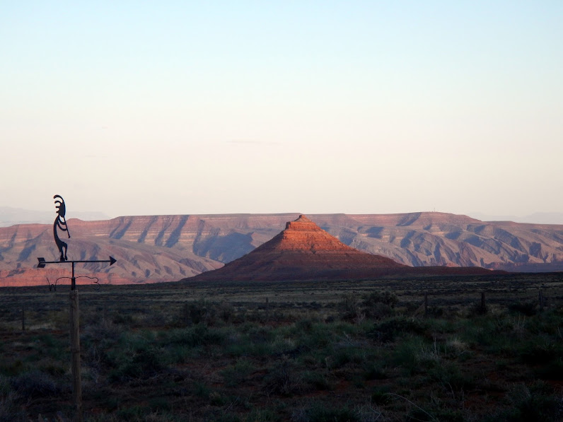
We met a couple friends from Utah in the southeast corner the state (Cedar Mesa / Grand Gulch area) for 4 days of hiking and exploring to find Anasazi ruins and see the natural landscape. The trip went well, with beautiful scenery, incredible ruins that you could explore by yourself, ancient art, good hiking, and some fun four-wheel-drive trails.
This was actually a continuation of a trip from a couple years ago, when we intended to spend a few days in the area on the way back from Canyonlands Maze District but had to cut the Cedar Mesa stay to a single day due to some family events. So it was great to fulfill longstanding plans.
Day 1.
We met our friends as planned, and found a nice campsite at the north end of Comb Wash trail.

Camp set for the start of a great adventure
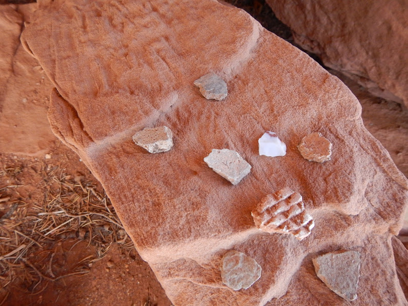
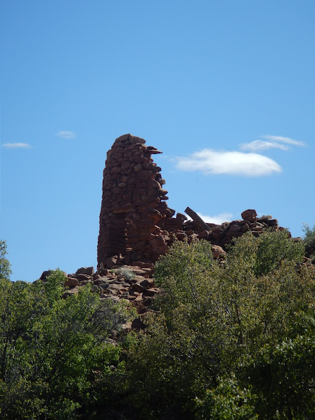
After setting up camp, we had a little time to explore around camp and found some ruins at Lower Mule Canyon. It was almost like catching a fish on your first cast; we were gabbing at the start of a hike and scanned the ridge and, whoa, ruins right away.
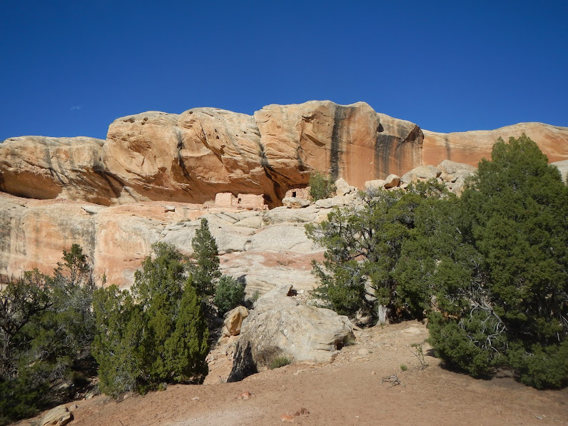
Ruins very near our campsite - in Lower Mule Canyon
Most of the planning went well, but the weather threw us a bit of a curve: a cold front moved through, and night-time lows were in the low 20s - maybe even lower. The second morning we checked the temperature, and it was 22 deg at 8 a.m. We had packed extra blankets, but at those temps, your head gets cold, pillows get cold, so if you rearrange at all, your head feels like it's on a block of ice instead of a soft, warm pillow. My wife has one of those fitbit things that tracks sleeping patterns, and she said it was like a like a seismograph those first 2 nights. In the morning, the 7 gal water container was mostly frozen.
But enough whining; it was all part of the adventure.
Day 2.
This was our long hike day. With 2 vehicles, we left one at the Bullett Canyon trailhead, then proceeded to Sheik's Canyon to do a canyon-to-canyon hike starting at Sheik's and exiting at Bullett.
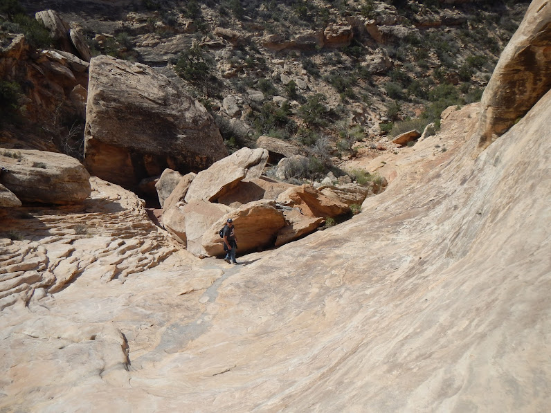
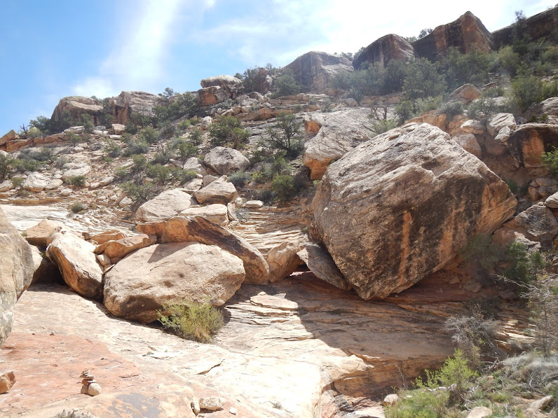
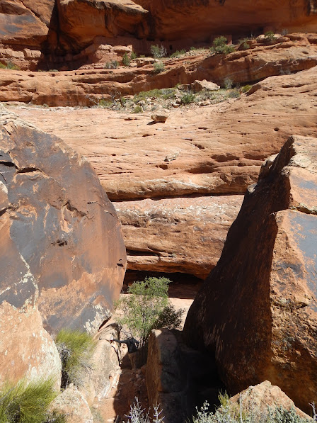
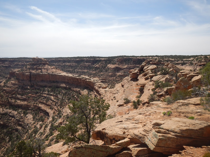
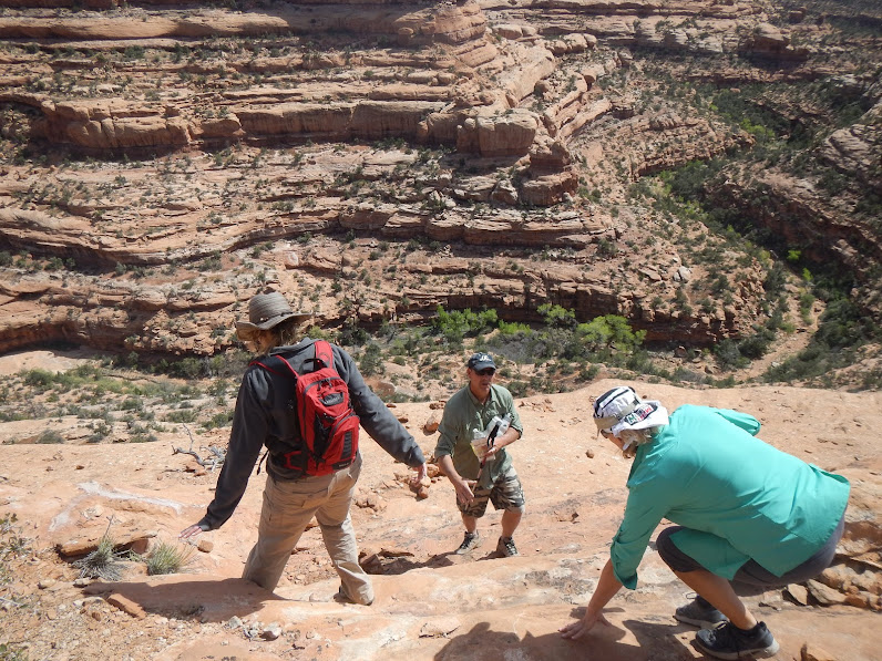
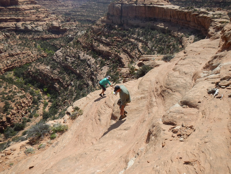
This turned out to be a good 12 mile hike, with some fairly difficult sections and lots of sightseeing, so it was a long day. Sheik's Canyon is lesser traveled canyon, and we got off trail a little bit a couple times, retraced our path a couple times, but as long as you keep heading down-canyon, you're fine.
The first highlight was the Yellow House ruins.

Yellow House ruins, Sheik's Canyon
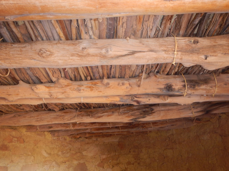
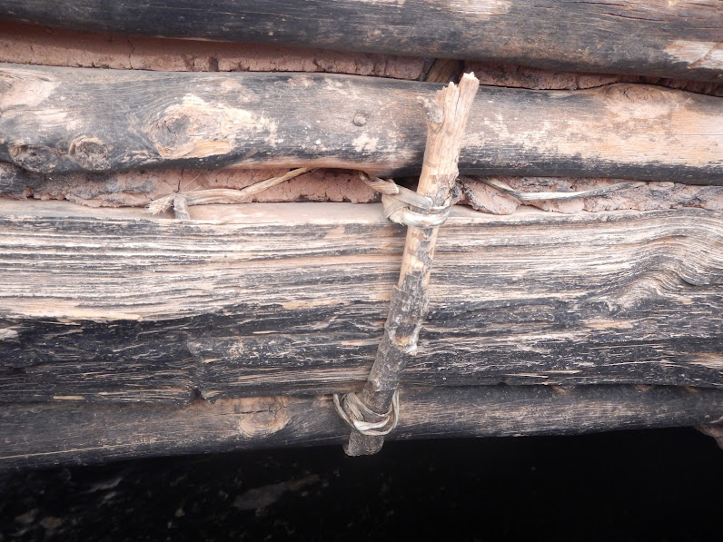
Yellow House ruins, incredible that the roof is in such great shape, right down to the lashings
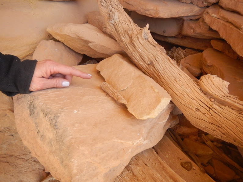
A little corn cob left from Anasazi
There were many scenic, interesting hiking sections.
Big, wide, smooth section of sliprock wash in Sheik's Canyon - looks like a ski slope
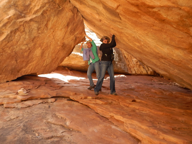
Strong women
For perspective, those are the 2 angled boulders Laurie and Pam were holding up

Steep part of the Shiek's Canyon trail
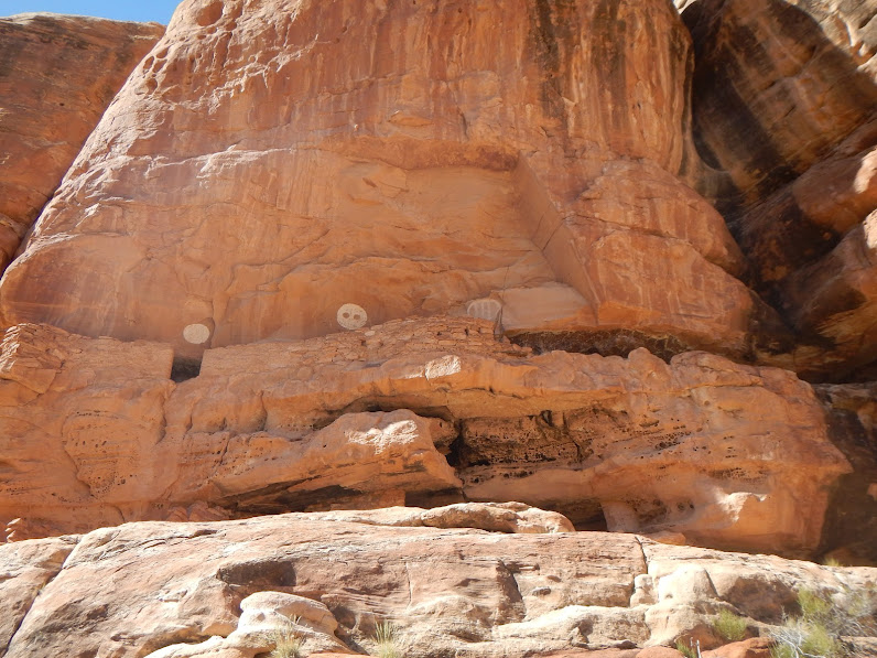
Further down the canyon, we came to the Green Mask ruins and art panel. This and Moon House were the highlights of the entire trip for me. Much of the panel is inaccessible (too high), so we took turns viewing it through the binoculars while eating lunch. There are literally hundreds of pictographs and petroglyphs, spanning millenia (so they say). And the Green Mask was certainly eerie, looking like a clown with sworls of long red hair and green stripes across the face. One bit of research I read surmised that the painting correlated with an actual scalp and mask that was found (currently in some museum) with similar colors that might have been carried into battle.
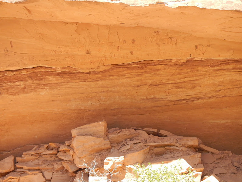
Green Mask panel (need zoom lens to do it justice)
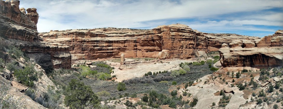
Panorama of confluence of Sheik's Canyon and Grand Gulch
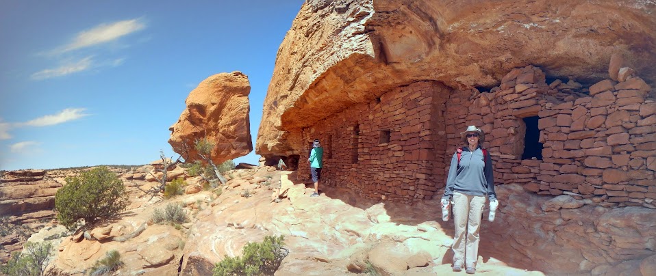
Returning up Bullett Canyon, we found a couple more impressive ruins.
Pictographs above Jailhouse ruins (a 2-story ruin)

Window that gives Jailhouse ruin its name

Perfect Kiva, a bit further up Bullett Canyon

This ladder is the one inauthentic remnant - but appreciated for allowing access to kiva interior
And as we picked up the vehicle from the starting trailhead at Sheiks Canyon, we met MPH of Expo Forum fame. I noticed the nicely outfitted rig, but the area is lousy with those. This one seemed like it was well used. I asked if he ever wrote about his adventures, and found out that it's MPH. Small world.
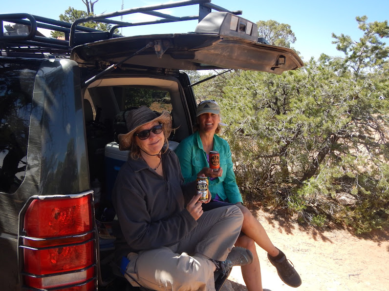
With all the hiking and excursions to check out the ruins, it was a long and tiring day. We got back to camp just before dark and enjoyed a great camp dinner (chili and garlic bread) and celebrated with a few beers around the campfire. We certainly employed that trick of shoveling out a small pile of embers to place under the chairs.
Day 3.
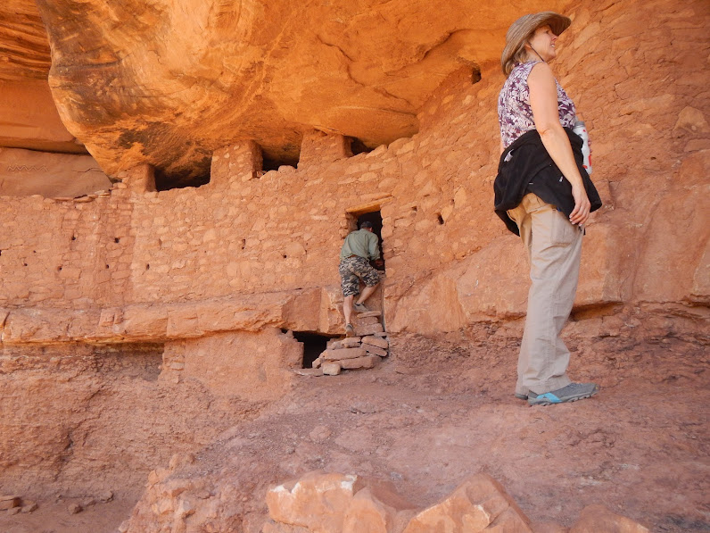
This was a less ambitious day. There were some assorted blisters, and we were all generally sore and tired. We stopped in at the Kane Ranger Station and acquired passes to access the Moon House ruins. Due to the delicate nature of the paintings, only 20 people per day are allowed to access the site. This is the only site with those restrictions. The entire area is so remote that we only ran into a handful of people the entire 4 days, but it was nice to be the only ones at this and other sites. The hike was only a mile or so, but it was a rim-to-rim canyon crossing nonetheless. The ruins didn't disappoint.
Narrow spot between boulders with Moon House above
Within the entry, there is a corridor and a number of interior rooms

Pictograph on wall to one of the interior rooms, off the corridor

Paintings on the wall of the Moon room (note reverse image of full moon)
The Moon House ruins are 8 miles in on a 4WD trail (Snowflat trail), which continued to Comb Wash, so we bounced and jostled on this trail to get back to camp. As another historical note, this trail was used by Mormon pioneers back in the day.
We didn't wimp out because of cold, but when planning this couples trip, we had previously made reservations to spend a couple nights at Valley of the Gods Bed and Breakfast, which is in the middle of nowhere (which happened to be where we were), so we broke camp and headed south on Utah 261, down Moki Dugway, to the B&B located almost directly at the bottom of Moki Dugway.
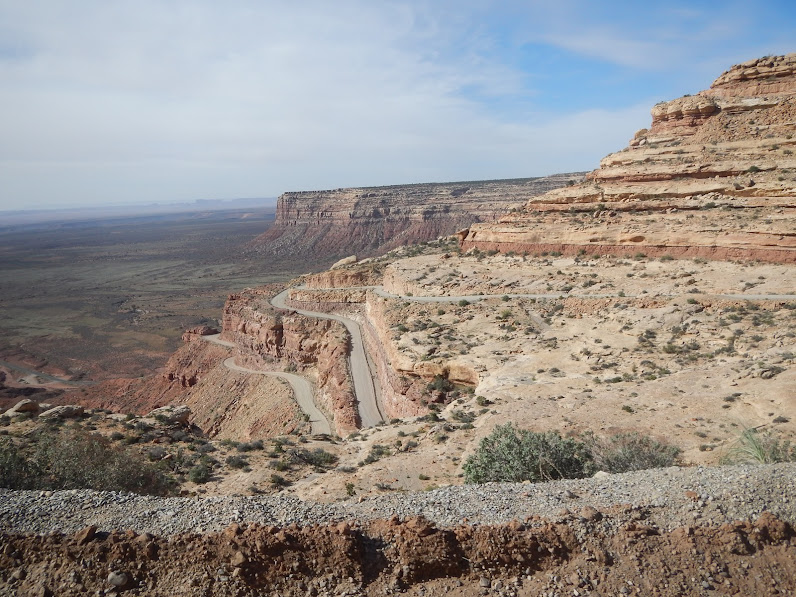
Switchbacks on Moki Dugway

After 2 freezing nights camping, we stayed at Valley of the Gods B&B for the 3rd and 4th nights
Sunset view for the front porch of the B&B
Continued in next post
This was actually a continuation of a trip from a couple years ago, when we intended to spend a few days in the area on the way back from Canyonlands Maze District but had to cut the Cedar Mesa stay to a single day due to some family events. So it was great to fulfill longstanding plans.
Day 1.
We met our friends as planned, and found a nice campsite at the north end of Comb Wash trail.
Camp set for the start of a great adventure
After setting up camp, we had a little time to explore around camp and found some ruins at Lower Mule Canyon. It was almost like catching a fish on your first cast; we were gabbing at the start of a hike and scanned the ridge and, whoa, ruins right away.
Ruins very near our campsite - in Lower Mule Canyon
Most of the planning went well, but the weather threw us a bit of a curve: a cold front moved through, and night-time lows were in the low 20s - maybe even lower. The second morning we checked the temperature, and it was 22 deg at 8 a.m. We had packed extra blankets, but at those temps, your head gets cold, pillows get cold, so if you rearrange at all, your head feels like it's on a block of ice instead of a soft, warm pillow. My wife has one of those fitbit things that tracks sleeping patterns, and she said it was like a like a seismograph those first 2 nights. In the morning, the 7 gal water container was mostly frozen.
But enough whining; it was all part of the adventure.
Day 2.
This was our long hike day. With 2 vehicles, we left one at the Bullett Canyon trailhead, then proceeded to Sheik's Canyon to do a canyon-to-canyon hike starting at Sheik's and exiting at Bullett.
This turned out to be a good 12 mile hike, with some fairly difficult sections and lots of sightseeing, so it was a long day. Sheik's Canyon is lesser traveled canyon, and we got off trail a little bit a couple times, retraced our path a couple times, but as long as you keep heading down-canyon, you're fine.
The first highlight was the Yellow House ruins.
Yellow House ruins, Sheik's Canyon
Yellow House ruins, incredible that the roof is in such great shape, right down to the lashings
A little corn cob left from Anasazi
There were many scenic, interesting hiking sections.
Big, wide, smooth section of sliprock wash in Sheik's Canyon - looks like a ski slope
Strong women
For perspective, those are the 2 angled boulders Laurie and Pam were holding up
Steep part of the Shiek's Canyon trail
Further down the canyon, we came to the Green Mask ruins and art panel. This and Moon House were the highlights of the entire trip for me. Much of the panel is inaccessible (too high), so we took turns viewing it through the binoculars while eating lunch. There are literally hundreds of pictographs and petroglyphs, spanning millenia (so they say). And the Green Mask was certainly eerie, looking like a clown with sworls of long red hair and green stripes across the face. One bit of research I read surmised that the painting correlated with an actual scalp and mask that was found (currently in some museum) with similar colors that might have been carried into battle.
Green Mask panel (need zoom lens to do it justice)
Panorama of confluence of Sheik's Canyon and Grand Gulch
Returning up Bullett Canyon, we found a couple more impressive ruins.
Pictographs above Jailhouse ruins (a 2-story ruin)
Window that gives Jailhouse ruin its name
Perfect Kiva, a bit further up Bullett Canyon
This ladder is the one inauthentic remnant - but appreciated for allowing access to kiva interior
And as we picked up the vehicle from the starting trailhead at Sheiks Canyon, we met MPH of Expo Forum fame. I noticed the nicely outfitted rig, but the area is lousy with those. This one seemed like it was well used. I asked if he ever wrote about his adventures, and found out that it's MPH. Small world.
With all the hiking and excursions to check out the ruins, it was a long and tiring day. We got back to camp just before dark and enjoyed a great camp dinner (chili and garlic bread) and celebrated with a few beers around the campfire. We certainly employed that trick of shoveling out a small pile of embers to place under the chairs.
Day 3.
This was a less ambitious day. There were some assorted blisters, and we were all generally sore and tired. We stopped in at the Kane Ranger Station and acquired passes to access the Moon House ruins. Due to the delicate nature of the paintings, only 20 people per day are allowed to access the site. This is the only site with those restrictions. The entire area is so remote that we only ran into a handful of people the entire 4 days, but it was nice to be the only ones at this and other sites. The hike was only a mile or so, but it was a rim-to-rim canyon crossing nonetheless. The ruins didn't disappoint.
Narrow spot between boulders with Moon House above
Within the entry, there is a corridor and a number of interior rooms
Pictograph on wall to one of the interior rooms, off the corridor
Paintings on the wall of the Moon room (note reverse image of full moon)
The Moon House ruins are 8 miles in on a 4WD trail (Snowflat trail), which continued to Comb Wash, so we bounced and jostled on this trail to get back to camp. As another historical note, this trail was used by Mormon pioneers back in the day.
We didn't wimp out because of cold, but when planning this couples trip, we had previously made reservations to spend a couple nights at Valley of the Gods Bed and Breakfast, which is in the middle of nowhere (which happened to be where we were), so we broke camp and headed south on Utah 261, down Moki Dugway, to the B&B located almost directly at the bottom of Moki Dugway.
Switchbacks on Moki Dugway
After 2 freezing nights camping, we stayed at Valley of the Gods B&B for the 3rd and 4th nights
Sunset view for the front porch of the B&B
Continued in next post


") Happy Trails!
Happy Trails!