Ultimate Expedition To/From Overland Expo - Flagstaff Ariizona

mercier@streetsmart.ca

Expedition Scout
Your right Little Foot, there is so much to explore in the American Southwest, this route is like 'hair in haystack', no really! I see you drive a 96 Cherokee. My daily driver is a 1998 Grand Cherokee 5.9. It only has a 2' lift and Iv'e been tempted to go 4.5, like you have on your Cherokee. Like I said I use it as a daily driver but also Overlanding, when our dedicated rig is parked in the Southwest. Would you recommend it, and any cautions?
 

mercier@streetsmart.ca

Expedition Scout
Leg 17:Belmont to Ophir Pass and Berlin Ghost Town.

It was hard to leave the Monitor Valley with so much to explore in this area. After touring up the valley we were drawn back to Belmont with its cottonwood tree bordered natural spring, ghost town buildings and stately courthouse with hopes of spending a night in the old Monitor Mine office, now a Bed & Breakfast-Saloon, but it was temporarily closed.

The fantastic little ghost town makes a great springboard for a Journey over the dramatic 10,000' Shoshone Mountain Ophir Pass to Berlin, another great 1860's ghost town and mill now preserved in a state of arrested decay. Up the road you will find the 225 million year old Ichthyosaurs fossil beds. But getting there is way more than half the fun. We traveled through a variety of canyon and desert-mountain passes, starting with the interesting eroded cliffs of Charanock Pass and Dry Canyon, on into the vast Big Smokey Valley, Ophir Pass - a steep incline up and down a long breathtaking ledge road with incredible valley views on both sides of the summit – and finally Ione Canyon to Union Pass. Route travels by Murphy Mine-Mill, Hamlin Mine ruins and the Ione and Berlin Ghost Towns. Rating: This is a Moderate route, but could be Difficult going up the steep eastern slope and down the long western side switchback ledge road, based on weather conditions and erosion.

We had hoped to spend a night at the Monitor Mine Office, repurposed as the Belmont Inn Bed & Breakfast. The Inn and Saloon overlooks the ghost town. Unfortunately, they were temporarily closed.


Belmont Ghost Town & Monitor Mine Office, now Belmont Bed and Breakfast. by Overland Frontier, on Flickr

Indian Maggie's Saloon, part of the Inn, was open at time of writing, July 28, 2015. The Belmont Inn website is even offering an economical choice for groups looking to do some volunteer restoration work on the vintage barn, with an incentive of free accommodation in bunkhouse.


Indian Maggie's Saloon, part of Belmont Bed and Breakfast by Overland Frontier, on Flickr

The first of many interesting canyons, on the scouted route is Charanock Pass. It links to Dry Canyon that was once main pass route. The original trail passed through Moores Creek and Dry Canyon. It has been replaced with New Moores Creek Road, but the part of the old trial and Dry Canyon is worth a visit.


Dry Canyon and Old Mores Creek Road. by Overland Frontier, on Flickr


Dry Canyon. by Overland Frontier, on Flickr

The next geographic experience, is the vast Big Smokey Valley, where Pronghorn antelope thrive and in the Shoshone Mountains come to sight.


Pronghorn in Big Smokey Valley. by Overland Frontier, on Flickr

As you get closer to Shoshone Mountains, you have to respect the tenacity of early prospectors and miners that blazed the 10,000' Ophir Pass in the 1860's. The first adventurer on record is John C Freemont. He camped near here in 1845, at the Darroughs Hot Springs.


Shoeshone Mountains. by Overland Frontier, on Flickr

The Eastern Ophir Pass Gateway switchbacks can be seen from afar. The terrain gets progressively steeper as you approach the 10,000' summit.


Switchbacks up first leg of Ophir Pass trail. by Overland Frontier, on Flickr

1880's mercantile ruins still front the Ophir Pass trail.


Old Store in Ophir Pass Ghost Town. by Overland Frontier, on Flickr

It is amazing how intact this old miners cabin is near Murphy Mine. The silver strike was made in 1863 and petered out by 1895, with a couple of flash-in the pan reworks afterward, further up the canyon.


Miners cabin Ophir ghost town. by Overland Frontier, on Flickr

We found the canyon pretty tight once we got into it, but found sites suited to dispersed camping near the canyon mouth.


Setting camp near Ophir ghost town. by Overland Frontier, on Flickr

A great day on the trails is always better with a fine meal. Shotgun rider, Bruce Daniluck always feels at home when is at the helm of a BBQ.


Master Chef Bruce Daniluck at work. by Overland Frontier, on Flickr

Now, time to relive the day and plan the next, over a fine meal.


Fine dining in Ophir Pass ghost town. by Overland Frontier, on Flickr

The majority of the trail we encountered on the Eastern side of Ophir Pass Summit, had a solid rocky base.


Ophir Pass trail. by Overland Frontier, on Flickr

Several tree-covered sections had a dirt base with soft spots, dips and signs of previous deep erosion, which could make this trail difficult with heavy rains or flash floods.


Ophir Pass trail in softer tree section. by Overland Frontier, on Flickr

There was a side trail off the Ophir Pass Summit that toke us right to the tip of the mountain that warranted a flag for future camping. We could see our route across Big Smokey Valley and how the new road takes a left around Moores Creek and Dry Canyon, the historical route.

Ophir Pass Summit. by Overland Frontier, on Flickr

The terrain on the backside became more open and barren, making it easy to see the trails ahead and behind.


Ophir Pass trail western side. by Overland Frontier, on Flickr

Long, sweeping ledge road on the eastern side of Ophir wash.


Ophir Pass western side ledge road. by Overland Frontier, on Flickr


Switchback above Ophir Wash. by Overland Frontier, on Flickr

1864 Saloon in Ione ghost town opened in 1864, a year after silver was discovered. Ione became the first county seat of Nye County only to loose it three years later to Belmont, as the population was lured to greener pastures.


Ione ghost town, Ore House Saloon. by Overland Frontier, on Flickr

Berlin Mine and townsite was established in 1863 as part of the Union Mining District. It had three miles of tunnel but produced only $860,000 in gold and silver. The Berlin mill, mine and machine shop (below) as well as the nearby camp homes, stage station and assay office were abandoned until 1970 when the state stabilized them in a preserved state of arrested decay under the Berlin-Ichthyosaur (ancient marine reptiles) State Park. The 30-stamp mill is a rare example found in this condition.


Berlin Mine and Mill. by Overland Frontier, on Flickr


Berlin 30 Stamp Mill Ruins. by Overland Frontier, on Flickr

I'm a sucker for old stage stuff, so I really enjoyed peering into the window of Berlin Stage Station and barns, where horses were boarded under the same room roof as the operator, separated by a small partition. In winter a portion of the corral was enclosed. The stage ran from 1904 to 1915 with horses, when service with a Model T continued until 1925.


Berlin ghost town stage station office and residence. by Overland Frontier, on Flickr


Berlin ghost town Model T truck in front of machine shop. by Overland Frontier, on Flickr


Berlin ghost town assay office. by Overland Frontier, on Flickr

The view from the Berlin machine shop our next Trek Leg post, provides a sneak peak at the route we will take to Mentor Pass and on to Rawhide in our next post, the first of the next Trek Series in our Journey: Nevada Pony Express/Overland Stage Route to Virginia City.

Berlin machine shop view of trial to Mentor Pass and Rawhide our next Trek Leg post. by Overland Frontier, on Flickr

If you want to see the complete recently enhanced Scouting Report; 41 sequential photo documentary slideshow, check out:

http://www.overlandfrontier.com/trek-legs/belmont-berlin

This is the last of 4 Trek Legs, in the Nevada Ghost Towns Series. If you want to view the entire series in more depth or plan your own trip, download our free GPS/GPX trackless of the expedition route scouted, or preview it on line:check out:

http://www.overlandfrontier.com/trek-series/nevada-ghost-towns

Hope you enjoyed this Trek Leg region as much as I did while research and documenting it - What an experience, two great Ghost Towns, sandwiched between a dramatic pass, with Ghost Towns and Mill embedded in a rugged canyon.

If you like this type of route coverage, we could use your help with a Like on Facebook.

Thanks for traveling along.
 
Last edited:

JCTex

Observer
You rarely mention gas. How many miles do you use as your safe range when trekking these way out there trails? I don't see extra cans; so, how many gallons do you carry? Are your gas refill points written in the Scouting Reports? How can I purchase these reports?
 

mercier@streetsmart.ca

Expedition Scout
(Expanded response from first post)
Actually I have an AEV Auxiliary tank that holds 10.2 gallons, that wraps around my spare tire. That is what I like to leave as reserve, and rarely dip into it. I top off every chance I can, and will often backtrack to fill up after exploring, if unsure where next fuel stop is. I ask locals and use the internet/phone to check ahead before I leave, in some cases.

I will talk about where I did or did no find gas stations sometimes in my scouting reports but I don't like to provided a definitive list, particularly on the edge of civilization, as they are not reliable. What is open in one trip may be closed on the next. Listing them as gas sources may be more damaging to overlanders counting on them. Other times, I will provide locations that may have gas but should be confirmed before your own departure.

Our Scouting Reports, which by the way are free, are not intended to be a recommended or definitive route. Rather, our documentaries of scouting expeditions provide pictorial reference and information that can help enthusiasts find scenery, terrain, activities and relics that fascinate them the most. I believe it is important for anyone going on expeditions, off the grid, to do their homework, that in addition to our GPS Tracklogs for reference, have printed maps, look at the range of their vehicle and check current fuel sources.

I have never run out of gas on any of our scouting expeditions, and probably tap part of our auxiliary reserve 10 to 20% of the time. I can recall only two times where we just made it to the service station, on fumes, but in both cases I was in civilization, within helps reach (I do carry a satellite phone as well – much more affordable theses days).

To answer your question more specifically, I went back on some logs that I kept during a recent 3400 mile trip and tracked mileage in various conditions. With a total capacity of 22.50 plus 10.2 auxiliary = 32.7 Gallons. Less 5% in case it does not pick up everything in tank = 30 gallons

I run a 7200 Pound JK with a LS 5.3 V8 and 6 Speed automatic:

Highway ranges between 12 -14 mpg depending on speed and wind, but the range is not as important because there are generally service stations readily available.

Most treks I do are a combination of gravel roads-dirt-sand-rock and bits of byways, so I track my average on that:

Mixed Highway/Dirt: 10.7 to 11.4 mpg = 321 to 342 miles

Just backroads-dirt-sand-rock in 4 high & low: 9.47 to 10.75 = 284 to 322 mpg.

Just 4-low with lots of up and down steep hills: 7.00 = 210 miles

Of course, I prefer not to count on auxiliary and only dip into it 10 to 20% of time.

If you want to check out our Free Scouting Report's just go to OverlandFrontier.com, the main page provides hot links to detailed scouting reports, and all our featured 130 Treks have a slideshow of the route, but only half of those have pictorial slideshow support copy so far.

By the way, thanks for raising this. This is a very good question, as it is such a critical part of doing your homework. We have a whole section on this and other important factors related to "Going Prepared" for anyone who is interested:

http://www.overlandfrontier.com/go-prepared
 
Last edited:

mercier@streetsmart.ca

Expedition Scout
Leg 18: Berlin, side-door to Pony Express and Ft. Churchill

PONY EXPRESS/OVERLAND STAGE ROUTE TO VIRGINIA CITY TREK SERIES

Never before has a venture that only lasted 18 months (1860-1861) captured the imagination of people worldwide; 150 years later the logo stands as an international icon of determination and speed. In 1851 overland mail would take three months from Missouri to California. The Overland Express Stagecoaches were able to shorten it to 22 days taking a southern route by 1857. The Pony Express delivered mail in 10 days from New York to San Francisco. To this day, determined Overlanders can retrace many surviving parts of the route. The trail was broken into five divisions; the most remote and dangerous was Division Five across the deserts of the Great Basin of Nevada and Utah. It continues to be the most remote and least retraced. Our two Trek Legs travel through the solitude of Division 5 but ends in one of North Americas' best-preserved 1860's old west boomtowns, Virginia City, not a museum but a self-sufficient community.

Leg 18: Berlin, side-door to Pony Express and Ft. Churchill

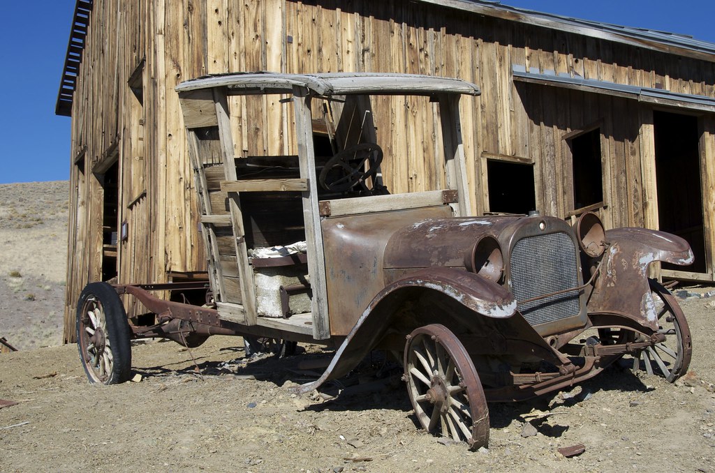
The first of three Trek Legs in this series we scouted for Overland Frontier starts in Berlin ghost town/mine. Our route makes a stop at the intact Poinsettia Mine camp before traveling north past Rawhide where we join the Pony Express. Each one-way XP delivery took 75 horses. Superintendents set up “Home Stations” every 65 to 100 miles to ensure replacement horses; feed and food were available for relay stations that are 12-15 miles apart. Our route passes the ruins of the 150-year old First Desert (relay) Station and the surviving Buckland (home) Station and nearby Fort Churchill, erected in 1861 to reduce friction with natives. RATED: Most of it is Easy but because it is very remote and some eroded bits can easily become more difficult, we rate it Moderate.

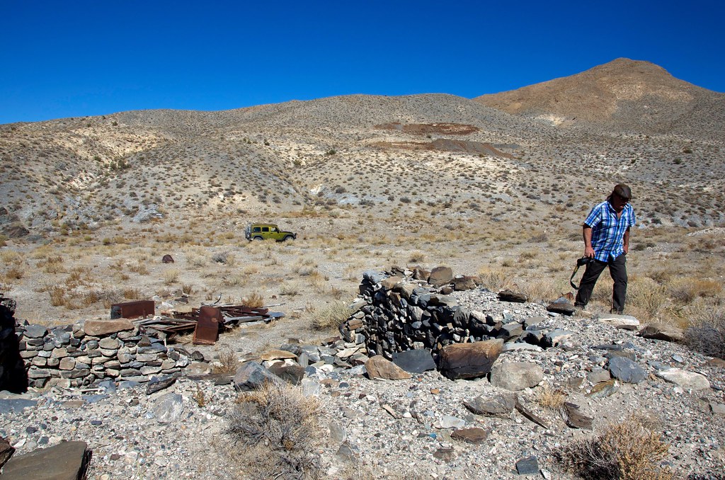
Leaving Berlin, the route crosses Mentor Pass and leaves the gravel road for Craig Canyon, and the Wells Fargo stage road through to Downeyville ghost town. Rich silver and lead deposits discovered above Craig Canyon in 1878 by four Downey Brothers.

Ruins of their namesake town can be found along the south side of the canyon. where saloons, mercantile and the ultimate sign that the mines were successful, a Wells Fargo office. Over 12 million in precious metal passed through Downeyville. Time was short on this segment and we later found out that the mines ruins above are well preserved and worth a visit.


Mentor Pass and Wells Fargo Stage Road by Overland Frontier, on Flickr


Downeyville Ghost Town by Overland Frontier, on Flickr

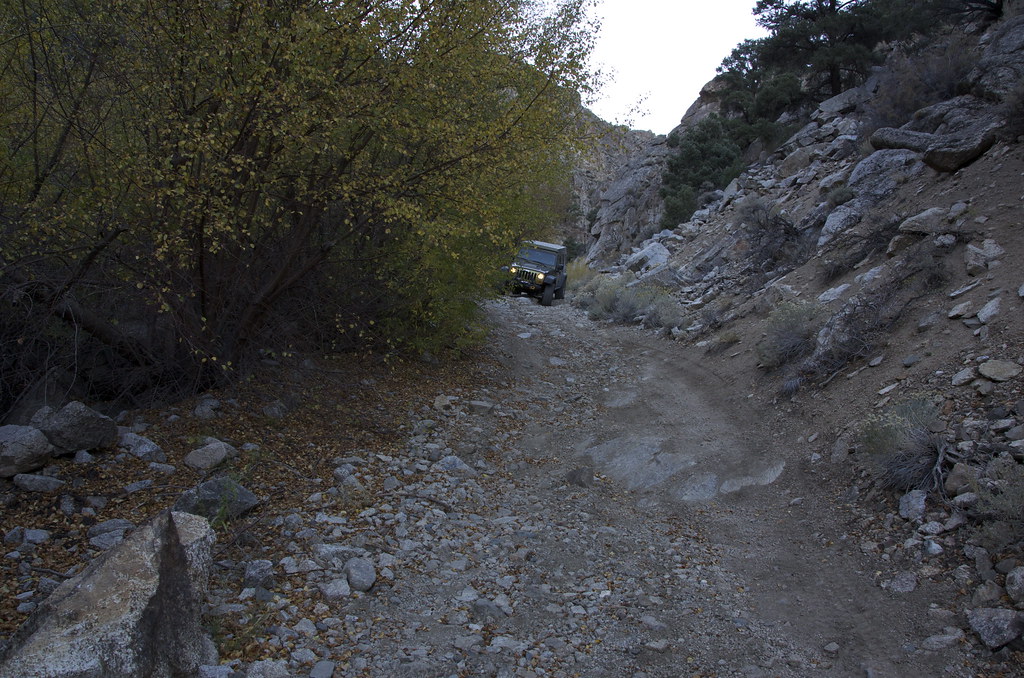
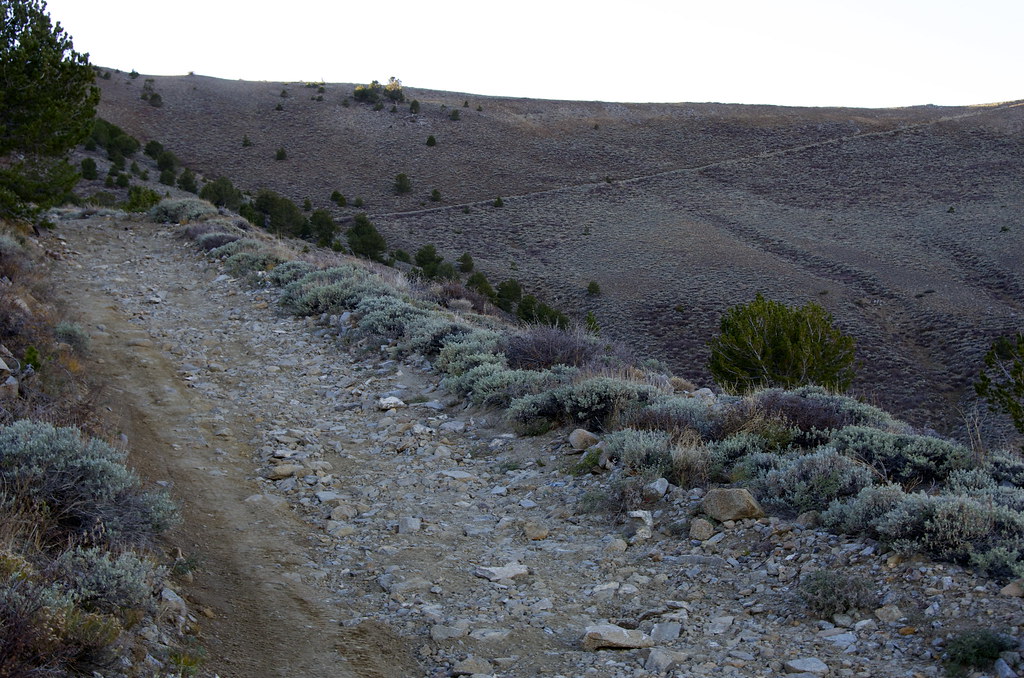
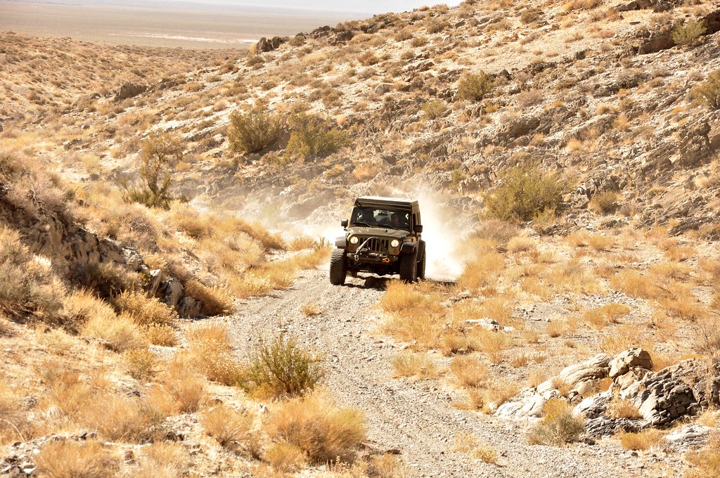
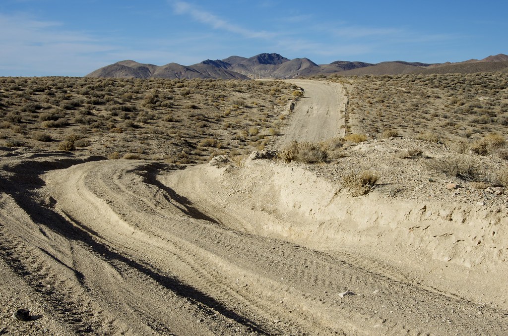
We would soon discover why the road the Rawhide was surprisingly wide.


Road to Rawhide by Overland Frontier, on Flickr

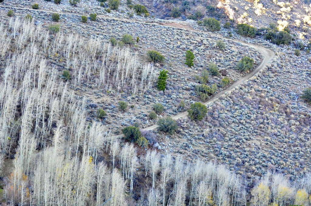
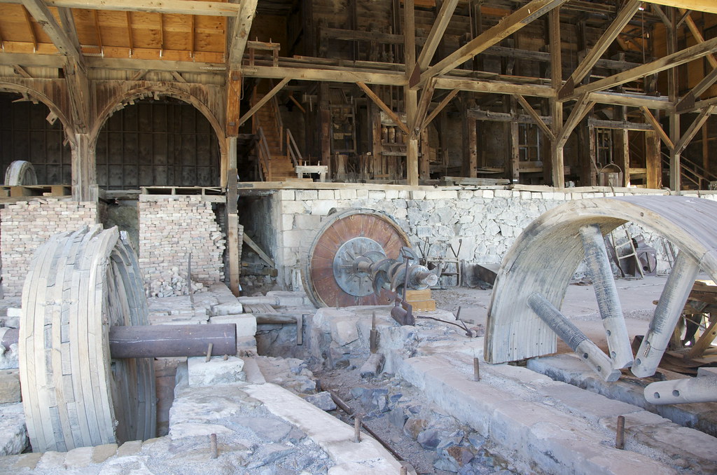
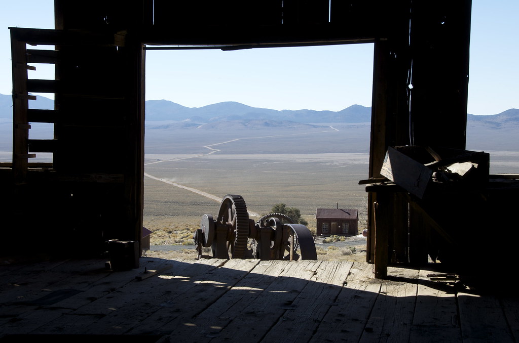
We were really happy that we decided to explore short side road to Poinsettia Mine. As we crested a ridge, we were surprised to see such an intact mining camp beside the Poinsettia Mine.


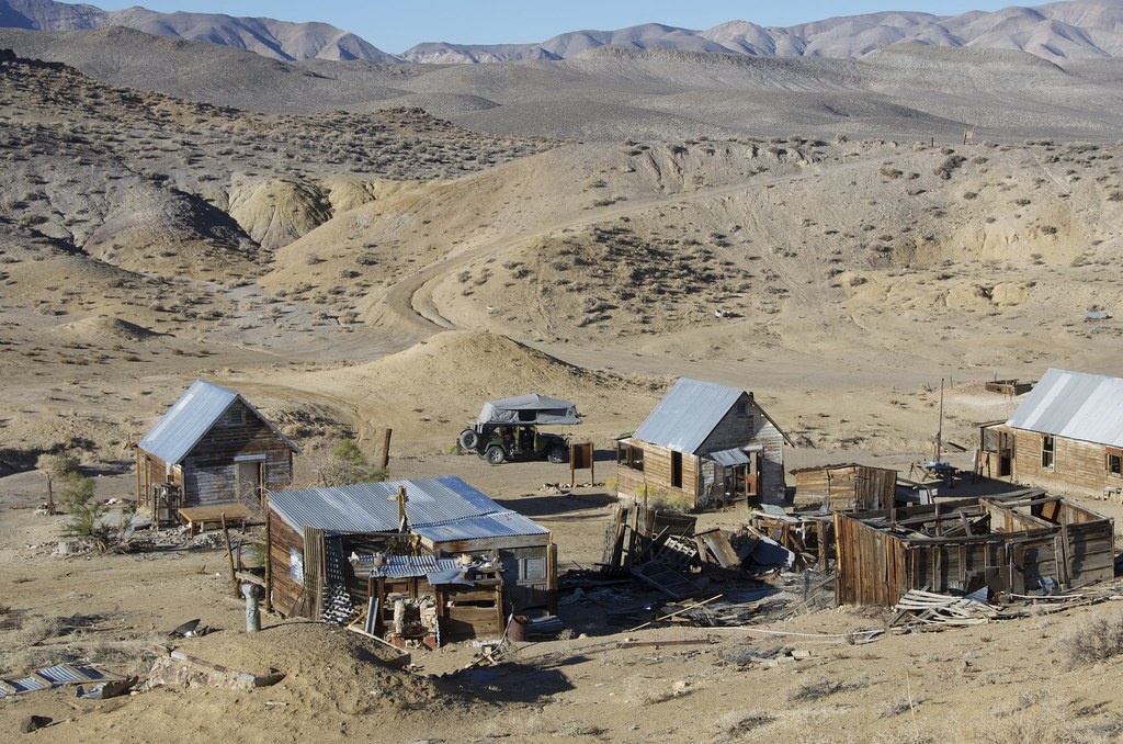
Poinsettia Mine Valley View by Overland Frontier, on Flickr

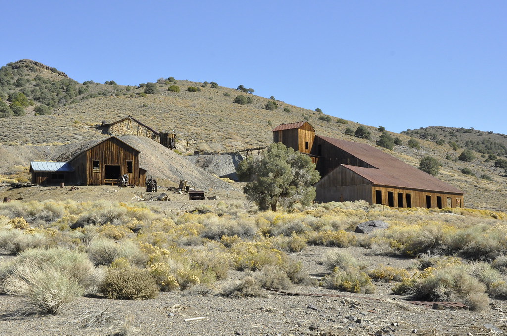
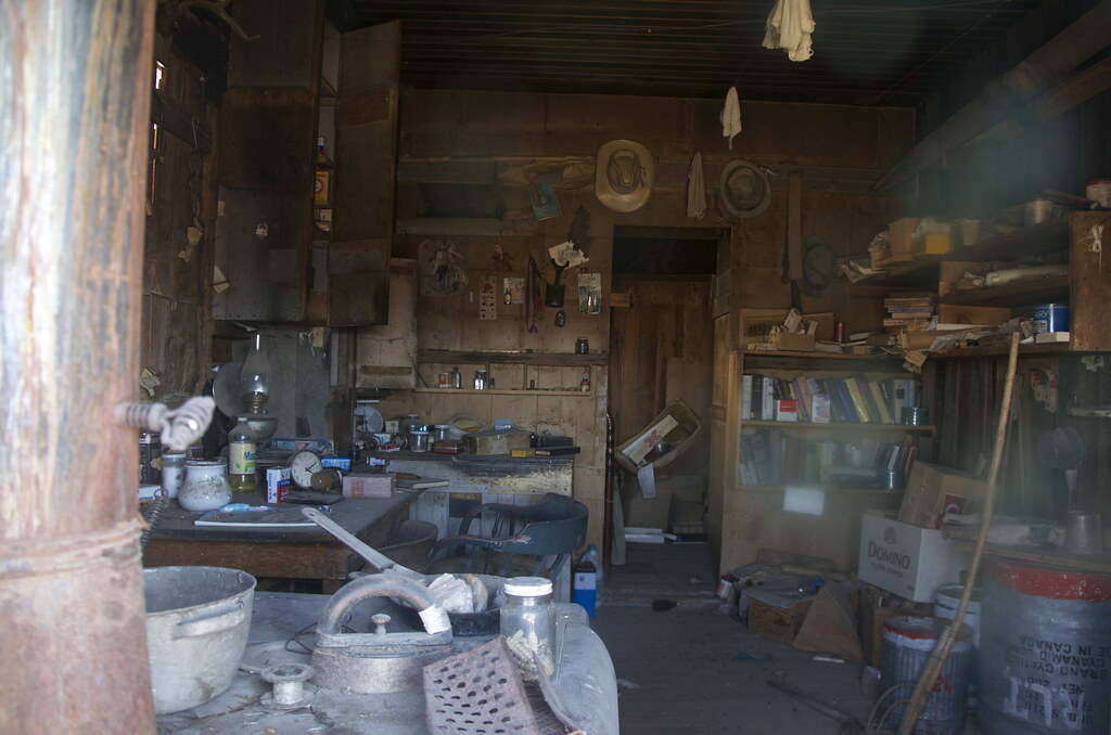
Poinsettia Mine has been adopted and is well kept by the Hawthorne Boy Scouts, a nice spot for overnight camp for those who respect the site.


Poinsettia Mine Camp. by Overland Frontier, on Flickr


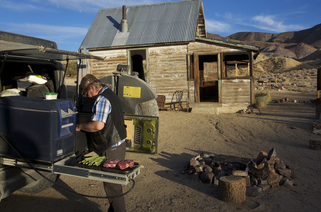
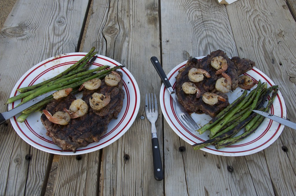
Fine Dinning at Poinsettia Mine. by Overland Frontier, on Flickr

By 1907 the shine was starting to come off the price of Silver in Tonopah and labor troubles were stalling Goldfield success, where citizens awoke to find a sign on a vacant church; “This Church is closed. God has gone to Rawhide”. Tek Rickard, ever the promoter, was trying to draw attention to Nevada's latest bonanza. Check out Tek Richards colorful story in our Detailed Scouting Report on page 20:http://www.overlandfrontier.com/sites/default/files/preview/leg/nevada/leg2/index.html
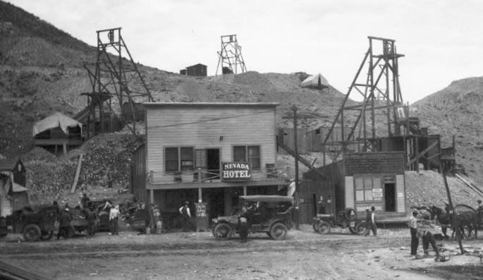

Rawhide by Overland Frontier, on Flickr

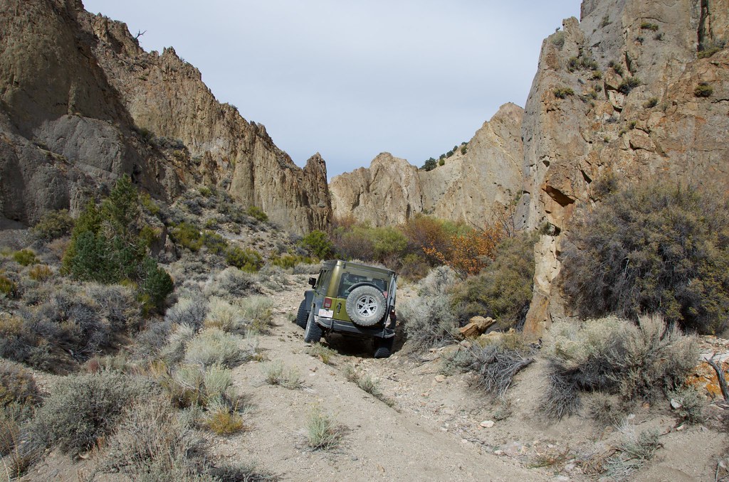
We were anxious to explore the mines peppered across Hooligan Hill, Murray Hill, Balloon Hill and Grutt Hill on our old map, but they were now off-limits. Unfortunately, the ruins of Rawhide and the old mines have been obliterated by a strip mining operation. We would rate most of exploratory route Easy, but there were no services whatsoever in this remote region and we encountered a few eroded sections that could easily become Moderately Difficult.
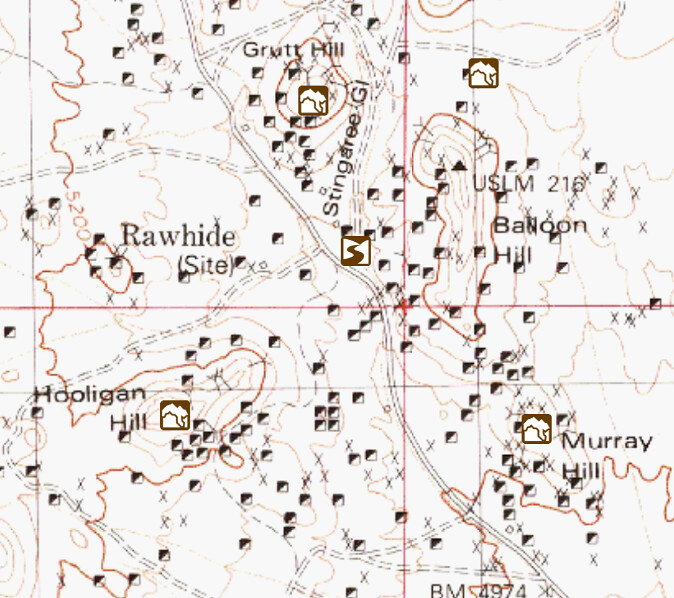

Rawhide Map by Overland Frontier, on Flickr


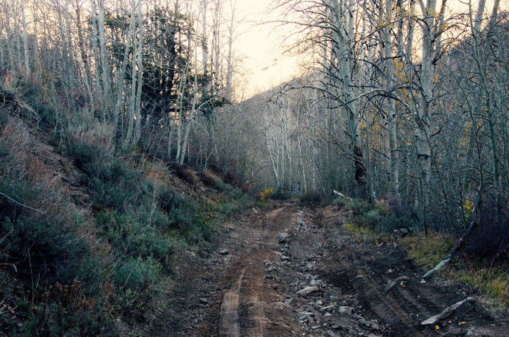
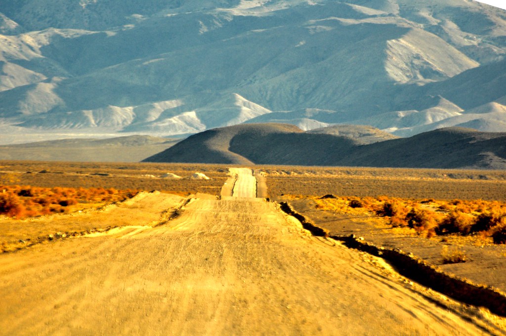
Road to Connecting to Pony Express by Overland Frontier, on Flickr

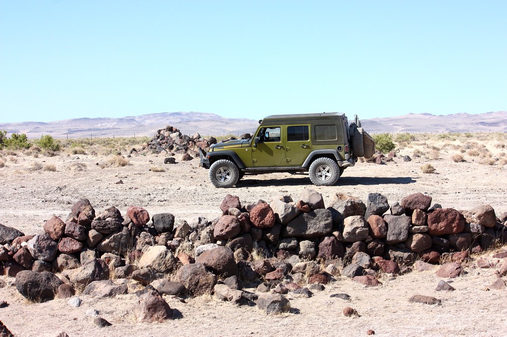
The trail north runs below the Cocoon Mountains. The route encounters the Pony Express near Rock Springs. In 1860 the Overland Stage was taking 22 days to deliver mail, on their faster Southern route from New York to San Francisco, until the Pony Express stepped it up to 10 days on the Northern route.


Pony Express by Overland Frontier, on Flickr

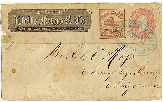
Pony Express and Overland Stage Mail by Overland Frontier, on Flickr

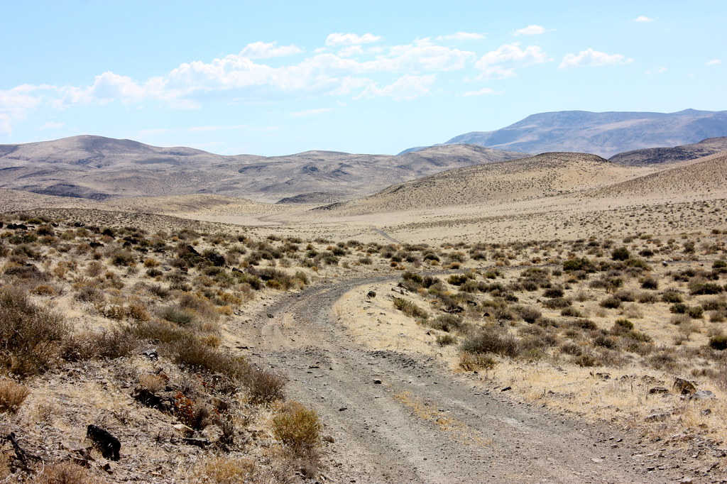
Traveling the roller-whoops along the Pony Express Route.


Pony Express Trail. by Overland Frontier, on Flickr

The Pony Express followed the Overland Stage Route except where they could take cross-country short cuts. This section was one of those, until Indian Wars forced the Overland Stage South of Carson Lake, on the Pony Express short cut.


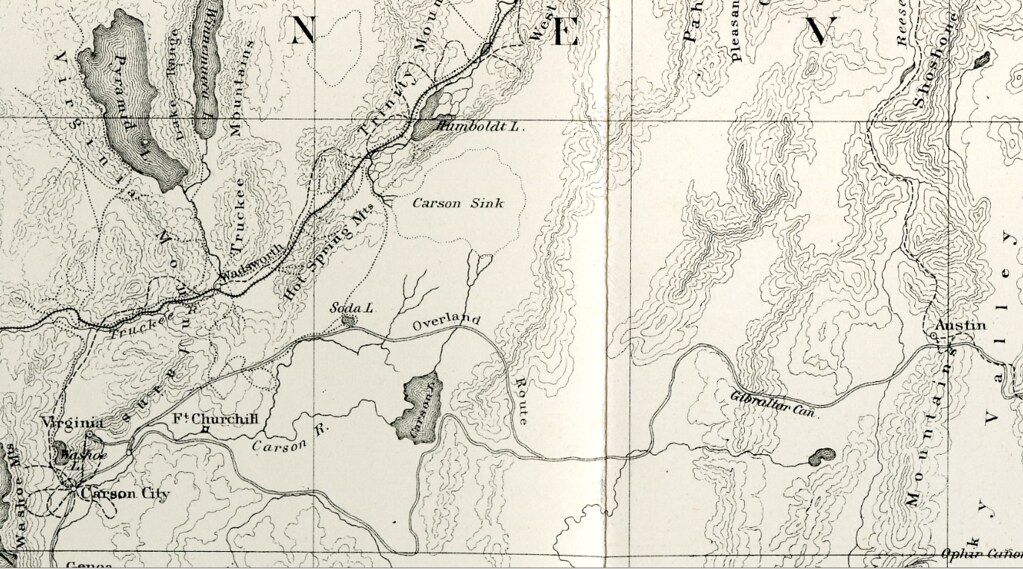
1867 Geological Exploration of the Fortieth Parallel by Overland Frontier, on Flickr

As the Pony Express crosses Bass Flat, private land required a by-pass around Carson Lake. Timothy O'Sullivan photographed his darkroom wagon at Carson Sink, just North of here, as the official photographer of the Geological Exploration of the Fortieth Parallel, in 1867.
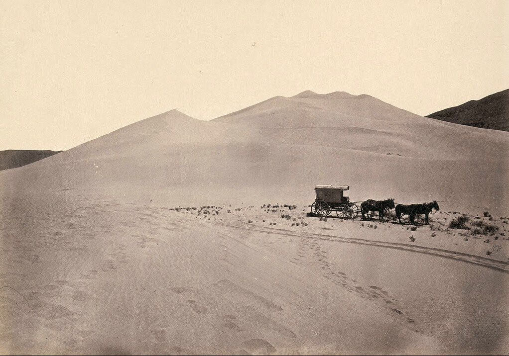

Carsons Sink. by Overland Frontier, on Flickr

Thanks to our GaiaMaps App (what a deal for $20 unlimited use), we were able to discover and travel along a little original section of the Pony Express. We used the app on our iPad to retrace the PonyX on USGS maps. At first, we mistakenly followed the trail along the drainage cannel, but found the gate just South, was right inline with the old XP route.

Some sections of the Pony Express see very little traffic and require a GPS to be followed. We were encouraged that we were indeed on the original route, when we came across celebrated remains of Telegraph poles.


Pony Express Route - Telegraph Pole by Overland Frontier, on Flickr

The completion of the national telegraph line put an end to the Pony Express, bringing the 18 month rocket ride to a grinding halt in 1861 – but not before playing a valuable role in the Civil War effort for President Lincoln, by keeping the caretakers of this massive wealth onside with the Union.


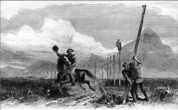
Telegraph Line, the end of the Pony Express. by Overland Frontier, on Flickr

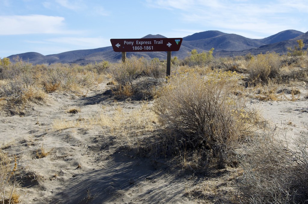
Even though were following a live GPS map that showed, in real-time, that we were on/near the original trail, it was reassuring to run into posted XP signage – it was a kick.


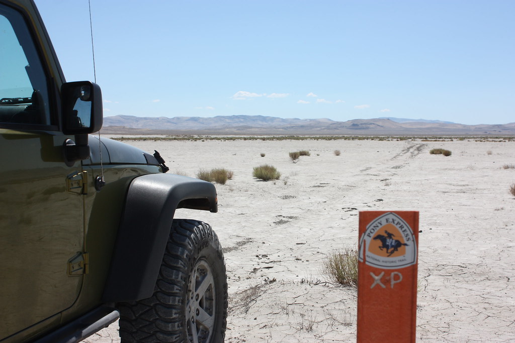
Pony Express Trail Marker. by Overland Frontier, on Flickr

Parts of the Pony Express have become a more defined road that, during Indian wars, was also used by the Overland Express Stage.

Pony Express & Butterfield Overland Stage Route. by Overland Frontier, on Flickr

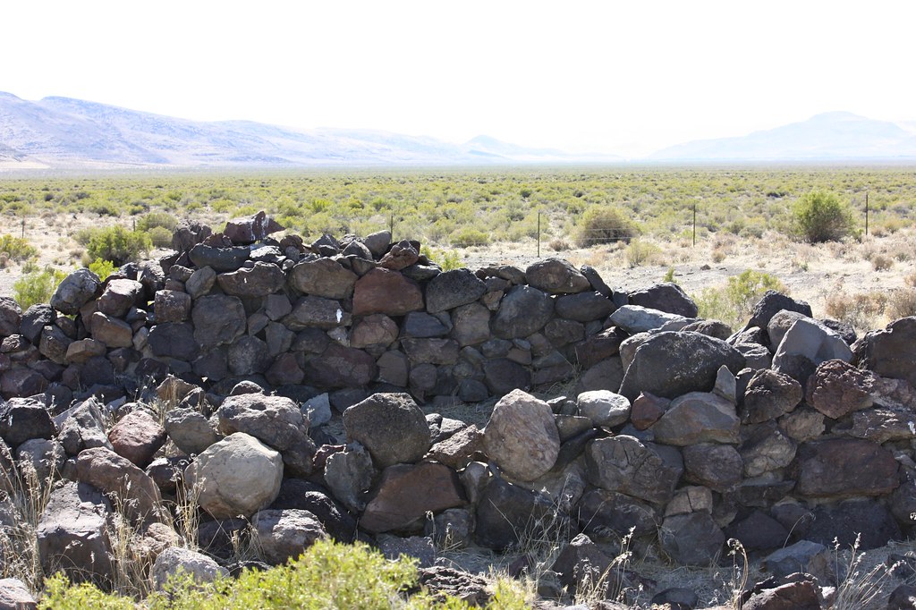
Relay stations that are 12-15 miles apart. Our USGS maps guided us, in a round about way, to the ruins of Desert Station and the surviving Buckland (home) Station.
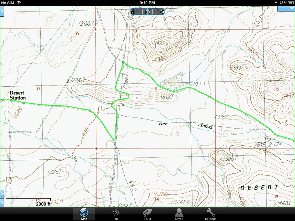

Desert Station Map. by Overland Frontier, on Flickr

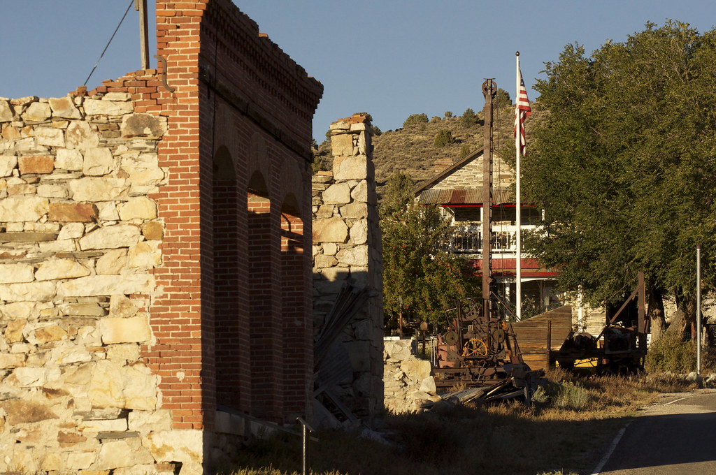
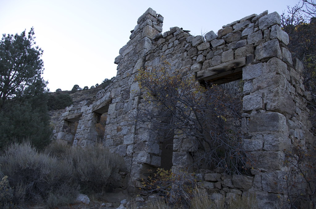
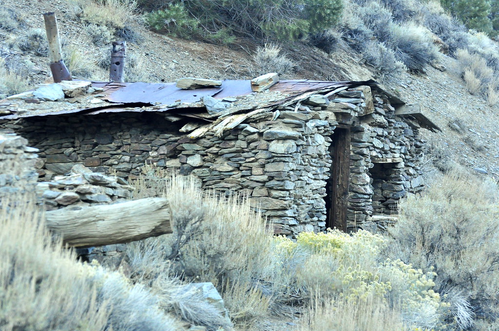
Desert (relay) Station ruins. It is surprising to see how much of the station and nearby stable remains considering it was built 150 years ago and was only used for 18 months, and faced many Indian attacks.


Pony Express Desert Station and Stable by Overland Frontier, on Flickr

Pony Express Station Ruins. by Overland Frontier, on Flickr

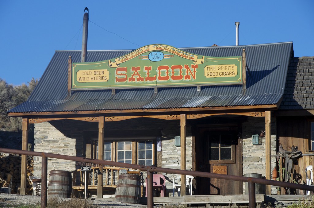
Samuel Buckland settled here in 1859 just in time to establish a log and tent hotel/saloon/stopping house for the Overland Stage and the Pony Express. Each one-way XP delivery took 75 horses. Superintendents set up “Home Stations” every 65 to 100 miles to ensure replacement horses; feed and food were available for regional relay stations. A new Buckland Home Station was built with salvage windows and doors purchased from Fort Churchill, when the nearby post was closed in 1869.

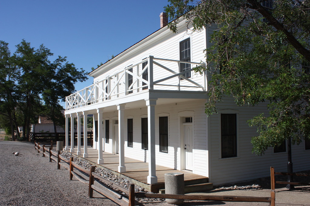
Buchanon Ranch, Overland Stage and Pony Express Station. by Overland Frontier, on Flickr

Buckland Station was used as an assembly station for volunteers during the 1860 Pyramid Indian Wars. Nearby Fort Churchill was erected in 1861 to help reduce friction with natives. Considerable adobe ruins survive

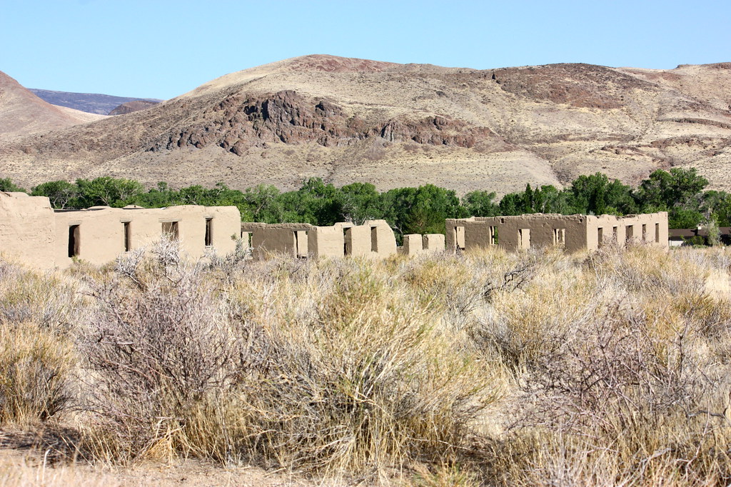
Fort Churchill Adobe Ruins. by Overland Frontier, on Flickr

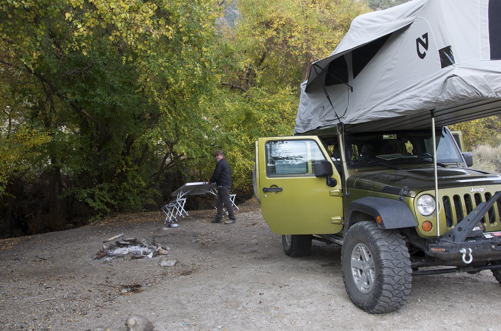
We have just enhanced our free on-line Scouting Report sequential slideshow documentary of the route explored to 49 photos and maps, including several great additional dispersed campsite regions near Fort Churchill; a perfect springboard for a full day in Virginia City, once of the best boomtown survivors in America – our next post. Check out:

http://www.overlandfrontier.com/trek-legs/berlin-side-door-pony-express-and-ft-churchill

Our free GPS/GPX Tracklog for the full three Trek Leg series, can be found at:

http://www.overlandfrontier.com/trek-series/nevada-pony-expressoverland-stage-route-virginia-city

Hope this thread helps inspire you to plan your own journey and get out there.

If you like this type of route coverage, we could use your help with a ‘Like' on Facebook.
 
Last edited:

chmura

Adventurer
Amazing trip!

Quick question how did you get to the Havasu Falls? Did you hike from the Supai Hill Top?
 

mercier@streetsmart.ca

Expedition Scout

dar395

Adventurer
Great trip and report write up. We like this area a lot and would enjoy these trails next fall, some of your post to called it (Easy) looks like we could do it in 2WD Van, we do have suspension upgrades, 10 ply tires and a winch. What's your thoughts?
 

mercier@streetsmart.ca

Expedition Scout
Great trip and report write up. We like this area a lot and would enjoy these trails next fall, some of your post to called it (Easy) looks like we could do it in 2WD Van, we do have suspension upgrades, 10 ply tires and a winch. What's your thoughts?

Sounds like this is not your typical 2x van, and I’m assuming you have sufficient clearance. Trails rated Easy on our site, in many cases, could be traveled by a properly equipped/powered 2x. There are some sections that could cause a 2x trouble, but a driver that has experience with choosing a line can or stacking rocks can often overcome eroded sections and a set of Maxtrax may help with soft/hi-centered sections.

Not sure if you have had time to look at the more detailed information on the routes that interest you from this thread, provided in Journey Overviews and detailed Trek Leg Scouting Reports on OverlandFrontier.com, but they may help plan and evaluate segments. Just a heads up, most photos make things look easier than they are.

For starters, you might want to look at our Nevada Ghost Towns and Iconic Trails Journey.

http://www.overlandfrontier.com/journey/nevada-ghost-town-iconic-trails-journey

Stage One, Legs 1, 2 and 3 if you avoid the moderate-difficult options, may work you. From Rhyolite, there is a great Easy road through Red Pass and Titus Canyon that you should consider, but I would not recommend taking Oriental Wash option to Gold Point, it has many soft-sand sections that get frequent flash floods. Instead look at highway 268 past Scotty’s Castle to Bonnie Clair Mine. From there, there is a long series of mine roads that link great ghost towns/survivors of Gold Point, Tonopah, Goldfield and Belmont. Not sure if the 10,000’ Ophir Pass is suited, it is pretty steep on the East side of summit and can have some soft-eroded sections without a lot of room for turning around (but easier coming from west). But backroads from Belmont to Austin, including the exciting Union Pass provide a great option to reach the Pony Express, where some sections can be done with 2x as you approach Virginia City.

To be fair, what is Easy one day, can be difficult the next. Getting stranded in the desert is not something to be taken lightly. Of course you can, in most cases, turn around or take another route providing you have the printed maps and even better the additional aid of GPS to help navigate around unexpected obstacles. There are so many trails in desert it is easy to get mixed up. Also you just don’t know alternatives are suited to 2x. I like to pre-research options before I leave, so I have some back ups.

I have a “Go Prepared” section on our website you might find helpful:

http://www.overlandfrontier.com/go-prepared

Hope this helps. Let me know if you have any questions on other sections featured in our thread.
 

grogie

Like to Camp
What amazing adventures! Thanks for sharing the photos and details.

Plus, if I had a JKU, I'd also have that tent! What an ultimate RTT!
 

justcuz

Explorer
Excellent trip report! I really like the way you share your mapping, your pictures are good and the photo captions are just right.
I'm drooling over the pictures of the old Jeeps and GMC pickup
The truck in Berlin looks to be a 20's Dodge. The radiator and parallel leaf springs are a dead giveaway it's not a Model T.
The Dodge brothers did provide parts to Henry Ford for the Model T before striking out on their own though.
 
Last edited:

parkkitchings

Adventurer
Well done sir and a great website. Thanks for posting.

Clapping%20hands.gif
 

Forum statistics

Threads
185,839
Messages
2,878,749
Members
225,393
Latest member
jgrillz94
Top