Rumpig
Adventurer
DAY 18 - STRAHAN
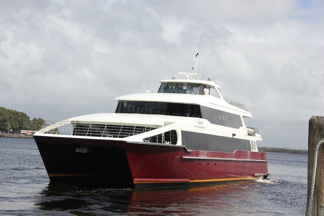
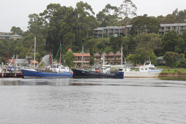
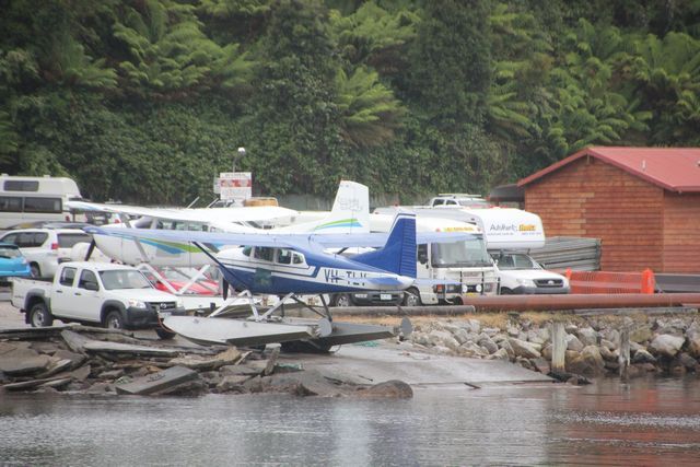
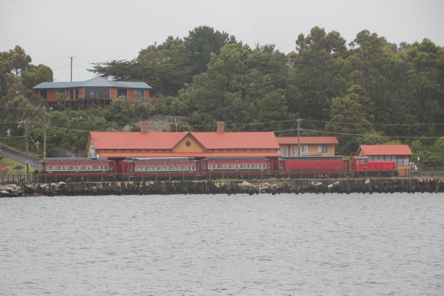
We wake to a wet miserable morning, it's not a big deal though, as today we'll be on a boat and undercover most of the day anyhow. We have a quick brekky then head on into Strahan for our day out on the water. There's 2 different main companies who run Gordon River cruises here in Strahan, we are heading out today with World Heritage Cruises, who operate "The Big Red Cat". Both companies run out of the same location in the centre of town, we arrive about 40 minutes before departure time to try and ensure we get a carpark nearby, which we manage to do. Much of todays boat cruise will be done on Macquarie Harbour, it's the 2nd largest natrual harbour in Australia behind Port Philip Bay, which we sailed out of Melbourne on when we caught the ferry over here to Tasmania. I am surprised to learn that Macquarie Harbour is actually 6 times larger then Sydney Harbour. The boat sets sail pretty much on time and as we leave Strahan i grab a few pics of the town from the water. Fishing boats, sea planes, unit complexes and a steam train pretty much sums this town up really. Like i mentioned previously already, Strahan thrives on the tourist trade, there's a heap of unit complexes and other rooms to rent for accomodation here in town, and things like the Wilderness Railway and River Cruises provide much needed employment opportunities for the town. If you're not envolved in tourism then fishing is another major industry for the town, there's a few small saw mills about the area also, but other then the usual small businesses providing essential services in any town, there doesn't appear to be much else to do as a job around these parts.
THE BIG RED CAT
FISHING BOATS AND UNIT COMPLEXES, THAT PRETTY MUCH SUMS MUCH OF STRAHAN UP REALLY
THERE'S A FEW SEA PLANES AVAILABLE FOR CHARTER HERE IN TOWN
WEST COAST WILDERNESS RAILWAY TRAIN...we'd hoped to go on this tomorrow, but it doesn't run out of Strahan on weekends
The first location the cruise heads for today is out front of where we are currently camped at the moment, it rains on and off as we head to this location, but as we near Hells Gate the rain pretty much disappears and the rest of the day whilst overcast, stays pretty dry.
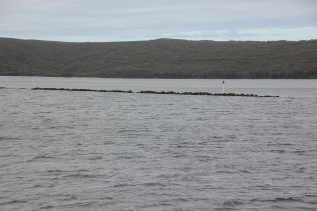
Hells Gate is the name given to the entrance where Maquarie Harbour and the Southern Ocean meet, it's a very shallow harbour entrance and only 120 metres wide, so you don't have much room for error when it comes to navigation here. Back in the early 1800's prisoners on the newly established penal settlement of Sarah Island named this spot Hells Gate, as conditions were so bad at this settlement, that entering the harbour to go here was like entering through hells gates.
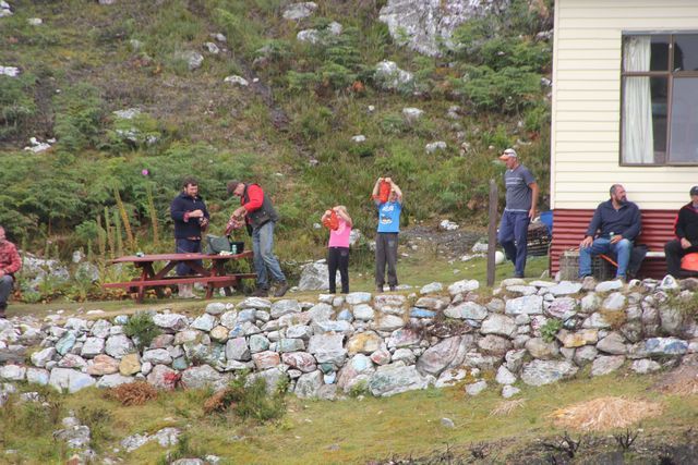
As we crooze out through Hells Gate into the Southern Ocean and then turn back around to head into the harbour again, we are given a running commentary by the ships captain on the history of this area. Cruising back into the harbour we note the break water wall to our right that is built here, it was built back in 1900 to help make the harbour entrance a safer place to navigate through. Also to our right is a house on what appears to be an island at first glance, but is in actual fact still part of the mainland, and is Macquarie Heads. The locals that live here have a routine where they show off to the tourists their daily catch of crayfish, and it appears they done alright for themselves by the looks of it.
PART OF THE BREAK WATER WALL AT HELLS GATE
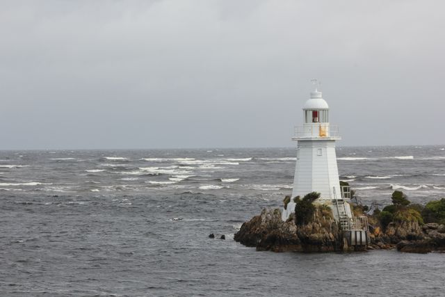
HEADING OUT THROUGH HELLS GATE...you need to go to the left of Entrance Island, it's to shallow to the right for boats to pass through
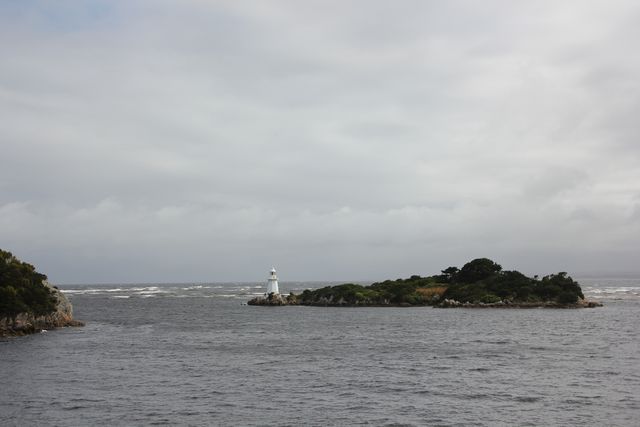
ENTRANCE ISLAND LIGHTHOUSE
LOCALS AT MACQUAIRE HEADS HOLDING UP TODAYS CATCH OF CRAYFISH (the adults held some up also, but i missed that in my pic taking)
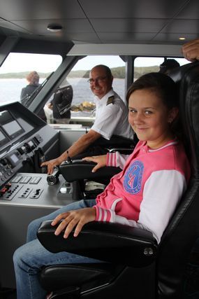
From Hells Gate we head towards Sarah Island where we will disembark the boat for a short while for a guided tour of the island. As we crooze through the harbour though, we are free to explore the boats different floor levels, and you can even join the captain up top and be his co-pilot for a while you want. I grab a few pics of my girls sitting beside the captain in the co-pilots seat, he's a nice easy going type of a guy, happy to answer any questions you might throw at him.
MY 2 GIRLS....TODAYS CO-PILOTS OF THE BOAT
Heading for Sarah Island we get to witness firsthand just how huge the fish farming industry is here in Tasmania. I've already mentioned this fact a few times previously in my report, but here in Macquarie Harbour we see it on a grand scale, everywhere we look there's pens floating on top of the water, it's quite the unexpected sight to see in such a prestine location. The captain pulls the boat up beside one of the pens and gives us a close up look, a few of the fish suddenly leap up out of the water into the air, they must think it's feeding time i reckon. It's a quick stop at the fish farming pen and we are back on our way onroute to Sarah Island once again.
ONE OF THE MANY FISH FARMING SET UPS IN MACQUARIE HARBOUR
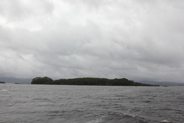
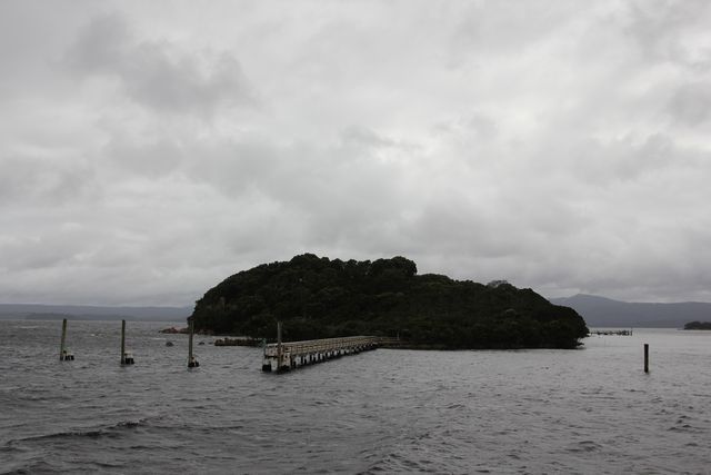
It's not long and Sarah Island comes into view, this island operated as a penal settlement from 1822 - 1833. The colony had a reputation as one of the harshest penal settlements in the Australian, It took the worst convicts and those who had escaped from other settlements. The chances of escape from Sarah Island were thought to be next to impossible, but many people did manage to escape, the most infamous of these being a prisoner by the name of Alexander Pearce. Alexander managed to escape the island twice, but this alone is not what makes him infamous. What makes him infamous is the fact that, both times he escaped he cannibalized his fellow escapees that escaped with him. Alexander was eventually captured and hanged and dissected in Hobart for murder.
Sarah Island is not a very big island at all, surprisingly though at one stage it became Australia's largest shipbuilding yard, using it's convict labour to do the work.
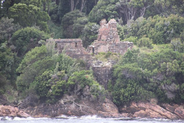
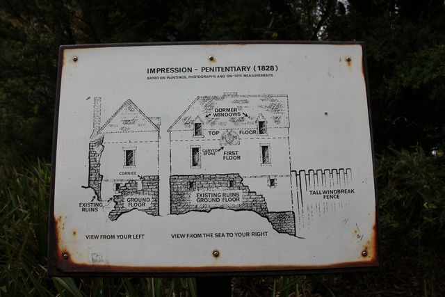
We disembark the boat and do the guided walk around the island, you're free to explore the place at your leisure if you like also, just make sure your back not long after the boat sounds it's horn, or they'll go without you. The people leading the tours give a great account of the islands past, to say the guy who is leading our tour is enthusiastic would actually be an understatement i reckon. There's quite a few ruins located around the island, but unlike Port Arthur that we visited previously where large buildings are still standing, most of the stuff here is much smaller in size and fallen down or just not a lot of it left....it's still good to see none the less.
The boats horn sounds and we make our way back to it, we jump back onboard ready to head up the Gordon River from here.
SARAH ISLAND....IT'S NOT REAL BIG IN SIZE
IT'S THIS BIG.....
BY THIS BIG.....
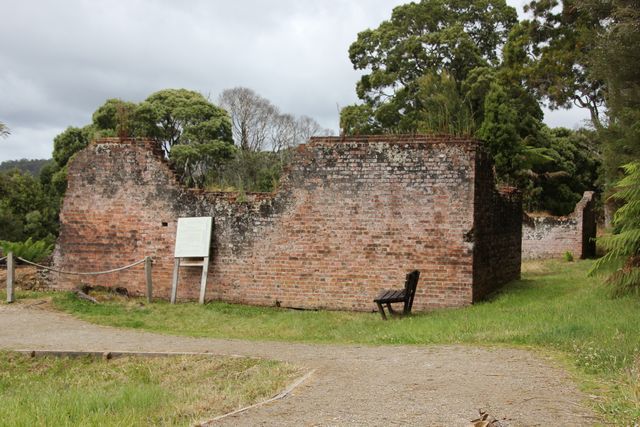
PENITENTIARY RUINS YOU SEE AS YOU ARRIVE AT THE ISLAND
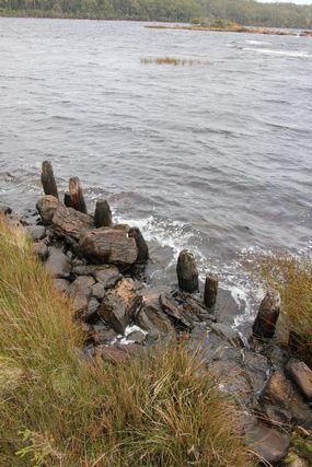
WHAT'S LEFT OF THE WIND BREAK FENCE THAT ONCE PROTECTED THE ISLAND
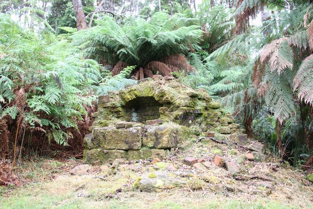
SOME RUINS WE SEE ON THE ISLAND
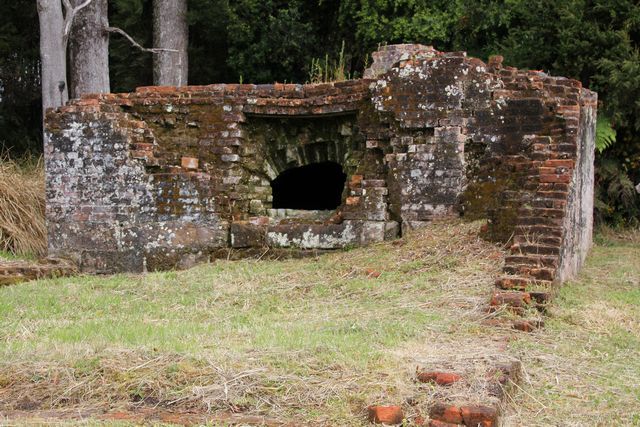
THE BAKEHOUSE
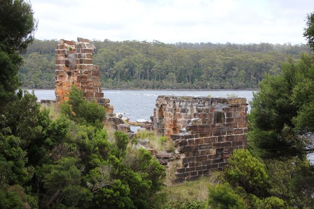
THE PENITENTIARY FROM THE LAND THIS TIME
TO BE CONT.....
We wake to a wet miserable morning, it's not a big deal though, as today we'll be on a boat and undercover most of the day anyhow. We have a quick brekky then head on into Strahan for our day out on the water. There's 2 different main companies who run Gordon River cruises here in Strahan, we are heading out today with World Heritage Cruises, who operate "The Big Red Cat". Both companies run out of the same location in the centre of town, we arrive about 40 minutes before departure time to try and ensure we get a carpark nearby, which we manage to do. Much of todays boat cruise will be done on Macquarie Harbour, it's the 2nd largest natrual harbour in Australia behind Port Philip Bay, which we sailed out of Melbourne on when we caught the ferry over here to Tasmania. I am surprised to learn that Macquarie Harbour is actually 6 times larger then Sydney Harbour. The boat sets sail pretty much on time and as we leave Strahan i grab a few pics of the town from the water. Fishing boats, sea planes, unit complexes and a steam train pretty much sums this town up really. Like i mentioned previously already, Strahan thrives on the tourist trade, there's a heap of unit complexes and other rooms to rent for accomodation here in town, and things like the Wilderness Railway and River Cruises provide much needed employment opportunities for the town. If you're not envolved in tourism then fishing is another major industry for the town, there's a few small saw mills about the area also, but other then the usual small businesses providing essential services in any town, there doesn't appear to be much else to do as a job around these parts.
THE BIG RED CAT

FISHING BOATS AND UNIT COMPLEXES, THAT PRETTY MUCH SUMS MUCH OF STRAHAN UP REALLY

THERE'S A FEW SEA PLANES AVAILABLE FOR CHARTER HERE IN TOWN

WEST COAST WILDERNESS RAILWAY TRAIN...we'd hoped to go on this tomorrow, but it doesn't run out of Strahan on weekends

The first location the cruise heads for today is out front of where we are currently camped at the moment, it rains on and off as we head to this location, but as we near Hells Gate the rain pretty much disappears and the rest of the day whilst overcast, stays pretty dry.
Hells Gate is the name given to the entrance where Maquarie Harbour and the Southern Ocean meet, it's a very shallow harbour entrance and only 120 metres wide, so you don't have much room for error when it comes to navigation here. Back in the early 1800's prisoners on the newly established penal settlement of Sarah Island named this spot Hells Gate, as conditions were so bad at this settlement, that entering the harbour to go here was like entering through hells gates.
As we crooze out through Hells Gate into the Southern Ocean and then turn back around to head into the harbour again, we are given a running commentary by the ships captain on the history of this area. Cruising back into the harbour we note the break water wall to our right that is built here, it was built back in 1900 to help make the harbour entrance a safer place to navigate through. Also to our right is a house on what appears to be an island at first glance, but is in actual fact still part of the mainland, and is Macquarie Heads. The locals that live here have a routine where they show off to the tourists their daily catch of crayfish, and it appears they done alright for themselves by the looks of it.
PART OF THE BREAK WATER WALL AT HELLS GATE

HEADING OUT THROUGH HELLS GATE...you need to go to the left of Entrance Island, it's to shallow to the right for boats to pass through

ENTRANCE ISLAND LIGHTHOUSE

LOCALS AT MACQUAIRE HEADS HOLDING UP TODAYS CATCH OF CRAYFISH (the adults held some up also, but i missed that in my pic taking)

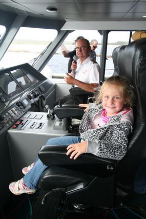
From Hells Gate we head towards Sarah Island where we will disembark the boat for a short while for a guided tour of the island. As we crooze through the harbour though, we are free to explore the boats different floor levels, and you can even join the captain up top and be his co-pilot for a while you want. I grab a few pics of my girls sitting beside the captain in the co-pilots seat, he's a nice easy going type of a guy, happy to answer any questions you might throw at him.
MY 2 GIRLS....TODAYS CO-PILOTS OF THE BOAT


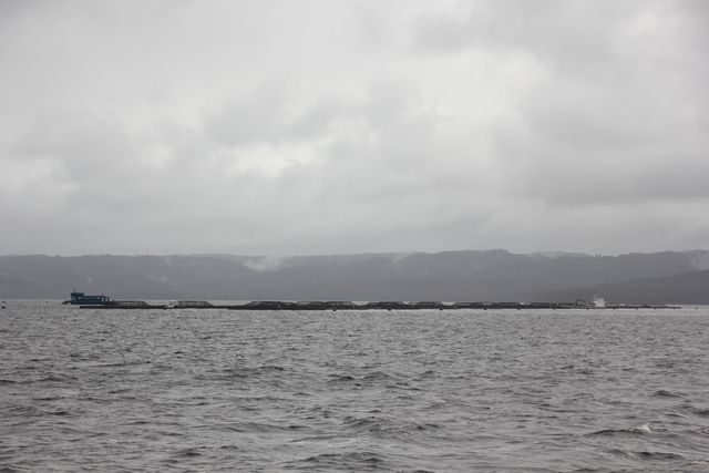
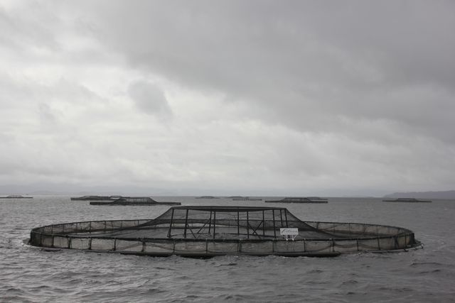
Heading for Sarah Island we get to witness firsthand just how huge the fish farming industry is here in Tasmania. I've already mentioned this fact a few times previously in my report, but here in Macquarie Harbour we see it on a grand scale, everywhere we look there's pens floating on top of the water, it's quite the unexpected sight to see in such a prestine location. The captain pulls the boat up beside one of the pens and gives us a close up look, a few of the fish suddenly leap up out of the water into the air, they must think it's feeding time i reckon. It's a quick stop at the fish farming pen and we are back on our way onroute to Sarah Island once again.
ONE OF THE MANY FISH FARMING SET UPS IN MACQUARIE HARBOUR


It's not long and Sarah Island comes into view, this island operated as a penal settlement from 1822 - 1833. The colony had a reputation as one of the harshest penal settlements in the Australian, It took the worst convicts and those who had escaped from other settlements. The chances of escape from Sarah Island were thought to be next to impossible, but many people did manage to escape, the most infamous of these being a prisoner by the name of Alexander Pearce. Alexander managed to escape the island twice, but this alone is not what makes him infamous. What makes him infamous is the fact that, both times he escaped he cannibalized his fellow escapees that escaped with him. Alexander was eventually captured and hanged and dissected in Hobart for murder.
Sarah Island is not a very big island at all, surprisingly though at one stage it became Australia's largest shipbuilding yard, using it's convict labour to do the work.
We disembark the boat and do the guided walk around the island, you're free to explore the place at your leisure if you like also, just make sure your back not long after the boat sounds it's horn, or they'll go without you. The people leading the tours give a great account of the islands past, to say the guy who is leading our tour is enthusiastic would actually be an understatement i reckon. There's quite a few ruins located around the island, but unlike Port Arthur that we visited previously where large buildings are still standing, most of the stuff here is much smaller in size and fallen down or just not a lot of it left....it's still good to see none the less.
The boats horn sounds and we make our way back to it, we jump back onboard ready to head up the Gordon River from here.
SARAH ISLAND....IT'S NOT REAL BIG IN SIZE
IT'S THIS BIG.....

BY THIS BIG.....

PENITENTIARY RUINS YOU SEE AS YOU ARRIVE AT THE ISLAND

WHAT'S LEFT OF THE WIND BREAK FENCE THAT ONCE PROTECTED THE ISLAND

SOME RUINS WE SEE ON THE ISLAND


THE BAKEHOUSE

THE PENITENTIARY FROM THE LAND THIS TIME


TO BE CONT.....


")


