Brisbane to Tasmania and back again....an Australian 7 week adventure

Rumpig

Adventurer
Our look about the park completed, it's time to head back towards Scottsdale so we can find somewhere to camp the night. We drive back to Scottsdale the same way we drove to Legerwood, normally at this time of year Scottsdale would be surround by lavender farms in full bloom, but it appears as though they have recently harvested most of the fields we can see from the road, so we miss out on seeing what is supposed to be a pretty spectatcular sight here normally. We pass straight through Scottsdale without stopping and head on towards Bridport. Reaching the intersection where you turn left to head to Bridport, we turn right onto Waterhouse Road. We can see on our maps there's a heap of camp areas up ahead off of Waterhouse Rd, so our plan is to drive in and have a look at them and see if we can't find somewhere suitable to stay the night. We soon take a left turn off of Waterhouse Rd to head into a camp area shown on our maps, i can't recall the name of it (think it was called something Waterhole maybe?), but after a shortish drive down a dirt track to access the campground we end up at this horrendous place that has absolutely zero appeal at all about staying here. To top it right off, it smells like an animal has died nearby aswell, so we turn around and head back to the main road to continue our search. Eventually we again turn left off Waterhouse Rd and follow another dirt road for quite a distance into Waterhouse Reserve, to a place called Waterhouse Point / Mathers Camp Area. We have a drive about the place and find ouselves a nice little camp spot big enough for both our vehicles and campers to fit into. We set the trailers up for the night and then grab a drink each and head down to the beach for a look around. There's no water views from our campsite here, but the beach is literally only a stones throw away from us. Out on the beach the place is deserted, there's a couple of other campers set up in the campground, but the place isn't what you'd call super busy by any means. The kids have a run around on the sand and i take a few pics of the place also. Off in the distance across the water from us, we can see what i think is Mussleroe windfarm, but i'm not 100% on that.
With the afternoon sun starting to set it's time to head back to camp and think about getting dinner going. We don't have any firewood with us at all, so the night is spent having dinner and a few drinks, before then calling it a night pretty early.

I THINK FROM MEMORY THIS WAS WATERHOUSE ISLAND WE SAW ON THE DIRT ROAD INTO CAMP


THE BEACH THAT IS A STONES THROW AWAY FROM WHERE WE ARE CAMPED AT


MUSSELROE WINDFARM (WE THINK ?) OFF IN THE DISTANCE


PLENTY OF SEAWEED OR KELP MAYBE? WASHED UP ON THE BEACH HERE


Rumpig

Adventurer
sorry for the slow updates to anyone reading this, my computer crashed last weekend so i had to sort that out, and i've been prety busy of late also, so haven't had much spare time to write this.

DAY 34 - WATERHOUSE POINT - BAY OF FIRES

We wake to a cracka of a morning and have an easy pack up of the camper seeing we didn't set very much of it up on arrival yesterday afternoon. Camper packed away, we then have a quick breakfast before departing for our next destination, which we are thinking will be Policemans Point at the entrance to Ansons Bay on the Eastern coastline. First stop for the day though is a few minutes drive away at the Village Green camp area of Waterhouse Point, which we just want to stop in at to see what it looks like. We drive the very short distance away and upon arriving at this camp area find it's completely deserted, not a sole to be seen. We do a quick lap around the campground, and whilst this camp area doesn't look to bad, i reckon where we stayed last night at Mathers camp area is a nicer spot to stay. One upside though if we'd choosen to stay at this spot is it's toilet block was actually in working order, unlike where we were (there was a fairly newish building with 2 toilets located in it here)...luckily we are fully self sufficient with our chemical toilets, so that wasn't an issue for us last night. Our quick scout of the area done and we head back out to the main drag / Waterhouse Rd via the same dirt road we drove into here on yesterday afternoon. Reaching Waterhouse Rd we take a left turn and then head for the town of Gladstone.
Waterhosue Rd at the start of todays drive is still a bitumin road, but once you get a short distance past the turn off to the township of Tomahawk (I've never been there, but i'd assume this place is a pretty tiny town going on just where it's located at) the road will eventually become a dirt / gravel road for quite some distance on the run into Gladstone. The road itself is a pretty good gravel road that in dry conditions would be fairly easily negotiated by 2wd vehicles, but this didn't stop us from having our first casuality of the day. Jeff who was leading the drive today calls me up on the uhf radio and says he has a problem and needs to pull over, when we eventually reach where he has stopped at on the side of the road (we are driving a fair way back from them to stay out of the dust), i find Jeff is tipping out a can of beer onto the ground. Jeff said the can was sitting in the rear cargo area and got a hole in it, he could smell the beer from his drivers seat so stopped to have a look and found the can leaking... i think i could almost see a tear in his eye as he tipped the left over contents of the hot can out on the ground...lol

I RECKON HE'S WEARING THOSE SUNNIES SO WE CAN'T SEE THE TEARS WELLING UP IN HIS EYES...LOL


A quick reshuffle of stuff done in the back of Jeffs Cruiser and we are on the way once again. The rest of the drive into Gladstone is uneventful, we stopped one more time to have a look at an eagle which Jeff and Sara spotted sitting on a fence post, but by the time we'd caught up to them the eagle had sadly taken off, and it was heading for the hills in the distance.
Arriving in Gladstone Jeff needs to grab some fuel for his vehicle, i don't really need any myself but take the opportunity to top up anyhow as we have no idea exactly where we are headed next, or just how far away our next fuel stop will be. It's a bit of a strange set up they have here in this small town with their fuel bowsers, the main shop has a couple of bowsers located out the front of it, but if you want diesel fuel like we want, then across the road out the front of an old shed is a single bowser which is where they sell there diesel fuel from. We park our vehicles either side of the bowser and i shut the vehicle off without even thinking as to whether it will start again or not come time to leave. Being the fuel bowser is located across the road from the main shop itself there's a padlock that you need to get a key for to unlock it, so Jeff walks across the road to get it, and once we then have the lock undone we are able to start putting fuel into our vehicles. Vehicles refueled and it's time to leave, as you may have guessed my Crusier decides it's not going to start. We give it 5 minutes to think about starting, and whilst waiting another traveller pulls up in town wanting to use the diesel bowser. I give the vehicle another try and suddenly the engine roars into life, this intermittent problem is really starting to peeve me big time, but we'll lay off doing anything about it for as long as we can.
We head East out of town along Browns Bridge Rd, the road is currently bitumin as it is back in town, but not long after turning right onto North Ansons Rd to start heading South, it then becomes a gravel road once again. We start to keep an eye for firewood as we drive along this road, but the trees we are seeing here on the roadside don't look to be suitable for burning, and are more like the type that smoulder away not burning properly. Just as we start to see some decent types of trees about the area a touch further along this road, we spot an old Landcruiser ute sitting on the roadside selling firewood. We decide we'll just buy our firewood now instead of collecting it, so we pull up here and start loading it onto the back of my camper trailer. The firewood is $10 a pile, there's seperate piles sitting on the ground beside the Cruiser ute, so we decide to grab $20 worth. It's an honesty system as far as payment and the amount you take goes, located on a tree infront of the Cruiser is a tin screwed to one of it's branches, so we drop our $10 each into it then continue on our way to Policemans Point.

THE OLD CRUISER UTE ON THE ROADSIDE SELLING FIREWOOD....strangely enough the vehicle had Qld plates on it, and was in pretty good condition for it's age


IT'S AN HONESTY SYSTEM FOR PAYMENT


FIREWOOD LOADED UP, IT'S TIME TO HIT THE ROAD


From where we grab the firewood from it's not that far really before we are taking a right turn onto Ansons Bay Rd, we follow this road a touch then take a left turn onto South Ansons Rd, this road then takes you straight into the camp area of Policemans Point. We arrive at the campground and have a quick look for a place to set up camp, we find one spot that's about as close to the water as you can get, but we aren't exactly overwhelmed with it and it's going to be a pretty tight fit getting both camper trailers and our vehicles in here. There's only really a couple of camp sites here that are close by the water, trees obstruct most of any view of the water you have, so i wouldn't say the camp sites themselves are anything spectacular. Around the back a touch further away from the water is a large flat area you can also choose to set up camp in, but IMHO it's even less attractive of a spot to set up in, and whilst it's not shoulder to shoulder by any means, there is already people set up in this area currently. It's still pretty early in the day and we decide we aren't exactly overwhelmed with the camping spots here, so we'll head on elsewhere and see where we end up. Before leaving this spot though, we park the vehicles up and walk out onto the beach that is located here to check out the view. What the campground lacks as far as beauty goes, is certainly made up for with the water views that you'll find here. It's quite a pretty spot away from the campground itself, and i can see why some people might like staying here, but with all the beautiful spots we've stayed at around Tasmania so far, we just didn't feel like the campground itself here was all that nice.

SOUTH ANSON ROAD ON THE WAY INTO POLICEMANS POINT...ANSON BAY IN FOREGROUND AND THE TASMAN SEA IN THE BACKGROUND


LOOKING LEFT UP THE BEACH TOWARDS ANSON BAY


LOOKING RIGHT ALONG THE BEACH TOWARDS THE TASMAN SEA


From the campground we head back to Anson Rd, we turn left onto it and start heading towards The Bay of fires which is where we have decided we'll try and stay at for a few days now instead. The gravel road is in pretty good condition, we spot a few girls touring by bicycle along this route, they are certainly much keener then i'd ever be...lol. Before reaching the Bay of Fires we decide we'll take a back dirt road into the area, the first track we see on our GPS we want to take has a locked gate at it at the turn off, so continue on a touch further and take a left turn onto what i think looking at a map now is called Fire Rd. Now i'm only guessing looking at a map that this is the track we took, i know it calls it a road on the map, but trust me this was a track well and truely. I'm not going to say this was a hardcore track by any means, but it did have it's share of small wash outs along the way, and it was slowish going negotiating some areas with the trailers on the back. Very much to our surprise about halfway along this track we come across 2 X 2wd sedans coming towards us down a hill, they are trying to negotiate some of the washed away sections of track, and bottoming out in many places. They ask us what the track is like ahead of them, we tell them that if they take it real slow and pick the right lines they should hopefully get through to the main road, but in all honesty this isn't a track you'd want to be taking a 2wd drive sedan along, it calls for slightly more ground clearance then your average vehicle has. We bid the duo good luck and continue on our way, as we continue on we find that they've probably negotiated the worst of it already, so they should have made it back to the main road ok. Reaching the end of this track / road we make a right hand turn onto The Gardens Rd, we immediately cross over a bridge / causeway of some description, there's a largish lake to our right and the ocean is off to our left. Up ahead of us on The Gardens Rd is numerous camp areas for people wanting to stay at The Bay of Fires, we reach these and start to turn off into them one at a time, trying to find a spot to make camp for a few days. The first place we turn into is packed and no vacant spots available, we then decide to split up and start searching a few other camp ground areas, but no luck is to be had.... it seems this is a pretty popular area and there's nowhere vacant so far. We get to Swimcart Beach camp area and Jeff calls me over the uhf radio to say he's found a few vacant sites, so we drive in and eventually find where he's at, surprised to see the sites here have a magnificent water views. There's actually quite a few vacant sites in this area for some reason, many have a side slope on them and aren't really suitable to set our camper up on, but we find a spot big enough for both our campers that is flatish, so we set about making camp for the next few days.
With camp set up we have a bite to eat for lunch and then spend the rest of the day doing not much at all, other then admiring the view out front of camp. The kids play on the beach all afternoon and i even go for a walk down the Southern end of the beach to take some phots of the rocks. The beach sand here is nothing like what we have back home, it's almost gravel like in it's coarseness, and when you try and walk on it you sink into it due to the slope of the beach, it's actually a decent work out just walking along the beach as there's not really any firm sand at all to walk along. I take some pics of the rocks down the end of the beach before i eventually make way way back to camp to join the others, the day is absolutely glorious and the colour of the ocean is just spectatcular, it's not hard to see why so many people choose to visit here.
As the sun starts to set we get a fire going and spend the evening sitting around it, we manage to see not one but 2 shooting stars tonight, before eventually calling it a night and heading off to bed.

OUR CAMP SITE AT SWIMCART BEACH CAMP AREA, AT THE BAY OF FIRES


A PIC OF THE ROCKS AND OCEAN FROM THE SOUTHERN END OF THE BEACH


Rumpig

Adventurer
DAY 35 - BAY OF FIRES

Oh what a differance a day makes...absolutely gorgeous weather yesterday, but this morning we wake to very ordinary / overcast and rainy day. We actually knew this weather was coming though, the forecast that we've been keeping an eye on has a heap of rain expected to fall in the coming days over all of Tasmania. Looking back now this actually turned out to be the case for the state, record rainfalls were recorded throughout many parts of it. Hobart had it's highest 24 hour rainfall figure in 3 years, some areas like Taroona had their highest 24 hour rainfall in 54 years, and Eaglehawk Nest which we'd visited back in the first week of this holiday had it's highest 24 hr rainfall figure in 90 years, so the state was getting a pretty good drenching.

THE OVERCAST VIEW TODAY IS NOT AS PRETTY AS YESTERDAY WAS


The rain however was the least of our problems at the moment, we'd chosen to sleep in this morning being it was such a miserable day outside, but Jeff and Sara weren't so lucky in the getting sleep stakes. Their youngest boy had kept them up all night, he'd thrown up twice and was still running a temperature which he'd had all night also. Jeff says they need to take their young fella to a doctors, so i grab my phone and start searching to see if there's any such service in the nearby town of St Helens, and luckily enough this turns out to be the case. Never having driven around Tasmania before we have no idea how big certain towns are you see on a map, we'd actually find out later in the day that St Helens is a nice sized little town, it's got a hospital / medical clinic , decent sized grocery store, large hotel and plenty of small boutique shops for tourists to spend their money in on a rainy day just like today is. A quick call to the medical clinic is made and Jeff and Sara are told to bring him straight down there, so they grab their stuff and head off into town.
We don't have any real plans for today ourselves, we knew the rain was coming so today is going to be a bit of a lazy day, we'll head into town later on and restock the food supplies, and also look at having a nice hot shower somewhere also. With the sleep in we had today we don't end up having breakfast until nearly 10.30 a.m, and with that done and out of the way, i then find time to make an oppointment with the local barber. Well when i say local barber, i actually mean my wife here. It's been over a month since i had my hair cut, and my facial hair is starting to drive me a touch crazy now also. When it comes to hair cuts for me, it consists of using a set of hair clippers with no blade in it, and zipping that over my head and my face...job done!!! . So with this booking made, i then grab the generator out of the front of the camper, run a short extension lead off of it, and grab my hair clippers out. It's not a big job, but it kills off a half hour of a crappy day by the time i get ever thing out and put it away. Hair cut done and facial hair buzzed off with the clippers also, it's a good feeling.

THE MOBILE BARBERS SHOP


Nothing else to do around camp, we decide to head into St Helens to have a shower. Along the way we spot an old jetty on the side of the road that has fallen into a sad state of disrepair, so i pull the vehicle over and take a few pics of it. We also see about 8 black swans swimming in the water here, i'd noticed a heap of them back around the Hobart area in the first week of our holiday and at Eaglehawk Neck also. They aren't an animal we have back home, so seeing them here in Tasmania makes for a nice change.

OLD RUN DOWN JETTY WE SPOT HEADING INTO ST HELENS


Arriving in St Helens we spot Jeff and Sara at the local laundrymat as we drive through town, we give them a call on the phone as we drive past and find out that their young fella has been diagnosed with having tonsillitis....he's been prescribed some stuff to help him out, so hopefully he'll start to improve soon. We tell them we'll catch up with them later on, and head around to the Waterfront public toilets which have hot showers there for travellers to use. Arriving at the toilet block we find that the showers cost $2 for 3 minutes to use, we don't have any coins on us, so we head back down the road to the IGA grocery shop to get some. We grab some supplies and some change to use in the showers from here before then going to head back to the Waterfront, but as i try and start the vehicle to leave, it once again won't start. I pop the bonnet and give the fuel pump and solenoid a few taps with the handle of a large screwdriver in a frustrated attempt to try and get it working again, this does nothing... but after waiting a few more minutes it suddenly decides it'll start now. What i know now that i didn't know back then at the time, is this issue is heat related, if you cool the immobiliser down the vehicle will start no worries at all, something i'll realize in the coming days. The simple act of opening the bonnet of the vehicle for a while allows enough heat to escape the engine bay, that it'll then start again. This is obviously a temporary solution to help getting the vehicle running again, eventually the immobiliser will fail to the point where it doesn't start at all, something we are hoping won't happen before we get back home at the end of our holiday. If it gets to that point we'll try and bypass the immobiliser, but for now we are avoiding doing that.
With the engine running once again we head to the Waterfront and have a nice hot shower, there's only one shower in each of the mens and womens toilets, so as we did whilst there, you may have to wait your turn to get to use them. After we finsh our showers, Jeff radios us up on the uhf to see what we are doing, they've finished doing their laundry, so drive around to meet us at the Waterfront. We decide to go for a drive around the area and see what's about the place, the rain is absolutely pouring down right about now, so sitting inside a dry warm vehicle is a pretty good option at the moment we reckon. We head South out of town along the Tasman Hwy, the road skirts along the edge of Georges Bay here, and it's quite a pretty drive...well it would be even more so on a sunny day anyhow. We take a left turn off the highway onto St Helens Point Rd, and follow this all the way to it's end. We explore down a few side tracks whilst in this area, and even contemplate driving out onto the Peron Dunes, but not knowing what it's like out on the beach here, we don't fancy getting bogged and having to recover vehicles in the pouring rain, so decide to give it a miss...we'll come back here in the coming days when the weather is better.
Our look about done here we head back into St Helens, i stop to grab another pic of a jetty along the way, then we stop in town so that Leanne can visit a jewellery store to buy something. Sara had paid the store a visit earlier this morning whilst waiting for her laundry to finish being washed, she'd purchased a Pandora styled Tasmanian devil for her bracelet, and sadly for me had shown it to Leanne, so now guess who wants to buy one also. I wait in the vehicle with the kids whilst Leanne runs inside the store to buy what she wants, it may sound dangerous letting her loose in there on her own, but to be honest it's absolutely pouring with rain outside, and i just didn't want to venture out there in it...lol.

THE OTHER JETTY I PHOTOGRAPHED ON THE WAY BACK INTO ST HELENS


With the jewellery purchase completed we then head back to camp, we cook up some toasted sandwhiches for lunch to try and warm ourselves up some, and spend the rest of the arvo doing not much at all. We manage to go for a short walk along the beach inbetween rain showers, but the rain doesn't look like clearing any time soon. As the afternoon turns to evening Jeffs young fella is refusing to take his medicine, he's going downhill and running a decent temperature once again, so they decide they'll take him into the hospital at St Helens and see what they can do for him there. It's a pretty miserable night tonight, there's no fire to sit around due to the rain, so it'll be pretty early to bed for us all. Jeff and Sara eventually come back from the hospital and are happy that the staff there could manage to get some medicine into their young fella, he's passed out asleep now, and we are all about to do the same thing ourselves, it's just to cold and wet to be outside. So with the diesel heaters cranking away, it's off to bed we all go.
 

Rumpig

Adventurer
DAY 36 - BAY OF FIRES / PUB IN THE PADDOCK

We wake to an overcast morning, but atleast it's not raining today. I actually sleep in a tiny bit this morning due to getting very little sleep during the night. The wind picked up big time after we went to bed, and the flapping of the canvas tropical roof on our camper was driving me crazy. It rained for most of the night, and around 1.30 a.m i'd had enough of the canvas flapping, so went outside and climbed up on the camper and removed the tropical roof inbetween the rain showers. The main problem with doing this though as i'd found out last time i did it several years ago, is water has a tendancy to start to leak through the stitching in the canvas that's under the tropical roof, and this is exactly what happened last night. The leaking wasn't to bad really, but it played on my mind the rest of the night, and i kept waking up and shining the torch around inside the camper to make sure nobody, or none of our stuff was getting wet. I'd occasionally have a droplet of water splat on my head also whilst lying in bed trying to get back to sleep, and the constant creaking and groaning of the camper trailer hoop poles from the strong wind that was blowing was driving me crazy also...i doubt i got 2 hours sleep that night. Come about 6.00 a.m when the rain had stopped i manage to fall asleep for a while, hence the slight sleep in.
Jeff and Sara also had a disrupted nights sleep last night due to the wind, thier young fella is on the improve though, so that's a good thing. They find the 3 way fridge in the thier camper trailer has stopped working for some reason this morning, so we spend some time trying to fix it. Pulling the side access panel off the trailer to get to the back of the fridge, it appears the gas jet is blocked when we remove it, we try everything we can think of to unblock it, but have no luck. Eventually we get a small drill bit and drill the blockage out, but this ends up enlarging the hole that was in the jet. When we refit it back in position we immediately realise this "fix" isn't going to work, way to much gas is being let through the jet and it's not working how it's supposed to do. We decide to put the food and drinks from their 3 way fridge into the other 3 working fridges we have between us, and turn that fridge off for now until we can get a new jet for it somewhere.
With no luck fixing Jeffs fridge it's time to make breakfast, i then find the griller we normally cook our toast under has broken and isn't working also. The pipe the gas runs through in the griller itself has cracked through completely, most likely from the many corrugations the trailer has encountered over the years. The whole griller section is cactus and will need replacing, but thankfully we can still use the 2 burners that are on the stove top. Just to top the run of bad luck this morning right off, Jeff tries to use the compressor in his vehicle to pump up a ball for his kids, this decides it doesn't want to work also, but after some fiddling with it we manage to get it up and going again.
With brekky done and dusted it's time to hit the road to see some sights today, we are heading for The Pub in the Paddock at Pyengana for lunch, and St Columba Falls also which is just up the road a touch from there. First stop of the day though is at Binalong Bay, which is only a short drive up the road from camp. Located here at Binalong Bay is a viewing platform you can walk out onto, it has some nice views out over the ocean and the surrounding red coloured rocks this Bay of Fires area is renowned for having. We spend some time looking around here checking out the view and taking pics of the rocks also.

AS THE STATUE SAYS WHEN YOU DRIVE INTO TOW...WELCOME TO BINALONG BAY


PART OF THE VIEW FROM THE VIEWING PLATFORM


THE RED ROCKS THIS AREA IS KNOW FOR HAVING


ANOTHER SHOT OF SOME OF ROCKS TO BE FOUND HERE


AND ANOTHER PIC OF THE RED ROCKS


We finish up looking about here and then jump back in the vehicles and leave town on the road we came in on. Reaching the main intersection back at The Gardens Rd, we could turn left here and head into St Helens along the bitumin and then onto Pyengana from there, but we decide we'll head straight on instead onto Reids Rd, and take a scenic dirt road route to todays lunch stop instead. The drive along this dirt road is nothing super spectacular really, it's just a nice change from driving on bitumin roads and gets us away from most of the traffic. Reaching the end of Reids Rd we take a left turn onto Ansons Bay Rd and follow this down to the Tasman Hwy, we then take a right turn onto this and follow it for about 30klms. Reaching St Columba Falls Rd on our left we then take this turn off and soon find ourselves turning right into the driveway of The Pub in the Paddock. A heritage listed circa 1880 hotel, this pub whilst known for it's great feeds and relaxed country pub atmosphere, is more known for something else...and that's it's beer drinking pig. Yep you read that right, a pig that loves drinking beer.
More about the pig later though...we park the vehicles up and walk inside the pub to order some lunch and grab something to drink. Whilst ordering lunch i notice this pub sells the one thing i've been searching for to buy whilst on holidays here in Tasmania...and that's a t shirt of a decent pub that we've visited whilst here. None of the previous pubs we've stopped in at so far on this trip sell t shirts advertising themselves for some reason, i've bought t shirts from pubs at various locations all over Australia in our outback travels on previous holidays, but thought i was going to miss out on the doing the same thing whilst here in Tassie. Aswell as the t shirt we purchase a stubbie cooler from here also, so add in lunch for the family aswell as a few drinks, and the pub has done ok out of us today.

SIGN AT THE FRONT ENTRANCE OF THE PUB IN THE PADDOCK


THE ST COLUMBA FALLS HOTEL..AKA..THE PUB IN THE PADDOCK


Now as i mentioned earlier, this pub is well known for it's pig that loves drinking beer. Priscilla the beer drinking pig was a major draw card of the pub for many years, you could buy a stubbie of beer from the front bar and then walk outside and give it to her to drink (it's a special type of stubbie they sell, i think they must water it right down). Sadly though Priscilla has now gone to that big ham house in the sky, but in her place these days they have Pinky the Pig, so if you like you can purchase a special stubbie of beer from the bar and try your luck "feeding" it to her. I say try your luck for a very good reason, because for the entire time we were here at the pub, Pinky didn't move a muscle and was fast asleep in her house. If it wasn't for the fact i saw her ear twitch at one stage, i would have thought she was dead, and prime pickings for my next Sunday morning bacon and eggs cook up. The pig seriously didn't move an inch the entire time we were here, a few other people had purchased a couple of stubbies of beer thinking they could get to feed it to Pinky, but she was not the least bit interested / not even awake. It would have been nice to see the pig in beer guzzling action, but this wasn't to be the case today.

PRISCILLA THE BEER DRINKING PIG...THOUGH NOWADAYS IT'S ACTUALLY PINKY THE BEER DRINKING PIG


PINKY SLEEPING OFF A BIG NIGHTS BENDER I THINK


Lunch eaten and we head off from here to St Columba Falls, we turn right out of the drive way back onto the road, and the falls are only about 10 minutes drive away at most. Reaching the car park area we jump out and get ready to do the short walk down to the waterfall, we can actually see some of the falls from where we are parked, and with all the rain we've had the past few days about the area, there's a pretty decent flow going over them. The walk to the falls is only a short distance really, it's 600 mtrs each way, you return back along the same track you go to them on. Be aware though, the easy part of the walk is on the way there, it's downhill all the way to the falls, so on the way back it's uphill all the way. I won't say it's a hard work out by any means doing this walk, but those of you like myself who aren't exactly what you'd call fit, will be looking for a drink of water by the time you get back up to your car. As you get closer to the falls themselves you'll walk through a beautiful tree fern lined area, my pic below does the spot no real justice though. Reaching the falls and as i mentioned already the water is absolutely roaring down them today, it's not the prettiest sight you'll ever see with the torent of dirty brown water of recent days rains being funneled downstream, but it's certainly an impressive sight to behold none the less.

ST COLUMBA FALLS AS SEEN FROM THE CAR PARK AREA


TREE FERNS NEARER THE FALLS THEMSELF


THE RECENT RAINS HAD THE WATER ABSOLUTELY POURING OVER THE FALLS


SOME MUSHROOMS WE SAW GROWING BY THE SIDE OF THE WALKING TRACK


Back at our vehicles after viewing the falls and we head straight back to camp along the bitumin via St Helens, i manage to spot an echidna in a field on the side of the road along the way, but it was in an area of windy road and there was nowhere to stop to try and photograph it. Arriving back at camp and we find the wind is starting to pick up quite abit, the wind gusts are getting pretty full on actually and we are pretty exposed to it where we are. The wind has broken one of the rods in Jeffs toilet tent and it's also broken some tie down ropes on our toilet tent also, i end up packing up the tent, as it's not going to last in the wind we are currently experiencing. Looking out at the surf infront of camp and the waves are really dumping down hard at the moment, it's a very different scene to when we arrived here the other day, the waves making big booms as they crash ashore.

THE WAVES WERE REALLY DUMPING DOWN HARD ONSHORE


As the late afternoon goes on into the evening, the wind is getting worse by the minute, the gusts are getting pretty strong and it's not a real pleasent spot to be at the moment. Around 8.00 p.m and with Sara in the middle of cooking dinner for us all, we've had enough of the current conditions and make the massive call to pack up camp immediately, and to try and find somewhere more sheltered to stay the night. Sara was in the middle of cooking a meatloaf for dinner, she just ended up turning off their oven and leaving the meal sit inside there whilst we packed up and went elsewhere. Last night we got little sleep due to the buffeting we copped from the wind and rain, and tonight it was going to be even worse again. The weather forecast has the wind increasing in the coming days, so we knew if we stayed here we wouldn't get very much sleep at all, and there's the real possibilty the camper trailers could get damaged also. We leave camp and stop in to look at another couple of camp grounds closer towards Binalong Bay, hoping they are better sheltered from the wind. I find one spot that sort of seemed better sheltered at the start, but as soon as the wind started gusting once more, i knew it wasn't much better then where we'd just left from. We then decide we'll drive into St Helens and check out the free camp area they have in town there, we are hoping it's in a showgrounds or the like, and that we might find a building we can tuck behind to use as a wind break. Reaching the free camp in town we find this is not to be the case though, the spot you camp in is an open paddock, so it's just as bad as the place we'd left behind. I try ringing a few of the local caravan parks in the hope they might answer thier phone at this late hour of night, to see if they have any cabins available to stay in. As expected seeing it's now well after 9.00 p.m by now, none of them answer their phones and they all go to an answering service instead. We pass by one place that has a sign out front saying rooms to rent and try that number also, they atleast answer their phone but only have single bed rooms available, nothing suitable for families. Back in the centre of town now, and we pass by the Bayside Inn, it's probably the biggest hotel / motel complex in town, so we give it a call to try our luck. Thankfully the manager answers the phone and luck is very much on our side, they have several rooms available to stay in tonight, it costs $100 each room, but at the moment we don't really care about the cost, we just want somewhere to sleep that's out of this wind. So around 10.00 p.m we end up checking in here, and we then set about grabbing dinner out of Jeff and Sara's oven in their camper trailer. Sara tries as best she can to rescue dinner and give us something to eat, it's a bit of a lost cause in the end, but we don't really care that much, we're just glad to have a decent roof over our heads for the night. Around 12.30 a.m after a big day / evening, we then finally manage to head off to sleep
 

Rumpig

Adventurer
DAY 37 - ST HELENS - BICHENO

Up around 7.30 a.m this morning and the wind has died right off overnight, it's a pretty good day today actually. I walk across the road to the park that is here as i see a strange shaped sculpture like object of some sort, and i want to find out what it is. From a distance the object looks quite nice in appearance, but as i get closer i notice it's covered in mosaic tiles, and many of them have fallen off over the years, leaving a pretty run down looking object in a very nice park beside the water. Reading the plaque that is located beneath the object, i note it is called a Cosmic Egg & Time Capsule, and it's to be opened on Australia Day (January 26th for the non Aussies reading this) in the year 2026. Built back in 2006, i'm thinking this time capsule would have looked pretty nice when first completed, but the elements have definately taken their toll on it now, which is a real shame.

WHERE WE STAYED LAST NIGHT...pretty old and run down rooms really for $100 a night, but atleast we were out of the wind...i'd have happily paid double that to get out of that wind last night actually....lol


THE COSMIC EGG & TIME CAPSULE


I GUESS WE'D ALL LIKE THAT TO HAPPEN ONE DAY


Walking back to the motel room and it's time to load our clothes and what not back into the vehicle. With the room emptied out, we then walk around to the bistro they have here at the Inn and have a nice hot bacon and eggs breakfast. The bistro area and bar they have here is a lot more modern then the old rooms we were staying in out the back of this place, i'm thinking there's possibly more modern rooms available here then what we got last night, but beggars can't be choosers at 10.00 p.m at night.
It's time to hit the road now but we aren't leaving town just yet, we head back down to the RV park / free camp on the edge of town first of all, we are going to leave our camper trailers here for the day and go explore a few more of the local sights before heading on to our next camp. We are a touch worried about leaving the trailers here unattended, but after speaking to an elderly camper who'll be here all day and being told he'd keep an eye on them for us, and then chaining them both together, we reckoned they'd be ok. We take the opportunity whlst here to empty out the chemical toilets at the dump point and top up our trailers water supplies also, you can't complain about the facilities here for somwhere that's free to stay at that's for sure. Speaking of free...i haven't mentioned this previously, but the spot we were camped at the past few days is free of charge to stay at also, all around this Bay of Fires area is a heap of free camp spots to stay at actually, though National parks fees do apply in the Northern section of the park. The Bay of Fires is actually located in a Conservation Park, not a National Park, so dogs are apparently allowed to be brought in here also i believe.
Trailers offloaded for the day and we head back through town once again towards Georges Bay, we take the same left turn onto St Helens Point Rd that we took in the pouring rain the other day, and we head down that road past Steiglitz to the dirt track entrance for the Peron Dunes. You may recall we toyed with idea of going out onto the beach here the other day, but didn't want to risk getting bogged and having to recover vehicles in the pouring rain. Well today the weather is absolutely glorious, and it's now time for us to explore the dunes and the beach that is here. We have no idea what this beach is like to drive on, all we do know is that (according to Jeff) lowtide is supposed to be about a couple of hours away, so should something go wrong, in theory we should have heaps of time to get ourselves out of any trouble we find ourselves in.
We turn right onto the dirt road that leads from the bitumin and follow this for a short distance, we then turn down another track running off to the right and find a nice open flat area where a sign says to stop and deflate your tyres before going any further. We take this advice and i let my tyres down to 18 psi alround, we then head off up over the first dune of the day and pretty quickly find ourselves going down a nice long decent out onto the beach...that could be fun to get back up later on we say to each other over the uhf radios. Turning right once we hit the beach itself it's a pretty easy run South, the sand is firm for the most part, though there is the odd softer section to be found also. We drive about 3 klms South down this beach before reaching a rocky headland that stops us from going any further. We park the vehicles up here and let the kids out to have a play in the sand, we have the entire beach to ourselves right now, there's not another sole around. The kids have fun running around playing on the beach and we kick back and relax in the warm sun. Located right out infront of us we can see St Helens Island, the island forms part of the St Helens Important Bird Area because of its importance as a breeding site for seabirds. Whilst sitting here relaxing i notice something quite strange, and that's the fact that whilst Jeff reckons lowtide is still supposed to be about an hour away, the water from the waves breaking on the shoreline is gradually getting higher and higher up the beach. All of a sudden a few waves come right up nearer to our vehicles, so we suddenly decide it's time to make a move inland before we get washed away, and call time on the kids playing on the beach.

THE SIGNED TURN OFF TO PERON DUNES


DRIVING SOUTH DOWN THE BEACH


ST HELENS ISLAND OUT INFRONT OF WHERE WE PARKED UP


WE HAD THE ENTIRE BEACH TO OURSELVES TODAY


From where we'd parked up on the beach there was a track leading inland into the dunes, so we take this track and it's time for us to have some fun climbing up and down the sand dunes. Be aware that this area is able to be used by all types of recreational vehicles including dune buggies, so you need to keep a good eye out for others, but today there's only us driving about the place. It's here i'll express a word of caution...there's some pretty serious side slope action happening on some of the dunes you'll find here, many of the wheel tracks you'll see in here are likely formed by something other then a large 4wd vehicle, so don't go blindly following them over the edge of a dune. Jeff drove down one dune that i considered way to sketchy to follow down, i reckon his butt cheeks would have clinched pretty tightly together as he negotiated one side slope around one particular corner of a dune, and there was no way in the world i was following him along that track. I take another track and meet back up with him again not to far away, our play time now done for the day, it's time to head back out onto the beach and make our way up to the exit point we came down onto the beach on. The longish decent we came down to the beach on wasn't anywhere near as hard to get back up as we thought it may be, a fair whack of right foot on the accelerator at the start of the run up from the beach, had me backing off the go fast pedal as we neared the top of the climb. Out of the dunes we follow the dirt track back to the bitumin road, we park up under the shade of a tree and reinflate our tyres back to road pressures once again.

HEADING OFF THE BEACH INTO THE DUNES


JEFF LEADING THE WAY, CLIMBING UP INTO THE DUNES


POSER PIC ON A DUNE TOP


BOTH VEHICLES PARKED ON A DUNE TOP, WITH ST HELENS ISLAND IN THE BACKGROUND


JEFF COMING DOWN A DUNE


TIME FOR ME TO FOLLOW


We drive back into St Helens and then head back out past the camp area we'd stayed at the past few days. We are now going to go have a look at The Gardens, which not strangely at all, is located right at the end of The Gardens Rd. The Gardens is located approximately 20 klms past Binalong Bay, it's a bitumin road all the way out to there, so easy access for all types of vehicles. We make a small detour along the way and stop in to check out a few camp sites along the way, Jeff wanted to show me a small camp spot he stopped in at when we were looking for somewhere to stay a few days ago, we'd split up at that point looking for vacant sites, and this was a nice place he found that was unfortunately already taken. The place still had campers located there when we drove in, we did however park up here for a short period and check out the view of the small bay it was located in.
We push on from looking around here and it's not that long before we then reach the end of the road at The Gardens. There's not a lot of car park spaces here, and once someone leaves i manage to find a spot to park my vehicle up. I'm worried the vehicle isn't going to start again now if i shut it off, so i tell the others to go have a look and i'll stay here with my fourby and leave the engine running. The others head off to have a look down one pathway located here, after doing so my wifes returns back to our vehicle and says i should come have a look around also. I end deciding to shut the vehicle off and go for a look, but i open the bonnet of the fourby up before going, and leave it like that to allow the heat to escape out. The Gardens was so named by Lady Jane Franklin, the wife of Governor John Franklin who spent some time in the region in the 1840s. Located here is more of the red lichen covered rocks the area is renowned for, aswell as rock pools and more spectacular coastal views. It's a pretty short walk from the carpark area to the viewing platform at the end of the pathway, we take a few pics here looking North towards policemans Point direction which we'd stopped in at the other day for a look around, and also spend a while rock hopping over the lichen covered boulders you find here aswell.

HEADING OUT TO THE GARDENS ON THE GARDENS ROAD


WE DID SOME ROCK HOPPING OVER MORE LICHEN COVERED BOULDERS


THE VIEW NORTH FROM THE VIEWING PLATFORM AT THE GARDENS


Back at our vehicles in the car park area i close the bonnet of my 4wd and hope it'll start when i turn the key. The vehicles kicks into life straight away, so opening the bonnet to allow the heat to escape appears to have done the trick. We drive back to St Helens to the Rv Park and collect our camper trailers, it's a bit of a relief to see they are still there untouched, so we unchain them from each other and hook them up to our vehicles once again. The afternoon is getting on a touch but we haven't had lunch yet, so we make a few quick sandwiches to eat, before then loading everyone back in the vehicles and heading on out of town.

RANDOM DRAGON STATUE WE SAW AT ST HELENS INFO CENTRE TODAY...it actually has something to do with the "Tin Dragon Trail" of Tin Mines about the North East area, and the Chinese mining heritage in the 1800's.


We head South out of town along the Tasman Hwy, the plan for tonight we've just come up with over lunch is to stay at a caravan park around Bicheno maybe, but we haven't actually booked anywhere yet. As we drive along the highway Sara makes a few calls on her mobile phone to see what accomodation places have vacancies, most had no vacancies for 2 families, but we eventually manage to get a couple of powered sites at the Bicheno Caravan Park and Takeaway Food park, so that's where we are now headed. As we drive along the Tasman Hwy we pass through the town of Scamander, i vaguely recall visiting and staying in this town when i was a young boy many years ago. As we enter the town i immediately recognise the Scamander Beach Hotel Motel that we stayed in on that visit, i always had a memory of the hotel from that holiday due to it being located right across from a river, but never could remember just what town it was in. It's a nice surprise being able to recall a place you visited as a kid many many years ago, i mention this fact to the others as we drive past the place.
The rest of the run into Bicheno is uneventful, we check into the caravan park and then set up camp for the night. The van park itself is nothing to rave about, it's a small park located beside the main road / hwy so you do get some road noise (though it's a pretty quite highway really), and it's fully fenced in with no views at all to be had. The park is relatively clean, though showing it's age some, if i visited this area again i'd try and find somewhere else that has a view of something other then a steel fence though. If you really need a spot to lay your head for the night, it's an ok place for a one night stop over. I plug the camper trailer into the power point located at our site and notice the battery charger on the camper is playing up, so i switch it of. I've paid $38 for a powered site for the night, which turns out to be a slight waste of money seeing we can't run the charger now. We have plenty of power still left in the battery bank though, so this isn't the end of the world. With camp set up for the evening we settle in around a picnic table they have beside our camp site and enjoy a few drinks, we even have a few other random kids come join our kids to play for a while. As the afternoon comes to an end it's time to get cleaned up and have a shower, it's then that we find once again that this van park like the one back at Longford that we stayed at, actually charges you for the hot water. Just like Longford you need some coins to operate the hot water set up, it costs $1 for 6 minutes, so atleast it was cheaper then Longford was. Showers had and then dinner eaten, we enjoy a few more drinks at the picnic table before calling it a night and heading off to bed.
 
Last edited:

Regcabguy

Oil eater.
Thanks for the pics and insightful account.
What a far cry from southern California.
I was in NSW and Queensland in 1979 for 4 months and could just kick myself for not making it over to Tasmania. My friend's kids visited a few yrs ago and found the locals very cordial and warm.:)
 
Last edited:

Rumpig

Adventurer
Thanks for the pics and insightful account.
What a far cry from southern California.
I was in NSW and Queensland in 1979 for 4 months and could just kick myself for not making it over to Tasmania. My friend's kids visited a few yrs ago and found the locals very cordial and warm.:)
I've lived in Australia all my life (over 40 years), and only been to Tasmania twice myself (once as a kid, and this trip), so don't be to harsh on yourself for not going there...lol. The locals are pretty friendly as you say, it's a much slower paced lifestyle they live down there, which we be a good thing to have i reckon. If it didn't get so cold there, and the employment situation was better (there's heaps of unemployment in Tasmania), it's be a fantastic place to live.
 

Rumpig

Adventurer
DAY 38 - BICHENO - SWANSEA

It's a touch hard to get up out of bed this morning, it's overcast looking but not raining at all. We eventually get out of bed and have breakfast, then pack the campers up ready to leave. The main reason for staying in a van park last night was so that Jeff could run the fridge in his camper trailer off of 240V power, he wants to keep doing this until we can fix the jet in his fridge, so before leaving Bicheno we ring ahead to a few places to try and get a couple of powered sites for the next few nights. We are heading down towards Freycinet next and reckon with it being peak holiday season at the moment it'll be pretty busy there at the moment. The first place we try has no vacancies, i then ring the caravan park in the town of Swansea and manage to book the last 2 powered sites they have. With that task now done and the camper trailers hooked back onto the tow vehicles, we leave the Bicheno van park and head a very short distance down the road to go check out the blowhole that the town is known for having.
We park the vehicles up in the small car park area they have at the blowhole, but i am concerned my car won't start come to leave. I recall that Leanne has a spare set of keys to my fourby in her handbag that we'd brought along just incase being so far from home, so i double check that she has them on hand once she's out of the vehicle, then lock the vehicle up with my keys still in the ignition and with the engine running. It's only a short walk to the blowhole from the carpark, it's a bit of a risk leaving the vehicle running with the keys in it, but this place is a bit of a sleepy little town, and i'm not venturing far from the vehicle, so reckon i'd have to be pretty unlucky for anyone to smash the window then and there to steal it. I recall as a kid on our last visit to Tasmania visiting a blowhole also, and i'd remarked to my wife that the previous one we'd visited back near Eaglehawk Neck looked nothing like i remembered visiting back then. This blowhole also didn't look exactly the same as i'd recalled, but atleast it's similar, i guess near on 30 years has gone by since then, so things tend to get a bit mixed up in your memories at times.
The blowhole is in action as we walk out onto the rocks to view it, you walk right up to the attraction itself, but would need to be very careful here on days of big surf action i reckon. Today however the sea is relatively calm, there's some nice consistent waves rolling in to have the blowhole working, but there's no waves you'd call huge at all. We spend probably a half hour or more here watching the water spray up into the air and taking pics of it also, before then heading back to our vehicles for the short drive to Swansea.

BICHENO BLOWHOLE...take note of the warning on bigger surf days


BLOWHOLE IN ACTION


TODAY THE SURF WAS RELATIVELY SMALL, SO WE COULD UP CLOSE TO THE BLOWHOLE


It's only a 44klm drive from Bicheno to Swansea, we arrive in town before 11.00 a.m and head straight to the caravan park to see what it's like there. It's already very windy outside and we note there's not a massive amount of protection from the wind in the van park itself. The gusts that are blowing through at the moment could certainly do damage to our campers, and there's actually a gale wind warning for today. We've checked the forecast and the wind is supposed to get stronger this afternoon then it currently is, and be stronger again over the coming days.....not a good time to be in a mostly canvas camper trailer really. We don't go inside the van park when we arrive there, we instead turn around and head back into the main street of town to come up with a plan B. We end up deciding we'll try and get a house to stay in for the next few days if we can find one about the area, so we end up at the towns information centre to try and do this. The 2 lovely ladies working here went out of their way to try and help us out, pretty much every rental property in the area is booked out at the moment though, but the ladies did know of one house that might be available They make a few phone calls, and before you know it we have accomodation sorted for the next few nights out of the wind. It's a 4 bedroomed house that has 2 X queen sized beds and 5 X single beds in it, and also has 2 bathrooms. Normally the place rents for $400 a night, but seeing we are taking it for a few days, they decide we can have it for $350 a night...not bad i reckon being it's peak holiday season at the moment.
We can't gain access to the house for another hour and a bit though, so with this in mind the wives head over the road to the local grocery store to grab some supplies, whilst Jeff and myself take the kids to play on the beach that is located right behind said store here also. Walking over to the beach i make a quick call to the carvan park and cancel our booking, it's well before lunch time now, so they shouldn't have any problems filling those 2 vacancies this afternoon we reckon. The kids spend a bit of time on the beach playing, but the sand is being whipped up by the strong wind and sandblasting us some, so we head up to the playground at the entrance to the beach and let the kids have a run around here.
Eventually our wives meet back up with us at this park once they've finished doing the shopping, they've bought some chocolates for the lovely ladies at the information centre to thank them for being so helpful today, so we walk back over to there and surprise them with our gift. The 2 ladies are very much surprised with our gesture, but when you get people going out of their way to help you even though it is their job to do it, it's always nice to thank them for doing so i reckon.

HEADING INTO SWANSEA FROM BICHENO YOU'LL CROSS THE WYE RIVER...you've gotta love Aussie humour i reckon...lol


SWANSEA'S LOCAL GROCERY / GENERAL STORE...a beautiful old character building in the main street of town


CIRCA 1838


THE MORRIS FAMILY APPEAR TO HAVE RUN THE STORE FOR MANY GENERATIONS


THE BEACH BEHIND THE SHOPS IN THE MAIN STREET OF TOWN


After thanking the ladies from the info centre we head to a local motel complex down the road to collect the keys to the house we are renting. The owners of the rental property are also very nice people aswell, they give us heaps of info of what to see and do in the local area, and we thank them for doing so before heading off to the house. Arriving at the house we find it's a nice enough little brick house with plenty of room to park our vehicles and trailers inside the property. It appears as though the place was originally set up for someone that owned a trailer and used to park it down beside their shed, so i open the extra gate they have on the front fence to back my camper trailer down into that position of the property. Being my 4wd won't fit under the double carport they have here, Jeff comandeers that location to park his camper trailer and vehicle under, we then grab our clothes and food from the vehicles and set about making ourselves right at home.
We've booked this house for 2 nights originally, but did mention to each other that we may stay here 3 nights overall. Before booking the extra night though we wanted to see what the property was like, and now we've seen it we are more then happy with where we are staying, so we make a call to the property owners and let them know we plan to stay here an extra night. The property owners are pretty easy going people, they tell us to drop by whenever in the next day or so to fix them up for the cost of the extra night, so we thank them and tell them we'll see them tomorrow sometime.

THE HOUSE WE'VE RENTED FOR THE FEW NIGHTS TO GET OUT OF THE WIND


With all our gear stowed in the house we then have a bite to eat for lunch. Jeff's young fella still isn't 100%, so they make an opointment to see a local doctor. They are told a time to bring him down, but when they get there they actually end up waiting 2 hours in the waiting room to see the doctor...so much for having an opointment time hey. We don't do a lot this afternoon ourselves, we take the opportunity to do a few loads of laundry, and i spend a few hours watching the One Day International cricket on the television. The wind outside has been blowing a constant 50kph all day, the wind is gusting to over 75kph also and some of the outdoor area of the house is creaking and groaning in the wind....getting this house was the smartest move we've ever made i reckon.
Jeff and Sara eventually return back to the house late in the afternoon, a small thunderstorm rolls through town after they get back, but there's not a lot in it other then some rain and the odd bit of noise. We'd noticed when we arrived here that there's a practically brand new bbq in the entertainment area of this house, so we get Jeff and Sara to grab some steaks from the grocery store whilst they were out, and tonight i'll be cooking dinner on the bbq for everyone. Cooking on the bbq is about as far as my cooking skills go sadly, if it can't be cooked on a bbq, then don't come looking to me for a feed...lol.
As the sun starts to set i notice a bunch of rabbits running about in the field across the road from the house, i walk outside to point them out to my kids, and it's quite surprising just how many of them we see. We don't spend to long outside here though as it's starting to get quite cool actually, so we head back inside to seek the warmth of the house. The evening is spent relaxing watching tv, and playing a few card and board games etc. It's nice to be in a house for a change with all it's conveniences, as it's been over a month since we last slept in one (other then the old run down motel room at St Helens that is). It's a good night in the cricket for Australia, we get a win over England i think it was from memory. With the game over it's time for bed, so i call it a night and head off to some bedroom comfort for a change.

THE SUPER CHEF IN ACTION...LOL...getting the kids sausages out of the way first up


Rumpig

Adventurer
So it's been a while since i updated this report of mine, my apologies for that to anyone who was reading it previously, i've been pretty busy of late doing other stuff. I've now completed a few more days of the trip report, and hopefully i can keep it going now to finish the last 6 or 7 days that are left to write.

DAY 39 - SWANSEA AND SURROUNDS

With no rush to do anything in particular today we start the morning off with a nice hot cooked brekky, then on finishing this i make a phone call and book a quad bike tour for tomorrow at 1 p.m, for myself, my youngest daughter, Jeff and his eldest boy, with a company called All4adventure, that operates in Freycinet National Park. Seeing as though the wives and my eldest daughter got to go horse riding at Cradle Mountain, this will be our treat for the trip. The company runs both quad bikes and Polaris Ranger side by sides in it's tours, so i book the 2 Rangers they have, with Jeff taking his 2 boys in one, and i'll take my youngest daughter in the other. The cost i think was $220 for each Ranger for a 2 1/2 hr tour.
With brekky had and the tour booked for tomorrow it's time to go exploring the local area. First stop this morning is only a few hundred metres up the road in the middle of town though, we need to buy some sunglasses for our youngest daughter as it's likely going to be dusty and even muddy in places on the quad bike tour, so we make a quick stop and pick a pair of sunnies up for her to wear tomorrow. With these purchased we start to head North on the highway out of town, before exiting town completely though, we stop off to visit the Bark Mill Tavern and Bakery. Located here is a fantastic bakery and a pub as the name alludes to, but there is a museum out the back you can visit also.
The Bark Mill is a restored mill and museum in Swansea on Tasmania's east coast. The mill is Australia's only restored Black Wattle Bark Mill, and possibly the only one in the world. The fully working mill demonstrates how bark from local black wattle trees was once crushed for export across the world. The bark is the basic ingredient used in tanning.

The mill was established in 1885 and continued operation until the early 1960s.

A visit here gives a fascinating insight into the ancient art of milling bark. The museum depicts the early history of the oldest rural municipality in Australia. Individual working displays depict life as it was in the 1800s. The descendants of the original settlers have loaned many items and photographs to the exhibition.

Aswell as a heap of interesting displays and artifacts, there's the working steam engine that powered the original Bark Mill located here also....sadly for us it wasn't running and the museum seemed to be half closed with the bakery staff happy to take your entrance fee money, but then you're on your own after that. What is a very interesting place with fantastic displays, turned out to be a touch of a let down also really. The displays we saw and read relating to the Bark Mill industry were very interesting, it's just a shame that half the place where the steam engine is located almost seemed sort of "closed", and that the steam engine wasn't running....for $23 for a family to enter i expected more for my money, though it was an informative place to visit non the less.


BARK MILL MUSEUM


THERE WAS SOME NICE FLOWERS GROWING IN THE FRONT GARDEN HERE


AN OLD TRUCK AND SOME OF THE STUFF ON DISPLAY


THERE'S A RIPPER OLD SCOOTER ON DISPLAY HERE ALSO


A PILE OF BARK


THE ORIGINAL STEAM ENGINE FROM THE BARK MILL (apparently it still runs, even though not working when we were there)


THERE'S BELTS RUNNING OFF THE ENGINE EVERYWHERE FOR POWERING DIFFERENT THINGS


With our look around completed here we jump back in the vehicles and head Northwards out of town. We don't travel to far and see a sign for a place called Dolphin Sands, so we turn right of of the highway and head for the point that we can see on our GPS units. We end up at the end of the road and drive out onto a dirt / sand track that appears to take you out onto the beach here. There's tracks runing off in all directions, but it appears as though large rocks have been put in many areas to try and stop people driving about the area. Unsure whether we are allowed to be driving around here or not, we don't continue on and jump out of the vehicles to grab a few pics looking out over the water.

THE VIEW WHERE WE ENDED UP AT THE END OF DOLPHIN SANDS ROAD


We hop back in the vehicles and drive back towards the highway, we explore a road off to the right that on our GPS shows has a dirt track running off it that'll take us back to the highway, but in reality this road doesn't exist at all, so we back track along the bitumin road instead. Off to our left we see a sign for 9 Mile Beach, we park the vehicles up here and hop out to go for a walk. Cresting the sand dune that leads you down onto the beach we are immediately smashed by the strong winds that are blowing about the area today. We go for a short walk along the beach, but our bodies are literally being sandblasted as we walk along, so after a short while we beat a hasty retreat back to our vehicles once again...it really was quite unpleasent being out on this beach today with the wind that was blowing.
From Nine Mile Beach we head back to the main highway and turn right to keep heading North. It's not long and we come across a lookout that we wanted to stop at yesterday as we drove past on the way to Swansea, but there just wasn't any room for us to stop here with our trailers on the back, as there were several vehicles here already then. The lookout is located at Apslawn and is literally right beside the highway, you pull off the side of the road onto a dirt verge and hop out of your vehicle to check out the view. Known as the Great Oyster Bay Lookout, here you'll have a stunning view out over Moulting Lagoon Game Reserve with a back drop of Mount Peter and Mount Paul.

VIEW FROM GREAT OYSTER BAY LOOKOUT


If you look at the pic above, in the bottom lefthand corner you'll see some of a vineyard that belongs to a local winery. Know as The Hazards Vineyard, this winery has a cellar door that has free tastings of it's Devil's Corner range and that's where we headed to next. The view to be seen from the cellar door looking over the lagoon and mountains i mentioned earlier is probably more spectacular then from the lookout located above, well at worst it's on a par with it...so it's well worth stopping in here if you get the chance. As usual with our wives being the wine connoisseur's that they are, they had to partake in the sampling of the local grape juice, so Jeff and myself looked after the kids and enjoyed the view on offer whilst the girls hit the plonk.

HAZARDS VINEYARD CELLAR DOOR


NOT A BAD VIEW TO BE HAD FROM THE VINEYARD


With the grape juice swilling completed here we jump back in the vehicles and continue heading North up the highway. A short distance up the bitumin we take a left turn and make another stop at yet another winery, this one being the Freycinet Vineyard. The cellar door here is a bit flasher building then then what we encountered at the previous vineyard, it's got some nice stone and timber structure happening, so i admire this for a bit. Whilst here, Sara was hoping to grab a bottle or 2 of their Radenti Sparkling Chardonnay which was familiar with, but sadly the winery had sold out of this, and she'd have to go without. We don't stay as long at this winery as we did the previous one, a few samples done and we hit the road again with a few bottles purchased and continue going North.

FREYCINET VINEYARD


From here we then head to Friendly Beaches for a late lunch, we turn right off of the highway onto Coles Bay Rd then take a left turn off of this road at the sign for Friendly Beaches. The road into here turns to dirt / gravel somewhere along the way, it's a good dirt road, with only very minor corrugations when we were there. We stop off at a lookout on the way to the camp area / beach, it's only a very short walk to the lookout from the carpark area we've stopped at, the view Southwards towards Coles Bay area is your reward for the short walk.

HEADING TO FRIENDLY BEACHES FOR A LATE LUNCH


LOOKING SOUTHWARDS TOWARDS COLES BAY


Back in the vehicles again and we continue on the short distance to the camp ground and beach itself. We did consider camping here at one stage hoping it's be out of the wind this East Coast area is getting smashed by currently, it does appear to be slightly better sheltered then other places we've seen thus far, but it still has some wind gusting about currently. The dozen or so camp spots located here aren't what you'd call big either, there's the odd spot you could fit a camper trailer into if they happened to be vacant (which they weren't when we were there), but ideally this place is more suited to tent type campers or people with small motorhomes or vans IMHO.
We manage to find ourselves the last few remaining carparks located here (there aren't all that many to start with really) and jump out of the vehicles to head down to the beach for a while. Before doing this though, we make a quick lunch from the back of the vehicles, and eat this in the car park area. Whilst having lunch i notice a strange noise coming from under the bonnet of my fourby, so i pop the hood and find the main starter battery is venting gas from itself. I've never actually seen a battery do this before (though have heard of it happening), so i just let it do it's thing and slowly lower the bonnet back down into position again and finish having lunch. With lunch eaten we head down onto the beach, it's only a very short walk with a bit of a goat track leading the last 15 metres down onto the sand, but once down here we are able to take in the beauty of the beach we are on, seeing it stretch Northwards for some 1.8 kilometres. We spend quite a while relaxing here on the beach and letting the kids run wild, there's only a handful of of other people about the area, a few crazy ones even ventured into the water for a swim. Down here at the beach is actually sheltered from the wind that is about the area, it's a great spot to relax, and you definately can't complain about the view. The combination of the colours of water in the ocean, the white sand and the rocks off to are right was something that needed to be seen to be believed, it really was quite stunning....it's amazing the contrast between being here and being sandblasted at 9 Mile Beach a few hours earlier today. I take a few pics of the area looking both Northwards and Southwards along the beaches here, and then eventually we call an end to our lazing about and head back to our vehicles.

LOOKING NORTHWARDS AT FRIENDLY BEACHES


LOOKING SOUTHWARDS TOWARDS COLES BAY


Back at the vehicles and my fourby's battery is no longer venting gas, i turn the key in the ignition and the vehicle fires to life, so i just leave the battery be for now. On the way out of Friendly Beaches we take a left turn and go explore a track that looks to head South to another section of beach. We follow this for a while until it comes to an end, it appears you need to go for a bit of a decent walk to reach the beach from here, so we decide to give it a miss and turn the vehicles around and start heading back to Swansea. The run back to Swansea is fairly uneventful and we notice the wind hasn't died down any on the run back also, we encounter one vehicle with a camper fitted on it's trayback taking it very slowly on the corners, it's high centre of gravity isn't copping very well at all with the strong wind gusts that are battering it.
Back in Swansea and we pay the IGA store another visit to get our eldest daughter a set of sunglasses also, kids being kids, they always want what the other sibling has gotten....no idea why we didn't think to get them a pair each this morning when we were doing it. I let the wife go into the store with our eldest daughter to get the sunnies whilst i waited on the main street in the vehicle. Whilst sitting in the fourby, it was literally rocking back and forth from the super strong wind gusts that were hitting it. I kid you not here, the entire vehicle was moving so much, it felt when a roadtrain goes past you whilst it's doing 100kph with the wind from it smashing against your vehicle....i don't ever recall having this happen to me previously with the way the wind rocked the vehicle like it did, which shows how windy it is at the moment.
With child 2 now happy to have her own sunglasses also, we head back to the house to bunker down out of the wind. I don't stay at the house though, i actually drop the wife and kids off at the house then head off up the road a touch to take a few pics of a local church i spotted yesterday in my travels. The All Saints Church of England in Wellington St, is a lovely old Gothic style stone building, and was completed being built in 1871. I take some pics here then call it a day and head back to the house.


THE ALL SAINTS CHURCH OF ENGLAND IN SWANSEA


NOTE IT'S BEAUTIFUL CONSTRUCTION...BUILT MOSTLY OF FIELDSTONE WITH SANDSTONE BUTRESSES AND GABLE COPPINGS


Parking the vehicle up in the front yard i pop the bonnet and notice the battery is venting gas once again, so i leave the bonnet open and walk off to leave it be for a while. Whilst waiting for dinner to cook i note the creaking and groaning that is going on from the strong winds with the steel carport and patio entertainment area that is attached to the house. Whilst this house wasn't exactly cheap to rent (great value though really), the cost of staying here is money well spent IMHO, because i'm sure our camper trailers would have gotten damaged by now had we of been trying to camp in them at the moment with the wind that is blowing.
Dinner had for the night and i note that Jeff had 3 serves of dessert, i can't recall what it is that we ate that night, but i did write in my trip notes about the gluttony going on his behalf...lol...so it must of been ok. After dinner i go out to my fourby and wash the battery and it's general area down with water, before closing up the bonnet and calling it a night to head off to bed. We'll see what happens with the battery in the morning, it'll need to be replaced somewhere soon is my thinking.
 

Rumpig

Adventurer
DAY 40 - COLES BAY

Most of the household has a sleep in this morning, eventually they all get up and have brekky before we get ready to head off to the Coles Bay area for the day. With everything we need packed in the vehicles for a day out, i go start my fourby but the battery is dead. Testing the start battery with my multimeter it reads 9.9V....it's cactus. I jump start the vehicle off the second battery, it fires to life and i then head up the road a few hundred metres to the local BP service station to try and get a new battery. I don't like my chances of getting a battery in a smallish town like this on a Saturday morning, but miraculously they have one battery left in the size i want with the terminals the right way around, and it only cost me $180. Not wanting to clog up their driveway being space is at a premium here, i drive back to the house and then swap the batteries over on the road out front. With my fourby all fixed, we then head off for the day, back towards where we had spent yesterday afternoon at Friendly Beaches.

SWAPPING OUT THE CACTUS BATTERY FOR THE NEW ONE


The run North up the highway is uneventful, we take the right turn off the highway we need to take onto Coles Bay Rd, and then follow this until we reach the town itself. Our quad bike / polaris ride isn't until 1.00 p.m today, so we have the morning to do some exploring of the area. As we come into Coles Bay we see the place we need to go to later today on the righthand side, so make note of it's location and continue on along the main road towards Freycinet. We eventually take a lefthand turn onto Cape Tourville Rd, and follow this almost to it's end before turning onto a dirt track that takes you down to Bluestone Bayabout a kilometer before the lighthouse. There's a sign stating this track is for 4wd vehicles only, it's not a hard track by any means, and in the dry a high clearance 2wd vehicle could likely negotiate it. The majority of the track has a few minor washouts on it and is pretty easy stuff to navigate, the only place a non 4wd vehicle may struggle though is right at the end of the track where it decends down to the bay itself, as it does get slightly more rutted out there. Soon enough we are parking the vehicles up at the end of the track, the carpark area being literally a stones throw away from the waters edge. Bluestone Bay is completely different to most other parts of Freycinet, it's shore is not covered in sand, but covered with pale blue and pink boulders instead. We spend abit of time looking about here and taking pics of the area, and by coincidence we actually meet up with the guide who will be leading our bike ride tour this afternoon. I have a quick chat with him (pretty quick really as he was leading another tour at the time), and he mentions that this is where he was going to bring us this afternoon on the tour, but seeing as though we are here now, he'll take us to another location they also go to instead.

SIGN AT START OF THE "4WD" TRACK


IT'S A PRETTY EASY GOING TRACK REALLY


BLUESTONE BAY


We say goodbye to our guide for now, then jump back in our vehicles and head back out to the bitumin of Cape Tourville Rd. We make a left turn onto the bitumin and drive the short distance to the end of the road, which is a car park area for the Cape Tourville Lighthouse. Built in 1971, this unmanned automatic lighthouse replaced the Cape Forestier Lighthouse which used to be located at Lemon Rock, another jutting off the Freycinet Peninsula which i believe lies South East of Wineglass Bay. It's quite busy here at the lighthouse, we struggle to find 2 vacant car parks for both our vehicles to park in.... i find a spot straight up, and eventually when someone else leaves Jeff parks his vehicle aswell. There's a short 600mtr long circuit walk of you can do here, we actually don't have time to do it at the moment due to needing to get going soon to make our quad bike ride, so we just opt to have a quick look at the view of the ocean from the boardwalk that is here, and we'll try and make time to come back later this afternoon if we get the chance for a better look around. We take a few pics whilst checking out the spectacular views to be found here, then it's back in the vehicles once again and we head to the office of All4Adventure back at Coles Bay.

CAPE TOURVILLE LIGHTHOUSE


LOOKING SOUTH TOWARDS WINEGLASS BAY FROM THE LIGHTHOUSE BOARDWALK


THE NUGGETS...THERE'S 4 SEPERATE LITTLE ISLANDS THAT MAKE UP THIS FEATURE JUST OFF OF CAPE TOURVILLE


Arriving at All4Adventure headquarters i go inside the building to do some paperwork and pay for our tour, it's then that i am given the news that one of the Rangers we have booked for today isn't running at the moment, and the guys are out the back trying to repair it as we speak. We're not real happy to hear this news as Jeff and myself were really looking forward to driving a Polaris Ranger each today, our only option now is that both our kids hop in the Ranger with one of us adults (as they are a 3 seater), and the other adult gets to ride on a quad bike instead. We don't have much of a choice in the matter, we can see the guys working frantically out the back trying to fix the busted vehicle all to no avail, so we say we'll do the quad bike and Polaris Ranger combination, but we want to swap around on the machines part way through the tour.... which they happily agree to let us do.
With the paperwork completed and money handed over, we make our way a few hundred metres across the other side of Coles Bay Rd, to where the rest of the working vehicles are waiting for us. The first half hour of the tour is spent doing a training / practice session , so that the tour guide knows we are capable of operating the vehicles we'll be driving today. They are all pretty straight forward machines to operate, there's no clutch to worry about, just an accelerator, brake and gear selector. There's atleast about a half dozen other quad bike riders coming along on our tour today, we all take turns weaving in and out of a course as directed, and Jeff and i have to quickly swap from one vehicle to the other so the guide knows we are competent in both machines we'll be operating this afternoon. With the training course done and everyone seeming to know what they need to be doing, we then head off into the bush along a dirt track. As i mentioned earlier we were originally going to be taken to Bluestone Bay on this tour, but seeing as though we'd been there already today, we are now heading to South Friendly Beaches instead. First up on the ride Jeff is driving the Polaris with both the kids, and i am riding the quad bike. The ride is nothing hard to do, there's a few people along for the ride today that don't strike me as normally being the most adventurous type (both males and females), and they had no issues at all negotiating the wash outs and very slight side slopes we encountered along the way. After a while our first stop for the tour is at an old abandoned tin miners shack. Tin was first mined in the area back in the 1870's, work was centred on Saltwater Creek (north of Coles Bay) and Middleton Creek with limited success, and most operatins in the area were pretty short-lived.

JEFF AND THE KIDS IN THE RANGER


OLD TIN MINERS SHACK WE STOP AT ALONG THE WAY


MY DAUGHTER ON THE QUAD BIKE I WAS RIDING


Our guide gives us a good run down on the area and it's tin mining past, it's a short stop here and then we push on to South Friendly Beaches. Arriving at the beach we park the vehicles up in the small car park area at the end of the track, and our guide has some snacks and drinks for us that were included in todays tour price. If you have a good map of the area that shows all the tracks, you can actually drive your own 4wd to this area we are currently at. The spot we are at is actually where we were looking South to yesterday when we were at Friendly Beaches for the afternoon. It's approximately 8 klms North from here to where we were yesterday, and if you were keen enough to walk this section of beautiful beach, you'd likely have it all to yourself. With our drinks and snack break over, we jump back on the bikes / polaris and head back to where we left from at the start of the trip. On the run back to base i drive the polaris whilst Jeff rides the quad, we take a few small detours along some other tracks on the run back, but mostly we follow the same route back that we went to South Friendly beaches on. Almost back at base we detour along a track that ends with a steepish loose climb up a hill that has some decent wash outs in it. I'm actually surprised at how well the Polaris fights and grabs for grip on the loose surface, it's pretty good fun driving one of these things. With our tour completed we park the vehicles up back where we left from a few hours earlier, and are joined by our wives here who had taken Jeffs 4wd into town, and lazed about at the pub having lunch.

LOOKING NORTH FROM SOUTH FRIENDLY BEACHES


THE TRACKS WE DROVE WERE FAR FROM EXTREME, BUT THEY DID GET SLIGHTLY HARDER THEN PICTURED HERE


MYSELF AND THE KIDS IN THE POLARIS ON THE RETURN RUN TO BASE


From here we all jump back in our 4wd's and head back through Coles Bay to Freycinet, where we plan to do the walk to the lookout for Wineglass Bay. Parking up in the car park area here we jump out of the vehicles and are greeted by a kangaroo that is wandering about the area. There's a few overseas tourist amazed at seeing a kangaroo in the wild, likely for their first time i'd hazard a guess, we let the kids have a bit of a close up look at it before then continuing on to do our walk. The walk to the lookout is a steep uphill walk along a rocky, well-constructed track , there's plenty of steps to negotiate along the way, so it'll give your knees a good work out. It's 1.5 klms from the start of the walk to the lookout itself, then another 1.5 klms back again...though it feels like 5 times that distance going there, as it's pretty much uphill all the way there. The kids all do well walking to the lookout, we stop a few times along the way for rest breaks, and after a while arrive at the lookout.
It's not a bad view out over Wineglass Bay here, though i do make the comment to Jeff that i am a little underwhelmed with what i am seeing....and he agres with me. You always hear of people raving about Wineglass Bay when they've been to Tassie, i guess we really needed to walk down to the bay itself though to see if that's what they are on about. The view from the lookout is nice as i mentioned already, but we've seen so many spectacular views throughout Tasmania in the near on 5 weeks we've already been travelling throughout this state, that this view just doesn't blow us away as much as we'd have expected it to do before coming here. Maybe next time we visit Tasmania we'll do the walk down to the bay and see if that is what people rave about, but for now this will have to do us here. We take some family pics and then start on the walk back to the car park.

ROCK FEATURE ALONG THE WALK TO WINEGLASS BAY LOOKOUT


BE PREPARED TO NEGOTIATE A HEAP OF THESE AS YOU DO THE WALK


THERE'S THIS GREAT SEAT TO TAKE A BREAK AND RELAX ON PART WAY ALONG THE WALK ALSO


FAMILY PIC AT THE WINEGLASS BAY LOOKOUT


Back at our vehicles and the walk has taken us approximately an hour and a half to complete all up, we grab some cold drinks from the fridge in the back of the fourby, then it's time to make tracks once again. From here we head back Cape Tourville Lighthouse which we briefly visited earlier today, this time we have no problems at all getting car parks, as there's only one other vehicle here now. We do the full circuit walk and read the information boards they have located along the way aswell....it's quite nice being here late in the afternoon with practically nobody else about. One thing i will say though about coming to the lighthouse at this time of the afternoon versus earlierin the day, is that you get much nicer photographs earlier in the daydue to the shadows now on the sheer rock faces to what i pictured earlier in todays posting.
With our walking done for the day it's time to head back to the house at Swansea. It's an uneventful drive back to the house, and when we get there we get dinner going straight away which is a roast pork. Dinner is a pretty late affair tonight being the hour we got home at, it doesn't matter though as we're on holidays, and are just taking everything as it comes at whatever time it happens to occur. We spend the evening watching the One Day Cricket on the television, before calling it a night and heading off to bed.
 

Rumpig

Adventurer
DAY 41 - SWANSEA TO OATLANDS

Time for us to move camp today, so we load everything back into the campers from the house we have been renting the past few days, and hit the road. First up we have to drop the key to the house back at the motel that we got it from, we do this and then head to the Bark Mill bakery to grab some brekky. This eaten it's time to leave town, we head North for about 55klms back along the Tasman Hwy, and then take a left turn onto the Lake Leake Hwy to start heading West. Traffic is pretty light on / non existent really, and once we get a bit of a long climb up a range out of the way, it's a nice easy scenic drive into Campbell Town after that.

HEADING FOR CAMPBELL TOWN


We hadn't really planned on stopping in Campbell Town originally, but something one of us (not sure who it was now) read along the way made us take a right turn instead of our planned left turn at the T insersection of the Midland Hwy, and head into there. We are so glad we made the decision to head into this town, be sure you stop here if in the area as it has plenty of stuff well worth seeing. Originally established in 1821 by Governor Macquarie as one of the four garrison town and probation stations between Hobart and Launceston, we park our vehicles up on the side of the highway in the main street and hop out to find we are at the very start of the Convict Brick Trail. The Convict Brick Trail is literally a trail of bricks layed down on the footpath in High St, and is dedicated to the nearly 200 000 convicts that were transported to Australia between the years 1788 and 1868. Over 70 000 of these convicts were tansported to Tasmania, and most of these people travelled through the town of Campbell Town at some stage of their journeys through the state. Each brick in the trail has the convicts name, their age, the ship & arrival date, their crime & length of sentence. The first brick was laid by Mayor Kim Polley on August the 28th 2003, it is dedicated to those who died on their way to Australia either by disease or misfortune. Reading the other bricks it's hard to work out how the judges came up with the sentences that each convict got handed to them, many of the crimes seems rather minor for the period of time they have been sentenced to, and there doesn't seem to be consistency in time people get to serve for the offences they had commited. Located here where we have parked our vehicles at the start of the trail is also the Foxhunters Return, which is a convict built building that today still has the holding cells beneath it`s floors where the convicts were held at night. We didn't actually go inside this building to check the cells out for ourselves, as we sadly weren't aware at the time that they were there.

THE CONVICT BRICK TRAIL IN CAMBELL TOWN


I COULDN'T WORK OUT HOW ONE CONVICT WAS SENTENCED TO 7 YEARS FOR THEFT OF WOOL & RUM, YET ANOTHER COPPED LIFE FOR THEFT OF A BROOCH


Also located here at the start of the Convict Brick Trail, is the Red Bridge. This bridge is the oldest surviving brick arch bridge in Australia, and the oldest bridge still in use on an Australian National Highway. It was entirely built using convict labour, and each convict was paid six pence per day for the work they did, with 220 convicts working on the bridge at the peak of it's construction . The convicts hand made the 1,250,000 bricks used in it's construction, and the bridge originally was built on dry land. Upon the bridges completion, the convicts were then instructed to divert the river to run beneath it's arches. To achieve this diversion, convicts had to dig a new river course one kilometre either side of the newly constructed bridge, a massive feat of it's own to achieve without the aid of modern day machinery.

THE RED BRIDGE SPANNING THE ELIZABETH RIVER


1,250,000 HANDMADE BRICKS WERE USED IN IT'S CONSTRUCTION


AS THE STONE SIGN LAYED IN THE BRIDGE SAYS... IT'S 41 MILES (66KLMS) TO LAUNCESTON


Directly across the road from the start of the Convict Brick Trail is Blackburn Park, so named after James Blackburn who was the designer of Red Bridge. Back in the 1930's, 3 Macrocarpa trees were planted on this location, and just like in the town of Legerwood that we have visited previously on our trip, these trees would later have to be felled for safety reasons. Eddie Freeman who is the chainsaw artist that carved those memorial trees in Legerwood originated from here in Campbell Town, he has turned these 3 Macrocarpa trees into similar works of art, with these trees depict the towns "natural and human history of the region".
One tree closest to Red Bridge features a heritage theme with a British Soldier guarding a convict labourer during the construction of Red Bridge. Another tree highlights the region’s natural rich aquatic and terrestrial wildlife complete with platypus, duck, trout, Tasmanian Devil, dragonfly and more.
A third tree pays tribute to prominent people in Campbell Town’s history, Governor Macquarie and his wife; bushranger Martin Cash, Dr William Valentine and Harold Gatty, while the sheep and wool bales represent the Campbell Town Show, the longest running annual show in Australia. These sculptures capture the very essence of this beautiful town and region, and are a perfect tribute to the history of Campbell Town.

BLACKBURN PARK TREE CARVINGS


We have a bit of a look around town after checking out the tree carvings, and try to locate The Black Bridge that i'd just read about which is supposably here also, but we are unsuccessful in our search for it. Made of bluestone it carries the railway through the east of the town, but we didn't have any actual directions to it's location, so we just drove around the area trying to locate it. In our search for the Black Bridge we did stumble upon a free camp that is located here in town also, the Lions Park is a nice enough spot to make camp for a night if your looking for somewhere to stay about the area.
With our look about Campbell Town done, we head out of town along the Midland Hwy in a Southerly direction. Our next stop for the day is only about 12klms down the highway, it's the small town of Ross. Just before you reach the turn off on the highway for Ross you'll go past a large 42 degree sign that is loacted in a field to your East. This sign is located here as it refers to the 42 degree South latitude, which is the location of all points approximately 4650klms South of the equator. This "line" passes through Tasmania just North of Ross, and also passes through the South island of New Zealand, and through Chile and Argentina in South America aswell. The township of Ross is apparently the only town of any size close to this "line" anywhere along it's length, hence why they put this large sign in the field where they have done so.

THE 42 DEGREE LATITUDE SIGN JUST NORTH OF ROSS


After passing the sign in the field we then take our exit to the left and drive into the town of Ross. Very much like the previous town we had just visited, Ross has a rich convict history and like Campbell Town also has plenty of beautiful old sandstone buildings to be found in it. We drive into the centre of town and then park our vehicles up in a carpark area by the banks of the Macquarie River. Located here beside the park is the Ross Bridge, a beautiful old sandstone bridge constructed by convict labour once again in 1836, and is the third oldest bridge still in use in Australia. We spend some checking this bridge out and photographing it, the detailed carving work in the sandstone is amazing to view, something we just don't see in todays modern engineered buildings.

THE ROSS BRIDGE


THE BRIDGE WAS COMISSIONED BY LIEUTENANT - GOVERNOR ARTHUR


THE DETAIL IN THE SANDSTONE CARVINGS IS AMAZING TO VIEW


ANOTHER MILE MARKER SIGN ON THIS BRIDGE ALSO, JUST LIKE THE RED BRIDGE HAD....69 MILES TO HOBART


From the bridge we walk back into the centre of town to "The four corners of Ross". This cross roads in the centre of town has a war memorial as the central feature of the instersection, complete with a field gun from the Boer War. The four conrers of the intersection each have a label, "Temptation" refers to the corner with the Man O' Ross Hotel on it, "Recreation" has the Town Hall on that corner, "Salvation" corner has Roman Catholic Church, and "Damnation" was the old Jail.
We turn right and start to walk up the hill to the Wool Centre, this museum gives a good insight into the towns heritage and its historical links to wool growing in the area.
With our look about the Wool Centre done we continue walking up the street some more and stop in next at the Uniting Church that sits prominently on the hilltop. Built in 1885, it's Gothic style architecture is stunning to view, and this church is also noted for its blackwood pews and carved baptismal.

LOOKING DOWN CHURCH STREET TOWARDS THE "4 CORNERS OF ROSS", THE STONE BUILDINGS IN THIS TOWN ARE STUNNING TO VIEW


IT'S THE LITTLE DETAILS IN THE STONE WORK THAT REALLY SETS THE BUILDINGS OFF


ROSS UNITING CHURCH


MEMORIAL AT UNITING CHURCH TO THE PIONEER METHODISTS OF ROSS


Rumpig

Adventurer
From the Uniting Church we continue walking on exploring the town, our next stop is at The Female Factory. The Female Factory was one of four female factories established in Tasmania, and this one located at Ross ran from 1847 to 1854. There's not much in the way of architecture remaining at this site above ground these days, but apparently it's the "most archaeologically intact female convict site in Australia". Situated here is a museum that outlines the roll this place played in our countries convict past. Female prisoners were used in a manufacturing industry here, they could be hired out to be used as domestic servants and the like, but would be sent back to the factory for punishment if they were charged with an offence by their master or mistress.

ROSS FEMALE FACTORY...THE BUILDING ON THE RIGHT IS THE MUSEUM


A PATHWAY ACROSS THE ROAD FROM THE FEMALE FACTORY THAT LEADS TO THE TOWNS CEMETRY


We finish up at the Female Factory and the afternoon is starting to get away from us, so we start to head back to our vehicles. I'd spoken to someone earlier as we walked about the town who mention viewing the original stables for the military garrison horses out the back of the Uniting Church which we'd visited earlier, so we pay these a visit next.

OLD MILITARY GARRISON HORSE STABLES AT ROSS


There's so much to see in the towns of Campbell Town and Ross which we've just visited, that we have really only scratched the surface of both these towns.... i'd love to come back here again sometime in the future and spend a few days looking through the towns fully. Time however is against us, and it's time to move on to the town of Oatlands, which is our planned camp for tonight. It's only about 36 klms drive to Oatlands from Ross, so before we know we've reached our camp location, a free camp on the banks of the Lake Dulverton Wetland. You have a choice of 2 places to camp in town here, if it's to full by the banks of the wetland, there is a large overflow area up behind the towns windmill, which is just across the road.

TONIGHTS FREE CAMP IN THE TOWN OF OATLANDS


LAKE DULVERTON WETLANDS


After several nights holed up in a house, we were thinking ow nice it would be tonight to be once again sitting around a campfire enjoying a few rinks. Sadly for us this didn't turn out to be the case though, the wind is blowing to strong this afternoon / tonight to get a fire going, so the firewood we ought about a week ago now, is still of no use to us. I take the kids across the road to the overflow camp area, there's a playground located here, so they burn off some energy playing on it. As the sun starts to set we head back to camp and have dinner, then put the kids to bed for the night. We ask Sara and Jeff to keep an eye on the kids for us, then Leanne and myself head up to the Callington Mill to try and get some night time pics of it. We manage to get a few nice shots of the windmill lit up at night, then head back to our camper and call it a night, it's to cold and windy to sit outside and enjoy the evening.

THE PLAYGROUND BEHIND THE CALLINGTON MILL


THE PLAYGROUND EVEN HAS SOME NICE TIMBER CARVINGS IN IT


THE CALLINGTON MILL AT NIGHT


ANOTHER NIGHT TIME PIC OF THE WINDMILL


Rumpig

Adventurer
DAY 42 - OATLANDS TO ARTHURS LAKE

We wake to a nice morning but the wind gusts start to pick up as we pack up camp. There's no rush to do much this morning, our plan is to tour the Callington Mill that we photographed last night, and it doesn't open until 9.00 a.m. I grab the camera and take a few pics of the bird life that calls the wetlands we camped beside home, they seem content to keep some distance from people, but do let you get close enough to snap a decent pic of them also. With everything packed away and a small brekky eaten, we drive around the corner and park our vehicles up on the main street near the centre of town.

A COUPLE OF PICS OF SOME OF THE BIRDLIFE TO BE FOUND AT THE WETLANDS


With our vehicles parked up, we hop out and do a short walk in the main street checking out some of the sandstone building that Oatlands has in it. Surprisingly to me... Oatlands is considered to have the largest number of colonial sandstone buildings in any town in Australia, i myself would have thought a town such as Ross or Evandale would have more sandstones buildings in it, but apparently i'm incorrect.

A RANDOM PIC I TOOK WALKING AROUND THE TOWN... the windmill is a pretty dominate feature in this town


We next head over to the mill and book to do a tour of it, and the cost is $40 for a family to do this. The first tour doesn't start until 10.00 a.m, so we have about 30 minutes to kill off...tours take about 45 minutes to do and run on the hour until 3.00 p.m.
With half an hour to spare we walk around the gardens that are located beside the mill, taking pics of both the gardens and the windmill. Someone has put a lot of time and effort into the garden that is located here, and their hard work does not go unnoticed by us....it is nice to stroll around here in this mornings sunshine. Half an hour goes past pretty quickly and before we know it we are lining up to do our tour.
The Callington Mill was originally built back in 1837 and was operated by several different owners in it's working life, it's the third oldest windmill in Australia and today is the only operating mill of its type in the Southern Hemisphere. Callington Mill operated as a fairly successful venture until the new railways bypassed the town in the 1870's, this benefitted the larger mills located around the northern & southern parts, and then the banks forclosed on the mills last owner in the depression years of 1892 - 93, with the mill then eventually falling into a state of disrepair. Restoration of the mill was completed in 2010, and today if you're lucky you can see the mill running on wind power, grinding the locally grown produce that makes the flour the souvenier shop next door sells.
I'd like to show you some pics that we took of inside the mill, but sadly this is not possible.... due to the highly combustible nature of being inside a mill such as this, all cameras, phones and electrical devices are confiscated before you can do the tour, and locked away in a safe storage area until your tour is completed. Our tour guide is not only enthusiastic, but super knowledgable on all aspects of the mill and it's runnings, i doubt there's a question you could throw at him about the mill that he wouldn't have had an answer to. Now i'd like to say that whenever you visit this mill you are guaranteed to see it running on wind power via it's large sails you see on the outside of the building, but mother nature being what it is, this isn't always the case. Luckily for us today however, whilst about 3/4 of the way through our tour a couple of guys rock up and get the mill running in operation. We literally get to see the mill being started up right before our eyes, Jeff and myself even race back up the internal ladders to the top floor, to see how all the gears work with each other to spin the mill stones down below. It was quite fascinating seeing how everything operates inside the mill, a major bonus was having them start the windmill up whilst we were inside it.
With our tour then completed, we get our electronic devices back and then head over to a private room in the cafe building. As part of the tour package, we get to do a tasting of some scones made from the flour the mill produces. The scone you get to taste is a fairly small portion really, they are tasty with the jam and cream on them, but basically just wet your appetite for wanting more. With the tour now completed we then head in next door to the actual cafe area, and i order a proper serve of scones with jam and cream on them to go.

OUR TOUR OF CALLINGTON MILL


ANOTHER PIC TAKEN FROM THE GARDEN AREA BESIDE THE WINDMILL


ANOTHER PIC FROM INSIDE THE GARDEN AREA


RANDOM PIC TAKEN AT THE BACK OF THE SAME GARDEN AREA


Now i know i have ordered some scones to go, but i'm not in the good books with the misses for doing so. Yes i am supporting the local economy by buying these, but we are actually headed directly from here across the road to the Pancake and crepe shop to have some brunch (you know, a combination brekky and lunch). My arguement for buying the scones is that i need the energy boost to get me the 150 mtrs away to where the shop is for brunch, but i don't think it's all that convincing really...lol. We manage to grab the last few spare tables in at the Pancake and Crepe shop to dine at, it's quite a popular little place to eat at, we'd heard from other fellow campers by the wetlands that the food here is quite nice. We ordered and then ate our meals, and i will concur that the meals are pretty nice here...Jeff even managed to woof down a dessert creep to go with his main meal he'd eaten.
With lunch out of the way, we head up to the local IGA store to replenish our food and drink supplies, Jeff and i drive the vehicles up there, whilst the wives walk off lunch to the store with the kids in tow. Once this is done we then head on out of town. Leaving Oatlands we cross over the Midland Hwy onto Interlaken Rd and head up towards Interlaken. It's a nice scenic route we take on this drive with much of the road being dirt along the way, and we pass along the Eastern edge of Crescent Lake as we go. We spot our second wombat of the trip along this road somewhere, sadly it's another dead one just like the last one was, and it's ********** bang in the middle of the road. I thought about straddling it with the 4wd as we drove by but it was way to big to do that, so i ended up squeezing by one side of it, only just having enough room to stay on the road as i went past.

ON THE ROAD TO INTERLAKEN


We reach Interlaken and vere left on the road across an isthmus of sorts between Crescent Lake and Lake Sorell. We intend to camp the night at a campground located at Lake Sorell, though i'm very surprised to see waves breaking here on the Southern shoreline of this lake. The wind that is blowing at the moment is whipping up some decent wave action here, we hope the campground is located in an area that gives us some protection from this wind, otherwise we'll be looking elsewhere for a spot to stay tonight.

WAVES BREAKING ON THE SHORELINE AT LAKE SORELL


We soon take the turn off for the campground and head on into it, we find quite a few houses located here that seem to be in use by people, but struggle at first to find the main campground area. The playground that is here is pretty overgrown and run down, it doesn't seem to be in use these days by the looks of it. We eventually find the track that leads into the campground area, the further we drive into it, the less it looks like it's been used by many people in a long time. To be brutally honest here, the place had a real weird vibe about it, it was almost like the type of place you'd see in a horror movie, really run down and where campers get hacked to death by some local nutter...lol. We drive all around the camp area and are blown away by how big it is, but it's really weird in that you can tell nobody has really camped here in a very long time. There's the odd spot a single camp site has been set up at during some stage in recent months, but for a place that literally could hold thousands of campers, it's now abandonded and very much overgrown...we don't understand why this is so. We find a spot we think might be suitable to set up camp for the night at, but when we hop out of our vehicles we notice the wind is gusting about the place and it's not that great a spot to stay at as far as flapping canvas all night goes. We make the call to head off and look elsewhere, there's quite a few campsites we can see on our maps further afield about the area, so we'll try our luck at those.

HEADING INTO THE GHOST TOWN CAMPGROUND


We continue following Interlaken Rd towards Highland Lakes Rd, planning on stopping in at Woods Lake which appears to have another campground located at it according to our maps. The road to Woods Lake has a sign saying "Private Road" on it, so we are confused as to whether or not we are allowed to head into this campground we see on our maps or not, in the end we deciding it's best not to drive into there just incase. Lagoon of Islands is the next spot on our maps that shows another campground, we take the turn off for it and are promptly greeted with a locked gate, and a sign saying camping is no longer allowed here, and the lake is now dry. The afternoon by now is starting to get away from us, and we are fast running out of options nearby of where we can camp the night according to the maps we have with us. Arthurs Lake is the next spot we can see with a campground shown on it, so we now head for there.

BACK ON THE BITUMIN AGAIN, HEADED FOR ARTHURS LAKE


Reaching Poatina Rd we take a righthand turn onto it, with the campground being located just past the township of Flintstone...i wonder if Fred and Wilma live there?
As we drive along Poatina Rd we see an echidna crossing the road infront of us, we quickly pull up to grab a pic of it, but man these fellas are quick when they want to run for cover. We jump back in the vehicles after snapping a photo of the echidna, and not more then 500 mtrs up the road we spot another one, though this one runs for cover before we get a chance to photograph it. We soon take the right turn off of Poatina Rd for the Arthurs Lake campground, it's called Pumphouse Bay Campground, and is located a short distance down a good dirt road. We arrive at the campground and find it's quite the popular little spot, well it is atleast with the grey nomad army by the looks of it. It costs $4 per adult a night to camp here, and normally it's $10 for a family. Being tucked up in the North Western corner of a section of the lake, it's pretty sheltered and out of the wind here, so even though this place is a touch crowded for our likings, we make the call to set up camp here for the night. The guy running the place is friendly enough, he only charges us $8 instead of the $10 it should be, and before long we are all set up and relaxing with a drink in hand. This campground as i mentioned is pretty popular with the grey nomads, it seems there are many who are set up here for a stay of quite some time, and speaking to some of them later on, i find this to be the case. Many of the people come here every year and stay for weeks and even a month or more at a time, it's almost like this place is a retirement village away from home for them.

AN ECHIDNA WE SPOT CROSSING THE ROAD


With the camp set up and a fire going it's time for a hot shower, showers cost $2 for 4 minutes here, so you'd best be quick in them. On the way back to the camper from my shower i spot a couple who don't look like they belong here much like ourselves (not grey nomads). The couple look cold sitting at their camp eating their dinner, so i tell them i have a fire going at our campsite, and after they've finished eating to come up and join us by it. Graham and Irene are this couples names, they are travelling Tassie in a G Wagon, and ironically they happen to be from Brisbane just as we are...what's the chances of that...lol. We have our dinner and afterwards Grahan and Irene do come up and join us by the fire. It's a good night spent swapping yarns around the fire with them, and sometime around 11.00 p.m we all call it a night and head off to bed.
 

Rumpig

Adventurer
DAY 43 - ARTHURS LAKE - CAMBRIDGE

WHERE WE ARE NOW


It rained during the night on and off but nothing real torrential at all, just fell lightly. I had the diesel heater running all night lastnight, not only did it help with the coolness of the night, but as i've mentioned previously, it also helps to dry the canvas on the camper when the rain falls. We have a pretty lazy start to the morning with the overcast conditions about, we really don't have anything specific planned to do on our holidays over the next few days that are left here in Tassie, and our thoughts are starting to turn to having to return back home and go back to work soon....what an awful thought that is. I say good morning to Graham and Irene who joined us at our fire last night, and whilst chatting with them another lady walks up and joins in on our conversation. Whilst we chat away, the lady who just joined us mentions that she has recently visted a woodstave pipeline that you may recall we went on a failed search for around Lake Margaret Power Station earlier in this trip. You may also recall earlier in our trip we had visisted The Wall at Derwent Bridge, we had been told by Greg Duncan (the artist who is building The Wall) whilst there, that there was 2 places the woodstave pipeline can be found, one being where we couldn't gain access to at Lake Margaret, and the second location was where this lady had recently visited, which i'd just found out is on the road into a place called Laughing Jack Lagoon. Greg Duncan didn't actually mentioned Laughing Jack lagoon to us as the second location, he mentioned there was a spot South of Derwent Bridge it could be found, but being we had already just travelled from that direction, we said we'd look at Lake Margaret and didn't get the other spots exact location from him.
I finish up my conversation with these people, and after that head over to Jeff to mention i know where we can find a woodstave pipeline that we'd previously fruitlessly searched for. Both Jeff and myself really wanted to see one of these pipelines in the flesh, so we grab out our HEMA and maps and start searching for how far away this Laughing Jack Lagoon is from where we currently are camped. We find that the lagoon is located only about 20klms out of Derwent Bridge, and it's approximately 70 odd klms from where we are now. Laughing Jack lagoon is completely in the wrong direction from where we sort of planned to head to next, we'd actually decided to head back to Hobart area to spend the last few days of our holiday before the family flies out from the same airport we'd picked them up from on arrival here, but all of a sudden we say what the heck, lets head to Laughing Jack Lagoon instead and go see this pipeline.
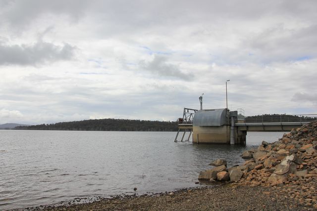
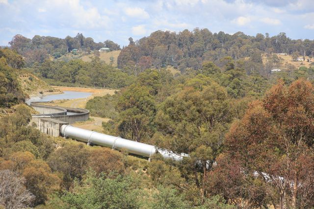
With brekky done and dusted and our campers packed up, we hit the road once again. Heading back out to the bitumin road of Poatina Rd, we take a small detour to the left and go check out what Arthurs Lake actually looks like, as we didn't stop to check it out on the way into camp yesterday afternoon. Built back in the 1920's to help with the generation of hydroelectricty at the Poatina Power Station, Arthurs Lake today is also Tasmania’s most popular trout fishery. If you plan to fish here you'll need to have a current Inland Angling Licence, and it's Brown Trout you'll been fishing for, as that's the only trout species they have recorded thus far as being here. Water still gets pumped from the lake for hydro generation, where we stop to check out the lake is actually right beside a big pipeline that runs up a hill way off into the distance, where it is fed into Great Lake to then be used for hydro generation.
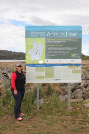
Whilst at this location we take a few pics of the lake, and i also take one of my wife standing by the sign saying Arthurs Lake. Arthur was actually the name of my wifes late father who died several years ago, for some reason on our trips we usally manage to get photos of family members names, if we happen to see one along the way.

MY WIFE BESIDE THE ARTHURS LAKE SIGN


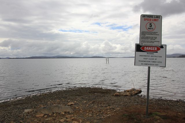
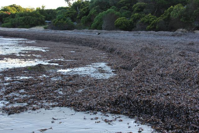
SOME OF ARTHURS LAKE


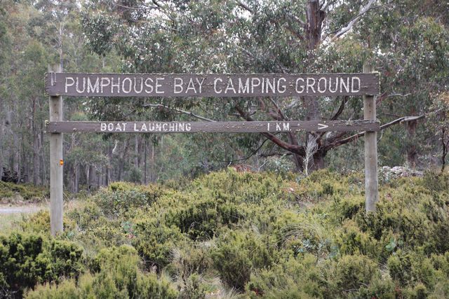
I'M WONDERING IF THIS IS WHY IT'S CALLED PUMPHOUSE BAY CAMPGROUND HERE?


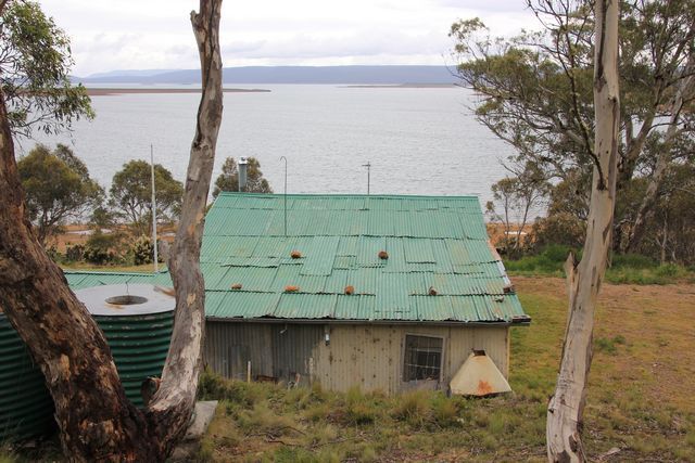
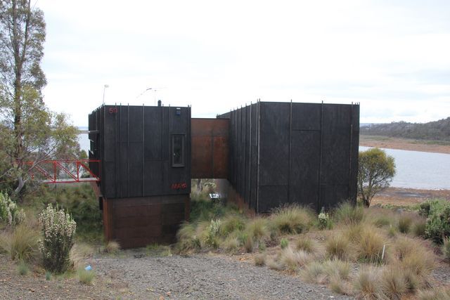
We say goodbye to Arthurs Lake and take a left turn back onto the bitumin of Poatina Rd. We follow this to the T intersection of Highland Lakes Rd and take a right turn onto it, and then head towards Miena direction. Miena is a fairly small lakeside town, being located right on the banks of Great Lake, which is Australias second largest freshwater lake. As we drive to this town the Alpine landscape we pass by on the side of the road is quite pretty to look at along the way, this landscape being how it is due to the fact Miena is one of the coldest places in Tasmania. Arriving in Miena the town itself is basically a heap of holiday shacks by the looks of it to me, i doubt there's a very large permanent population that actually lives here. We take a tour around some of the side streets whilst passing through this town, seeing a nice mixture of old run down shacks, and some pretty new much more expensive architectually designed "shacks" aswell.

OLD SHACK WITH A GREAT VIEW OF THE LAKE...GOTTA LOVE THE ROCKS HOLDING THE ROOF DOWN...LOL


AND THEN AROUND THE CORNER IS THIS FLASHIER LOOKING "SHACK"


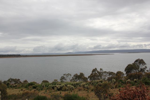
SOME OF THE VIEW OF GREAT LAKE


From Miena we continue our drive in a Westward direction along Highland Lakes Rd, where we then take a left turn onto the Marlborough Highway. It's here we on this corner i pull into the Great Lakes hotel / service station to top up my fuel. Yesterday when we left Oatlands we hadn't planned on venturing to far away from anywhere really, so i hadn't bothered to top up my fuel before leaving there. Now we are headed to an area without any options of possible fuel stops along the way, Derwent Bridge being the main nearest town to where we are headed, and it's a 40 klm detour (20 klms each way) out of the way to where we are going. I don't fill my tanks here and only get what i think i'll need, as it's the dearest fuel we enconter in all of our trip throughout Tasmania...$1.59.9 per litre.
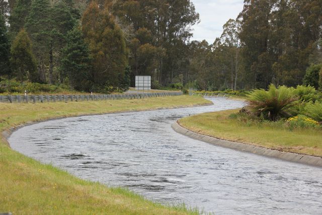
With enough fuel onboard now to keep me out of trouble, we continue on along the Marlborough Hwy, following it it's entire length to a t intersection where it meets up with the Lyell Hwy. The Marlborough Hwy was a nice little drive, sections of it were dirt road, but it was in very good condition at the time we drove it. We stopped somewhere along it's length towards the Lyell Hwy end to take a photo of a water canal, i'm always amazed at the ingenuity that has gone into constructing Tasmania's water / hydro schemes whenever i see sections of it throughout the state somewhere.

WATER CANAL FEEDING INTO A PIPELINE, SOMEWHERE ALONG THE MARLBOROUGH HWY


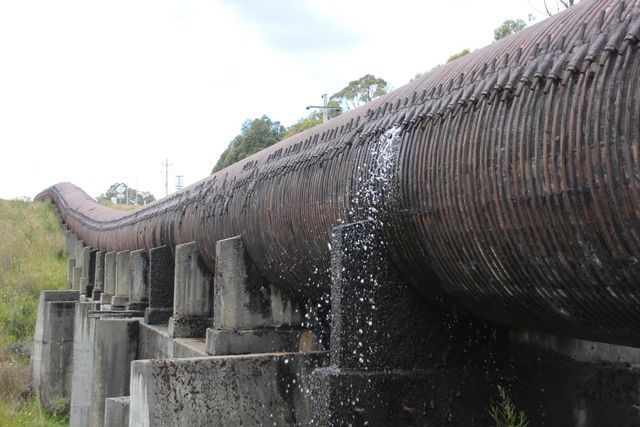
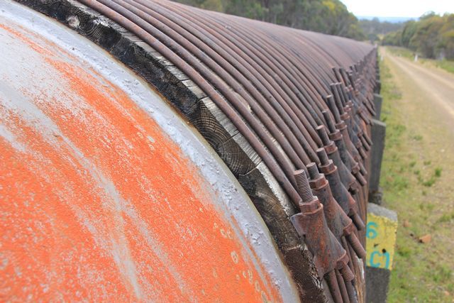
At the Lyell Hwy we take a right turn and head towards Derwent Bridge, but about 20 klms before getting there we take a left turn off of the highway, at the sign for Laughing Jack Lagoon. Once again we are back on a dirt / gravel, and just like the previous dirt road it's in pretty good condition to drive on. Stay on this road and eventually you come to another sign pointing off to the right for Laughing Jack Lagoon. It's right here that you'll find yourself seeing the Wood Stave Pipeline that we have come to see. We turn right onto the track that leads to Laughing Jack Lagoon, and park the vehicles up in the middle of the road to go check out this amazing structure. Built basically in the same fasion as a wine barrel is built, it is made up of wooden staves, slightly curved pieces of wood that create a circle held together by joints and steel bands. This section of wood stave pipeline is preserved here for it's historical significance, but looking at the leaks it has sprung in numerous places, i fear that the cost of it's future upkeep will mean i doubt it'll still be here when my kids become adults and want to bring their kids here to see it. It's not a small section of timber pipeline you'll find here either, continue on driving into Laughing Jack Lagoon as we did, and you'll see kilometres of this timber pipline running along beside the track. As you drive along the road into the lagoon, you can see where sections of the old timber pipeline have been replaced with modern steel pipeline, so one minute it's timber, then it's steel, then it becomes timber again...it changes like this in several places along the way into the lagoon. We spend quite some time checking out the timber pipeline in a couple of different locations, it's a very simple structure, but it's amazing to look at non the less.

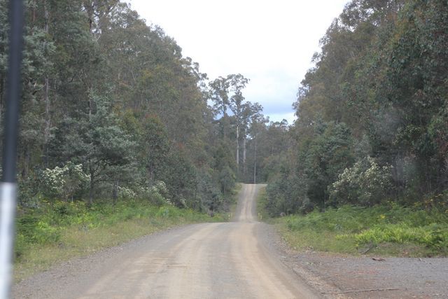
THE ROAD THAT RUNS OFF OF THE LYELL HIGHWAY...it's suitable for 2wd vehicles in dry conditions


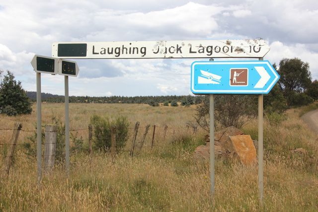
JUST FOLLOW THE SIGNS TO LAUGHING JACK LAGOON AND YOU'LL FIND IT


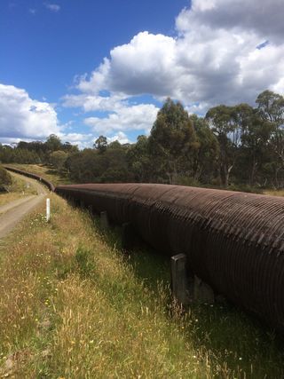
THE WOOD STAVE PIPELINE RUNNING ALONG SIDE THE ROAD INTO LAUGHING JACK LAGOON


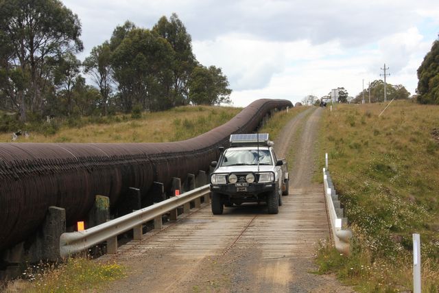
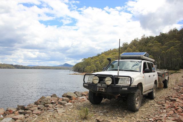
PIC OF MY FOURBY BESIDE THE PIPELINE TO GIVE A SIZE COMPARRISON OF IT


ONE OF MANY LEAKS WE SAW IN THE OLD TIMBER PIPELINE


WHERE THE STEEL PIPELINE MEETS THE TIMBER PIPLINE


With a good look at the pipeline done we head into Laughing Jack Lagoon itself to see what's there. I had heard there's a camping spot here at the lagoon, but we didn't actually see anything when we reached the end of the track we were on. I did see where a 2 wheeled track disappeared in amongst the trees in one spot, which may be where it was, but having the camper trailer on the back meant i wasn't going exploring down what could be a dead end track, so in the end we parked up down below the weir wall here and then had a bite to eat for lunch.

AT LAUGHING JACK LAGOON


Lunch eaten and we hit the road once again, we drive the 10 klms back to the main dirt road we'd turned off to head into the lagoon, then make a right hand turn and follow this dirt road through to the Lyell Highway. Not to far along the Lyell highway we pull up to check out another water canal, and then a touch further up the road we pull over to take a pic of the same canal in another location....the amount of water that flows through it is quite impressive to view.

WATER CANAL WE STOP TO PHOTOGRAPH ON THE SIDE OF THE HIGHWAY


When we stopped at the Great Lakes Hotel / service station earlier this morning we got some decent mobile phone reception, at was at this point we decided to ring a few van parks around the Hobart area, and make a booking to stay there for the final couple of days of our holiday time in Tasmania. Barilla Holiday Park in Cambridge is where we settled on choosing in the end, and this is where we are headed to now. As we crooze along the Lyell Highway, somewhere between Tarraleah and Ouse i think it was, we are flagged down by a person who's vehicle has broken down. They have pulled off the road into a side dirt track, so we pull in here to see what their problem is. We find it's a young overseas / backpacker fella and 3 girls driving in a Commodore sedan that appears to have overheated. Talking to the guy who owns the car, we find out he's only just bought it from a caryard recently, and they are currenty heading towards Queenstown. Luckily for them we have a heap of water with us, we slowly start putting it into the radiator, but it's a slow process being the engine is quite hot currently and takes a fair bit of filling. Whilst we are filling the radiator back up for these people another vehicle comes up along the dirt track we are stopped in on, the guys in the vehicle look to be local forestry workers, and one of them seems to know abit about Commodores. Have you checked the oil he asks us almost immediately?, which we hadn't done yet. Checking it we find it's milky in colour, a pretty decent sign it's likely done a head gasket. The guys leave us to keep filling the radiator and continue on their way, they didn't seem real keen to want to help to much really. We eventually get the radiator filled and the vehicle seems to be running ok'ish...the temperature gauge looks to be normal, but who knows how long that'll last for. We give the people all the spare bottles we have and fill them with water, aswell as any bottles they can rustle up. We suggest that they don't continue drivin towards Derwent Bridge direction and head back towards Hobart, as there really isn't much in the way of mechanical repair places until they get to Queenstown if they keep going the direction they are headed in..and we seriously doubt they'd make it that far. They say thanks for the help we have given them, and we leave them there and head off once again.
Further on as we drive along the highway i notice the oil pressure gauge in my fourby drop, i radio to Jeff that i need to stop, and it's then we enter into a tiny township, where we pull into an area to check out my vehicle. Pulling up i pop the bonnet to see if i can see anything out of the ordinary, but all seems ok at a quick glance and there's plenty of oil in the engine. There isn't much i can do if there's something internally wrong with the engine, so i decide to just keep on driving, and if the engine blows up then so be it....i've been wanting to do an engine transplant in the vehicle to something more powerful anyhow...lol. To be honest here, with the overheating issues the engine has had for a few years now, i actually said to my wife before leaving on this trip, that i'd be surprised if the vehicle makes it back home in one piece....i have half expected it to die somewhere along the way. As i drive along i notice the oil pressure gauge keeps jumping all over the place, one minute it's up, the next minute it's right down, so i start to wonder if it's not just a faulty reading it keeps giving...i really have no idea what's going on with it at the moment. The rest of the drive into Cambridge from here is fairly uneventful, it's a touch stressful wondering if the fourby will make it there or not, but in the end the vehicle gets there and still seems to be running ok, other then the oil pressure gauge dropping right down regularly.
We check into the van park at our powered sites, the park seems ok, though the sites aren't huge by any means.

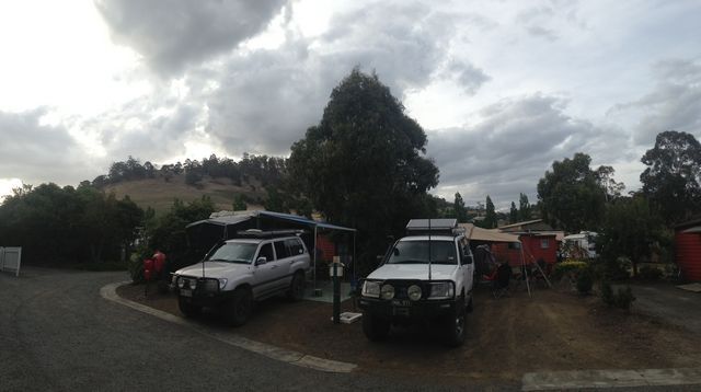
THIS WILL BE OUR LAST CAMP SITES IN TASMANIA


We have a few drinks and the kids have a play in the playground that is here. Dinner then had and it's time for a shower, i don't recall the showers costing anything here, but they are on a timer. The timer runs for 5 minutes of hot water, then there's a wait time until the hot water can come through again, so make sure you're quick or the last part of your shower will be in the cold...lol. The bugs that are attracted to the lights of the ammenties block at night time here are pretty full on, i think it must have something to do with the bushland that surrounds the park...what ever the reason for it, there's hundreds of them on the ground in the shower and toilet block, which could freak out those of you who have insect phobia. A few more drinks had and then it's an earlish night to bed for all of us
 

Forum statistics

Threads
185,827
Messages
2,878,614
Members
225,393
Latest member
jgrillz94
Top