mercier@streetsmart.ca
Expedition Scout
Trek Leg 6: Cochise Stronghold Canyon
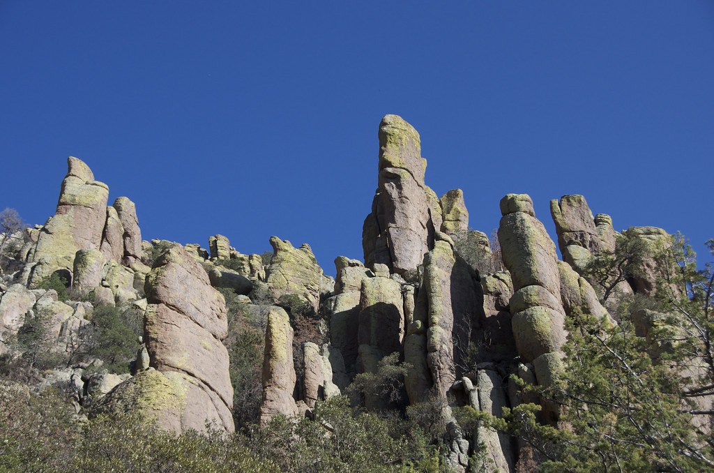
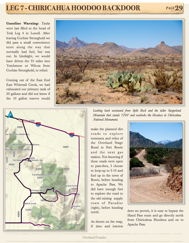
Cochise Stronghold Canyon is a perfect destination for camping, a beautiful setting in the Dragoon Mountain. While the site has some structured campsites, the real appeal of this region is the fantastic array of random camp areas. Some feel very secluded and sheltered by the steep cliffs and granite domes above. The Apache used these mountains to evade the US Cavalry until Cochise signed a treaty in 1872, on these very grounds, where he was born and buried in a secret location. Camping below the steep Dragoon Mountain ridges, it is easy to see how a stealth band of 250 Apache warriors could stay a step ahead of an Army marching below.
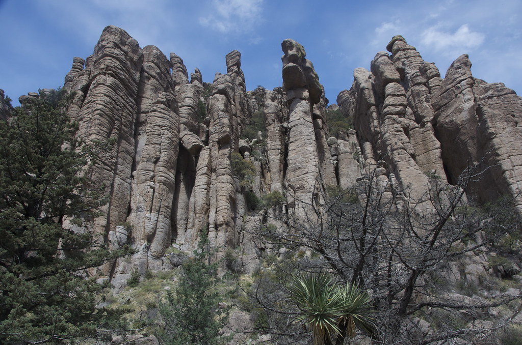
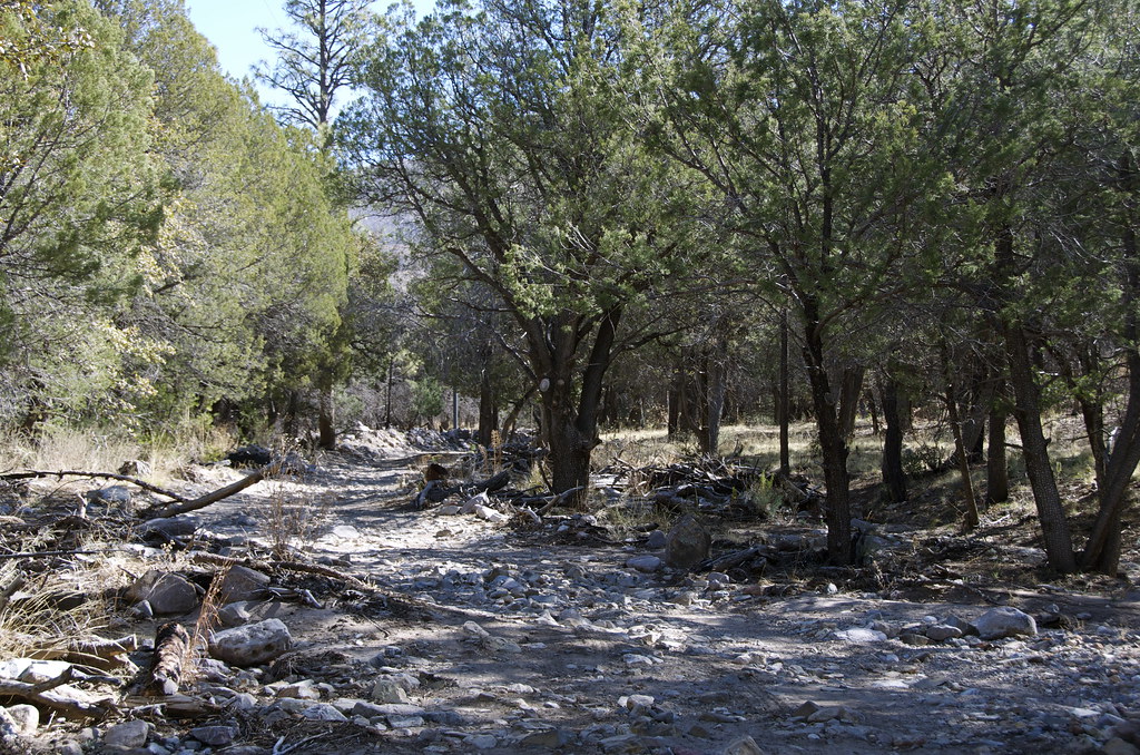
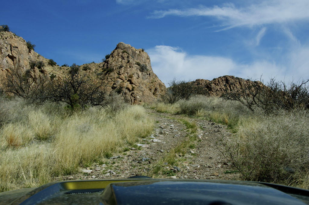
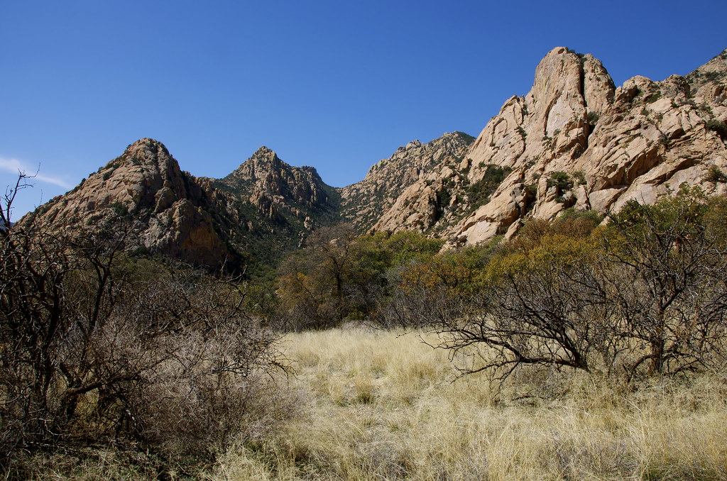
Entering the gateway to Stronghold Canyon East, the forested valley conceals the rugged granite cliffs above that were used by the Apache to evade the US Army for over a decade.
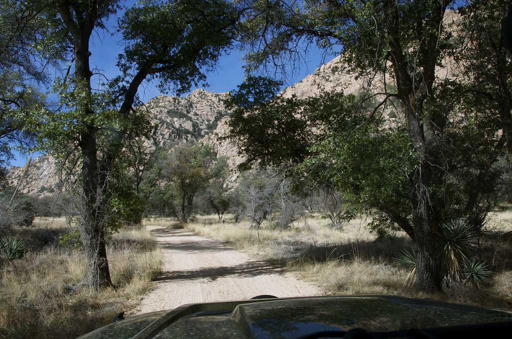
Stronghold Canyon East Gateway. by Overland Frontier, on Flickr
The original plan was to camp inside Cochise Stronghold Canyon but not reaching it before sunset left only a day on the roster to scout the region for future drives, hikes and rides.
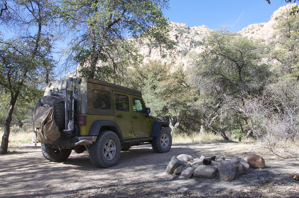
Stronghold Canyon East Campsite. by Overland Frontier, on Flickr
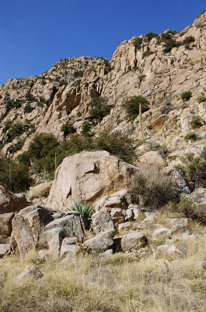
Some of dispersed campsites are very secluded and sheltered by the steep cliffs for campers.
Dispersed Campsite in Stronghold Canyon East by Overland Frontier, on Flickr
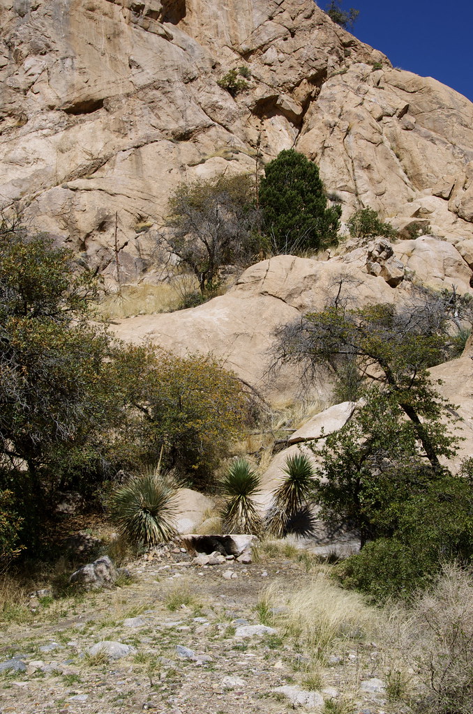
The north end of the canyon provides more remote sites along the mountain ridge.
Trail to far end of Stronghold Canyon East. by Overland Frontier, on Flickr
Rustic campfire rings can be found nestled in alcoves below cliff ridges.
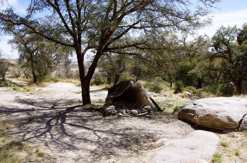
Sheltered campsite below Stronghold Canyon East ridge. by Overland Frontier, on Flickr
The nomadic Chokonen-Chiricahua Apache roamed this region long before Spanish colonization in the 1600's. Masters of guerilla warfare, the Apache honed their skill by raiding Spanish-Mexican settlers, to the point where the Mexicans posted bounty for their scalps. The Dragoon Mountains became their retreat.
Tensions eased after the Mexican War when Americans took the region over in the 1850's, where an uneasy peace lasted until shortly after the Butterfield Overland Stage Road was built in 1858, where Cochise even traded firewood with operators of the Apache Pass stage station.
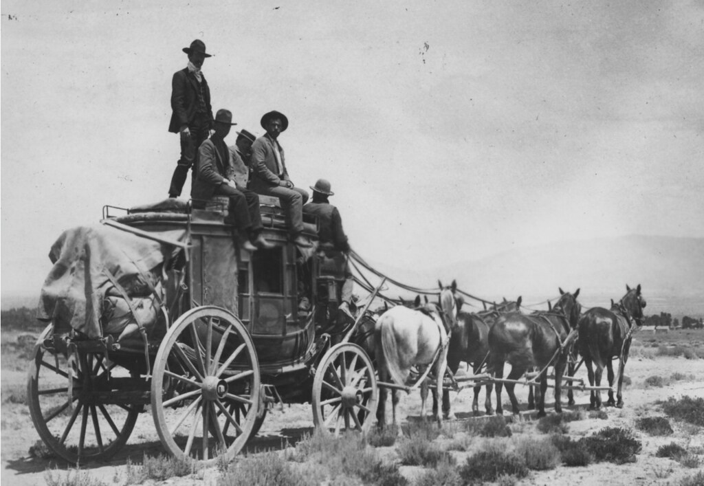
Overland Stagecoach. by Overland Frontier, on Flickr
The Wagon and Stage Road was blazed through Apache Pass, a wash trail between the Dos Cabezas Mountains and the Chiricahua Hoodoos across a desert plain and over the northern tip of the Dragoon Mountains, and what would become known as Cochise Stronghold.
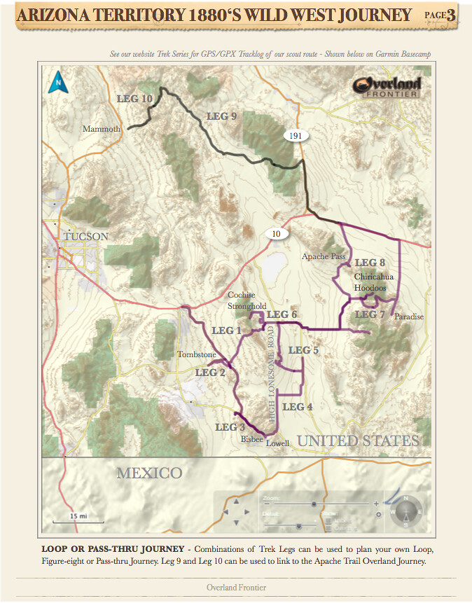
Overland Frontier Journey Overview Map. by Overland Frontier, on Flickr
Cochise never allowed himself to be photographed but this painting was recently discovered with the inscription, “Cochise 1872”.
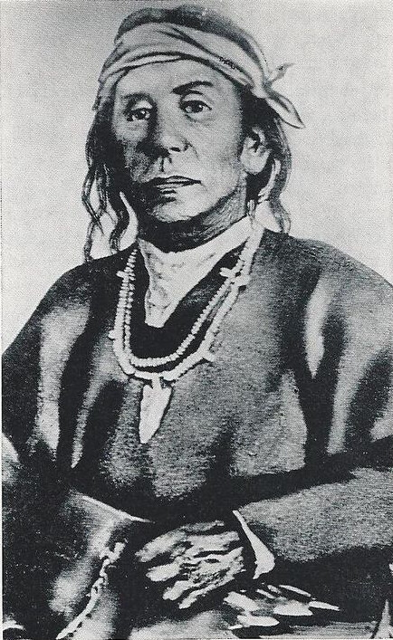
Cochise 1872. by Overland Frontier, on Flickr
All was well until a green second lieutenant named George N. Bascom entered the scene. Anxious to make a name for himself he invited Cochise for a parley under the flag of truce. The chief was wrongfully placed under arrest for kidnapping a local rancher's 11-year old boy and rustling cattle. Cochise escaped under a hail of gunfire, with only a leg wound. His wife, young son, brother and two nephews who had accompanied him, were held hostage.
In retaliation, Cochise quickly took civilian captives for exchange for his family. When Bascom refused, Apache warriors killed their hostages and ambushed a wagon train and stagecoach in Apache Pass, where captives were burnt alive.
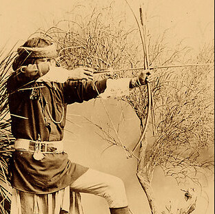
Apache Warrior. by Overland Frontier, on Flickr
Embittered, Cochise allied himself with his father-in law, Manga Coloradas, for guerrilla warfare against the Army and settlers.
Apache Medicine Men. by Overland Frontier, on Flickr
Despite being pursued by the US Army, warriors continued to strike with a vengeance, as was evident by the graves that literally lined both sides of the stage road between Dragoon Springs Station and Doz Cabezas Mountain Apache Pass Station. Budweiser promotional painting: "Attack on the Overland Stagecoach 1860" (with Plains Natives attacking).
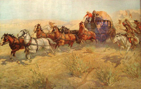
Attack on the Overland Stagecoach 1860, Budweiser advertising print. by Overland Frontier, on Flickr
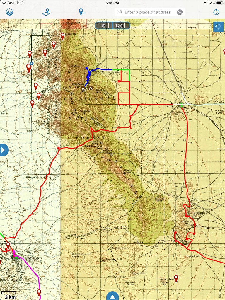
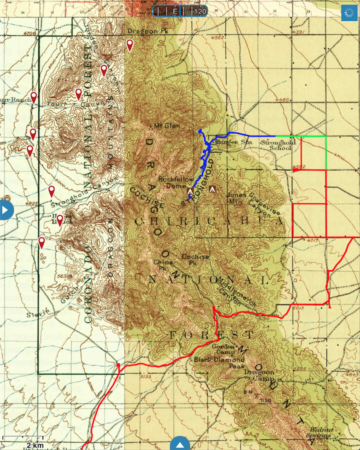
Dragoon Mountains and Cochise Stronghold Map. by Overland Frontier, on Flickr
Thomas Jonathan Jeffords, a frontier trailblazer and US Scout had been appointed superintended of the mail line, would become a legendary figure for his bravery and would forever hold the trust of the Apache Chief Cochise. Jeffords said: “He had killed twenty-one men to my knowledge, fourteen of whom were in my employ”, I made up my mind that I wanted to see him.
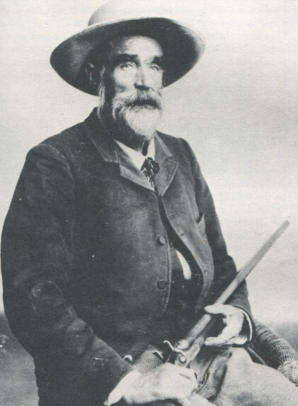
Frontiersmen Thomas Jonathan Jeffords, in his later years. by Overland Frontier, on Flickr
Walking fully armed into Cochise's camp: “I wished to leave my arms in his possession or in the possession of one of his wives whom he had with him, to be returned to me when I was ready to leave”. Impressed with the bold move; Cochise consented.
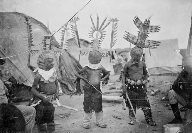
Apache Indian Dancers In Arizona. by Overland Frontier, on Flickr
After spending 3 days, Jeffords said: “I learned from Cochise, and I think his story bears me out, that up to about the year 1859 when he was betrayed by Lieutenant Bascom, he had always been very friendly to the whites, but since that time he had done them all the harm he could. This was the commencement of my friendship with Cochise, and although I was frequently compelled to guide troops against him and his band, it never interfered with our friendship”.
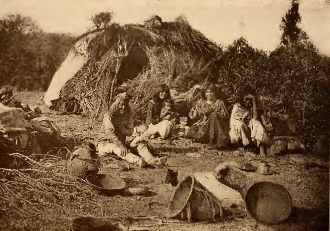
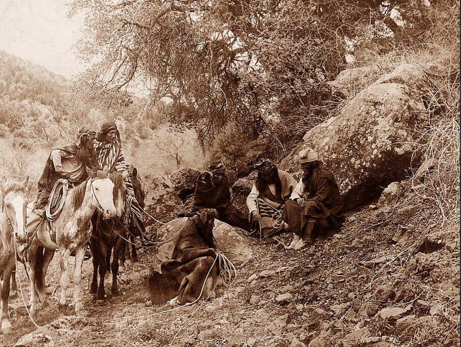
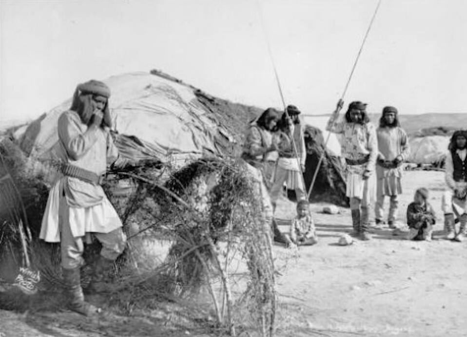
Apache Camp in Southern Arizona. by Overland Frontier, on Flickr
The situation came to a head in 1871, when 150 sleeping Indian innocents, mercenaries murdered mostly women and children. President Ulysses S. Grant was outraged as he had devised his Post Civil War Peace Policy to avoid massacres of this nature, sent a peace commission to Arizona by General Oliver Howard.
General Howard recruited the aid of Jeffords who arranged a one-on-one with Cochise that led to a treaty. After visiting his stronghold he stated that no general in the Army of the United States could have made a better disposition of his men to resist an attack from a superior force.
Apache Village. by Overland Frontier, on Flickr
Howard and Jeffords encouraged President Ulysses Grant to accept an unprecedented promise that allowed the tribe to choose a reservation location; Apache Pass and their Indian Agent; Thomas Jeffords. While under his four-year watch, peace was kept when Jeffords never allowed any soldier, citizen or government official without his consent.
Jeffords who was the epitome of the wild-west frontiersman; trailblazer, Army Scout, Stagecoach driver, Tombstone Deputy-Marshall, Indian Agent, was ripe for Hollywood portrayal. First told in a novel “Blood Brothers” by Elliott Arnold. It was adapted to a movie, “Broken Arrow” staring Jimmy Stewart in 1950, and later a 72 episode TV series.
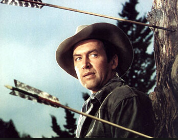
Promotional photo of Broken Arrow, movie, staring Jimmy Stewart as Thomas Jeffords. by Overland Frontier, on Flickr
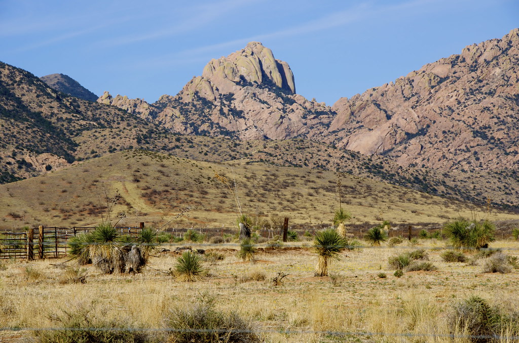
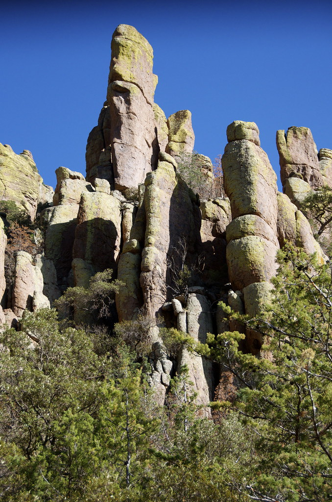
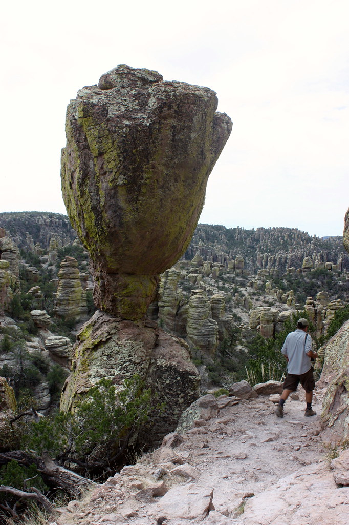
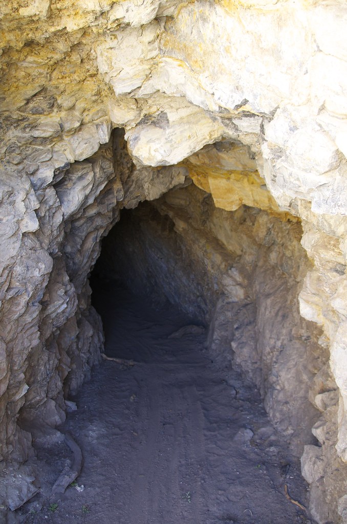
Rockfellow Dome in Cochise Stronghold. by Overland Frontier, on Flickr
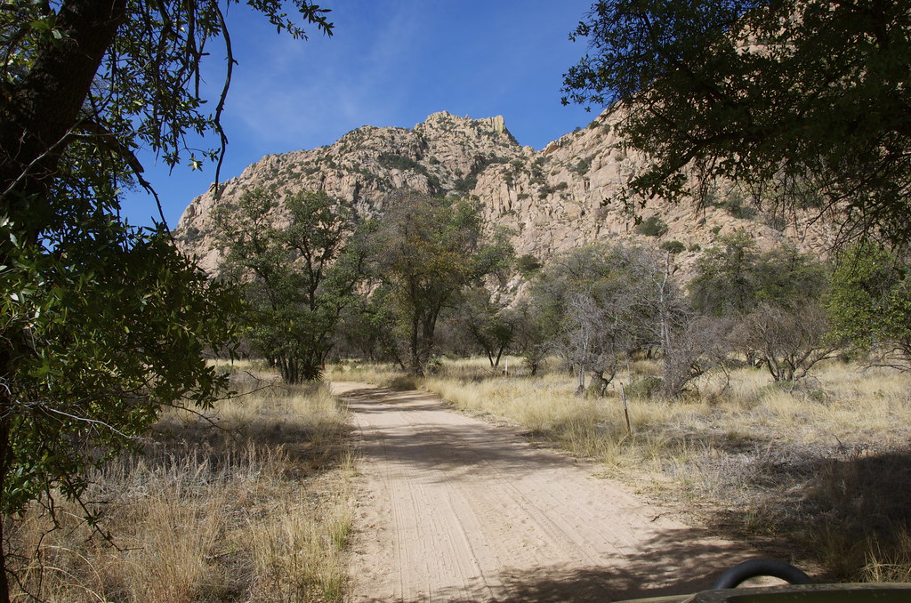
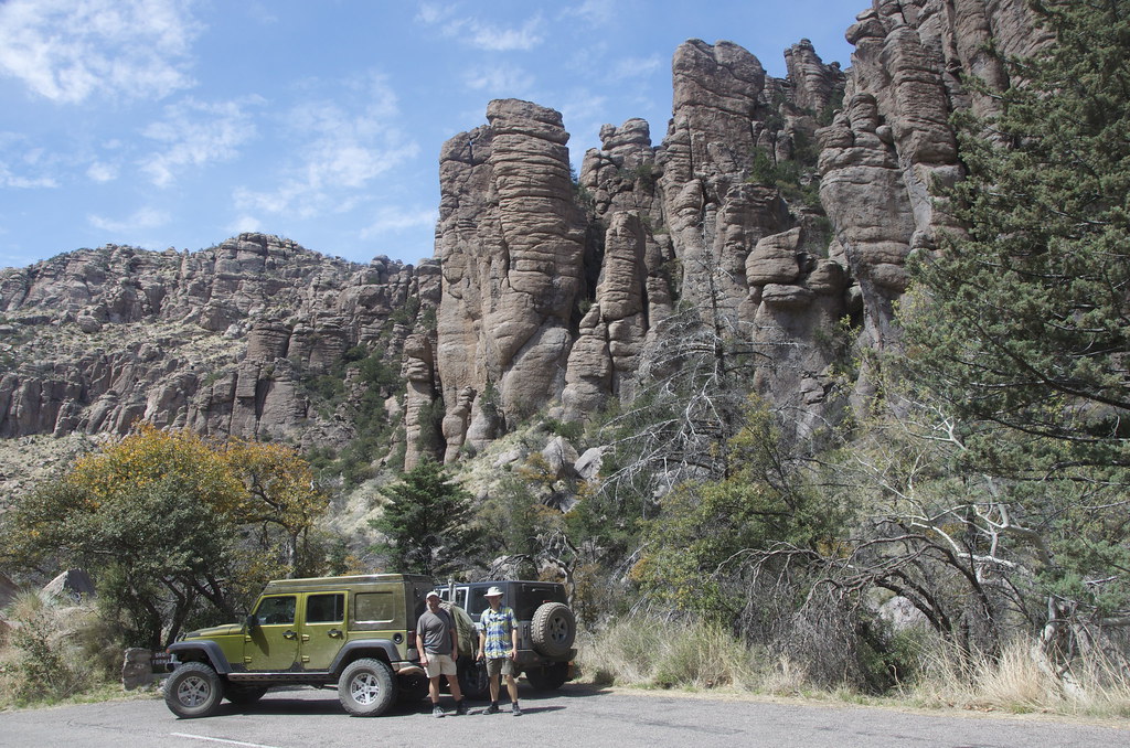
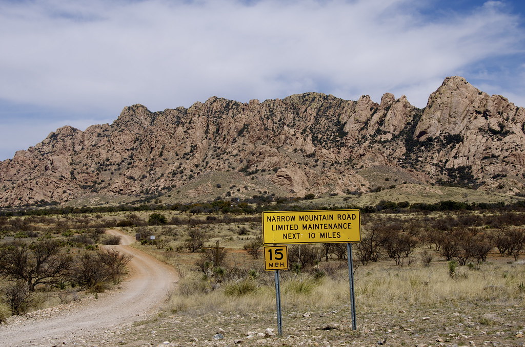
Stronghold Canyon East access road. by Overland Frontier, on Flickr
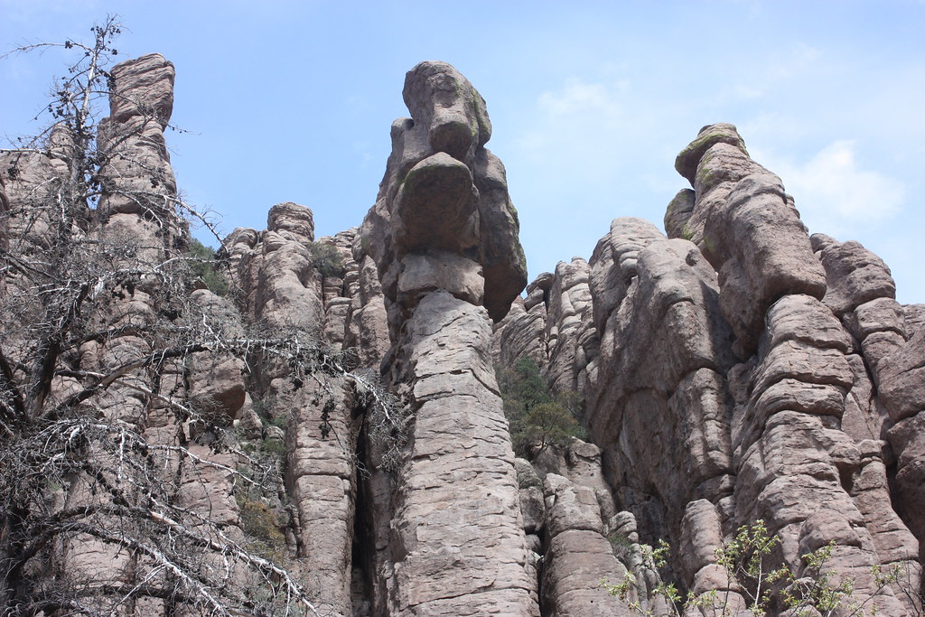
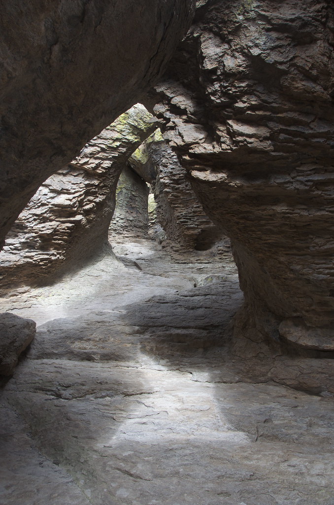
Stronghold Canyon walls have a natural fort-like feeling. by Overland Frontier, on Flickr
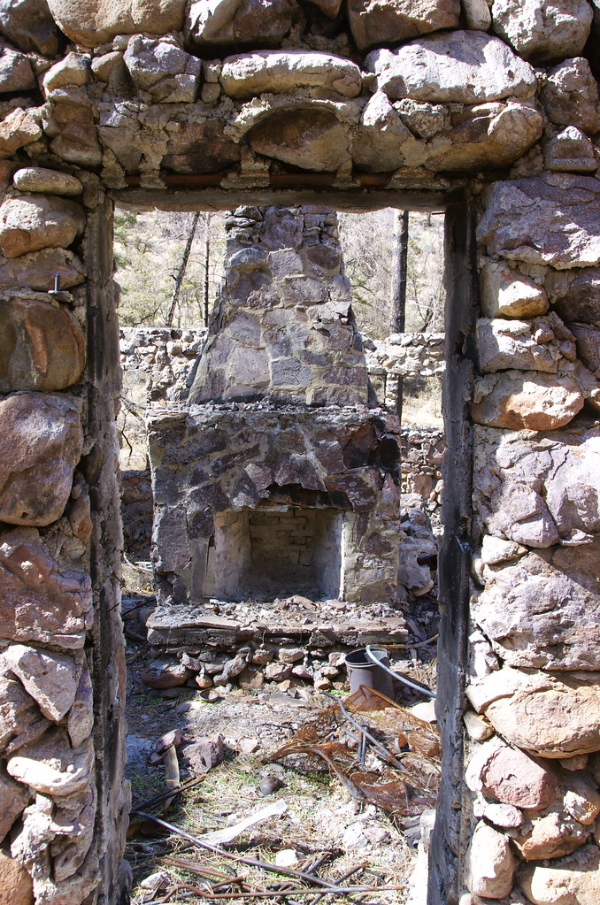
The Shaw family built a home in the heart of the Stronghold Valley in 1905, hoping Arizona's dry, clean air would help their son's asthma. With the exception of a temporary abandonment in 1920 fearing raids from Poncho Villa, the family lived in the stronghold until their four-acre homestead was donated to Fort Still Chiricahua-Warm Spring Apache Tribe.
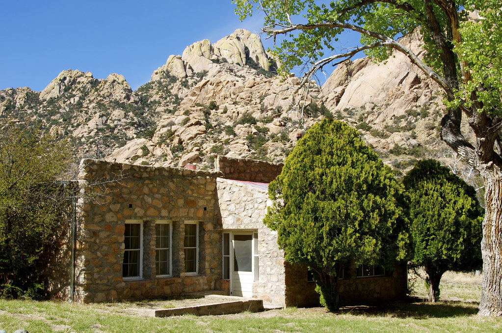
Shaw family home built in the heart of the Stronghold Valley in in 1905 by Overland Frontier, on Flickr
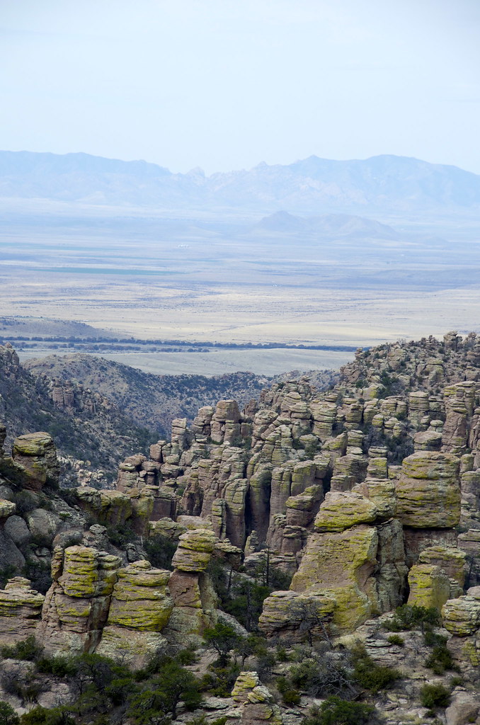
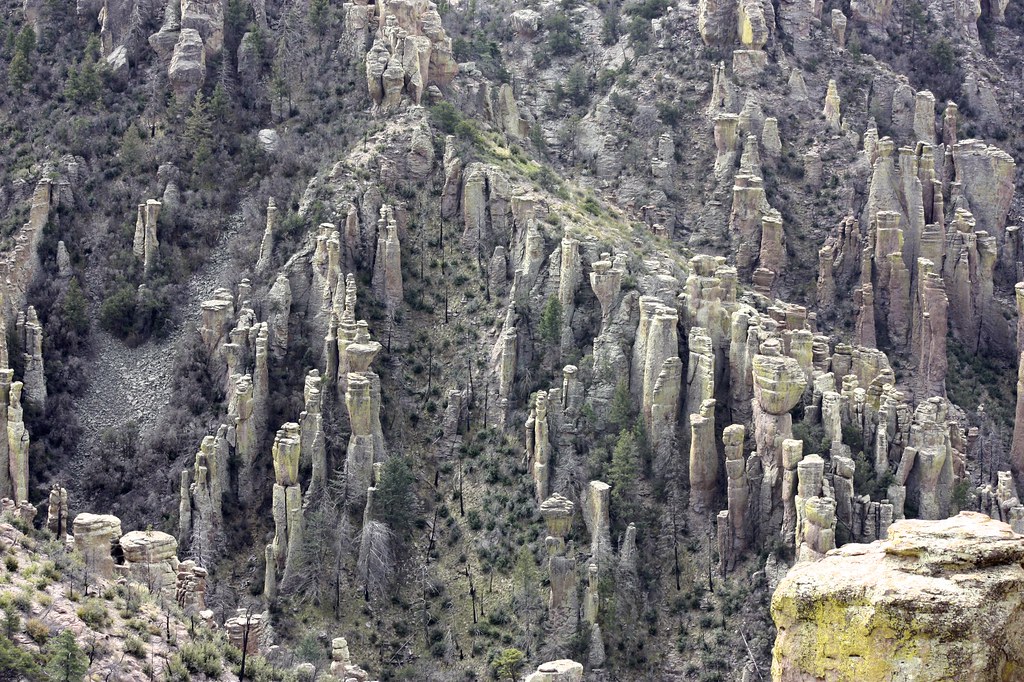
Cochise Stronghold East – Northern Canyon. by Overland Frontier, on Flickr

Cochise Stronghold East – Northern Canyon. by Overland Frontier, on Flickr
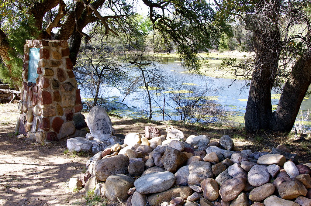
Middlemarch Road, cuts East-West, through the Dragoon Mountains, providing access to Cochise Stronghold Canyon –West. From Middlemarch Road, there is a trail that travels up to Cochise Stronghold Canyon – West, where Cochise signed a peace-treaty.
 Trail to Stronghold Canyon –West, where Cochise signed peace-treaty by Overland Frontier, on Flickr
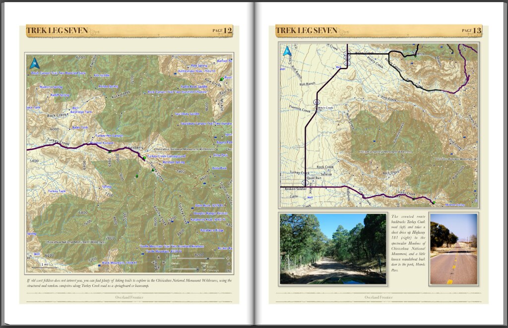
The West side of the Dragoon Mountains appears less frequented than the east side. The entire East-West loop trail is ideally suited to two or three days of exploration.
Cochise Stronghold West and East map. by Overland Frontier, on Flickr
Check out our free scouting report slideshow, with more photos:
http://www.overlandfrontier.com/trek-legs/cochise-stronghold-canyon
A companion GPS/GPX Tracklog that can be viewed on-line or downloaded free:
http://www.overlandfrontier.com/tre...ge-road-chiricahua-hoodoos-cochise-stronghold
Like us on Facebook, if you we are on the right trail.
https://www.facebook.com/OverlandFrontier
Cochise Stronghold Canyon is a perfect destination for camping, a beautiful setting in the Dragoon Mountain. While the site has some structured campsites, the real appeal of this region is the fantastic array of random camp areas. Some feel very secluded and sheltered by the steep cliffs and granite domes above. The Apache used these mountains to evade the US Cavalry until Cochise signed a treaty in 1872, on these very grounds, where he was born and buried in a secret location. Camping below the steep Dragoon Mountain ridges, it is easy to see how a stealth band of 250 Apache warriors could stay a step ahead of an Army marching below.
Entering the gateway to Stronghold Canyon East, the forested valley conceals the rugged granite cliffs above that were used by the Apache to evade the US Army for over a decade.
Stronghold Canyon East Gateway. by Overland Frontier, on Flickr
The original plan was to camp inside Cochise Stronghold Canyon but not reaching it before sunset left only a day on the roster to scout the region for future drives, hikes and rides.
Stronghold Canyon East Campsite. by Overland Frontier, on Flickr
Some of dispersed campsites are very secluded and sheltered by the steep cliffs for campers.
Dispersed Campsite in Stronghold Canyon East by Overland Frontier, on Flickr
The north end of the canyon provides more remote sites along the mountain ridge.
Trail to far end of Stronghold Canyon East. by Overland Frontier, on Flickr
Rustic campfire rings can be found nestled in alcoves below cliff ridges.
Sheltered campsite below Stronghold Canyon East ridge. by Overland Frontier, on Flickr
The nomadic Chokonen-Chiricahua Apache roamed this region long before Spanish colonization in the 1600's. Masters of guerilla warfare, the Apache honed their skill by raiding Spanish-Mexican settlers, to the point where the Mexicans posted bounty for their scalps. The Dragoon Mountains became their retreat.
Tensions eased after the Mexican War when Americans took the region over in the 1850's, where an uneasy peace lasted until shortly after the Butterfield Overland Stage Road was built in 1858, where Cochise even traded firewood with operators of the Apache Pass stage station.
Overland Stagecoach. by Overland Frontier, on Flickr
The Wagon and Stage Road was blazed through Apache Pass, a wash trail between the Dos Cabezas Mountains and the Chiricahua Hoodoos across a desert plain and over the northern tip of the Dragoon Mountains, and what would become known as Cochise Stronghold.
Overland Frontier Journey Overview Map. by Overland Frontier, on Flickr
Cochise never allowed himself to be photographed but this painting was recently discovered with the inscription, “Cochise 1872”.
Cochise 1872. by Overland Frontier, on Flickr
All was well until a green second lieutenant named George N. Bascom entered the scene. Anxious to make a name for himself he invited Cochise for a parley under the flag of truce. The chief was wrongfully placed under arrest for kidnapping a local rancher's 11-year old boy and rustling cattle. Cochise escaped under a hail of gunfire, with only a leg wound. His wife, young son, brother and two nephews who had accompanied him, were held hostage.
In retaliation, Cochise quickly took civilian captives for exchange for his family. When Bascom refused, Apache warriors killed their hostages and ambushed a wagon train and stagecoach in Apache Pass, where captives were burnt alive.
Apache Warrior. by Overland Frontier, on Flickr
Embittered, Cochise allied himself with his father-in law, Manga Coloradas, for guerrilla warfare against the Army and settlers.
Apache Medicine Men. by Overland Frontier, on Flickr
Despite being pursued by the US Army, warriors continued to strike with a vengeance, as was evident by the graves that literally lined both sides of the stage road between Dragoon Springs Station and Doz Cabezas Mountain Apache Pass Station. Budweiser promotional painting: "Attack on the Overland Stagecoach 1860" (with Plains Natives attacking).
Attack on the Overland Stagecoach 1860, Budweiser advertising print. by Overland Frontier, on Flickr
Dragoon Mountains and Cochise Stronghold Map. by Overland Frontier, on Flickr
Thomas Jonathan Jeffords, a frontier trailblazer and US Scout had been appointed superintended of the mail line, would become a legendary figure for his bravery and would forever hold the trust of the Apache Chief Cochise. Jeffords said: “He had killed twenty-one men to my knowledge, fourteen of whom were in my employ”, I made up my mind that I wanted to see him.
Frontiersmen Thomas Jonathan Jeffords, in his later years. by Overland Frontier, on Flickr
Walking fully armed into Cochise's camp: “I wished to leave my arms in his possession or in the possession of one of his wives whom he had with him, to be returned to me when I was ready to leave”. Impressed with the bold move; Cochise consented.
Apache Indian Dancers In Arizona. by Overland Frontier, on Flickr
After spending 3 days, Jeffords said: “I learned from Cochise, and I think his story bears me out, that up to about the year 1859 when he was betrayed by Lieutenant Bascom, he had always been very friendly to the whites, but since that time he had done them all the harm he could. This was the commencement of my friendship with Cochise, and although I was frequently compelled to guide troops against him and his band, it never interfered with our friendship”.
Apache Camp in Southern Arizona. by Overland Frontier, on Flickr
The situation came to a head in 1871, when 150 sleeping Indian innocents, mercenaries murdered mostly women and children. President Ulysses S. Grant was outraged as he had devised his Post Civil War Peace Policy to avoid massacres of this nature, sent a peace commission to Arizona by General Oliver Howard.
General Howard recruited the aid of Jeffords who arranged a one-on-one with Cochise that led to a treaty. After visiting his stronghold he stated that no general in the Army of the United States could have made a better disposition of his men to resist an attack from a superior force.
Apache Village. by Overland Frontier, on Flickr
Howard and Jeffords encouraged President Ulysses Grant to accept an unprecedented promise that allowed the tribe to choose a reservation location; Apache Pass and their Indian Agent; Thomas Jeffords. While under his four-year watch, peace was kept when Jeffords never allowed any soldier, citizen or government official without his consent.
Jeffords who was the epitome of the wild-west frontiersman; trailblazer, Army Scout, Stagecoach driver, Tombstone Deputy-Marshall, Indian Agent, was ripe for Hollywood portrayal. First told in a novel “Blood Brothers” by Elliott Arnold. It was adapted to a movie, “Broken Arrow” staring Jimmy Stewart in 1950, and later a 72 episode TV series.
Promotional photo of Broken Arrow, movie, staring Jimmy Stewart as Thomas Jeffords. by Overland Frontier, on Flickr
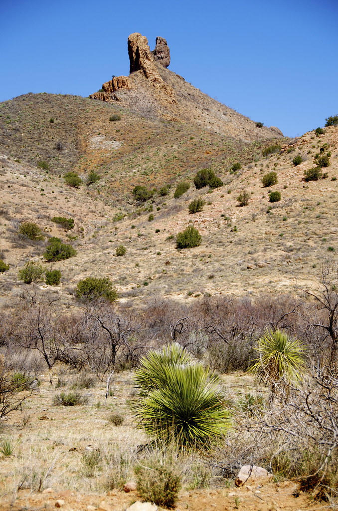
Rockfellow Dome in Cochise Stronghold. by Overland Frontier, on Flickr
Stronghold Canyon East access road. by Overland Frontier, on Flickr
Stronghold Canyon walls have a natural fort-like feeling. by Overland Frontier, on Flickr
The Shaw family built a home in the heart of the Stronghold Valley in 1905, hoping Arizona's dry, clean air would help their son's asthma. With the exception of a temporary abandonment in 1920 fearing raids from Poncho Villa, the family lived in the stronghold until their four-acre homestead was donated to Fort Still Chiricahua-Warm Spring Apache Tribe.
Shaw family home built in the heart of the Stronghold Valley in in 1905 by Overland Frontier, on Flickr
Cochise Stronghold East – Northern Canyon. by Overland Frontier, on Flickr
Cochise Stronghold East – Northern Canyon. by Overland Frontier, on Flickr
Middlemarch Road, cuts East-West, through the Dragoon Mountains, providing access to Cochise Stronghold Canyon –West. From Middlemarch Road, there is a trail that travels up to Cochise Stronghold Canyon – West, where Cochise signed a peace-treaty.
Trail to Stronghold Canyon –West, where Cochise signed peace-treaty by Overland Frontier, on FlickrThe West side of the Dragoon Mountains appears less frequented than the east side. The entire East-West loop trail is ideally suited to two or three days of exploration.
Cochise Stronghold West and East map. by Overland Frontier, on Flickr
Check out our free scouting report slideshow, with more photos:
http://www.overlandfrontier.com/trek-legs/cochise-stronghold-canyon
A companion GPS/GPX Tracklog that can be viewed on-line or downloaded free:
http://www.overlandfrontier.com/tre...ge-road-chiricahua-hoodoos-cochise-stronghold
Like us on Facebook, if you we are on the right trail.
https://www.facebook.com/OverlandFrontier
Last edited: