wreckdiver1321
Overlander
One of my favorite quotes about adventure is: "Adventure is the respectful pursuit of trouble."
I like this. I think it's integral to all overland and offroad travel. Overlanding in general is about taking the hard way. It's not about taking the most convenient way from point A to point B. It's not about taking the highway and simply gawking at the sights as you fly by them at 70 miles an hour. It's about taking the long way and immersing yourself. It's about surrounding yourself with the culture and the landscape. Anyone can be a tourist and see just the things that fall on the side of the highway. Those major points may be interesting or even fascinating, but I don't think they get to the real juicy parts of the areas traveled. That's why people who are adventurers are pursuing trouble. The easy way is safe and well-traveled. The long way, the hard way, is more open to problems and potential trouble. It's more remote, harder to get to, rougher, more difficult to navigate, further from help. That's what makes it adventure.
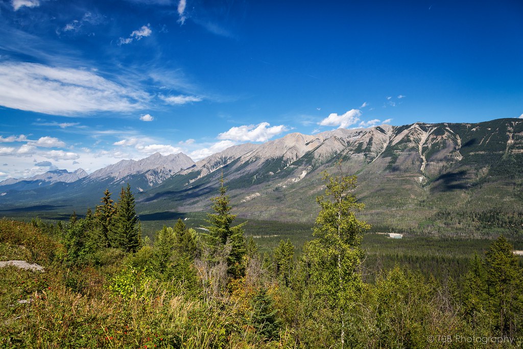
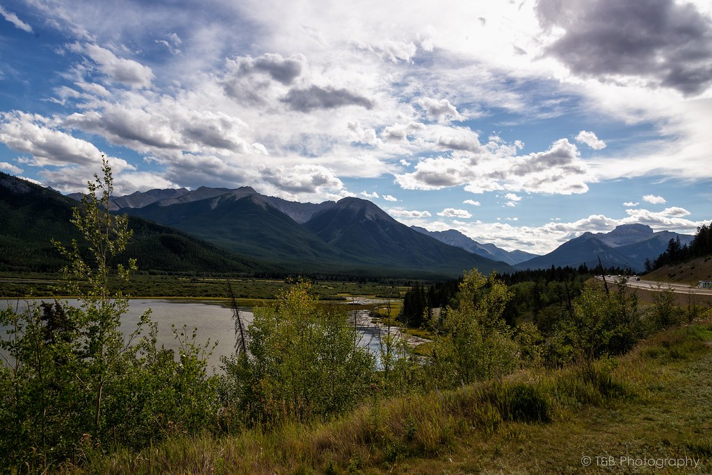
I'm a sucker for a beautiful landscape. I've spent many years exploring the mountains of Montana, and one of the things that draws me there is the natural and untamed beauty of the places. Well, there are few places more beautiful and wild than the Canadian Rockies. Sure, the national parks are pretty developed, but get just outside those boundaries and you're into some very wild places. As such, I've wanted to explore the mountains of Alberta and BC for a long time. My fiancee, Beret, and I have talked about it for a long time, and we finally had the means to explore it this summer. We took 10 days off work and planned to make our way up to northern Montana, explore Glacier National Park, meet some people to do some wheeling in Canada, see the sights in the Canadian Rockies, and then head back down south. Living in Billings, we're not that far away from Glacier. Plus, my parents have a house in the small town of Seeley Lake, just 90 minutes from the western entrance to Glacier Park. This made the trip even more convenient. So, several months ago, we started planning the trip.
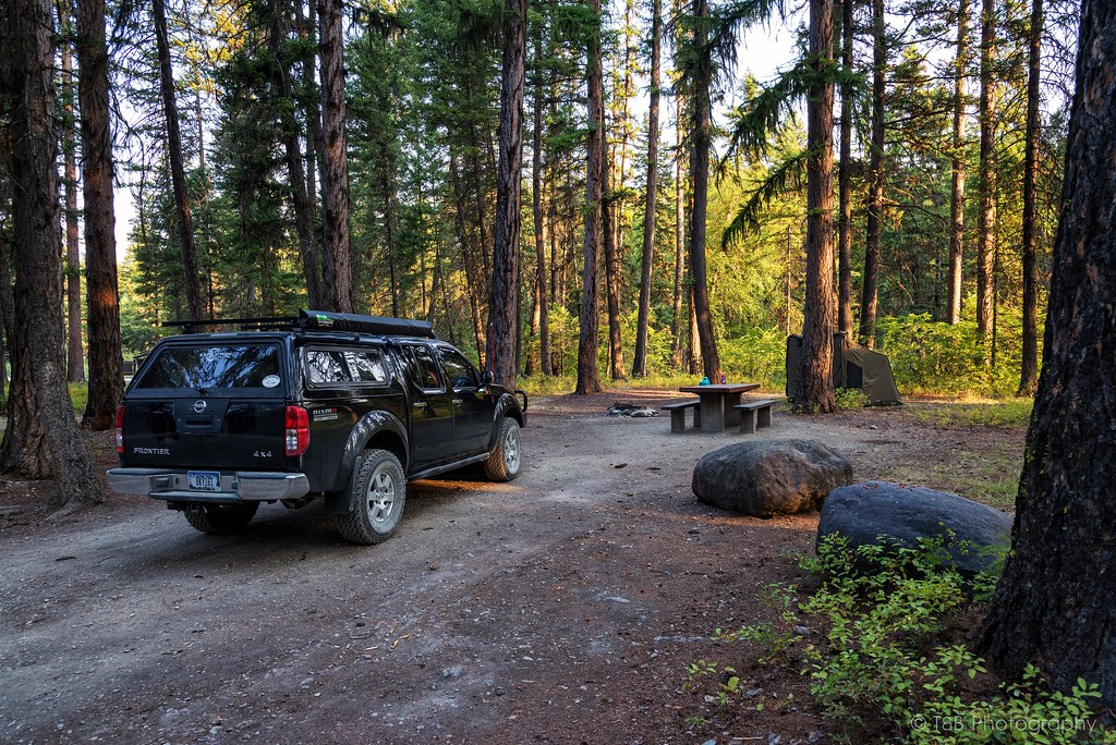
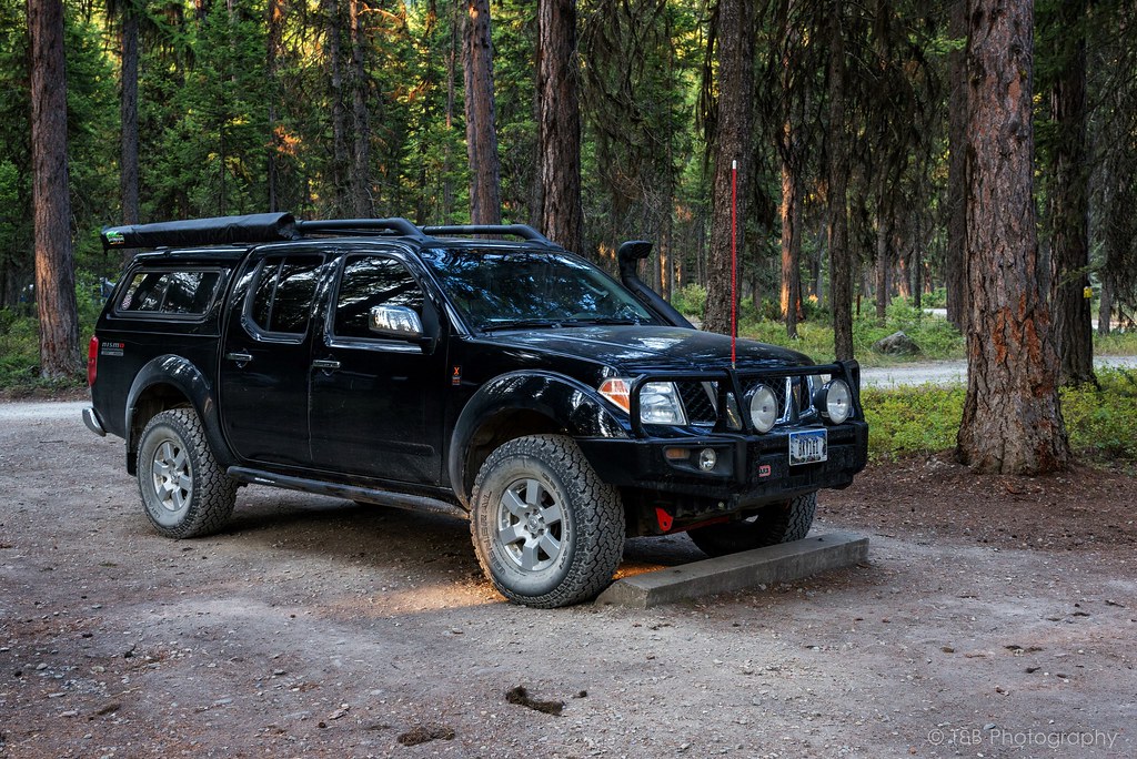
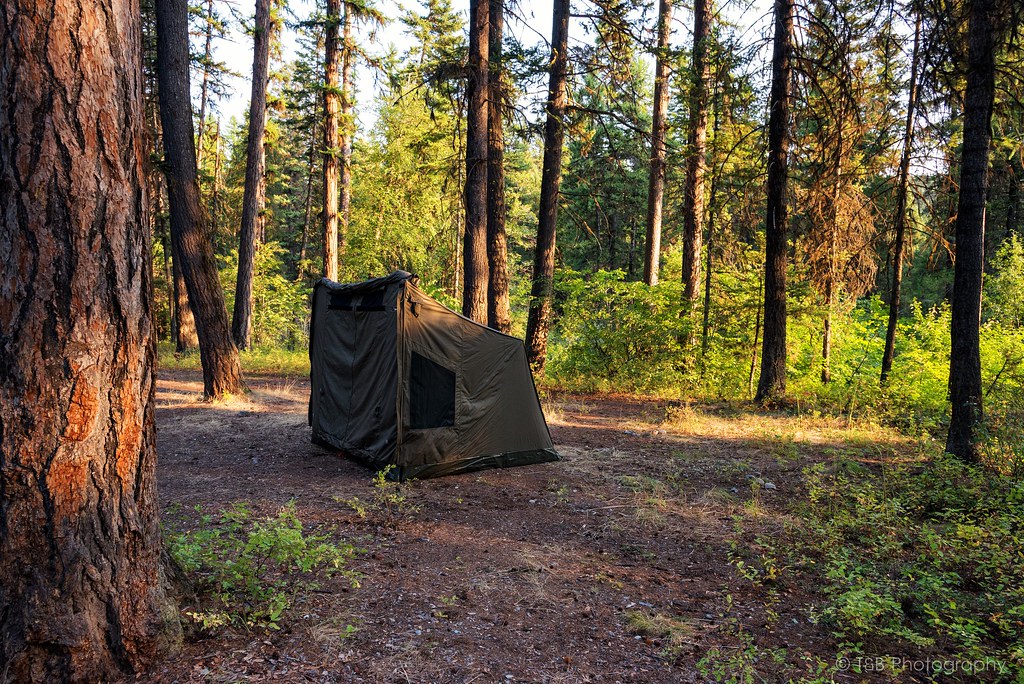
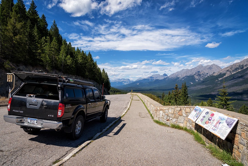
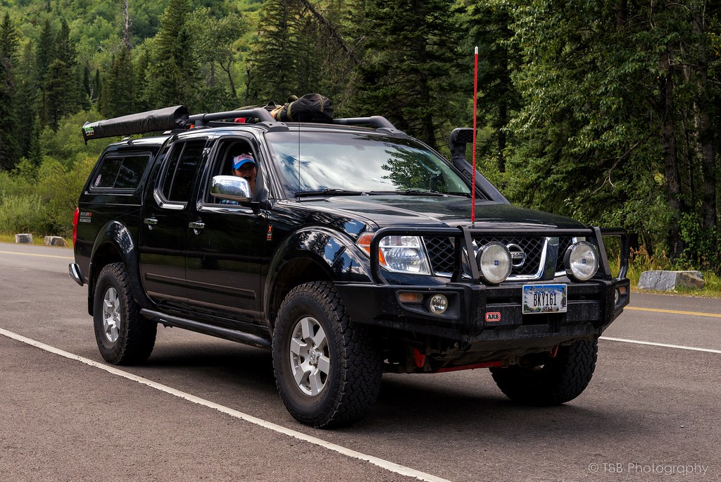
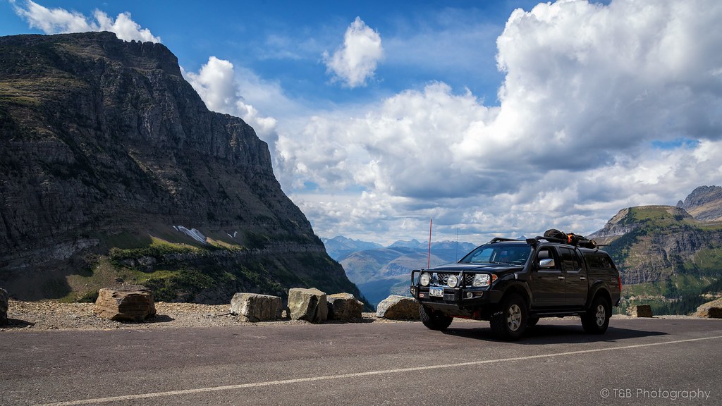
I had to finish outfitting my Frontier, known as Lola, before we could make the trip. I installed a skidplate that had been sitting in my garage for a while, got a 12v Indel-B fridge put in, installed a 175W inverter, and got a phone-based navigation system worked out. We had planned to do some wheeling with some Xterra guys outside the town of Coleman before heading up north via the Forestry Trunk Road to Jasper, so we wanted to be well equipped for several days in the backcountry. I had my Oztent and sleeping setup all dialed in. Finally, just a few days before departure, we were ready to rock.
The night of our departure, we got off work around 8PM and got the truck packed up. Originally, we had planned to do the trip with my friend in his Subaru. He was really excited to go, but backed out at the last minute due to reliability concerns with his car. Since we didn't have to wait on him anymore, we hit the road. Our first stop was in Seeley Lake, where we would spend a couple of days exploring Glacier before making the push to Canada. We also could leave our two dogs with my parents to minimize the hassle of traveling in a foreign country. We arrived in Seeley around 2 AM and hit the bed, dog tired.
We got up early the next morning and spent a few hours with my parents before heading north to Glacier. A brief stop had to be made just outside the park for some locally made huckleberry pie before going in. $25 later and we were in one of America's most beautiful natural landmarks. Our number one goal (as it should be for everyone) upon entering the park was a drive over the breathtakingly beautiful Going to the Sun Road.
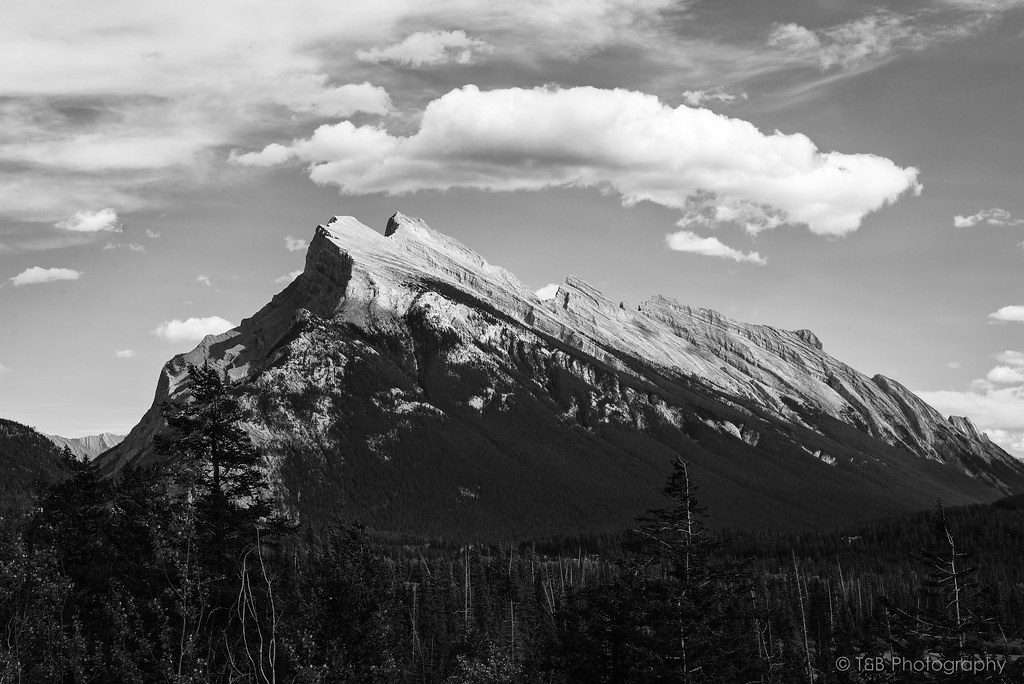
Going to the Sun Road is a monumental road. It winds 53 miles through some of the most spectacular scenery in Montana. The road is named after the dominating Going to the Sun Mountain, which stands at 9,647 feet. The road itself, which was completed in 1932, is quite the engineering spectacle, sometimes built into the sides of sheer cliff faces. As it twists and turns to its apex and the Continental Divide at Logan Pass, it offers some of the most astounding views you’ve ever seen. These mountains and valleys were carved by huge glaciers thousands of years ago, which has made these very vertical rock faces truly awe-inspiring.
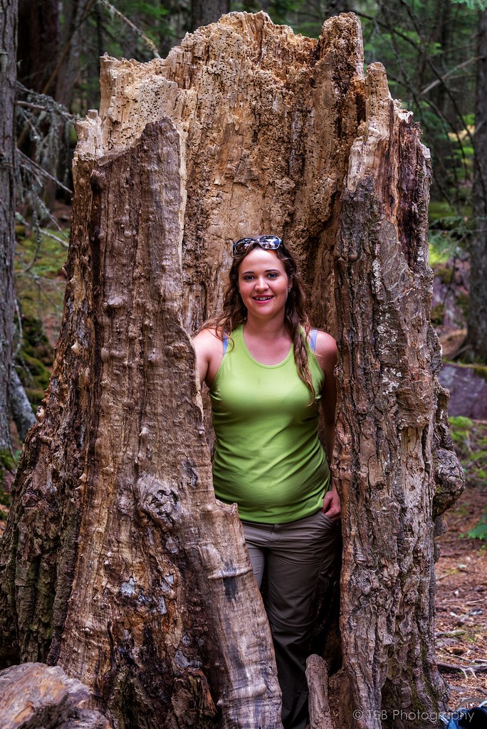
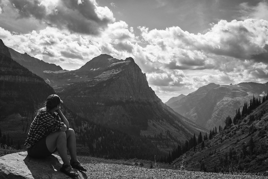
We started our way up the road. As you can see, Beret is very excited.
Before long, breaks in the trees offer really fantastic views of the mountains.
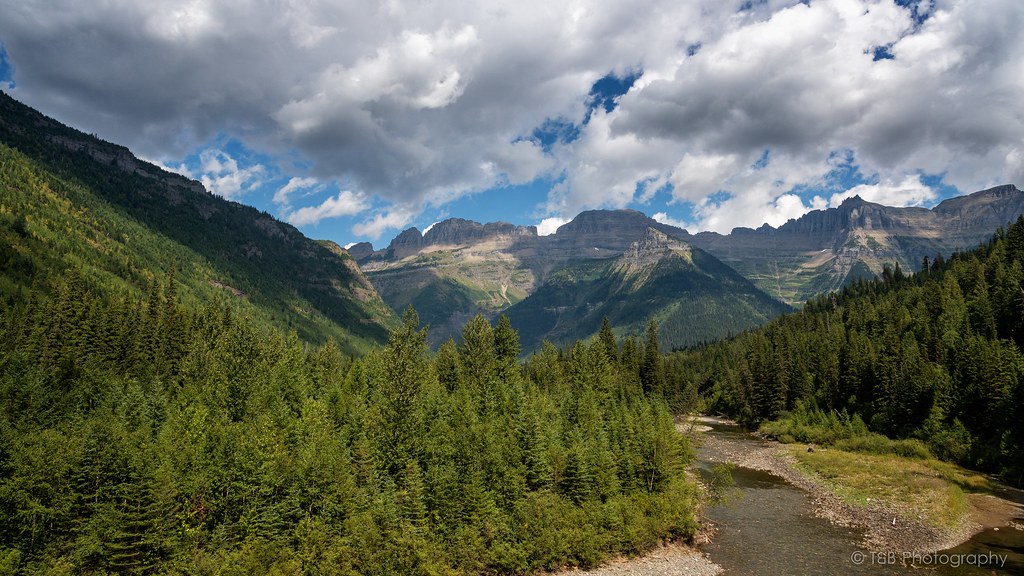
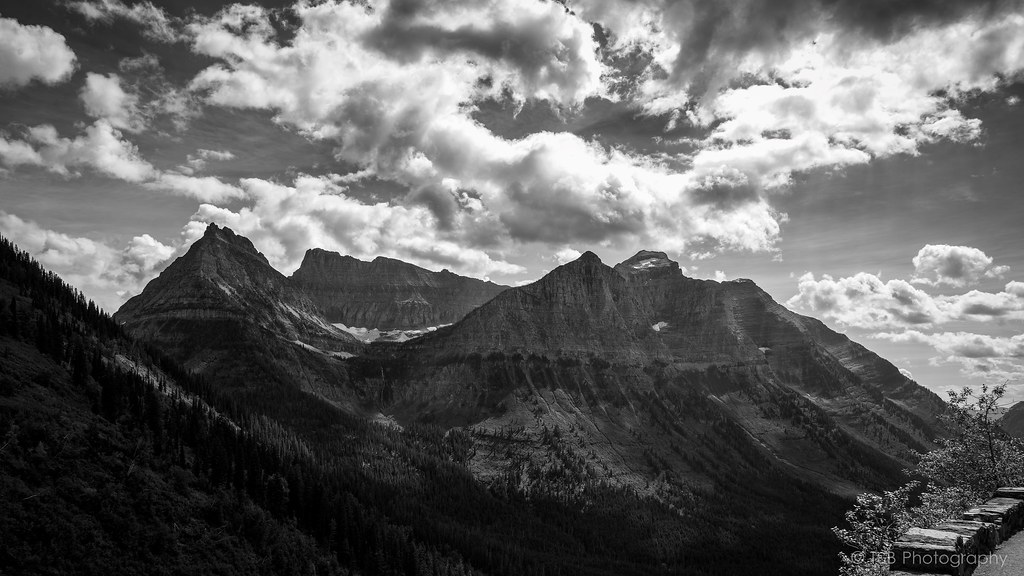
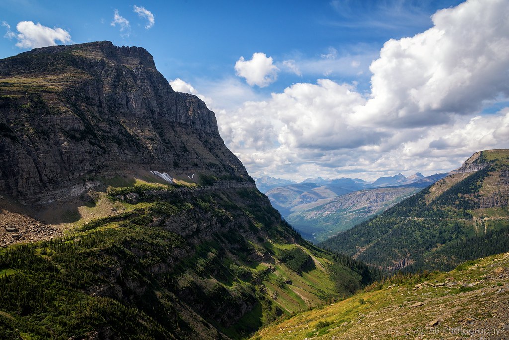
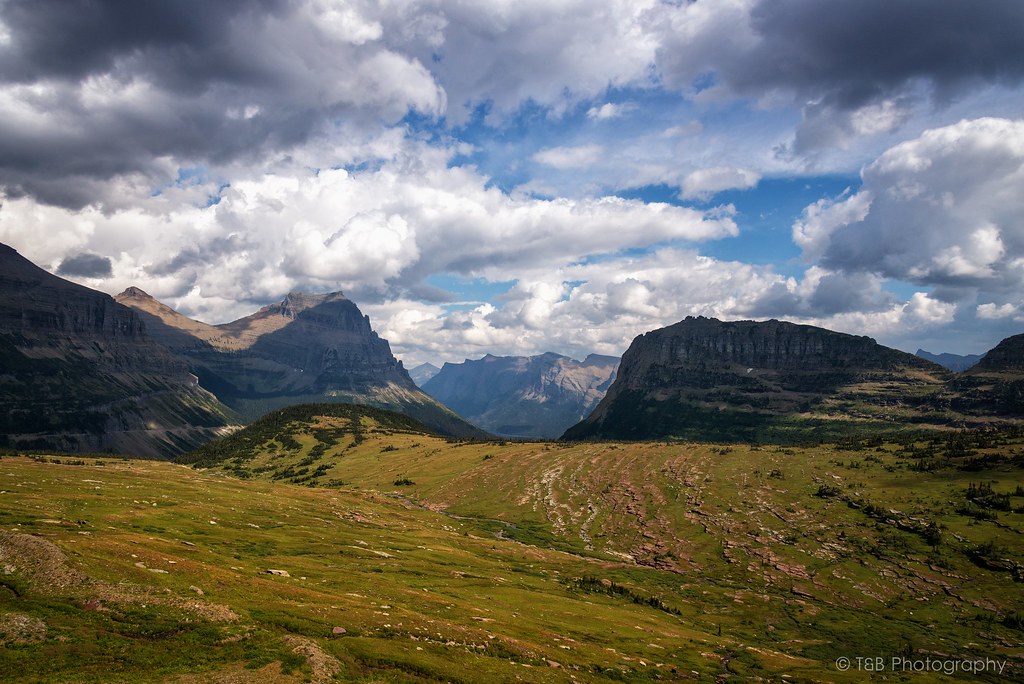
Soon after, the road begins to narrow and you cross the first switchback. As you climb, you are greeted with this enormous view of the Crown of the Continent.
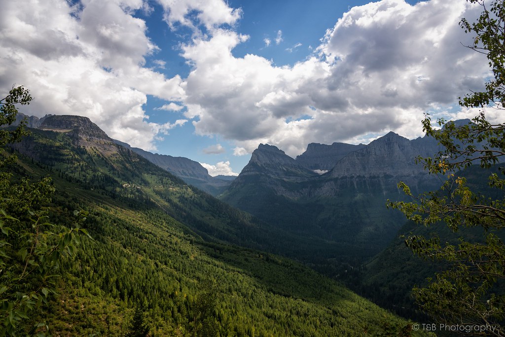
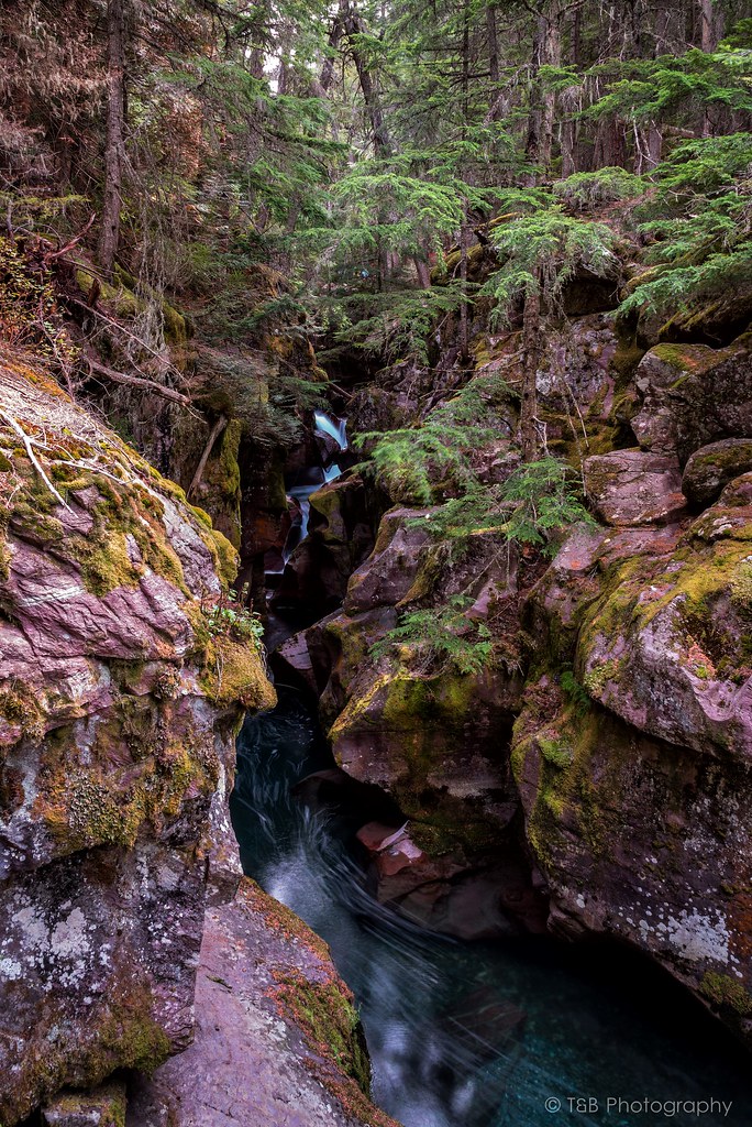
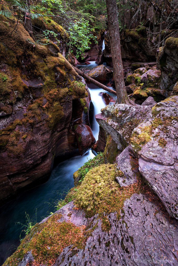
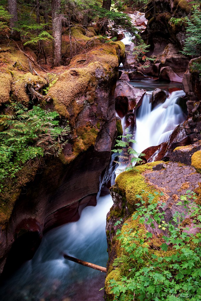
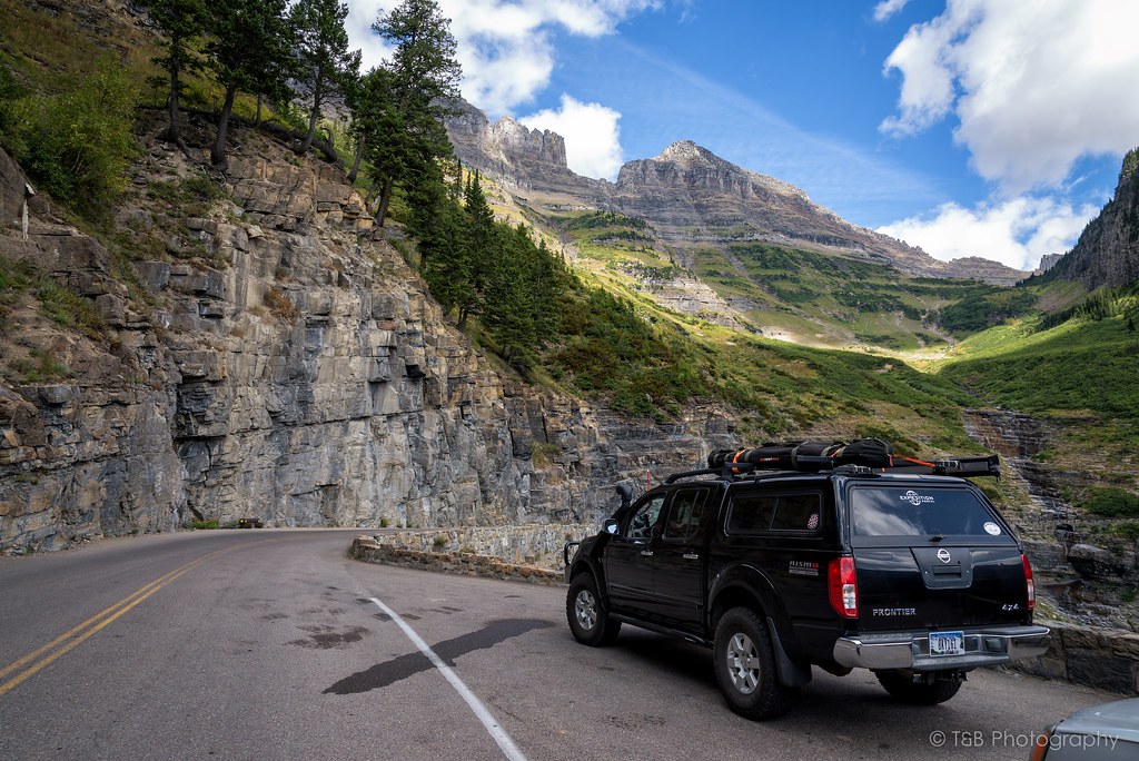
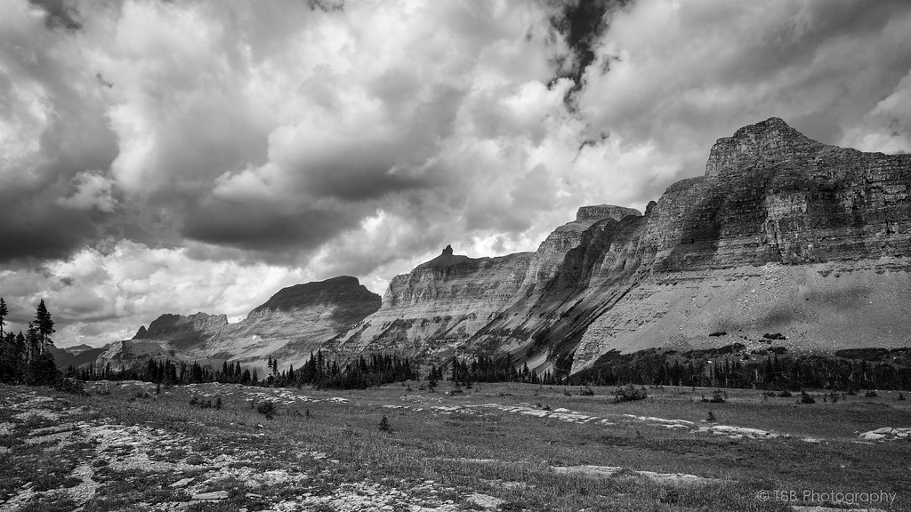
The road continues to sweep its way up the mountains. You pass running streams and waterfalls, piles of rock recently cleared from the road, and many people in vehicles far too large to be on the small mountain pass. Before long, you pass the Weeping Wall, a face of rock from which water seeps constantly. During this very dry year, the Weeping Wall was little more than a trickle. We passed the Wall and came upon one of the more captivating sights in Glacier, about a mile before reaching Logan Pass. We stopped for a while to let the scenery sink in.
Moments like these are really awe-inspiring. It’s very cool as a citizen of such a modern society full of creature comforts to be so humbled by the landscape. At times it’s actually difficult to comprehend the enormity of it. It’s an awesome feeling.
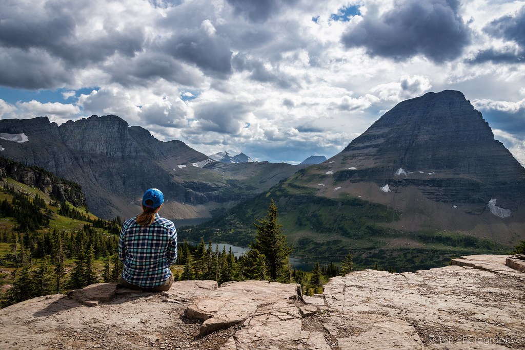
After taking in the sights here, we headed up to the highest point of Going to the Sun Road, Logan Pass. This pass is located along the Continental Divide at an altitude of 6,646 feet, and offers some really breathtaking views of the landscape beyond. There’s a small visitor’s center there with plenty of knick-knacks to buy before you go. I got myself a new patch for my headliner.

Also at Logan Pass is the Lost Lake trailhead. The Lost Lake Trail is a very developed trail with plenty of wooden steps to walk up and a very wide path. It’s fairly well traveled, but we figured it was worth the 1.5 mile hike to the lake. We were not disappointed.

The waters of lost lake are so clear and very blue. The spire rising above the lake is very impressive as well. At least we thought it was until we found out later how tall it is. It’s barely a shade over 8,500 feet, which is a good 2,500 feet lower than a mountain we had climbed a week ago. Nevertheless, it is still very beautiful and worth a stop to take it all in.
After coming back down from Lost Lake, we jumped back into the truck and started snacking as we made our way down the eastern side of Going to the Sun Road. I had a very specific destination in mind, especially as the sun was on its way down. After a few tight turns, we had the great misfortune of sitting for 25 minutes while we waited for a construction crew to finish painting a new center line on the road. At least the view was awesome, so I didn’t mind overly much.
A few weeks prior, a fire had broken out in Glacier. Just a few days before we departed, the fire had grown to encompass 15,000 acres and had shut down Going to the Sun Road. We were lucky to time our trip just days after the road had been reopened. As we rounded a corner, the landscape changed very abruptly. Suddenly, instead of a lush green forest full of life, we were surrounded by a burned out husk of a forest, blackened and acrid from the recent blaze. Nothing had survived. The trees that hadn’t burned were turned brown from the blistering heat, and are now very dead. It was devastatingly massive, and the stench of the burn was still very strong. Quite the testament to the often destructive power of nature. Unfortunately, there was no stopping allowed on this section of road, so I wasn’t able to get any photos of the aftermath.
The burned area lasted for a few miles before it opened back up into green forests again. We were enjoying the regular speed limits again when out of nowhere there was a traffic jam ahead. Thinking there was some other construction work going on, I slowed down. That’s when I spotted the black mass moving in the weeds on the side of the road. As we pulled closer, I was able to finally get a look at what all the hubbub was about.
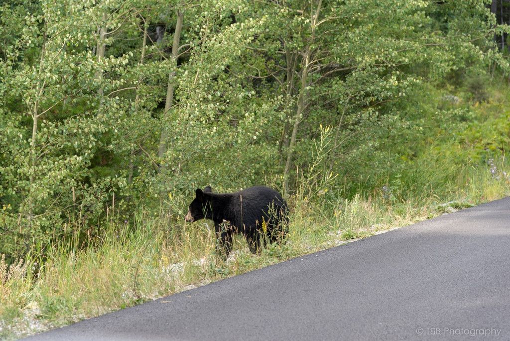
This little black bear cub was out in the open foraging for food. What an awesome sight. It’s so rare that you get a glimpse of a bear in the wild, and even though I had seen them in Montana before, it’s still fascinating to see one. We stopped and snapped a few photos before carrying on.
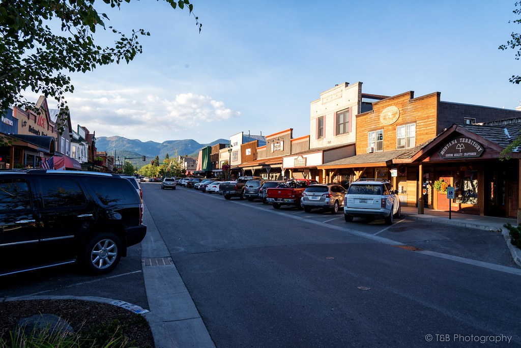
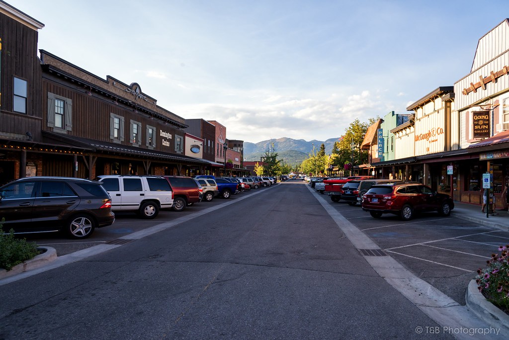
Before long we left the park and rolled into the small resort town of St. Mary. Viewing the mountains of the park from this distance is fantastic. St. Mary has a few cool little places to check out if you get the chance. We were chasing the sun before it went down though, so we turned north for a few miles. Before long we turned left and crossed back into the park. I knew what was coming, and I was very excited.
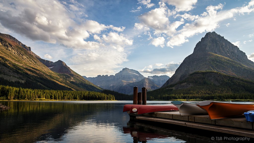
Situated in the northwest corner of Glacier National Park is my favorite little treasure there. The unbelievably beautiful Swiftcurrent Lake is surrounded by mountains, sharp walls of granite, and several active glaciers. Thousands of years ago, a massive glacier carved the landscape into the most beautiful shapes. Years of water and wind erosion has turned the scenery into this amazing spectacle.
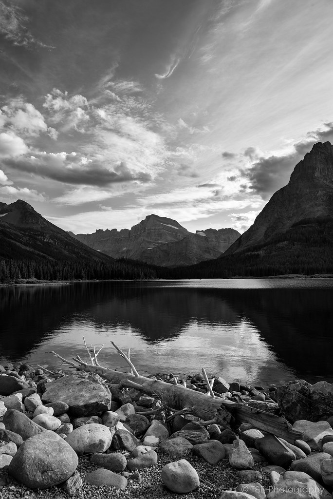
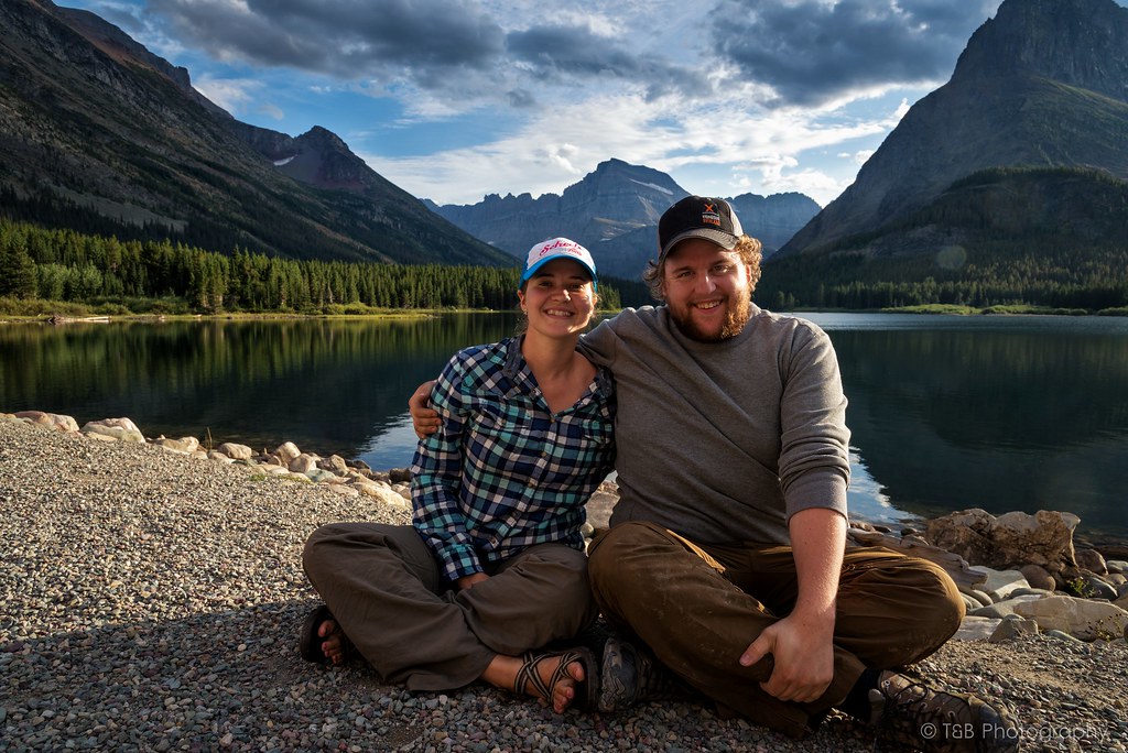
Beret and I reveled in the beauty of the sunset here, in front of the aptly named Many Glacier Hotel. Very excitedly, I framed the mountains in my camera and got one of the shots I had been planning for months.
We were pretty happy to be there.
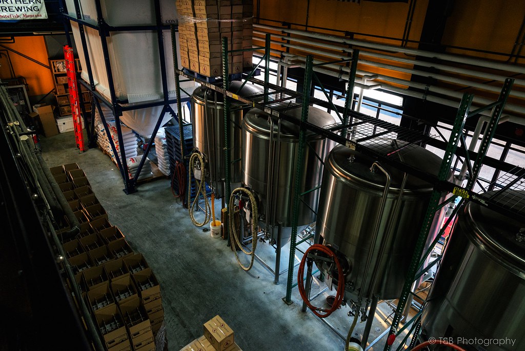
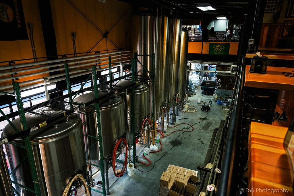
We sat for more than an hour watching one of nature’s greatest lightshows. The sky exploded into palettes of color as the sun drifted down lazily. It was a sight to behold, for sure. We shared a locally brewed beer as we sat on the beach, just about speechless. It was one of those moments I know I’ll never forget.
After managing to tear ourselves away from the view, we realized just how hungry we were! The hotel’s food was sure to be on the pricey side, so we drove up the road a bit to the Swiftcurrent Motor Lodge, where they have a small restaurant. Knowing we had to get back to Seeley Lake that night, we ordered a delicious pizza to go before turning around to go back over Going to the Sun Road again, this time in the darkness.
I like this. I think it's integral to all overland and offroad travel. Overlanding in general is about taking the hard way. It's not about taking the most convenient way from point A to point B. It's not about taking the highway and simply gawking at the sights as you fly by them at 70 miles an hour. It's about taking the long way and immersing yourself. It's about surrounding yourself with the culture and the landscape. Anyone can be a tourist and see just the things that fall on the side of the highway. Those major points may be interesting or even fascinating, but I don't think they get to the real juicy parts of the areas traveled. That's why people who are adventurers are pursuing trouble. The easy way is safe and well-traveled. The long way, the hard way, is more open to problems and potential trouble. It's more remote, harder to get to, rougher, more difficult to navigate, further from help. That's what makes it adventure.
I'm a sucker for a beautiful landscape. I've spent many years exploring the mountains of Montana, and one of the things that draws me there is the natural and untamed beauty of the places. Well, there are few places more beautiful and wild than the Canadian Rockies. Sure, the national parks are pretty developed, but get just outside those boundaries and you're into some very wild places. As such, I've wanted to explore the mountains of Alberta and BC for a long time. My fiancee, Beret, and I have talked about it for a long time, and we finally had the means to explore it this summer. We took 10 days off work and planned to make our way up to northern Montana, explore Glacier National Park, meet some people to do some wheeling in Canada, see the sights in the Canadian Rockies, and then head back down south. Living in Billings, we're not that far away from Glacier. Plus, my parents have a house in the small town of Seeley Lake, just 90 minutes from the western entrance to Glacier Park. This made the trip even more convenient. So, several months ago, we started planning the trip.
I had to finish outfitting my Frontier, known as Lola, before we could make the trip. I installed a skidplate that had been sitting in my garage for a while, got a 12v Indel-B fridge put in, installed a 175W inverter, and got a phone-based navigation system worked out. We had planned to do some wheeling with some Xterra guys outside the town of Coleman before heading up north via the Forestry Trunk Road to Jasper, so we wanted to be well equipped for several days in the backcountry. I had my Oztent and sleeping setup all dialed in. Finally, just a few days before departure, we were ready to rock.
The night of our departure, we got off work around 8PM and got the truck packed up. Originally, we had planned to do the trip with my friend in his Subaru. He was really excited to go, but backed out at the last minute due to reliability concerns with his car. Since we didn't have to wait on him anymore, we hit the road. Our first stop was in Seeley Lake, where we would spend a couple of days exploring Glacier before making the push to Canada. We also could leave our two dogs with my parents to minimize the hassle of traveling in a foreign country. We arrived in Seeley around 2 AM and hit the bed, dog tired.
We got up early the next morning and spent a few hours with my parents before heading north to Glacier. A brief stop had to be made just outside the park for some locally made huckleberry pie before going in. $25 later and we were in one of America's most beautiful natural landmarks. Our number one goal (as it should be for everyone) upon entering the park was a drive over the breathtakingly beautiful Going to the Sun Road.
Going to the Sun Road is a monumental road. It winds 53 miles through some of the most spectacular scenery in Montana. The road is named after the dominating Going to the Sun Mountain, which stands at 9,647 feet. The road itself, which was completed in 1932, is quite the engineering spectacle, sometimes built into the sides of sheer cliff faces. As it twists and turns to its apex and the Continental Divide at Logan Pass, it offers some of the most astounding views you’ve ever seen. These mountains and valleys were carved by huge glaciers thousands of years ago, which has made these very vertical rock faces truly awe-inspiring.
We started our way up the road. As you can see, Beret is very excited.
Before long, breaks in the trees offer really fantastic views of the mountains.
Soon after, the road begins to narrow and you cross the first switchback. As you climb, you are greeted with this enormous view of the Crown of the Continent.
The road continues to sweep its way up the mountains. You pass running streams and waterfalls, piles of rock recently cleared from the road, and many people in vehicles far too large to be on the small mountain pass. Before long, you pass the Weeping Wall, a face of rock from which water seeps constantly. During this very dry year, the Weeping Wall was little more than a trickle. We passed the Wall and came upon one of the more captivating sights in Glacier, about a mile before reaching Logan Pass. We stopped for a while to let the scenery sink in.
Moments like these are really awe-inspiring. It’s very cool as a citizen of such a modern society full of creature comforts to be so humbled by the landscape. At times it’s actually difficult to comprehend the enormity of it. It’s an awesome feeling.
After taking in the sights here, we headed up to the highest point of Going to the Sun Road, Logan Pass. This pass is located along the Continental Divide at an altitude of 6,646 feet, and offers some really breathtaking views of the landscape beyond. There’s a small visitor’s center there with plenty of knick-knacks to buy before you go. I got myself a new patch for my headliner.
Also at Logan Pass is the Lost Lake trailhead. The Lost Lake Trail is a very developed trail with plenty of wooden steps to walk up and a very wide path. It’s fairly well traveled, but we figured it was worth the 1.5 mile hike to the lake. We were not disappointed.
The waters of lost lake are so clear and very blue. The spire rising above the lake is very impressive as well. At least we thought it was until we found out later how tall it is. It’s barely a shade over 8,500 feet, which is a good 2,500 feet lower than a mountain we had climbed a week ago. Nevertheless, it is still very beautiful and worth a stop to take it all in.
After coming back down from Lost Lake, we jumped back into the truck and started snacking as we made our way down the eastern side of Going to the Sun Road. I had a very specific destination in mind, especially as the sun was on its way down. After a few tight turns, we had the great misfortune of sitting for 25 minutes while we waited for a construction crew to finish painting a new center line on the road. At least the view was awesome, so I didn’t mind overly much.
A few weeks prior, a fire had broken out in Glacier. Just a few days before we departed, the fire had grown to encompass 15,000 acres and had shut down Going to the Sun Road. We were lucky to time our trip just days after the road had been reopened. As we rounded a corner, the landscape changed very abruptly. Suddenly, instead of a lush green forest full of life, we were surrounded by a burned out husk of a forest, blackened and acrid from the recent blaze. Nothing had survived. The trees that hadn’t burned were turned brown from the blistering heat, and are now very dead. It was devastatingly massive, and the stench of the burn was still very strong. Quite the testament to the often destructive power of nature. Unfortunately, there was no stopping allowed on this section of road, so I wasn’t able to get any photos of the aftermath.
The burned area lasted for a few miles before it opened back up into green forests again. We were enjoying the regular speed limits again when out of nowhere there was a traffic jam ahead. Thinking there was some other construction work going on, I slowed down. That’s when I spotted the black mass moving in the weeds on the side of the road. As we pulled closer, I was able to finally get a look at what all the hubbub was about.

This little black bear cub was out in the open foraging for food. What an awesome sight. It’s so rare that you get a glimpse of a bear in the wild, and even though I had seen them in Montana before, it’s still fascinating to see one. We stopped and snapped a few photos before carrying on.
Before long we left the park and rolled into the small resort town of St. Mary. Viewing the mountains of the park from this distance is fantastic. St. Mary has a few cool little places to check out if you get the chance. We were chasing the sun before it went down though, so we turned north for a few miles. Before long we turned left and crossed back into the park. I knew what was coming, and I was very excited.
Situated in the northwest corner of Glacier National Park is my favorite little treasure there. The unbelievably beautiful Swiftcurrent Lake is surrounded by mountains, sharp walls of granite, and several active glaciers. Thousands of years ago, a massive glacier carved the landscape into the most beautiful shapes. Years of water and wind erosion has turned the scenery into this amazing spectacle.
Beret and I reveled in the beauty of the sunset here, in front of the aptly named Many Glacier Hotel. Very excitedly, I framed the mountains in my camera and got one of the shots I had been planning for months.
We were pretty happy to be there.
We sat for more than an hour watching one of nature’s greatest lightshows. The sky exploded into palettes of color as the sun drifted down lazily. It was a sight to behold, for sure. We shared a locally brewed beer as we sat on the beach, just about speechless. It was one of those moments I know I’ll never forget.
After managing to tear ourselves away from the view, we realized just how hungry we were! The hotel’s food was sure to be on the pricey side, so we drove up the road a bit to the Swiftcurrent Motor Lodge, where they have a small restaurant. Knowing we had to get back to Seeley Lake that night, we ordered a delicious pizza to go before turning around to go back over Going to the Sun Road again, this time in the darkness.