Arizona Strip - 2016 trip report

Martinjmpr

Wiffleball Batter
Nice that you included profiles of the people. Seems like a great group to travel with. You're based out of SoCal?
 

Explorer 1

Explorer 1
Nice that you included profiles of the people. Seems like a great group to travel with. You're based out of SoCal?

With every group there are differences and disagreements, especially when traveling such long hours and with so many challenges, but you're right, this was a good group to travel with and since we took the adventure as it was presented to us daily....ultimately we had no disappointments, only unexpected adventures!

We'll I guess you could say we're based out of Southern California, at least that is where I live. The small group I do a lot of traveling with has it's own Forum to keep track of each other and communicate, nothing all that formal. You welcome to take a look, It's:

http://fourwheelfriends.boards.net/


Thanks,
Fred
Explorer 1
 
Last edited:

Explorer 1

Explorer 1
Mollie's Point....Finally!

Day 7 – Part 3
Mollies Point

After the unique "get away cabin" the trail had a few more rocky sections. Just before a rocky section I heard over the radio Cody’s voice stating he was finished and couldn’t go any further. He had been nursing a bad control arm bushing on his front axle and it had deteriorated to the point that every rock he went over there was metal on metal contact. Jim his passenger was committed to whatever Cody decided and it was obvious that all the stress and damage to the Explore had worn on Cody. He wasn’t going any further. There was a conflict of wills, I wasn’t willing to stop or turn back, and he wasn’t willing to go any further.

We discuss our options and it was decided that Cody and Jim would make camp right there where they stopped. I would push on with the rest of us to Mollie’s Point, camp and then meet up with them on the way out the next day. There didn’t seem to be any other viable option.

After making sure Cody and Jim had all they needed for the evening and the next day, we continued on hoping to make camp before dark. After a short distance Jim’s voice came over the radio, verifying our return route out of Parashant Canyon and if the junction at Mule Point Pond is where we would exit. I gave him an affirmative without any further conversation.

As we came around MN (Mollie’s Nipple) the road narrowed even more and the soil changed from rocky to a more red sand type. It also leveled out was much easier to travel on. The road now traveled parallel to the canyon leading us further and further away from where Parashant Canyon empties in to the Grand Canyon.

One more gully to descend and climb then a small rise and there it was, road end. It was a long struggle….but every bit worth it.

The sun was quickly setting. I called to the others behind me to let them know they were almost there. Again, pictures don’t do justice, but it’s the best I can do to describe what we saw.


IMG_2587_zps1rf1hus8.jpg


IMG_2595_zps6agdsokv.jpg


IMG_0860_zps9ptsomuv.jpg


Day%207_zps2dzfvarm.jpg


IMG_0842_zpstfvasaxf.jpg


IMG_0833_zpsnvgy04rc.jpg


IMG_0831_zpsd2orqw7o.jpg


IMG_0830_zpserzbtqfa.jpg


IMG_4344_zpszpeekcbb.jpg


Another evening around the campfire, this time the clouds cleared and we had a sky full of stars. Eleven and one half hours and 59 miles to reach this “point” and such a glorious point at that. We were tired. As I fell asleep I wondered how Cody and Jim were fairing. We would find out soon enough tomorrow.

Thanks,
Fred
Explorer 1
 

Explorer 1

Explorer 1
Day 8 - Exiting Parshant Canyon

Day 8
Parashant Canyon exit.

We decided to have another Big Breakfast morning at Molly’s Point. We arrives so late the day before and we wanted to enjoy the sunrise and view.

The morning was cool but nowhere near what we had experienced at Poverty. We took time to enjoy some of the morning light changes and of course try our hand at picture taking.

Interesting enough, that point just on the left of center in the foreground is part of Kelly Point. Such a short distance as the "crow flies" but days away by road.

IMG_0885_zpsmwoznvdl.jpg


IMG_0887_zpsnq9uktwt.jpg


IMG_0889_zpsdatlfyke.jpg


IMG_0892_zpsibla1d5a.jpg


IMG_0898_zpslbncxl6j.jpg


The road almost completely loops around MN on the right side. Molly's seen in the center.

IMG_0882_zpseusvedgo.jpg


IMG_0879_zps6rredul0.jpg


IMG_0875_zpssmblie6s.jpg


IMG_0871_zps6wxl3xxr.jpg


IMG_0868_zpsmp1pemnp.jpg


I also concerned about Cody and Jim we left on the trail late in the afternoon yesterday. I had a sneaky suspension that they might try to make some miles back out of the canyon after we departed. I only hoped he didn’t have further suspension failures which would require us pulling him up out of the steep section at the end of the canyon.

Here is the Molly's Point Group just before we headed back up the canyon:

IMG_4350_zpswg4vdxcy.jpg


The view back from our campsite with Molly’s predominate nipple on the right.

IMG_0864_zpsgbpbt9x6.jpg


Since we traveled out the same way we came in, we were all a bit more relaxed knowing what to expect of the trail. We also remembered to take more movies of us traveling.


Once we passed where we left Cody & Jim the day before my suspicions were confirmed that they were trying to make their way ahead of us out to Mule Point Pond. The further we traveled without any sight of them or radio contact the better the chances would be that we wouldn’t see them again until we exited Parashant Canyon.

The climb out of the canyon especially toward the end has several steep climbs over loose rocks. Nothing all that technical, just steep and loose.


On the final climb we made radio contact with Cody & Jim waiting for us at Mule Point Pond. Turns out that right after we left them on the trail the day before they decided to try and make as much mileage back out as they could that day. It took them until 9:30 pm to make their way out to Mule Point Pond. I think Cody enjoyed the drive out with a chance to use his additional driving lights. They then set camp and stayed there waiting for our return.

Here we are, all briefly united again at Mule Point Pond:

IMG_4355_zpsh4sb9fts.jpg


Next: “The big separation”

Thanks,
Fred
Explorer 1
 

Explorer 1

Explorer 1
Day - The big separation and WHitmore Point & Canyon

Day 8 – The big separation

It took us only 4 ½ hours to retrace our way out of Parashant Canyon. While we were traveling out I started hearing “chatter” on plans some were making to start their way home once we reached the top. It’s not unusual for groups once they pass the one week mark to start to grow a bit weary and out come the “excuses to start heading home. This group was no different. I gave my blessing to all who want to head home and once we reached Mule Point Pond all but Dan had chosen, for one reason or another to exit.

As they discussed their route out Dan and I left for our next destination, Whitmore Point.

Whitmore%20Point_zpsaahfjp0x.jpg


We made it from Mule Point Pond in just over 1 hour, 38 miles. From the North/west side of the point we got a grand view of Parashant Canyon and some of the road we traveled.

These pictures are in sequence from the beginning of Parashant Canyon panning down toward Molly’s Point.


IMG_0910_zpsywexbshi.jpg


IMG_0909_zpss4znhk6j.jpg


IMG_2598_zps75jsjmbl.jpg


IMG_0911_zpsfpd0uu5w.jpg


And when you put it all together, it looks like this:

IMG_2597_zpsq7g0rsbt.jpg


Now that we were down to just two vehicles, finding a camping spot was much easier. There were two good sites on Whitmore Point, one on the south/east side well protected from wind. I let Dan make the decision if we were to camp here or push on down to Whitmore Canyon for the night, he chose the latter.

Here is a picture looking east toward Whitmore Canyon. You can clearly see the flow of the lava which at one time dammed the Colorado River and formed a huge lake.


IMG_2601_zpspitodaql.jpg


IMG_4358_zpsi6n6xsgg.jpg


On the way down from Whitmore point one can also get a great view of “Hells Hole” in the distance.

IMG_2602_zpsebgtofgi.jpg


On our way down to Whitmore Canyon we stopped at Bar 10 Ranch to verify they would sell us some additional gasoline, without which Dan and my adventure would also quickly end. I’ve always been impressed with the great attitude of the staff at Bar 10 and their willingness to help. We decided to purchase our gas tomorrow morning on the way out.

Whitmore Canyon takes you about as low and as close to the Colorado River as you can get on the North Rim. There is even a hiking trail which takes about 30 minutes to hike down to the water. We arrive at the road end which is also the barren camping spot just before evening.

IMG_4365_zpsbkqbot98.jpg


IMG_0923_zpsgweospju.jpg


We also were blessed with the sight of some rafters going by and making camp below up on the river.

IMG_2604_zpsybnp41du.jpg


To give you some perspective….that little dot in the river is 3 (THREE) full size rafts tied together!

IMG_2603_zpsv8rtwab6.jpg


Once again we enjoyed a beautiful evening, watching the colors change and the glory of such a place.

IMG_0921_zpsnafmosue.jpg


IMG_4364_zpsm8bqrs4q.jpg


We had a little bit more time after dinner so I mixed up the birthday cake for Jim (who wasn’t there) prepared the Old Dutch Oven and it ended up being enjoyed by just Dan & I with half left over to have with breakfast the next day. (Sorry Jim!)

IMG_0933_zpsgagakft9.jpg


(I use the extra butter and brown sugar recipe)

Thanks,
Fred
Explorer 1
 

mph

Expedition Leader
that's a wonderful campsite and spot...Love that area. Looks like the weather held out:)
 

Explorer 1

Explorer 1
Here's the map for Whitmore Point, Bar 10 and Pa's Pocket:

Whitmore%20Canyon%20Rd%20End%20-%20RT%2030.2%20miles_zps5o6psyww.jpg


You can also see Hell's hole too.

Thanks,
Fred
Explorer 1
 

Explorer 1

Explorer 1
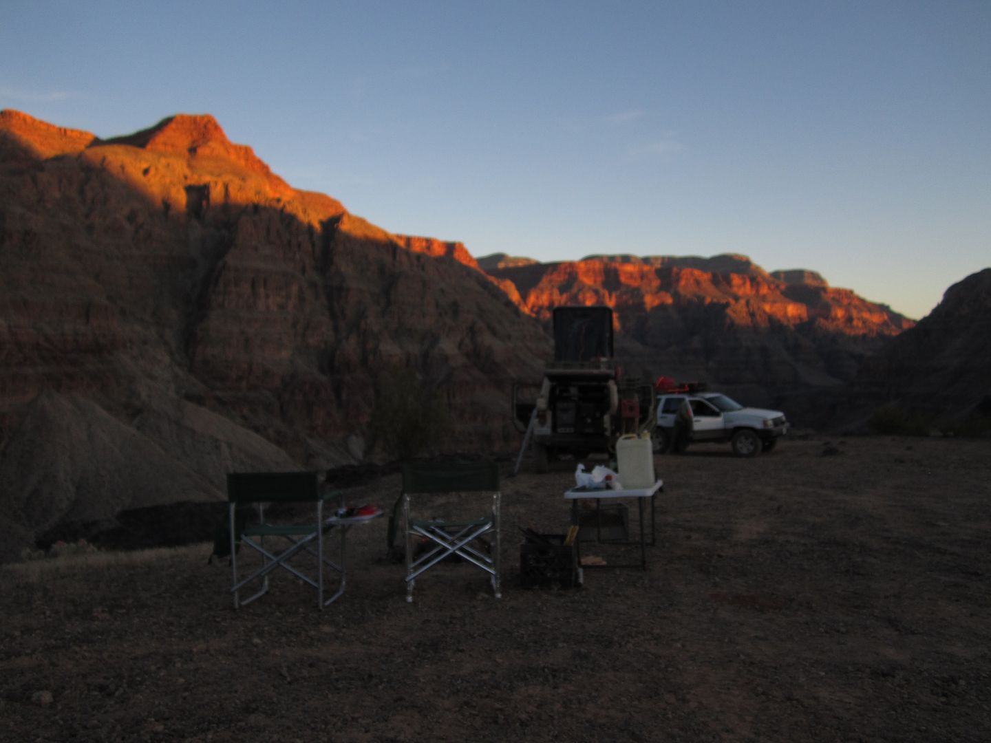
Day 9 -Alone again........

Day 9 – Alone again

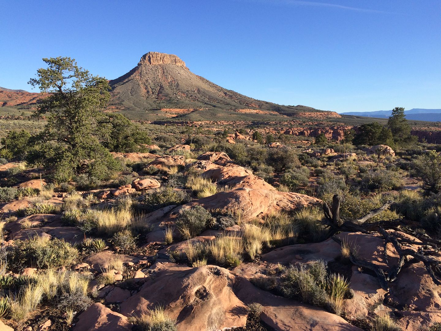
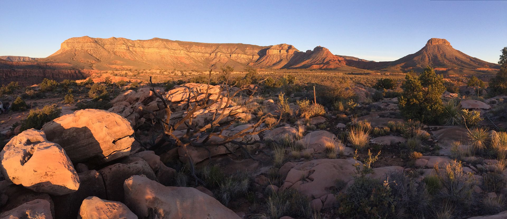
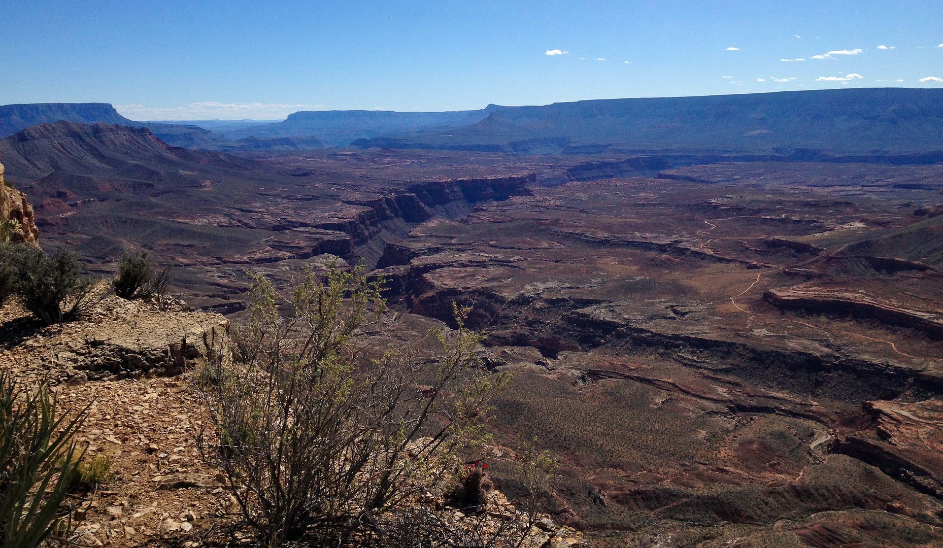
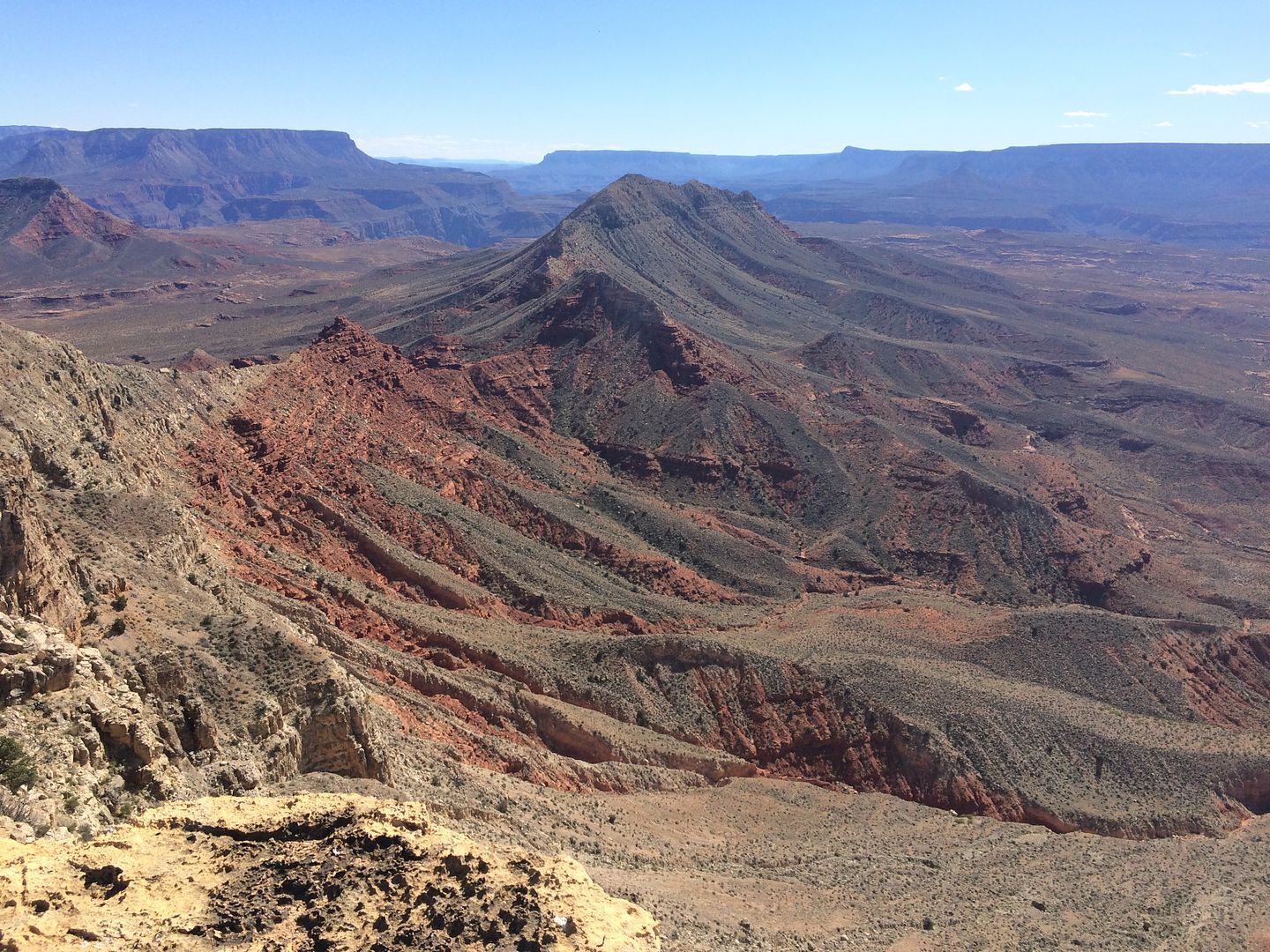
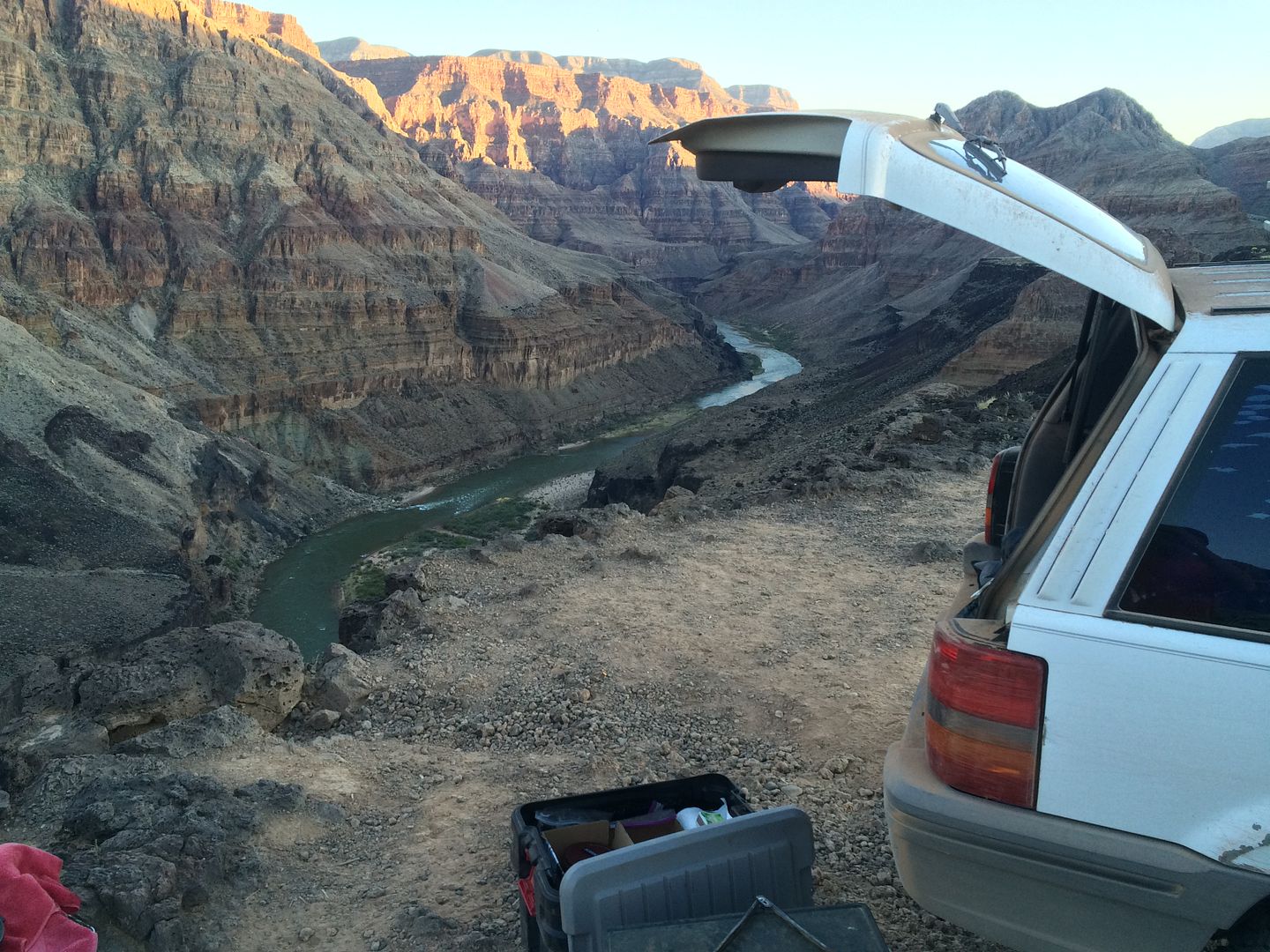
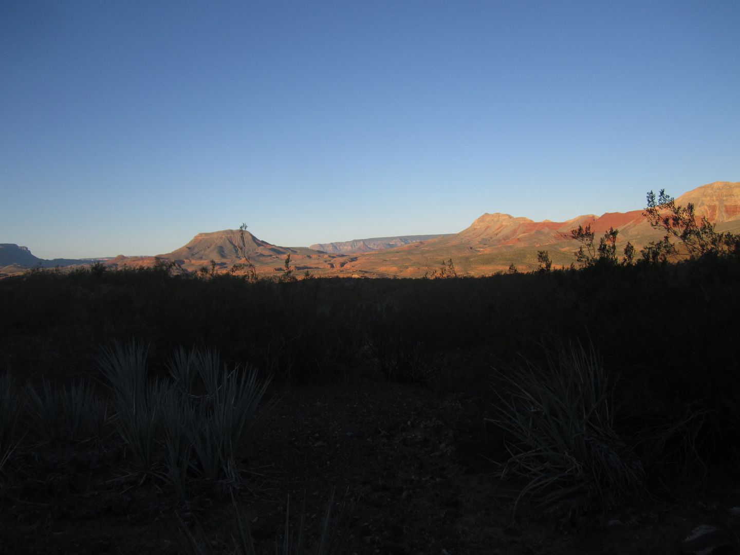
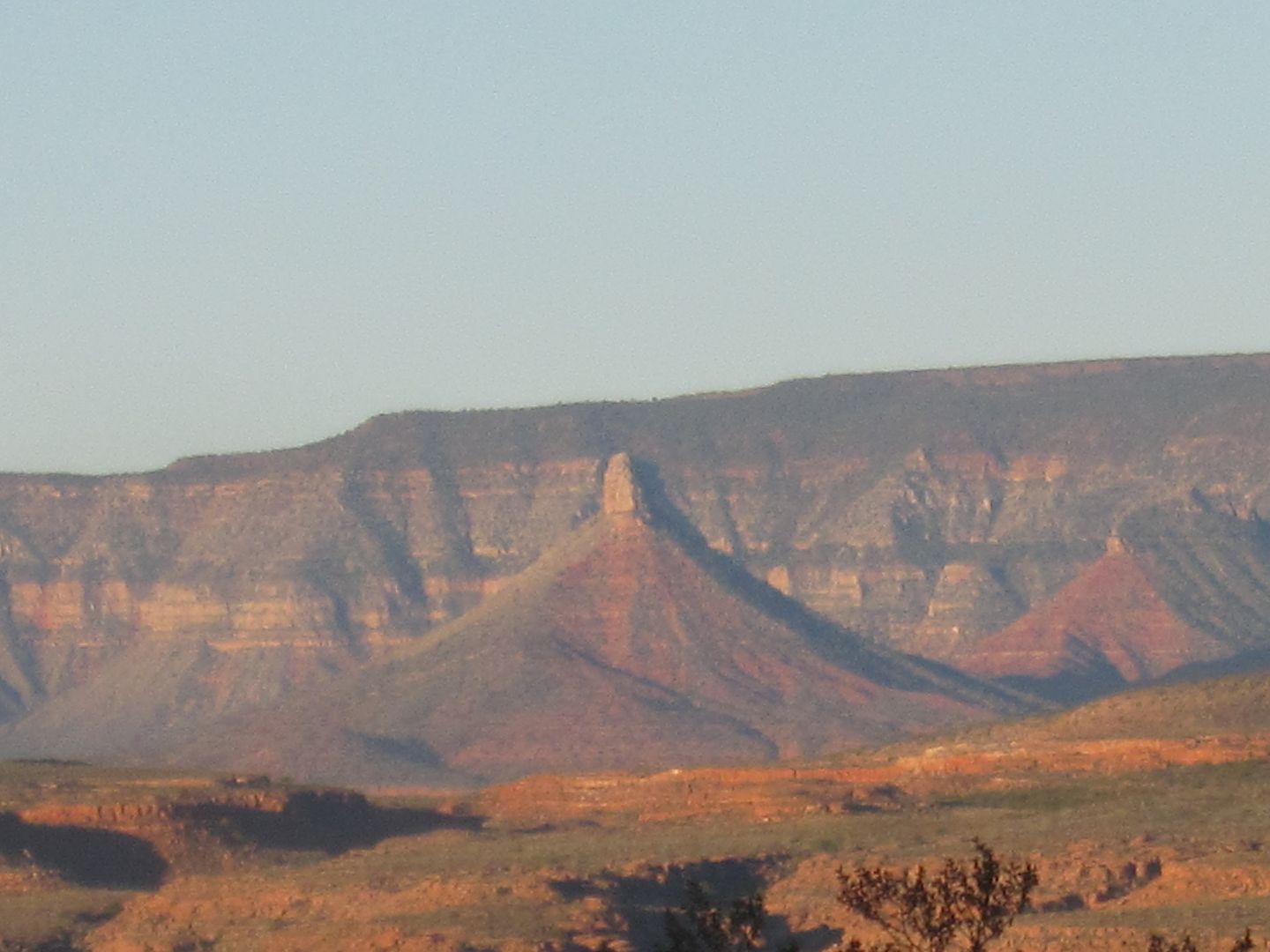
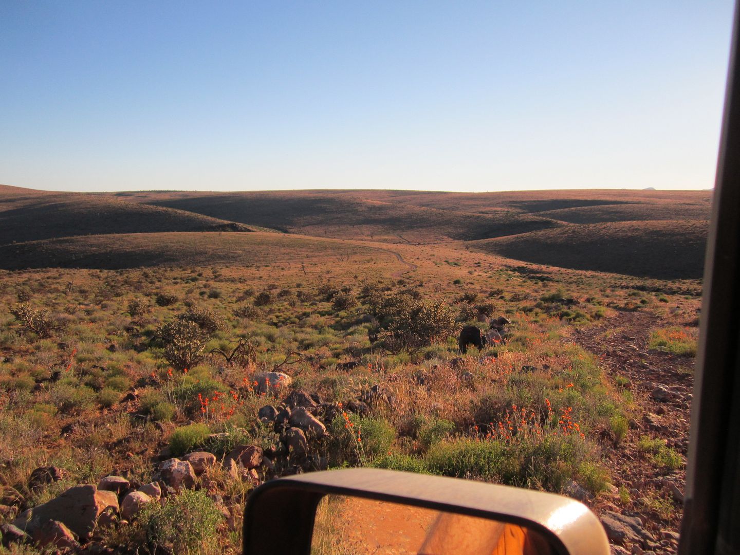
On the way back up Whitmore Canyon one could barely make out Molly’s Nipple toward the west. I took two pictures.
IMG_4368_zpswgux22rp.jpg


IMG_4366_zpsv9iihs1k.jpg


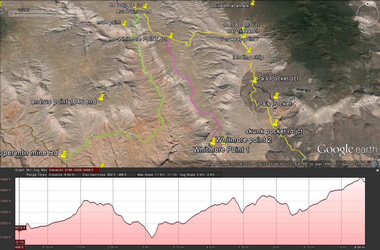
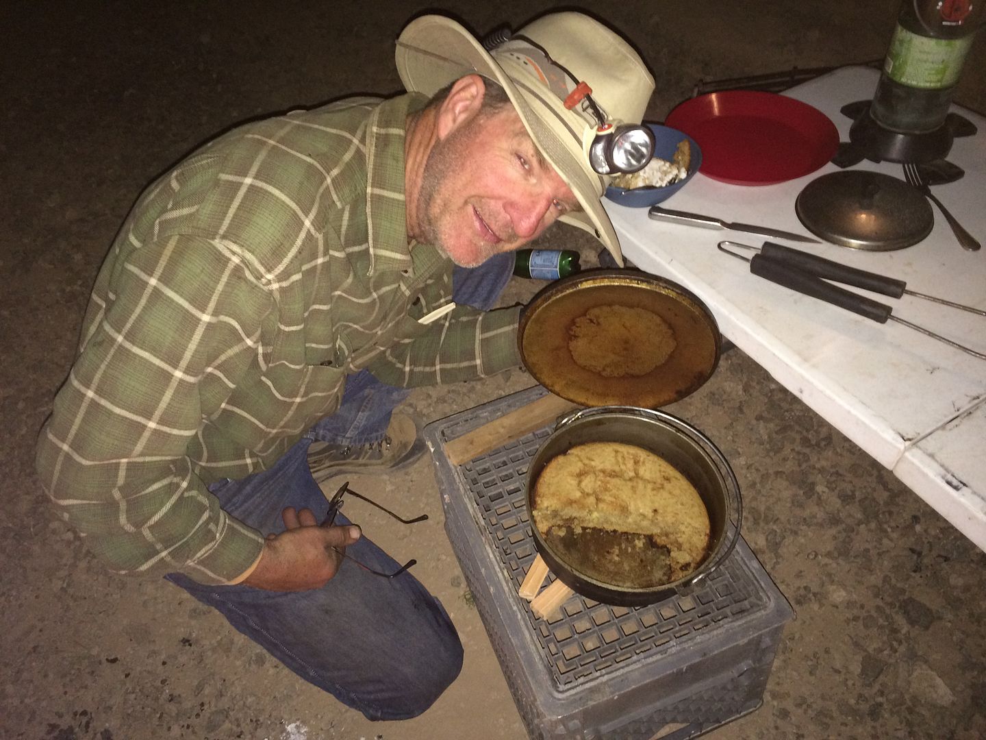
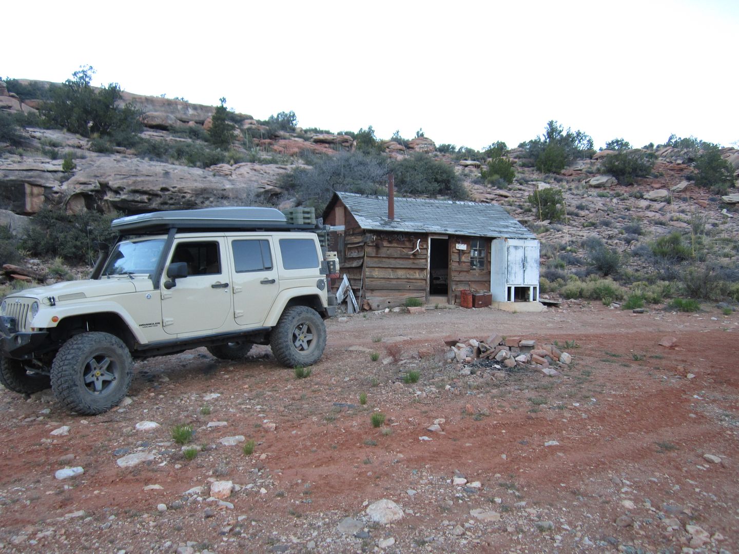
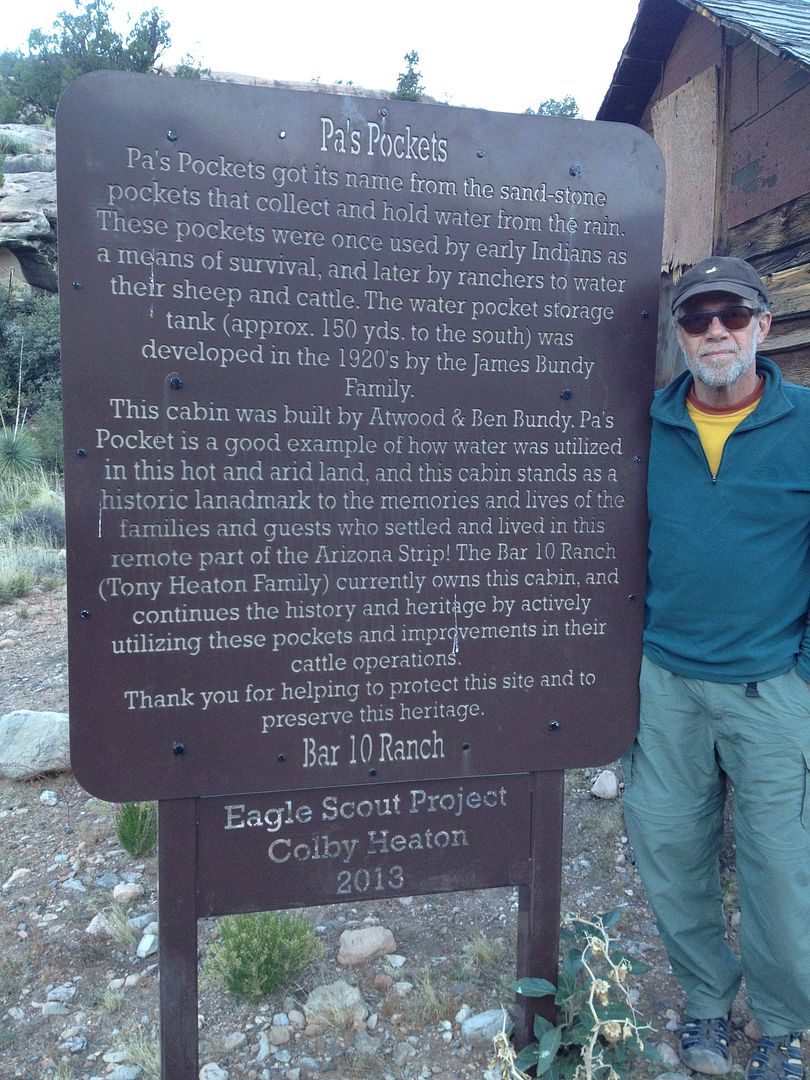
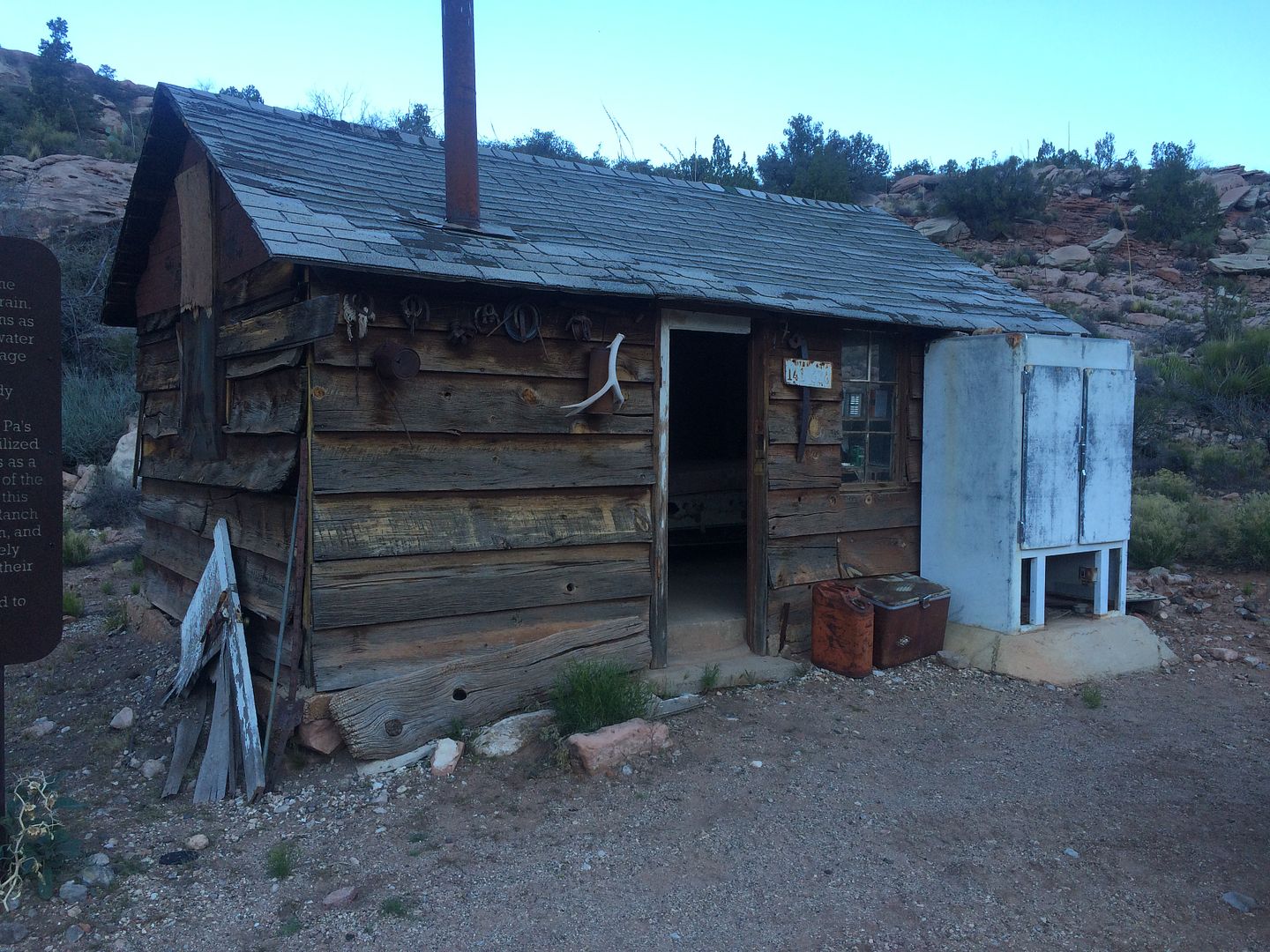
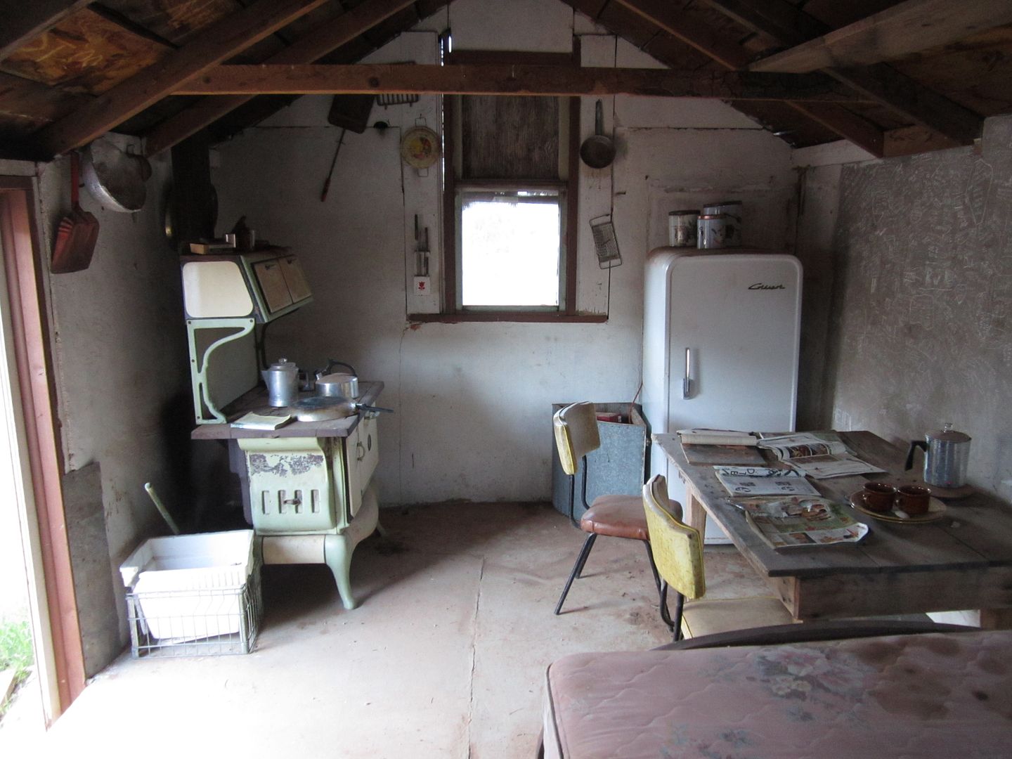
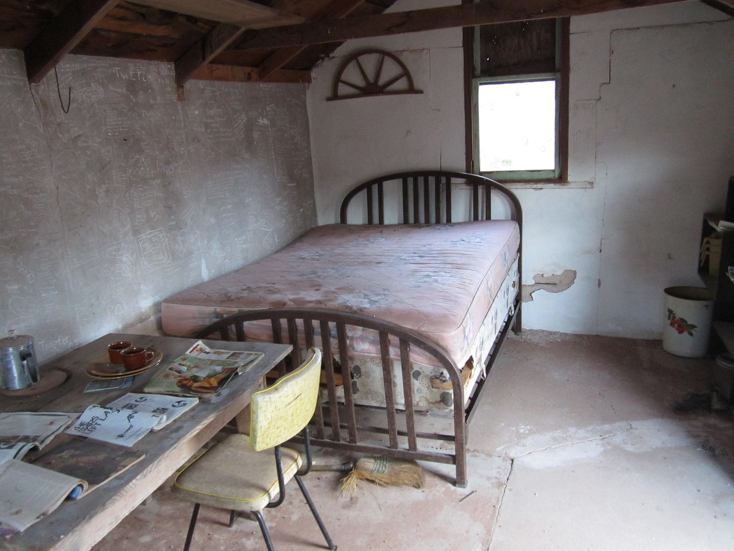
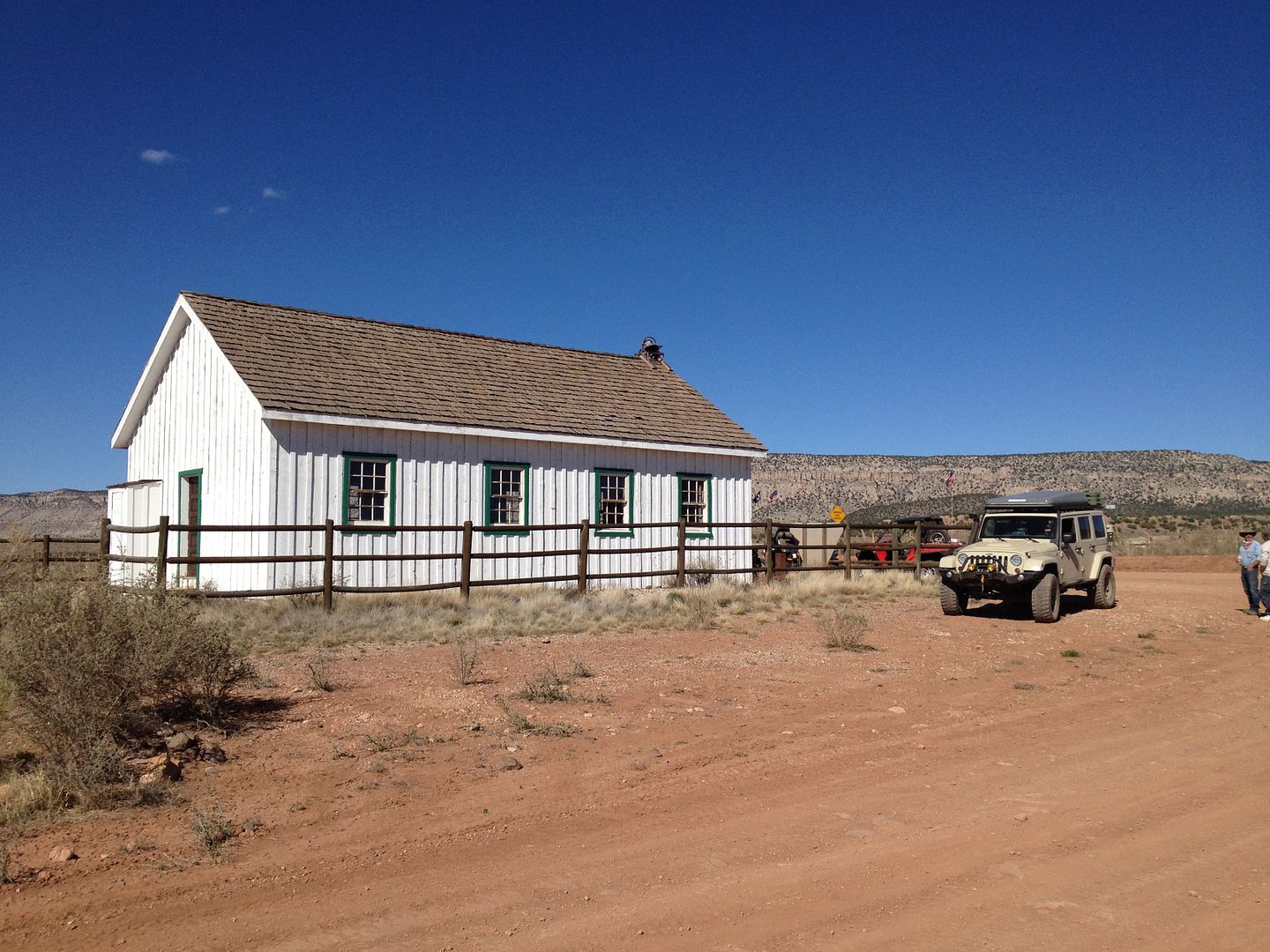
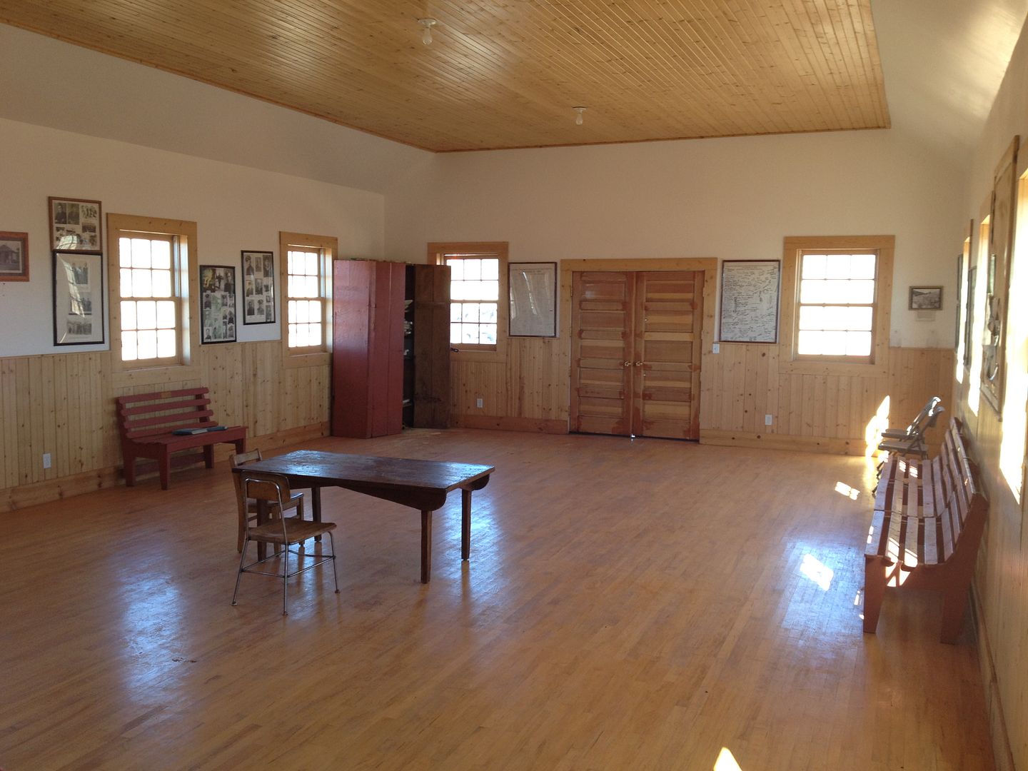
The initial climb away from the camp spot is somewhat steep and rocky. I wanted to make a side trip to Pa’s Pocket this time as in 2011 we bypassed this historic cabin.

IMG_4372_zpsfpsbttzf.jpg


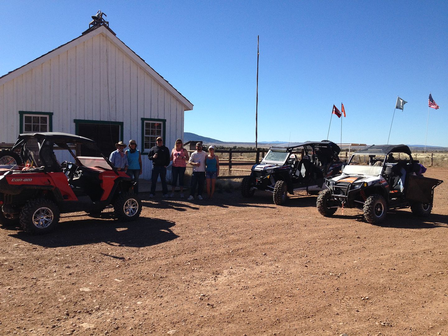
It’s quite well preserved including furnishing and lots of dated LDS literature inside. I’ll just let you read about it here:

IMG_2622_zps1bt4kgfz.jpg


The Bundy family had I believe 9 kids, I was thinking about what it would be like with that large of a family is such a small place, but later I found out that they actually lived over near the school house with the large family and this was just a cabin some of the sons stayed in when they were working the herds.

IMG_0934_zpsm9fk9nda.jpg


IMG_4371_zps2ltuau9a.jpg


IMG_4370_zpsprpi7cfq.jpg


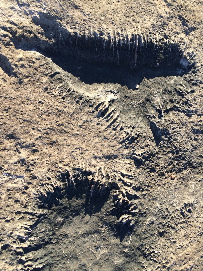
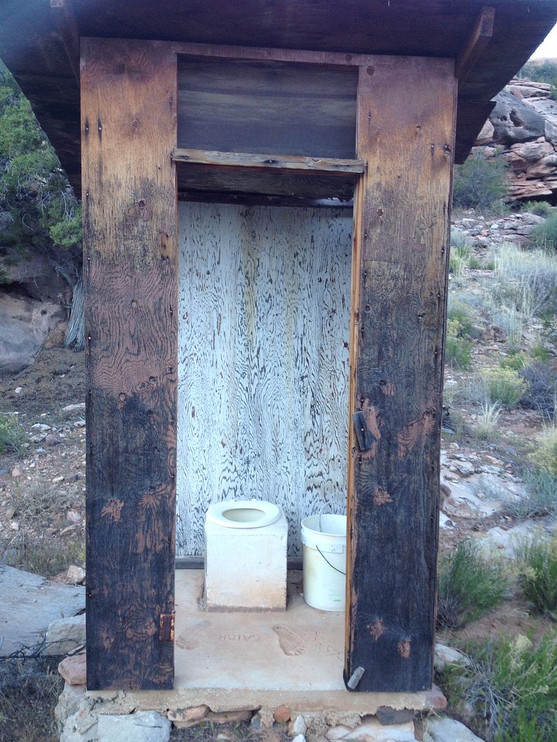
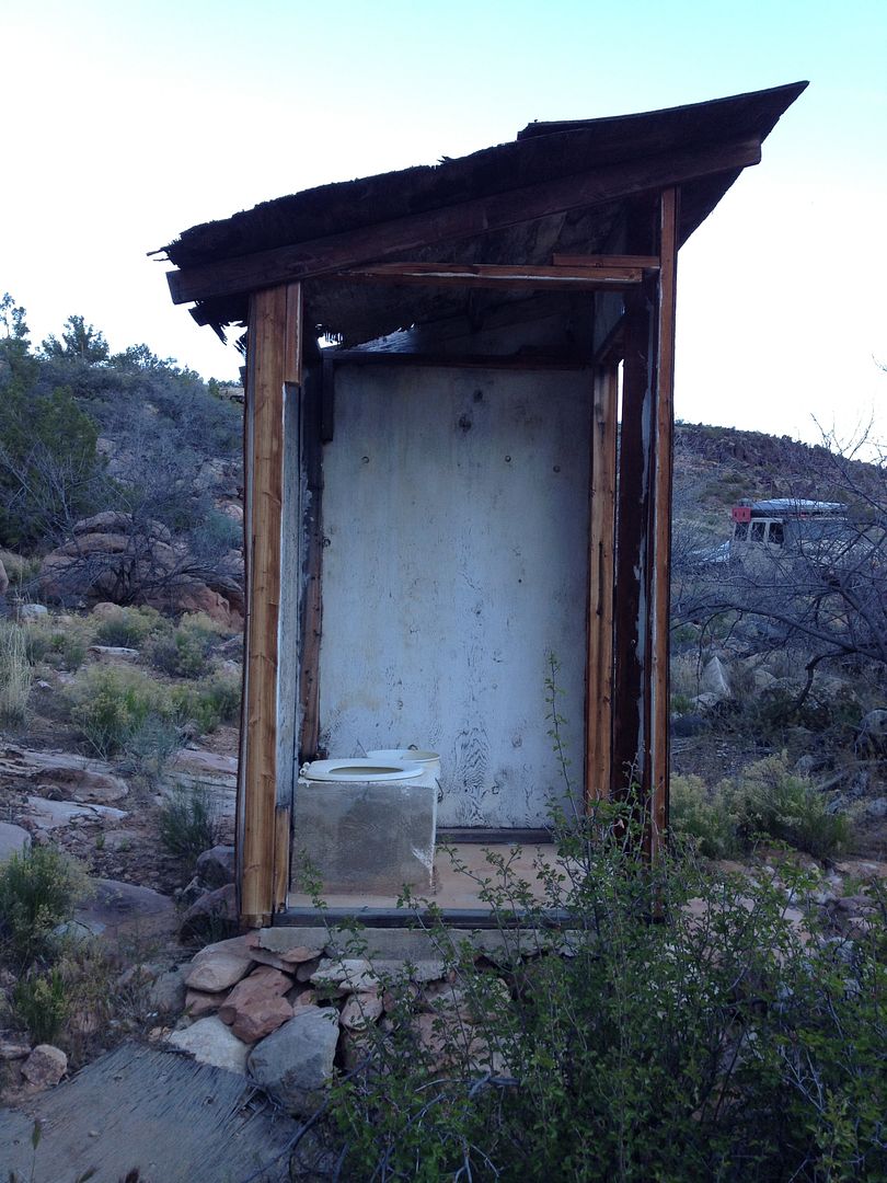
It has a rather nice outhouse with an open air feeling and great side view:

IMG_2623_zpsurqckjkx.jpg


IMG_2624_zpsgkhjngm5.jpg


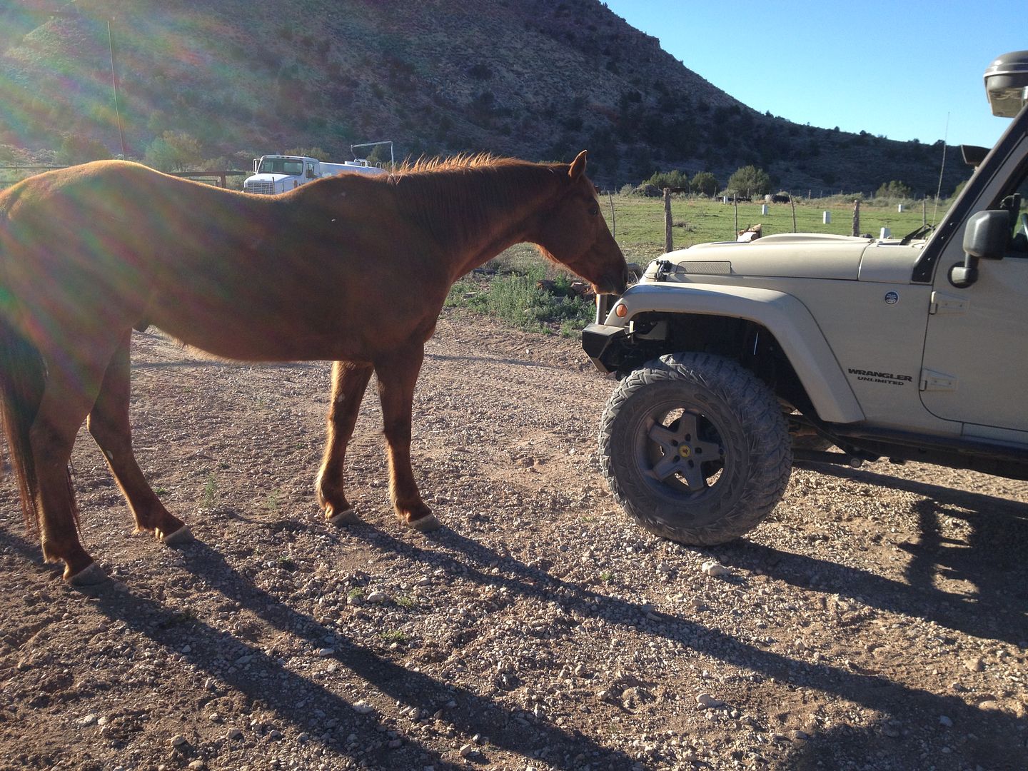
Next stop was the good folks at Bar 10 Ranch who were willing to sell me some much needed gas. It would seem that they still have the horses provided full service. As soon as I pulled up a couple of them came over and started cleaning the front of my Jeep KJ with their tongues!

IMG_2625_zpsmjlzwbc3.jpg


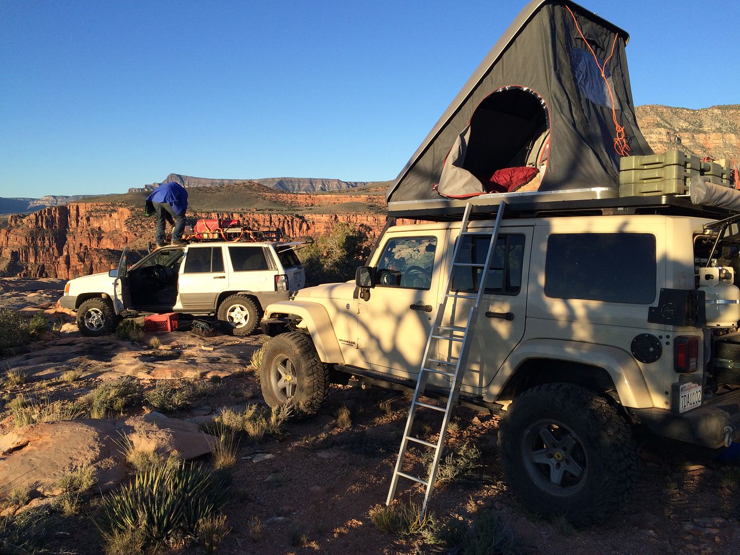
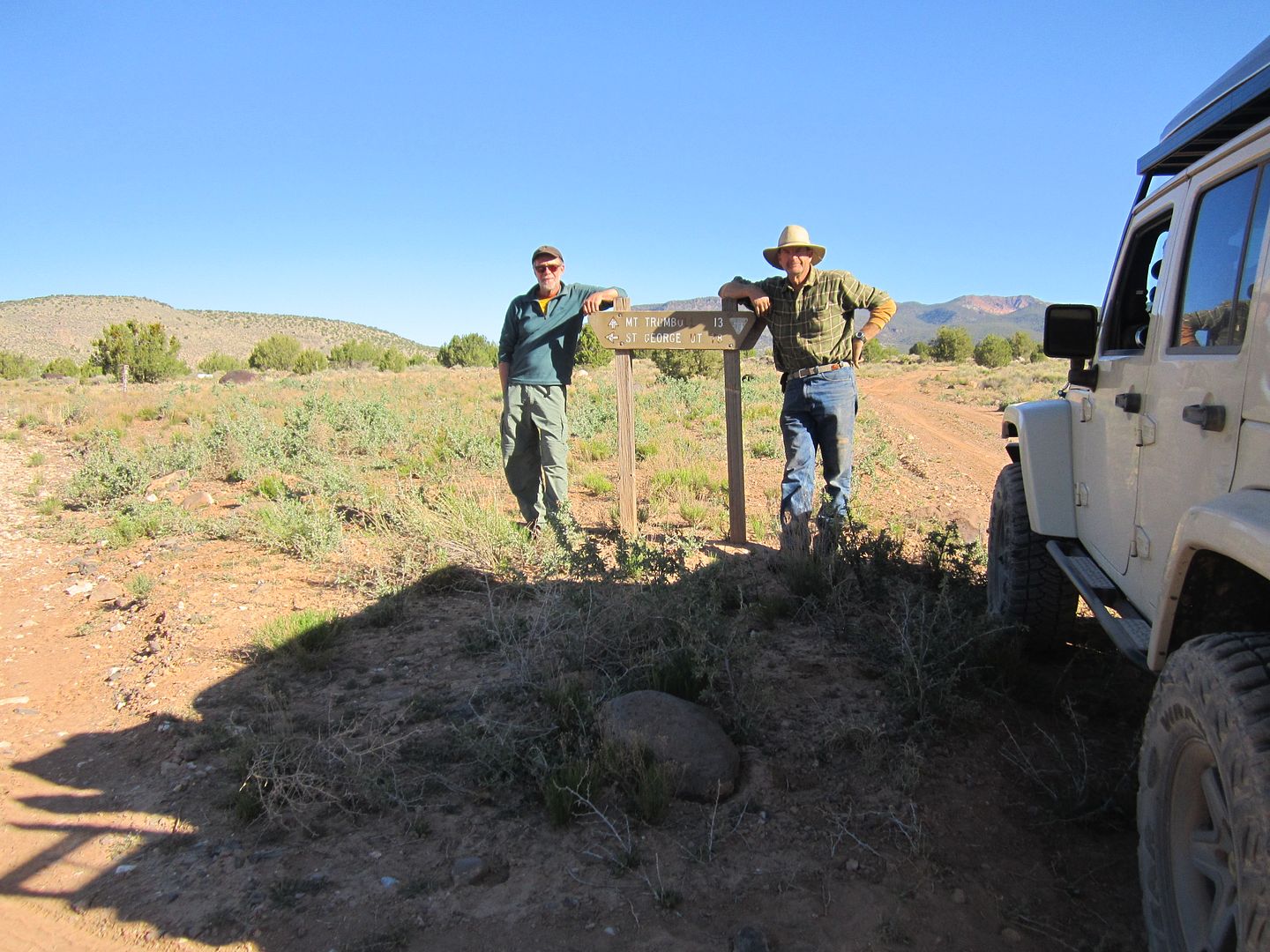
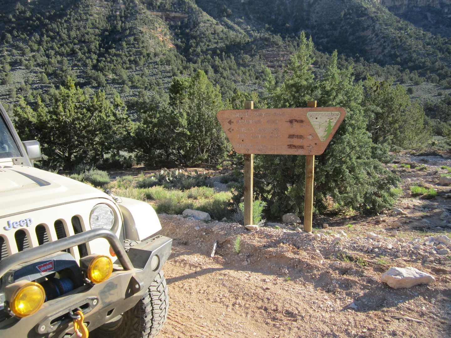
Just above the ranch is a road junction, the left takes you to St George 78 miles away, the right takes you up Hell’s Hallow and toward Mt Trumbull. Here is where Dan and I parted. He heading for home and I once again was exploring solo.

IMG_4373_zpsrmidqjkp.jpg


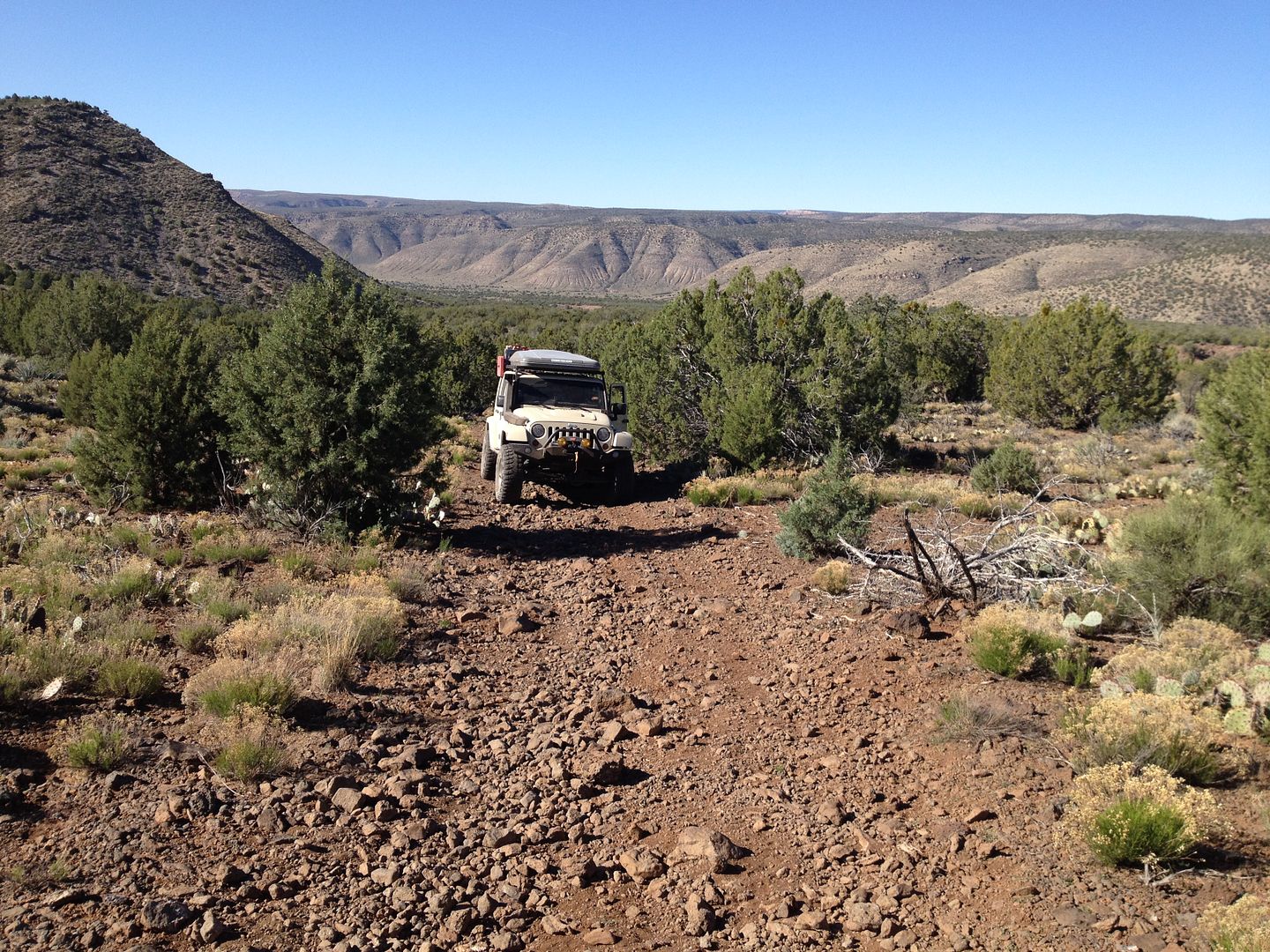
I remembered the climb up Hell’s Hallow as steep and rocky. It would appear my memory was correct. It wasn’t long until I could hear my electric fan running full speed and my water temperature gauge was moving toward the hotter side. Last time I drove this road we had to stop twice to allow the transmission and engines to cool off some. By myself, while I was running a bit hot, I was able to make it all the way to the top without stopping.

IMG_2628_zpsjvmi6xa7.jpg


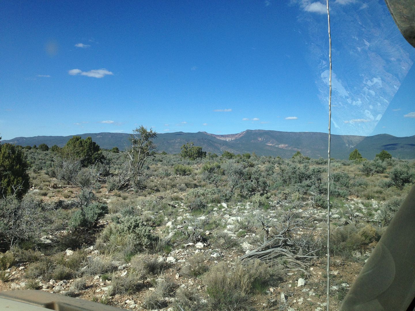
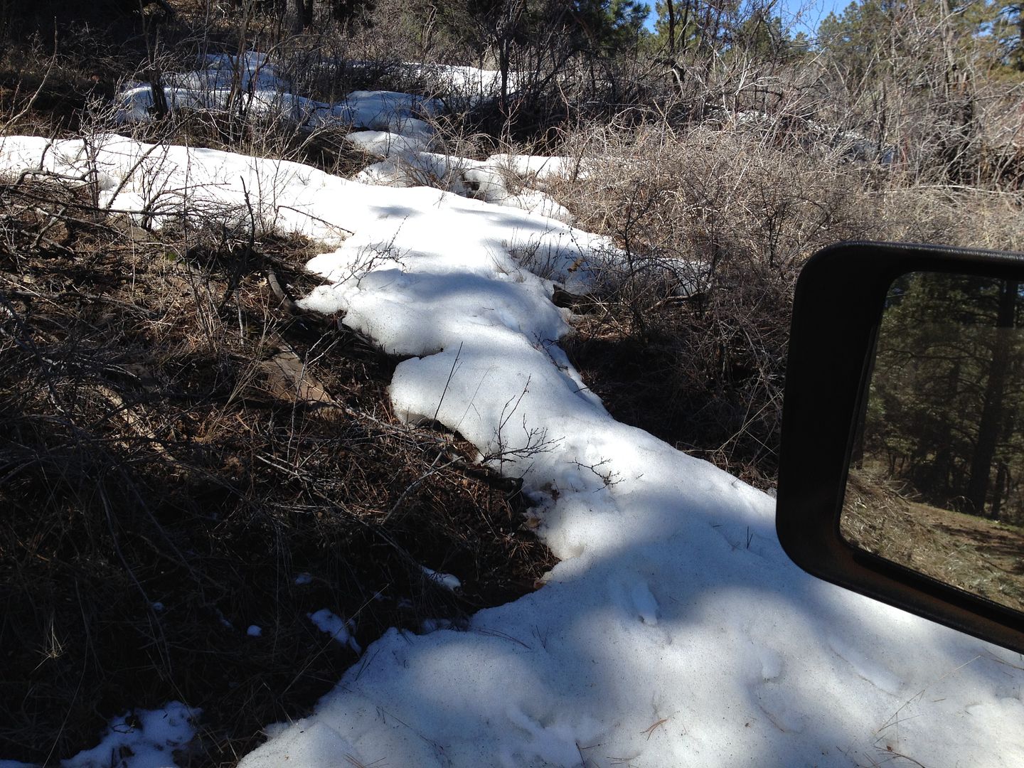
This is one of the quickest roads I know in the “Strip” that takes you from desert to forest pine trees in just a few very steep miles. At the higher elevation the temperature drops quickly and it isn’t very far before you see some snow left over from the past winter. Spring hasn’t come yet to some places along this road as many of the trees are still waiting to green up.

IMG_2638_zpsqktiassh.jpg


IMG_2634_zpsonp4zcxv.jpg


IMG_4383_zps1zzu1tpi.jpg


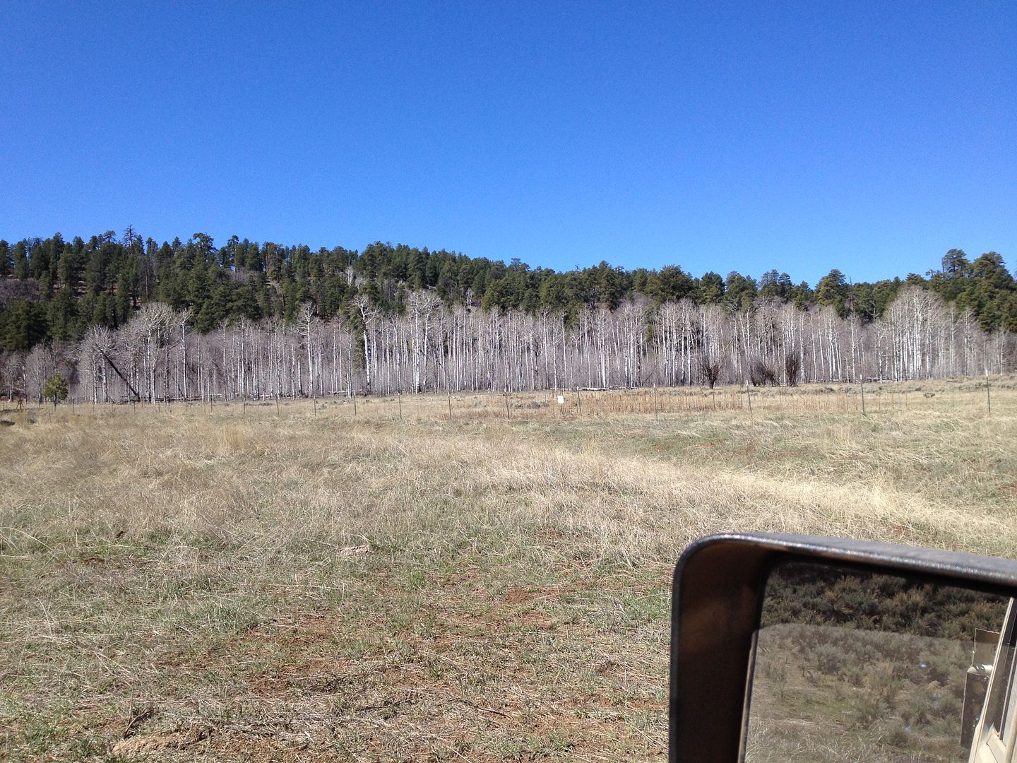
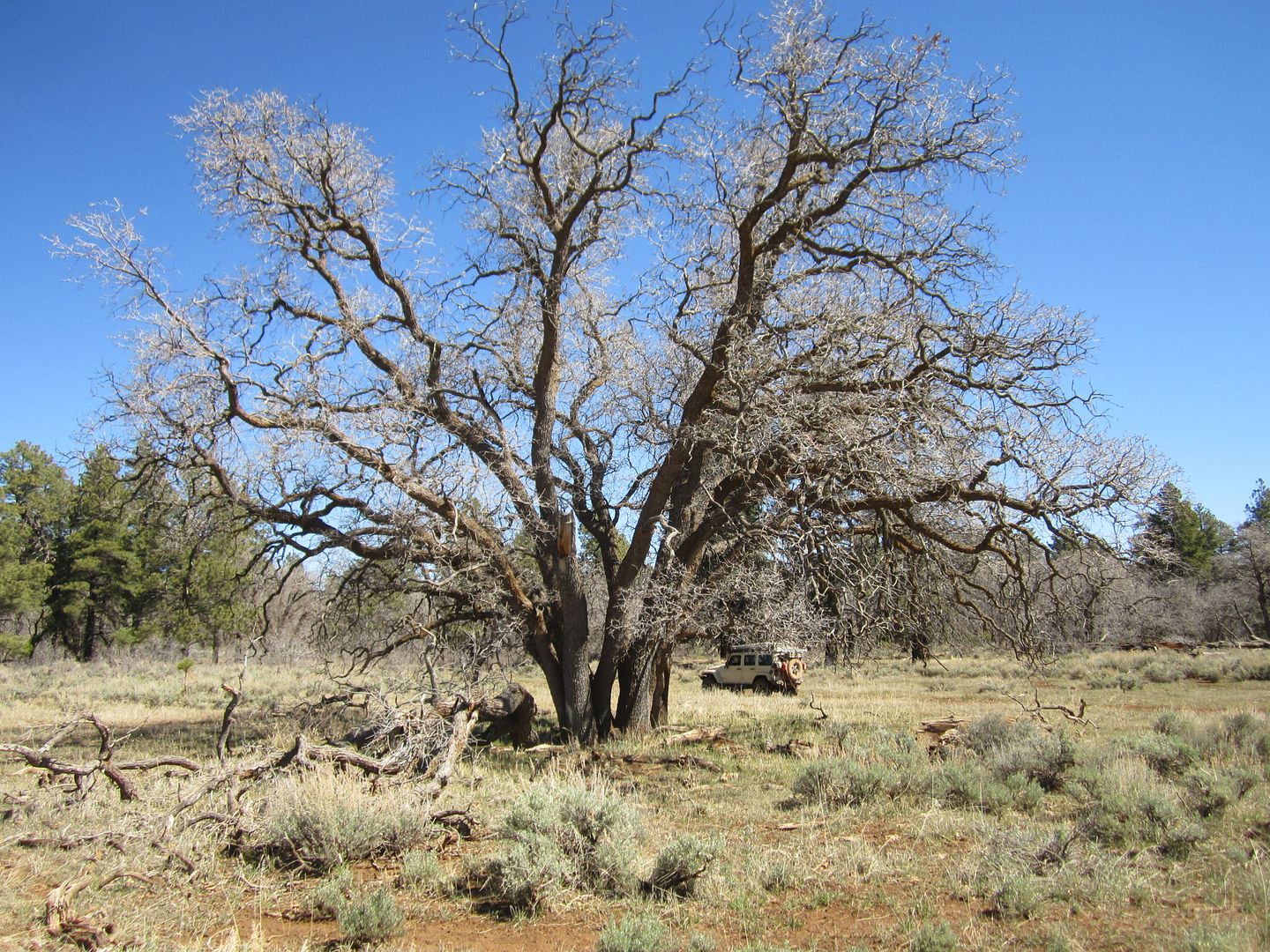
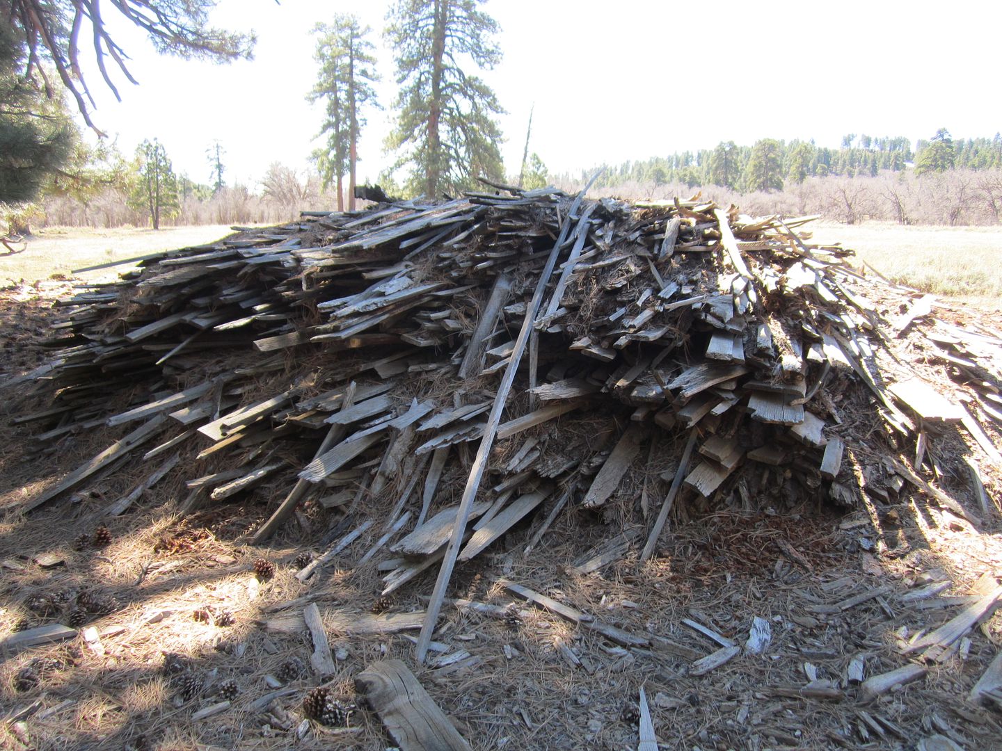
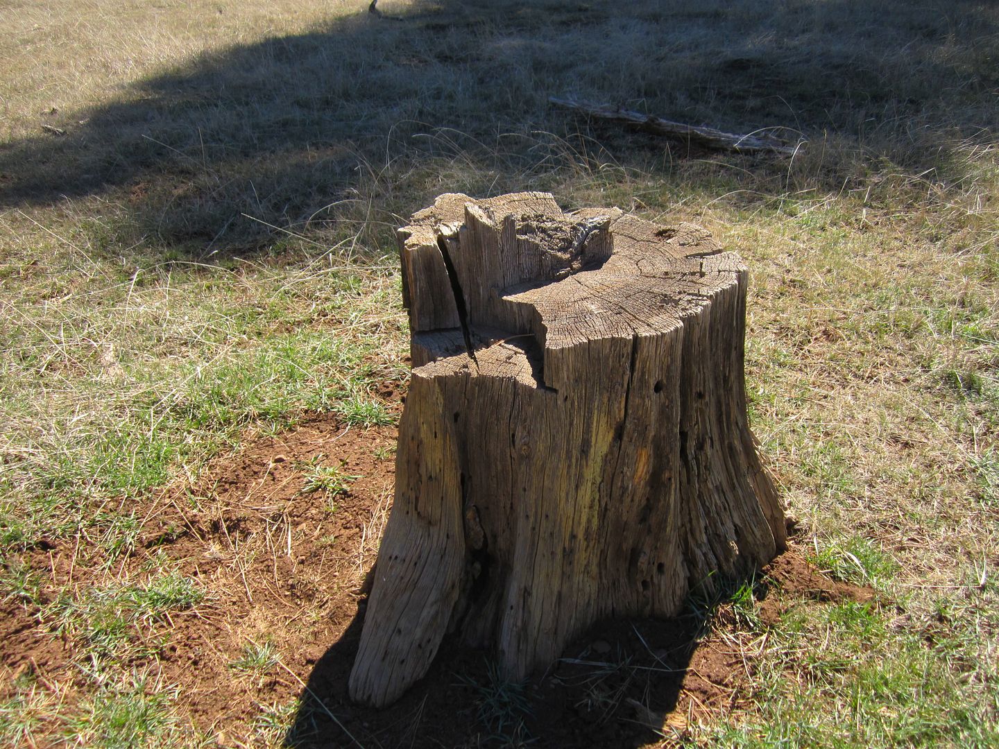
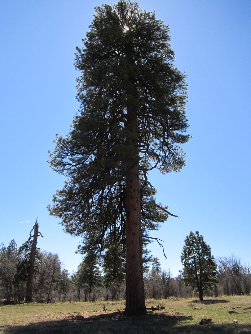
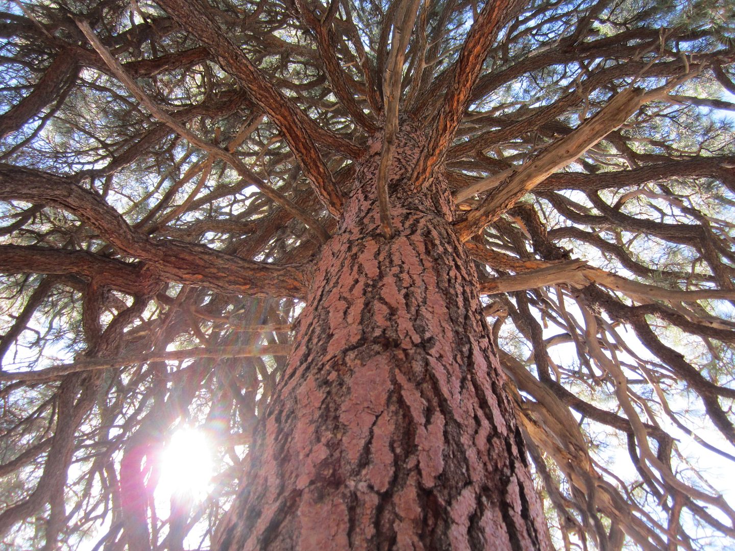
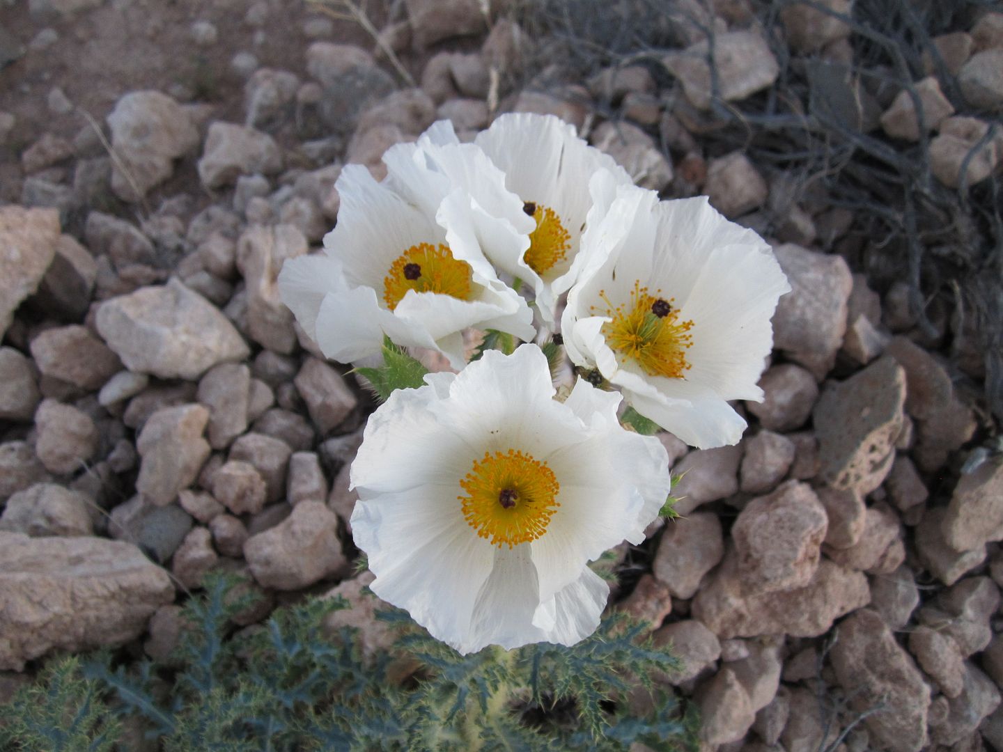
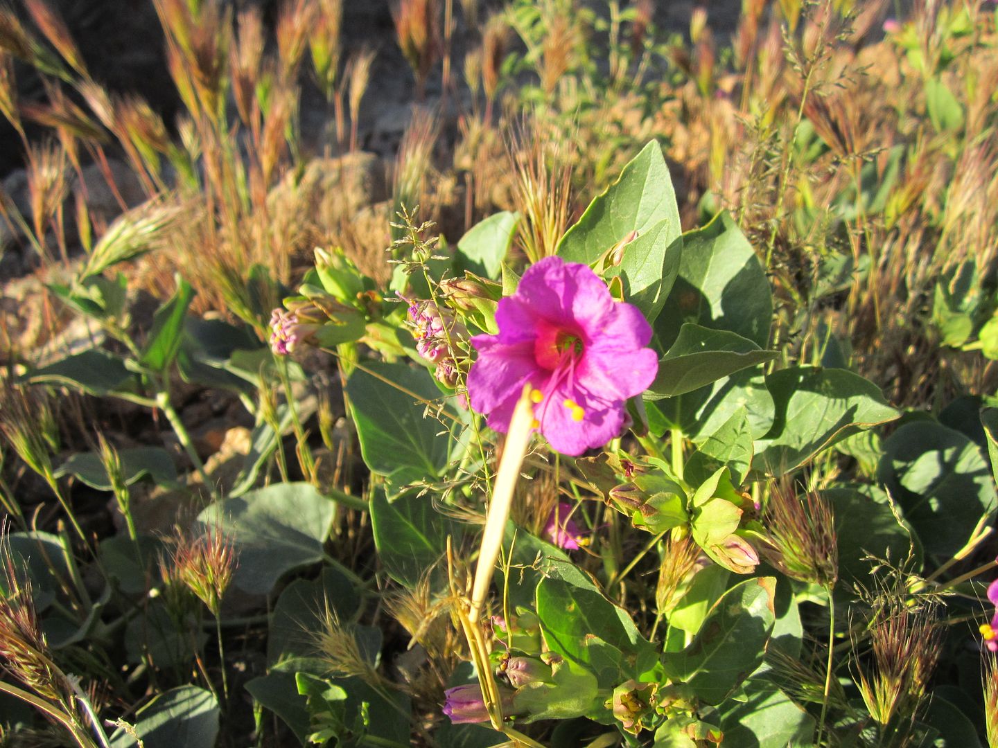
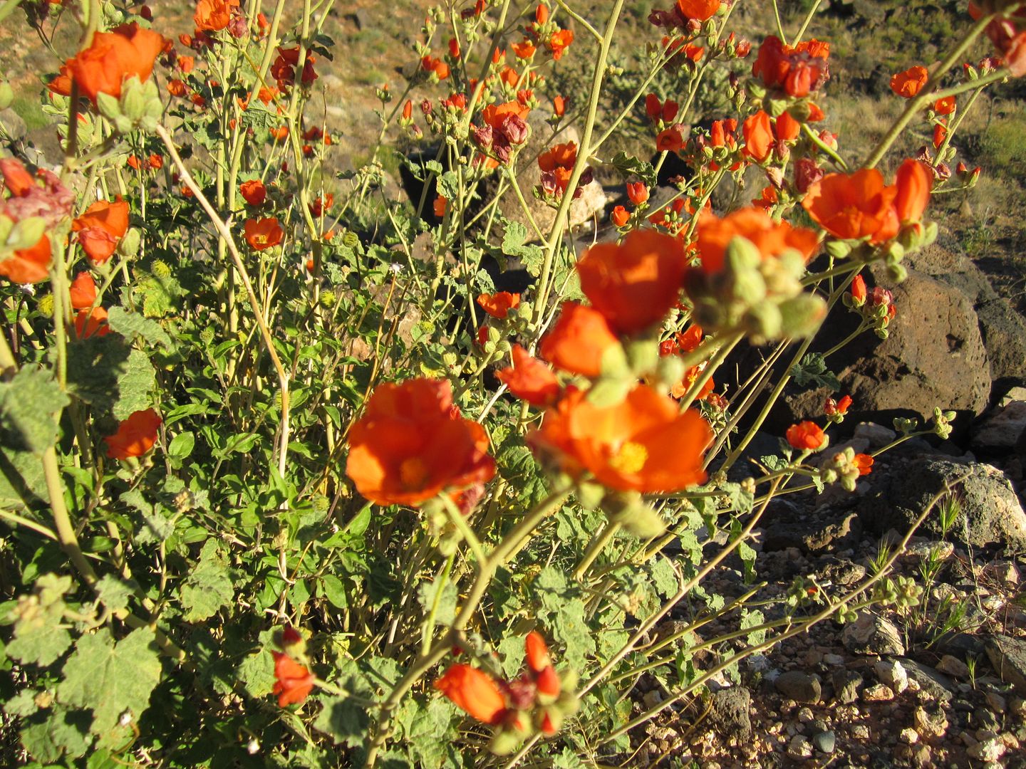
Since I was traveling alone I had the pleasure of stopping and wandering around whenever I choose to explore. I found an old stack of lumber near a meadow which had been harvested years ago but still had some of the largest trees I had even seen anywhere in the “strip”.

IMG_4378_zpsyvj0uvva.jpg


IMG_4381_zpsnvgvu8p5.jpg


IMG_4382_zps2omrl6g4.jpg


IMG_4380_zpsgt73dhyh.jpg


I also stopped at a natural spring to enjoy a rinse of some of the dust that had accumulated in my hair.

Youtube video

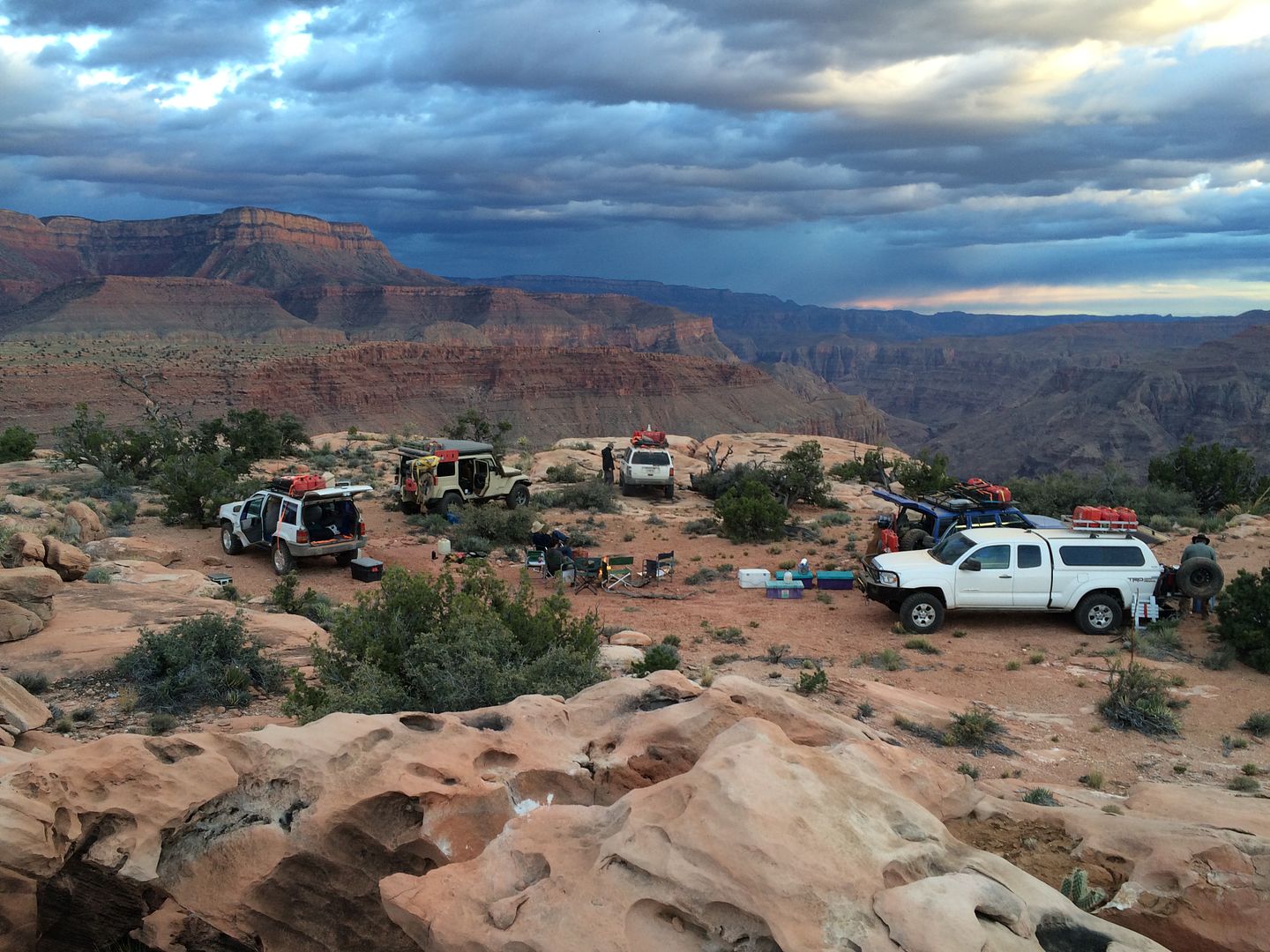
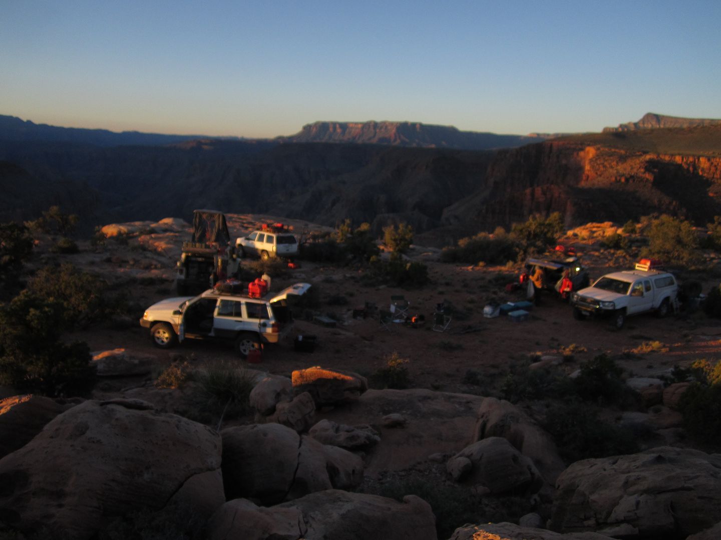
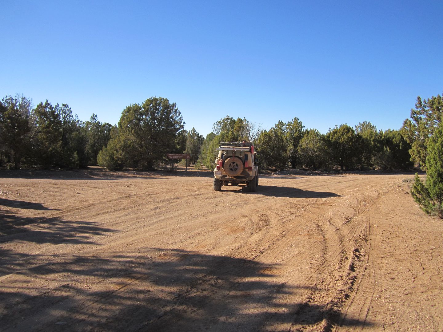
As I turned unto the main road that takes you to Toroweap I came across my first traffic of any kind since leaving pavement 9 days ago. Among the vehicles driving out here there were small tour groups and several 2wd types.

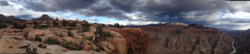
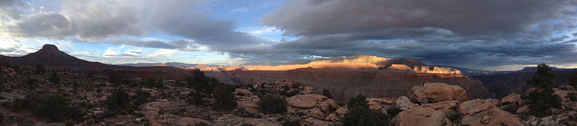
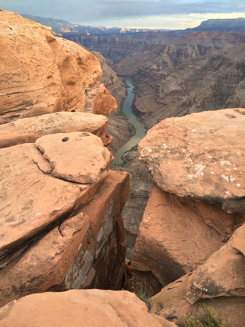
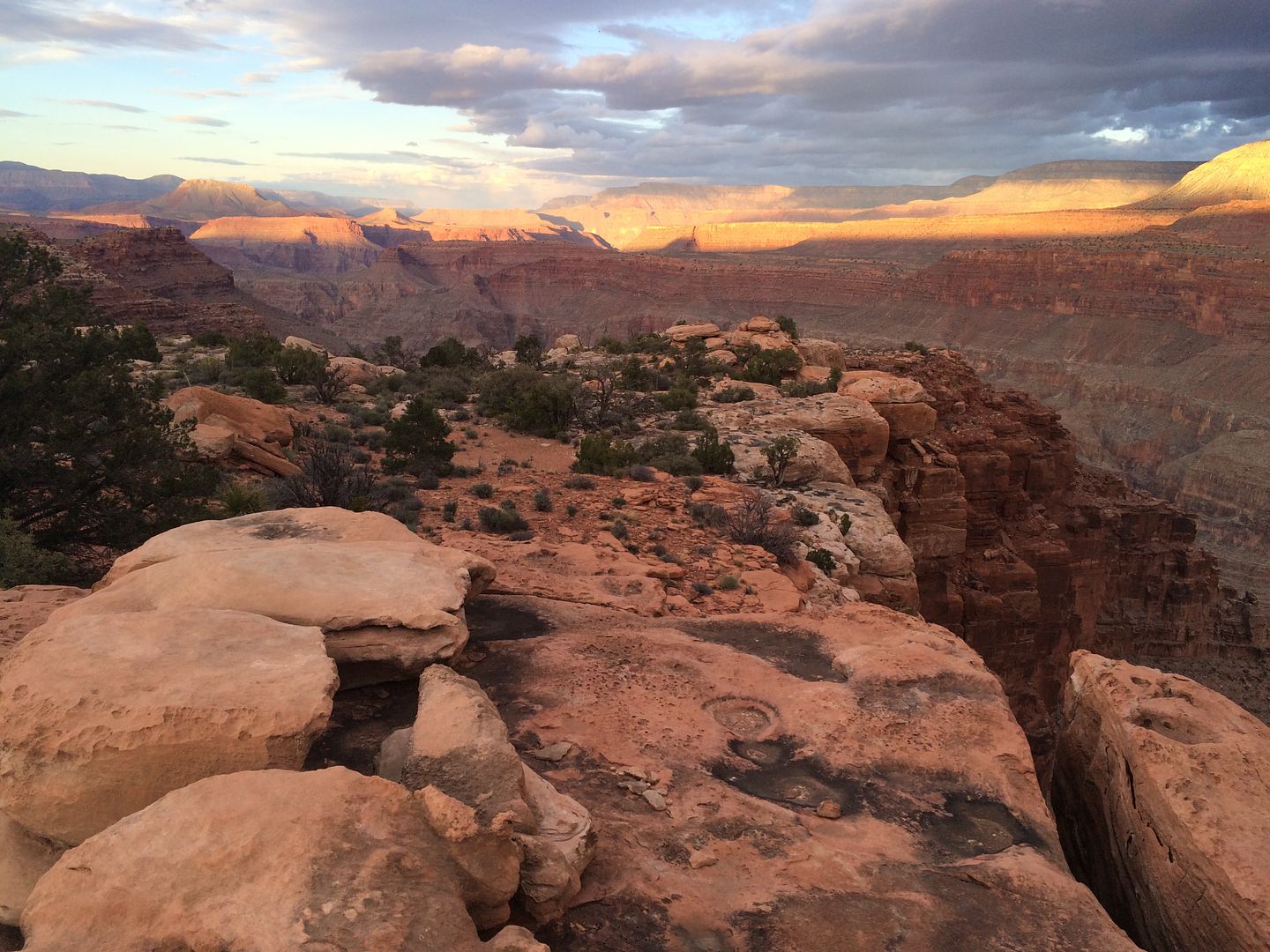
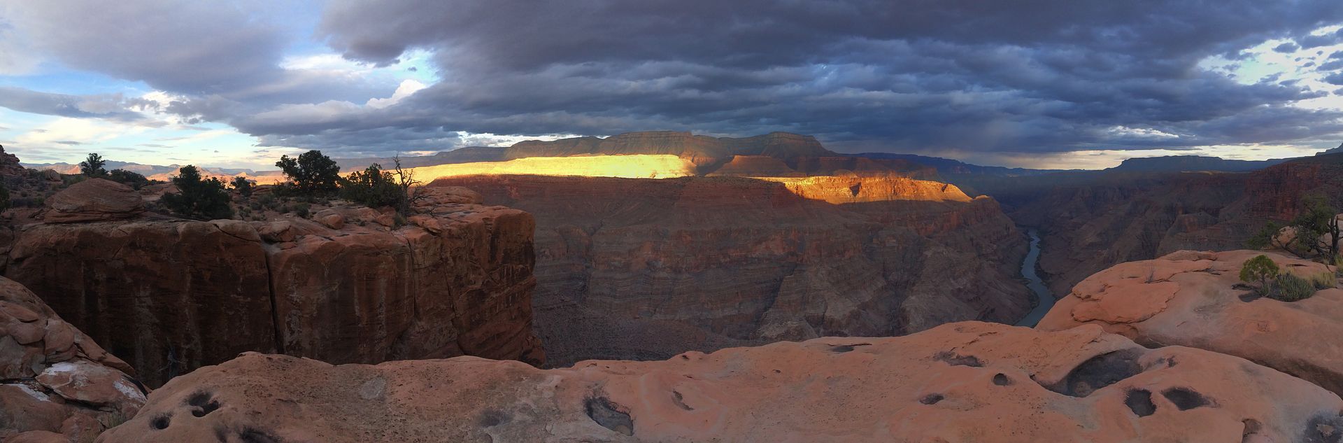
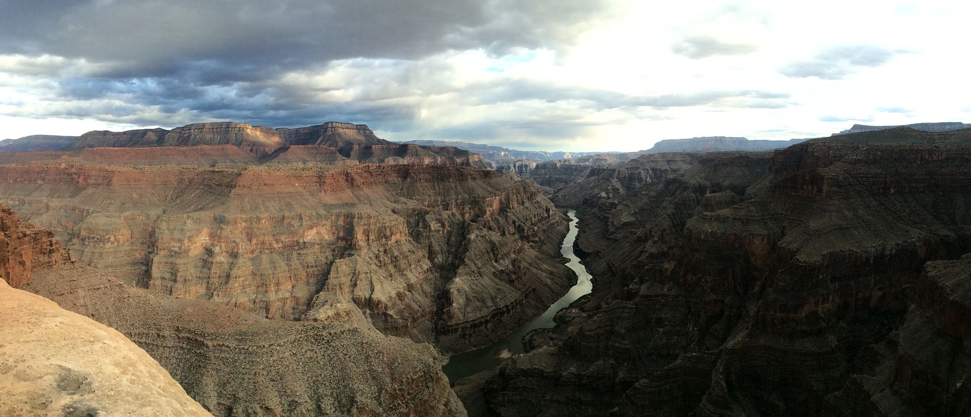
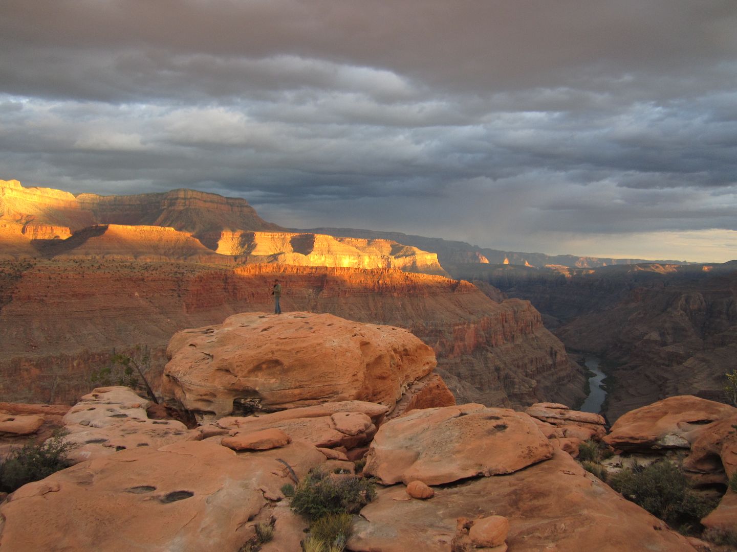
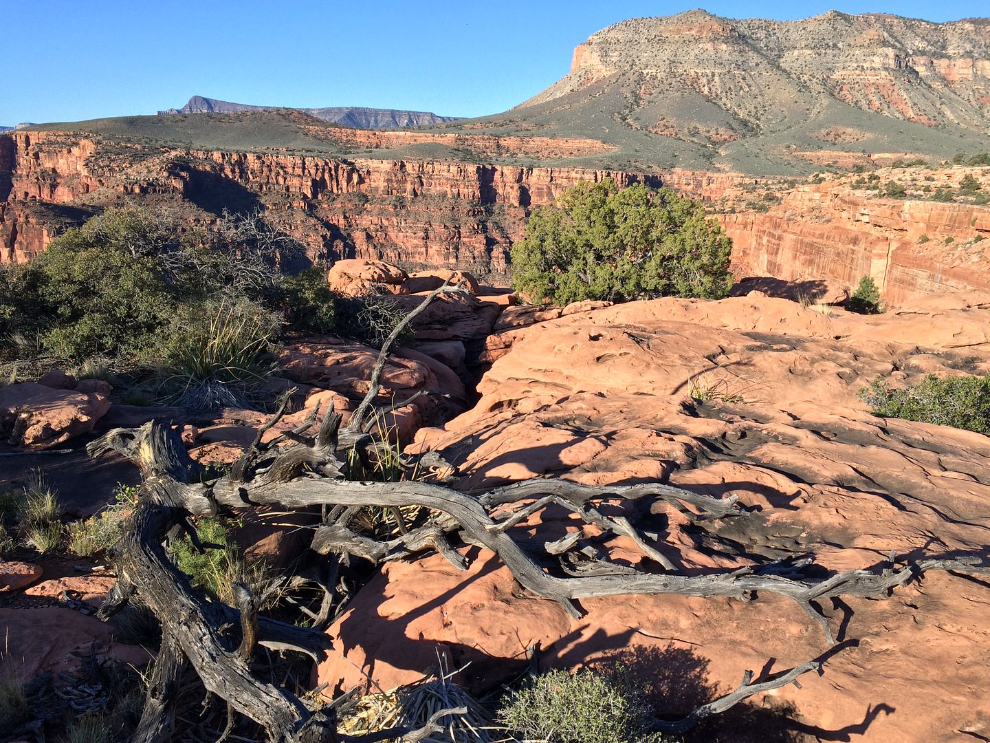
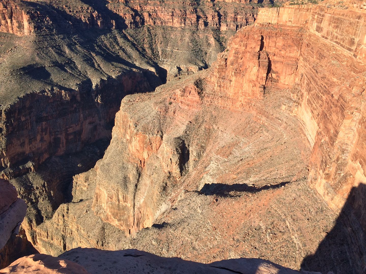
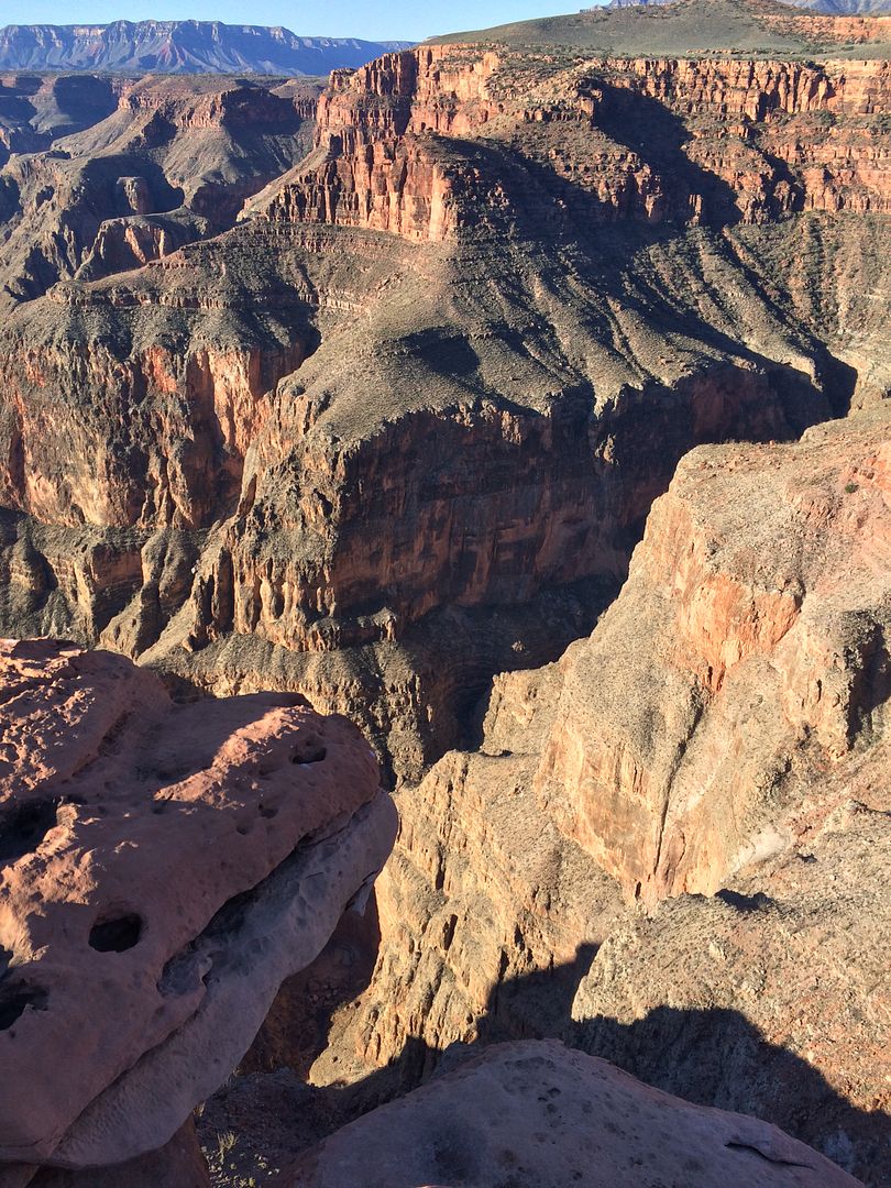
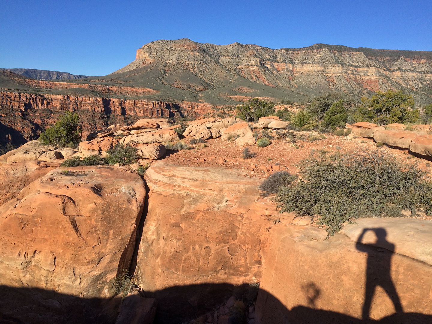
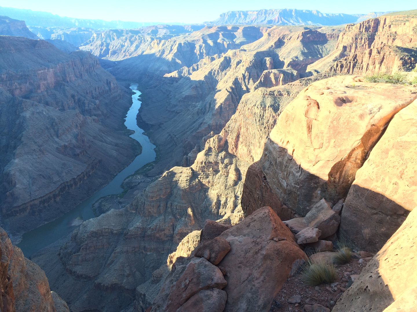
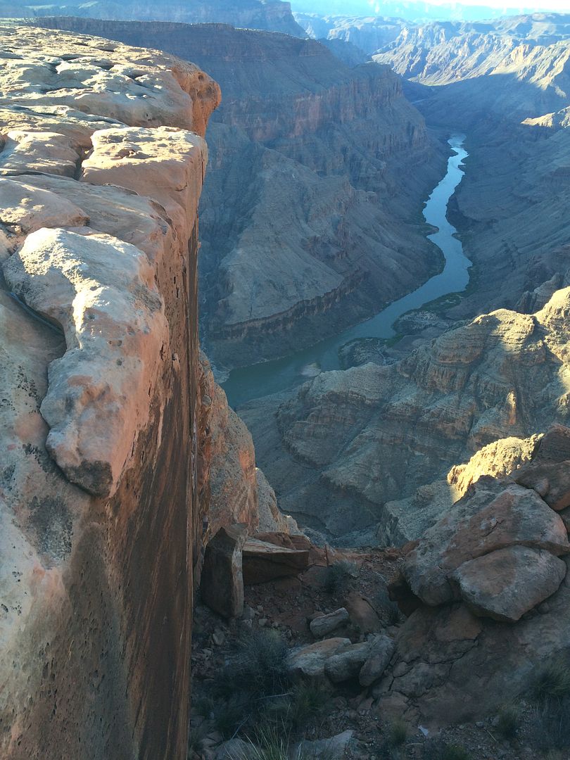
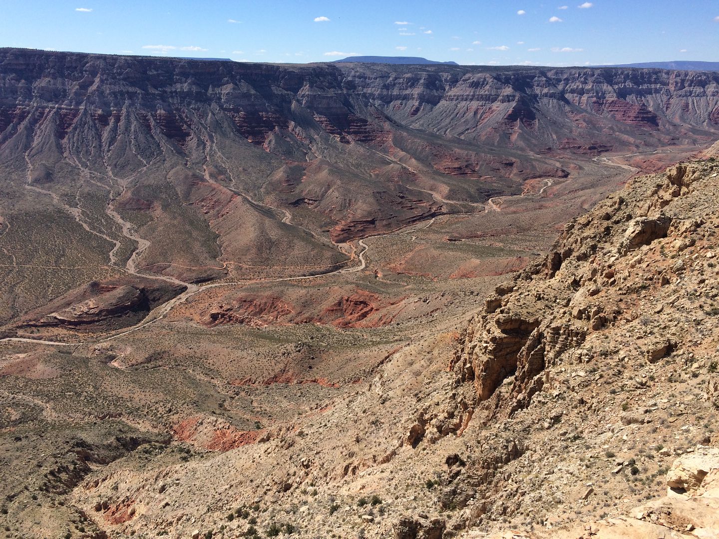
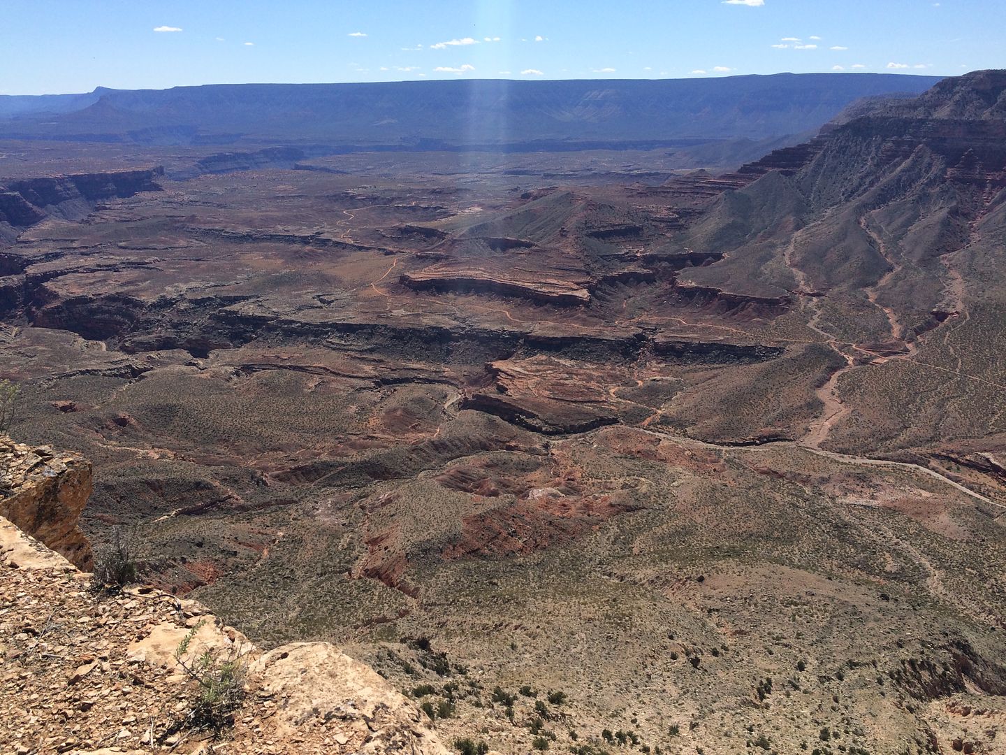
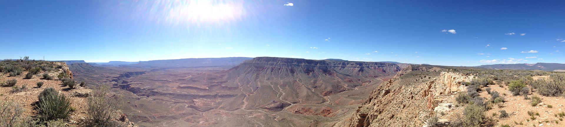
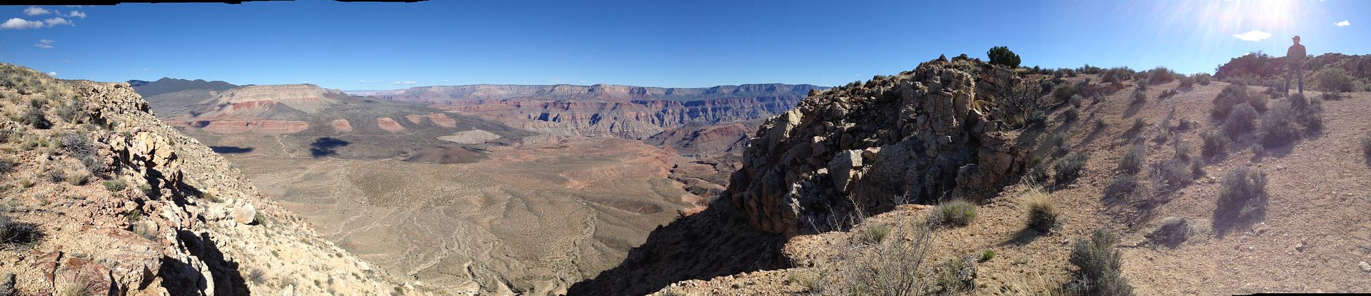
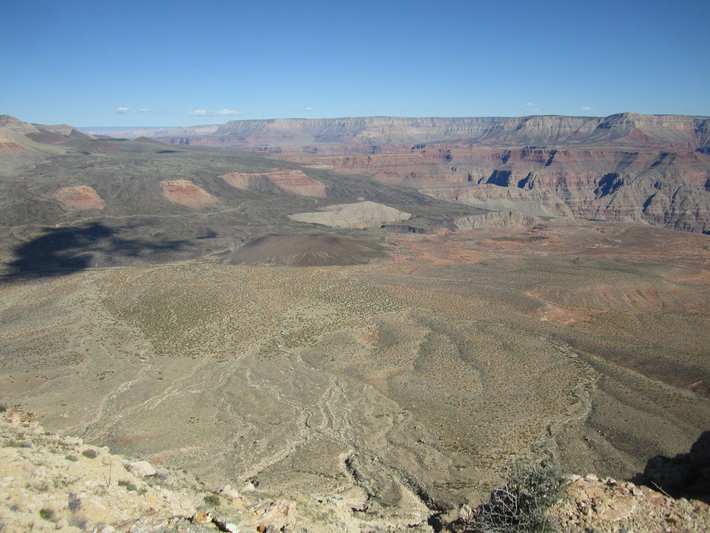
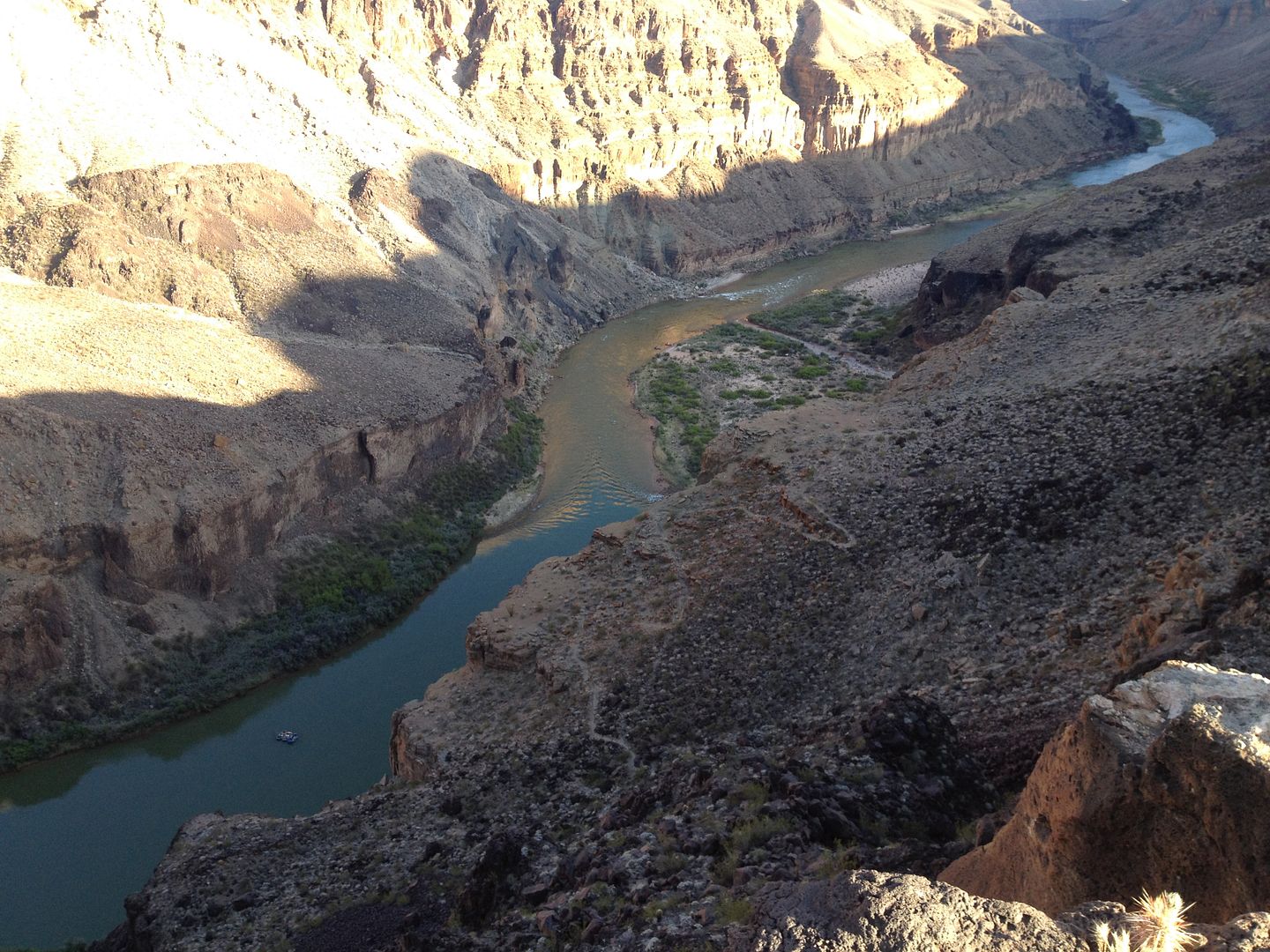
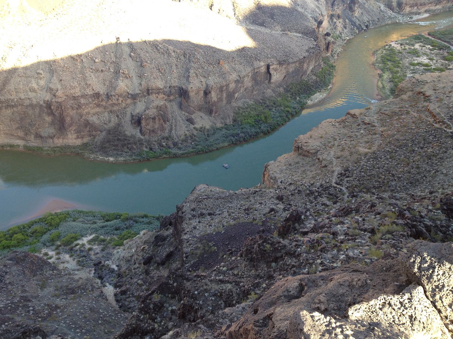
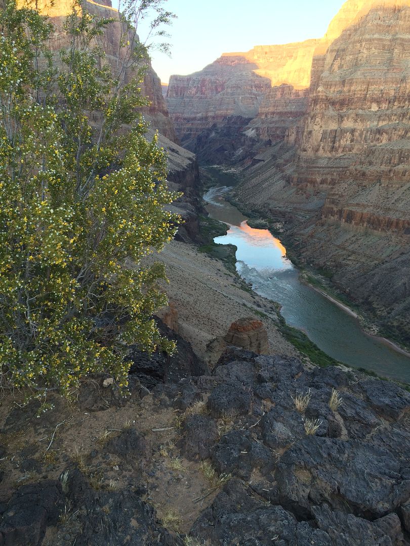
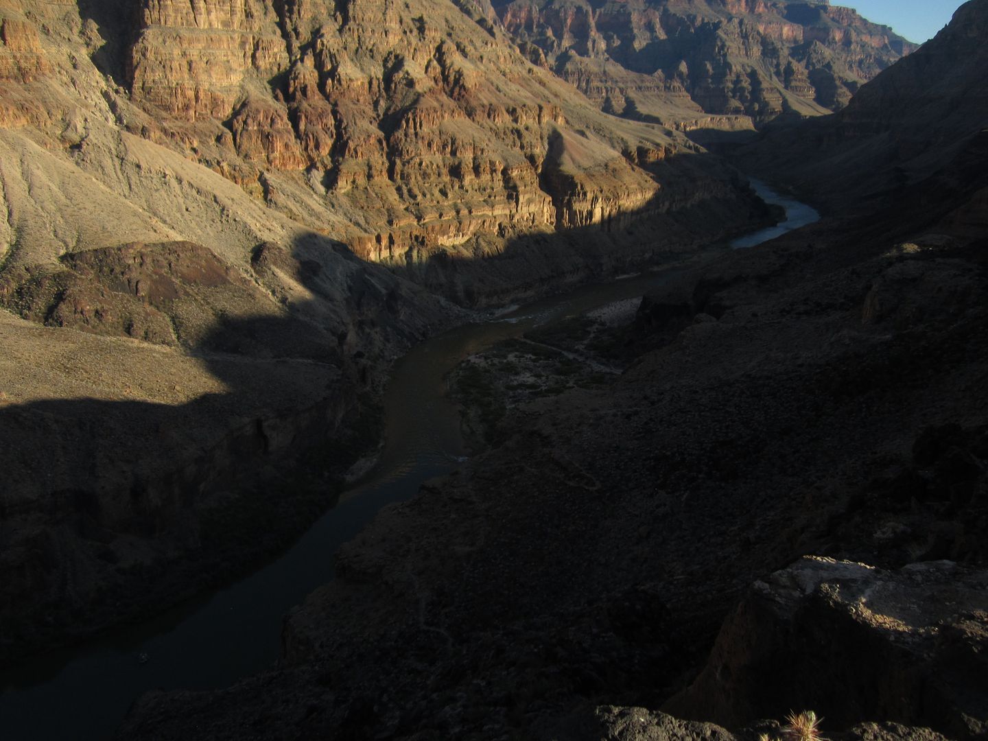
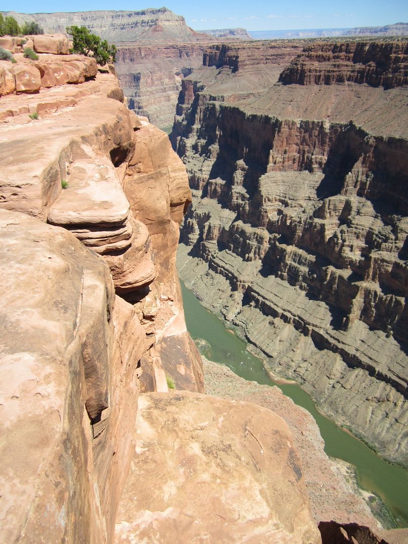
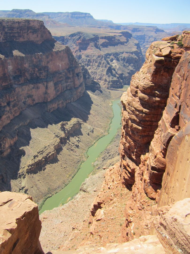
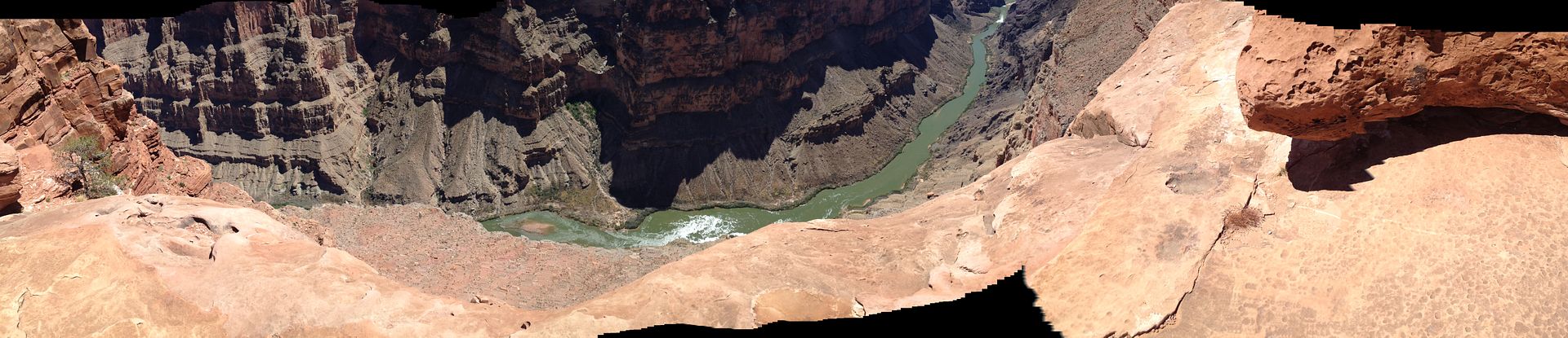
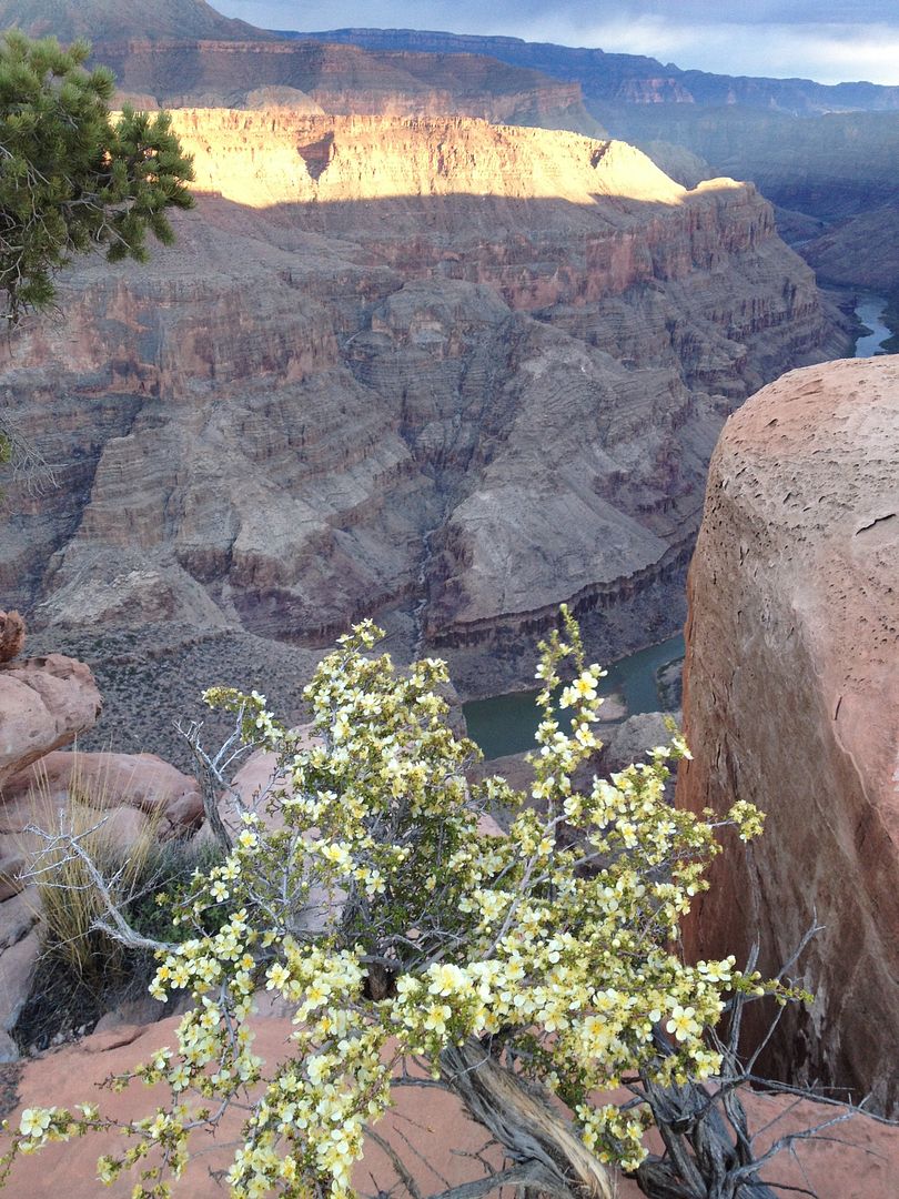
Toroweap is quite an attraction and when I arrived around lunch time there were at least 15 other vehicles there and a lot more people. I took a few pictures and while I ate lunch reviewed my maps and books for my next destination.

IMG_4388_zps1qvhrh2c.jpg


IMG_4385_zpsj81yhhbw.jpg


The drive to Toroweap, right up the very last part hides the surprise of the steep canyon.

IMG_2655_zps2aflqo8o.jpg


IMG_2653_zpsootgnwpx.jpg


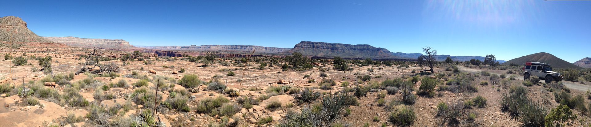
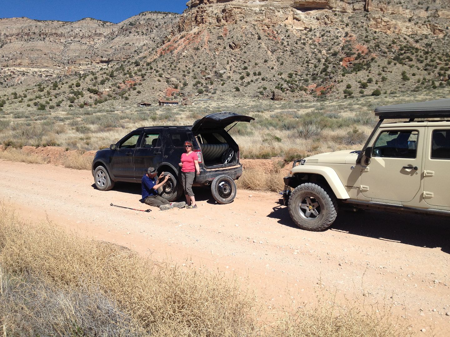
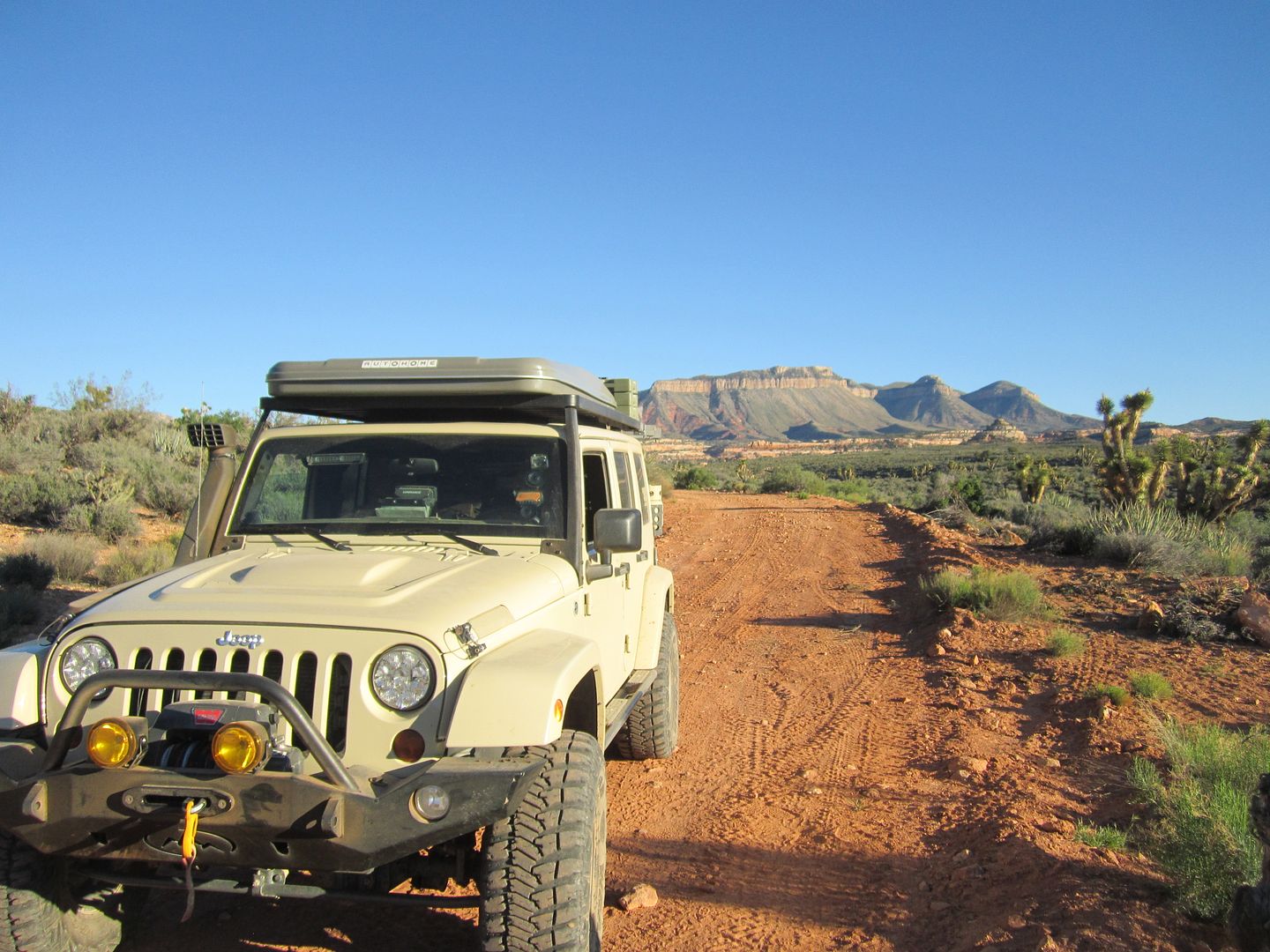
I took a northwesterly route following the main road out toward St. George. Along the way I came across a slow moving Ford Explorer (Cody’s vehicle was haunting me) as I pulled alongside the motioned to me that they wanted to talk.

Apparently they had suffered a flat on the way in and put on their “mini” spare. They were wondering what the easiest and quickest way back to pavement would be. That “mini” spare was so small and thin and they had at least 60 or so mile s left of gravel I was concerned that they may not make it. I asked to take a look at their flat tire and discovered what looked like a nail hole in the center. I plugged the hole used my compressor to charge up the tire and all seemed well enough to put the full size tire back on. In short order they were off and I was left with a business card and invite in I ever was in their neck of the woods to drop on by. They offered me some cash for the help which was graciously refused.

IMG_2658_zpsoibazsq0.jpg


Thanks,
Fred
Explorer 1
 

SmoothLC

Explorer
Really enjoyed reading this TR. Nice job and thanks for sharing. This is still on my list!

I had a friend who was out there a week or two ago on 2 wheels. Said he was running 70 to 80 to Toroweap.
 

SmoothLC

Explorer
Really enjoyed reading this TR. Nice job and thanks for sharing. This is still on my list!

I had a friend who was out there a week or two ago on 2 wheels. Said he was running 70 to 80 to Toroweap.
 

RIDGE

Adventurer
Looks like I found my next adventure (after Alaska!) My van and trailer are going to struggle. It'll be fantastic!

And thank you for posting this. You have made me want to go there immediately!
 

Explorer 1

Explorer 1
The final wrap up!

I guess I should finish this adventure and wrap up the final day. If I don’t get to it now, I may never. It’s already three other adventures behind.
When we last left me I had just plugged and aired up John & Cheri Stratte of Pine Forest Lodge in Mercer Wisconsin, tire and sent them on their way, hopefully they made it to pavement without further incident.
If you look at a map, most of the Arizona Strip’s trails are like a hand with the fingers pointing down. Each finger ends at a point near the Colorado and the Grand Canyon. From left to right or west to east, the fingers we traveled down were:

1. Kelly Point
2. Mollies Point
3. Whitmore Point
4. Whitmore Canyon Overlook
5. Toroweap Overlook

It took multiple days of driving to reach all of these; however you can easily driver across the knuckle of the hand passing all the beginning of these “fingers” in one afternoon.

That’s just what I decided to do after visiting Toroweap. I took road 5 over to the old Mount Trumbull school house then road 1018 past Poverty and then through Hidden Canyon (road 1003), Around the north side of the Grand Wash Cliffs wilderness, the south on Road 1007 past Pakoon Springs (Road 111), then northwest over Whitney Ridge and past Whitney Pockets.

At Whitney Pockets the sun was setting and it was dark enough for headlights when I hit pavement.

It was a thrill and joy to revisit the beginning points of the past weeks travels. Here are a few shots I took along the way:

IMG_2664_zpsvkhkc0u8.jpg


IMG_2665_zpsv5tajvk7.jpg


IMG_2662_zpsawhdosng.jpg


IMG_4392_zpslolbw6pj.jpg


IMG_4391_zpspuaeii0l.jpg


IMG_4390_zpsfjarx28m.jpg


IMG_4397_zpsvftmb4vd.jpg


IMG_4402_zpswowvtoeh.jpg


And finally I’ll end with some of the many flowers that met us along the way.

IMG_4406_zpsb6cgncvk.jpg


IMG_4400_zps3qpxuxtz.jpg


IMG_4399_zpsy5kvlcmw.jpg


IMG_4395_zpsprfe5ngp.jpg


IMG_2590_zpshjakjqrw.jpg


IMG_2584_zpseaemmhgl.jpg


IMG_4335_zps92vlqptn.jpg


IMG_2554_zpsctzjtaie.jpg


IMG_2546_zpscvnlgxhg.jpg


IMG_2543_zpsvr9om4oc.jpg


IMG_2536_zpsrevjbsuo.jpg


IMG_4305_zpspmbmdlbj.jpg


IMG_0660_zpsvkzk4ecp.jpg


Thanks for traveling along with me!

Fred
Explorer 1
 

Forum statistics

Threads
185,842
Messages
2,878,778
Members
225,393
Latest member
jgrillz94

Members online

Top