Nav Apps and competition overlanding

I'm slated for a spot in the 36 hours of Uwharrie and have some NAV App questions.
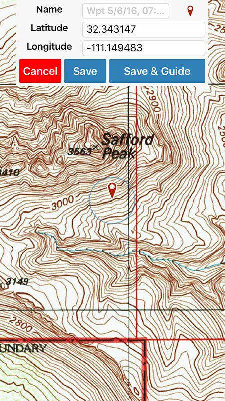
I currently use a hybrid of HERE by nokia for Turn by Turn and I use MyTrails for off paved roads. It does really well at storing tons and tons of maps and following a course that is imported as a gpx.

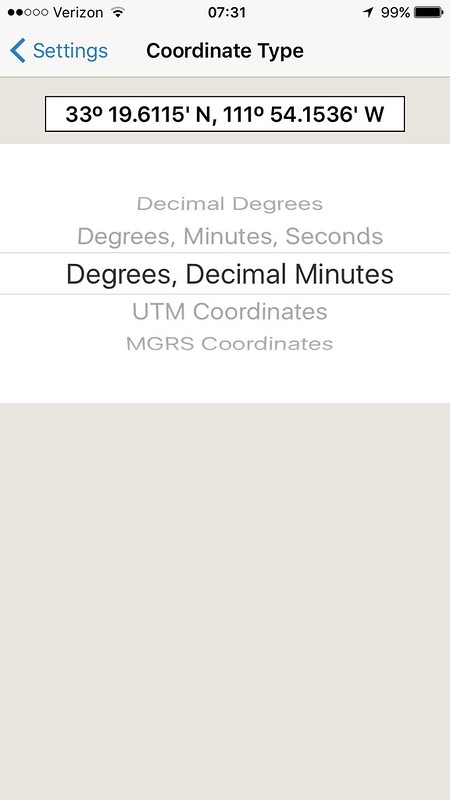
Problem is I've never actually done one of these comps and I'm not sure how or how much time ill have to plan and its a PITA to plot a course on the app. And if all the way points are just on sheet of paper that means typing in a ton of way points. Im thinking I may need a full laptop to plot and plan then transfer to tablet for implementation.

Anyone have any experience in this field?
 

1Louder

Explorer
How much advanced notice do you get on the waypoints?

It is very easy to plot points in GAIA. If you had them in a note and could then copy and paste it would make it even easier. With GAIA Cloud account you can also draw tracks online and then download the GPX files.

26757593052_425159da70_c.jpg

I use decimal but if you data is in a different format like degrees, minutes, seconds it's easy to change the settings.

26246030784_fbf85e4d3b_c.jpg

Here are all the options.

http://www.gpsvisualizer.com/draw/ - can help you draw maps but I have never personally used it.

I like running a tablet in my vehicle because it makes viewing everything so much easier.
 
I think i may have the evening to put it together as it seems we wont get any info until we check in at base camp the night before. Assuming i can get internet out there i could use my laptop and caltopo.com to build a full map and all way points id need. if i cant get net then Ill be stuck using the nav app unless there is another standalone route planner that doesnt need nav connection
 

1Louder

Explorer
I am guessing you are using an Android device based on the name of the app you referenced, MyTrails. Maybe post up what device you have and some folks can provide more insight. I really love GAIA because to me it makes doing stuff like this pretty easy. Orux is pretty popular too. But since I am more of an iOS person it's hard for me to provide more help. http://www.oruxmaps.com/index_en.html

In GAIA you could easily download the maps of your choice, I like USFS Raster, and have them ready to in case you have no internet access. Then enter the points in. Evernote is a pretty good app which has OCR built in. You might be able to take a picture of all the waypoints and then Evernote could convert that into text. Then you would just copy and paste each waypoint in the app of your choice. Just another thought to try to make things easier.

I run a lenovo 7in that I will probably upgrade to a powerhouse tablet in the 10in variety for this comp.

I like the evernote idea. Im gonna test that theory and hope the ocr works if that does that will make it alot easier than manual hand jamming.
 

AaronK

Explorer
I use Orux. I really like the offline routing function. You select your waypoints and it finds a route for you and builds a GPX file for the route.

Sent from my OnePlus One using Tapatalk.
 
I use Orux. I really like the offline routing function. You select your waypoints and it finds a route for you and builds a GPX file for the route.

Sent from my OnePlus One using Tapatalk.
What's it's knowledge base for those routes. I'm guessing alot of this will be on private properties.
 

AaronK

Explorer
It's based on Open Street Map so it's always developing but it's based on actual roads so private property might not work well

Sent from my OnePlus One using Tapatalk.
 
No Android version for North America yet. Newly release iOS application is VERY similar to GAIA.

I saw that statement. Wish I had some experiance with the GAIA for android. I hate that these guys dont have a free version i can test before I buy. makes me question if they are worth a damn
 

1Louder

Explorer
I saw that statement. Wish I had some experiance with the GAIA for android. I hate that these guys dont have a free version i can test before I buy. makes me question if they are worth a damn

Beauty is in the eye of the beholder. I say GAIA is well worth it. Email them and ask for a trial app/beta. Maybe they would be willing to send you something. There are 9 developers supporting GAIA. While that is no guarantee that it is the app for you it is very well suported.

Someone posted about this app in another thread. There are free and paid versions, https://play.google.com/store/apps/details?id=menion.android.locus
 
Last edited:

Forum statistics

Threads
185,912
Messages
2,879,541
Members
225,497
Latest member
WonaWarrior
Top