unURBAN Adventures - Alaska to Argentina to AFRICA!

unURBAN

Adventurer
El Mirador?

5498674802_87b7510256_b_d.jpg


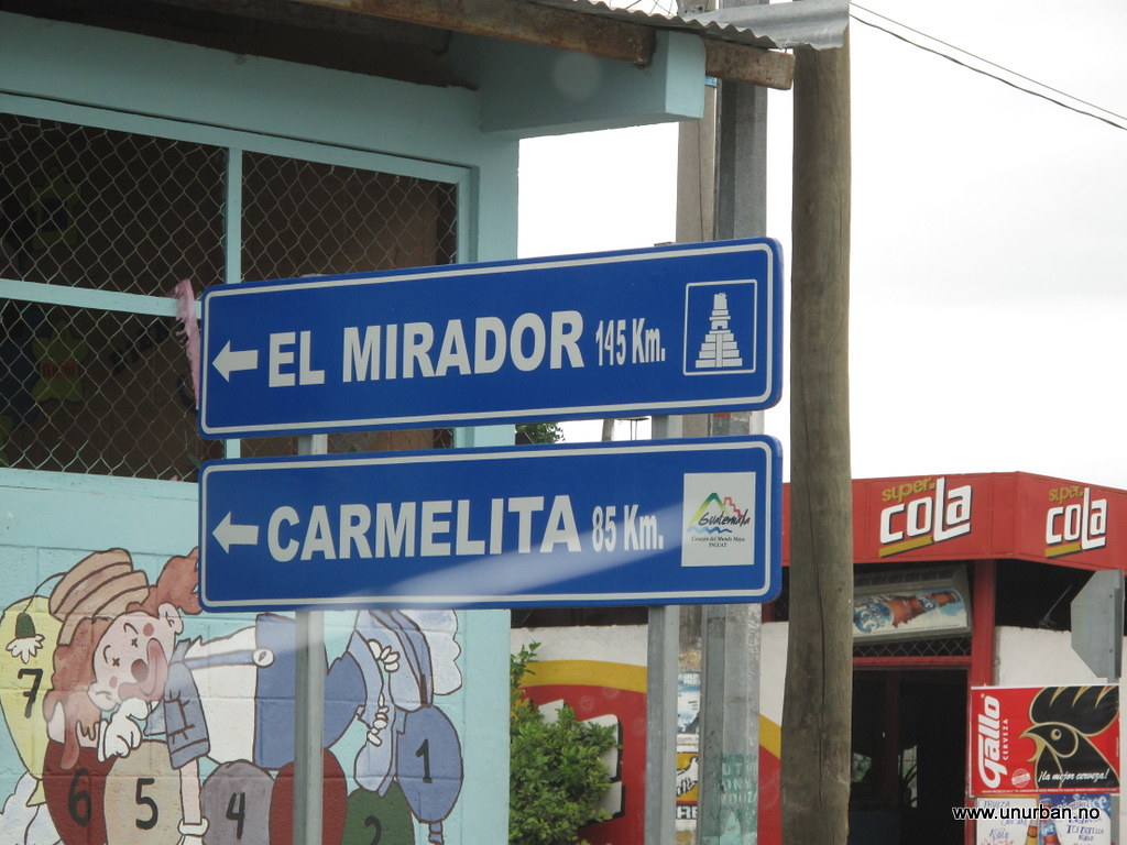
When we drove through the town of Flores on our way up to Tikal we noticed a road sign saying “El Mirador: 145 kilometers”. This triggered our curiosity. El Mirador is one of the biggest Maya ruins out there, and they are not yet excavated and restored. According to all the guide books the only way to get there is a five days arduous trek through the jungle with mules or, for the people with fat travel budgets, a flight in with a helicopter. But a road sign saying “El Mirador: 145 kilometers”??? We just had to drive up there to have a look…

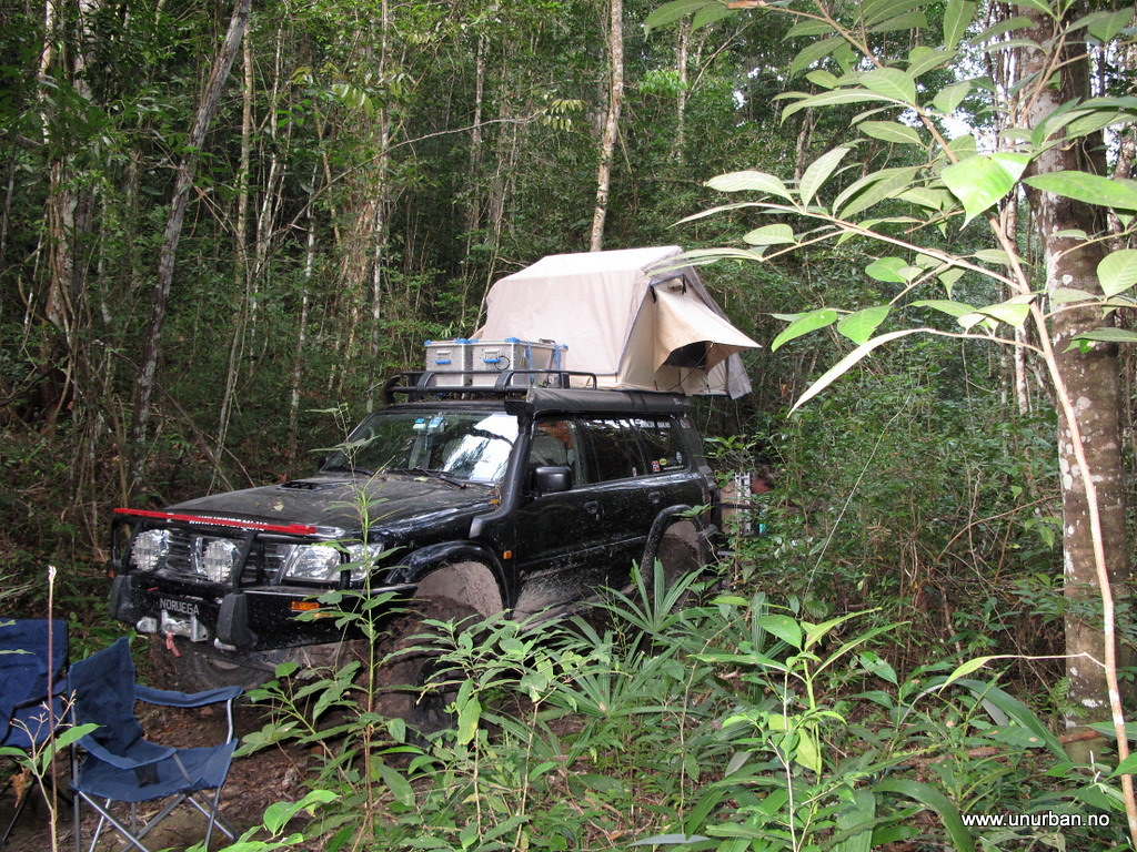
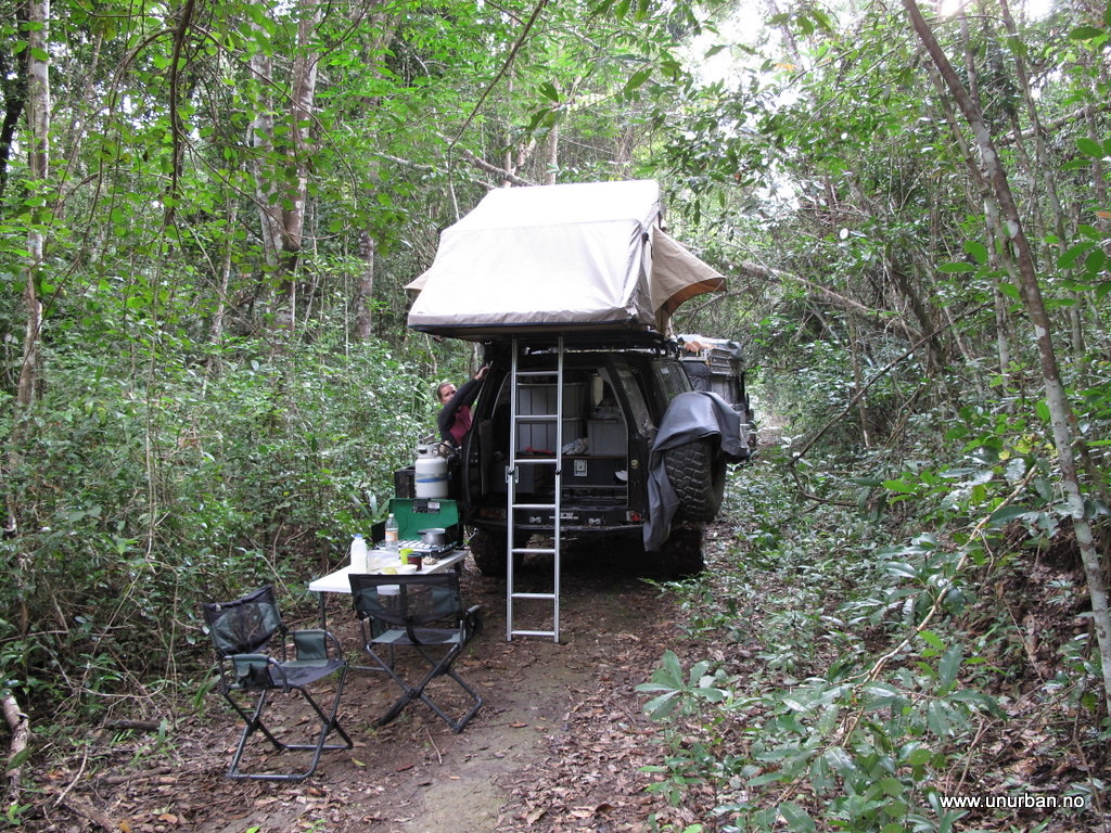
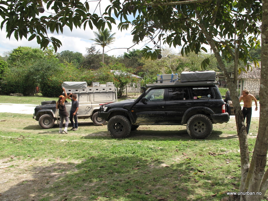
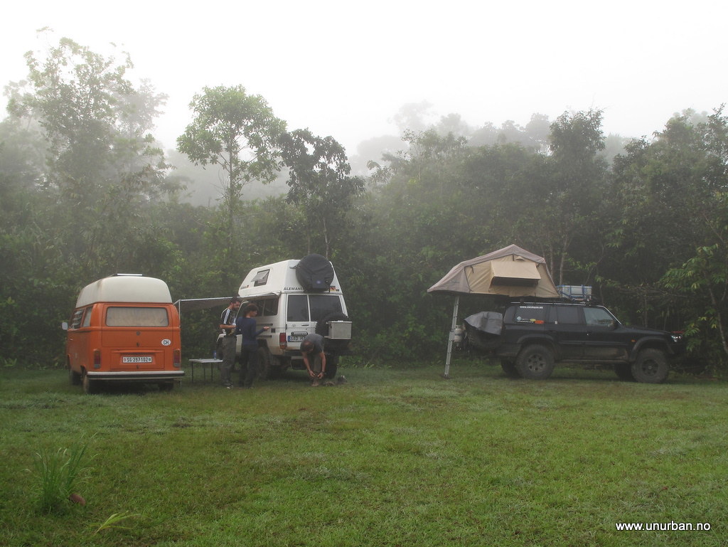
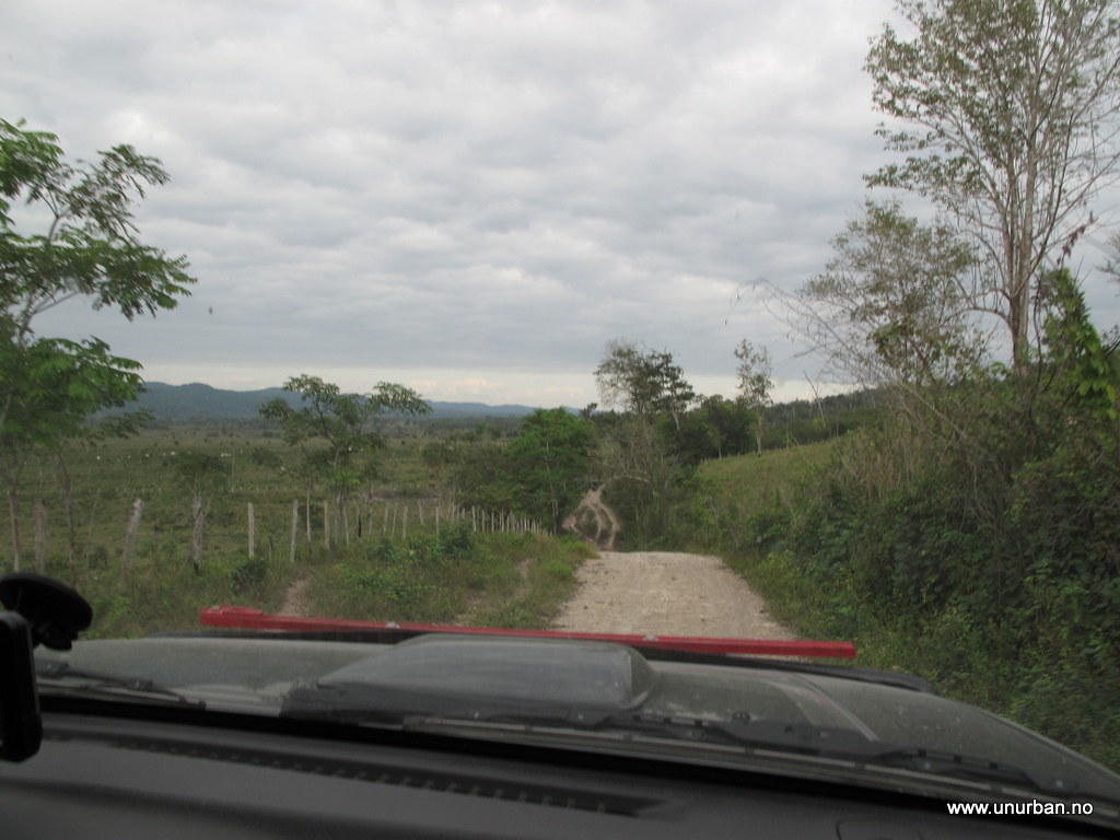
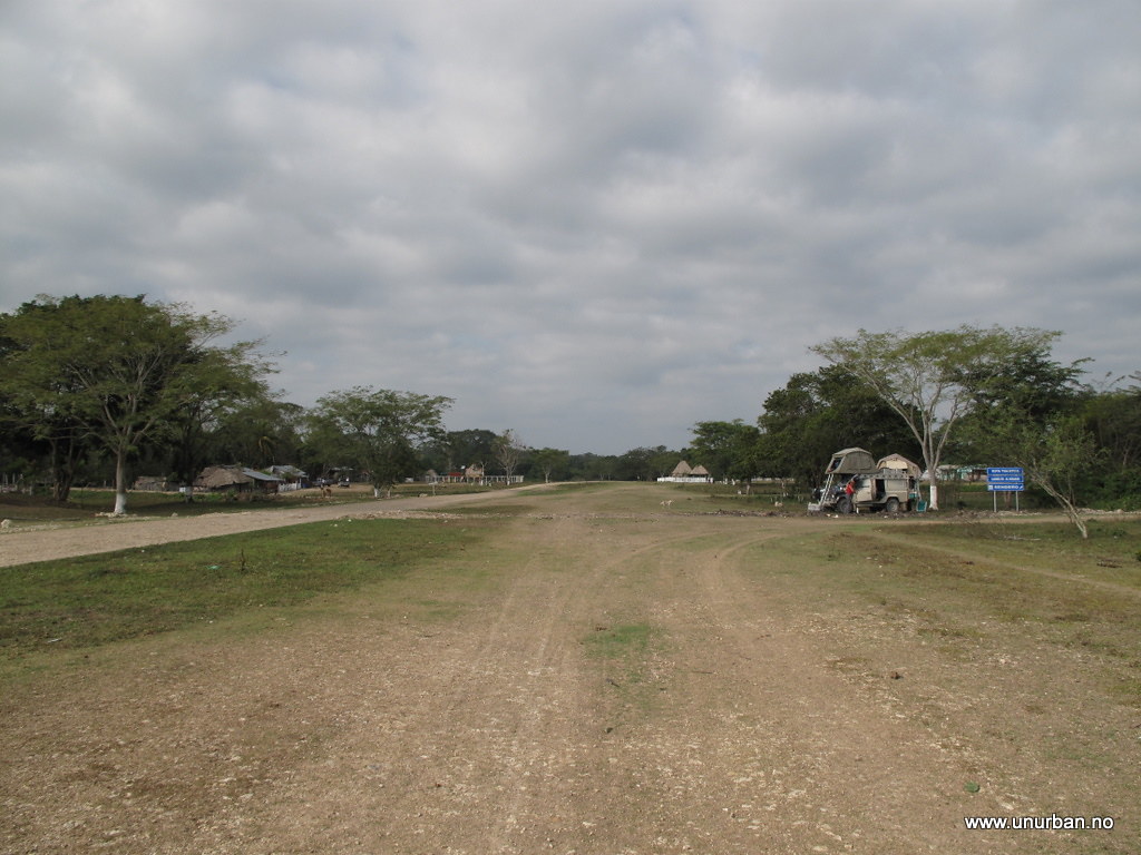
In Tikal we had met up with Christof and Judith in their Land Rover 110, and after a nice dinner at Jaguar Inn they were in on the plan! So the next morning we drove around the Lago de Petèn Itzá lake on the north side, and headed north towards a village named Carmelita, which is where the treks start from. The road up is rough, but not difficult. When we got there it was getting late, and we asked around for a place to stay. Jack jumped out of nowhere and told us this was a friendly place and that we could camp pretty much everywhere we wanted. So we decided to camp just next to the air strip in the middle of “town”.
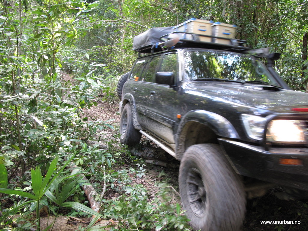
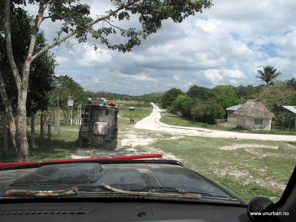
5511529214_1781222f67_b_d.jpg


Road to Carmelita

5498702842_b2b2267ebf_b_d.jpg


Jack turned out to be from Africa, but now living in Guatemala working as a tour guide. He had just transported a group of people up here for a trek in to El Mirador, and he told us that driving in could not be done. And we had heard the same thing from the military check point a few kilometers down the road. Not promising… The least promising detail was perhaps that El Mirador was now a National Park, and making new roads is strictly forbidden. Cra#! Now what?

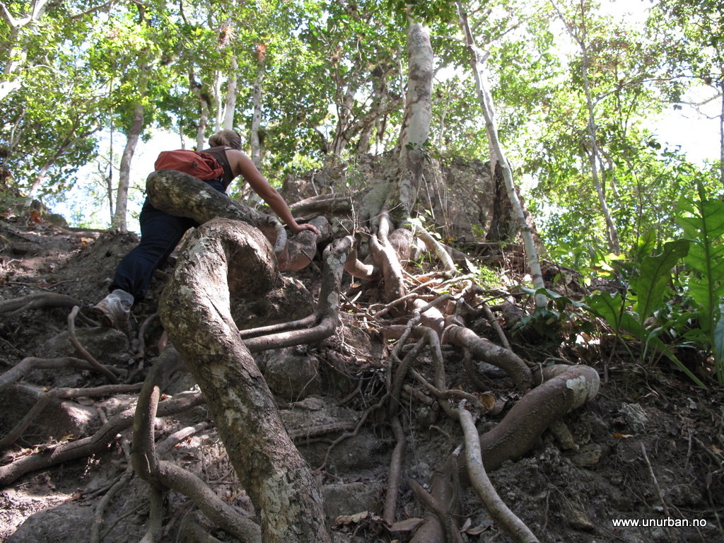
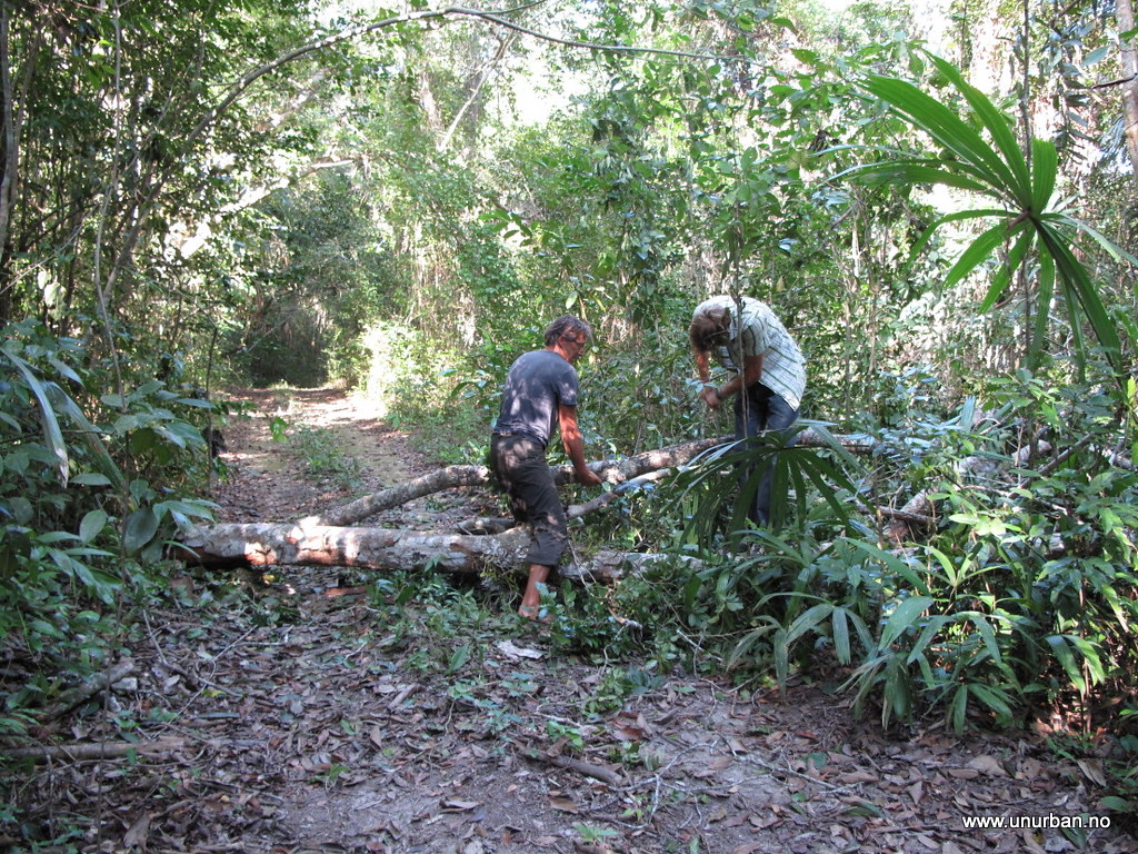
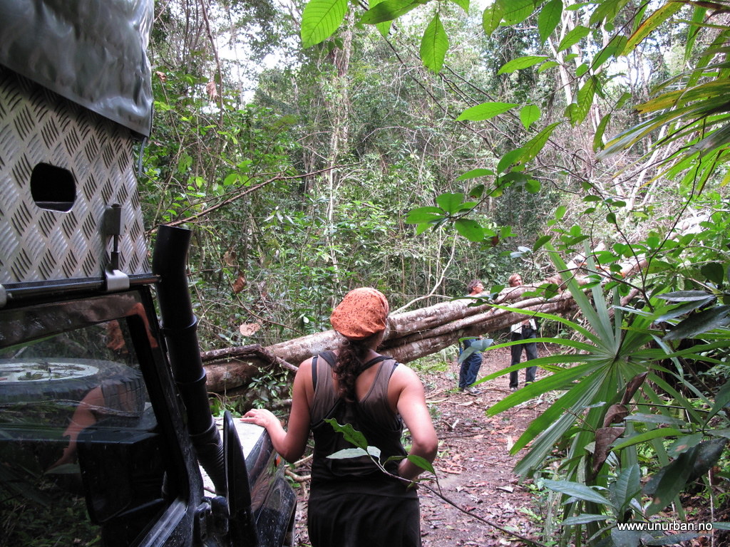
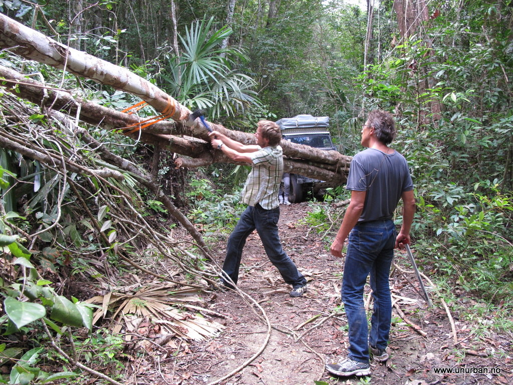
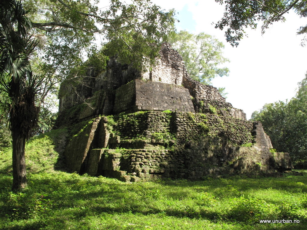
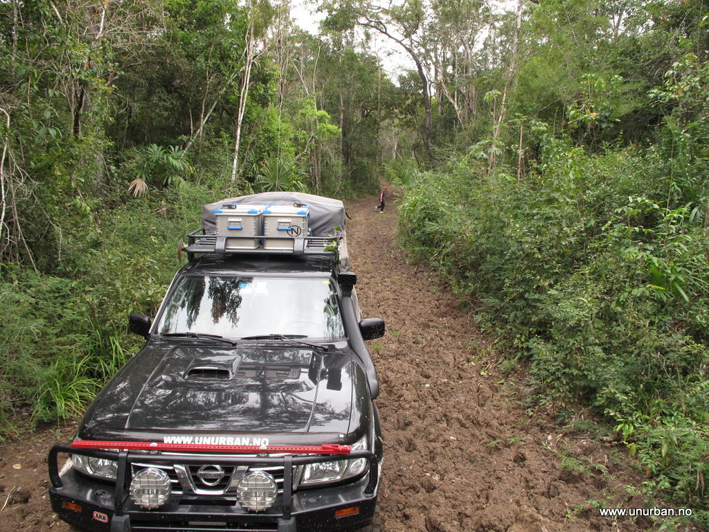
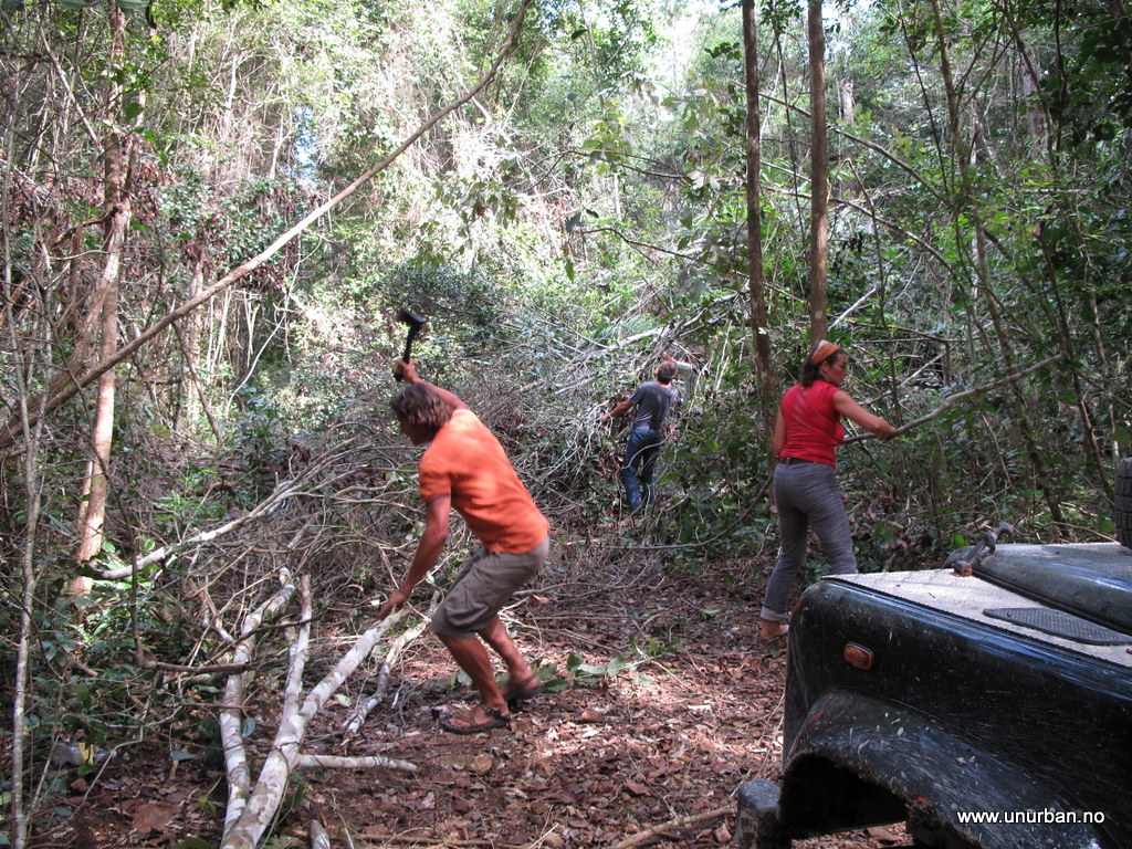
The next morning Jack came over and he had had a chat with some locals that mentioned a few other possibilities for driving in the area. Jack didn’t have a 4x4 truck (make a note of that for the next post…) so he was interested in joining us if we wanted to check out some local 4x4ing. And there are ruins up here that are not on the maps! One is supposed to have a fantastic location in a lake, but would require a chainsaw. We saved that one for the next time… And then went for another road going out to a different ruin via a jungle lake. We had already decided to drive a bit back south to try another “missing road” that would take us through the jungle and back to Tikal from the north, so we didn’t want to spend the whole day looking for these ruins. But after two and a half hour chopping our way through the jungle, we were exactly half way by the lake, and realized that we wouldn’t make to these ruins and back the same day.

5510930009_a8281cbe49_b_d.jpg


5498120389_dff0afde82_b_d.jpg


5511459216_01631eaec1_b_d.jpg


5498113247_55d3014ccb_b_d.jpg


5498128319_0ea287c67f_b_d.jpg


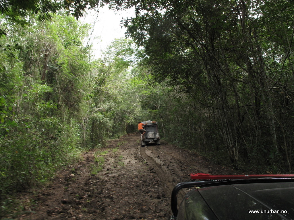
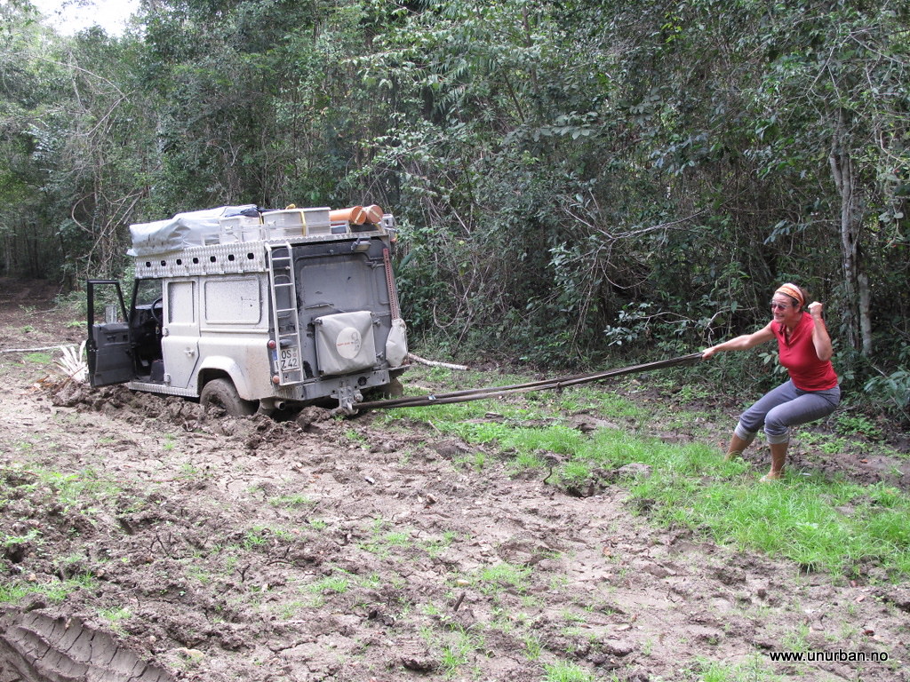
We turned around. Going back the same road took us about half an hour as all the trees were cleared away and we knew the mud holes.

5498728480_95330bb94f_b_d.jpg


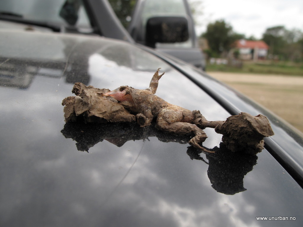
It is possible we were driving kind of fast on our way back out. We wondered for a long time what this frog’s last thoughts could have been... (sorry for the graphic pic (but it didn’t suffer, as it was most certain instantly fried after landing on the hood...)) :)

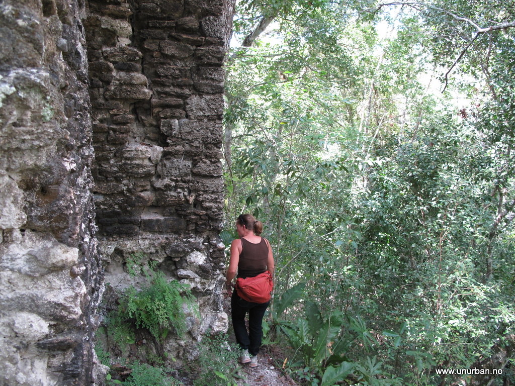
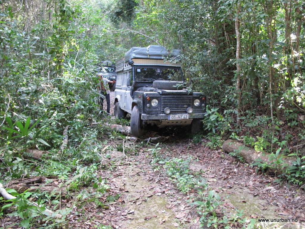
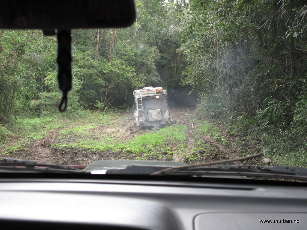
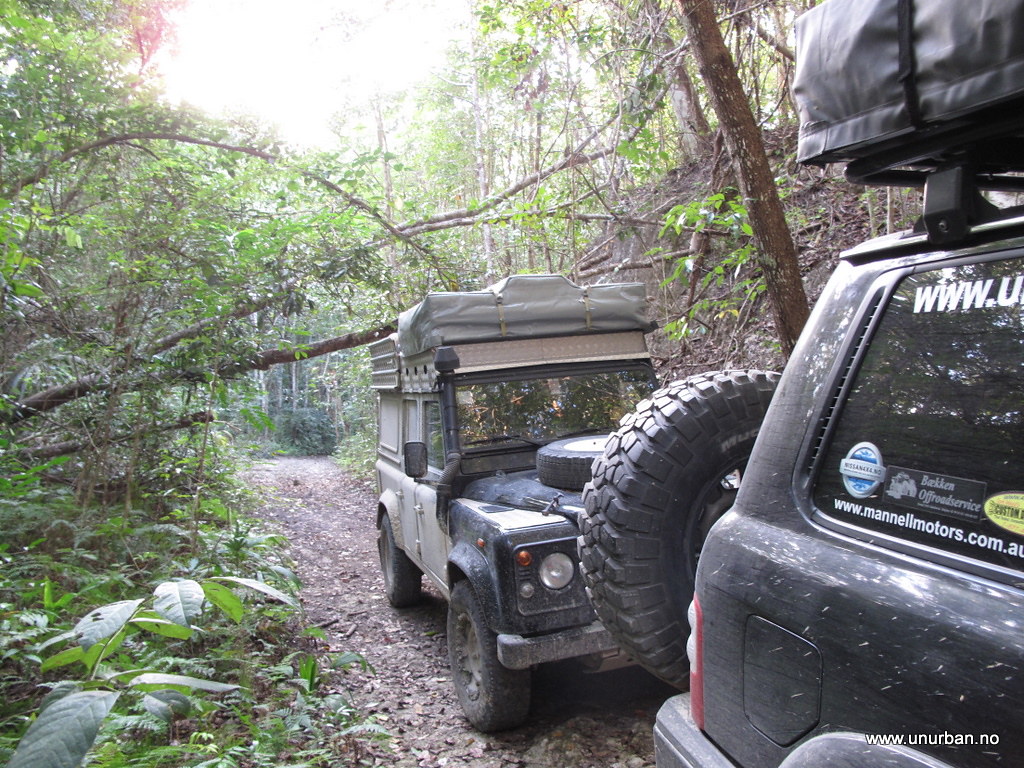
Back in Carmelita we had a break and then started driving south to some Maya ruins called El Zotz. Jack had some stuff to do in Carmelita, but told us he would try to drive in to El Zots a later to check out the place. The road in was a lot tougher than we expected, and the 30 minutes that the military check point guys told us it should take, was suddenly more like two hours. On the way in we drove through quite a few big mud holes and had to clear trees laying across the road.

5498730342_c82fafd2f8_b_d.jpg


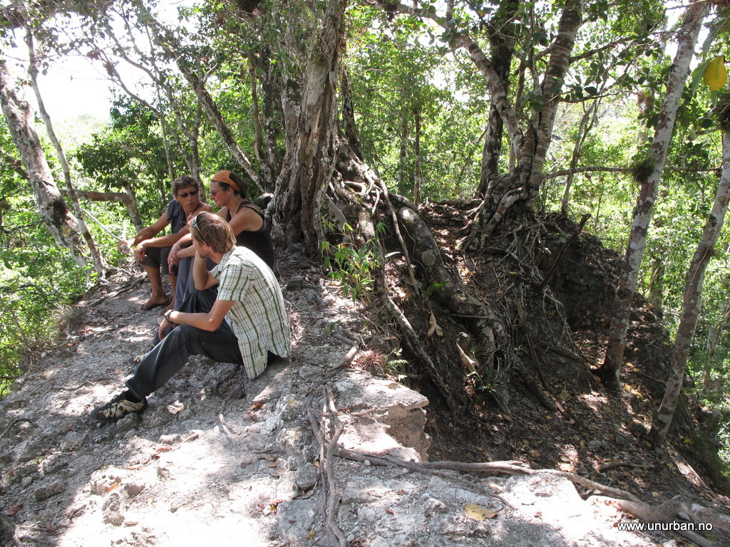
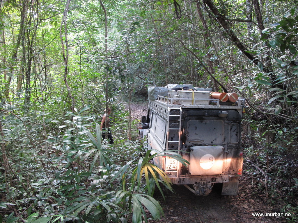
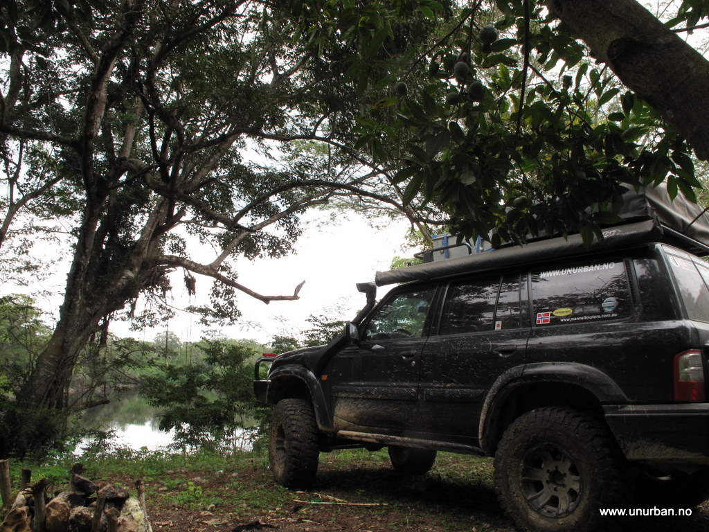
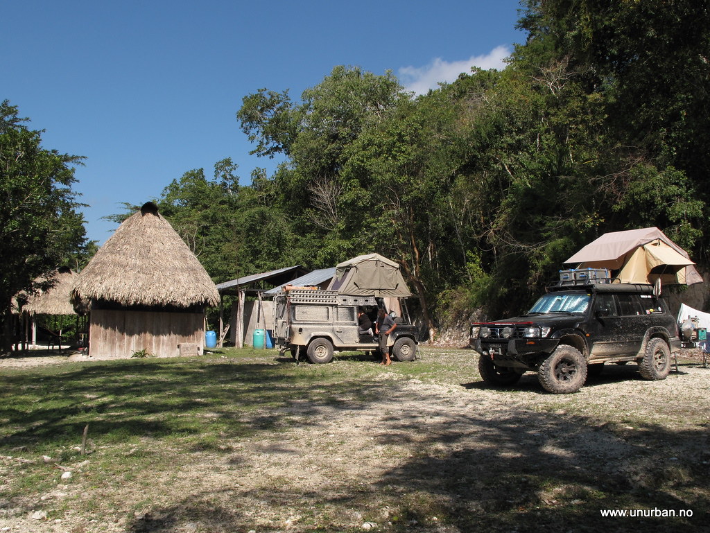
At El Zotz “park” there is basic camping facilities even including cold showers. And if you ever decide to go there, remember to keep driving past the first group of houses, and up a small hill to the left. The road ends there in a big “parking lot”. Only minutes after we parked our vehicles we saw in the sky why the Mayan called this place El Zots, meaning “bat”. When the sun goes down millions of bats fly out of nearby caves and fly over the temples. An amazing sight!

5498732168_a3384c7376_b_d.jpg


We did of course ask the guys working in the park if it was possible to keep driving through the jungle to Uaxactun north of Tikal, but they all told us that this would not be possible. Hmm… Would we have to turn around a second time? We postponed the decision to the next morning. And where the he## was Jack…?

E&M
 

unURBAN

Adventurer
El Zotz and a jungle road

After breakfast the next morning we went to look for the El Zotz ruins. This site is still unexcavated, and all the ruins are in the jungle just as they were when they were found. Here we could actually climb to the top of the ruins by the help of lianas and roots. Fascinating! From the top of the highest ruin we could see the highest pyramid of the Tikal ruins 25 kilometers away (in a straight line).

5498146369_ff91f6d983_b_d.jpg


5511464674_551657d8de_b_d.jpg


5498144667_3cd8411036_b_d.jpg


Back in camp we were discussing what could have had happened to Jack as he never showed up the last evening. We concluded that something had come up, and that he never left Carmelita. And IF he had tried to drive in to the ruins, he would definitely have come across the mud holes, and turned around. After all he didn’t have 4x4 on his pick-up truck…

We packed up and decided that we should take a look at the road continuing further into the jungle. This morning we had talked to a guy that told us that there was some kind of a road, but he thought it only would be passable on a motorbike. Seeing is believing...

5498155355_9ba360b73c_b_d.jpg


5498751902_e4517b58ef_b_d.jpg


5498150729_32dd5f8b13_b_d.jpg


The first few kilometers weren’t as bad as we had been told. Only smaller trees across the road, and the mud holes were passable. The Land Rover was in front as it would be a lot harder for him to pass a mud hole after us (with 37s), not to mention that we are about 1000 kilograms heavier to pull out if we would get stuck.

5511457556_85e09d20ea_b_d.jpg


5514275092_eb4015d552_b_d.jpg


Some smaller trees and brush to get through, but most stops took only a couple of minutes. We were about 20 kilometers in when we had our first little setback. A huge tree across the road, and it was just about to get dark. We had different info on how far this drive should be, ranging from 20 to 35 kilometers. We were of course hoping for the first, so potentially it could be as little as a couple of kilometers left. However, we had some very inaccurate maps on our GPS, and they indicated at least 10 Ks more.

After assessing the situation we saw that it could be possible to clear some smaller trees and moving a big log to get under the big fallen tree on the “higher side”. After some sawing and axing, we attached the winch to the log on the ground, and pulled the whole thing away from our path by the help of a pulley anchored to another big tree some 10 meters past the obstacle. When the road was cleared after about an hour work, we could just pass under the fallen tree. And if you come the same way later this season, you can get through if your vehicle is not higher than 2 meters 54 cm. NOT 2 meters 56!

5514272366_4b6e8fd22d_b_d.jpg


By now it was pitch black (camp pic above is from next morning), and we continued driving for another kilometer or so before we ran into the next tree across the road. This wasn’t very big, but we were too tired and too hungry to start on that one. We camped in the middle of the “road” being pretty sure nobody would come driving through this night (as nobody had been driving through here for quite some time..). After dinner we popped the roof top tents and climbed in for a good nights sleep.

E&M
 

RMP&O

Expedition Leader
If you want to meet up I leave for home in just a few days....I plan to be in San Juan del Sur, Nicaragua by Tues/Wed. next week.
 

unURBAN

Adventurer
If you want to meet up I leave for home in just a few days....I plan to be in San Juan del Sur, Nicaragua by Tues/Wed. next week.

Just checked your tread, and you have already passed us!?!?!? D##m, you're fast! :)

We feel inspired and hope to go from Yucatan to Nicaragua in 6-7-8 days.
Hope that our paths cross another time (and hopefully in Patrols!!!).

E&M
 

unURBAN

Adventurer
Through to Uaxactun!

5498161375_40e8efbe89_b_d.jpg


Coffee never tastes as good as it does in the forest or jungle, probably because of all the insects and stuff that fall into the pot when brewing. The tree that had stopped us the night before was gone in less than 15 minutes, and we were again ready for the road to Uaxactun. Then something funny happened. There was a weak sound of an engine growing stronger and stronger, and we all stopped doing what we were doing and waited for what was to come. Out of the jungle came a local guy on a motor bike and I would definitely say that was the most surprised look on a face I ever saw. But after a few seconds of mild shock he gave us a big smile, and when we explained what we were doing there and asked if we were on the right way he just started laughing and laughing. Eventually we got around to ask what he was up to in the middle of the jungle, and he explained that he was cutting certain kind of leafs that was exported to Canada for use in flower decorations. No wonder so many of the locals down here think of North America as a strange and exotic place….

After some small talk he hid his bike in some bushes and disappeared into the jungle, and we got back into our vehicles and started towards Uaxactun. The flower decoration guy told us it was still about 15 kilometers to go, and that there was another huge tree in the road that we couldn't get past. We, of course, wanted to “take a look”…

5498163161_9382f8c461_b_d.jpg


And there it was. Definitely a bit of work without a chainsaw, which we didn't have. And this tree had a nasty twist and tension on it that added a little bit of excitement to the cutting.

5498165383_85f827e63e_b_d.jpg


In the end we had cut all the branches but one, and that one wouldn't let go without a fight. Even if the trunk was cut all the way through, the weight of the upper part of the tree was so heavy that we couldn't haul it away using a strap attached to the Land Rover. We set up the pulley again to change the direction of the pull and used the winch. After almost two hours the road was cleared enough to get through.

The last section was more or less brush and lianas, and we didn't have many problems negotiating our way through these. However, a liana must have missed our attention, as Judith and Christof got some damages to their roof top tent mounted on the front of their roof rack. 10 kilometers later we saw the first signs of car tracks, a few buildings, and then a road sign saying “Rio Azul”!?! (this could be the “back road” up to El Mirador…), before ending up on the airstrip in Uaxactun! We were through!

5498765692_14b6e0d4e7_b_d.jpg


5539245216_955b3514a0_b_d.jpg


After the high fives and an ice cream, we drove over to the Uaxactun ruins for a look, and these were really amazing. Hardly any restoration, but they are remarkably well preserved. In here were also a couple of buildings that were quite different from any other sites we have seen so far on our way through the Maya world.

5498769274_1c5a08df94_b_d.jpg


We will absolutely recommend driving up to Uaxactun from Tikal if you are in this area (or through the jungle if you have a good 4x4 (and a friend also with a good 4x4…)). Three hours later we were back in Tikal, and the road from Uaxactun comes out through the site of the ruins. The guard asked if we had a permit for driving up to Uaxactun, so we showed him the ticket to El Zotz. He needed a couple of minutes… But in the end all was fine, and after checking that we hadn't brought with us any animals or rare plants (fortunately he overlooked all the lianas hanging from our roof racks …) he waved us through. From Tikal we drove straight down to a campground in El Remate (By Lago Peten Itza) for a beer and a shower! A wonderful little detour indeed!

5539245378_1e76216a27_b_d.jpg


Oh! I almost forgot about Jack. Back in El Remate we checked our email, and we learned that Jack HAD driven in towards El Zots later that same day. He found the big mud hole… And got stuck… For two days! He told us he had learned an important lesson in 4x4ing. Rule number one: Make sure you have 4x4!

E&M
 
Last edited:

unURBAN

Adventurer
Belize coast

Leaving Guatemala the immigration women told us that we had to pay a departure fee of 20 Q each (2.5 USD). We told the women behind the counter that we paid 10 Q each for the tourist card when we entered the country, but then she just replayed that that was at a different border crossing and now we had to pay for this crossing. To be honest we did not really know all about the different fees we have to pay at the different crossings, we have just read reports from other travellers. From what we have read we paid the right amount crossing into Guatemala, but we have never read anything about departure fee. After discussing back and forth with the immigration women for a while we decided to pay her so we could actually leave Guatemala. After giving her the money and she put it away, we asked for the recite.. She just looked at us as if we were stupid, and then she asked us why we needed it. So after another discussion she finally wrote us one witch is probably not a very official one and probably not worth the paper it is written on. I guess the money went straight into her pocket or maybe the immigration officers share the money they charge the tourists in the end of the day…

The immigration woman told us that at the Melchor de Mencos border crossing going into Guatemala you do not have to pay for the tourist cards. We will see what she tells us when we will cross into Guatemala again in the few week’s time. Other travellers have told us that they did not have to pay anything for the tourist cards, others again had been charged 20 Q per person, but when they pretended that it was 20 Q for two people and paid just that it was ok too…. Maybe we have to practice our Spanish and see if the official Guatemalan pages say anything about the fees we have to pay when we enter and leave their country. It is not that it is a lot of money it is just annoying that officials use their posission to enrich themselves.

5500685767_9789e98d8c_b_d.jpg


Aduana (costums) in Guatemala was no problem, and our vehicle permit was multiple entries for 90 days. The costumes officer wrote on some papers, took our original permit that he would keep in a folder until our return and we got a new piece of paper.

5500687331_83dd5fd54d_b_d.jpg


The border crossing into Belize was no problem and the car was stamped into Espen’s passport. A few hundred meters after the border was a small house where we had to buy liability insurance for Belize witch is mandatory. The insurance you buy is per week and we paid 23 USD for two weeks.
After more than three months in Mexico and Guatemala it was kind of strange to cross the border into Belize and read signs in English and having no problem understanding the locals when they talk to us. As soon as you cross the border you can see that you are in another country because of the differences in the building style, the colorful houses, and the people. Belize has the largest ethnic diversity that I have ever seen in one country. The largest ethnical group is creoles, descendants of African slaves and British pirates, one third of the population is mestizos, 10 % is Mayan people, and then there is the Garífuna and other small ethnic groups from Europe, North American and China.

5501284988_fc961a31f9_b_d.jpg


Our old travel companions in Valley and Lotti had met up again on Yucatan and when we got to Belize we found them in Cockscomb Basin Wildlife Sanctuary. It was great to see them again and the first evening was spent updating each other on what the different parties had been up to since we travelled in different directions 6 weeks earlier. Cockscomb is sometimes also referred to as the Jaguar Reserve, but I will still call it Cockscomb since we did not see any Jaguars.

5501291160_66802e3c6d_b_d.jpg


Then it was time to say hallo to the Caribbean for Espen and me. There is no better place to get the Caribbean feeling than in the Garífuna fishing village Hopkins. The village stretches for a mile or two along the coast and has 1800 inhabitants. We camped on the beach for BZ$ 10 (US$ 5) for the two of us. It was great to be on the beach again. Last time Espen and I camped on a beach was at Maruata Beach in mid-December.

5501298300_be3bc9443f_b_d.jpg


Saturday evening we spoiled our self to a four course dinner at Chef Rob´s Gourmet Café. The food was incredible and the fish tasted even better with a cold white wine to accompany it.

5500700097_66d9a27006_b_d.jpg


Before leaving Hopkins we stopped by the local bakery to buy some fresh bread and muffins.

5540169175_2b8d609d06_b_d.jpg


A bit further south along the coast from Hopkins is Placencia that lies at the southern tip of a long narrow, sandy peninsula. Placencia did not have the same feeling as Hopkins even if it is nice. There were more big houses and Americans or other foreigners owning properties here. It was enough of small cozy resorts and hotels, but nowhere to camp. After asking around in Placencia “city” center and finding nothing we drove further and further out and found Seakunga. The friendly owner said it was ok to camp in their parking lot and we got a place that was just our style. It did not take us long to find the beach, bringing our books and having one relaxing afternoon in the hammocks.

5540169713_1b34531dda_b_d.jpg


Then the cold beer in the bar was calling out to us. The bar was up some stairs and had sand floor. The owner told us that it was no point fighting the sand on the floor all the time, it was better to make the floor into an extension of the beach…

After some relaxing days on the beach it was time to see some more of the Belize and next stop was the Cayo district in the west.

E&M
 

Christian P.

Expedition Leader
Staff member
E&M,

Glad to see that you are enjoying Belize! One of my favorite places in Central America.

I guess I am going to have to go visit this Maya ruin on the way back up - now that you have cleared the road, it should be easy...

:)
 

Forum statistics

Threads
185,911
Messages
2,879,535
Members
225,497
Latest member
WonaWarrior
Top