How would you outfit this custom LJ?

tweenerlj

Adventurer
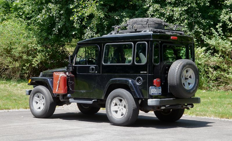
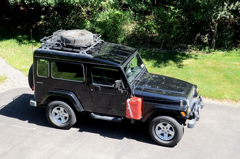
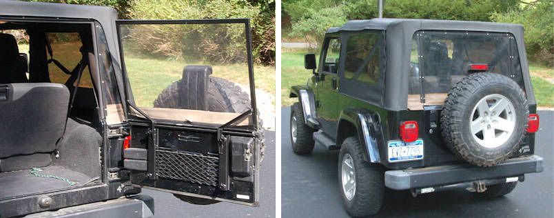
Here's what I call "barn doors"...

And the "soft barn door" I've designed and built for use with the factory soft top:

SoftBarnDoorDone5.jpg

Inspired by jscherb's soft barn door, fabrication of my soft hatch has begun:


Thanks for the ideas and inspiration! Gee it is going to be hard to take a knife to that soft top window, but the results will be worth it! Once I do that, it will be the point of no return. Technically, just much more expensive to get it back to stock. Really looking forward to not having to futz with that darn zipper all the time!
 

jscherb

Expedition Leader
The LJ Safari is just about ready for the Alaska trip. we're leaving tomorrow morning from upstate New York and we'll be heading west to the Chicago area, then northwest to North Dakota, leaving the lower 48 there and then through Alberta to the Alaska Highway. We'll take that all the way to Alaska, then on to Fairbanks, and from Fairbanks we'll head north up the Dalton Highway/Haul Road to Deadhorse/Prudhoe Bay.

The Dalton Highway is 414 miles of gravel/dirt road with services only available at Coldfoot camp, roughly halfway along the road, so I'm carrying three spares (one inside), and two gas cans, as well as a bunch of various spares.

LJLoaded1_zps2a7793d2.jpg


LJLoaded2_zpsa4db0fdd.jpg


A photo of the road sign at Deadhorse at the north end of the Dalton from Wikipedia:

Daltonsign.jpg
 

jscherb

Expedition Leader
After driving 2744 miles since leaving home on Tuesday morning, this evening we arrived at mile 0 of the Alaska Highway in Dawson Creek, British Columbia. Heather drove the Jeep around the mile 0 sign while I took a photo.

Mile0DawsonCreek_zps7cfa6492.jpg


Tomorrow we'll start up the highway towards Alaska.

Heather's been updating her blog every day along the way BTW.
 

MOSDIF589

Axel Adventures
This trip is on my bucket list and hopefully only a few years away... I am locked on to your trip and also enjoying your wife's blog...

Enjoy.... Albert
 

jscherb

Expedition Leader
Day 1 of the Alaska Highway - Dawson Creek to Fort Nelson, about 300 miles. The scenery gets increasingly interesting as you leave the prairie near Dawson Creek and follow along the eastern edge of the rocky mountains to Fort Nelson. The road is excellent, with very little traffic today.

We're staying in hotels/lodges the entire trip, but we decided to check out a few of the campgrounds along the way. There are quite a few small ones, like the one at Duhu Lake.

DuhuLake1_zps116b7a6d.jpg


Duhu Lake is about 6km off the highway, along a wide dirt road (which is also shared by the gas industry - there's lots of gas activity here).

DuhuLake2_zpsaf1221e0.jpg


Campground included outhouses and a covered picnic pavillion.

DuhuLake3_zps0e9842a9.jpg


Duhu Lake is an unspoiled wilderness lake; we had our picnic lunch on the shore.

DuhuLake4_zpsa1d536fb.jpg


Later in the day, close to Fort Nelson, we took the Jeep a little more off-road and did some wading in the Muskwa river.

MuskwaWading_zpsa7d2e55b.jpg


Tomorrow we'll head for Watson Lake, about another 300 miles.
 

jscherb

Expedition Leader
Today's drive on the Alaska Highway took us through the Rocky Mountains in British Columbia to Watson Lake, Yukon Territory. Scenery was spectacular, although the mountains aren't as high or as rocky as they are in Colorado.

We took a quick break at Muncho Lake:

MunchoLake2_zpsa957de3a.jpg


Because of the high temperature (about 90f), most wildlife was hiding in the forest during the day to keep cool, but we did see a bunch of Stone Sheep, three black bears (all of which were munching on clover, I guess it's tasty to them), and a huge bison, it seemed only slightly smaller than the Jeep. The bison was very close to the road:

Bison1_zpsd1254cb3.jpg


The last part of the drive was in the Yukon. Watson Lake is just inside the Yukon from BC, but tomorrow we'll be spending the whole day driving in the Yukon.

Yukon1_zps74ee1ade.jpg
 

jscherb

Expedition Leader
Sure looks pretty. Impressed how fast you got from NY to Alaska!

Doesn't feel that way! We left upstate NY last Tuesday morning and we won't be at the Alaska border until tomorrow night. We are only doing about 300 miles each day on the Alaska Highway though, we want to make sure we have time to stop anywhere that looks interesting. (Heather is covering a lot of those stops in her blog: http://ljsafarigirl.wordpress.com ).

How many total miles do you have on that LJ now Jeff?

I haven't checked today, but it should be about 112k right now.
 

jscherb

Expedition Leader
Drove about halfway through the Yukon today. Lots of great scenery and mountains. Here's a typical view of the Alaska Highway in the Yukon, although this photo wasn't taken in the really mountainous section.

AlaskaHighway2_zps557c5612.jpg


Planning your gas stops is important, often it's 90 miles or more to the next place to get gas.

Our mid-day gas stop was at Teslin, on the shores of Lake Teslin. Gas stop is just over the longest water bridge on the Alaska Highway, you can see the bridge beyond the Jeep.

TeslinLakeBridge_zps8768fd6e.jpg


Highlight of the day was probably the momma bear and her three cubs. Momma was digging at a rotten log to get at bugs to eat, one of the cubs was following her lead, and the other two were playing around. Here's one of the cubs:

BabyBear2_zpsd2e1b390.jpg


Heather's been keeping up her blog with many of the sights and stops, so if you're interested in those details check it out at http://ljsafarigirl.wordpress.com/ Yesterday she wrote about our dip in the Liard Hot Springs.
 

jscherb

Expedition Leader
Today we got to within 20 miles of the Alaska border, we're at Beaver Creek YT. We drove along the St. Elias mountain range, which has peaks up to 19,500 ft - 5000 feet higher than the peaks in the Colorado Rockies.

Here's one view:

StEliasMountains1_zps6f9fc443.jpg


We stopped for lunch along the shore of Kluane (Klu-ah-nee) Lake, the largest lake in the Yukon Territory. It wouldn't be a Jeep expedition without some 4wd action, so we drove out to the edge of the lake. 4wd definitely necessary in the soft gravel.

KluaneLake2_zps21a65a4b.jpg


KluaneLake_zps3b9fbe21.jpg


The last 75 miles or so of the Alaska Highway in Canada is under construction, so lots of dirt sections of road, but I figure that's just preparing me for the rough ride up the Dalton Highway in Alaska.

In a number of places you have to wait for a pilot car to take you through the construction:

RoadConstruction_zpsbc839f93.jpg


Tomorrow we'll enter Alaska and make our way to Fairbanks.
 

jscherb

Expedition Leader
3943 miles after leaving home, we crossed the border back into the U.S. this morning:

AlaskaWelcome2_zpsa3bca080.jpg


And about 200 miles later, we reached the end of the Alaska Highway at Delta Junction. The end of the highway marker post is behind the Jeep.

EndAlaskaHighway_zps6721c18e.jpg


EndAlaskaHighway2_zps0416d093.jpg


If you keep your eyes open along the way, you can often find relics from the original construction of the highway in WWII. There are a few at Delta Junction...

EndAlaskaHighway3_zpsc8e3ac3b.jpg


We're in Fairbanks now. We'll spend tomorrow here exploring the sights of the city, and Friday we'll head up the Dalton Highway to Coldfoot Camp, where we'll spend the night before going the rest of the way to Prudhoe Bay.
 
Last edited:

Forum statistics

Threads
185,897
Messages
2,879,321
Members
225,497
Latest member
WonaWarrior
Top