EDIT: Video Here... http://www.vimeo.com/17231150
Houston to Big Bend National Park (and back again)
[This Report co-insides with Bryans which is here: http://www.expeditionportal.com/forum/showthread.php?t=49050]
After weeks and weeks of gear purchase and preparation, our day of departure approached with worrying rapidity. This was our first ‘major' trip for Holly and I, neither of us having any camping or overlanding experience whatsoever. Expedition Portal proved invaluable for gear and vendor selection with Sierra Expeditions, TRDParts4U, BajaRack, American Toyota and craigslist (amongst many others) all getting a workout.
The itinerary? Well, the idea was to spend 9 days away from Houston headed West to Big Bend National Park. The kicker was our two extra passengers – Holly's parents were flying in to stay with us for a month.
The final week saw parcel after parcel arriving each day, and our nights spent trialing, test packing, cooking and preparing meals. When Thursday night finally rolled around and we headed off to the airport to pick up the (future) in-laws we were both pretty exhausted but we felt we had done everything we needed to get done.
After a shortened day at work on Friday we shot home and loaded up the Land Cruiser and hit the road just in time for peak hour traffic… All went smoothly though and after a few detours on the San Antonia expressways we checked in at a budget hotel for the night. 3.5 hours done. 7 hours to go. After a ‘lovely' continental breakfast it was on the road again. Albeit for 10 minutes as we called in Academy sports for a few clothing essentials that they in-laws hadn't brought with them (they had been traveling for over a month in England and as such had packed pretty light). I picked up a couple of Columbia fishing shirts – these proved to be brilliant as they are cool and dry fast.
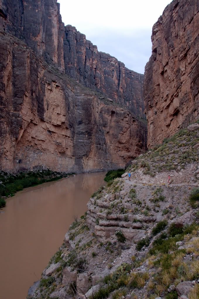
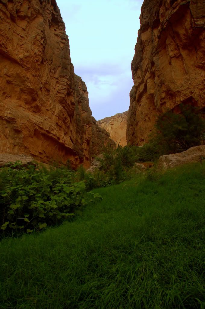
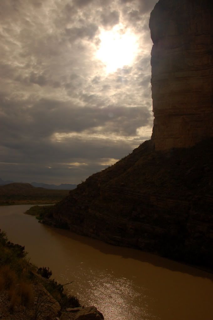
We decided to take the southern route to Big Bend, heading through Del Rio and Sanderson before a left turn at Marathon. On the way, we went through a US Boarder Patrol stop but sailed through no problem (thanks for the heads up on the passports Bryan!). The drive from Del Rio to Marathon is quite pretty for Texas, with plenty of large canyons and waterways to cross.
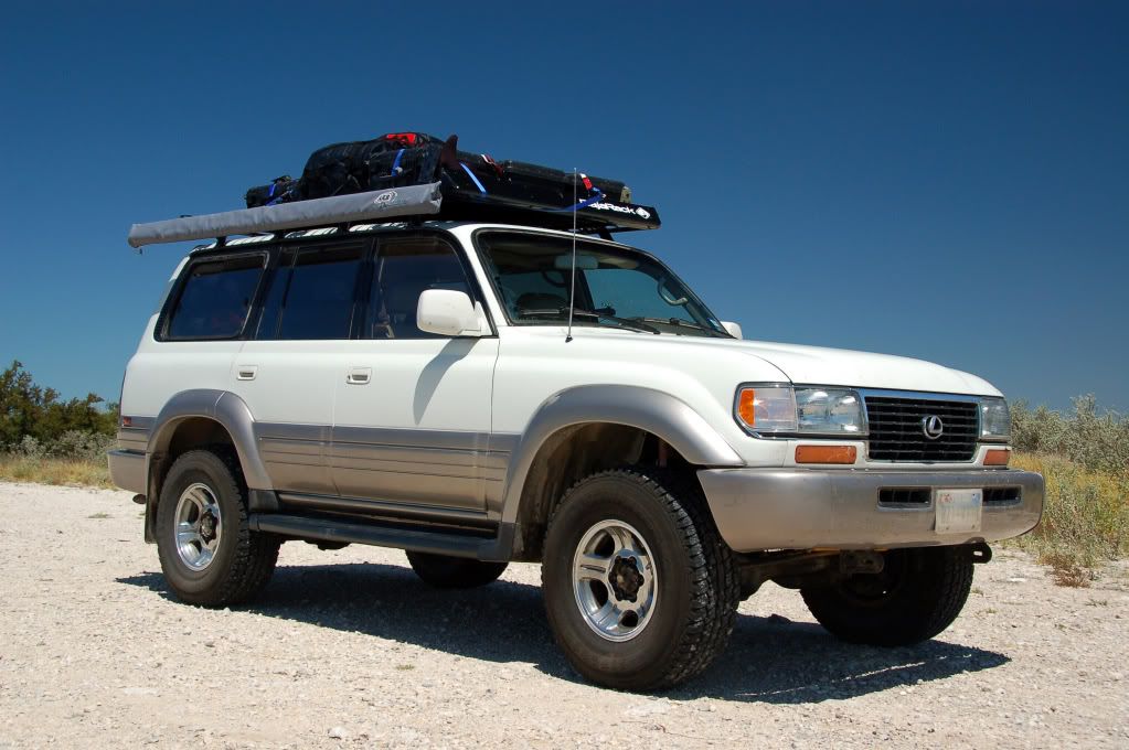
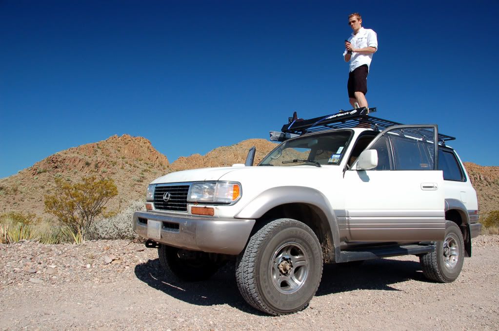
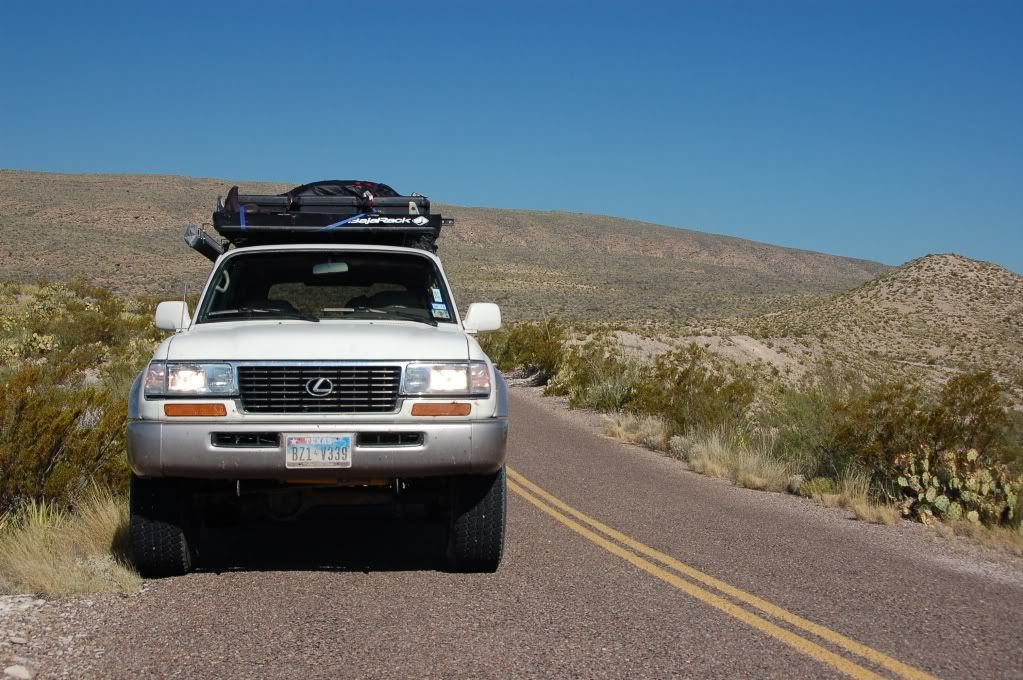
The Land Cruiser laden with gear. We stopped West of Del Rio to check out the Pecos River from the US 90 bridge.
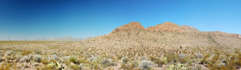
You start to get a taste of the offerings Big Bend may have as you approach Sanderson and the terrain shifts from rolling hills to slightly more abrupt butts and juts. Mile after mile of lonely highway, with only empty train tracks to keep us company took us all the way through to Marathon, our final fuel stop and the last leg of the journey to the Park.
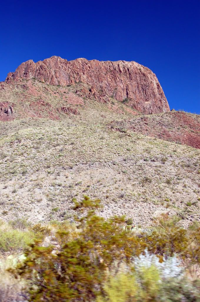
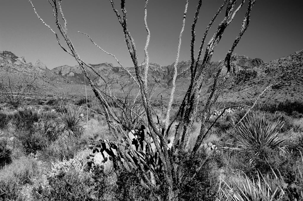
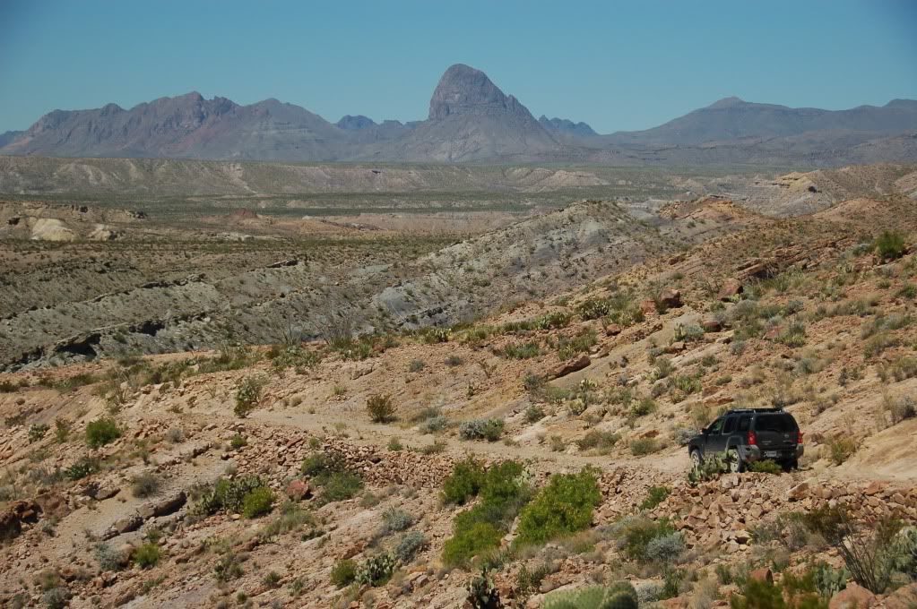
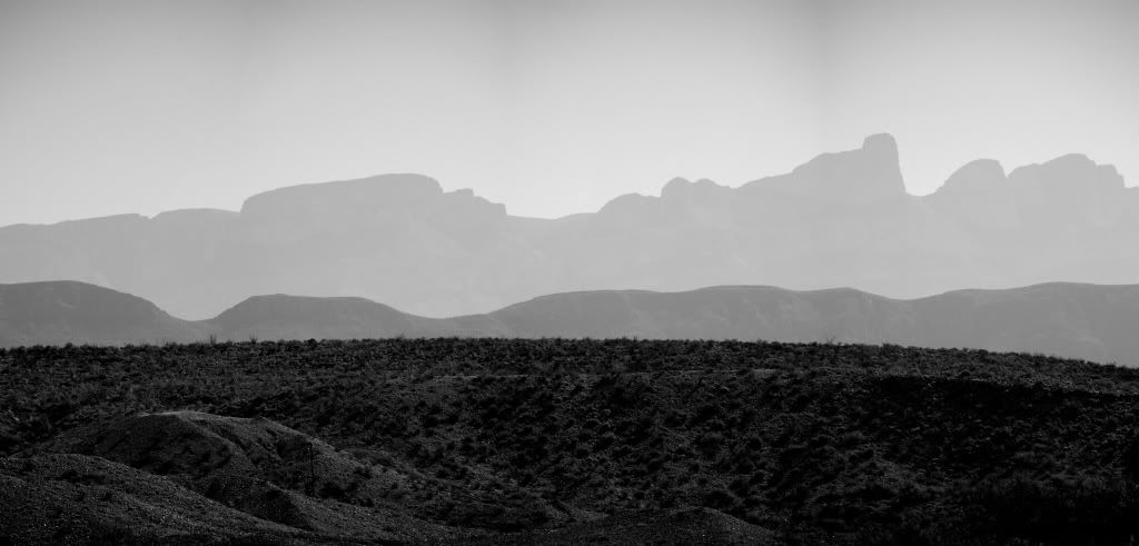
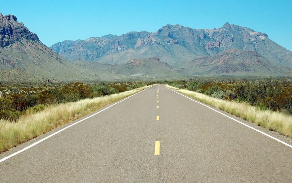
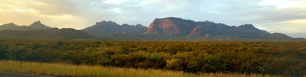
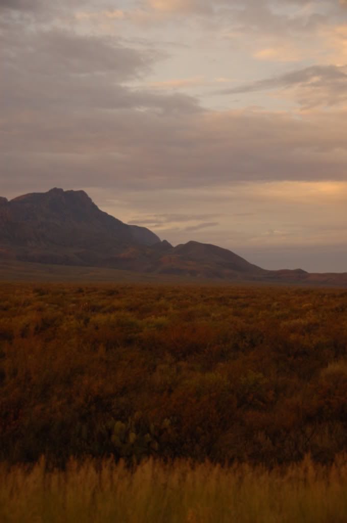
From Marathon you take US 385 South. This is where the scenery really starts to get interesting. Limestone ridgelines protrude from weathered hills and look remarkably like a Stegosaurus' armour plates at times. Other features include a mile of uniformly folded cream color limestone looking like a perfect sinusoidal wave across the landscape.
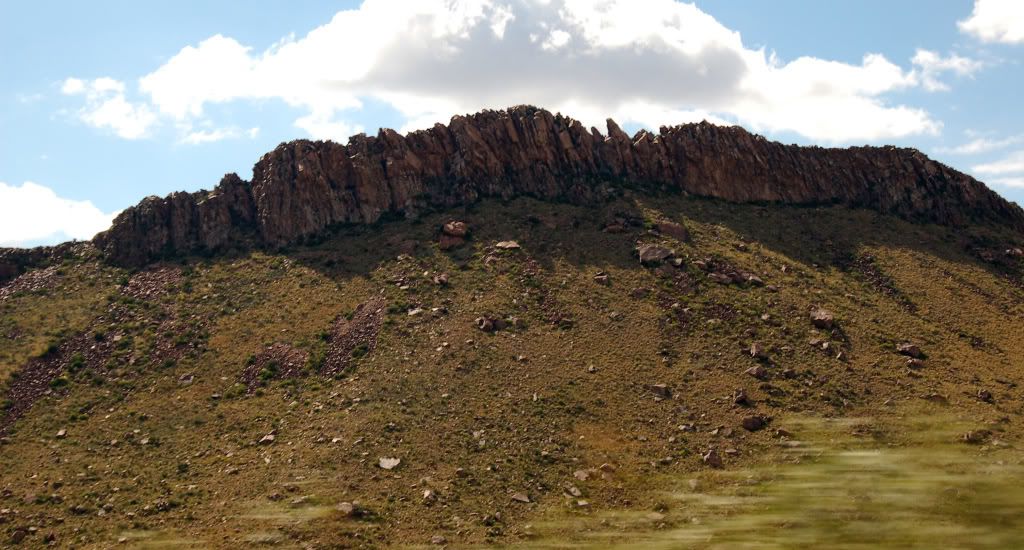
A spiny ridgeline off US385 south to Big Bend
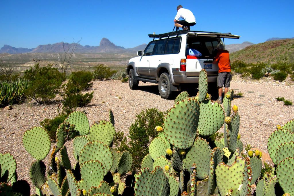
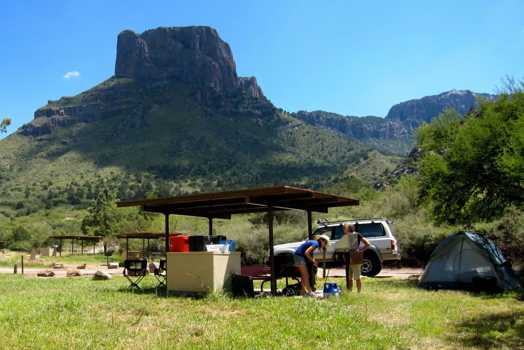
An hour after departing Marathon we enter the park proper. A quick stop at the ranger station to pay the park fees and get some advice, we hit the road again heading for the Rio Grande village and our liaison with Bryan and Angela in the Xterra and Mike in the 4runner. What struck us, once we set off from the station was just how vast the park is – it would another 45 minutes of driving (at 45pmh) just to get to the Village! Anyhow – a long days driving saw us arrive to very warm campsite right on the US Mexican border.
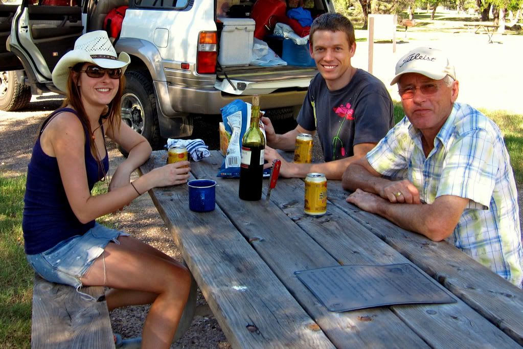
We made it! First things first: Beers and snacks before we contemplate setting up camp.
Bryan, Angela and Mike roll in soon after from a day on Big Bends gravel roads. We catch up, tent up, beer up and cook up feeling good to finally be here.
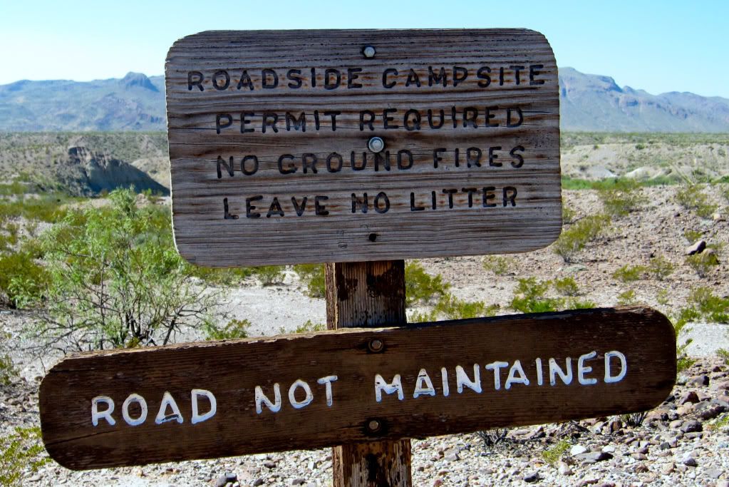
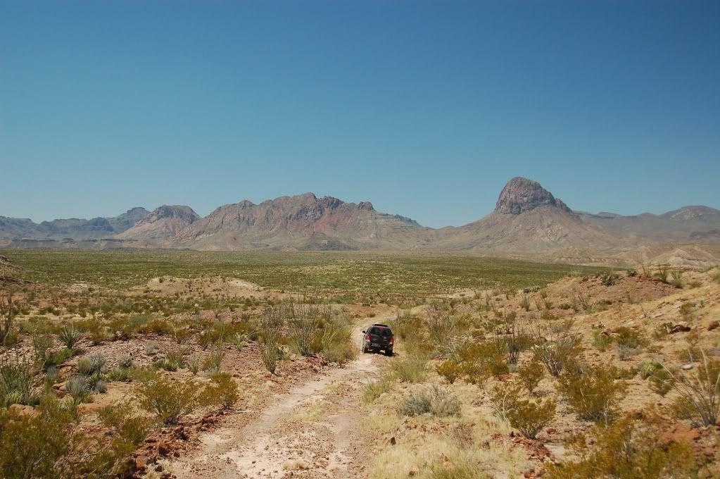
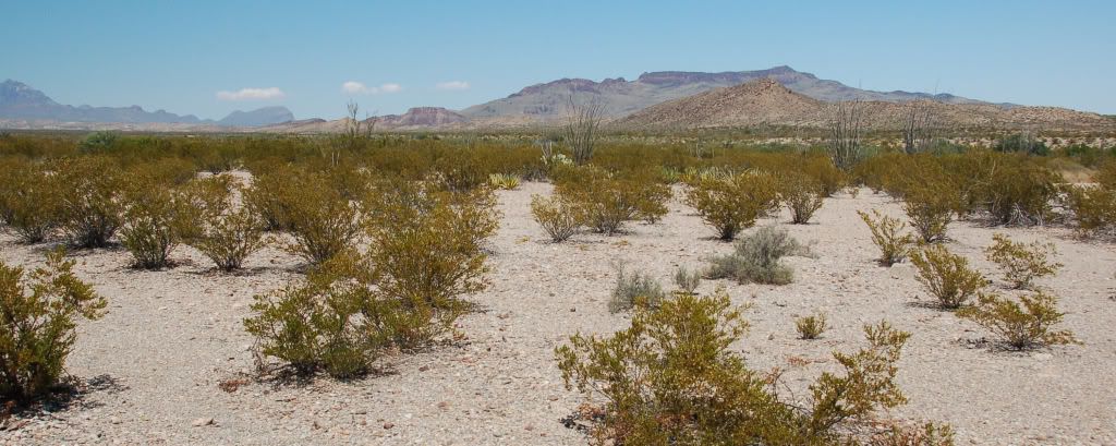
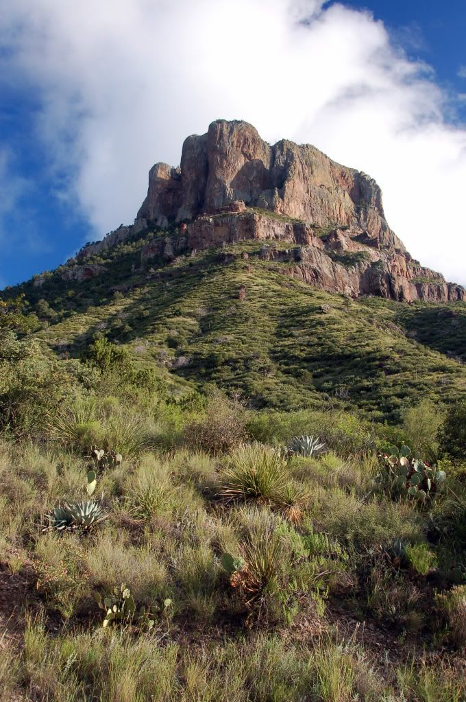
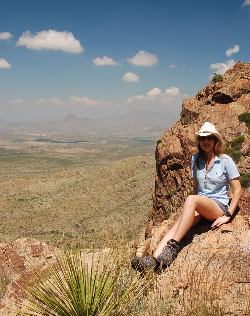
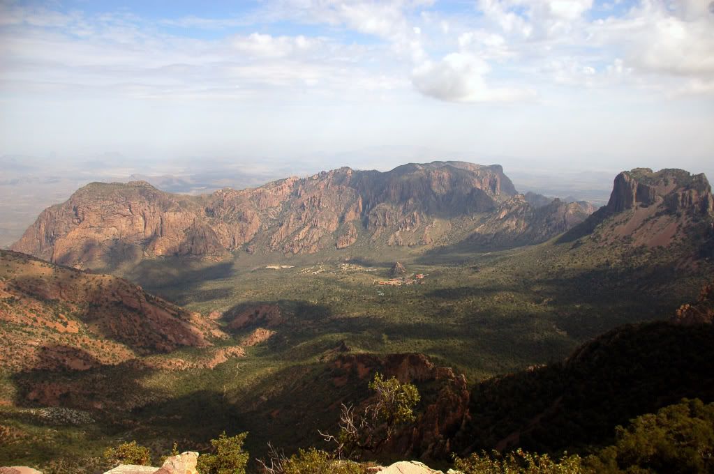
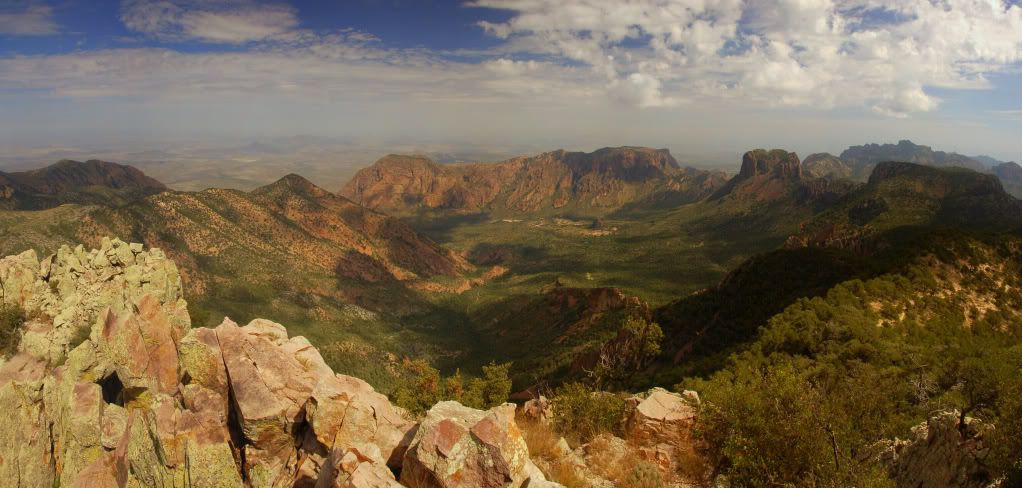
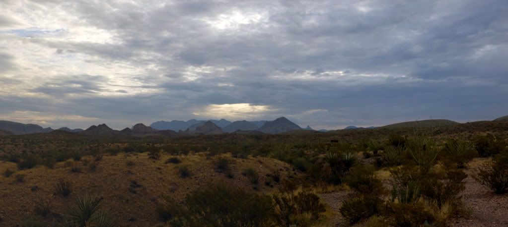
The next day saw us driving the trails on Big Bends ‘toughest' roads. Damn it was hot, but also very very special to see this part of the park. The Park is known for the Chisos Mountains, but it is the contrast between these sky islands and the surrounding desert and rivers which make Big Bend truly unique. From a stark, desolate, dry and dangerous desert floor to a green semi alpine environment in the mountains. We loved the drive around the base of the mountains as it gives you some perspective of the abrupt and forceful uplift of the protruding intrusive igneous upwellings.
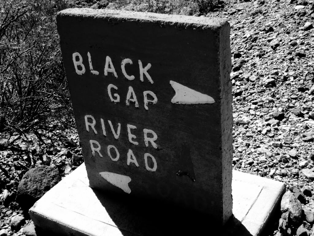
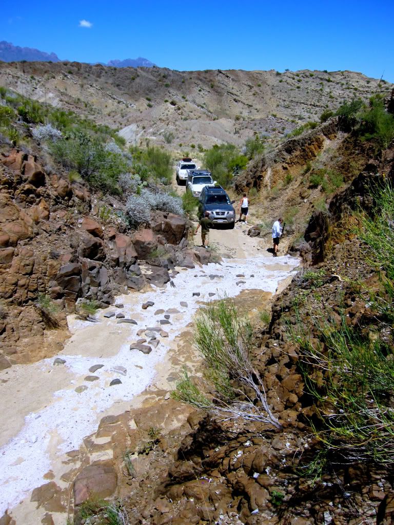
A few narrow sections that required a careful approach on the Black Gap Road
Navigating one of the many washouts along the trial. They didn't represent a problem to our vehicles but reaffirmed the ‘high clearance' status of the road. As usual, these things look much tamer in the photos…
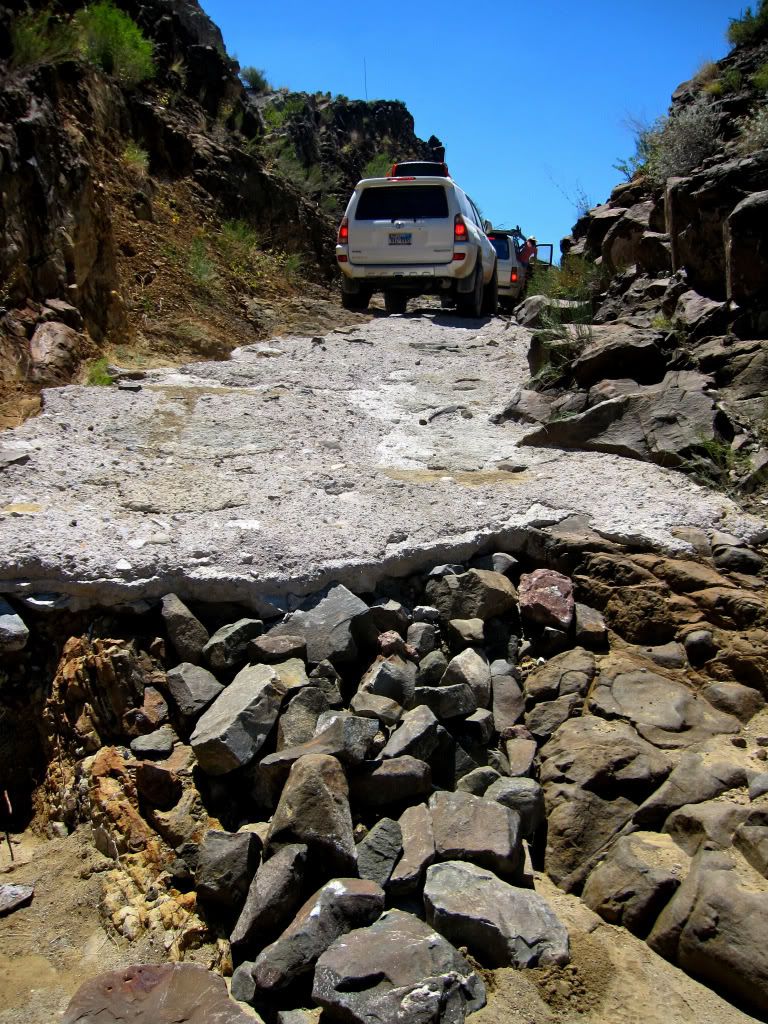
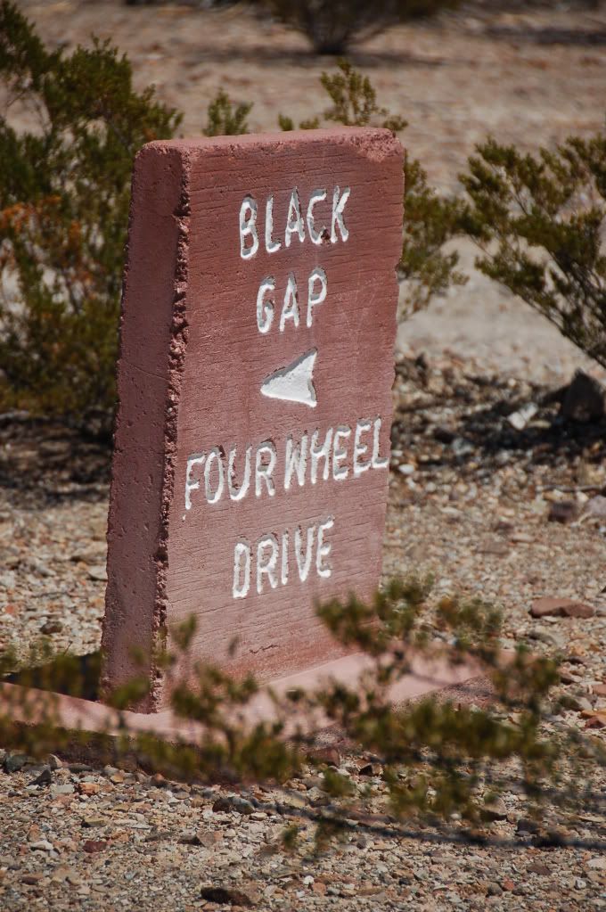
Arrival at the Black Gap pass. A culvert in the hillside and the crux of the trail. As you can see, most of the gap has been cemented over, leaving only the step as the challenging part of the Gap (or so we thought).
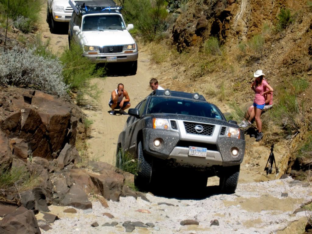
Bryan leading the pack up the step.
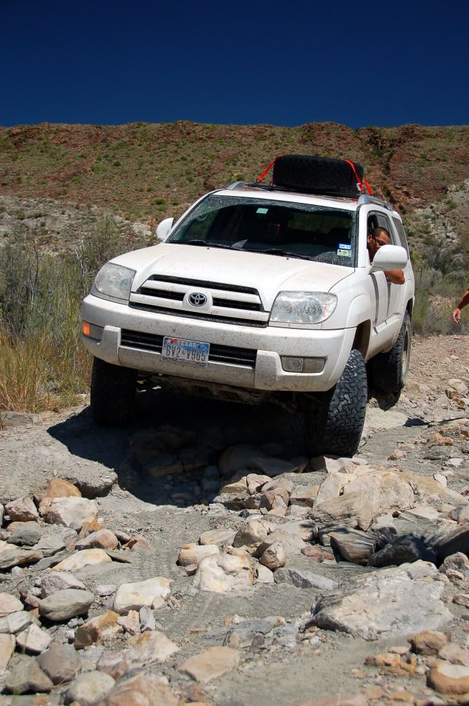
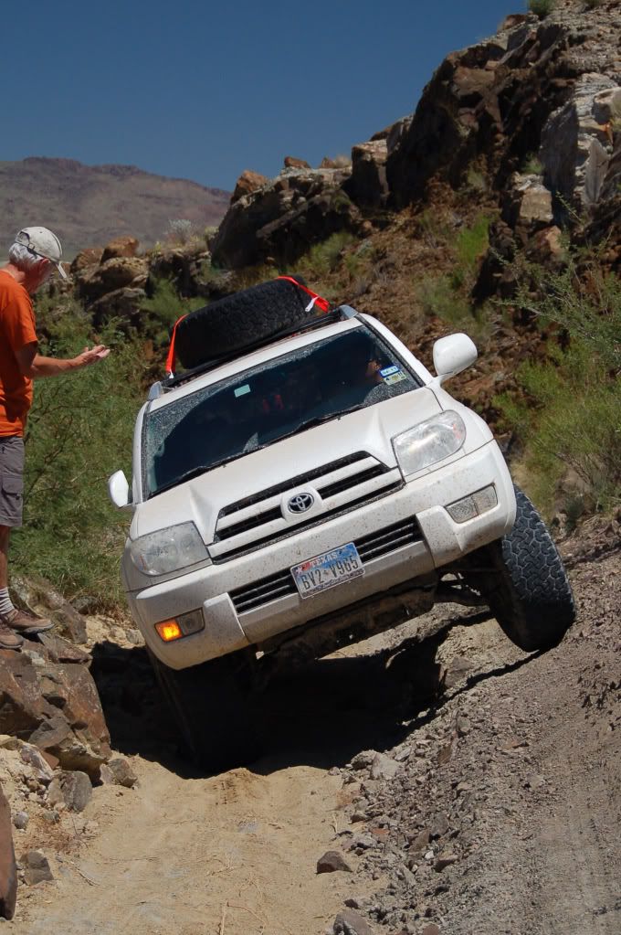
Toyota's follow suit.
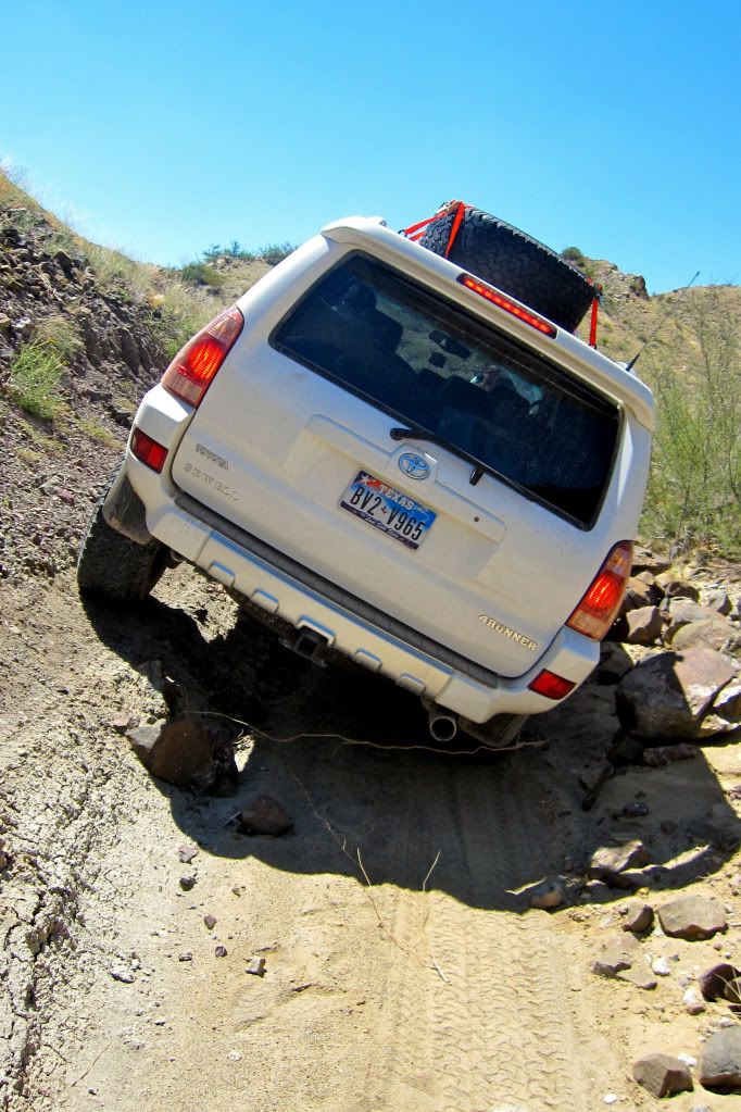
Interestingly the trail just after the step got quite tight and required some careful driving to avoid some rocks on the low side of the ditch.
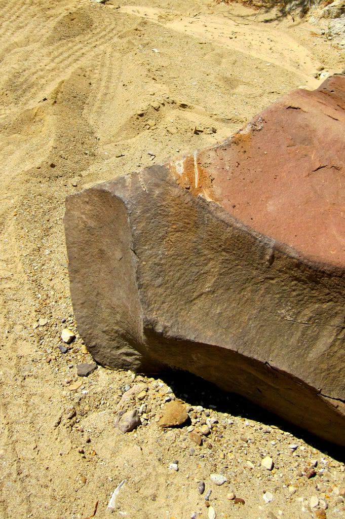
Oh f*@k. Slee Sliders probably on order soon…
Houston to Big Bend National Park (and back again)
[This Report co-insides with Bryans which is here: http://www.expeditionportal.com/forum/showthread.php?t=49050]
After weeks and weeks of gear purchase and preparation, our day of departure approached with worrying rapidity. This was our first ‘major' trip for Holly and I, neither of us having any camping or overlanding experience whatsoever. Expedition Portal proved invaluable for gear and vendor selection with Sierra Expeditions, TRDParts4U, BajaRack, American Toyota and craigslist (amongst many others) all getting a workout.
The itinerary? Well, the idea was to spend 9 days away from Houston headed West to Big Bend National Park. The kicker was our two extra passengers – Holly's parents were flying in to stay with us for a month.
The final week saw parcel after parcel arriving each day, and our nights spent trialing, test packing, cooking and preparing meals. When Thursday night finally rolled around and we headed off to the airport to pick up the (future) in-laws we were both pretty exhausted but we felt we had done everything we needed to get done.
After a shortened day at work on Friday we shot home and loaded up the Land Cruiser and hit the road just in time for peak hour traffic… All went smoothly though and after a few detours on the San Antonia expressways we checked in at a budget hotel for the night. 3.5 hours done. 7 hours to go. After a ‘lovely' continental breakfast it was on the road again. Albeit for 10 minutes as we called in Academy sports for a few clothing essentials that they in-laws hadn't brought with them (they had been traveling for over a month in England and as such had packed pretty light). I picked up a couple of Columbia fishing shirts – these proved to be brilliant as they are cool and dry fast.
We decided to take the southern route to Big Bend, heading through Del Rio and Sanderson before a left turn at Marathon. On the way, we went through a US Boarder Patrol stop but sailed through no problem (thanks for the heads up on the passports Bryan!). The drive from Del Rio to Marathon is quite pretty for Texas, with plenty of large canyons and waterways to cross.
The Land Cruiser laden with gear. We stopped West of Del Rio to check out the Pecos River from the US 90 bridge.
You start to get a taste of the offerings Big Bend may have as you approach Sanderson and the terrain shifts from rolling hills to slightly more abrupt butts and juts. Mile after mile of lonely highway, with only empty train tracks to keep us company took us all the way through to Marathon, our final fuel stop and the last leg of the journey to the Park.
From Marathon you take US 385 South. This is where the scenery really starts to get interesting. Limestone ridgelines protrude from weathered hills and look remarkably like a Stegosaurus' armour plates at times. Other features include a mile of uniformly folded cream color limestone looking like a perfect sinusoidal wave across the landscape.
A spiny ridgeline off US385 south to Big Bend
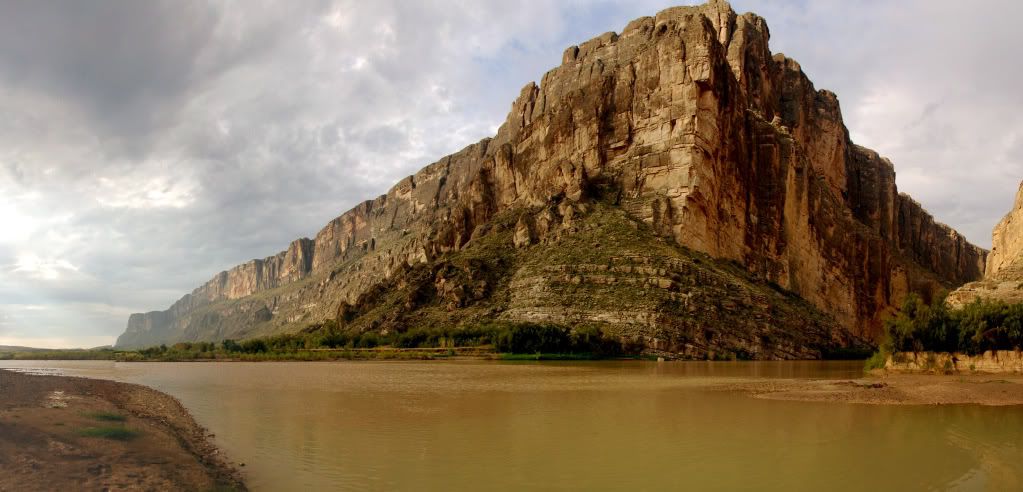
An hour after departing Marathon we enter the park proper. A quick stop at the ranger station to pay the park fees and get some advice, we hit the road again heading for the Rio Grande village and our liaison with Bryan and Angela in the Xterra and Mike in the 4runner. What struck us, once we set off from the station was just how vast the park is – it would another 45 minutes of driving (at 45pmh) just to get to the Village! Anyhow – a long days driving saw us arrive to very warm campsite right on the US Mexican border.
We made it! First things first: Beers and snacks before we contemplate setting up camp.
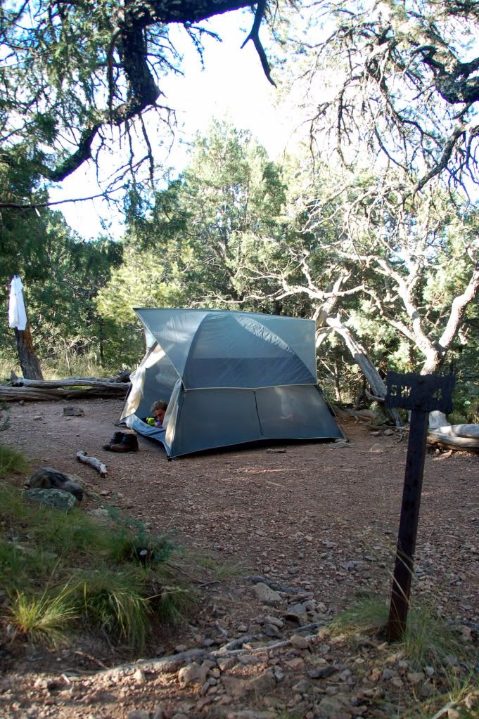
Bryan, Angela and Mike roll in soon after from a day on Big Bends gravel roads. We catch up, tent up, beer up and cook up feeling good to finally be here.
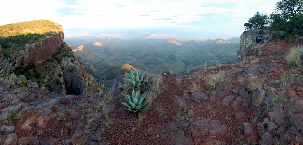
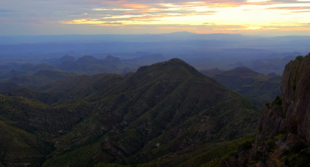
The next day saw us driving the trails on Big Bends ‘toughest' roads. Damn it was hot, but also very very special to see this part of the park. The Park is known for the Chisos Mountains, but it is the contrast between these sky islands and the surrounding desert and rivers which make Big Bend truly unique. From a stark, desolate, dry and dangerous desert floor to a green semi alpine environment in the mountains. We loved the drive around the base of the mountains as it gives you some perspective of the abrupt and forceful uplift of the protruding intrusive igneous upwellings.
A few narrow sections that required a careful approach on the Black Gap Road
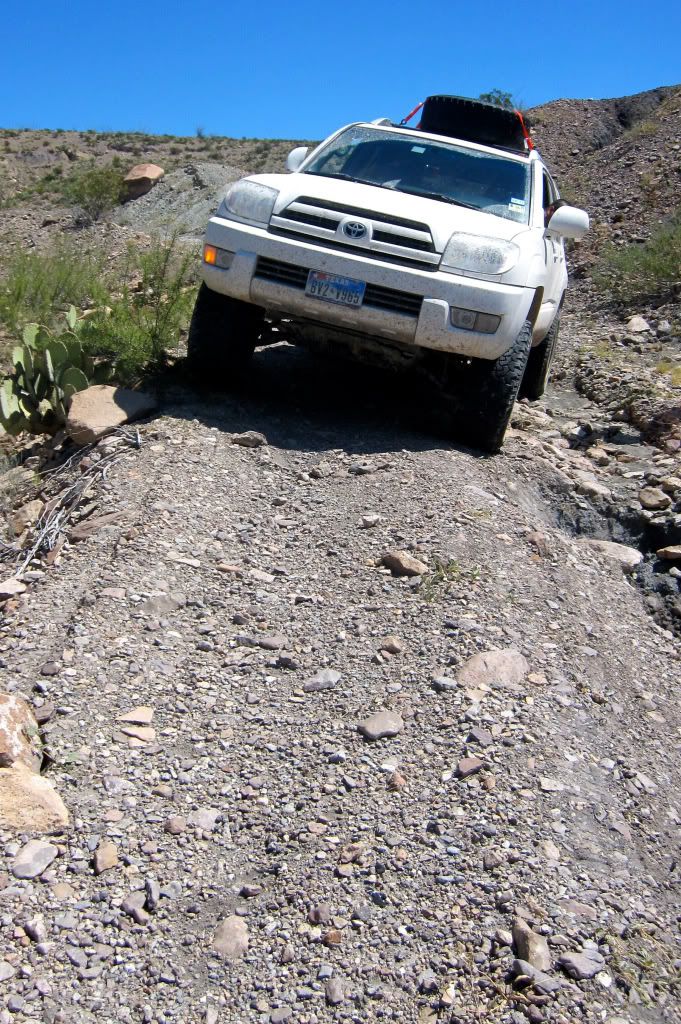
Navigating one of the many washouts along the trial. They didn't represent a problem to our vehicles but reaffirmed the ‘high clearance' status of the road. As usual, these things look much tamer in the photos…
Arrival at the Black Gap pass. A culvert in the hillside and the crux of the trail. As you can see, most of the gap has been cemented over, leaving only the step as the challenging part of the Gap (or so we thought).
Bryan leading the pack up the step.
Toyota's follow suit.
Interestingly the trail just after the step got quite tight and required some careful driving to avoid some rocks on the low side of the ditch.
Oh f*@k. Slee Sliders probably on order soon…
Last edited:
")


