KaiserM715
Adventurer
Last year, I took a family vacation in our Raptor to New Mexico and had the opportunity for some adventure. Our first stop was Red River, NM.
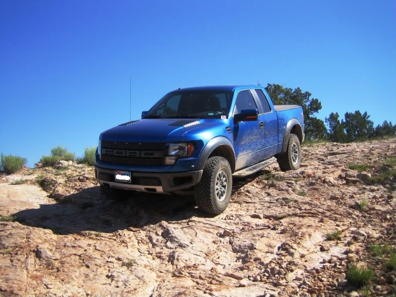
In the Red River area, I drove up to Greenie Peak, back down through the Midnight Meadows area to Forrest Access Road 134. We went east on 134 to the Anchor Mine. We took a side trip off of 134 up to Cabresto Lake for some fishing (no luck) on the way back to town via Questa.
Greenie Peak is not much of a challenge but parts of the trail are relatively slow going and I used low range quite a bit for the additional engine braking. The width of the truck was only an issue in a couple of places (good thing I brought my tree pruners!!). There were two places I had to turn around and I was very thankful the wheelbase was not any longer that it already is. The road up to Cabresto Lake (Forrest Access Road 134A) is pretty rough, but again, not much of a challenge.
Here is a trail description w/ GPS waypoints for Greenie Peak:
http://www.webejeepin.com/Trails/New_Mexico/Greenie_Peak.htm
Map location of Greenie Peak:
Greenie Peak - Google Maps
Map location of the Anchor Mine:
Anchor Mine - Google Maps
Map location of Cabresto Lake (end of Forrest Access Road 134A):
Cabresto Lake - Google Maps
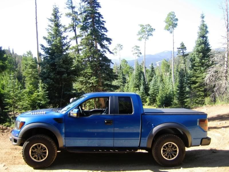
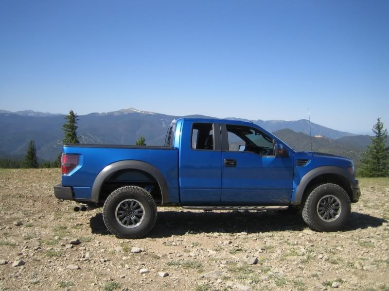
On the way up to Greenie Peak (note the Red River Ski Area in the background):
At the Greenie Peak / Midnight Meadows road juncture:
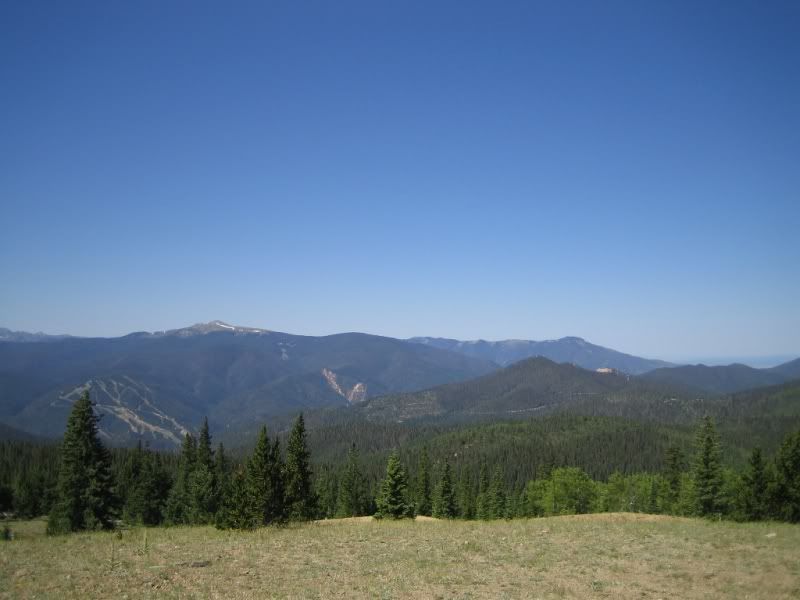
Greenie Peak (note the ski area) Est. elevation 11,250 ft:
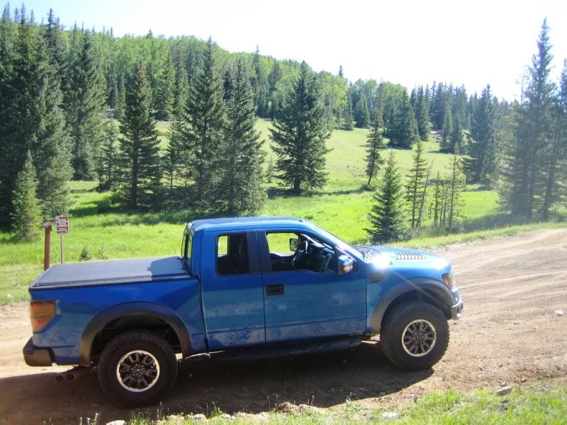
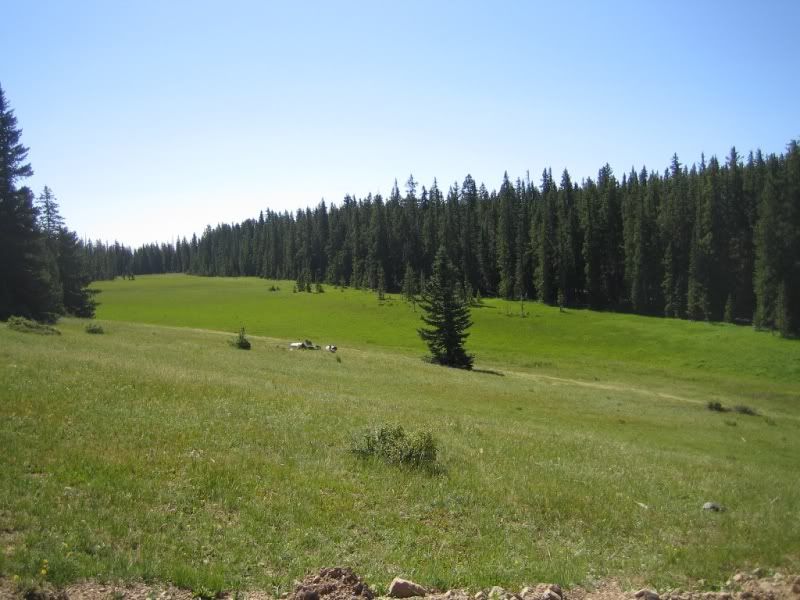
Midnight Meadows:
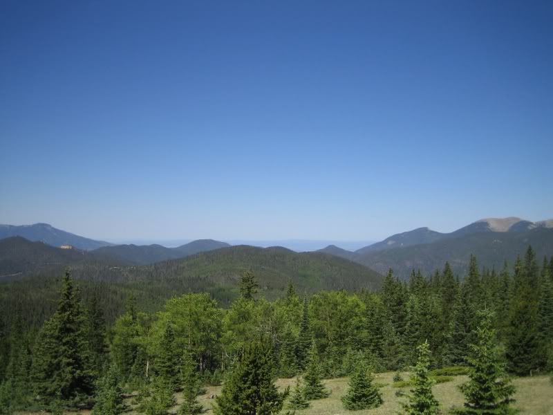
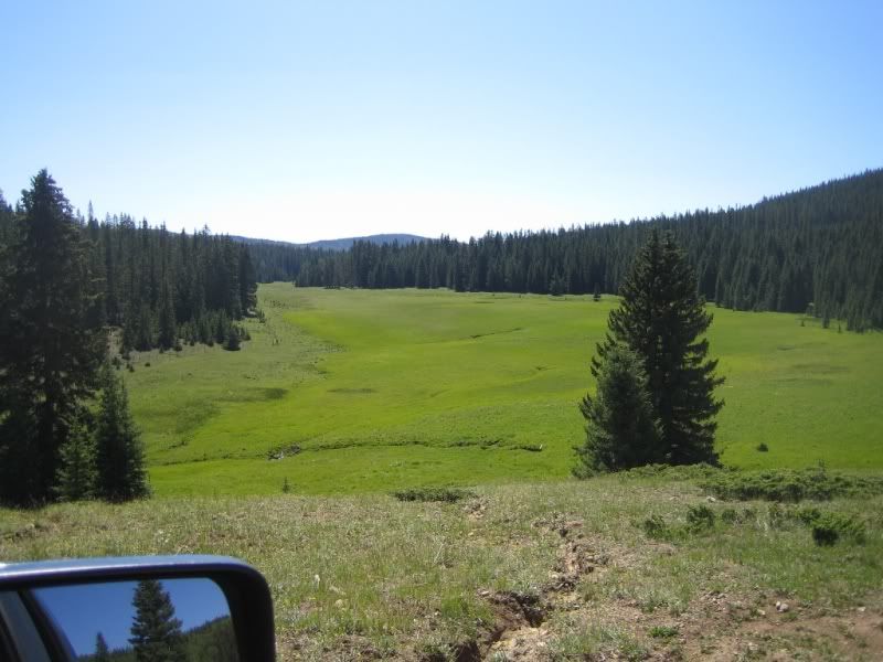
A different meadow on the way down to 134:
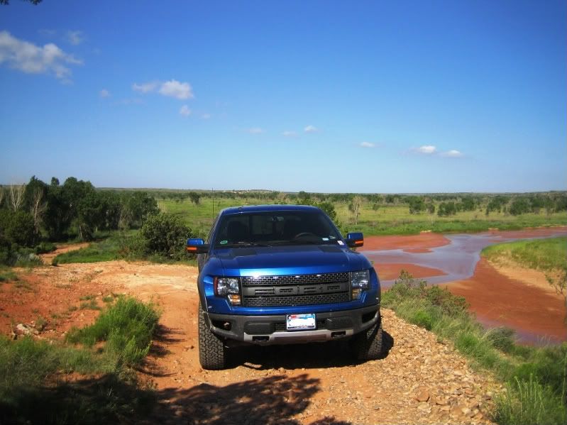
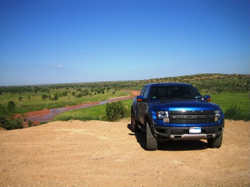
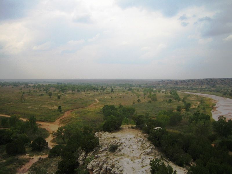
We stopped in Amarillo on the way back and I had a morning available to go to the Canadian River area. The area had received a lot more rain than usual and the vegetation was really grown up and there were a lot more deep mud holes than I remember (mud is not my thing). There were quite a few more ATV trails than I remember from previous visits. Due to the increase in garbage (mainly beer bottles / cans), frequent underage drinking (while operating an ATV), frivolous new ATV trails and the numerous additional mud holes, I would not be surprised to see this public area get shutdown at some point. As a note, this area requires the Texas Off-Highway Vehicle program sticker.
Map to the turnoff off of US-287 (the pointer is a little off):
Canadian River Flats turnoff - Google Maps
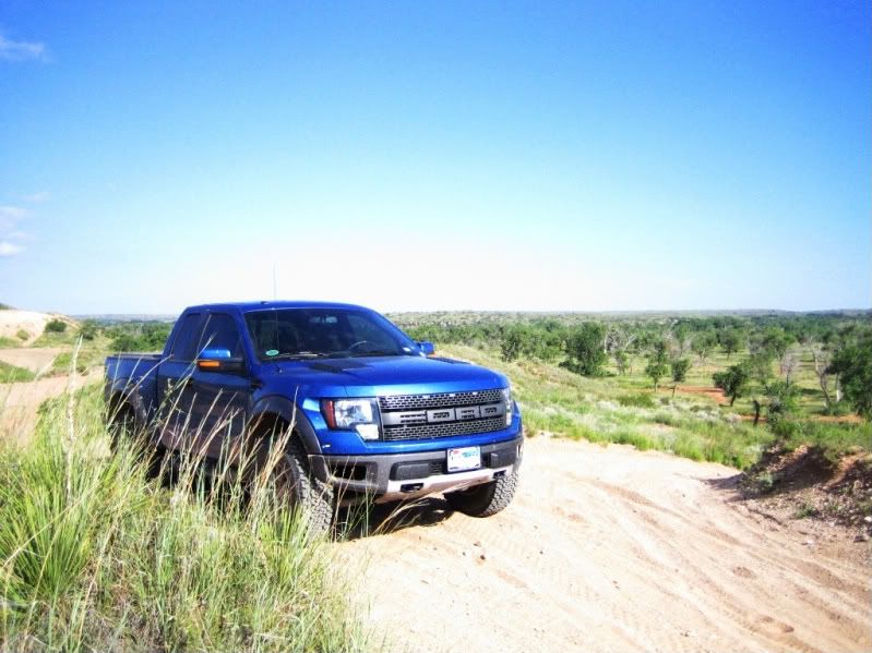
The Canadian River in the background:
The Canadian River in the background:
Here is an older pic of the area:
In the Red River area, I drove up to Greenie Peak, back down through the Midnight Meadows area to Forrest Access Road 134. We went east on 134 to the Anchor Mine. We took a side trip off of 134 up to Cabresto Lake for some fishing (no luck) on the way back to town via Questa.
Greenie Peak is not much of a challenge but parts of the trail are relatively slow going and I used low range quite a bit for the additional engine braking. The width of the truck was only an issue in a couple of places (good thing I brought my tree pruners!!). There were two places I had to turn around and I was very thankful the wheelbase was not any longer that it already is. The road up to Cabresto Lake (Forrest Access Road 134A) is pretty rough, but again, not much of a challenge.
Here is a trail description w/ GPS waypoints for Greenie Peak:
http://www.webejeepin.com/Trails/New_Mexico/Greenie_Peak.htm
Map location of Greenie Peak:
Greenie Peak - Google Maps
Map location of the Anchor Mine:
Anchor Mine - Google Maps
Map location of Cabresto Lake (end of Forrest Access Road 134A):
Cabresto Lake - Google Maps
On the way up to Greenie Peak (note the Red River Ski Area in the background):
At the Greenie Peak / Midnight Meadows road juncture:
Greenie Peak (note the ski area) Est. elevation 11,250 ft:
Midnight Meadows:
A different meadow on the way down to 134:
We stopped in Amarillo on the way back and I had a morning available to go to the Canadian River area. The area had received a lot more rain than usual and the vegetation was really grown up and there were a lot more deep mud holes than I remember (mud is not my thing). There were quite a few more ATV trails than I remember from previous visits. Due to the increase in garbage (mainly beer bottles / cans), frequent underage drinking (while operating an ATV), frivolous new ATV trails and the numerous additional mud holes, I would not be surprised to see this public area get shutdown at some point. As a note, this area requires the Texas Off-Highway Vehicle program sticker.
Map to the turnoff off of US-287 (the pointer is a little off):
Canadian River Flats turnoff - Google Maps
The Canadian River in the background:
The Canadian River in the background:
Here is an older pic of the area:
Last edited:

")