Explorer 1
Explorer 1
Last year I took a day trip out to the Caldelaria Pipeline where it crossed near US Hwy 6 and Nevada Hwy 360 in western Nevada.
You can read about that trip at:
http://www.expeditionportal.com/forum/threads/71225-Candelaria-Pipeline-Western-Nevada?highlight=
On that trip I was driving my Tacoma which in it's own right is a fairly well equipped off road vehicle, however after few miles on the trail I decided I didn't want to subject it to the rigger of what I found in that visit.
So this past Memorial Day week end I decided to load up my most rock worthy ATV and take another trip exploring this lost and forgotten trail with the plan of following the old pipeline all the way to the ghost town, Caldelaria.
Now before anyone starts lecturing me on traveling alone in remote areas, I've had to accept the risks associated with such travel, otherwise waiting for one of my friends availability would frankly cut my exploring trips in half. I have taken steps to insure my survival in the event something unexpected were to occur which includes a Satellite tracker which allows my wife to know my where about and condition.
The trail is rather faint and difficult to find near the intersection of highways of US 6 and NV 360. From here the trail follows the mild slope northeast toward the west side of Miller Mountain.
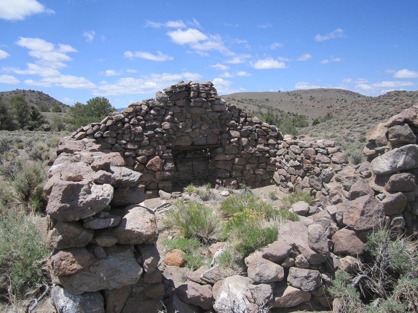
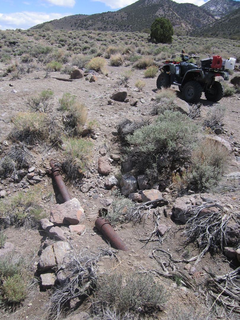
Once you enter the ravine and come to the switchback the trail goes from a class 3 to a class 5. Most full size vehicles would need front and rear lockers and good driving skills to climb the narrow, steep, rocky section. My ATV provided some benefit in that it is narrow and in the worse section I can walk along side of it as I throttle up this section. Once on top the trail becomes a much easier class 2 to the top of the ravine and for the next few miles. There are signs of the pipeline along with the remains of some stone buildings which I would assume housed employees who serviced the pipeline.
From this point the trail becomes much more faint, almost disappearing. One must start following the scar left in the ground where the pipeline was laid. This is a narrow path more suited for walking, saddle animals or a motorcycle. Then within a quarter of a mile even this small trail disappears into the washes and ravines.
Just before the pipeline disappears there is faint 2 track trail the comes out of the canyon on the left and heads up a nearby hill heading roughly northwest. From this vantage point one can see quite a distance and make out where the pipeline exited the ravine where it disappeared. The trick is to make it down the hill back into the ravine and then up the other side to follow the pipeline. Much easier said then done! After some hiking on foot and attempts I found a place where I could walk along side the ATV and throttle it along with pushing and pulling to make the to edge of the ravine.
From here your mostly following a small trail very off camber but every few miles there is an easier section and some indication that you on the right path.
My son loaned me his go-pro camera which was mounted on top of my helmet, the pictures taken by it were the best record of the trip. Hopefully, I have them edited down soon and add them to this post.
At this point in the trip I was so hot, sweaty and starting to feel that I might not be able to make it, so there were fewer photos taken with my regular digital camera.
Once again as I crested a hill the trail completely disappeared, however about a half mile ahead I could see the scar of the pipeline so I knew the general direction to travel. This time a even deeper and steeper ravine stood in my way. Again foot travel, and exploring eventually lead to a path down and back up the other side.
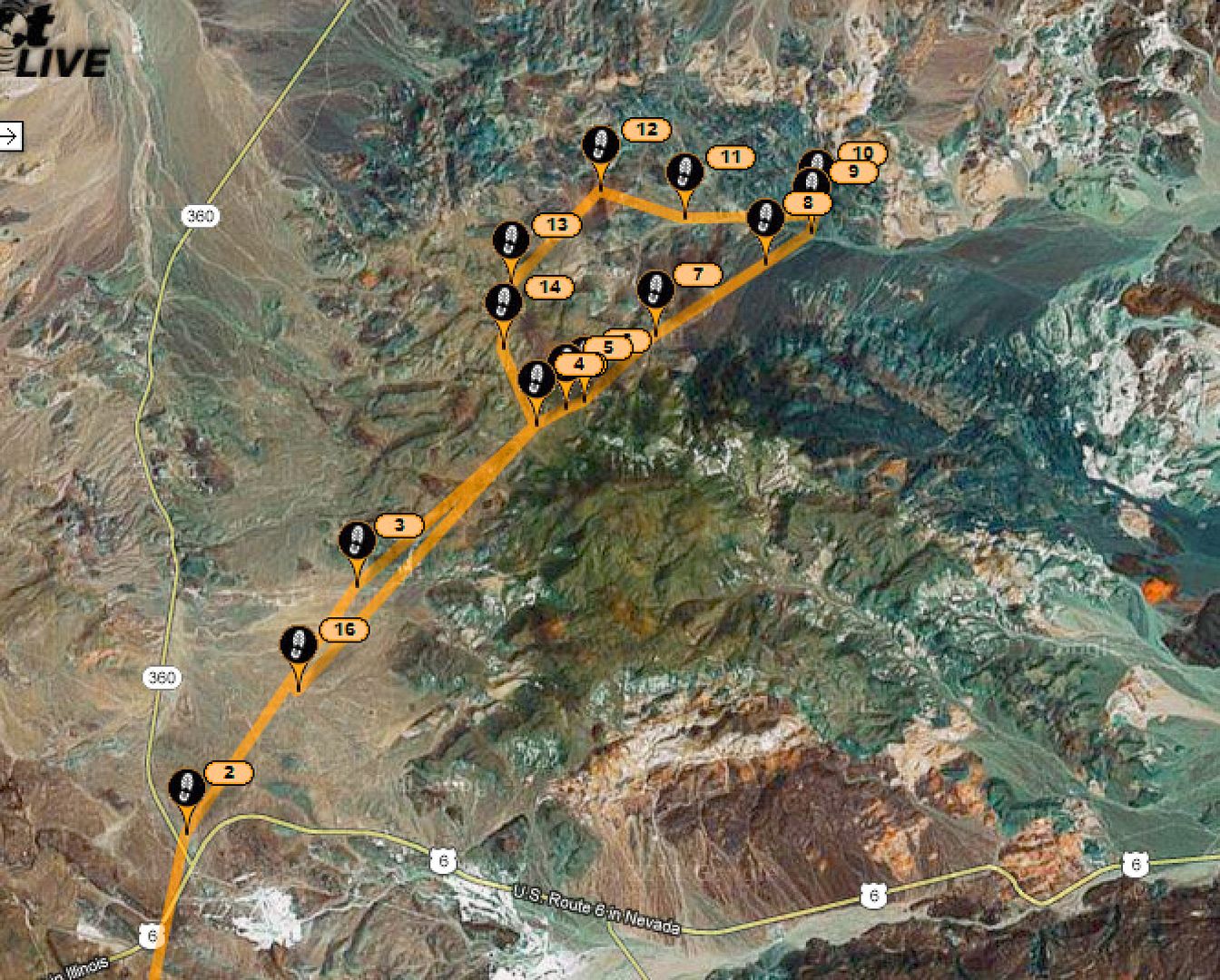
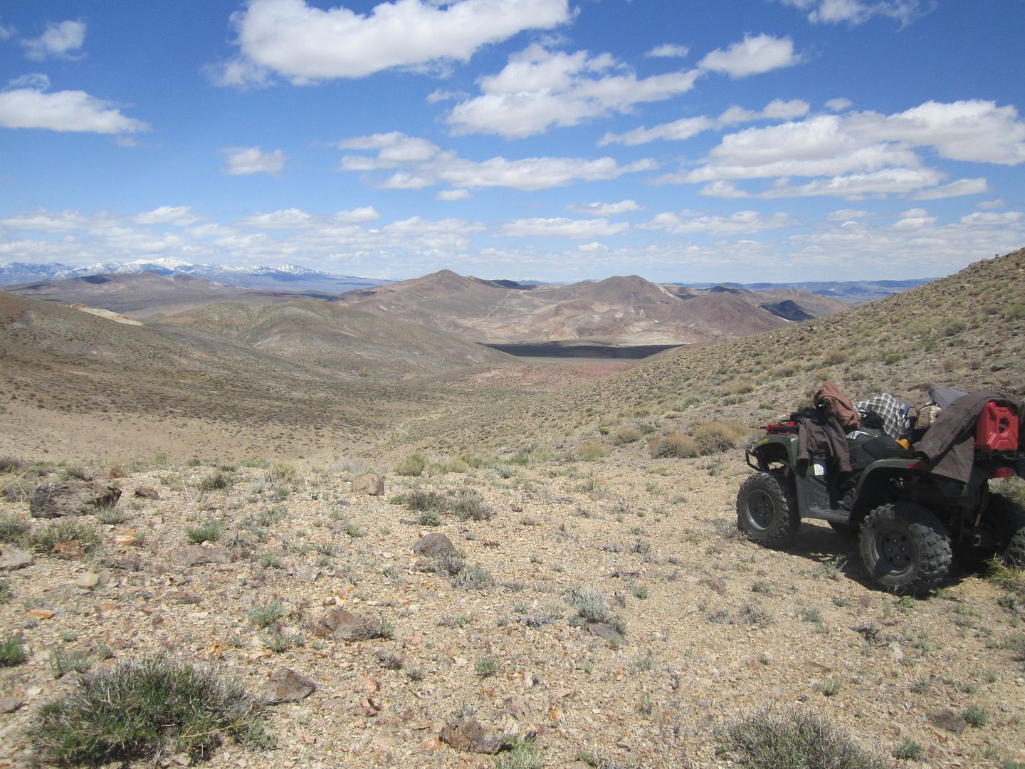
By now it was the middle of the afternoon and I knew I wouldn't be able to make it to Caldelaria and back on this trip. I decided to climb to a high ridge to see if Candelaria might be viewed in the distance. This is indicated as waypoint #10 on the tracker map.
This is the turn around point, in distant mountains just above the cloud shadow that looks like a lake is Candelaria Mountain, on the other side is the town and mining district. I could just make out some tailings on the right side of the peak.
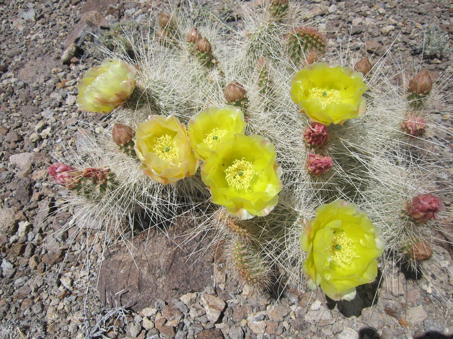
This lone cactus flower was blooming at the top of the saddle where probably no one would ever see it, except me:
In trying to follow the pipeline my body took such a beating and took so much time I resolved to take a different route through the tough stuff even if it meant that I had to make my way out to Hwy 360 and travel on the shoulder back to my pick up and trailer.
Fortunately, I ended up finding an old mining trail that when followed took me back to the small hill I climbed earlier to gain a view if where the trail climbed out of the first ravine. You can see it on waypoints 11-14.
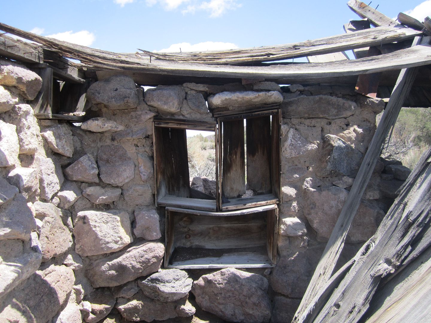
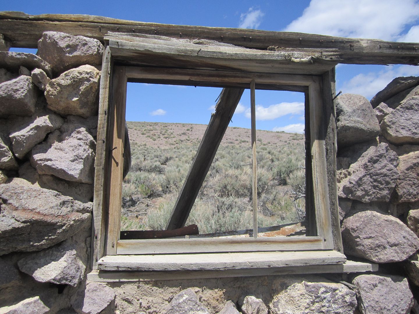
On my way back I stopped for some additional photos of one of the stone buildings:
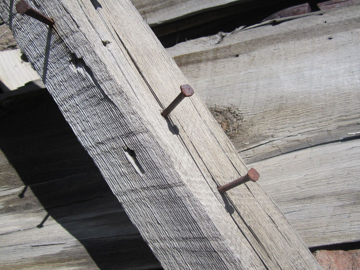
Interesting that all the nails were square, I would assume that would help identify when it was built:
Coming down the steep rocky section which I climbed early in the trip was about all my shoulders could handle, I was beat when I arrive back at the Tacoma and trailer.
While I didn't make it to Caldelaria, I have a much better appreciation of all the work the crews had to endure to dig and lay that pipeline. Now that I know what to expect, maybe next fall or spring I'll take another crack at it!
Thanks,
Fred
Explorer 1
You can read about that trip at:
http://www.expeditionportal.com/forum/threads/71225-Candelaria-Pipeline-Western-Nevada?highlight=
On that trip I was driving my Tacoma which in it's own right is a fairly well equipped off road vehicle, however after few miles on the trail I decided I didn't want to subject it to the rigger of what I found in that visit.
So this past Memorial Day week end I decided to load up my most rock worthy ATV and take another trip exploring this lost and forgotten trail with the plan of following the old pipeline all the way to the ghost town, Caldelaria.
Now before anyone starts lecturing me on traveling alone in remote areas, I've had to accept the risks associated with such travel, otherwise waiting for one of my friends availability would frankly cut my exploring trips in half. I have taken steps to insure my survival in the event something unexpected were to occur which includes a Satellite tracker which allows my wife to know my where about and condition.
The trail is rather faint and difficult to find near the intersection of highways of US 6 and NV 360. From here the trail follows the mild slope northeast toward the west side of Miller Mountain.
Once you enter the ravine and come to the switchback the trail goes from a class 3 to a class 5. Most full size vehicles would need front and rear lockers and good driving skills to climb the narrow, steep, rocky section. My ATV provided some benefit in that it is narrow and in the worse section I can walk along side of it as I throttle up this section. Once on top the trail becomes a much easier class 2 to the top of the ravine and for the next few miles. There are signs of the pipeline along with the remains of some stone buildings which I would assume housed employees who serviced the pipeline.
From this point the trail becomes much more faint, almost disappearing. One must start following the scar left in the ground where the pipeline was laid. This is a narrow path more suited for walking, saddle animals or a motorcycle. Then within a quarter of a mile even this small trail disappears into the washes and ravines.
Just before the pipeline disappears there is faint 2 track trail the comes out of the canyon on the left and heads up a nearby hill heading roughly northwest. From this vantage point one can see quite a distance and make out where the pipeline exited the ravine where it disappeared. The trick is to make it down the hill back into the ravine and then up the other side to follow the pipeline. Much easier said then done! After some hiking on foot and attempts I found a place where I could walk along side the ATV and throttle it along with pushing and pulling to make the to edge of the ravine.
From here your mostly following a small trail very off camber but every few miles there is an easier section and some indication that you on the right path.
My son loaned me his go-pro camera which was mounted on top of my helmet, the pictures taken by it were the best record of the trip. Hopefully, I have them edited down soon and add them to this post.
At this point in the trip I was so hot, sweaty and starting to feel that I might not be able to make it, so there were fewer photos taken with my regular digital camera.
Once again as I crested a hill the trail completely disappeared, however about a half mile ahead I could see the scar of the pipeline so I knew the general direction to travel. This time a even deeper and steeper ravine stood in my way. Again foot travel, and exploring eventually lead to a path down and back up the other side.
By now it was the middle of the afternoon and I knew I wouldn't be able to make it to Caldelaria and back on this trip. I decided to climb to a high ridge to see if Candelaria might be viewed in the distance. This is indicated as waypoint #10 on the tracker map.
This is the turn around point, in distant mountains just above the cloud shadow that looks like a lake is Candelaria Mountain, on the other side is the town and mining district. I could just make out some tailings on the right side of the peak.
This lone cactus flower was blooming at the top of the saddle where probably no one would ever see it, except me:
In trying to follow the pipeline my body took such a beating and took so much time I resolved to take a different route through the tough stuff even if it meant that I had to make my way out to Hwy 360 and travel on the shoulder back to my pick up and trailer.
Fortunately, I ended up finding an old mining trail that when followed took me back to the small hill I climbed earlier to gain a view if where the trail climbed out of the first ravine. You can see it on waypoints 11-14.
On my way back I stopped for some additional photos of one of the stone buildings:
Interesting that all the nails were square, I would assume that would help identify when it was built:
Coming down the steep rocky section which I climbed early in the trip was about all my shoulders could handle, I was beat when I arrive back at the Tacoma and trailer.
While I didn't make it to Caldelaria, I have a much better appreciation of all the work the crews had to endure to dig and lay that pipeline. Now that I know what to expect, maybe next fall or spring I'll take another crack at it!
Thanks,
Fred
Explorer 1