A Week in the Pennsylvania Wilds - Allegheny NF - Bald Eagle SF - Pine Creek Gorge

mortonm

Expedition Leader
Looking forward to the negro hollow installment. We were camping up in BESF this past weekend and checked out a couple of the trails that you listed here on the forum. Negro Hollow appeared almost impassable from the eastern side entrance. A narrow little 2 track that seemed more water than visible road.

We have a lot of pictures from that section. We entered from the Eastern side. Was there a lot of rain leading up to your trip ?
 

daveh

Adventurer
I'm not sure. I live in PA about 3 hours from BESF and we had some rain prior to our weekend trip but not sure what they had up in that region. When we came up to the trail head we stopped to look at the map thinking we missed negro hollow. My wife looked up and pointed into the woods and said I think that's were we are supposed to go.
 

mortonm

Expedition Leader
I'm not sure. I live in PA about 3 hours from BESF and we had some rain prior to our weekend trip but not sure what they had up in that region. When we came up to the trail head we stopped to look at the map thinking we missed negro hollow. My wife looked up and pointed into the woods and said I think that's were we are supposed to go.

You have inspired me, I will finish the write up later tonight. It looks like there is a lot more water than there is. The good news is the bottom is hard pack with rocks, so its not muddy at all...but it depends what your definition of deep is.

Also I was mistaken, we entered from the West side and headed East. Most of the water is actually towards the west end. But it is the tightest at the East, with a couple of big puddles near the start....stay tuned
 
Last edited:

daveh

Adventurer
It looked a lot narrower than Henstep also. We combined the narrow width and the fact the we got a bit lost on the way and came upon another 15' long mud hole than turned out to be much deeper than it looked and decided to pass this trail this time around. Looking forward to your update.
 

mortonm

Expedition Leader
It looked a lot narrower than Henstep also. We combined the narrow width and the fact the we got a bit lost on the way and came upon another 15' long mud hole than turned out to be much deeper than it looked and decided to pass this trail this time around. Looking forward to your update.

Overall henstep was definitely narrower. Just a few sections on negro hollow that didn't make me happy, overall I enjoyed it much more.
 

mortonm

Expedition Leader
THURSDAY
We started off that morning by packing all of our equipment and personal items up. We had tried to get an addition night at Poe Valley State part but it was Thursday and people were starting to trickle in for the weekend.

We had made the decision the night before over a few beers that we would head back to Poe paddy drive, and see the two great Vistas again, and then head for Negro Hollow Trail, it was one of the prime reasons we had chosen Bald Eagle State Forest.

We got a few great pictures at the lookout to the East of Penn's view; where we had seen the nice Tacoma the day before and didn't have a chance to stop.


This would be a good rock for a field oil change or front end inspection!


We had been looking for a spot to keep our DeLorme Atlas, and earlier in the week the thought popped into my head to keep it on the cover for the sunroof, fit in perfectly and kept it from getting roughed up during loading/unloading the truck. The DeLormes are quite big.


As we continued cross-country to Negro Hollow, we came across a nice view on Winkelbleck road, aptly named Winkelbleck Vista


I just like this picture, not sure why, just think it turned out nice. Nothing fancy, just a dirty Nissan to get me there and back again.

 
Last edited:

mortonm

Expedition Leader
After a bit of driving on forest service roads, we reached Negro Hollow Trail from the West end. The trail isn't marked, so you will have to be careful you don't miss it. It is easy enough to find though.


The trail started off pretty tame, and we made good time for the first quarter to half mile, we thought this trail might have dried up through the summer and wouldn't pose too many challenges, well we were wrong. We had seen some pictures on here about some trips down this trail in the spring, and it was nothing like that, but still quite wet. The one nice thing about his area, is that the trails and roads are all a solid well packed base, with lots of rocks. None of the water holes we drove through on this trail contained mud at all, nothing that wouldn't stop anyone with the mildest of AT tires with at least some tread left on them.

Looks muddy, but isn't!


This section was a little tricky as the trail was pretty rutted and required some tight steering, and there were a few large rocks at the bottom that you cant see, found that out by going through a little too fast


There is a bypass to this section, that is completely dry, but it is a little tight in a couple spots. This section of water was nearly a hundred yards long, but no deeper than twenty inches or so


Some off camber, not a lot to some, but it used to be a lot to me, I feel much more comfortable in these situations after this trip


Some of the longer holes we checked. Their depth was misleading as there was a pond scum across them so you couldn't see bottom. This hole we checked about eighty percent of the way, we assumed it was all good to go, most of it less than a couple feet deep. Well as you can see in this series of pictures it got a liiiiiittle deeper at the end.


Little Deeper here!


Looks A LOT worse than it is this water was literally 8 inches deep


There were definitely some rocky sections as well! This trail took us over an hour to complete, and was probably our second favorite on the trip. Absolutely worth the time to hit up if you are in the area.


Last edited:

mortonm

Expedition Leader
After we finished up Negro Hollow Trail, it was time to head North out of the Park. Our plan was to make it to Williamsport for the night, get a motel room to watch the NFL season opener and clean up a bit, but not before we saw a little more of the area!


A Drink with a view!


A beer with lunch


One branch of this tree had turned stark red, the rest was still a vibrant green; fall is coming!


One last trail before we were out of the woods! We hit up Duncan trail. I had seen in report before that this trail was horribly overgrown, but it has been cut way back in the recent past. There was about 3 feet on each side of the track cut back, most of the brush still laying there. this wasn't a particularly long trail, maybe half an hour, but the first half is off camber driver side, and the second half off camber passenger side. Most of it was 10 to 15 degrees, but we did hit 20 a few times.


We ran into this Dodge at our motel, we were admiring the truck when we realized the named of the company, Morton Buildings, our last name is Morton, so this picture is a two for one


We were sad to see the end of Bald Eagle State Forest, it was an awesome three days here, but we were heading onto new places and new sights. The morning would bring a trip to Pine Creek Gorge (sometimes referred to the Pennsylvania Grand Canyon) and then home.
 
Last edited:

mortonm

Expedition Leader
Friday

We woke up that morning a little sad, we were out of Bald Eagle State Forest, but it loomed on the southern horizon, it was so close to just go back....but unfortunately it did not fit with our timeline. We would push North and West to the Pine Creek Gorge. Our vehicle exploration portion of the trip was completed, but that doesnt mean that there wasnt any fun left to be had. We had gone on several small hikes earlier in the week, but this day we were planning a much longer day hike, with a lunch stop. We sitll had lots of bread, meat and cheese left from earlier in the week, so it would be easy to put together.

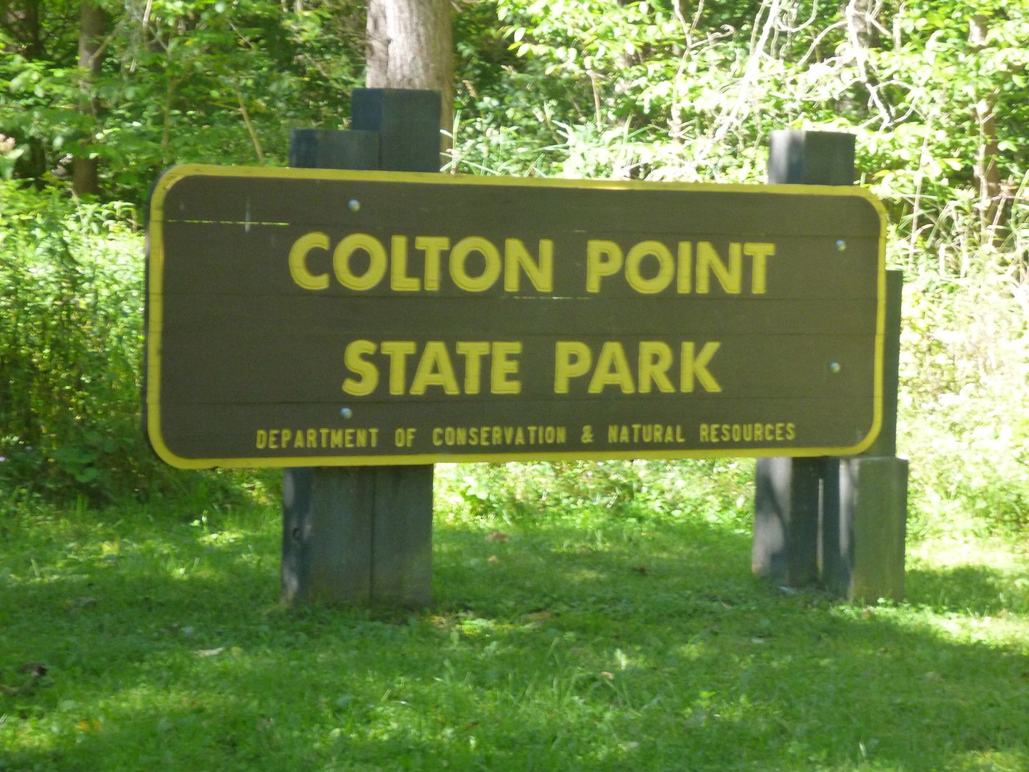
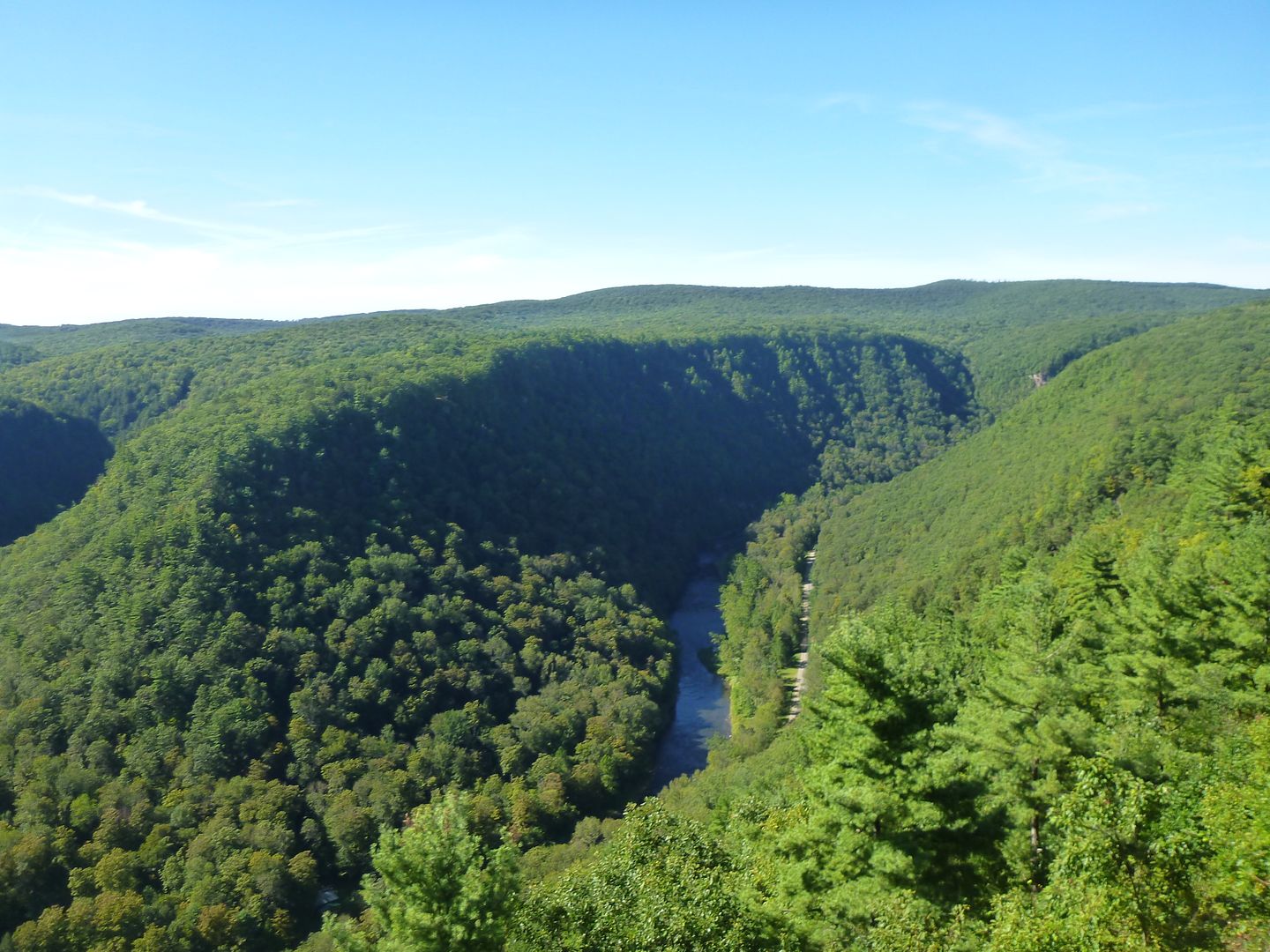
We decided to come into the Pine Creek Gorge from the East, into Colton Point State Park.


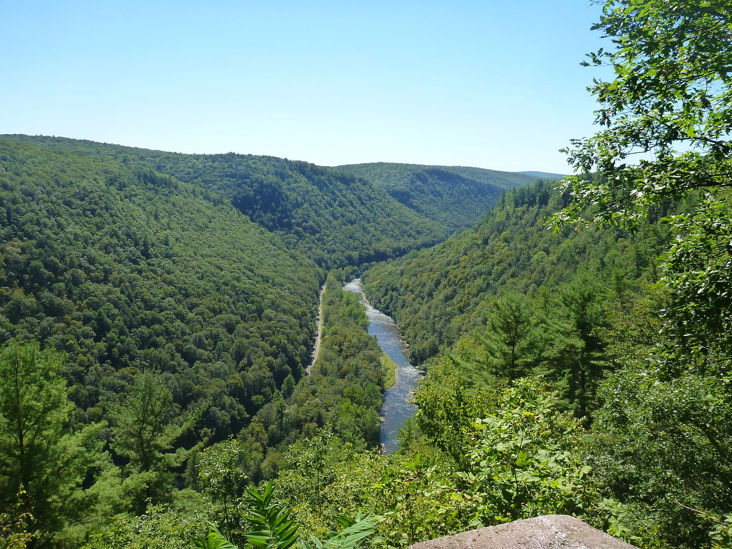
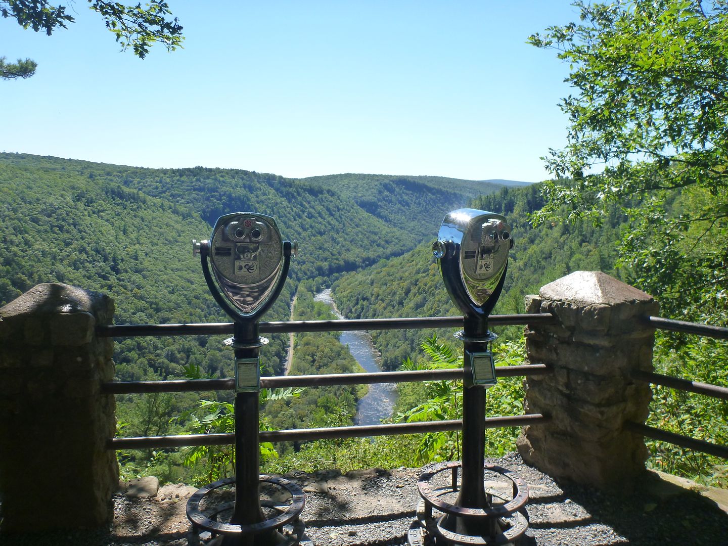
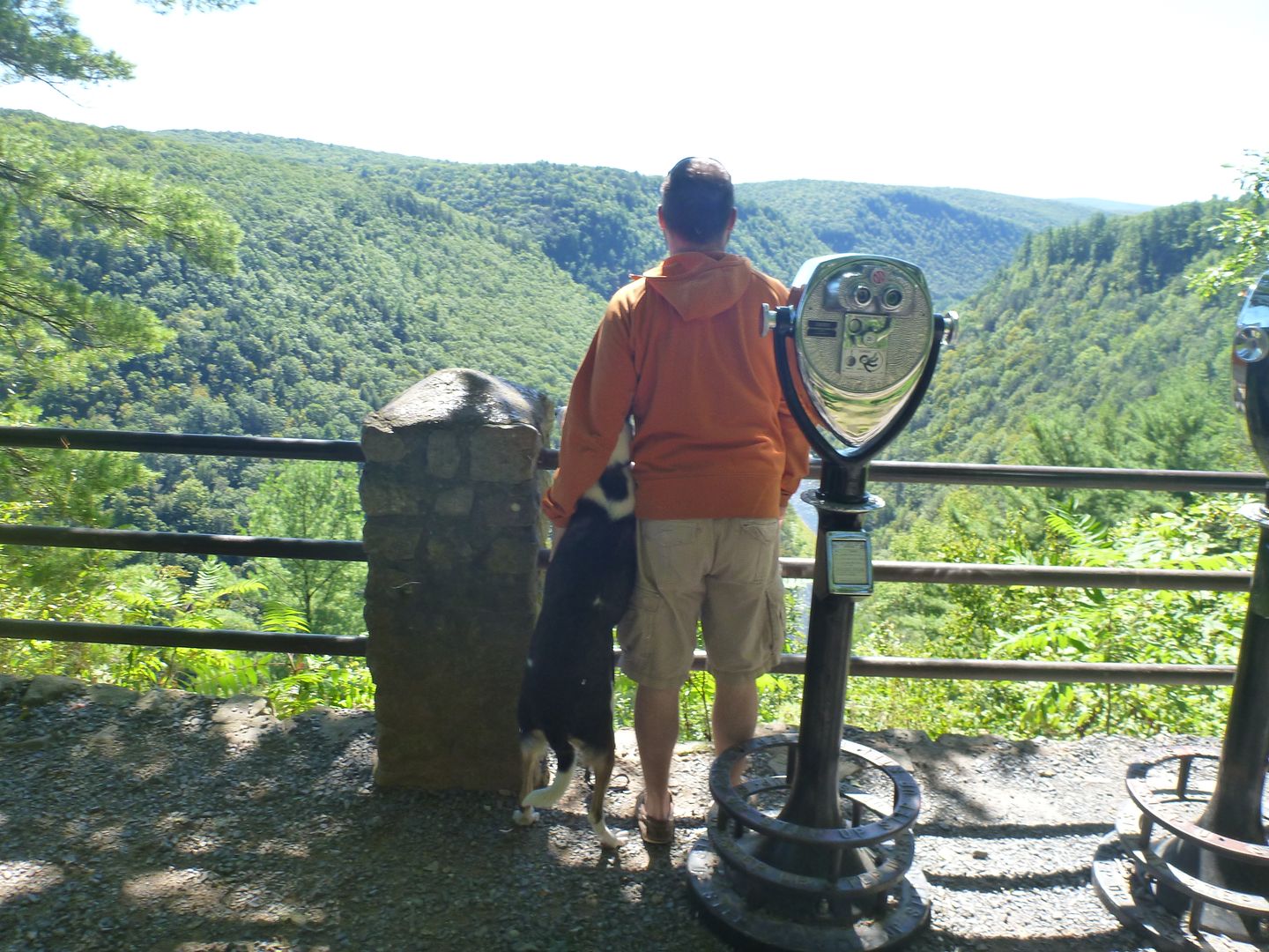
After a 5-10 minute drive up the mountain (west coasters dont laugh) we came to an observation point. Great views, they had some of those old pay binoculars, there look like they were from the 50s, made by Bausch and Lomb


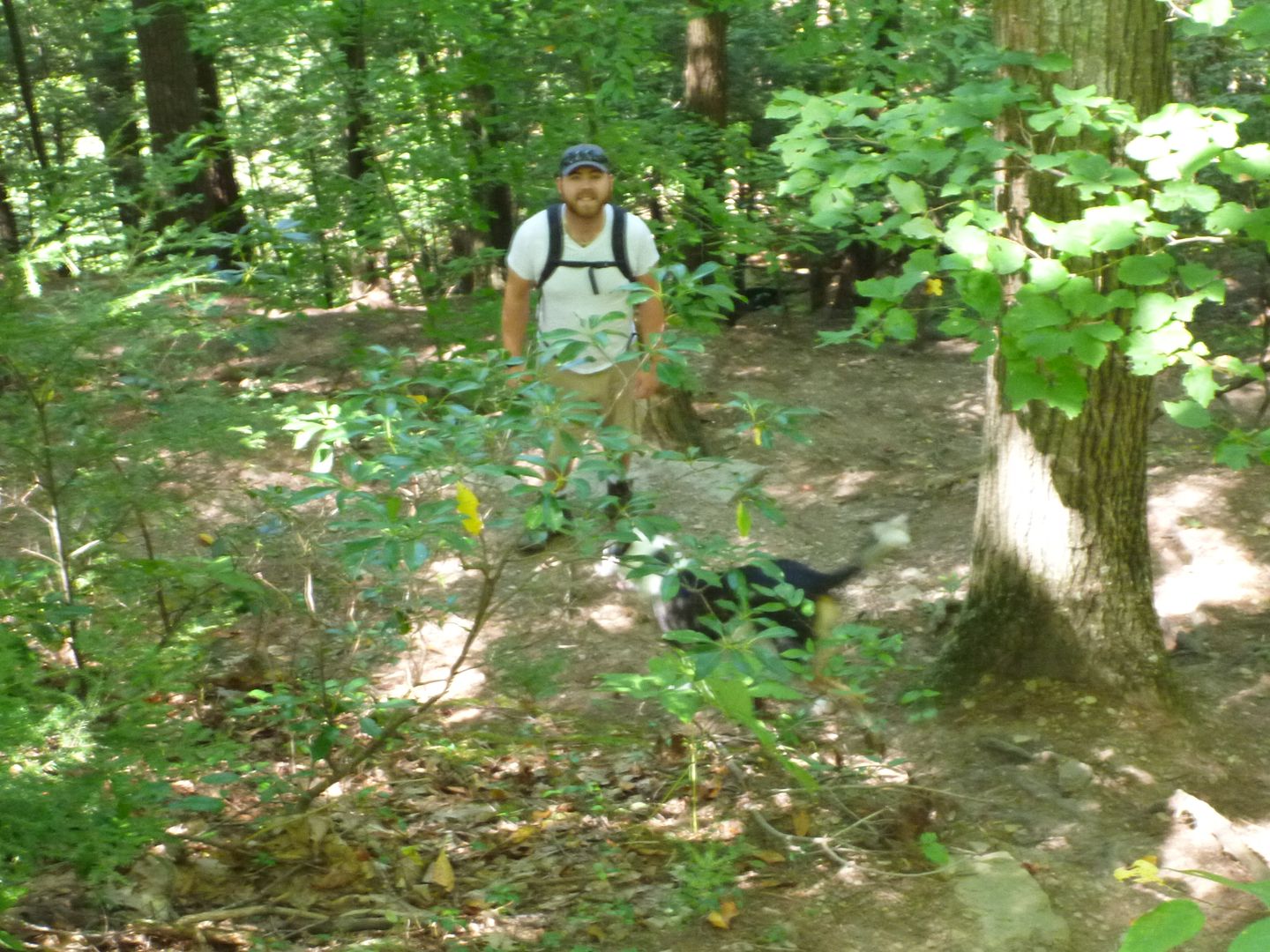
We then parked at the top, and grabbed all of our hiking stuff, as well as lunch and some water and headed out. We grabbed a map from the parking lot and would follow the Rim Trail to Turkey trail, this looked like it winds around down the valley across Pine Creek and then up the other side. Remember this, and the fact that my sometimes navigationally challenged brother was holding the map.

Coming down Turkey Trail there was some pretty heavy duty switchbacks, this picture doesnt do it justice, at all. Some of the places we were walking there was a pretty high chance of falling down the slope, especially in wet weather. Good boots and absolute requirement.


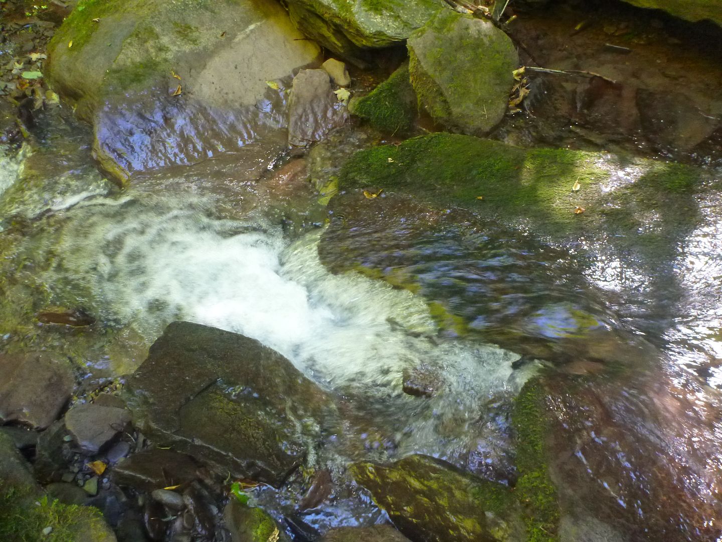
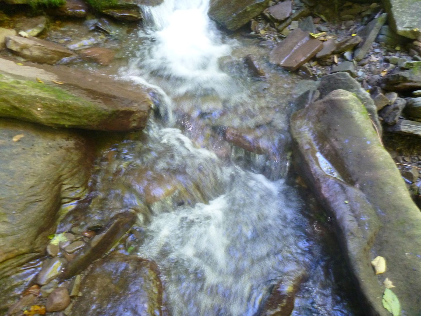
There was a nice waterfall at the bottom of the switchbacks, we crawled into the creek, it was only an inch or two deep, but then fell off 50 feet not far from where we were standing


Living Life on the Edge!


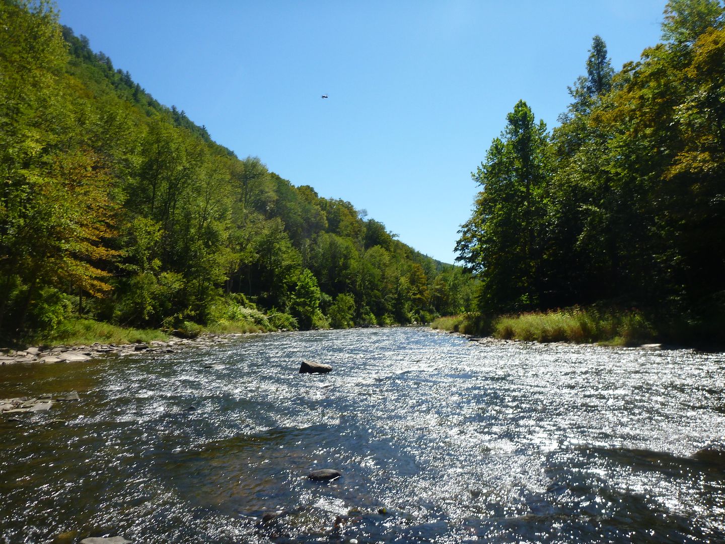
It was not far after the tree picture we got "lost" The night before we were debating which side of the gorge to Hike from, and we had originally decided to start from the far side, but switched in the morning. So when we came to a fork in the path, my brother was looking at the map from the OTHER side of the gorge, so we ended up in a creek bed. After awhile I figured out what had happened, but we saw the creek ran down to Pine Creek, and where they met, the trail wasnt far off. So we would continue walking down the creek, we were glad we did in the end, some nice little water falls, and generally a better hike than the actual trail.


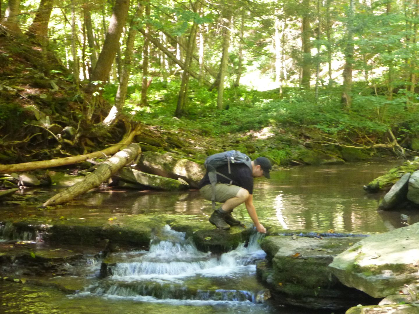
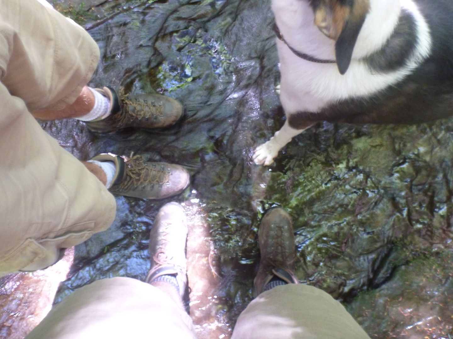
When we got to the creek, we came across a path, but it wasnt marked at all. My brother was pretty sure there was a footbridge across Pine Creek, even though I didnt think so from the limited map we had. We decided to cross the creek by foot take off the boots) and have lunch. Then after lunch the plan was to walk up the rail trail that exists along the creek on that side, and re-cross at the foot bridge.


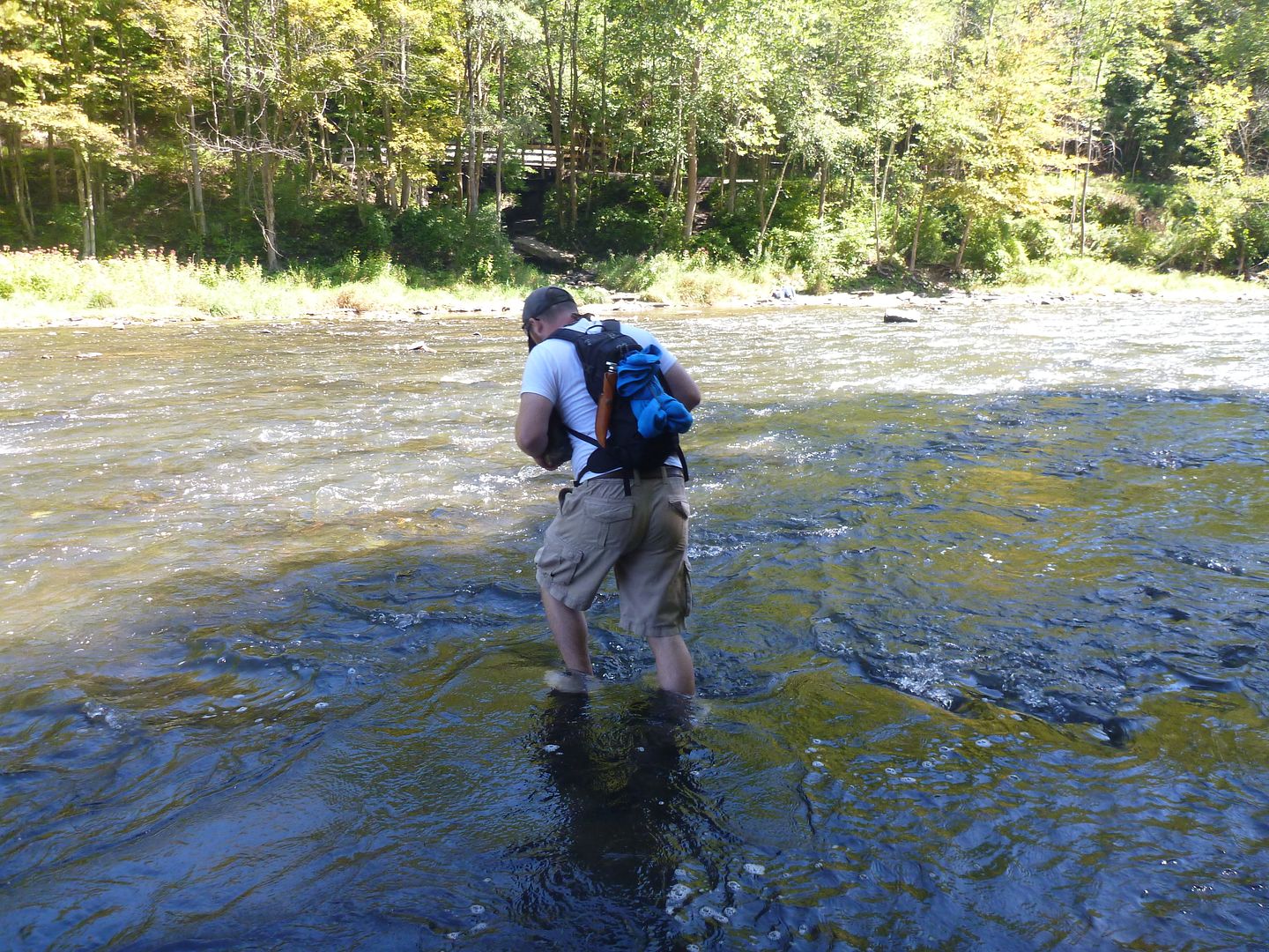
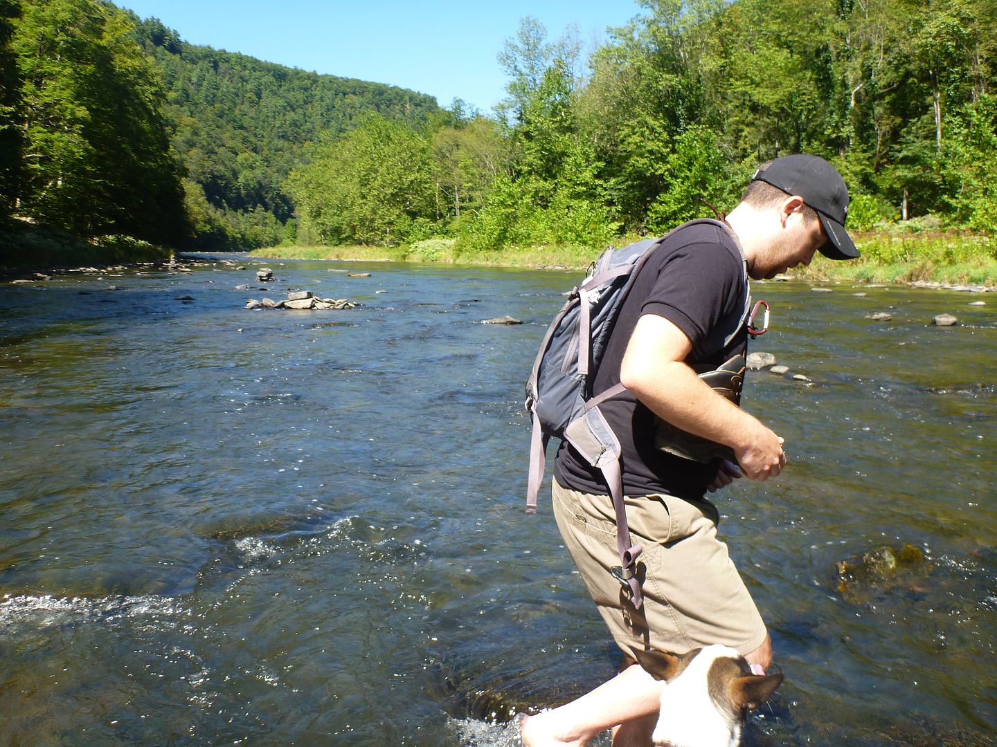
Buddy loved it!! I think he crossed 2-3 times before we were across. It was pretty slippery and hard on the feet, but we were still laughing having a great time, especially every time one of us nearly falls into the creek!


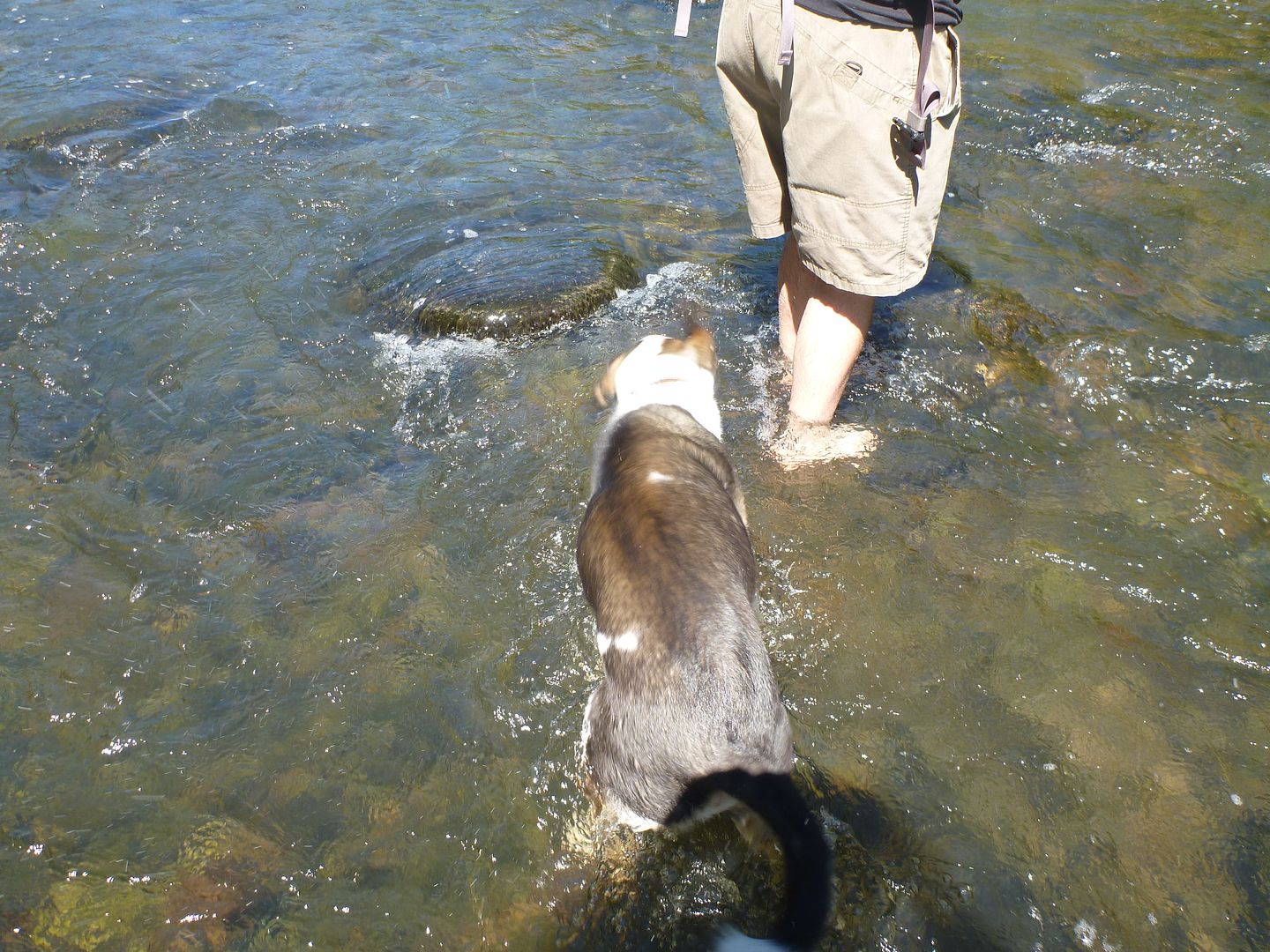
Great shot while mid stream - I wish the helicopter wasn't there, didn't realize until later unfortunately


After we finished lunch, we were talking to a couple that came down from the other side, they confirmed there was NO foot bridge, and that we would be making the trek back across Pine Creek and up the other side. We hadn't put our boots back on yet so it wasn't so bad. The trail that we had seen that wasn't marked, indeed was the Turkey trail, and we followed it back up to the truck.

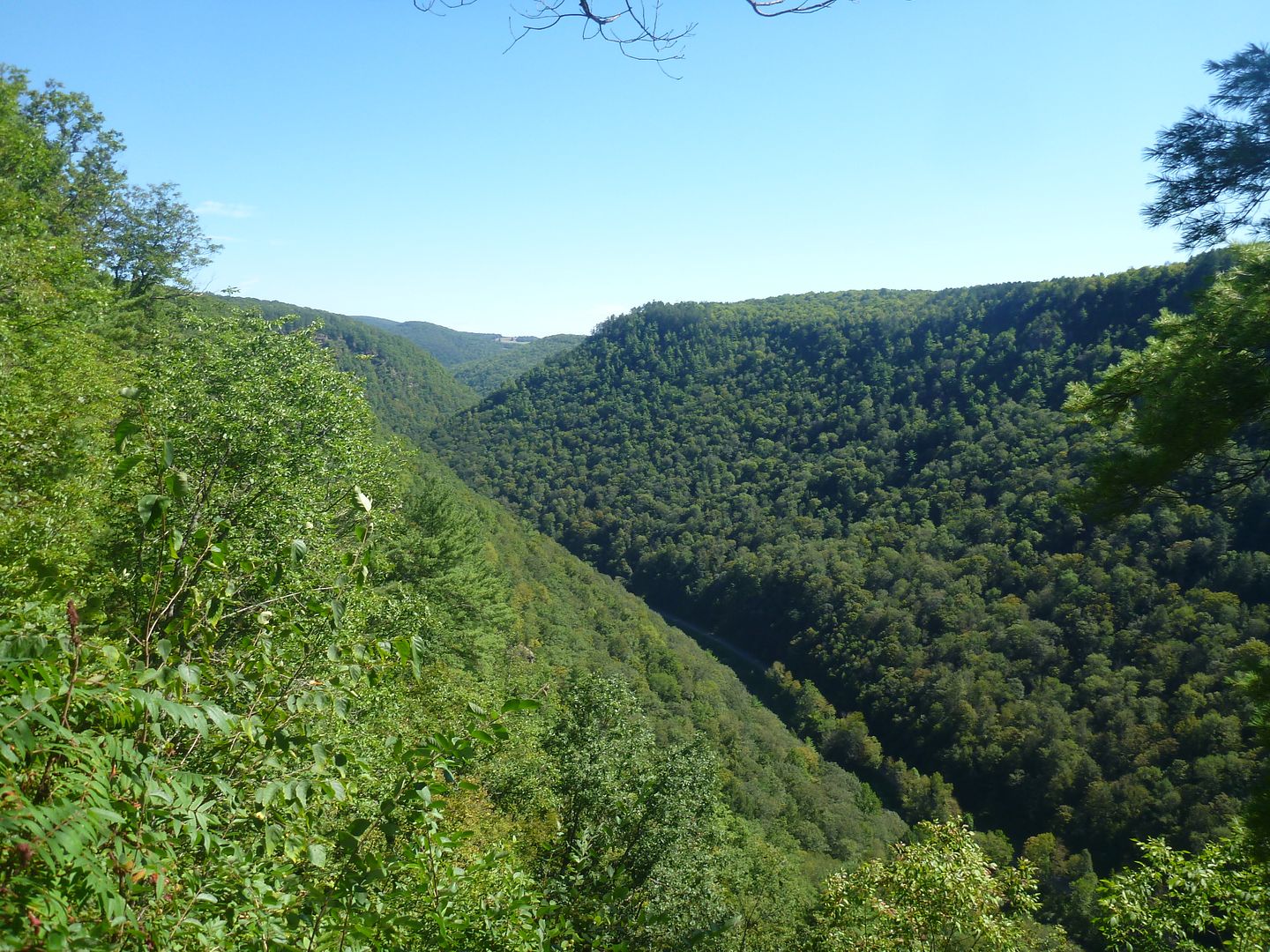
We then proceeded to the other side of the gorge, to check out a fire tower we had seen earlier in the day. It turns out that it is a mile or so back from the edge, and it privately owned now, and requires a credit card to access. The views from the park on the other side of the gorge were spectacular and as it was getting late int he day we decided to forgo finding the old fire tower.

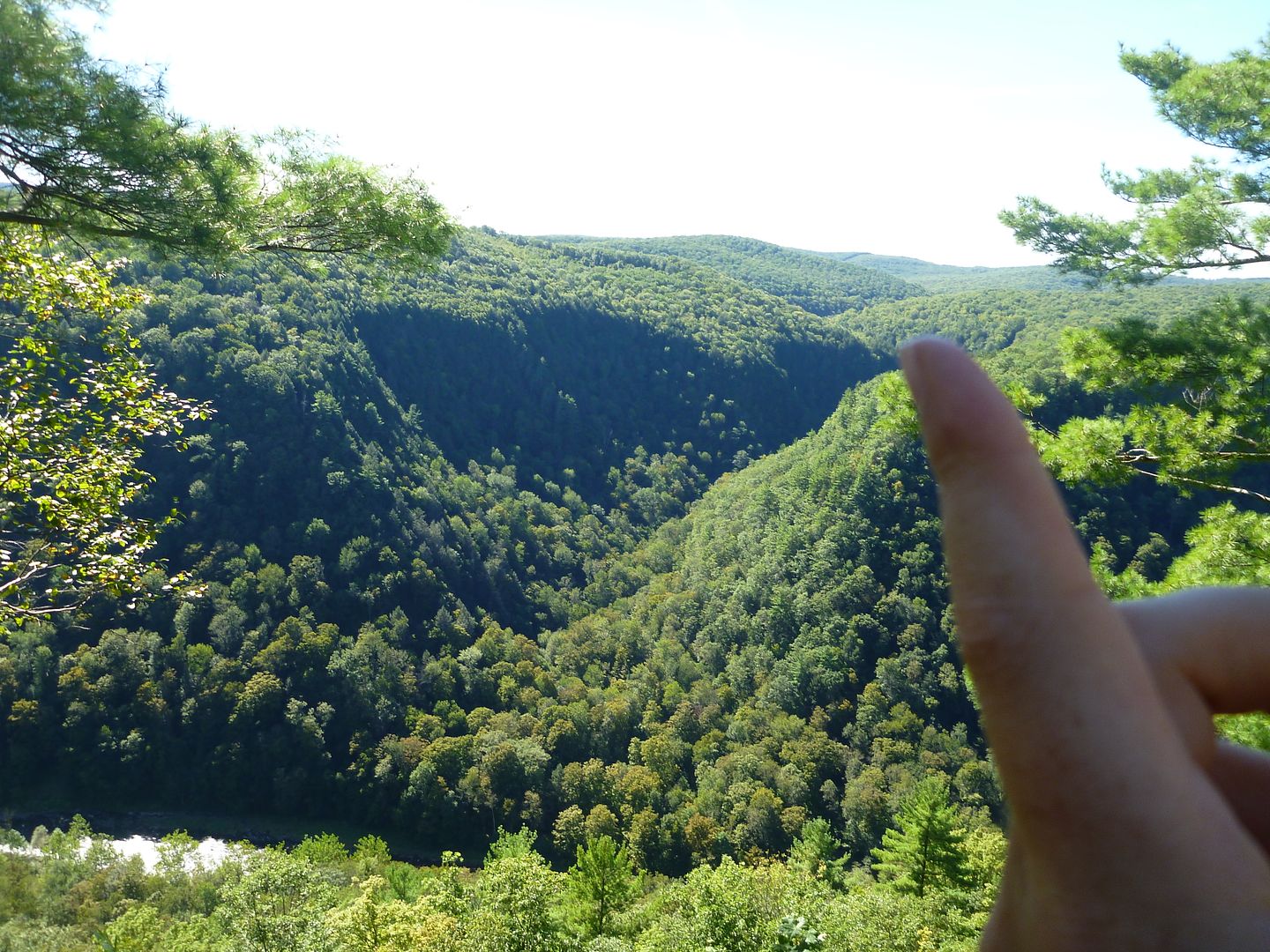
This is the smaller creek that valley that we hiked along after we got a little lost, my finger is pointing to roughly where we started our hike that morning


We had decided that we would head home late that night, it was supposed to rain that night and all day tomorrow. We figured we could be home by 10pm or so, and avoiding setting up and tearing down all our equipment in the rain, just to head back first thing.

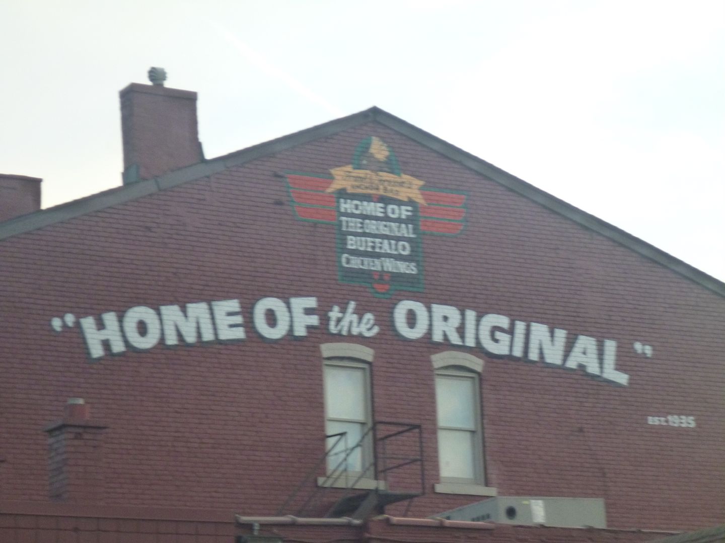
We headed out from Pine Creek Gorge a little sad and lots hungry around 4pm. My brother had never been to the Anchor Bar in Buffalo (home of buffalo wings, and chicken wings in general I believe).

So we decided to stop there at 7 and grab some dinner before we headed back across the border.


As we sat at the Peace waiting to return to Canada, we sat reminiscing about the trip, we were in a good mood, the line seemed pretty short, but sad the adventure was over.

Turns out that wasn't exactly correct. We were laughing about how bad it would be to be stuck in line at the border, if the chicken wings didn't agree with us. It was all fun and games until about 15 minutes later when I had my first grumble. It was quite the mission to cross the border and the Xterra steamed out of the gate into Canada with all the fury her 170 ponies could muster. We made it to the first gas station and all was well! That was the longest 30 minutes of my life.

We had a great time, and were itching to go back, even now as I write this two weeks later, I wish that I were going back to the see the fall colours that will be coming in very soon.

We hoped you have enjoyed sharing this adventure, as we certainly enjoyed partaking and documenting it.

This wont be the last you will hear from us, plans are already underway for a week long trip to the North Maine Woods next year....
 

Haggis

Appalachian Ridgerunner
Thanks for sharing your romp through our "backyard". An excellent tale and well told. You managed to hit some of our favorite spots here in the Keystone State,though there's a lot more to experience.

If you really want to experience the Pine Creek Gorge its best to do it by boat. Heres some links to get you thinking about bringing a 'yak some Spring and a link over to our Spring float down the Pine this year.

Here's the trip report...American Adventurist Pine Creek Gorge Float 2013...and here's a video our friend Chris made to wet your whistle...


mortonm

Expedition Leader
Nice read and kewl trip, thanks for sharing.

Thank you

Thanks for sharing your romp through our "backyard". An excellent tale and well told. You managed to hit some of our favorite spots here in the Keystone State,though there's a lot more to experience.

If you really want to experience the Pine Creek Gorge its best to do it by boat. Heres some links to get you thinking about bringing a 'yak some Spring and a link over to our Spring float down the Pine this year.

Here's the trip report...American Adventurist Pine Creek Gorge Float 2013...and here's a video our friend Chris made to wet your whistle...


Wow that looks awesome. Rest assured we will be back. Pennsylvania is so close that we will be coming back often in the years to come. I was actually looking at Kayaks not too long ago, more inspiration!
 

Forum statistics

Threads
185,821
Messages
2,878,583
Members
225,378
Latest member
norcalmaier
Top