Dan's North American Journey--4 months on the road

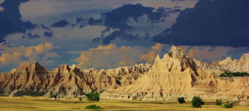
Post 9: Badlands, South Dakota.

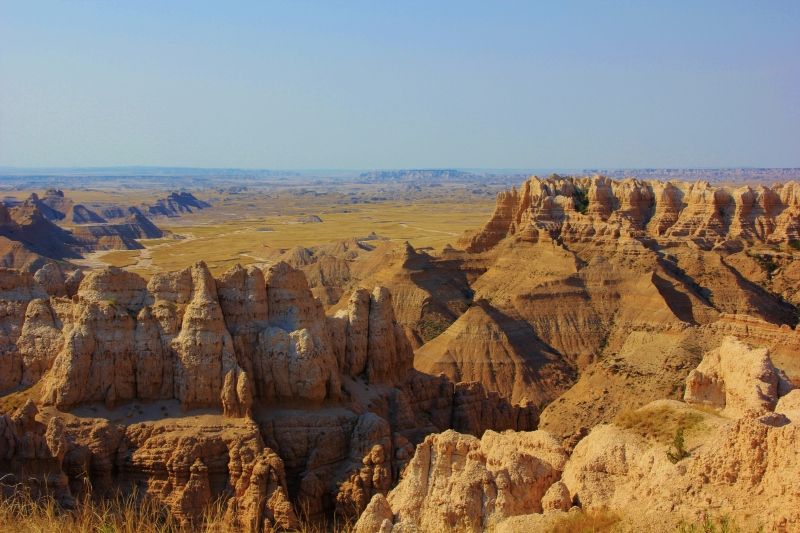
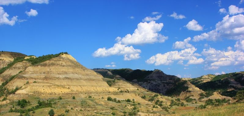
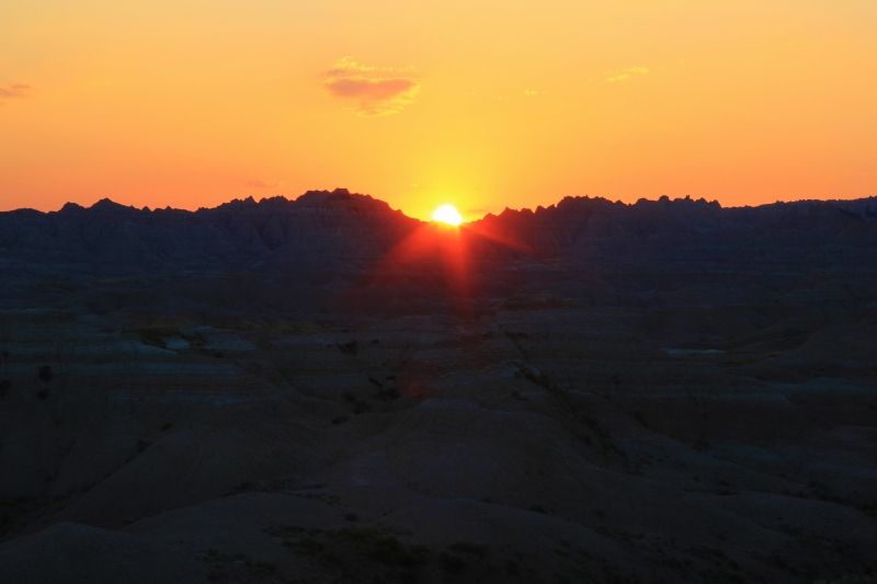
July 13th, I made to the Badlands. I wasn't sure what to expect, but this place exceeded my expectations. What a great park!

IMG_1814.jpg


IMG_1838.jpg


IMG_1863.jpg


IMG_1920.jpg


IMG_1897.jpg


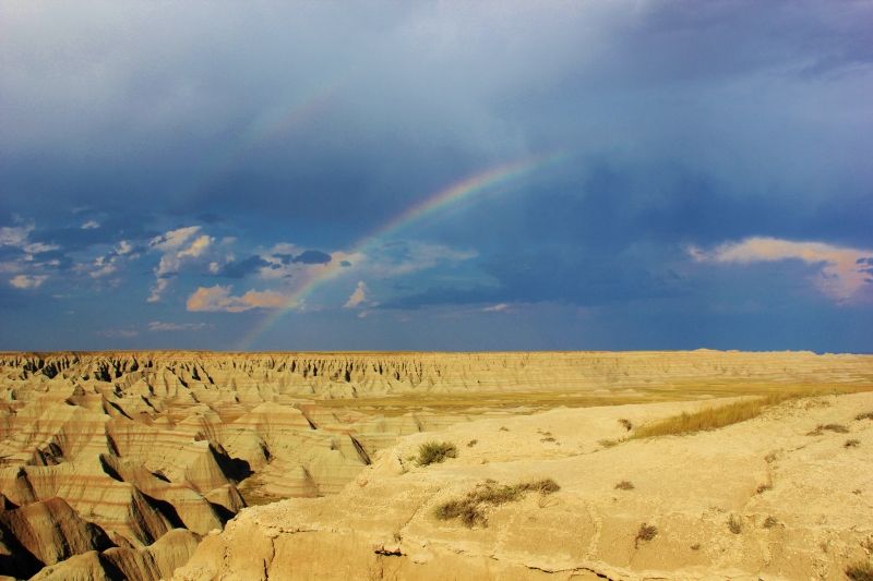
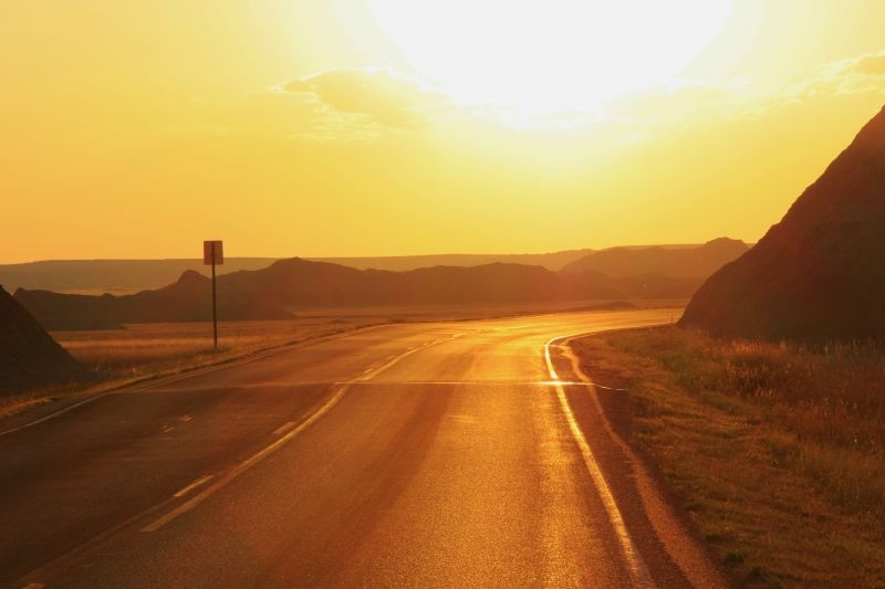
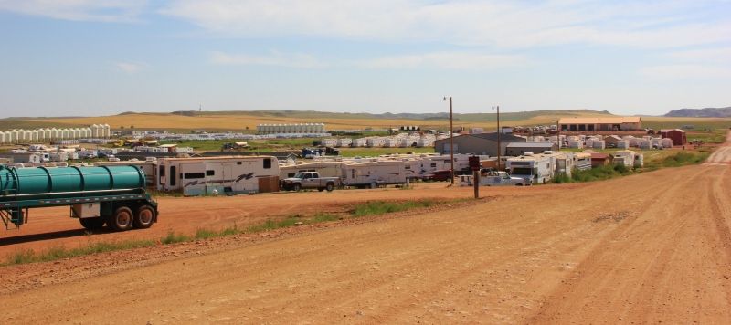
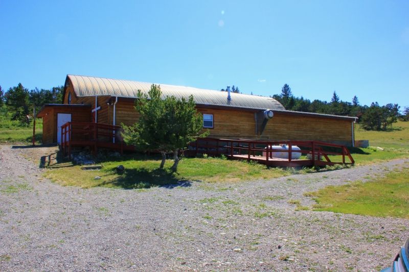
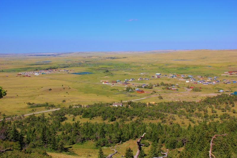
I set up camp in a free "primitive" campground. It turned out being a pretty nice campground, but you did have to drive down 12 miles of dirt roads to get to it. Of course, I didn't mind the dirt roads, and the view was great.

IMG_1964.jpg


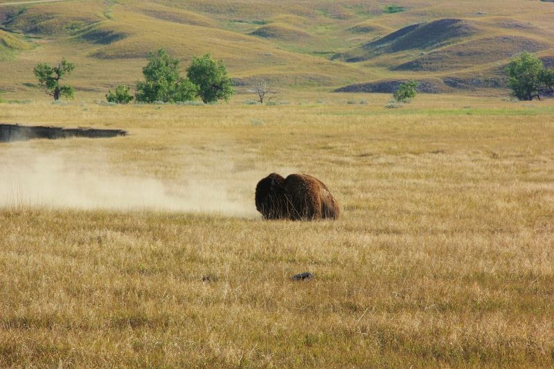
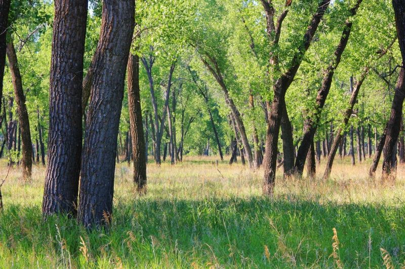
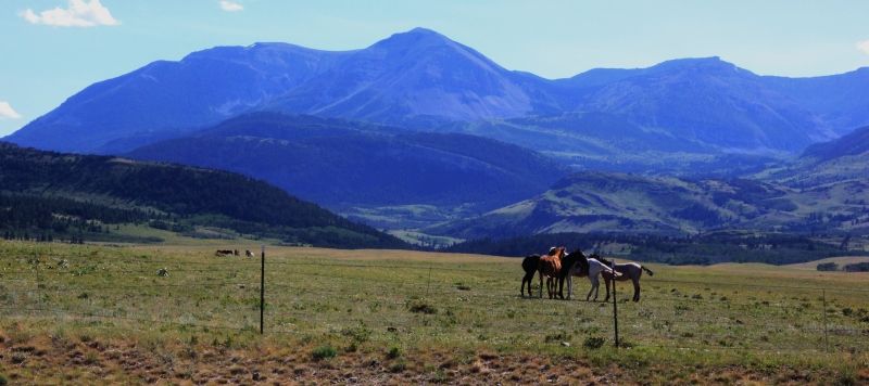
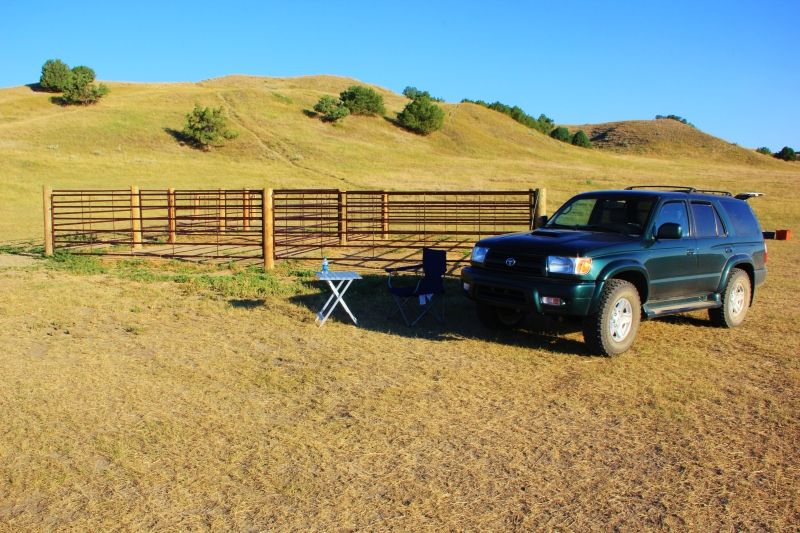
I set up camp next to a horse coral at the Sage Creek Campground. I still didn't have proper silverware, and once again I ate my wonderful breakfast (cereal), and a great dinner (ravioli) with my giant stirring spoon.

IMG_1960.jpg


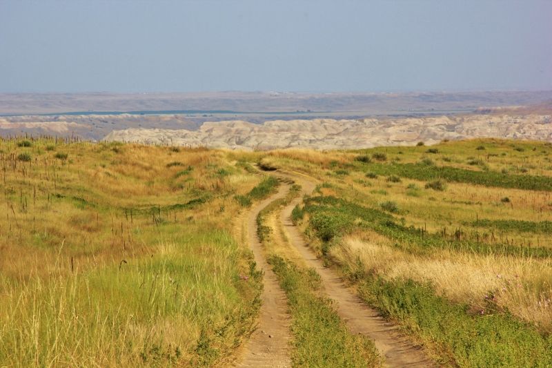
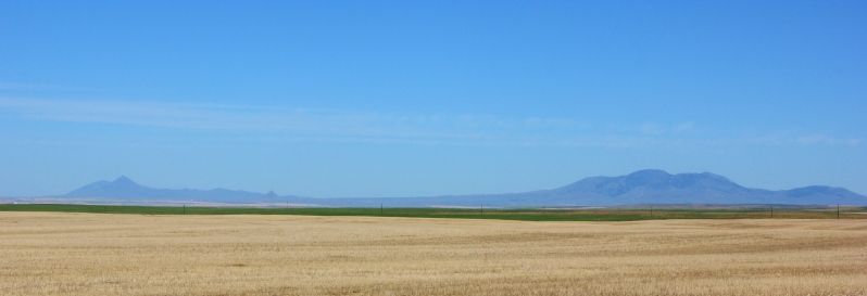
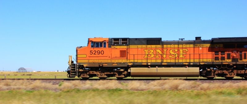
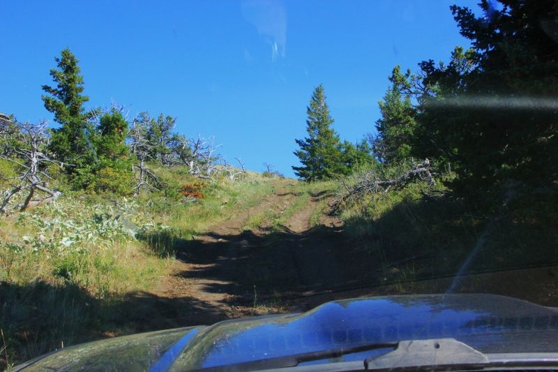
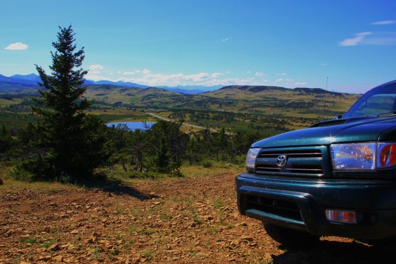
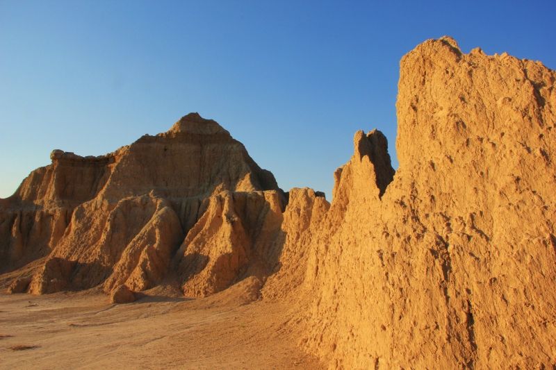
On my way out of the park, I came to a T intersection. To the right was route 44 which takes me to my next destination, Rapid City, South Dakota. To the left was a road that took me to the south side of Badlands National Park. At first glance, the map didn't seem to show anything more spectacular in the south side, so I turned right towards Rapid City. After driving for a mile or so, I glanced down at the map again, and noticed a road that said, "Sheep Mountain--High Clearance Vehicles Only". That sounded fun! But, that meant I had to turn around and head back to the south side of Badlands. I was low on fuel (again), but figured I had enough to make it.

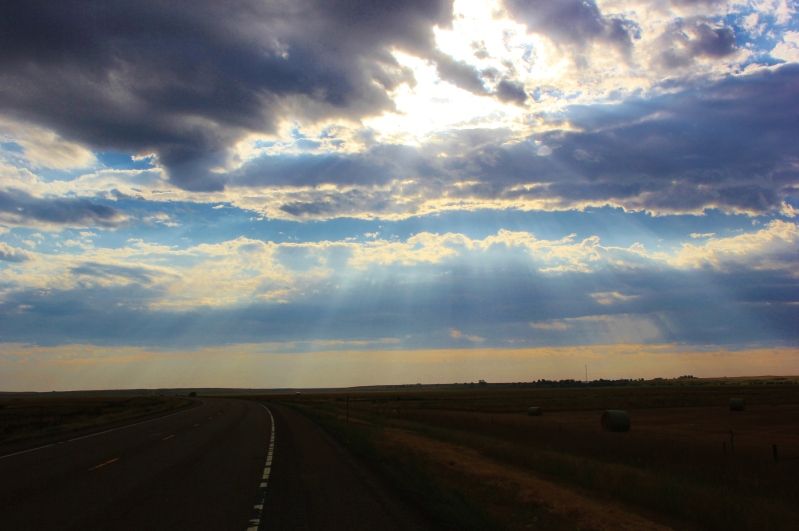
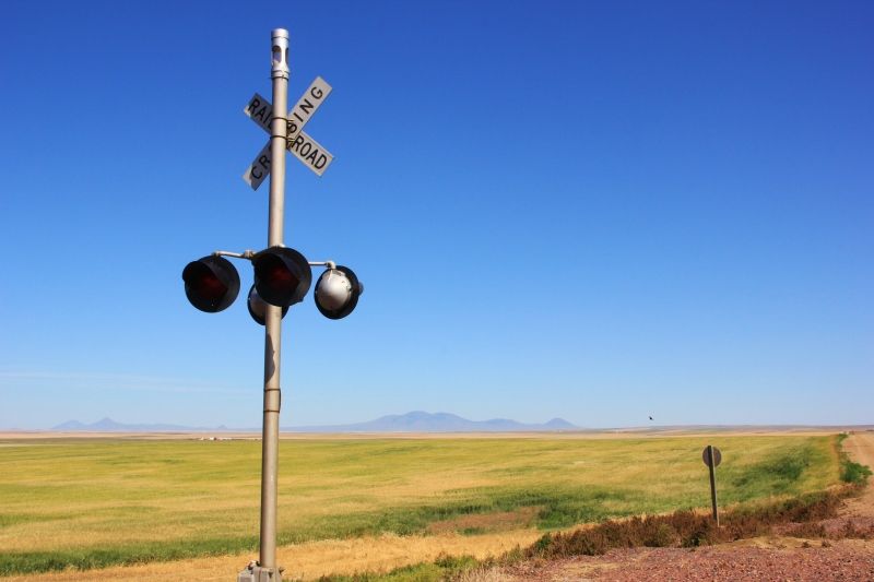
This turned out to be a great road to take, and the views were amazing. The first few miles of the dirt road were really nice, and I couldn't figure out why the map said "high clearance vehicles only". A car could make it. Turns out, once you pass the first scenic overlook, the road turns into a couple of ruts for the next several miles. There were a few hairy off-camber sections as well.

IMG_2025.jpg


IMG_2021.jpg
 
I'm looking at staying somewhere in the Prescott or Flagstaff area for a few weeks starting in early to mid August. If anybody knows of a place (room, apartment, house...doesn't matter) I can stay in for 2-3 weeks for a good price, let me know.

Same for southern California. I'll be looking for something 2-3 weeks, maybe longer. Ideally somewhere around Temecula or as far north as Pomona.

Thanks!
 
Post 10: Black Hills, SD.

From the Badlands, I headed up to the Black Hills. I wasn't sure what to expect, and I figured the only thing here was Mt. Rushmore. I was wrong. There's so much stuff do here! The scenery is amazing as well!

IMG_2193.jpg


If you're ever in the area, make sure you take the route 16A, AKA the Iron Mountain Road. This is the funnest paved road I've ever been on, so much so that I drove the road 7 times during visit.

The road has 3 "pigtail" turns. In one spot, the road loops around itself twice. The wooden bridges are way cool as well.

IMG_2287.jpg

Pigtail on the Iron Mountain Road

There are three tunnels on the Iron Mountain Road, and all three were constructed to frame Mt. Rushmore.

IMG_2271.jpg

Tunnel framing Mt. Rushmore on the Iron Mountain Road

That night I checked out the lighting ceremony at Mt. Rushmore.

IMG_2246.jpg

Mt. Rushmore

I stayed overnight in a super nice KOA campground. The shower and internet were nice. The plumbing in the shower was connected backwards, but I didn't realize this till halfway through my shower. It was kinda cold at first, but still very welcome.

Once again I ate my wonderful breakfast (cereal), except this time, I didn't have to use my giant stirring spoon! I used a fork. I went to Wal-Mart to buy supplies the day before, and I bought a box of forks. I figured I'd get more for my money, and I couldn't think what I needed spoons for. The jury is still out whether cereal is easier to eat with a fork or giant stirring spoon. It's rather dry with a fork.

The next day, I drove back to Mt. Rushmore for a daylight view.

IMG_2256.jpg

Mt. Rushmore

Then I drove down the Needles Highway, which was another awesome drive!

IMG_2318.jpg

View from the Needles Highway

IMG_2336.jpg

Eye of the Needle

All of the tunnels on both the Iron Mountain Road and the Needles Highway are single lane and most are on blind corners. Much honking is involved when driving through.

IMG_2335.jpg

Tunnel on the Needles Highway
 
Last edited:
Glad to share my experience with you all! It's not as fantastic as some of the trips others have posted, but I'm having a blast. It's nice to see another NC member on the board as well. :victory:
 
Post 11: Black Hills Continued

The Iron Mountain Road has all kinds of signs warning RV and campers about the narrow roads and tunnels. I noticed this class A RV at one of the observation points. It must have been at least a 32'. I wanted to see how well it negotiated the turns, and I purposely followed it down the mountains.

I was impressed with the driver's skill, even though he often took up both lanes.

IMG_3823.jpg


However, the tunnels were a pretty tight fit.

IMG_3827.jpg


While in the Black Hills, I also visited a couple of the caves in the area.

First, I stopped at Wind Cave National Park, which is known for it's boxwork formations. It's estimated that 95% of the world's boxwork formations are in Wind Cave.

IMG_2435.jpg

Boxwork formation in Wind Cave

The path was made from cement, and I asked the guide how they got the cement down in the cave. In the 1930s, the workers took innertubes from the tires, cut them in half, filled them with concrete, and carried the concrete filled innertubes around their necks. Even today, that method is till used.

Next, I drove over and visited Jewel Cave National Monument.

IMG_2487.jpg


Both caves had quite a few stairs, but I got the most pooped at Jewel Cave. Walking up the sloped parking lot to my car wore me out.

That night, I visited the light show at Crazy Horse.

IMG_2562.jpg


The next day, I stopped by Thunderhead Falls. The falls are inside an old gold mine. Back when the mine was being mined, miners accidentally blew out the bottom of a creek that ran above the mine. The result was waterfall and flooded mine.

IMG_2604.jpg


IMG_2612.jpg
 
Last edited:
Post 12: From South Dakota to Wyoming

From Thunderhead Falls, I headed up 385 and stopped for lunch along the Pactola Reservoir.

IMG_2597.jpg


I followed 385 to 85 North. Somewhere along one of these roads, I made a detour down a dirt road to some falls.

IMG_2671.jpg


IMG_2635.jpg


I ended up staying overnight at a Hotel in Spearfish, SD. I ate some Taco Bell for dinner, and the greasy taco didn't settle well. I figured a room with a toilet nearby would be really nice. I did manage to grab a spork at Taco Bell though, so no more eating my cereal with a giant stirring spoon or fork. Woohoo!

After staying overnight in Spearfish, I made my way west to Wyoming. I wasn't planning to stay too long in Wyoming, but I did want to visit the Devil's Tower. Some neighbor campers in the Badlands highly recommended it.

IMG_2718.jpg

Devil's Tower, Wyoming

Some strong storms moved through the area while I was there, and the trail up to the tower was closed. There was some nickle sized hail as well, which I think put a new ding on my hood.

It's a pretty neat park. The Devil's Tower is the remains of a volcano and is made from igneous rock. The tower is made from columns that are mostly 6 sided, but also 4 or 5 sided.

IMG_2701.jpg
 
I'm looking for ideas about how to get from Post Falls, ID to Yellowstone. I90 is the fastest, most direct route, but it seems like I would miss a lot of back country. I'm running short on time, so I may still take I90, but I'm very open to any suggested alternate route. Thanks.

Thanks for the compliment Jay. I'm new to photography, and I'm still learning how to use my DSLR. This trip is pretty much the first time I've used it. If anybody has suggestions on how I can improve, I'm all ears.
 
Post 13: Wyoming to North Dakota

From the Devil's Tower, I started to make my way to North Dakota. There were still storm warnings out, and I changed my route to skirt pass the backside of the storm. I headed back into South Dakota, then north on Hwy 85 to North Dakota.

The stretch of hwy 85 between Spearfish, SD and Watford City, ND was probably the most desolate stretch of highway I've been on thus far. The only trees in sight were telephone poles, but after a while, even those disappeared.

After a while, I did stop at a truck stop and took a picture of a semi hauling a blade for a wind turbine.

IMG_3829.jpg


I had a little chat with the driver of the flag car that followed the truck. This particular semi was 147' long. The rear axles on the trailer are steerable, and the steering is controlled via remote control from the following flag car. Pretty cool I thought, and it turns out these steering flag car drivers get paid good.

I have seen many of these trucks on my trip, but haven't had the chance to take a picture. The 19 axle trucks that haul the turbine nacelles are really impressive as well (this one just had an empty trailer):

IMG_3815.jpg


Anyways, I continued north on hwy 85. One of the few towns I drove through was Redig. Redig was nothing more than 4 junk yards, a couple stacks of hay, and a few dilapidated buildings. I drove through, and didn't even stop to take a picture. Kinds wish I did.

So, the drive north continues. My destination was Watford City, North Dakota. This is one of the towns that is experiencing an oil boom right now. It's pretty crazy.

Watford City is pretty small and doesn't have enough housing for the workers, so there are many makeshift campsites.

IMG_2741.jpg


There are constant traffic jams at the major intersections, and there were long lines at the two gas stations. It seemed like there were more trucks than cars, and in some places, the paved roads had deep ruts.

IMG_3830.jpg


I stayed a couple nights at the north unit of the Theodore Roosevelt National Park, which is about 15 miles south of Watford City. I wasn't sure what to expect from this park, but it's actually pretty neat. The park lies within a valley that was carved by the Little Missouri River.

IMG_2723.jpg


IMG_2730.jpg


At this campground, I met Al and Mary Berry. They were from Michigan and had one of those neat Volkswagon/Winnebago campers. But, more about them later.
 
Post 14: North Dakota to Montana

Forgot to mention, my last night in Theodore Roosevelt National Park, I made my Taco Salad that I love so much. It's easy, just crush some chips on a plate, dump on a can of chili, add cheese, and whatever fresh vegetables you like. I love Tomatoes on mine.

As I was prepping dinner, I realized that I also left my knife behind, and I had no way of cutting my tomato. I sat at my picnic table and, while staring at my tomato, I pondered how I was going to dice my tomato.

IMG_3225.jpg


First, I poked my tomato repeatedly with a fork (think shooting a watermelon with a machine gun). That didn't work too well. After starring at my tomato for a few more minutes, it dawned on me. I have the lid from my can of chili! The edges of the lid are sharp! Using the lid from my can of chili, I gingerly diced my tomato. It worked surprisingly well, and sure did taste amazing.

Anyways, from Watford City, ND, I made my way up to Williston, ND. The oil boom is having an impact on Williston as well, and housing is in very short supply. From what I hear, people are starting to leave the area because of the lack of housing.

In Williston, I picked up Hwy 2 and headed west. Next destination was Glacier National Park and Waterton Lakes International Peace Park in Canada.

IMG_2743.jpg


IMG_2750.jpg


Hwy 2 through Montana wasn't as desolate as I expected, and there were many farms and small towns along the way. BNSF Railroad also had a major east/west line that ran alongside Hwy 2.

IMG_2758.jpg


I had the cruise set at 65 (speed limit was 70), and I was surprised that the freight trains could keep up.

IMG_2768.jpg


The Walmart in Havre, Montana will always have a special place in my heart. It was at this Walmart that my 4Runner hit 100k. I had the oil changed here too, so it should be pretty easy to remember when to do my oil changes from now on. Next change at 105k! They didn't have any Ford Taurus filters in stock, so I had to settle for the smaller 4Runner filter.

IMG_3834.jpg
 

RusherRacing

Adventurer
Post 12: From South Dakota to Wyoming
Somewhere along one of these roads, I made a detour down a dirt road to some falls.

Roughlock falls in Spearfish Canyon If you would had parked in the parking lot where you took a left to go down the gravel road to the falls - there is a walking path down to another beautiful waterfall. Just FYI next time your in the area..

Love the black hills and you did a great job capturing the beauty.
 
Post 15: Glacier National Park

Every time I come to this area, I'm amazed at how abruptly the Rockies stick out of the plains.

IMG_2770.jpg


In the picture above, the mountain on the right edge (barely visible) is Chief Mountain. Chief Mountain is where the US/Canada border crossing is.

My first stop in the area was Heart Butte. Heart Butte is located within the Blackfeet Indian Reservation, and from what I've been told, this is one of the poorest areas in the United States. Back when I was in school, a group of us students made a trip up here for a week every summer. We would do things like VBS with the kids and make repairs to the church or other structures in the community.

IMG_2777.jpg

Church in Heart Butte

I took a drive up to the top of Heart Butte. 5 years ago, I took a Subaru Outback up this hill, but the rail has gotten considerably worse since then.

IMG_2778.jpg


IMG_2788.jpg


The town of Heart Butte. The nearest grocery store, gas station, and fast food is 45 minutes away. No cell signal and no radio stations.

IMG_2780.jpg


From Heart Butte, I took a drive towards Many Glacier, which lies within the eastern side of Glacier National Park.

The last three times I've been been to this area was much earlier in the season, and crowds were almost non-existent. This time however, the parking lots were full. If you plan on visiting, come in the earlier part of the season. As beautiful as the area is now, I think it looks even better when there is snow still on the peaks.

IMG_2796.jpg


IMG_2809.jpg


IMG_2800.jpg
 

r3run33

Adventurer
thanks again for posting your trip; I was thinking of passing up on the badlands park but now I definitely will include it.
 

Forum statistics

Threads
185,837
Messages
2,878,729
Members
225,393
Latest member
jgrillz94
Top