Dan's North American Journey--4 months on the road

Post 16: Waterton Lakes International Peace Park in Alberta, Canada

I'm not forgetting about my part 2 of Glacier to post, but for now, I'll post about my side trip to Waterton Lakes National Peace Park in Canada. Waterton Lakes is the Canadian side of Glacier. It's a much smaller park, but almost just as beautiful as Glacier.

First stop was the town of Waterton. Neat little town with nice views of Waterton Lake. The US/Canada border crosses the lake, and the south side of the lake is in the United States.

IMG_2871.jpg


On the backside of town, there are some pretty neat falls. I never noticed the falls the last 3 times I've been here. I discovered it while I was trying to find the road to Cameron Lake.

IMG_2881.jpg


I finally found the road to Cameron Lake. It was actually pretty well marked--when you are coming from the other direction. Cameron Lake also lies on the US/Canada border. Last time I was here, the lake was frozen over and there was an avalanche on the US side. This time, however, the lake was busy with boaters and tourists.

IMG_2890.jpg


Next I headed over to Red Rock Canyon. It's a great drive with lots of twists, nice scenery, and a good chance to see some wildlife.

IMG_2939.jpg


After spending the day in Waterton, I headed back to Glacier. Just south of the Chief Mountain boarder crossing, I stopped to take some pictures of the setting sun.

I thought the shadows being cast by the clouds were pretty cool, and not something I've ever seen before:

IMG_2956.jpg


And took a picture of the setting sun over Glacier:

IMG_2962.jpg
 
thanks again for posting your trip; I was thinking of passing up on the badlands park but now I definitely will include it.

Awesome! The badlands is a neat area. I recommend the drive down Sage Creek Rd., even if you don't plan on camping there. That's probably your best chance at seeing some wildlife. You can also enter/exit the west side of the park on Sage Creek Rd., which, irrc, goes to 44. 44 then goes on to Rapid City.
 
August 6. Right now I'm in Rocky Mountain National Park. I just arrived today, and haven't gotten to see much of the park. I'm sitting in my car typing this as a thunderstorm is going through the area. A super cool park ranger told me a good place to bum some internet, and even gave me the wifi password. I'll try to post this update once I get some internet tomorrow.

I've gotten a bit behind at posting updates again, and I'm sorry about that. It looks like my updates are about 2.5-3 weeks behind my actual location. I'd like to get back to my updates being less than a week behind my actual location.

Post 17: Glacier National Park part 2

Remember Al and Mary Berry, the couple I met back in Theodore Roosevelt National Park, North Dakota? In my last post, I forgot to mention that I ran into them at St. Mary's Lake in Glacier National Park, and again in Waterton Lakes National Peace Park in Canada. What are the odds of that!?

Anyways, on my last day in Glacier National Park, I took the drive down the Going to the Sun Road. It's said that the Going to the Sun Road is the most beautiful drive in the United States. It's definitely fantastic, but I've been on some other roads that would rival its beauty. More on that later.

The east side of Glacier, heading towards Logan?s Pass.

IMG_3048.jpg


IMG_3061.jpg


IMG_3062.jpg


I always thought this small gorge was really neat. The gorge is only about 4' or so wide at the top, and the river runs about 20' below the top of the gorge. I've wondered how many people and/or animals have fallen in.

IMG_3004.jpg


There are several trails to hike on starting at the Logan's Pass Visitor Center. I wanted to see Hidden Lake, which was a 1.5 mile hike in. The trail was super slick, and after going about half-way and almost falling a few times, I turned around and headed back. I definitely wanted to see the lake, but I really didn't want to fall and break my camera. I should have thought things through a bit, and just left my DSLR in the car and taken my old point-and-shoot instead. Next time, I'll make the hike!

IMG_3096.jpg


IMG_3099.jpg


There were a few goats at the visitor center as well.
IMG_3066.jpg


During each spring when the visitor center is dug out of the snow, metal plates help metal detector equipped snow removal teams find the steps.

IMG_3100.jpg


The last three times I've been here, I was never able to make the complete drive through the Going to the Sun Road. It was always snowed in, and the farthest I've made it was Logan's Pass. This time, however, the road was open the entire way, and I was excited to see what lies west of Logan's Pass.

IMG_3125.jpg


The west side of the Going to the Sun Rd. seems to have more waterfalls. Many of them are really easy to miss, especially for someone who is driving westbound. This waterfall I missed, and I had to do a couple of U-turns to get another shot at it.

IMG_3111.jpg


A couple more waterfalls.

IMG_3141.jpg


IMG_3148.jpg


I had a blast in Glacier, and I will definitely be back. Next stop: Kalispell, Montana, then on to Idaho.
 
Post 18: 2 Months on the Road.

I've been on the road for 2 months now, and I've had a blast. Here are some stats so far:

Miles driven: Just over 9,000.

Favorite roads: Beartooth Pass in Wyoming and Montana, Going to the Sun Road in Glacier NP, Montana state roads 43 and 278 from Hwy 93 to I15.

Favorite Park: Probably Glacier/Waterton.

Favorite Town: Sandpoint, ID; Colorado Springs, CO; Cumberland, MD; Wisdom, WY; and I'm probably forgetting a few.

Favorite food: Pahaska Tepee on the east entrance to Yellowstone. Awesome breakfasts!

Worst Food: China Buffet in Missoula, MT. Everything tasted off, even the chocolate pudding.

Favorite campground: Island Lake off of Hwy 212 on the NE entrance to Yellowstone. It's a National Forest Campground about 10 miles south of Beartooth Pass. KOA in Lyman, WY and Sage Creek Campground in Badlands NP were great as well.

Worst campground: Some National Forest Campground just south of Estes Park, CO.

Dumbest drivers: Aspen, CO.

Best gas mileage: 24.2
 
Post 19: Montana to Idaho

From Glacier National Park, I headed west on Hwy 12 to Sandpoint, Idaho.

Much of Hwy 12 runs along the Kootanai River. It was a great drive, and at one point, I stopped at some county park and hiked down to some falls.

IMG_3177.jpg


I also passed over a dam and hydro electric plant somewhere along Hwy 12. I took a dirt road that was supposed to lead me to a better view of the dam, but I couldn't find the right turn-off. It was still a cool drive, and I managed a picture or two.

IMG_3200.jpg


I stayed overnight in a Wal-Mart parking lot in Kalispell, MT. Wal-Mart parking lots aren't my favorite place to stay, but I got tired of trying to find a campground. This Wal-Mart had a bunch of RV's parked in front, and looked more like a campground than anything anyways.

As I was pulling into the Wal-Mart parking lot, I noticed a familiar looking Volkswagon/Winnebago camper. Could it be Al and Mary Berry? I drove around the camper, and sure enough, there were Michigan tags and a giant multi-colored map of the USA on the side. I could hardly believe it! I said howdy, and they were just as surprised to see me. After trying to convince each other that neither one of us were stockers, I headed next door to catch the new Batman flick. Great movie!

The next day, I headed west to Sandpoint, ID. Sandpoint is way up in the skinny part of Idaho, and lies on the edge of a pretty large lake.

IMG_3220.jpg


IMG_3149.jpg


Why go to Sandpoint? Several years ago, I was thinking about applying for a job at Quest Aircraft, located in Sandpoint. They make the Quest Kodiak. The Kodiak is a fairly new single engine turboprop specifically designed for bush operations. Anyway, at the time, the company wasn't very stable, and I decided it wasn't someplace I wanted to work. However, I did do some research on town, and it looked like a cool place. So, I decided to swing by on this trip.

As usual, I didn't take any pictures of the town, but I did get a picture of this:

IMG_3226.jpg


"Traffic Revision Ahead"? That's almost outside the scope of my vocabulary. Why couldn't they just have said, "New Traffic Pattern" or "Lane Shift" like everywhere else? People in Sandpoint must be smart! :D

On a completely unrelated note, I noticed that many semis in the northwest have many more wheels than the typical 18 wheeler. On the east coast, 18 wheelers are the norm, but here, it seems they are the exception rather than the norm. Most of the flatbed, tanker, livestock, and grain trucks have at least 26 wheels, and some, like the one pictured below, have 30.

IMG_3223.jpg


Longest truck I saw had two long trailers, the first being a tri-axle lowboy with a combine on it, and hitched to the rear was a 48' grain trailer. Wish I had a picture.
 
Post 20: Idaho back to Montana

While I was in Sandpoint, I bumped into Al and Mary Berry again. This is now the 5th time I've seen them. So crazy!

Once I hit the western part of the U.S., I've tried to avoid driving on interstates as much as possible. It seems like there is so much that is missed when driving down the interstate. So, from Sandpoint, Idaho, I took state rd 200 to Missoula.

IMG_3230.jpg


I stayed overnight in Missoula and ate some pretty terrible Chinese food. That evening was rough, but, feeling better the next day, I was off and on Hwy 93 south to state rd 43.

IMG_3240.jpg


93 is a great road with some amazing scenery. Right at the continental divide, which is also the Idaho/Montana border, state road 43 turns off to the left. It runs along the top of the continental divide for a bit before heading back down into Montana. This stretch of road, along with state road 278 would become one of my favorite areas.

I wasn't on 43 very long, when the mountains gave way to a large valley. After the long climb up to the continental divide, I was expecting a long descent as well. The valley was a surprise, and probably one of the reasons why I liked this area so much. The west side of the valley had snow-capped peaks, and a row of smaller, but still impressive, mountains to the east.

IMG_3280.jpg


There wasn't a whole lot in the valley. There were some ranches and a couple of small towns, Wisdom and Jackson, but not much else. It was a pretty desolate area.

IMG_3259.jpg


IMG_3233.jpg


I stopped in the town of Wisdom for some pictures. Even though this was a weekday, it seemed like everybody from town was out and about having a good time. Everybody seemed to congregate around this roofless flea market, which was one of a few buildings in town.

IMG_3261.jpg


Just outside of Wisdom, I took a right turn on state rd 278. This was another fantastic drive, and I stopped by the Wisdom Airport. There wasn't much there: just a grass strip, an outhouse, and an old hanger in the background. I love this area!

IMG_3266.jpg


IMG_3271.jpg


278 followed the valley for a bit, and I hit some rain at the southeast end of the valley.

IMG_3286.jpg


IMG_3291.jpg


After heading over a seven thousand something foot pass, I ended up on I15. I took I15 north a couple miles and stayed overnight in Dillon, MT.
 
Post 21: Yellowstone, Part 1

After staying overnight in Dillon, Montana, I headed down I15 for a few miles before picking up a dirt road in Modina, Montana. Modina was a fairly big dot on my map, and, not knowing the condition of the 40 mile long dirt road I was about to take, my original plan was to fuel up in Modina. Before I left Dillon, I changed my mind at the last minute and decided to fuel up there. I'm so glad I did! Modina was practically a ghost town, with only 1 or 2 inhabited houses. This shouldn't even be a dot on the map!

IMG_3293.jpg


So, after taking a couple pictures in Modina, I headed east on this dirt road. Looking at my map, this was the most direct route to Yellowstone. There were no paved roads for probably 50 miles in either direction. Not knowing the condition of the road, I texted my route to seanzorz so somebody knew where I was going to be. The road turned out to be pretty good, and pretty scenic.

IMG_3319.jpg


IMG_3300.jpg


After driving for nearly 40 miles on this dirt road, I came to a "T". I don't know who decided to put the "T" in the road, because, according to my map, it isn't supposed to be there. This is supposed to be a straight road. So, eeny meeny miney mo, and off to the right I go. After driving about 20 miles or so and passing a few dead cows along the road, I arrived to Hwy 20.

I hopped on Hwy 20 for a bit, and finally arrived in Yellowstone. Woohoo! I stayed overnight in a Yellowstone campground, and the next day I headed up to Mammoth.

IMG_3410.jpg


IMG_3391.jpg


IMG_3344.jpg


I also took some terrible wildlife picture:

IMG_3490.jpg


IMG_3459.jpg


Yellowstone is a great park!
 
Last edited:

1leglance

2007 Expedition Trophy Champion, Overland Certifie
your pics are really great and I like the commentary you add.
Of course the bits about missing your spoon were funny but the tomato bit & the tin lid were over the top...thanks for that.

Please keep posting your report, it just what I would like to be doing instead of working away :)
 
Post 22: Beartooth Pass

Right now, I'm in Prescott, AZ. It was a dark when I arrived, but from what I've seen, Prescott is a really nice area. I'm still farther behind with my updates than I'd like, but hopefully I can get a bit more caught up over the next week.

Anyway, after staying in Yellowstone for a day, I headed out Yellowstone's northeast entrance and took a drive up the Beartooth Pass. My original plan was to spend a few hours on the pass, but the area was so fantastic that I ended up spending a day and a half in the area.

The landscape was amazing, and this is probably one of my favorite drives I've been on. The weeds were in bloom, and added some really nice color.

IMG_3535.jpg


IMG_3679.jpg


The Beartooth Pass is only open for about 5 months a year, but snow storms may occur during the summer. The road curves its way along the Montana/Wyoming boarder and climbs to nearly 11,000'. My favorite part of the road was this portion with switchbacks.

IMG_3658.jpg


The view from the top of the pass is fantastic!

IMG_3606.jpg


IMG_3579.jpg


IMG_3712.jpg


I camped overnight in the Island Lake Campground, which was about 10 miles west of the beartooth pass. This campground was really nice, and the vault toilets were spotless. The elevation here was about 9,000' and some of the campsites had a nice view of the lake:

IMG_3688.jpg


The next day, I headed a bit further west and picked up the Chief Joseph Highway. I didn't know anything about this road, but I had several people recommend the drive, so I figured I would check it out. The first 10 miles or so were unimpressive, but after that, the views became impressive.

IMG_3735.jpg


IMG_3748.jpg


And I stopped at Beartooth Lake for some pictures.

IMG_3700.jpg


Beartooth Pass is a fantastic drive, and it's one of my favorite roads. It's definitely a drive that any visitor to Yellowstone should take.

I'll post part 2 of Yellowstone in my next update.
 

hrt4me

Adventurer
my wife and I will be following in your path in a few weeks, so this gives us something to look forward to and help us in our planning...
 
Post 23: Yellowstone, Part 2

From Beartooth Pass, I headed back to Yellowstone via the northeast entrance. Just before entering Yellowstone, I had lunch at the Beds N Buns, which is a small restaurant/motel. The building was an old log structure, and the kitchen was out back under a tent. They had a really good beef brisket bbq sandwich.

Once I entered Yellowstone, I drove a few miles and stopped to take a picture of a large herd of buffalo.

IMG_3522.jpg


And after driving a bit farther, I spotted a huge crowd on the side of the road. I managed to find a spot to park, and headed over to see what everyone was gawking at.

IMG_3788.jpg


Turns out a single wolf had taken down a young elk. Apparently, it's a bit rare to see the wolves in the park, and it was really neat to see them.

After watching the wolves for an hour or so, I headed south to find a campground. As it turns out, all of the campgrounds on the southeast side of Yellowstone were already full. The only campgrounds with space left were Norris and Mammoth, both of which were back in the northwest side of the park. Of course, by the time I got to Norris, it had filled up. I headed back north to stay at the Mammoth, but by the time I made it there, it too was full. So, I headed up Yellowstone's north entrance and set up camp in a national forest campground. It was a fiasco, and I went to bed a bit frustrated about the lack of campsites and all the extra driving around.

The next day, I retraced my route and headed towards the Grand Canyon of Yellowstone. On my way, I was able to spot a moose and a black bear. I really wished I had a better zoom lens!

IMG_3494.jpg


IMG_3497.jpg


The bear and moose were in the same field, and after watching them for a bit, I continued south to the Grand Canyon of Yellowstone.

IMG_4058.jpg


I took a hike down to Lower Falls.

IMG_4100.jpg


The hike back up was long and steep. It really pooped me out.

After visiting Lower Falls, I decided to find a campsite before they were all taken up. But, of course, they were all full. Most of the campsites had filled up by 10:00am. So, once again, the camping situation left me frustrated, and I headed out the east entrance to find a national forest campground.

The next morning, I headed back to the park and, on the way, I stopped at the Pahaska Tepee for breakfast. I had seen the place the day before, and the guy at the gas station said they had an awesome breakfast menu. He wasn't lying! The food was great!

So, with a full stomach and a new day, I was rethinking the frustrating camping experience I've had at Yellowstone. I realized that I've driven through every entrance to Yellowstone. Had it not been for the frustrating camping experience, I would have missed out on a lot of the wildlife and scenery that Yellowstone had to offer. In my opinion, the entrance roads offer better scenery, so, as I thought about it, I was really thankful for the opportunity to see all the entrances. When visiting Yellowstone, most people stick to the figure 8 loop that makes up the park. They miss so much amazing scenery!

And so, I continued the drive along the east entrance. The scenery along Yellowstone Lake was really beautiful.

IMG_3998.jpg


IMG_4022.jpg


IMG_3886.jpg


I stopped at West Thumb for some pictures of the geyser basin. This was a really cool part of Yellowstone and probably one of my favorite parts of the park.

IMG_4165.jpg


IMG_3928.jpg


IMG_3917.jpg


Last buy not least, I stopped by Old Faithful.

IMG_4204.jpg


And that concludes my trip to Yellowstone. What a great park!
 
Post 24: Yellowstone to Dinosaur

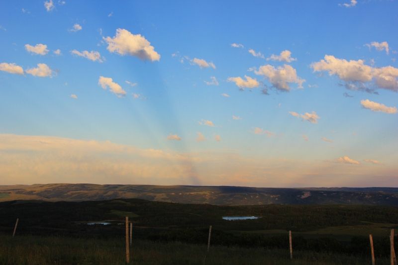
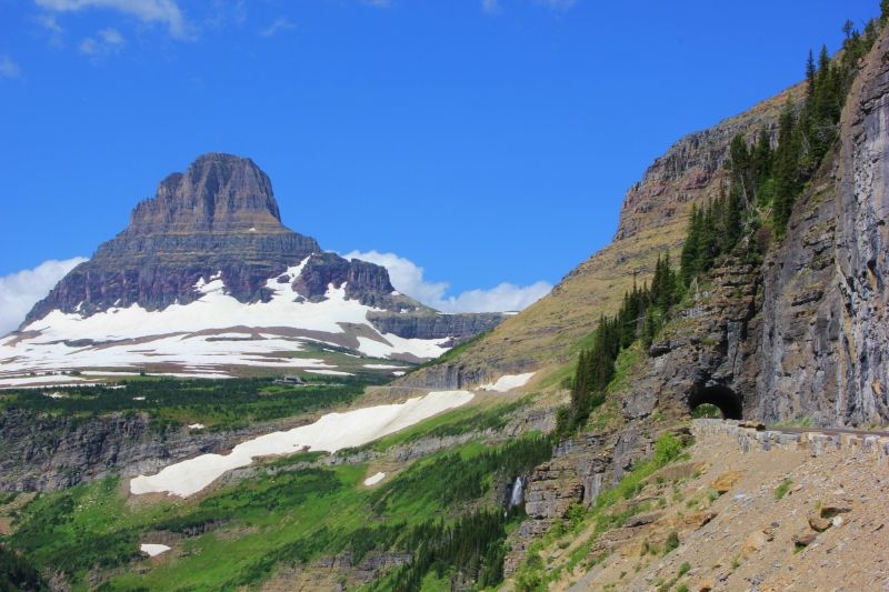
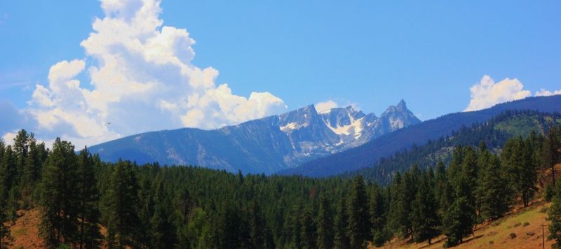
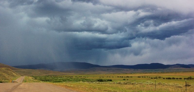
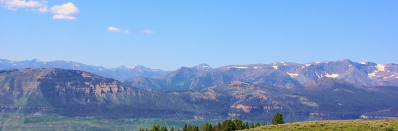
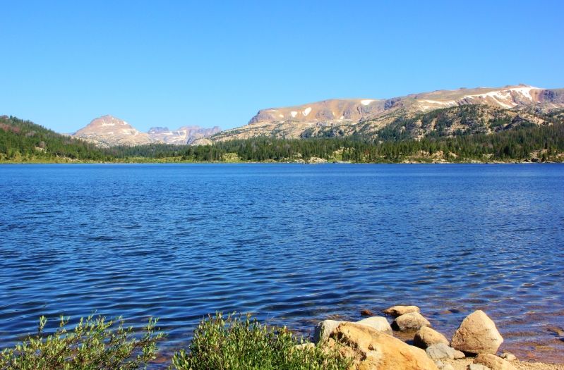
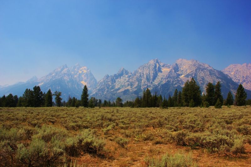
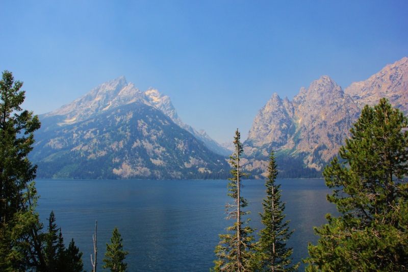
From Yellowstone, I headed south through the Grand Tetons. Smoke from the fires in California and Idaho has made its way into the area by blowing into Canada before being brought into the Tetons by the jetstream. In the morning, the mountains were barely visible from the road, but it did clear up enough for some ok pictures.

IMG_4216.jpg


IMG_4234.jpg


I was ready for a shower and wifi, so the plan was to camp at a KOA somewhere around the Jackson Hole area. But, once again, finding a campground would be a fiasco. The info I got from the Yellowstone Visitor Center said there were two KOA campground in the Jackson Hole area. I drove around trying to find these campgrounds, but as it would turn out, both of the KOA campgrounds no longer exist. I did find a third KOA, but they didn't allow car camping. After a few hours, I did find an overpriced campground just outside of Jackson Hole.

To make things more frustrating, while I was driving around trying to find a campsite, I found out my insurance company had accidentally taken the insurance off my 4Runner. They were supposed to just remove my old '90 4Runner from the policy, but they accidentally removed both 4Runners. Turns out I've driven 2 months without insurance. D'oh!

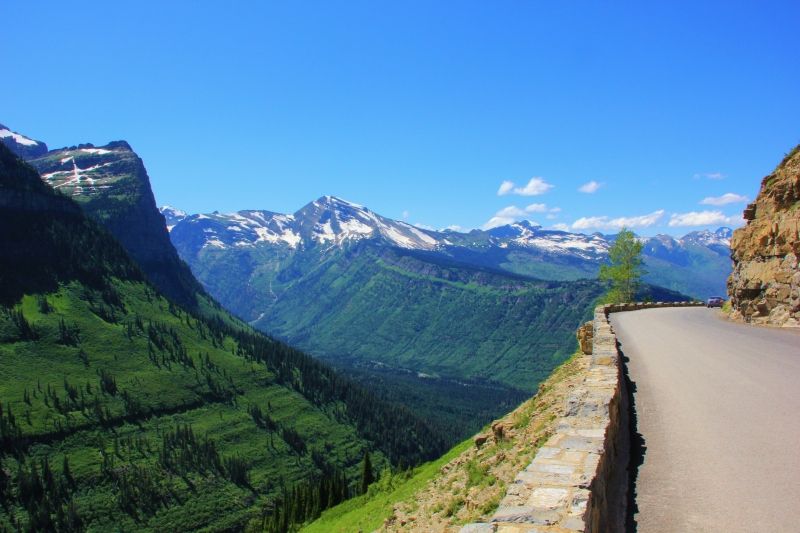
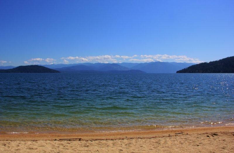
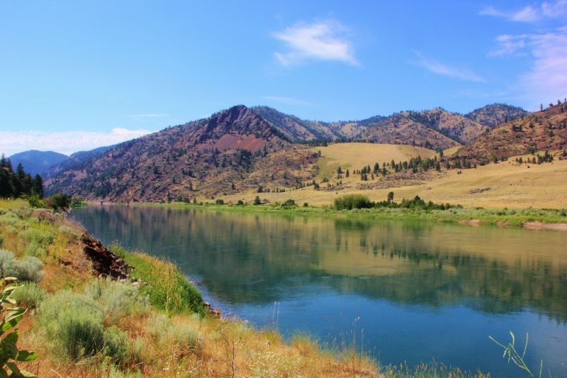
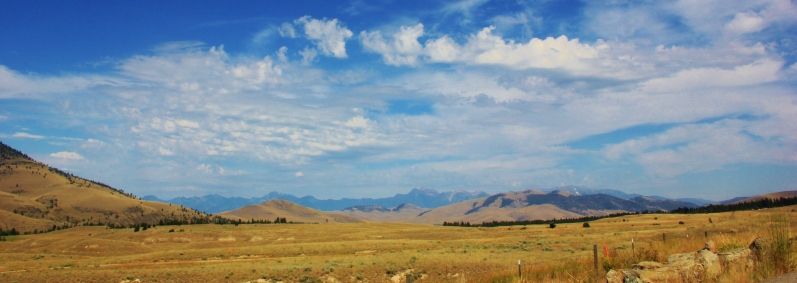
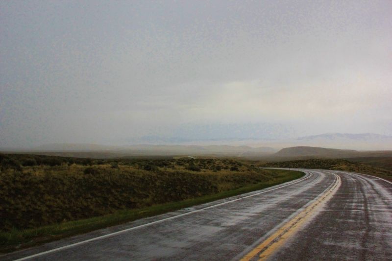
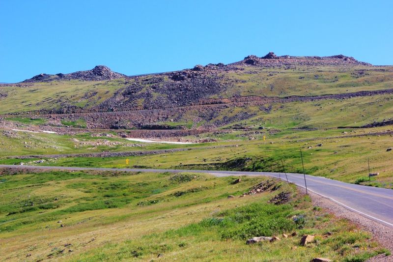
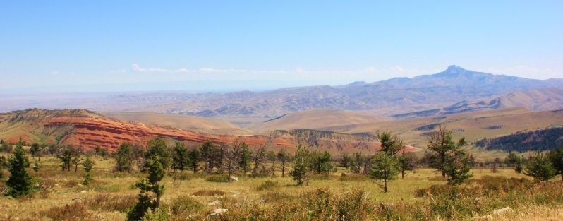
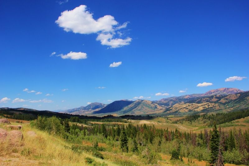
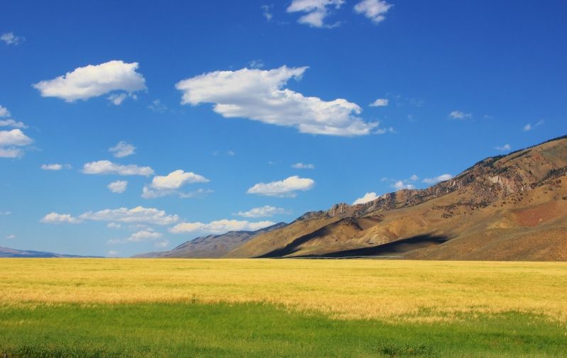
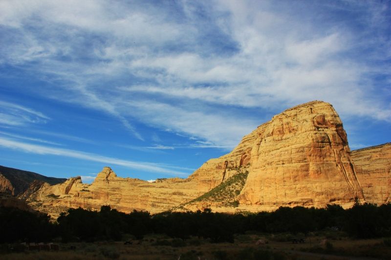
The next day, I headed south on Hwy 89 from the Jackson Hole to Montpelier, Idaho. This section of Hwy 89 follows part of the Snake River, and part of the road curves it's way into the mountains. The scenery was fantastic!

IMG_4242.jpg


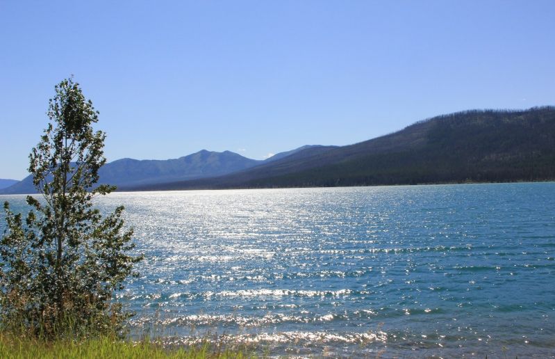
I stayed on Hwy 89 until I reached Montpelier, Idaho. There I picked Hwy 30 and stayed on that to Kemmerer, WY. This was another great stretch of road!

IMG_4251.jpg


In Kemmerer, I picked up Hwy 189 heading south to Evanston. In Evanston, I hopped on I80 east for short bit before arriving at the KOA in Lyman, WY.

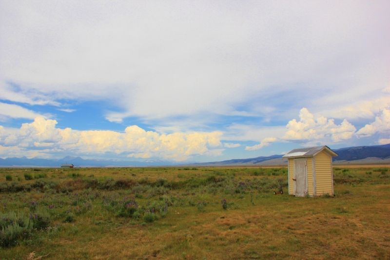
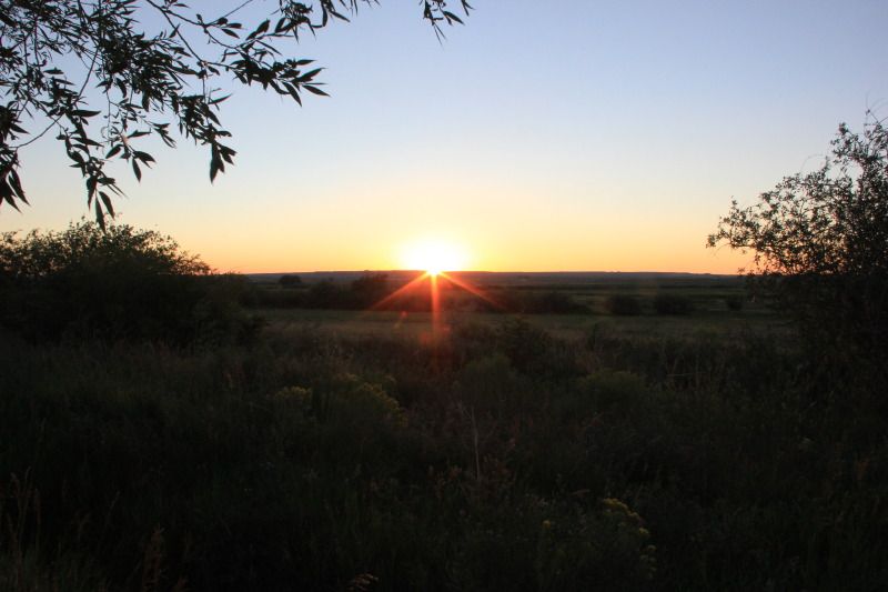
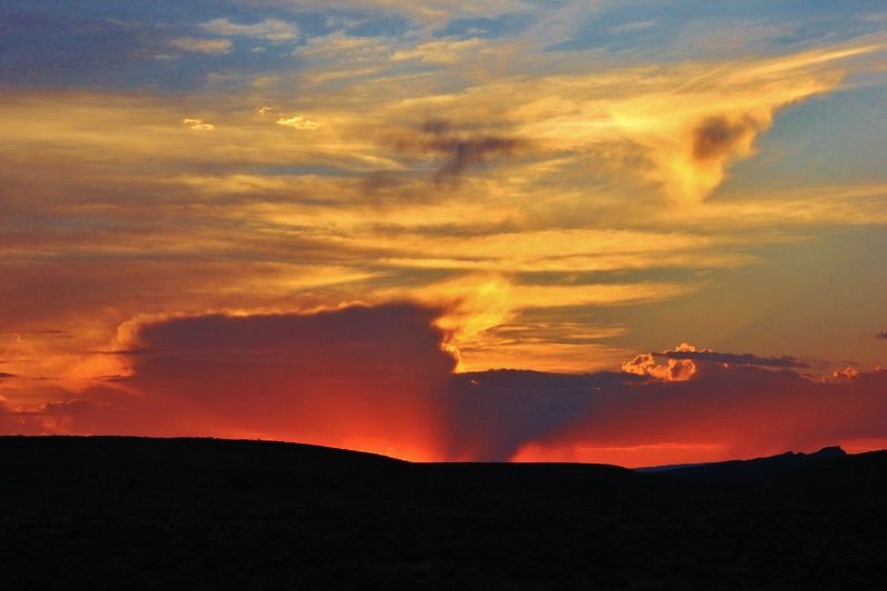
The KOA in Lyman is probably one of my favorites. It's small, and the campsite I had was under a big shade tree with a great view of the sunsets.

IMG_4256.jpg


I ended up staying here an extra day, which game me a chance to finish writing an article for a LEGO magazine.

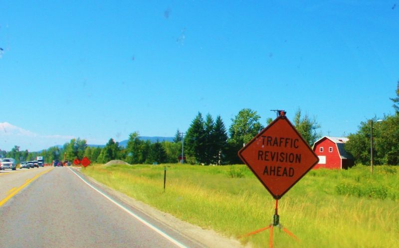
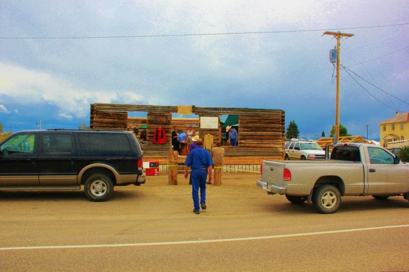
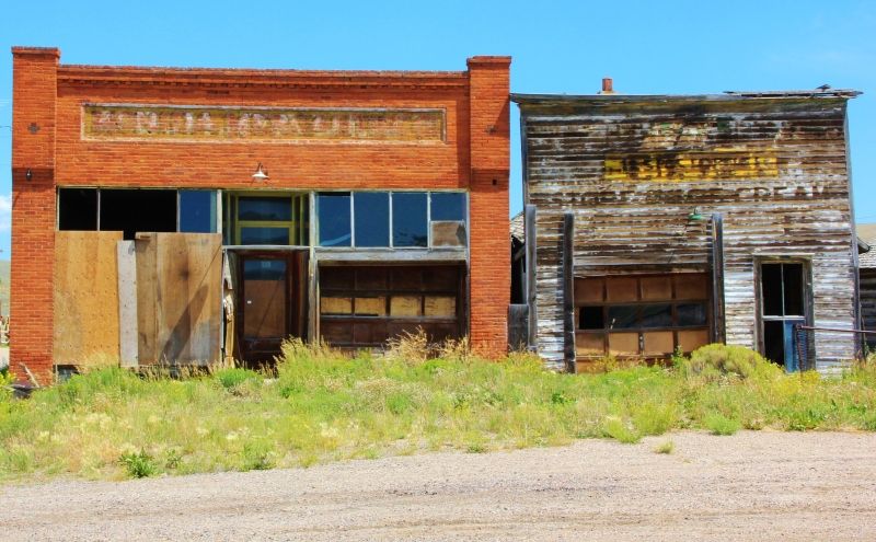
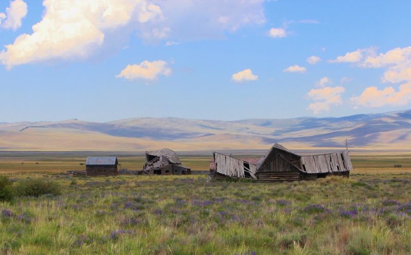
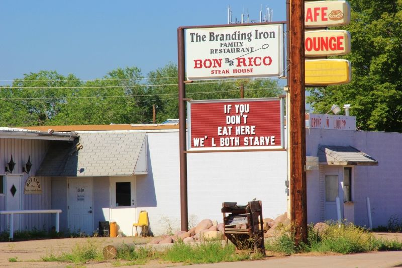
I spotted this sign in Lyman.

IMG_4269.jpg


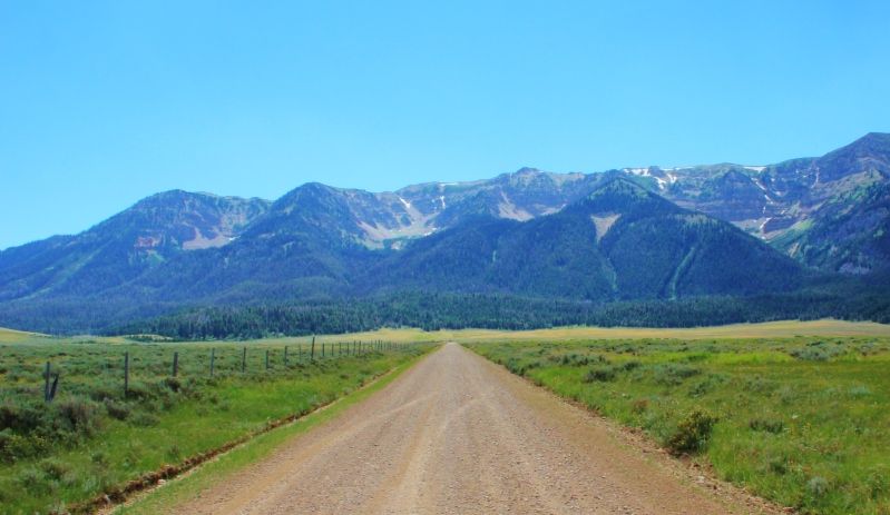
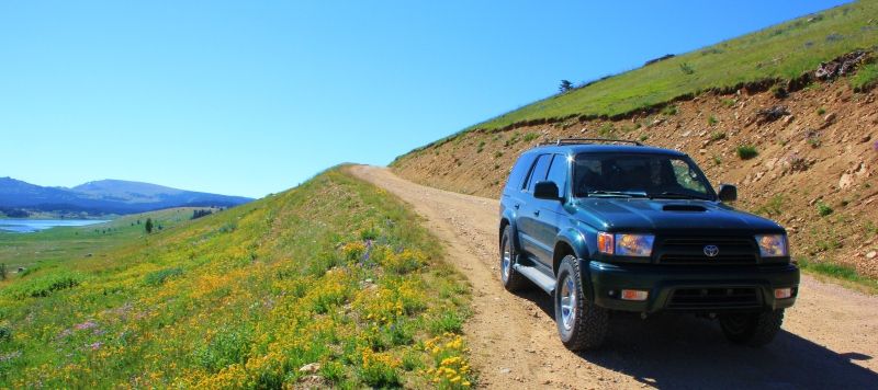
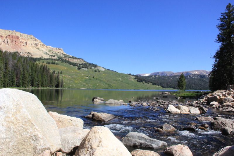
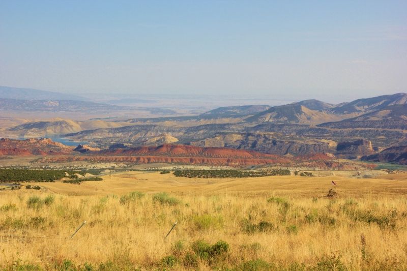
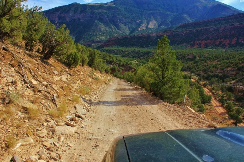
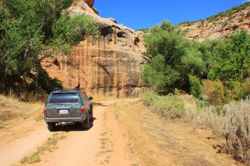
After spending a couple nights in Lyman, I headed south on some county roads. The plan was to drive through the Flaming Gorge National Recreation Area on my way to Dinosaur National Monument.

There were signs in Lyman that pointed in the direction of the Flaming Gorge, so I figured I'd just follow the signs. The view was great, but the drive seemed to be taking longer than expected. After driving a while, I arrived in Green River. This was odd, because Green River was a few miles east of Lyman on I80. I wondered why would the signs take me through some back roads when I could have just taken I80 instead? I got out my map, and somehow, I missed a turn I was supposed to take by about 45 miles. No wonder why the drive seemed to take longer than it should! I took advantage of my unplanned stop in Green River to grab some lunch, and I headed down the east side of the Flaming Gorge.

Most of you have probably figured out by now that I'm navigating the old-school way with paper maps. No GPS. I do have a GPS receiver and some map software on my laptop, but it has been useless, and long ago, I gave up trying to use it. At about 75 miles out of my way, my missed turn at the Flaming Gorge would be my most costly navigational error so far.

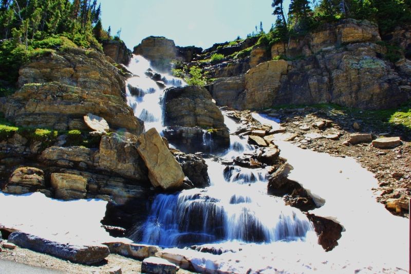
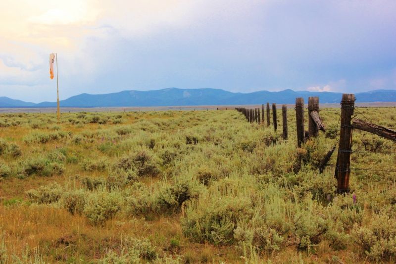
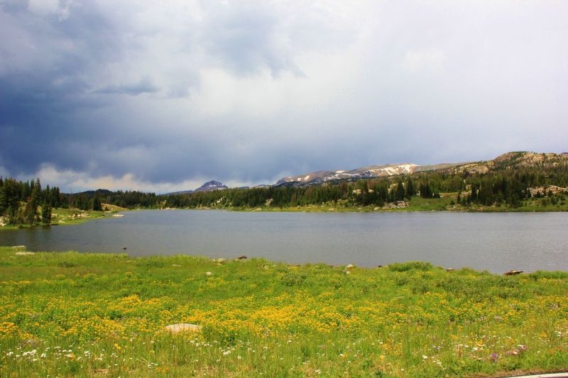
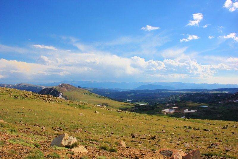
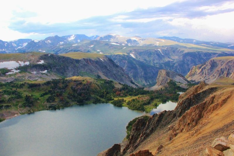
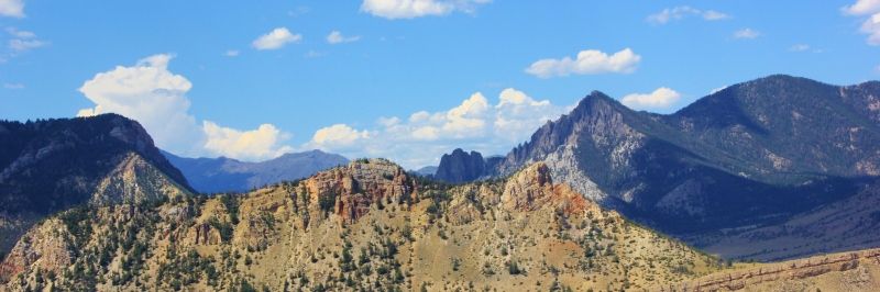
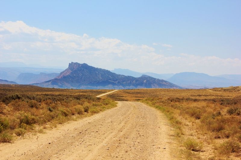
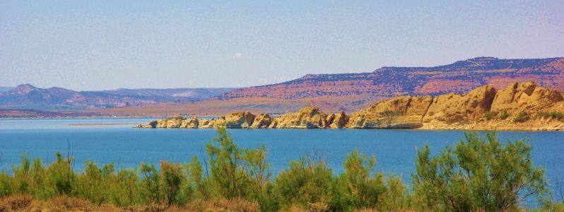
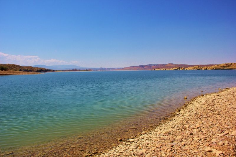
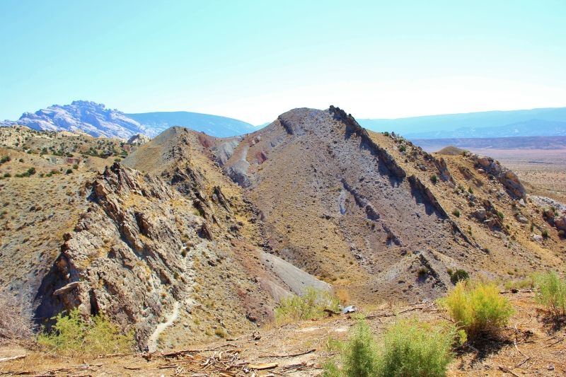
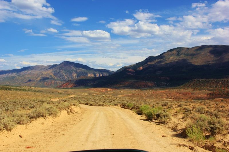
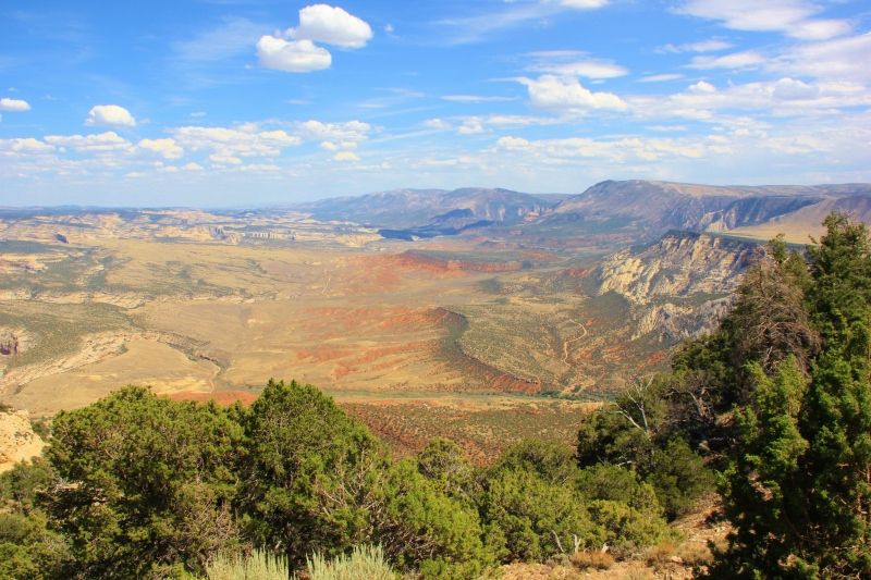
Anyway, the view along the east side of the gorge was really great, and I took a side trip down a dirt road for some better pictures.

IMG_4350.jpg


IMG_4317.jpg


IMG_4310.jpg


IMG_4308.jpg


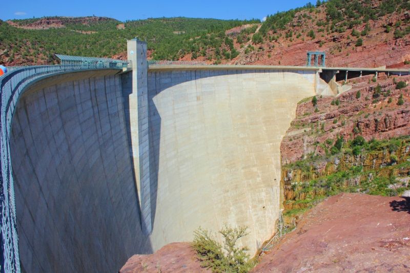
At the south end of the Flaming Gorge is a hydroelectric dam along the Green River. I've never been inside of a dam, so I took advantage of their free tours.

IMG_4332.jpg


Generators with an old turbine on display:

IMG_4336.jpg


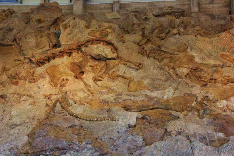
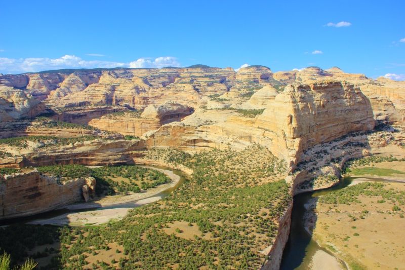
The Flaming Gorge is a really cool area. Despite missing my turn and almost running over a cow in the road, I'm really glad I visited the area. Next stop, Dinosaur National Monument.
 
Post 25: Dinosaur National Monument

From the Flaming Gorge, I headed south on Hwy 191 before catching Hwy 40 east to Dinosaur National Monument. Dinosaur National Monument lies on the Utah/Colorado border, with the dinosaur fossil part of the park being on the Utah side.

I left Lyman, WY earlier in the day, and with my stop at the Flaming Gorge, It was nearly dark when I arrived at Dinosaur National Monument. The monument had a fairly nice campground along the Green River, and I decided to crash there.

IMG_4398.jpg


The next day, I headed over to the fossil area of the park. I was too lazy to go on any of the hikes, so I just visited the enclosed fossil quarry area and took some pictures.

IMG_4436.jpg


And I took a couple pictures of the surrounding area.

IMG_4443.jpg


There wasn't much to see in the west side of the park (where all the bones are), so I headed over to the east side of the park.

The east, or Colorado side, doesn't have any fossils, but it does have a really neat canyon. There are paved roads that run to some scenic overlooks over the canyon, but I decided to take a 13 mile dirt road that runs down the canyon wall to the Echo Park Campground. Echo Park Campground lies at the convergence of the Green and Yampa Rivers, and the Steamboat Rock formation overlooks the campground.

IMG_4556.jpg


Most of the road to the campground was in ok shape, but there were some areas, especially on the switchbacks up the canyon wall, that were a bit worse. The park recommends high ground clearance and 4wd vehicles for this road, although I only found 4wd useful on the washboard sections and necessary while driving through a mud pit later on.

IMG_4543.jpg


IMG_4516.jpg


Just south of the camp, there is an old ranch.

IMG_4548.jpg


IMG_4553.jpg


After setting up camp, I headed off down the Yampa River Road. This was another dirt road that was in worse condition than the first. The road runs for about 20 miles or so, but my plan was just to drive down 8 miles or so to some overlooks before turning around and heading back to camp. The road was ok, but did have some sections that ran through some soft sand and another section that ran through a mud pit. Picture of an easy section:

IMG_4523.jpg


The overlooks offer a nice view of the canyon.

IMG_4525.jpg


IMG_4496.jpg


After visiting the overlooks, I headed back to camp. When I arrived at camp, I noticed my shackle had unscrewed itself and fallen off somewhere. There was a pretty bad washboard section about 1/2 mile out of camp, and I suspected it fell off there. I backtracked to the washboard section of the road, and sure enough, there was my shackle and bolt laying in the road. Somehow the bolt had worked loose on all the rough roads. After putting the shackle and bolt back on, I headed off to camp for the night.

The next morning, I awoke to heavy cloud cover. I had to get out of camp quick! The road down to the camp has many washes over it, and the road is impassible when it rains. Several park rangers told me if it rains, I could be stuck in camp for several days. I ate a quick breakfast, and headed out. Just in time too! It started to rain about 15 minutes after I hit the pavement at the top of the canyon rim.

I had a lot of fun in Dinosaur National Monument. The miles of dirt roads they have are a blast.
 

Forum statistics

Threads
185,897
Messages
2,879,321
Members
225,497
Latest member
WonaWarrior

Members online

Top