Exploring New Zealand From the Left.

luthj

Engineer In Residence
Greenstone and Caples Tracks
By Jen.

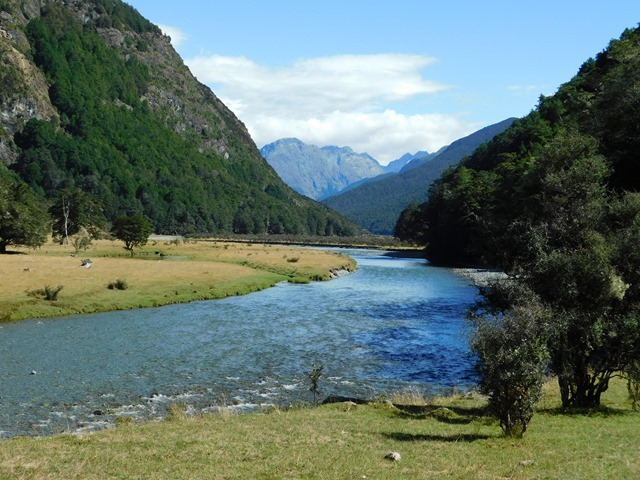
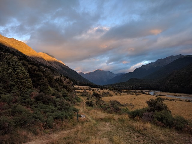
NZ is all about its longer, overnight hikes. So, we decided to take the plunge and try one. Greenstone and Caples tracks seemed like a good start, as it was a loop and only 4 days and 3 nights. Staying along the river valleys, except for one saddle crossing, it was a good choice for our first tramp with packs.

IMG_20180212_102850

IMG_20180211_204229
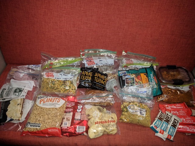
We spent the night before planning and packing our food. This was 5 days (one spare) of meals and snacks for us.

DSCN4632
Starting off.
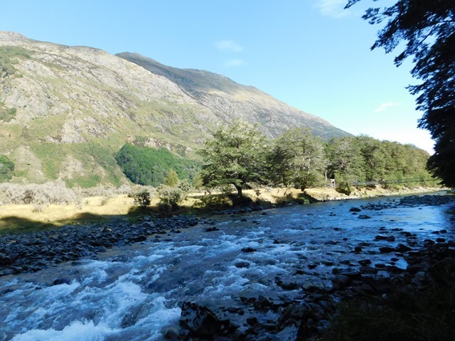
We decided to follow the suggestions in the Lonely Planet book, Hiking and Tramping in New Zealand, which had us going up the Caples first then down the Greenstone. Turns out this was a bad idea from the start. First of all, the first night had you staying at Upper Caples Hut, which is no longer a public DOC hut, but we did not discover this until we were already on our way. As we passed the intersection with the Greenstone track, some other hikers inquired about where we were staying tonight. Upon some discussion, we learned that wasn’t really an option, which meant that we would be staying at Mid Caples Hut instead. This wasn’t too big of a deal, except that it made our 2nd day a really long day (22km) coupled with the most elevation gain. On the downhill that day, we both got blisters, which made our last two days tougher than the should have been. Plus, the Caples Track is more scenic than the Greenstone Track, so I recommend doing the Greenstone then the Caples. Definitely a learning experience, reminding us that we should always preview the route and huts online before embarking on our journey. Still, despite all that, it was still a good track for us to start off on and we enjoyed it. The weather was nearly perfect, as well.

DSCN4635

DSCN4639

DSCN4646

DSCN4653

IMG_20180212_133448
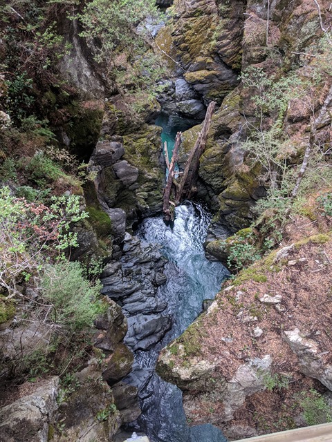
Right before the hut was a surprising little gorge.

DSCN4694

DSCN4684
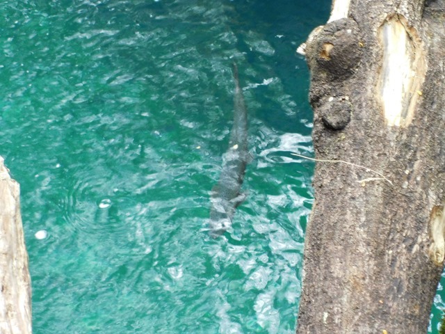
A fat trout was happily swimming in it where no fisher could reach it.
DSCN4689

DSCN4703
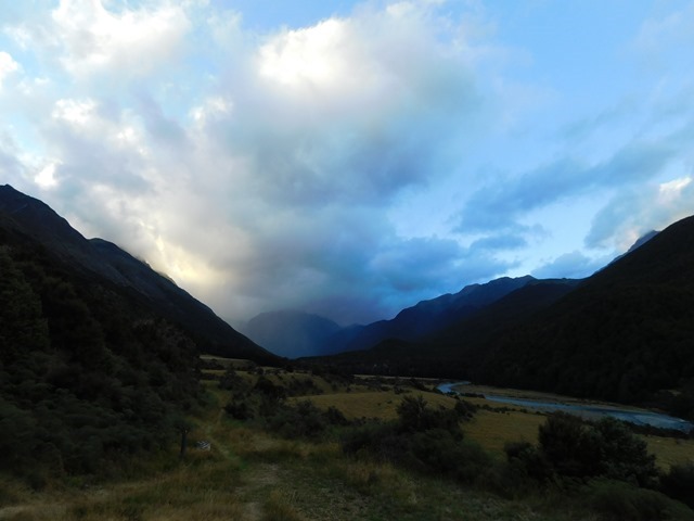
Sunset.

IMG_20180213_071553
Sunrise.


DSCN4712
We started off early the next morning and were surrounded by lots of birds. Robins, riflemen, tomtits frequented the path.

DSCN4793
A rifleman.

DSCN4739
These two tomtits were in a fight to the death and didn’t even care that we had come up on them. The one the ground was in a state of shock and left for dead. I will never look at these small guys the same again.

DSCN4745

DSCN4796
We reached the saddle.

IMG_20180213_135600
 

luthj

Engineer In Residence

DSCN4821

DSCN4827
And caught our first glimpse of Lake McKellar.

DSCN4832
We were walking through some red beeches.


DSCN4843

DSCN4844

DSCN4879
Cleaning/preening time, apparently.

DSCN4884
The next day, as we walked through Greenstone station fields, a cow decided we were a threat. For a while, it just watched us, then as we were exiting the fields, it decided to chase after us. I waited to get a picture until after I had gotten safely behind the trees where it wouldn’t follow us.

DSCN4902

DSCN4903

DSCN4907

DSCN4914

DSCN4918
Walking through recent rock slides.

DSCN4923

DSCN4924

DSCN4947

DSCN4952

DSCN4992


IMG_20180215_113135
 

Pacific Northwest yetti

Expedition Medic
It's so Beautiful! Reminds me a little of Patagonia.

Looks like a yearling Calf, those buggers are so curious I have seen them chase young bears, and anything that seems interesting to them.

Thanks for taking the time to post.
 

luthj

Engineer In Residence
Rob Roy Glacier to Jackson Bay
By Jen.

After hiking 59 kms (36.7 miles) in 4 days, we were ready for a break. So, we rested the day we got back and then spent the next day restocking on supplies. We had planned on finishing off the area by hiking around Lake Sylvan, but rain had set in. So, instead, we drove out of the rain and towards Wanaka. Our plan was to do the walk to the Rob Roy Glacier lookout.

DSCN4998
You can see the glacier, one of several, as you drive down the valley.

DSCN5003

DSCN5018

IMG_20180217_154128
Beware of falling rock.

IMG_20180217_160431

DSCN5038
It was quite a warm day. Probably 70s. It was definitely a bit bizarre to be in such warm weather staring at so much ice and snow.

DSCN5039

DSCN5065
The river here is pretty-much pure glacier water.

IMG_20180217_171327

DSCN5034

DSCN5068

DSCN5069
From here, the plan was to drive to Haast. Supposedly, the highway from Wanaka to Haast was only completed in the 1990s and is really remote. So, we weren’t expecting very many people along it. We were very wrong. Places were packed. Our only saving grace is that we tend to start early and finish early. The next morning was cloudy and rainy, which messed with some of our plans, but we were still able to visit several places.

DSCN5073
Fantail Falls was flowing strongly.

DSCN5074
These falls were essential in the development of the highway, turning a water wheel (whose platform you can still see) which powered drive compressors for the machinery.
 

luthj

Engineer In Residence


DSCN5077
We passed over the Gates of Haast, a particularly devilish section of the road to build. Sheer cliffs wide apart, raging river below.

DSCN5078
The water flow powerful enough to already begin to break apart the retaining wall under the bridge.

DSCN5080

DSCN5086
Thunder Creek Falls.

DSCN5091
There were lots of impromptu waterfalls and rivers that morning.
Upon arriving in Haast, we decided we would take the lonely road to Jackson Bay. It just so happened that we would arrive in time for lunch, so we decided to eat at The Cray Pot, a tiny, colorful restaurant in a tiny settlement at the end of the road. We arrived before they opened, so we took a walk to Ocean Beach. Worked up a good appetite for the delicious fish and chips as the restaurant.

DSCN5094

DSCN5102
Stranded jellyfish.

DSCN5104
Teeny fish in a creek.

DSCN5106
The orange building is the restaurant. In the beating that former cyclone Fehi issued upon the land, the beach lost a couple of meters of shoreline, bringing the ocean that much closer to the cafe.

We finished off the day by visiting Lake Ellery and Hapuka Estuary Walkway.

DSCN5108

DSCN5115

DSCN5120
Lake Ellery, whose peacefulness was only broken by the sandflies and the jet boats.

DSCN5145
 

luthj

Engineer In Residence
West Coast, First Pass

The West Coast of NZ is sparsely populated and remote, no more so than the area around Fox and Franz Joseph glaciers. Due to the recent damage caused the recent ex-cyclone, the Fox Glacier access road was blocked.

Here is the coastal highway. Large sections were badly eroded by the storm surge.
DSCN5155

Notice the piles of debris on the side of the road? These logs and limbs were washed down rivers, mostly from logging operations. The storm washed them over the road, causing numerous blockages.
DSCN5147

There was no way to access the Fox Glacier directly, so we drove out a ways for a viewpoint nearer to the coast.
DSCN5158

DSCN5166

That is some serious ice.
DSCN5157

Another ex-cyclone was expected to make landfall late that evening. We should have expected some closures. We decided to visit a nearby lake which boasts a great reflection of the glacier and alps when conditions are calm. Of course, it was closed. Incredibly frustrating was that they did not post the closure at the track head, but put it a few hundred meters down the track! Obviously they didn’t want to interfere with the café at the track head's business, so we wasted time parking and walking…

DSCN5171

We decided to drive on to Franz Joseph, as our options at Fox were limited. Of course, the Franz Josef access road was closed due to the approaching ex-cyclone, so we gave up and went to camp at a park at the Franz Josef village. There is a private wildlife center here. The main draw is that they breed brown kiwi (rowi) here, and have a nocturnal enclosure where you can see and hear young kiwi. We gave it a visit as they had closed the road north due to tree fall and landslide risks. Sadly, there was no way to get a good photo of the kiwi in near complete darkness. But they are a curious animal. They have nostrils at the tip of their touch-sensitive beak, with the 2nd best sense of smell among all birds. Their feathers are closer to fur, and they have whisker feathers on their heads. They can hunt for their food in complete darkness, which includes various invertebrates, insects, etc. Kiwis have been found in the wild who are nearly completely blind, but have no problem thriving. They have essentially no wings, and lay an enormous egg, which is up to 25% of their body weight!
They also had a few tuatara living there, and we got a few good photos.
DSCN5177

DSCN5176

The following day we continued north to Greymouth.
 

luthj

Engineer In Residence
Croesus Track
In the mountains north of Greymouth (west of Blackball) is the Croesus (pronounced Cree-sus) track. Originally built as a pack track to access various gold mining operations, it will soon be declared a Great Walk. After hearing good things about it, we decided to get a visit in before the rest of the world discovered it!

The western half of the track was closed halfway due to a recent landslide, so we decided to do a 2-3-day round trip from the Smoke-Ho parking lot in the mountains above Blackball.
DSCN5193

From Blackball to Smoke-Ho the road is a single winding gravel road. Originally park of the Croesus pack track it was widened in the 1940s for coal prospecting. No substantial coal was found, but plenty of low quality coal seams can be seen at the start of the track.
DSCN5191

DSCN5196

Well over a hundred years old, most of this excellently-benched track still survives. This is despite the meters of rain which fall every year.
DSCN5199

Having long since washed and rotted away, the original bridges and fords have been replaced with cable suspension bridges.
DSCN5202

DSCN5203

Views back into the towering central ranges appear on occasion.
DSCN5194

DSCN5220

We stopped for lunch at one of several long-abandoned hotel sites.
DSCN5228

Mostly worked out by the early 20th century, the mine works were reopened during the great depression under a government work scheme. One of the depression era huts still stands, as well as the derelict Garden Gully battery.
DSCN5237

DSCN5239

DSCN5252

DSCN5261

IMG_20180222_133801

DSCN5264

DSCN5253

DSCN5254

DSCN5255

Powered by high-pressure water from the mountains via this pelton water wheel, this beast received ore from the mountaintop via an aerial cableway.
DSCN5257
 

luthj

Engineer In Residence
DSCN5259

The side track to Garden Gully involved lots of water crossings. Thankfully most were not very deep.
DSCN5284

DSCN5272

DSCN5288

DSCN5384

As we continued upward, the track began switchbacking up the mountainside. The level of effort and skill that went into carving this track into the steep hill is amazing. Dry rock walls made of hundred-pound-plus stones still stand, stream crossings made from interlocking key stones stacked 6+ feet deep. Box drains and pits to duct water under the track, and drainage channels run along the track. All of this done by hand with basic hand tools. Not a single cut stone or ounce of motor to be found. Most of it still usable despite nearly a century of neglect.

DSCN5400

DSCN5401

Can you see the parallel interlocking stones? Even decades of water and torrential floods have failed to dislodge them.
DSCN5395

Eventually we cleared the treeline and arrived at Ces Clarke hut. Built in the days before the Department of Conservation, this hut is unique in construction and location.

DSCN5299

Ces Clark hut on the left, the hut in the bottom right is a gold miner's stopover hut from the early 1900s.

DSCN5293

Check out that view.
DSCN5298
 

luthj

Engineer In Residence
DSCN5294
IMG_20180223_071956
IMG_20180223_064827
The view from the toilet was pretty good too.
DSCN5296
A cheeky weka managed to get briefly stuck under the hut before figuring out it could just walk out the way it came…
DSCN5300
The next day we hiked up to Croesus Knob. Along the way we found the remains of the aerial cableway towers, crumpled after a century in the elements. Down the hill, the remains of the Croesus mine were visible.
IMG_20180223_095112
IMG_20180223_100914
IMG_20180223_112420
With persistent low clouds blocking our views, we decided to risk a walk along the Croesus track to the Moonlight Route junction, and then along the Moonlight Tops route for a while.
DSCN5328
DSCN5331
See the track climbing up the other side of this dip (left side)? Parts of the track were being remade by a track crew with a digging machine. The existing tramping track didn’t meet the Great Walks standard, I guess.
DSCN5332
DSCN5339
This is the shell of a carnivorous land snail. They roam about at night eating insects and worms, as well as any carrion.
DSCN5342
DSCN5376
After stopping for lunch, we decided to turn back, as the weather showed no sign of clearing. We heard a loud kee-aha, kee-aha in the distance, and were unsure of its source. A few minutes later a pair of Kea flew overhead, with one landing nearby for a short while.
DSCN5360
The only species of alpine parrot, the kea were hunted nearly to extinction. Believed to kill sheep, the government put a bounty on them until the 1960s. It wasn’t until 1986 that public pressure forced farmers to relinquish their right to shoot kea on their property. Today, only about 5,000 pairs are believed to exist in the wild. They are a very intelligent bird, having to survive and find food in the unforgiving alpine ranges. They are known for eating the eggs and chicks of other birds when available, and for even eating carrion, and cutting into sheep carcasses for their fat (check out that beak). Despite this omnivorous nature, they disperse over half of the alpine plant species seeds.
DSCN5364
No photos of them in flight this time, but the underside of their wings is a burnt orange and gold.
We returned to Ces Clark hut for our packs, and started back down to the van. Of course, despite the weather forecast, the sky cleared up halfway down!
 

luthj

Engineer In Residence
Ghostly Adventures
By Jen.

Since about Thanksgiving, we have been working hard to catch up on posts so that instead of being 6-8 weeks off, we would only be about 1-2 weeks off. We have finally reached that point. So, look forward to NOT being inundated with back-to-back long posts!

DSCN5407
We passed the remains of an old bathhouse leaving the Croesus Track. I was entertained by the picture.
After the Croesus Track, I was ready for a break. So we stayed in Greymouth for a day and worked on taxes. Then we had a decision to make: should we go to Nelson via the West Coast/Kahurangi NP or via Molesworth Station. Checking the weather, we decided on the latter. And, in typical fashion, we decided to make some scenic stops on the way. The first of which was Waiuta, a mining ghost town south of Reefton in Victoria Forest Park.

DSCN5435
Not much left of the town; most of it was disassembled and transported to another location when the mine closed following the collapse of the Blackwater Shaft.

DSCN5424
This town was the site of the Blackwater Mines with 2 shafts, including the deepest shaft in NZ at 879.5m (2885 ft).

DSCN5426
Prohibition Shaft and Mill were located on top of a hill overlooking the valley and town.

DSCN5418

DSCN5453

DSCN5461
One of the houses remained in place for visitors to see.

DSCN5467
I loved the stove!
 

luthj

Engineer In Residence
After that the foray into the ghost town, we hit the road again, heading towards Molesworth. Shortly after getting back on pavement, the van started vibrating/making noise. I told Jonathan that something was wrong with the van and he needed to pull over. He hadn’t noticed anything, but he trusted me and did so immediately. As I went to make sure there was nothing loose in the cabin to make the noise, Jonathan did a survey of the outside. Sure enough, my guess of the back right tire was confirmed!

IMG_20180225_122914
The tire delaminated and went out of round, but still held air.

IMG_20180225_123017

IMG_20180225_123027
But, Jonathan was able to change out the tire even quicker than I was able to whip out an email, and we were back on the road again. However, since Molesworth is known as a rough track and a remote destination, we did not want to go there without a spare. Instead, we revised our plans to head directly to Nelson, where we could get our tires replaced (it was definitely time). It was a good thing we did, as about 70 km out from Nelson, I noticed that familiar vibration again and told Jonathan we had a problem, probably the back left this time. Upon pulling over, we discovered the same thing had happened to the other side, less than 200 km later that day!

IMG_20180225_160853
We now had an issue, though; we didn’t have a spare. I checked my phone, which verified what I already knew: no reception. I checked the map and discovered we were but a kilometer or two from a small settlement, so Jonathan limped the vehicle there. We saw a house with laundry hanging, so we thought we would give them a try. As we approached the homestead and called, an intimidating dog of rotweiler/mastif mix came barking and growling at us. We stopped and the dog simply snuffled at us and then looked liked it wanted petted. Rather than risk the ire of the dog, we decided to call out to the owner instead. Fortunately, the owner was out pulling in the laundry and heard us. We asked if we could use her landline, and she didn’t even ask us any question (must happen a lot) before letting us in to do so. We called our contacts in Nelson and explained the situation, and after some debate decided the best option was to try and get one of our roadside-assistance programs to help us out. We decided to try AA first, as AAA would be the go-to answer in the States, and we had a reciprocal agreement with them. After forever on the phone, they said they would call us back and let us know if they could find anyone that was capable of towing us into Nelson, as we had a large (over 3500kg) vehicle. We waited nearly an hour for the call back and learned more about our host and the settlement. Glenhope was built up as a major rail station for the west coast railway that was a stimulus project during the Depression. Sadly, when the Depression ended, they stopped worked on the railway as well. We could see the station building across the field behind her house. Her house itself was the old first-aid building, and she was in the process of renovating it. She said she had found some entertaining medicines under the floors.

DSCN5474
The old railway station.

IMG_20180225_190323
After an hour, we finally received a call back from AA. They had found someone and the cost would $974, and AA would cover $100 of that. I said “Thanks, but no thanks; we will figure something else out.” Earlier, our host had said we could catch a ride with her into work the next morning, so we took her up on that. She had to be there super early, so we we were up by 5am to be ready with the spare by 530am for the ride in. She kindly dropped us off at our friends’ place in Nelson, and they graciously drove us to the tyre place when they opened. Our friends even supplied an old tyre to put on our rim so that we could drive the van to Nelson, while the new tyres were being ordered. Then drove us back to the van so we could execute that plan. I must say that the people in New Zealand have been extremely friendly and helpful. Every time we go into someone’s house here, even when we are imposing on them unexpectedly, they offer us the use of the toilet, shower, and washing machine; always much appreciated when living in a van.

DSCN5473
Putting on the loaner spare.
While we waited, Jonathan did some maintenance on the van, fixing a vacuum leak, a transmission leak, and a fuel leak. The next morning, our tyres had arrived, and we could safely drive the van again!

IMG_20180227_152010
A chocolate kiwi on sale for Easter!
 

luthj

Engineer In Residence
Buller Gorge and More West Coast
On our way south from Nelson, we stopped at Buller Gorge, where a pay-to-cross swing bridge lets you access some old gold mine workings, and the part of the White Creek fault.
DSCN5480

In 1929 a 7.8 magnitude earthquake struck this region. In addition to hundreds of deaths across the island, this faultline was lifted 4.5 meters in less than a minute. On the left you can see the sheer rock face, which formed from flat ground.
DSCN5488

This 5-meter cliff along the white creek formed during the earthquake as well.

DSCN5482

As the scene of various gold mining operations throughout the first half of the 20th century, there are plenty of old alluvial mineorks scattered about.
DSCN5490

This 5ft tall water wheel once drove mining equipment using high-pressure water, piped from the mountain streams.
DSCN5479

DSCN5495

IMG_20180228_135716

While walking through some of the older forest section we spotted a Tui.

DSCN5505

DSCN5504

DSCN5510

Continuing up the west coast, we wandered down the Cape Foulwind walkway.
DSCN5561

The rocky shores are a favored resting area for a seal colony. This time of the year the females are fattening up their pups, which are only a few months old.
DSCN5542

DSCN5544

DSCN5545

DSCN5555
 

luthj

Engineer In Residence
Oparara Basin

Located at the northern end of the west-coast road, the Oparara Basin is situated on the edge of a modest logging operation. One that thankfully ended by the mid 1960s. The basin is crisscrossed with limestone rock which has eroded to form various caves, arches, and other formations. This erosion is accelerated by the very high rainfall, which leaches tannic acid from the decomposing leaf litter, staining the rivers a dark brown.

IMG_20180302_092131

DSCN5598

The first stop was an enormous limestone arch. One of the largest in this part of the world, it is 200 meters long, and over 36 meters tall.

DSCN5623

DSCN5616

DSCN5619

At the outflow, another smaller arch has formed. Long ago the river was flowing above this hole, and swirling waters cut through splitting the still underground arch in two.

DSCN5599

DSCN5601

DSCN5607

DSCN5613

DSCN5617

DSCN5618

DSCN5624
 

Forum statistics

Threads
185,903
Messages
2,879,385
Members
225,497
Latest member
WonaWarrior
Top