BorregoWrangler
Rendezvous Conspiracy
Jacumba Mountains Run
(Elliot Mine/Smuggler's Cave/Mountain Springs Stagecoach Trail)
(Elliot Mine/Smuggler's Cave/Mountain Springs Stagecoach Trail)
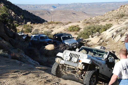
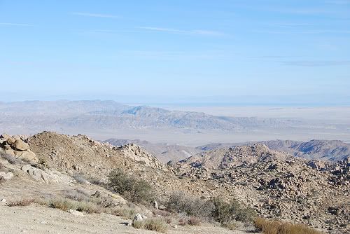
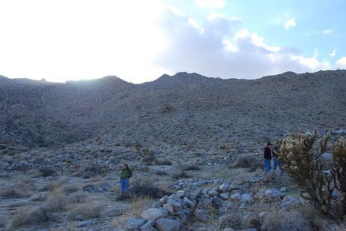
I got an invite Tuesday to wheel a few trails around Jacumba with a some friends. This is a very special place with lots of history. After meeting up at the gas stations just off Interstate 8 in Jacumba we cruised along Hwy 80 and then south down a dirt road towards the border fence. Once we had aired down, it was on up the narrow, rocky shelf road to several peaks that gave outstandings views of the surrounding areas. We had clear views out to Superstition Mountain, Salton Sea, Imperial Sand Dunes and Chocolate mountains.
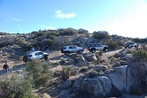
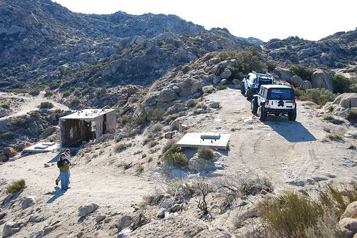
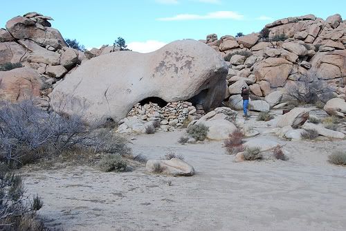
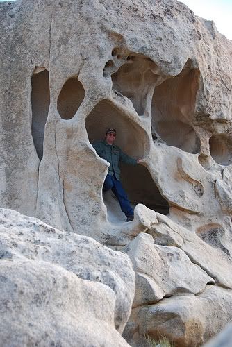
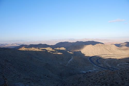
Soon we had made it up Elliot Mine to take in the views of Valley Of The Moon and explore a few of the mines. Afterwards, we parked down the trail a ways and made the short walk to the Smuggler's Cave. There a quite a few interesting rock formations there that make for fun exploring. It was getting later in the afternoon so we wanted to get down the trail and across the freeway so we could run the Mountain Springs Stagecoach Trail. We made it past the Border Patrol who eyed us suspiciously, under the freeway, past Table Mountain to the trailhead.
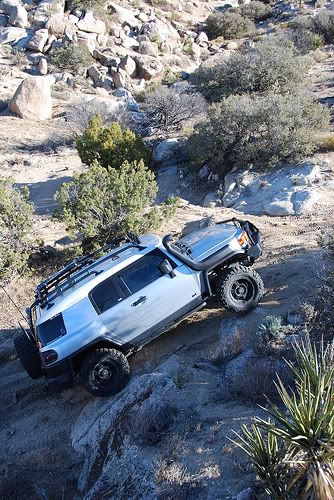
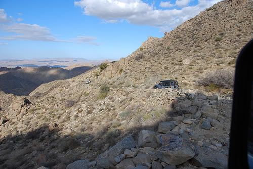
This trail has some very tight, rocky, and off-camber sections that must be carefully negotiated. Once you make your way to the bottom of the grade you'll see some stone riuns. This was long a haven to Indians, pioneers, muleteers and stage coach passengers. Colonel Kearney bivouacked here during the Mexican American War. The ruins here aren't of the original stage coach station, but a later lay-over station for freight wagons. When they cut Interstate 8 through this area in the early 1960's, Mountain Spring actually got more isolated, even as it became an easy sight from west-bound traffic from the four thousand feet from the desert floor.
--------------------
SAN DIEGO HISTORICAL SOCIETY:
In 1863 Pete Larkins and Joe Stancliff built a small house at Mountain Springs, selling meager supplies to travelers passing that way, and with their team of oxen they assisted travelers up the steep, thirty per cent mountain grade.
In 1870 the San Diego -- Ft. Yuma Turnpike Company purchased Larkins' holdings and petitioned the San Diego Board of Supervisors to allow them to establish a Toll Road and station at this location. The permit was granted, and the company operated a toll station in the old Larkins House for about six years, with Mr. Bowers as Station Agent. All that remains at present, to mark the location of the original station site, is a lone Washingtonia Palm tree and the remains of a portion of the old stone foundation.
In 1878 the Board of Supervisors relocated a portion of the road above the station, and eliminated the toll road. This change of alignment brought the road into the Mountain Springs area about one-half mile north of the old stage station. At this point another spring was developed in a near-by canyon. It was at this location, in about 1860, that sheep men built some stone corrals and a small stone house. In the corrals lambing ewes were kept at night, to protect them and their young lambs from the coyotes.
In 1900 Supervisor James Jasper constructed a new grade into the area. This new road came around the mountain from the north and terminated near the stone corrals. Jasper cleaned out the springs in the canyon, and piped the water a short distance to a large water trough at the feet of the grade; this was convenient for the sheep men, as the overflow ran into the nearby corrals.
In 1909, a new Mountain Springs Grade was constructed with monies provided by a San Diego County bond issue, to accommodate the increasing demand of the automobile. This grade entered the amphitheatre from the south and the old water trough was moved to a new location about a thousand feet to the south east from its position at the stone corrals, so that cool water could be had for the boiling radiators. A short time thereafter a small cafe and garage operated at this location, but closed when the California Division of Highways again relocated the highway a few hundred feet farther north. This is the highway that is in use as of 1955.
NOTE: Prior to 1907, San Diego County extended easterly to the Colorado river. In that year, Imperial County was formed, the division line between the two counties passing through the Mountain Springs area; in fact, the present highway down the grade crosses and re-crosses the County line several times.
-------------------------
One of these days I hope that the El Centro BLM office allows vehicles to once again travel through Devil's Canyon, which is a historic part of this route.