You are using an out of date browser. It may not display this or other websites correctly.
You should upgrade or use an alternative browser.
You should upgrade or use an alternative browser.
Nevada Strip AKA Gold Butte National Monument
- Thread starter Explorer 1
- Start date
Pacific Northwest yetti
Expedition Medic
Thanks, looking forward to more! Happy Trails & Safe Travels
Explorer 1
Explorer 1
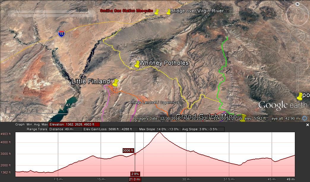
Before I get too far ahead, here is the map and elevations of day 1:
Day 2, Part one almost ready.
Thanks,
Fred
Explorer 1
Day 2, Part one almost ready.
Thanks,
Fred
Explorer 1
Explorer 1
Explorer 1
Day 2 – Pushing toward the unknown
Rising before the sun is something I relish while exploring. Making a fire, heating water for coffee and enjoying the quiet coolness of a new day, it just doesn’t get much better.
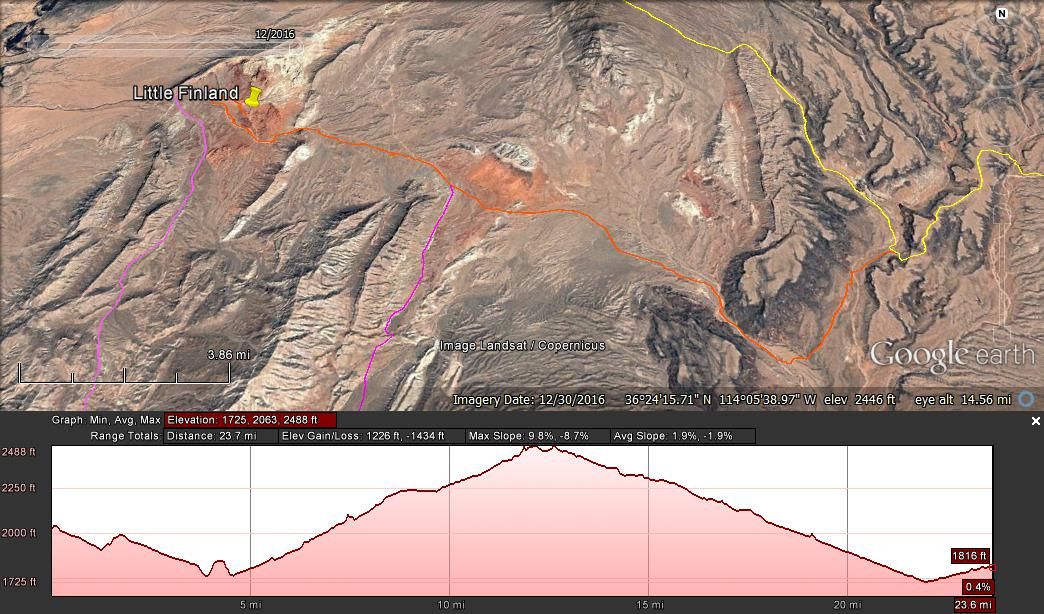
Mike has traveled with me on several occasions and knows I like to get an early start. So camp was broke, vehicles loaded and we were on our way before 8 am. We exited the Little Finland valley and instead of turning left and making our way back to the Gold Butte Rd the way we came, we took the less traveled route which would eventually end at the Gold Butte Townsite.
The main Gold Butte road is a well-traveled graded super highway compared to most the other roads in the Nevada Strip. We’ll travel this section on our way out days later when we head over to the Arizona Strip. But for now it’s the two-track, occasionally rough road.
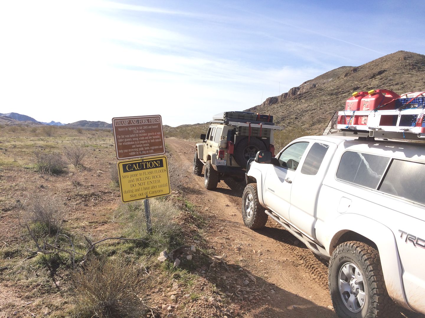
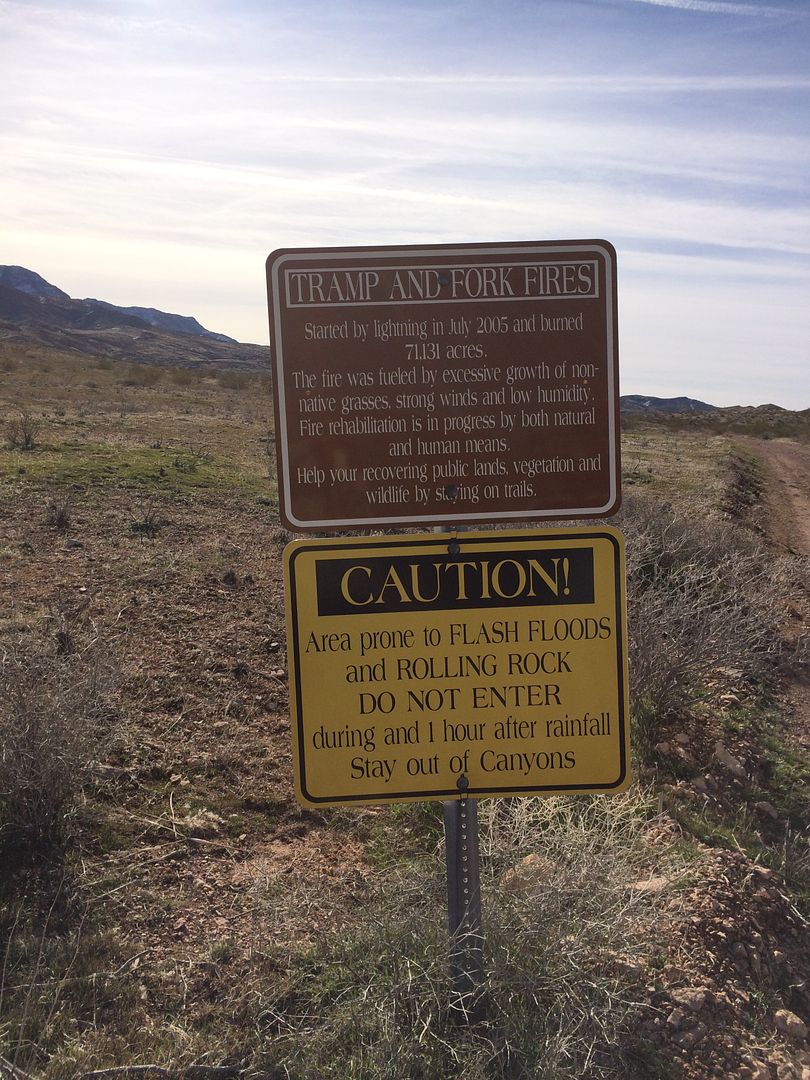
This route takes you through the middle of the 2005 Tramp and Forks fire that burned over 71,000 acres. From the looks of the amount of vegetation outside the burn zone it had to be a fire that was spread by very high winds. There just isn’t that much vegetation to keep a fire going otherwise.
It’s also the land of the giant slugs which show themselves all over the hillsides.

Gold butte town site has little to show for itself. One could easily drive by it with notice. It does lay at a major intersection of several roads. It also is the ending of the graded dirt section of the Gold Butte Rd and the beginning of the less maintained and less traveled road choices.
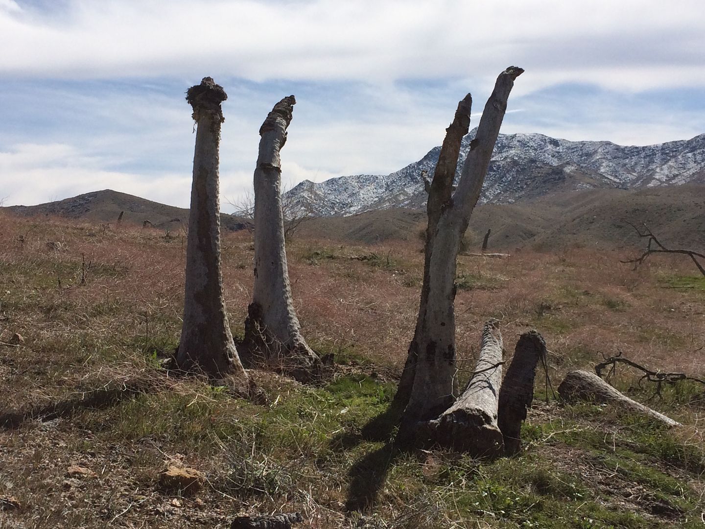
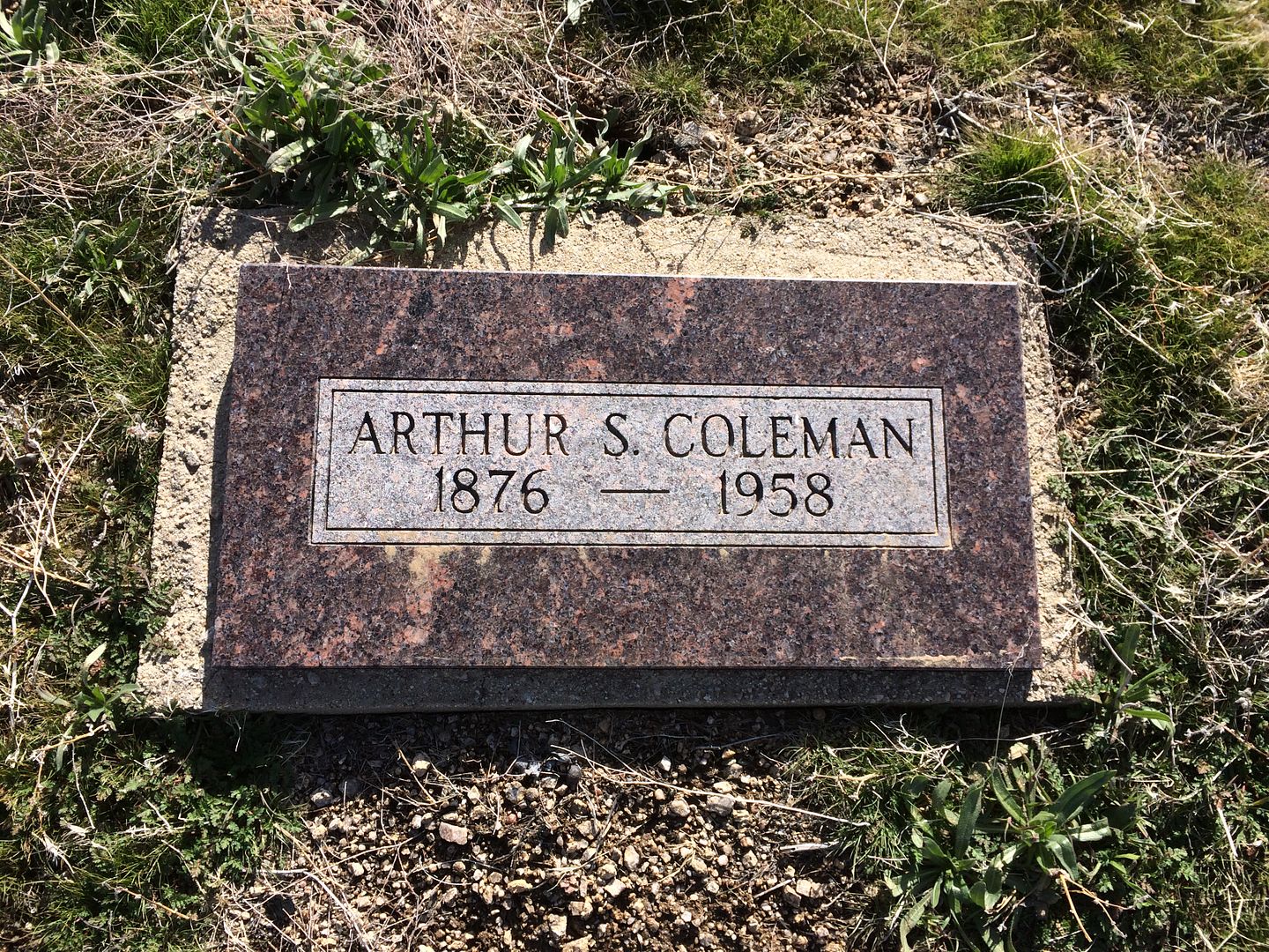
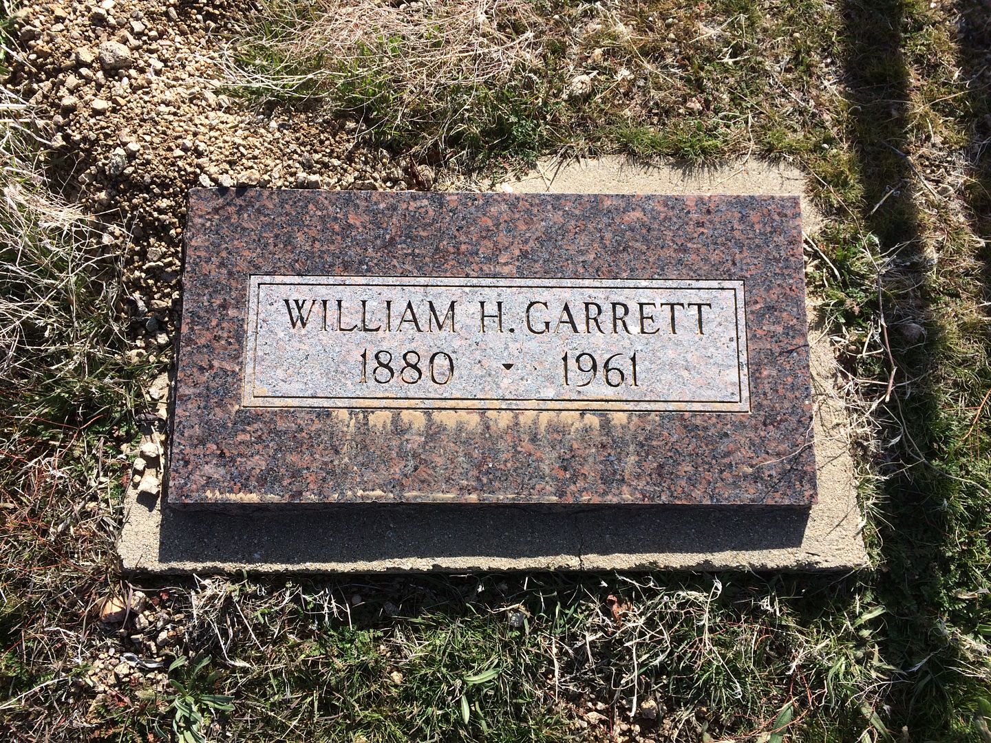
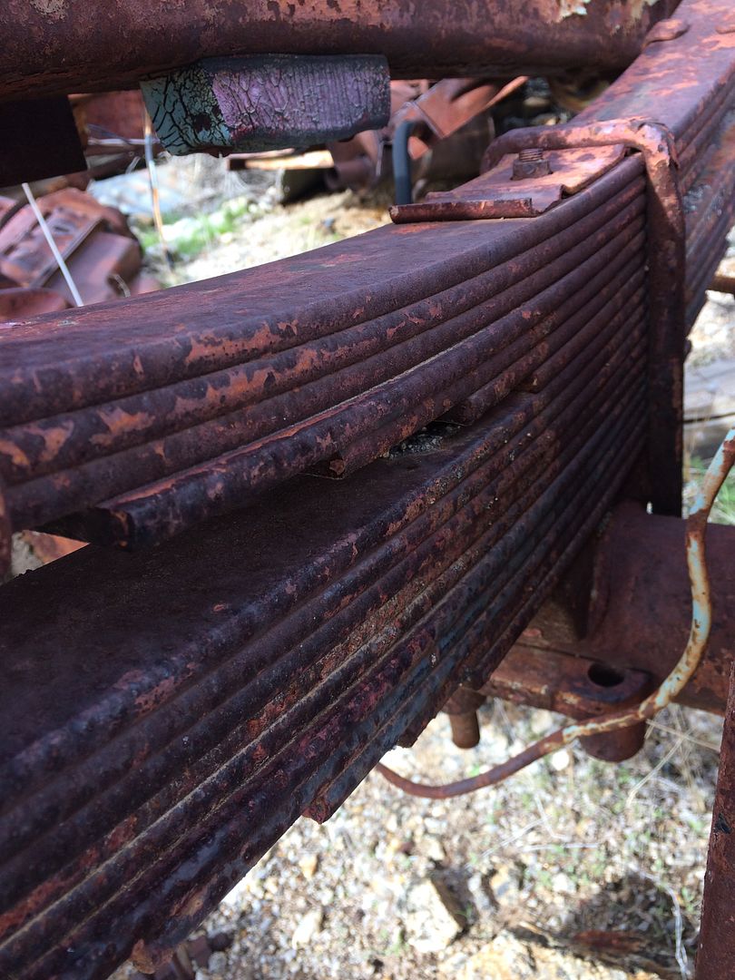
The site does have a few pieced of machinery and two more recent and permanent residents. Not sure who these folks were and why the earthly remains were parked here but maybe someone can enlighten me.
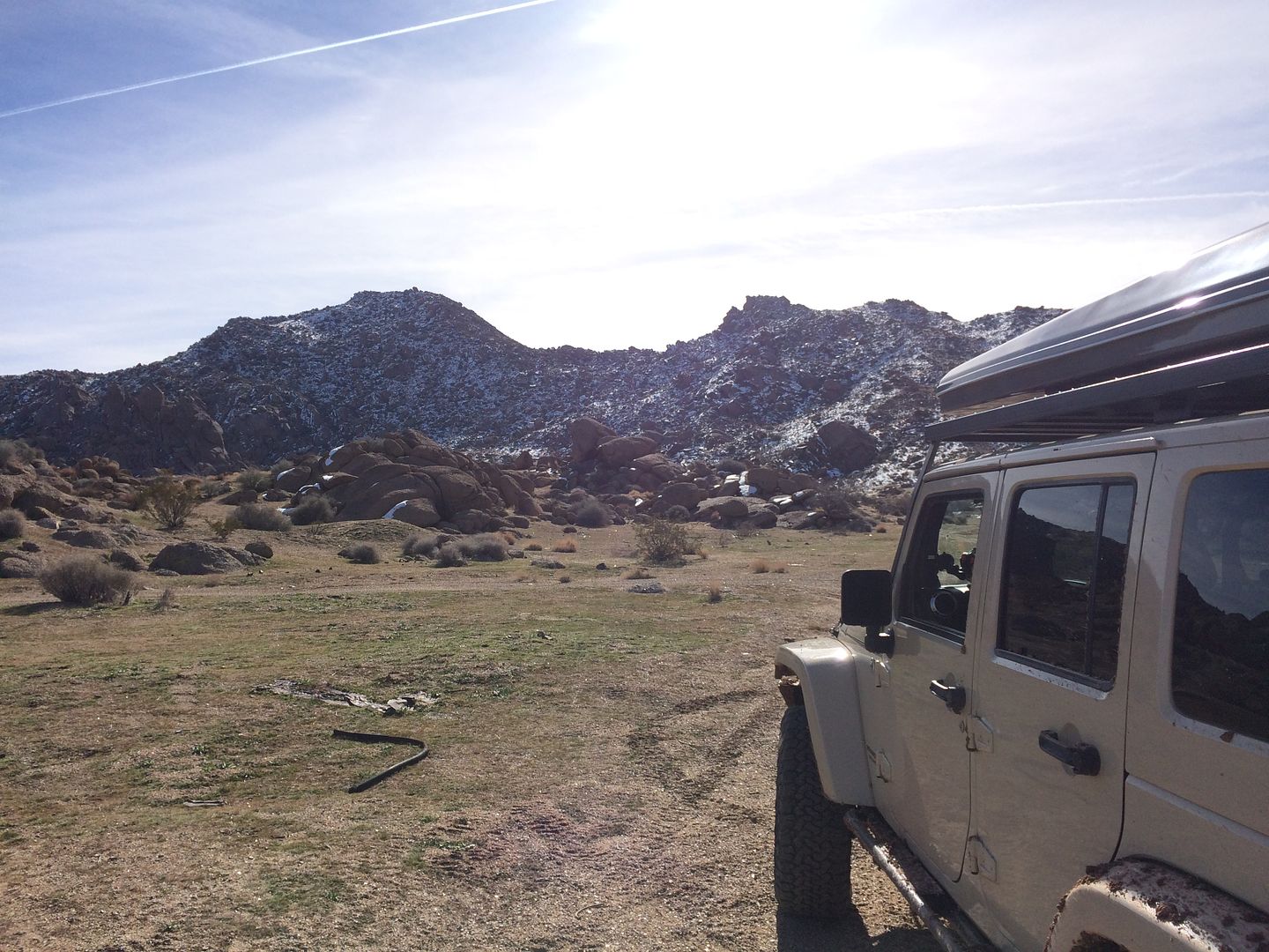
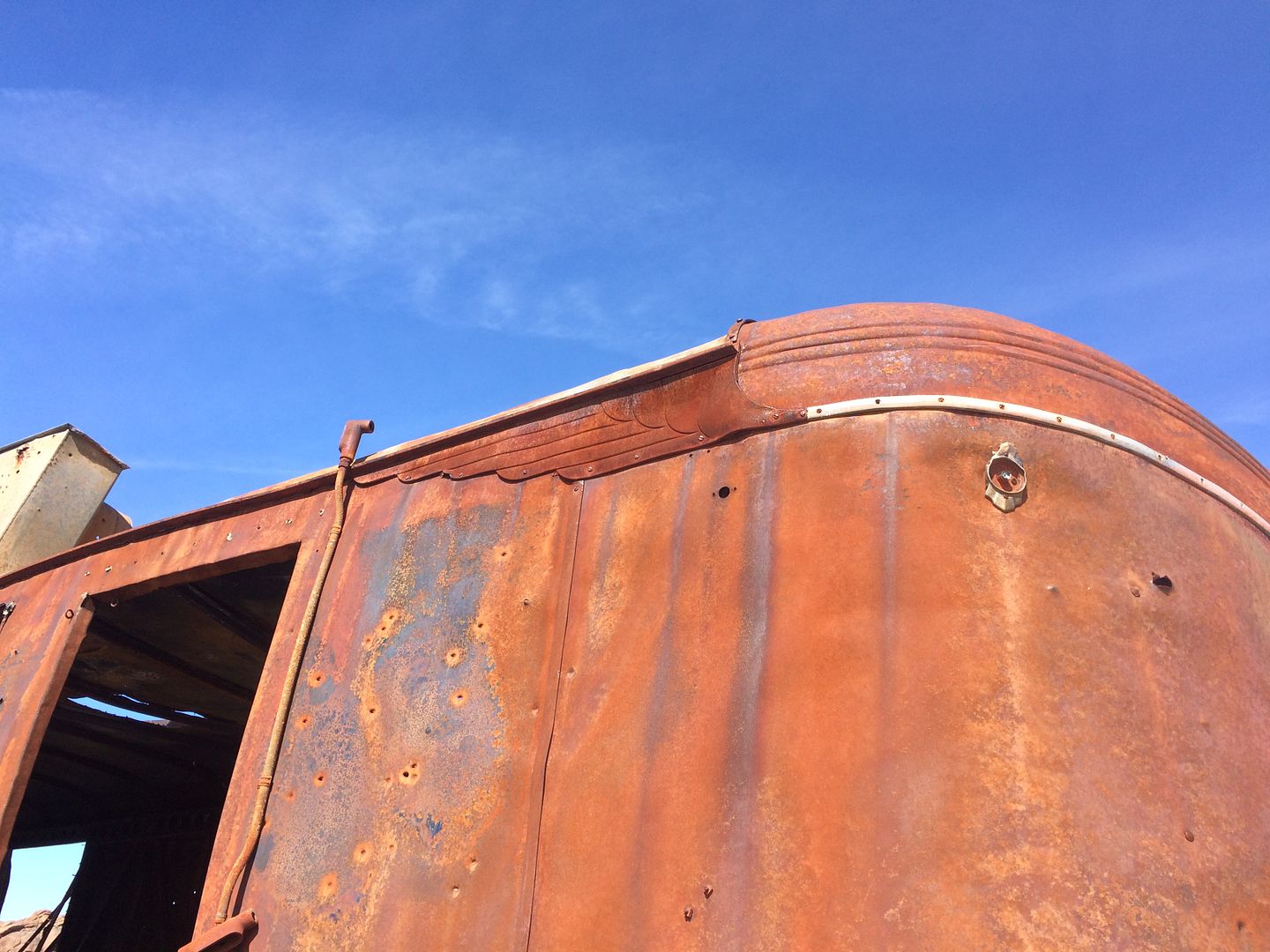
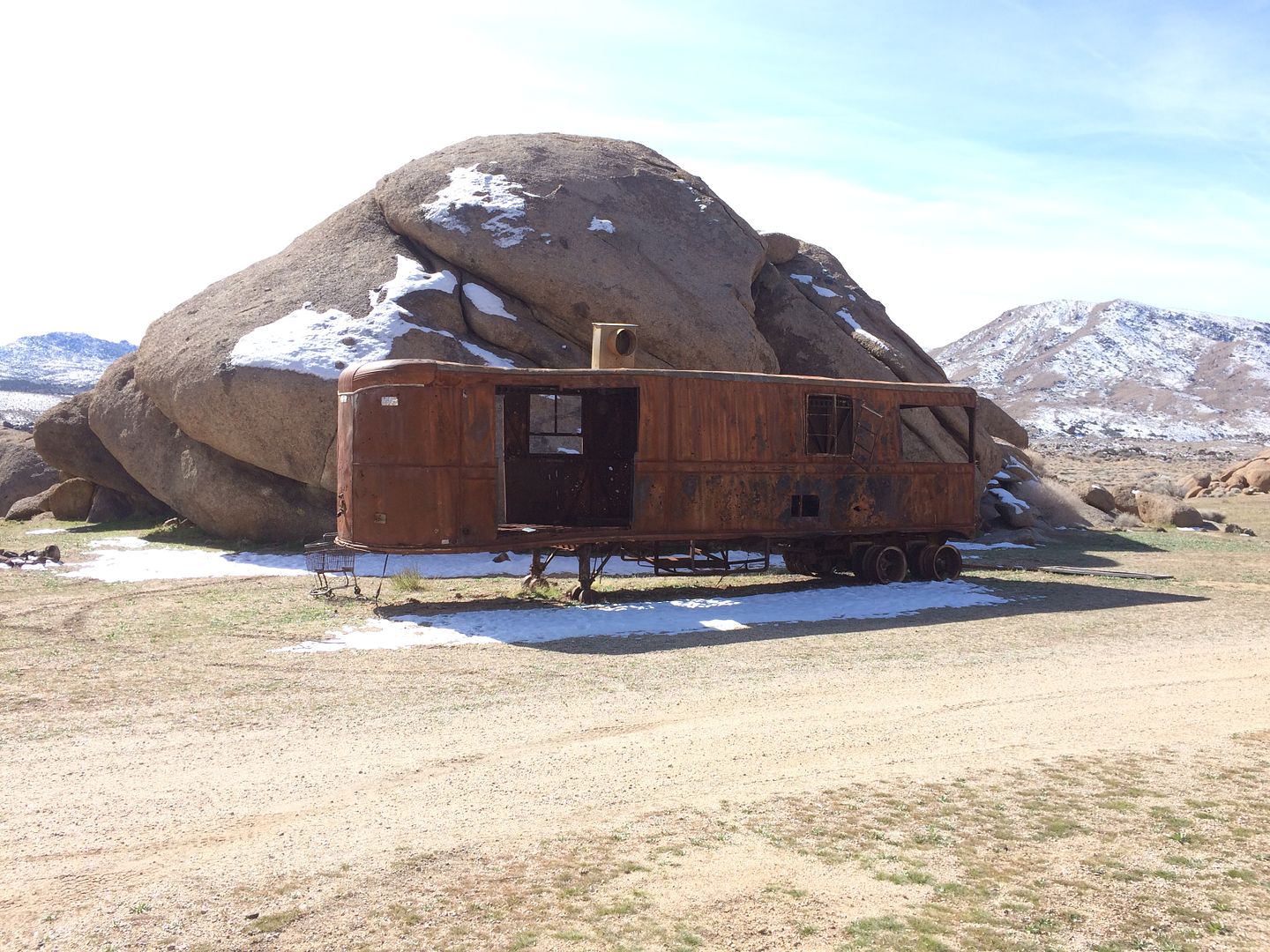
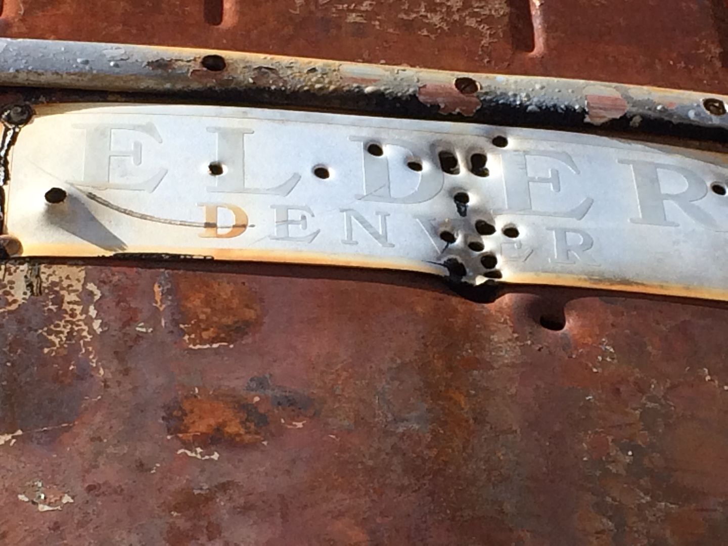
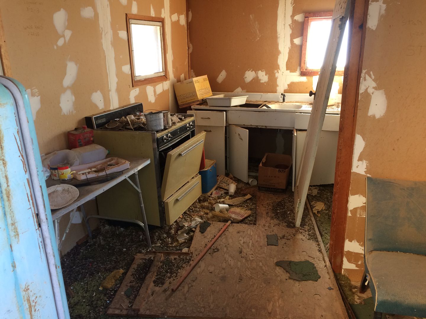
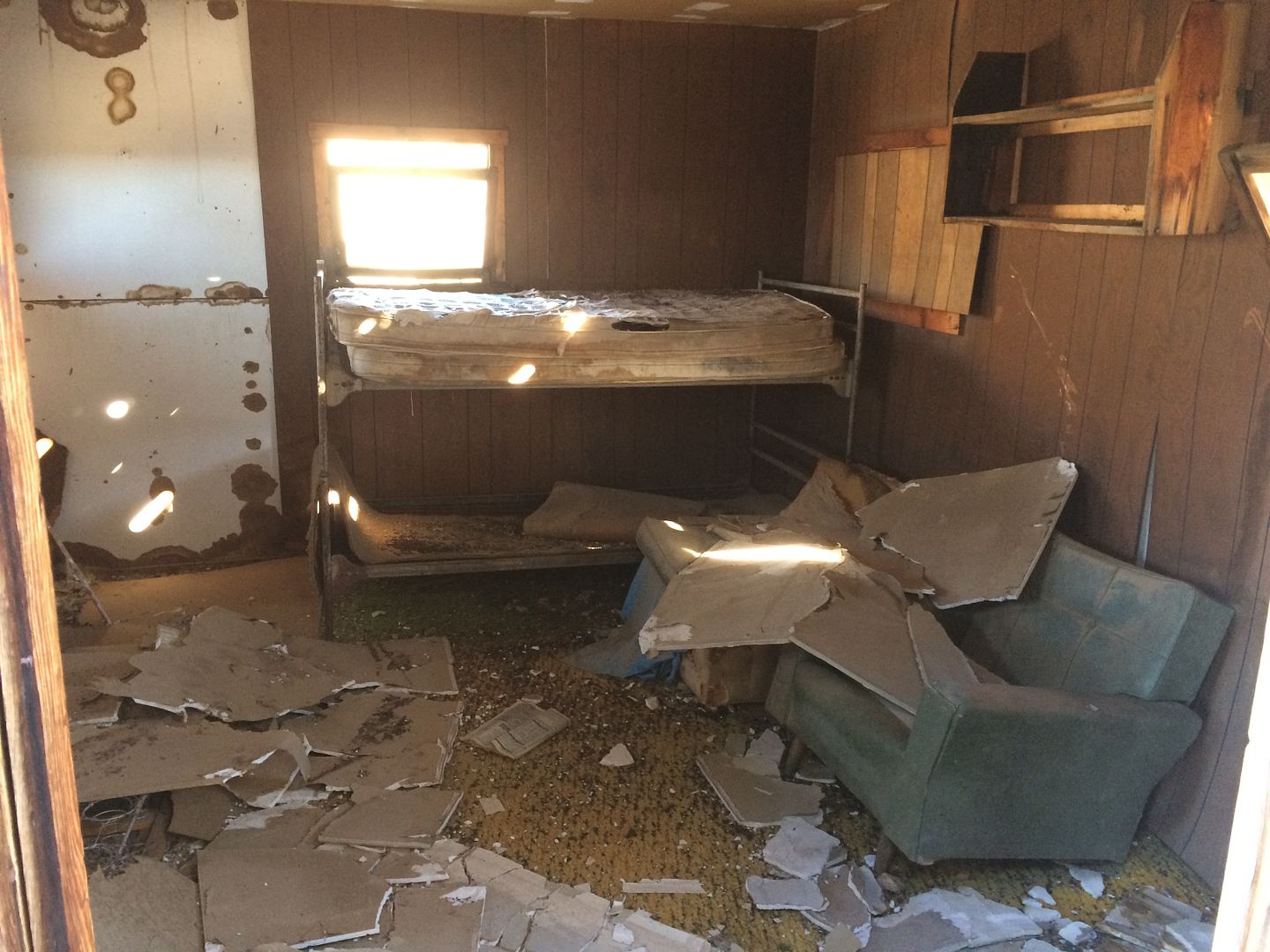
The mountain peak behind the town site is the name sake of the monument, Gold Butte itself. Our plans were to turn south and head toward Catsclaw wash and Lakeside bay, but I had included plenty of time for side rad exploring so we headed west around Gold Butte mountain on it southern side. After a few miles we came across an odd, which from a distance looked like a weather worn structure but upon closer view we found that is was an old moving van type trailer. At one time it house equipment and even had electrical hookups. I was intrigued by the decorative art deco fins on the top front of the trailer.
So many roads out here to explore but now was the time to work our way back and head south as we planned.
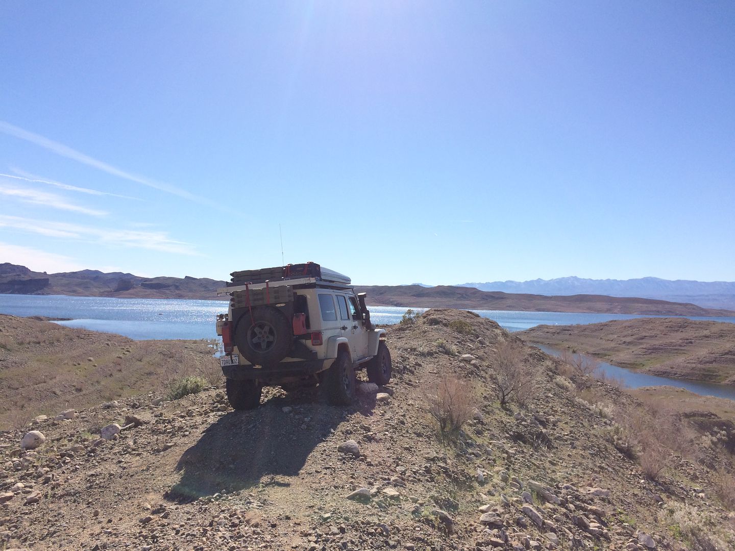
On a prior trip, I traveled out in my Sportsmobile to Catsclaw wash. The road goes right out to several possible campsites on the Virgin River arm of Lake Mead. There are places to fish, swim and canoe/Kayak.
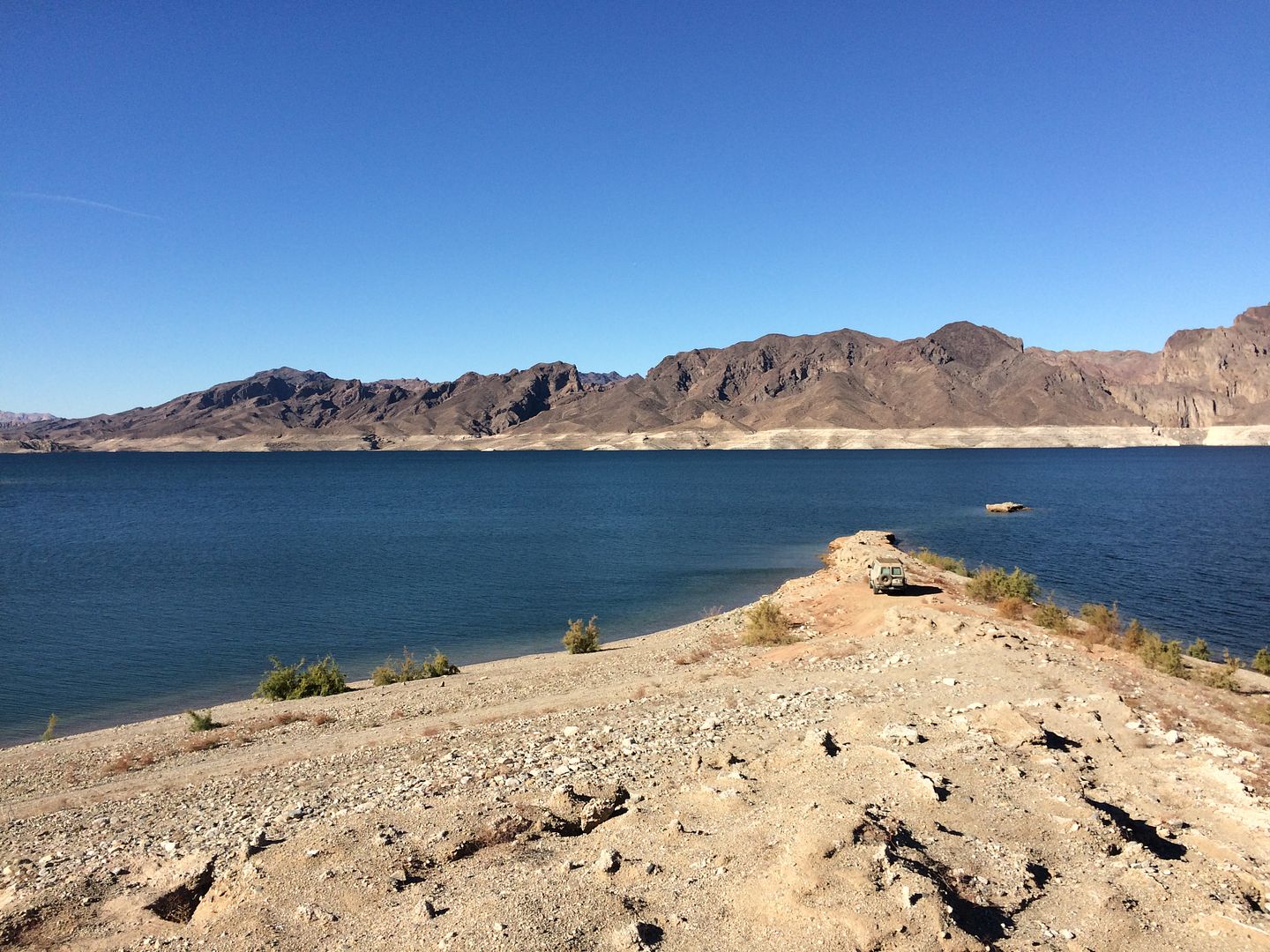
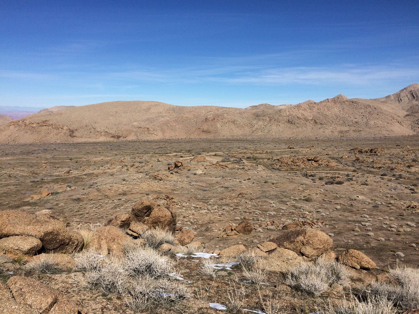
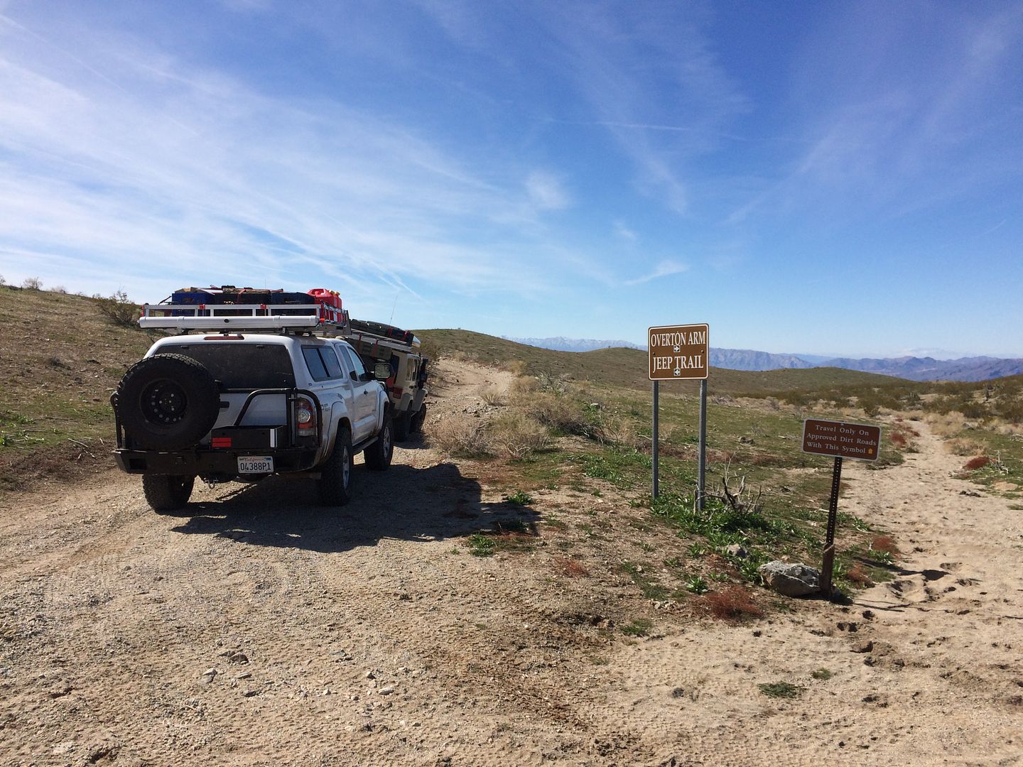
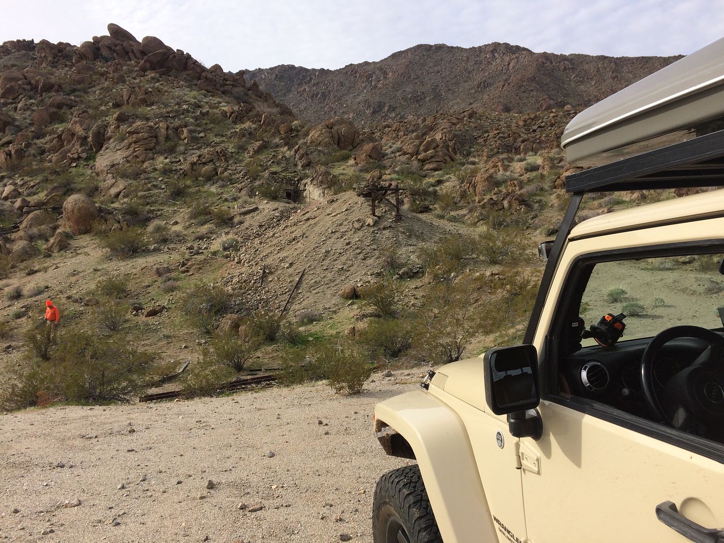
On this trip I will take the left hand road following the Overton Arm Jeep trail, which should end at Lakeside bay. Sounds’ inviting, but unfortunately, at road end it was rather disappointing. There is no level ground for camping and the waters of Lake Mead are a good 150 yards away down a steep hill. There is however one redeeming item of this trail and that would be the Lakeside mine. At the time of our visit the trail leading to the mine was marked by a newer sign about a mile from road end before the barbwire fence running next to the road began.
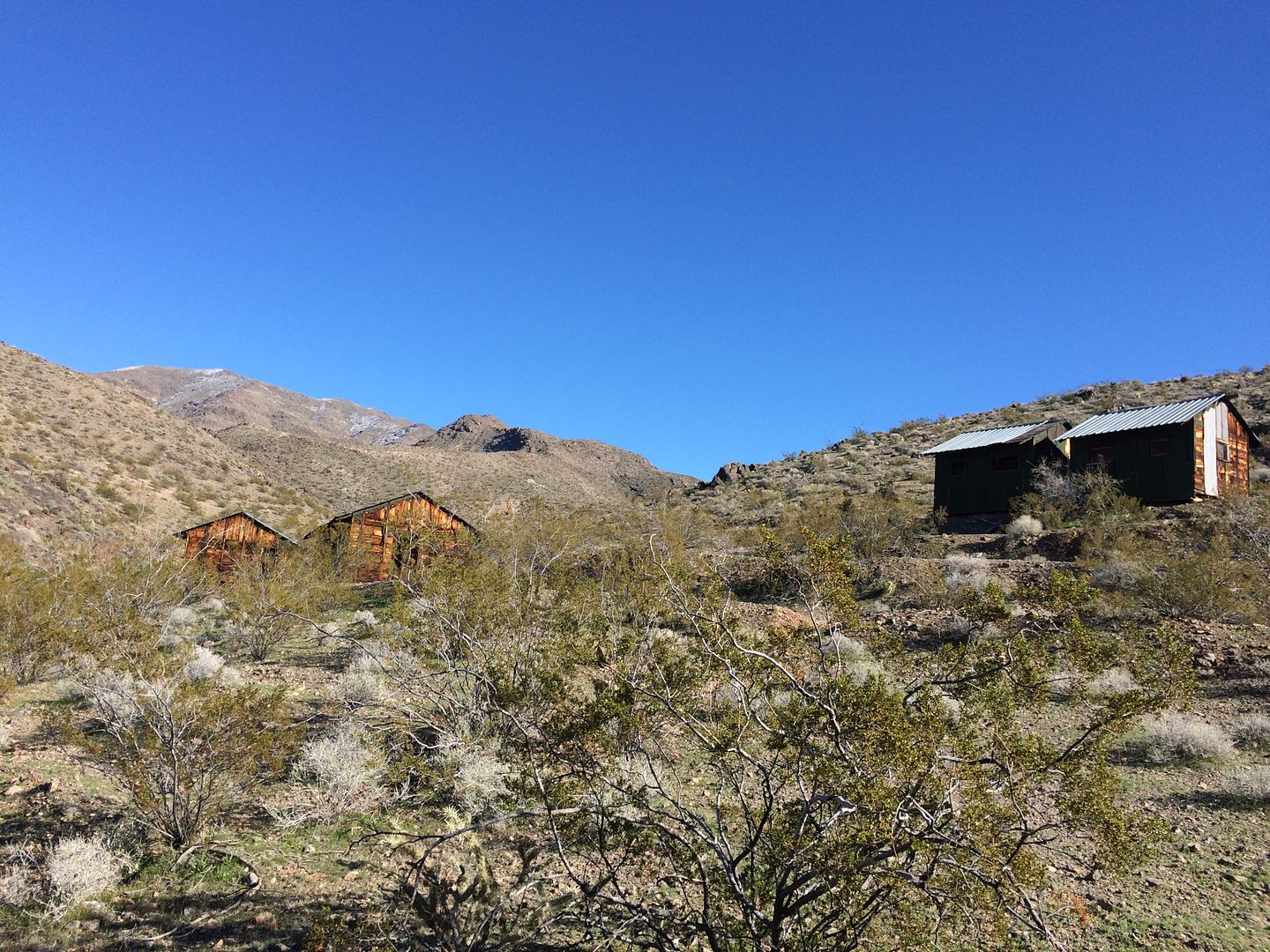
Lakeside mine was after copper, must have been a fairly profitable operation to be so remote. About ½ way to the actual mine there are several building in fair shape in a canyon. One is an interesting “5 seater” outhouse. Plenty of “junk” around to look at some of which would indicate that the mine was operating up into the 1960’s. The road up to the mine is narrow and steep and might be a bit of a challenge for a full size vehicle.
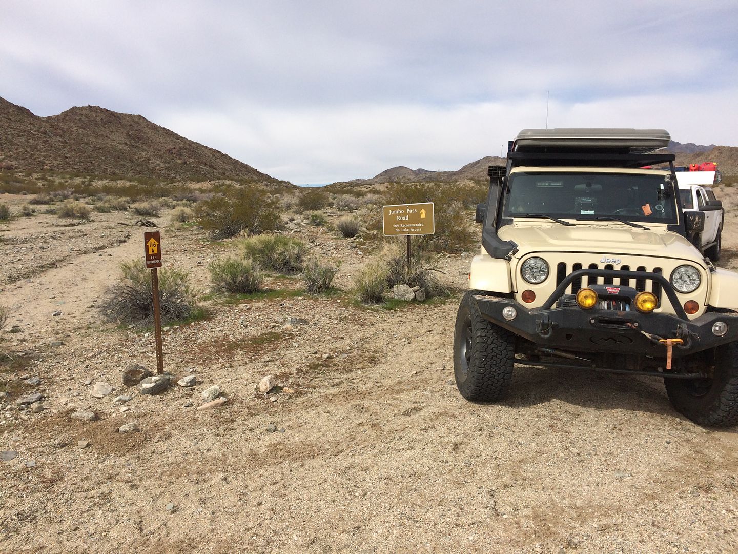
After exploring the mine we retraced our route back toward Gold Butte town site and turned right and started up the climb to the Scalon Ferry crossing and Jumbo Pass.
Day 2 part 2 later
Thanks,
Fred
Explorer 1
Rising before the sun is something I relish while exploring. Making a fire, heating water for coffee and enjoying the quiet coolness of a new day, it just doesn’t get much better.
Mike has traveled with me on several occasions and knows I like to get an early start. So camp was broke, vehicles loaded and we were on our way before 8 am. We exited the Little Finland valley and instead of turning left and making our way back to the Gold Butte Rd the way we came, we took the less traveled route which would eventually end at the Gold Butte Townsite.
The main Gold Butte road is a well-traveled graded super highway compared to most the other roads in the Nevada Strip. We’ll travel this section on our way out days later when we head over to the Arizona Strip. But for now it’s the two-track, occasionally rough road.
This route takes you through the middle of the 2005 Tramp and Forks fire that burned over 71,000 acres. From the looks of the amount of vegetation outside the burn zone it had to be a fire that was spread by very high winds. There just isn’t that much vegetation to keep a fire going otherwise.
It’s also the land of the giant slugs which show themselves all over the hillsides.
Gold butte town site has little to show for itself. One could easily drive by it with notice. It does lay at a major intersection of several roads. It also is the ending of the graded dirt section of the Gold Butte Rd and the beginning of the less maintained and less traveled road choices.
The site does have a few pieced of machinery and two more recent and permanent residents. Not sure who these folks were and why the earthly remains were parked here but maybe someone can enlighten me.
The mountain peak behind the town site is the name sake of the monument, Gold Butte itself. Our plans were to turn south and head toward Catsclaw wash and Lakeside bay, but I had included plenty of time for side rad exploring so we headed west around Gold Butte mountain on it southern side. After a few miles we came across an odd, which from a distance looked like a weather worn structure but upon closer view we found that is was an old moving van type trailer. At one time it house equipment and even had electrical hookups. I was intrigued by the decorative art deco fins on the top front of the trailer.
So many roads out here to explore but now was the time to work our way back and head south as we planned.
On a prior trip, I traveled out in my Sportsmobile to Catsclaw wash. The road goes right out to several possible campsites on the Virgin River arm of Lake Mead. There are places to fish, swim and canoe/Kayak.
On this trip I will take the left hand road following the Overton Arm Jeep trail, which should end at Lakeside bay. Sounds’ inviting, but unfortunately, at road end it was rather disappointing. There is no level ground for camping and the waters of Lake Mead are a good 150 yards away down a steep hill. There is however one redeeming item of this trail and that would be the Lakeside mine. At the time of our visit the trail leading to the mine was marked by a newer sign about a mile from road end before the barbwire fence running next to the road began.
Lakeside mine was after copper, must have been a fairly profitable operation to be so remote. About ½ way to the actual mine there are several building in fair shape in a canyon. One is an interesting “5 seater” outhouse. Plenty of “junk” around to look at some of which would indicate that the mine was operating up into the 1960’s. The road up to the mine is narrow and steep and might be a bit of a challenge for a full size vehicle.
After exploring the mine we retraced our route back toward Gold Butte town site and turned right and started up the climb to the Scalon Ferry crossing and Jumbo Pass.
Day 2 part 2 later
Thanks,
Fred
Explorer 1
roving1
Well-known member
Getting ready to read the report as it sounds great. What are the images being hosted from? Can't see them at work and I've never had this issue before so I am curious.
*Edit I can see pics on a dozen other threads that seem to be both uploaded and hosted so I am guessing this is adult content filtering due to "Nevada Strip". Oye...
*Edit I can see pics on a dozen other threads that seem to be both uploaded and hosted so I am guessing this is adult content filtering due to "Nevada Strip". Oye...
Last edited:
Explorer 1
Explorer 1
Day 2 part 2
After our brief visit to Lakeside Mine we back tracked and turned right on the road leading toward Scanlon Ferry. All I could find in my search about this road was this brief sentence.
“Mike Scanlon's Ferry, started in 1881, which was later bought by Tom Gregg, crossed the Colorado River at the area now known as Greggs Hideout.”
So there you have it, you know as much as I do, if anyone happened to find out more please let me know.
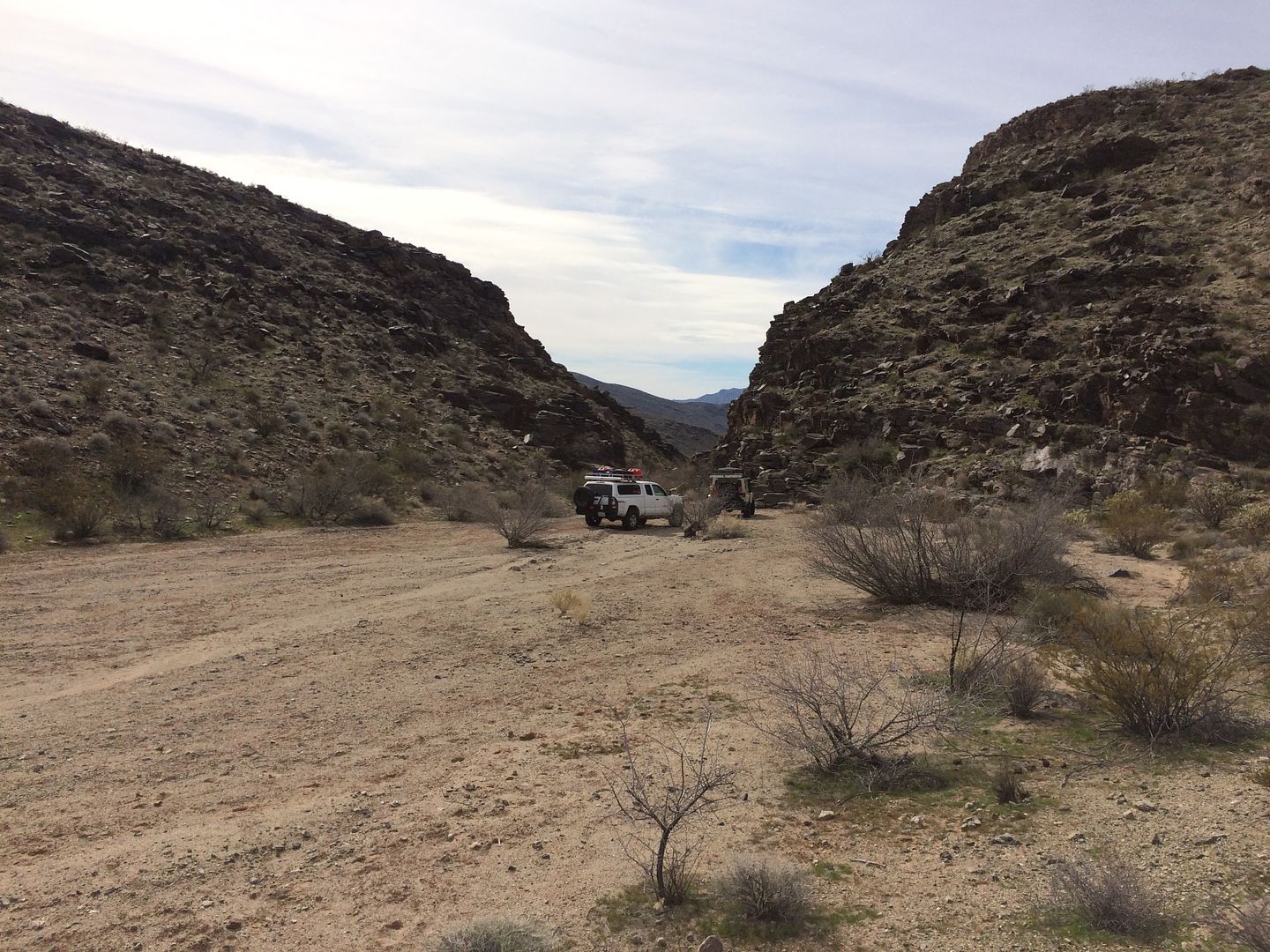
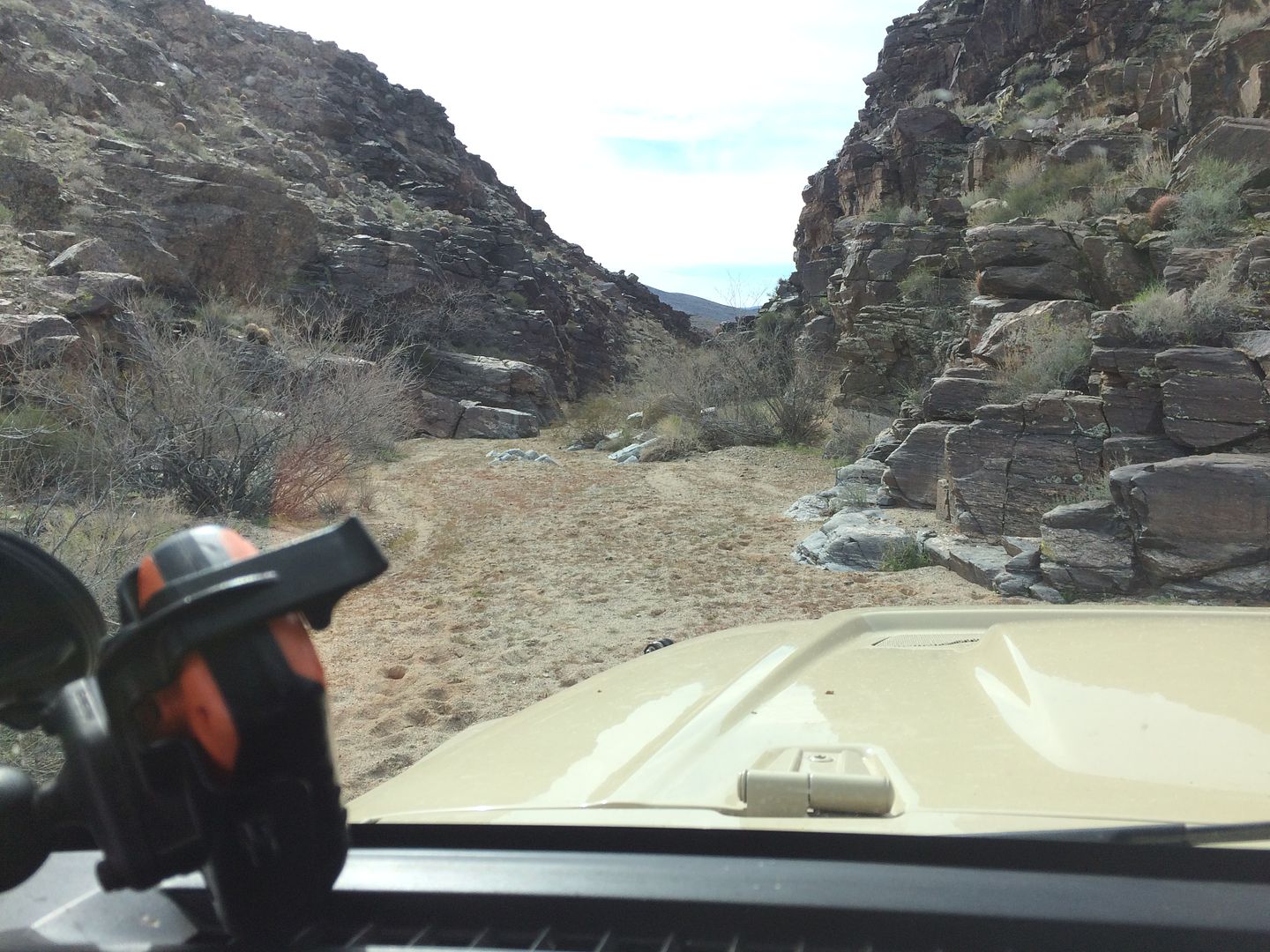
The narrow, sometimes very narrow, trail up to the divided before descending to what is left of the old ferry crossing is rather unremarkable. It would appear that as of lately it is rarely driven. After traveling a short distance on it all visual signs of prior vehicular traffic diminished o the point that at time it was early to believe you were just following an old wash and not a road as indicated on most maps.
Those with a desire to maintain a nice paint job would be well advised to avoid this trail. After several miles the trail does finally open up at the divide with some nice views either direction.
If the trail up would be rated on the more difficult side of the scale for its narrowness and crudeness, the trail down the other side would also be rated initially as “difficult” for the shelf road drop off and its steep loose rock surface. My YouTube search after the trip found this interesting video of some guy who listed it on his channel as one of the “most” dangerous roads, I think that was a bit of a stretch.
More later.......
After our brief visit to Lakeside Mine we back tracked and turned right on the road leading toward Scanlon Ferry. All I could find in my search about this road was this brief sentence.
“Mike Scanlon's Ferry, started in 1881, which was later bought by Tom Gregg, crossed the Colorado River at the area now known as Greggs Hideout.”
So there you have it, you know as much as I do, if anyone happened to find out more please let me know.
The narrow, sometimes very narrow, trail up to the divided before descending to what is left of the old ferry crossing is rather unremarkable. It would appear that as of lately it is rarely driven. After traveling a short distance on it all visual signs of prior vehicular traffic diminished o the point that at time it was early to believe you were just following an old wash and not a road as indicated on most maps.
Those with a desire to maintain a nice paint job would be well advised to avoid this trail. After several miles the trail does finally open up at the divide with some nice views either direction.
If the trail up would be rated on the more difficult side of the scale for its narrowness and crudeness, the trail down the other side would also be rated initially as “difficult” for the shelf road drop off and its steep loose rock surface. My YouTube search after the trip found this interesting video of some guy who listed it on his channel as one of the “most” dangerous roads, I think that was a bit of a stretch.
More later.......
MountainBiker
Experience Seeker
This is great! Sounds like a wonderful trip so far!
c.traveler2
New member
it's been many years since I've been in the Gold Butte area, your story and journey was indeed interesting!
Explorer 1
Explorer 1
As the day was waning, we hurried down toward the once Scanlon ferry crossing, our days destination. Along the way we saw some interesting places we would normally stop and investigate but since we would travel out the same route in the morning, we decided to postpone and side trips.
The former Scanlon ferry crossing is a wonderful remote place to camp right against Lake Mead. Directly across the lake, to the opposite shore (2 miles away) is the South Shore boat ramp. At night it is lit up but we only saw two vehicles come and go during our stay. There were no signs of any past campsites so we just made our own fire ring and with the abundance of available drift wood enjoyed an evening on the sandy beach.


During the time we were there we would only occasionally see a boater on the lake and even then they were so far away that the sound of their engines was faint.
The sky was clear, the weather cool but pleasant and the fire was warm. A great way to end the day!
Thanks,
Fred
Explorer 1
The former Scanlon ferry crossing is a wonderful remote place to camp right against Lake Mead. Directly across the lake, to the opposite shore (2 miles away) is the South Shore boat ramp. At night it is lit up but we only saw two vehicles come and go during our stay. There were no signs of any past campsites so we just made our own fire ring and with the abundance of available drift wood enjoyed an evening on the sandy beach.
During the time we were there we would only occasionally see a boater on the lake and even then they were so far away that the sound of their engines was faint.
The sky was clear, the weather cool but pleasant and the fire was warm. A great way to end the day!
Thanks,
Fred
Explorer 1
Explorer 1
Explorer 1
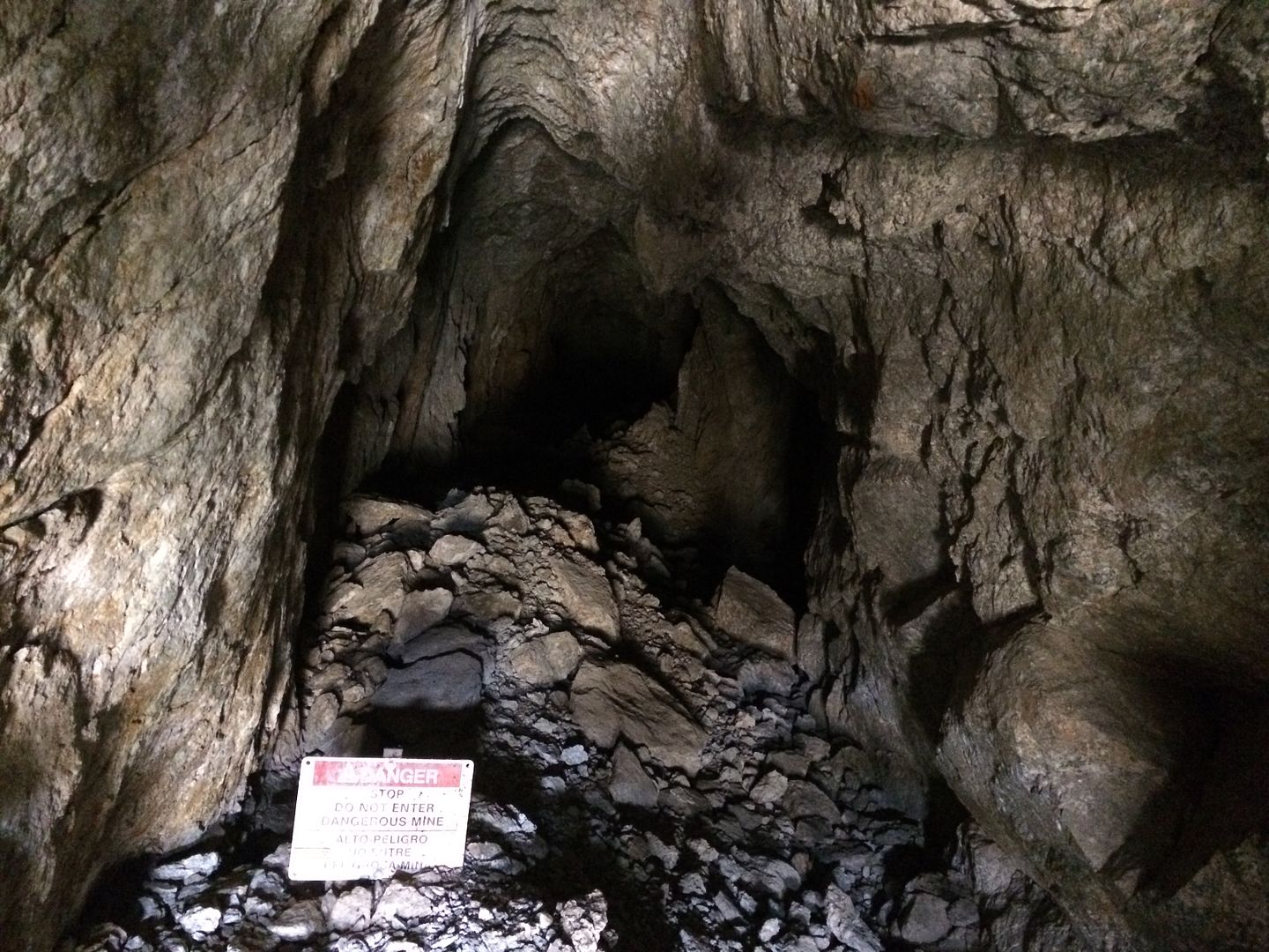
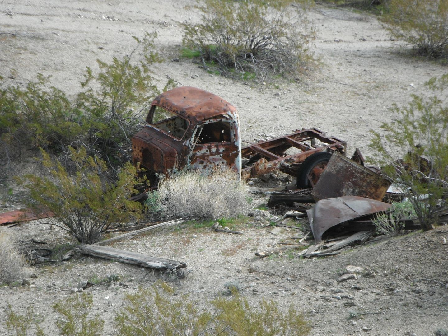
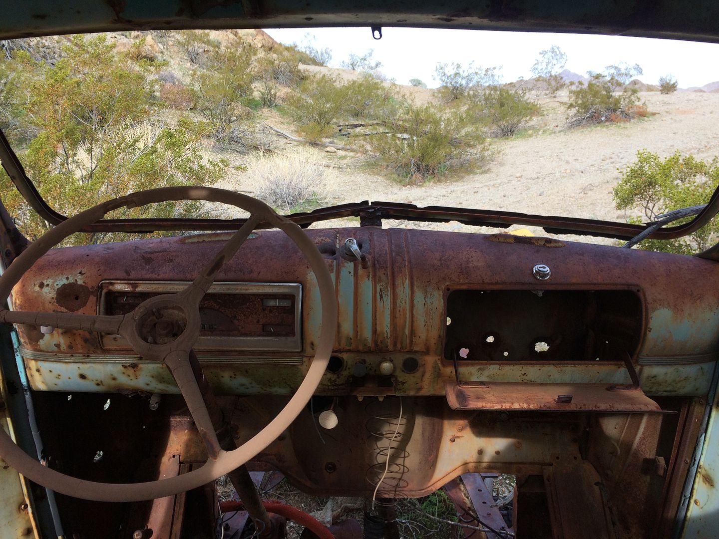
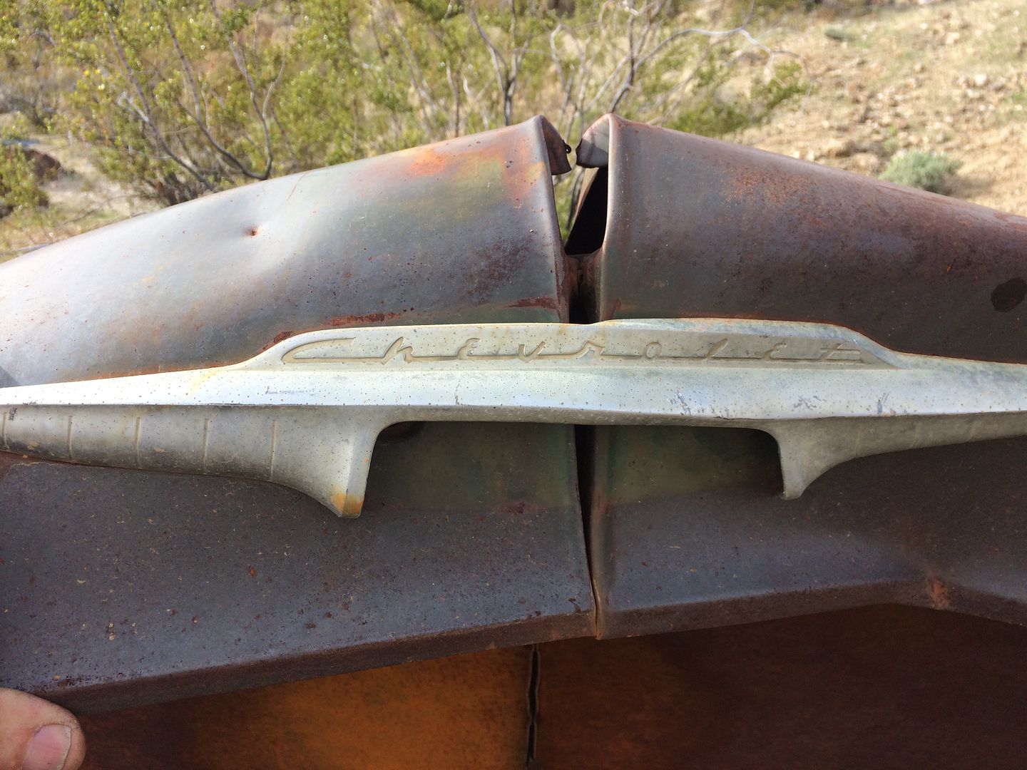
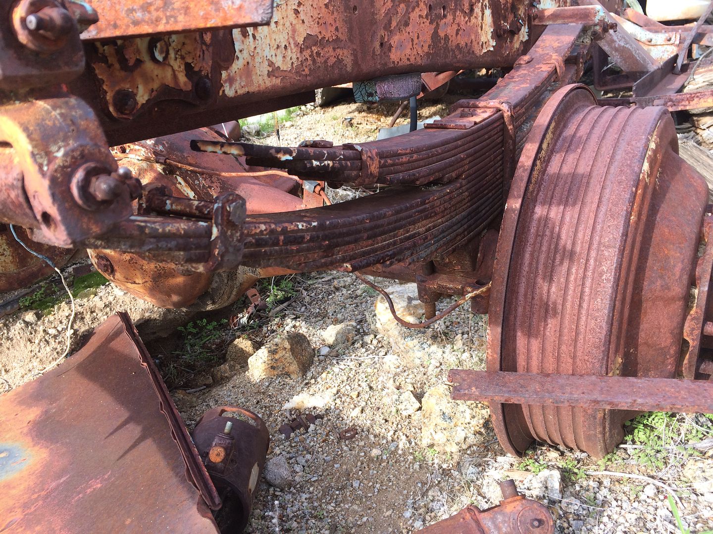
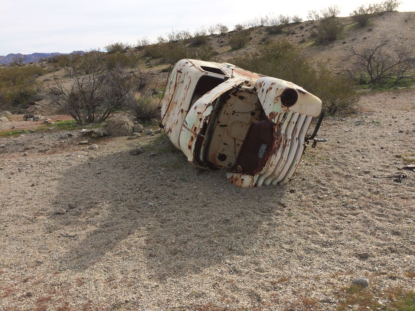
The next morning we decided to do some exploring. The map shows a small side road leading to pass. On the drive in I thought I may have seen a faint trail going that direction. After some wandering I found a very faint trail, no I found the only faint trail leading away from the lake and up toward the mountains on the west side. It suddenly ended at an old mine in less than a mile. The mine had some abandoned vehicles from the 1950’s era and lots of scrap lying around. The mine shaft had collapsed and was posted. What a lonely place, I suppose when the ferry was running there may have been more activity in the area.
After exploring the mine it was clear that the trail we traveled wasn’t the Jumbo Pass route. Heading back toward the trail coming down from Scanlon Pass on the left I found another trail going up the wash. This one was labeled and even had a sign letting us know we had found our trail. In just a short distance the trail pretty much disappeared and trying to follow it took several stops requiring foot reconnoitering to find the trail. Occasionally we’d bump into a BLM sign that gave us some idea that we were traveling in the correct general direction. The pass was actually a low rise which would divide the water shed (whenever it might rain). Shortly after the pass the trail lead into very narrow canyon named the “Black Box” I would assume because of the black volcanic rocks on either side. The canyon is an easy walk bit would require some serious rock crawling using the sidewalls for traction. On remote trips like these I’ve learned to avoid such challenges with my overloaded vehicle unless our destination required such course.
The map provides no clue as to where this “trail” would eventually end or what its original purpose was. Walking around there are loads of well-worn donkey trails heading in the same general direction so a foot trip would be the best way to explore further if you are so inclined.
https://www.topozone.com/nevada/clark-nv/gap/jumbo-pass/
After backtracking we met up again with the Scanlon Pass trail and started our climb this time stopping along the way at various signs of prior human development.
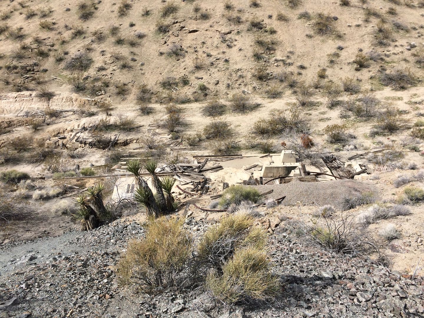
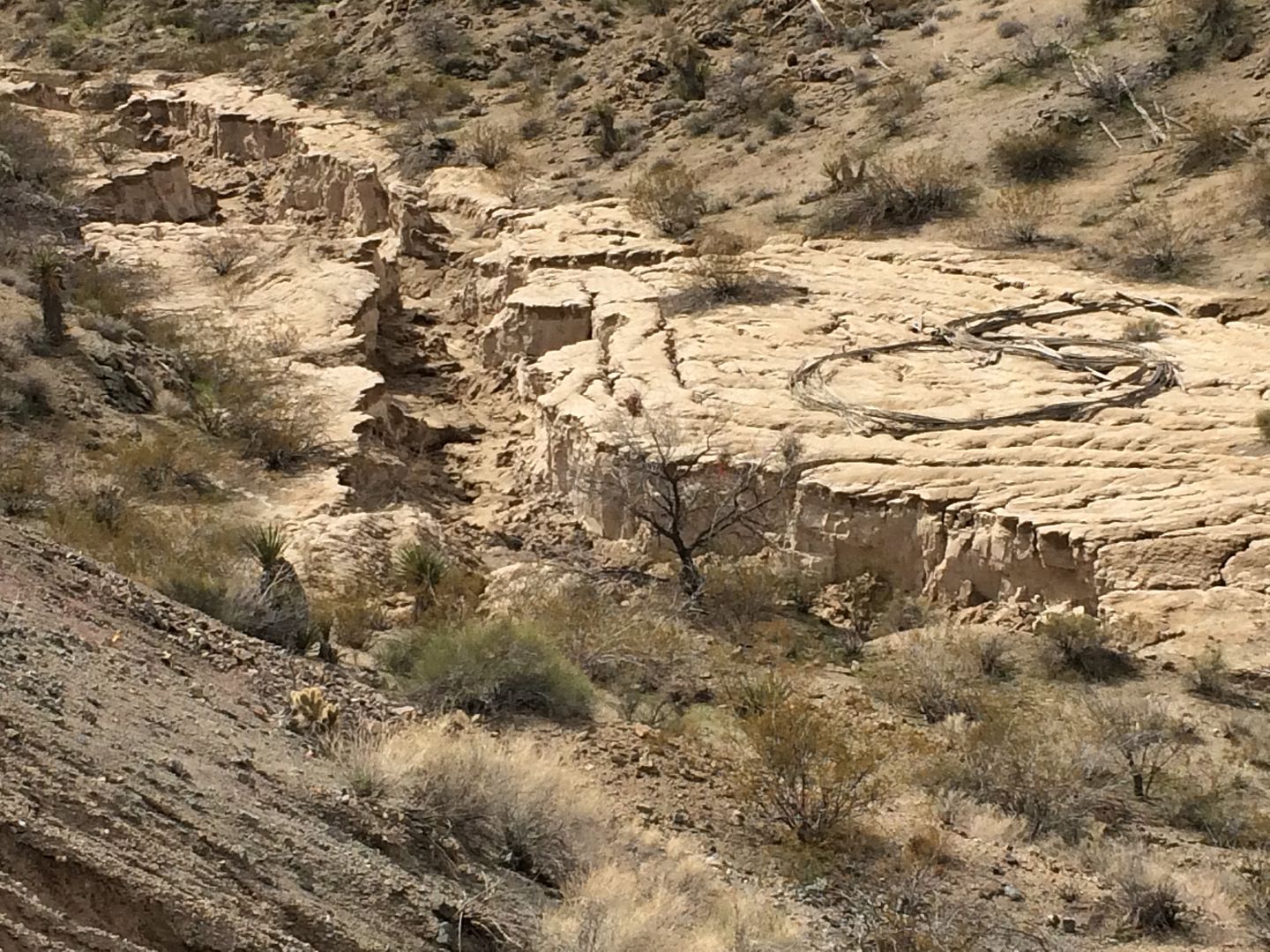
A large mining operation on the north side of the trail would indicate some kind of precious metals. Large slag tailings in a valley would indicate there was at one time some source of water used in the process.
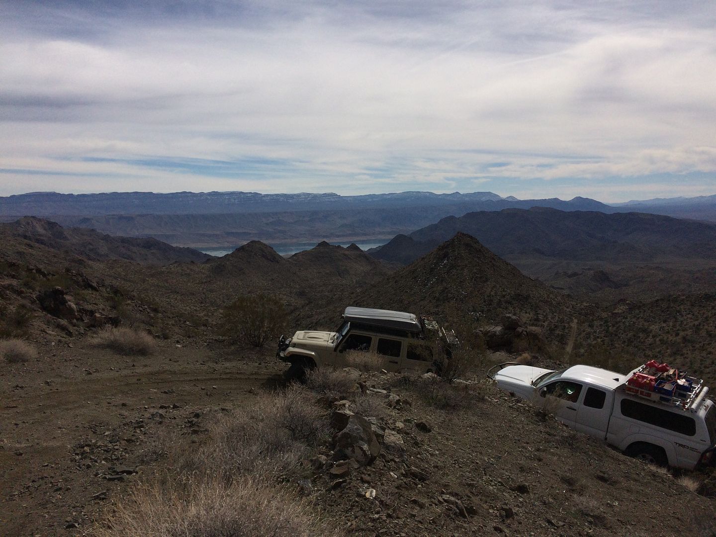
After the mine we started the very steep narrow section we came down the day before using a light throttle in the compound low gear setting, allowing some wheel spin as the vehicles climbed through the loose sharp rocks to the top.
The day was still young and we had quite a few miles to make through Cottenwood Canyon to the "Devils Cove" for the night.
Thanks,
Fred
Explorer 1
After exploring the mine it was clear that the trail we traveled wasn’t the Jumbo Pass route. Heading back toward the trail coming down from Scanlon Pass on the left I found another trail going up the wash. This one was labeled and even had a sign letting us know we had found our trail. In just a short distance the trail pretty much disappeared and trying to follow it took several stops requiring foot reconnoitering to find the trail. Occasionally we’d bump into a BLM sign that gave us some idea that we were traveling in the correct general direction. The pass was actually a low rise which would divide the water shed (whenever it might rain). Shortly after the pass the trail lead into very narrow canyon named the “Black Box” I would assume because of the black volcanic rocks on either side. The canyon is an easy walk bit would require some serious rock crawling using the sidewalls for traction. On remote trips like these I’ve learned to avoid such challenges with my overloaded vehicle unless our destination required such course.
The map provides no clue as to where this “trail” would eventually end or what its original purpose was. Walking around there are loads of well-worn donkey trails heading in the same general direction so a foot trip would be the best way to explore further if you are so inclined.
https://www.topozone.com/nevada/clark-nv/gap/jumbo-pass/
After backtracking we met up again with the Scanlon Pass trail and started our climb this time stopping along the way at various signs of prior human development.
A large mining operation on the north side of the trail would indicate some kind of precious metals. Large slag tailings in a valley would indicate there was at one time some source of water used in the process.
After the mine we started the very steep narrow section we came down the day before using a light throttle in the compound low gear setting, allowing some wheel spin as the vehicles climbed through the loose sharp rocks to the top.
The day was still young and we had quite a few miles to make through Cottenwood Canyon to the "Devils Cove" for the night.
Thanks,
Fred
Explorer 1
Last edited: