Imnosaint
Adventurer
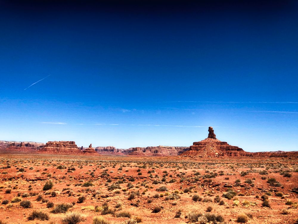
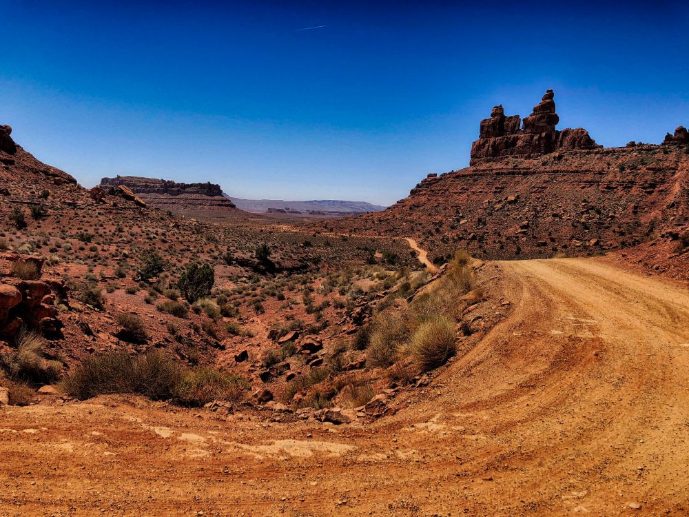
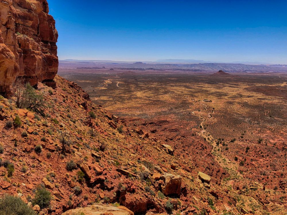
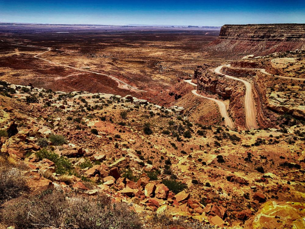
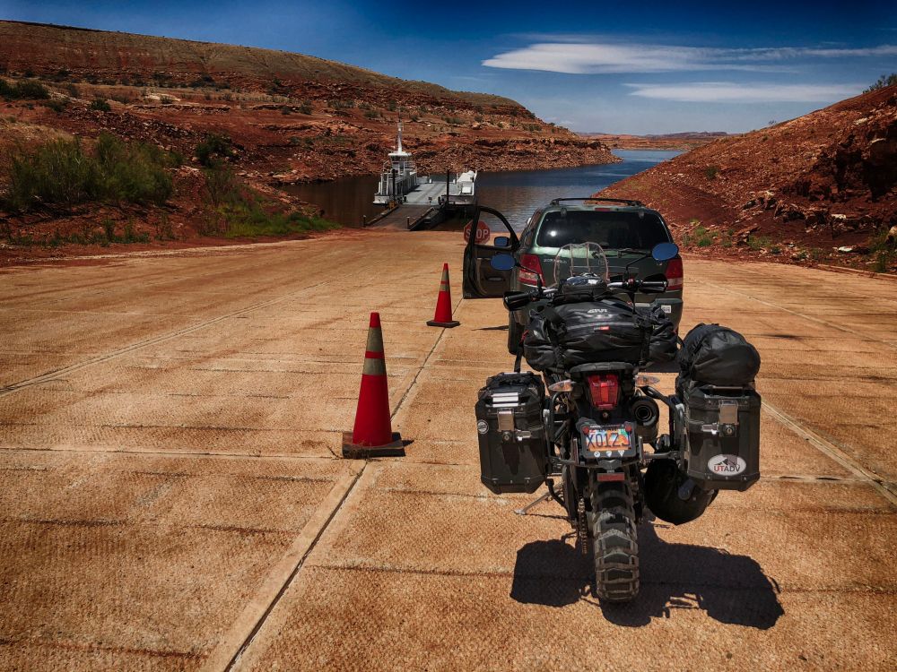
Two weeks to go before Summer semester begins and there’s a break in my days (mid-June), a perfect time for a quick trip to knock off some bucket list items, like the Shafer Trail, Valley of the Gods, Moki Dugway, Halls Crossing and a bonus – the Burr Trail.

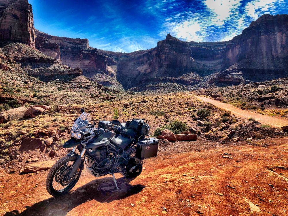
Other things had come together as well, the Tiger for one, and the right gear for this 902 mile trip in three days, from 1200 feet to almost 10,000, 56F degrees to 103.
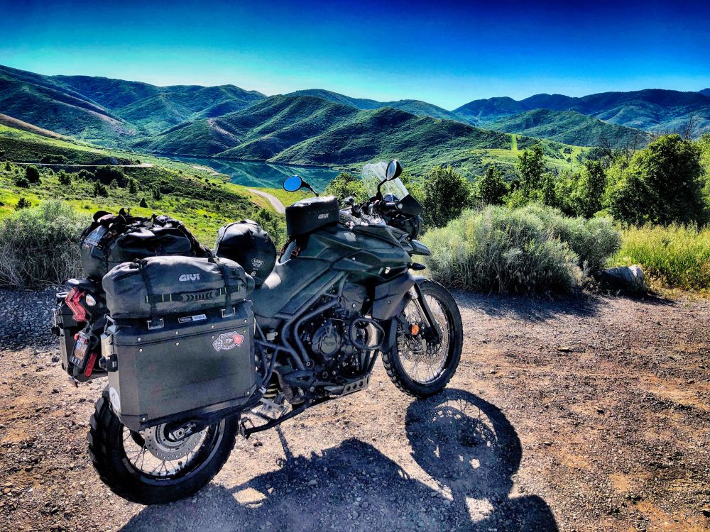
After living and riding in Southern Utah for twenty years it’s a switch to start my travels now from the Wasatch Front with cooler temps that tease you into thinking status quo on weather conditions and temperatures, all of which are amplified on a motorcycle.
The Tiger is packed for the range of temps mentioned above, along with gear for the random squalls that pop up down south. My route south took me through Emigration Canyon, over Parley’s to Heber, through Starvation State Park to Duchesne, on to Green River and then to the Canyonlands National Park turnoff, U313, that also goes to Dead Horse Point. This turnoff is a few miles north of Moab.
The road turns into Island in the Sky after the Dead Horse Point turnoff and delivers you to the Canyonlands National Park entrance. The Shafer Trail road starts beyond the entrance and the east side, well marked. On topo maps it’s U142.
The surface was a clean recent grade at the beginning. Within a mile you’re delivered to the first view of the canyon and the road as it stretches to the White Rim/Potash fork.
A rider on Softail passed me at this point ascending the trail, boosting my confidence. I felt a bit overdressed compared to his shorts, wife-beater and bare head. To his credit he wore sunglasses and fingerless gloves, but those were more accessories than gear.
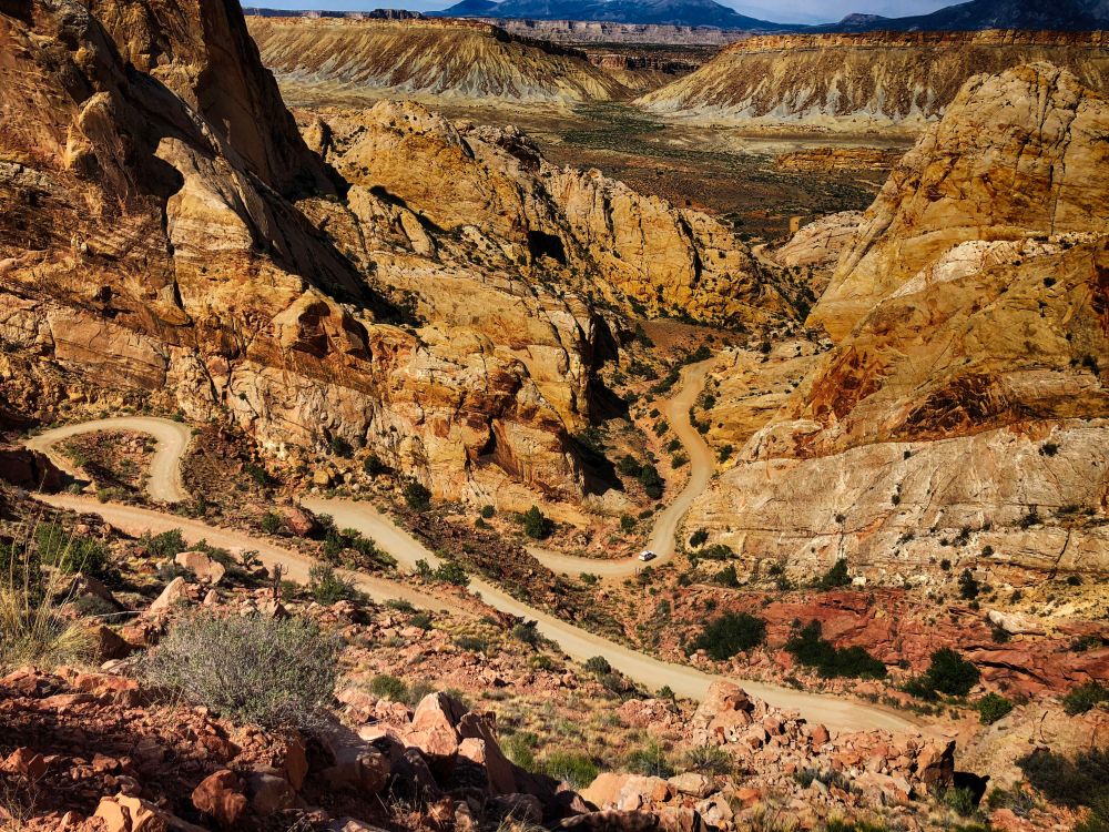
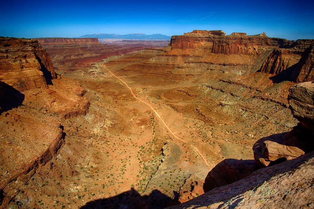
Under another mile and the switchbacks begin.
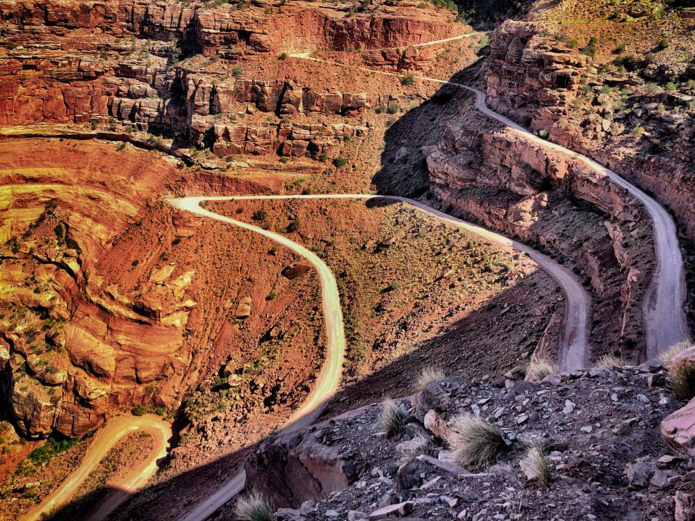
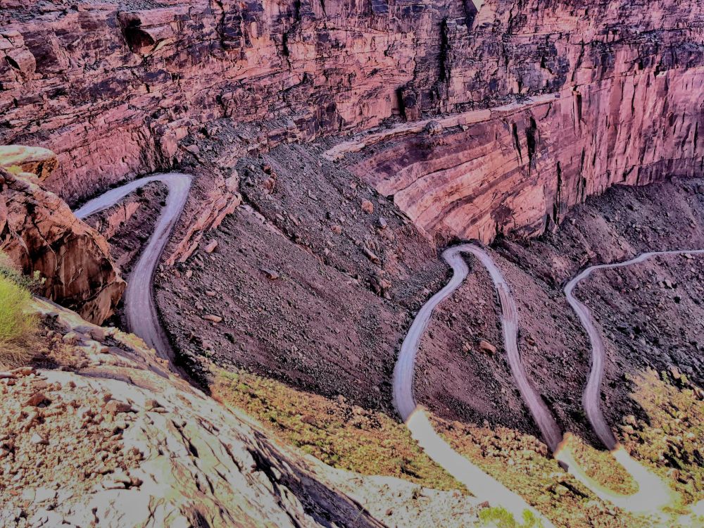
In the above image, just after the second switch from the left there’s a patch of new grade on the descent that looks like sand, but it’s hard packed and easily traversed.
The descent is a battle between concentrating on your line and being distracted by what’s beyond it. I quickly learned the Tiger’s nuance in feathering braking and second gear’s control in steep descents and cornering.
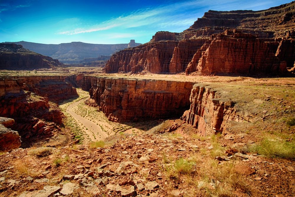
Above is at the bottom of the canyon looking back to the descent. The great Interweb will tell you it’s an easy traverse, or it’s terribly dangerous, the road is in terrible repair, blah. It is what you make it and what you bring to it. This was a first for me and I loved it and compared to what was ahead the next day on the Burr Trail, it was a walk in the park.
The Shafer Trail road ends at the White Rim/Potash Road fork. I chose Potash since I got a late afternoon start. The White Rim Trail would’ve required more time. Gives me a reason to go back.
Potash, U142, follows a technical route along the South Fork of Shafer Canyon delivering you to the surprising vista of the greens of Shafer Canyon carved by the Colorado.

Below is a look back where Potash traverses to this point. The trail can be seen on the right.

Potash Road has its challenges from lose shale to limestone steps, some a foot or more depending on your line. I spent much of the descent on pegs, picking best lines and being grateful for the Tiger’s front wheel diameter. I forgot about the load in and on the panniers behind me and enjoyed the traverse down the canyon.
“Enjoyed” is relative since temps were at the century mark. I stopped in shade where I could find it and by 1700 I reached the evaporation ponds.
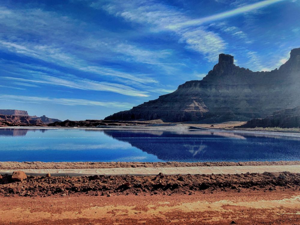
These super-blue ponds serve to remove brine that’s infused into potash in the mining process of slat that contain potassium. The ponds are actually dyed blue to expedite the evaporation process.
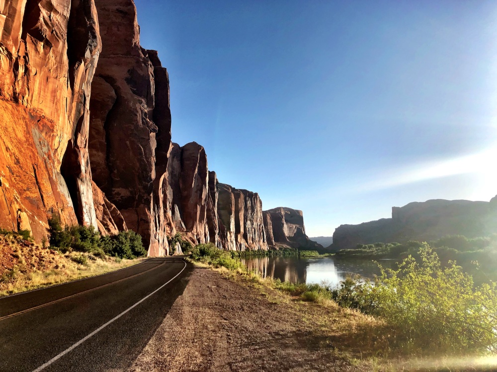
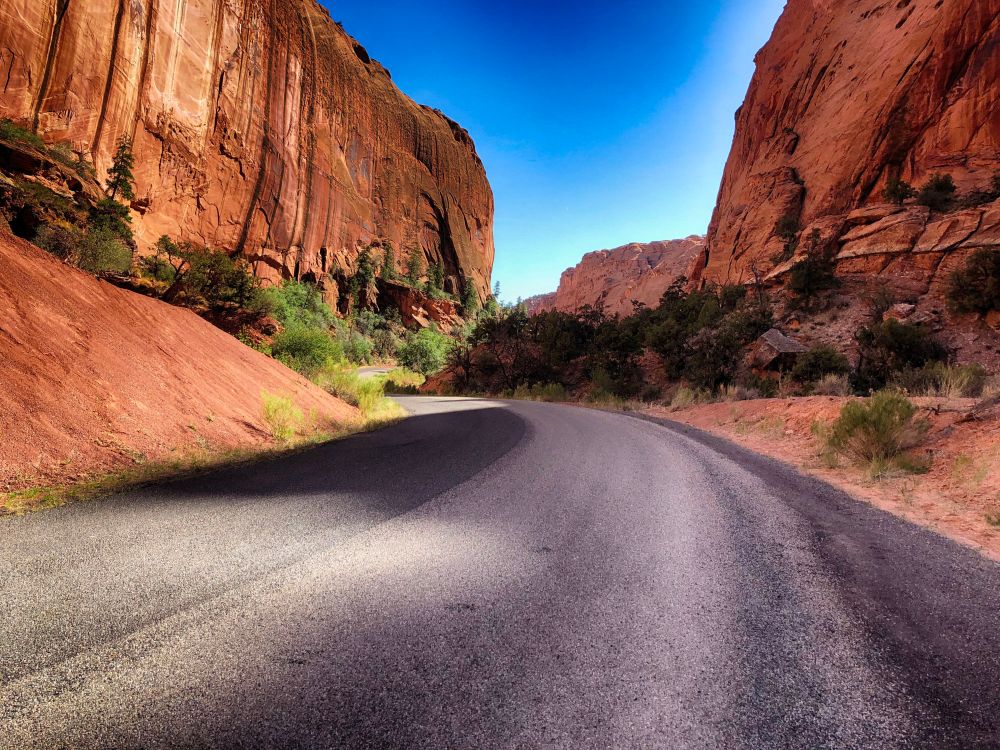
U142 meanders through mining land and turns back to asphalt at Intrepid Potash where the product is shipped via rail. It turns into U279, following the Colorado River all the way back to Highway 191 just north of Moab.
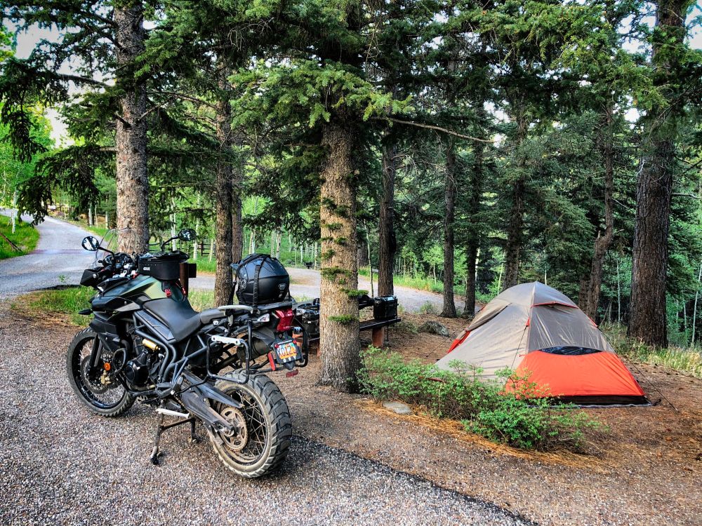
I camped along U279 at William Bottom campground, known, I’d imagine, to locals as Bill Butt. It’s primitive compared to Jaycee Park campground further north, but it was all but deserted and I could park the Tiger next to the tent.
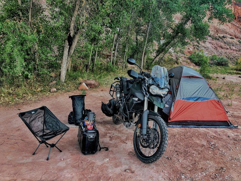
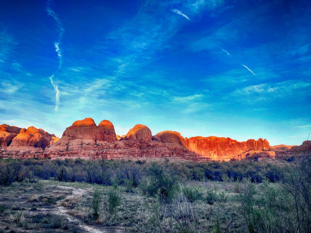
I was treated to this light at dusk and the satisfaction of completing the most challenging ride yet, until the Burr Trail.
I slept well that night.
Other things had come together as well, the Tiger for one, and the right gear for this 902 mile trip in three days, from 1200 feet to almost 10,000, 56F degrees to 103.
After living and riding in Southern Utah for twenty years it’s a switch to start my travels now from the Wasatch Front with cooler temps that tease you into thinking status quo on weather conditions and temperatures, all of which are amplified on a motorcycle.
The Tiger is packed for the range of temps mentioned above, along with gear for the random squalls that pop up down south. My route south took me through Emigration Canyon, over Parley’s to Heber, through Starvation State Park to Duchesne, on to Green River and then to the Canyonlands National Park turnoff, U313, that also goes to Dead Horse Point. This turnoff is a few miles north of Moab.
The road turns into Island in the Sky after the Dead Horse Point turnoff and delivers you to the Canyonlands National Park entrance. The Shafer Trail road starts beyond the entrance and the east side, well marked. On topo maps it’s U142.
The surface was a clean recent grade at the beginning. Within a mile you’re delivered to the first view of the canyon and the road as it stretches to the White Rim/Potash fork.
A rider on Softail passed me at this point ascending the trail, boosting my confidence. I felt a bit overdressed compared to his shorts, wife-beater and bare head. To his credit he wore sunglasses and fingerless gloves, but those were more accessories than gear.
Under another mile and the switchbacks begin.
In the above image, just after the second switch from the left there’s a patch of new grade on the descent that looks like sand, but it’s hard packed and easily traversed.
The descent is a battle between concentrating on your line and being distracted by what’s beyond it. I quickly learned the Tiger’s nuance in feathering braking and second gear’s control in steep descents and cornering.
Above is at the bottom of the canyon looking back to the descent. The great Interweb will tell you it’s an easy traverse, or it’s terribly dangerous, the road is in terrible repair, blah. It is what you make it and what you bring to it. This was a first for me and I loved it and compared to what was ahead the next day on the Burr Trail, it was a walk in the park.
The Shafer Trail road ends at the White Rim/Potash Road fork. I chose Potash since I got a late afternoon start. The White Rim Trail would’ve required more time. Gives me a reason to go back.
Potash, U142, follows a technical route along the South Fork of Shafer Canyon delivering you to the surprising vista of the greens of Shafer Canyon carved by the Colorado.
Below is a look back where Potash traverses to this point. The trail can be seen on the right.
Potash Road has its challenges from lose shale to limestone steps, some a foot or more depending on your line. I spent much of the descent on pegs, picking best lines and being grateful for the Tiger’s front wheel diameter. I forgot about the load in and on the panniers behind me and enjoyed the traverse down the canyon.
“Enjoyed” is relative since temps were at the century mark. I stopped in shade where I could find it and by 1700 I reached the evaporation ponds.
These super-blue ponds serve to remove brine that’s infused into potash in the mining process of slat that contain potassium. The ponds are actually dyed blue to expedite the evaporation process.
U142 meanders through mining land and turns back to asphalt at Intrepid Potash where the product is shipped via rail. It turns into U279, following the Colorado River all the way back to Highway 191 just north of Moab.
I camped along U279 at William Bottom campground, known, I’d imagine, to locals as Bill Butt. It’s primitive compared to Jaycee Park campground further north, but it was all but deserted and I could park the Tiger next to the tent.
I was treated to this light at dusk and the satisfaction of completing the most challenging ride yet, until the Burr Trail.
I slept well that night.
Last edited: